Spacecrafts
launched in 2007 :
.
.
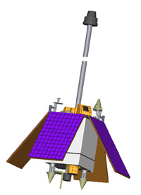
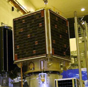
CARTOSAT-2
| Spacecraft: |
|
| Chronologies: |
2007 payload #1 ; 2007-001B ; 6,492nd spacecraft. |
| Type: |
Earth Remote Sensing |
| Families: |
|
| Ranks: |
|
| Sponsor: |
Indian Space Research Organisation (ISRO) |
|
 |
| Launch: |
10 January 2007 at 3h53 UTC,
from Sriharikota's Satish Dhawan Space Centre SHAR (LC-1), by a PSLV. |
| Orbit: |
Initial: 621 km x 641 km x 97.9° x 97.3
min. |
| Mission: |
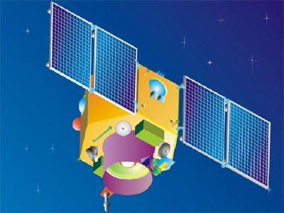
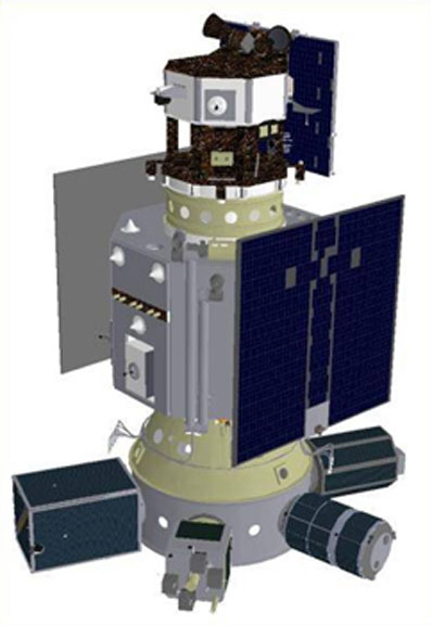
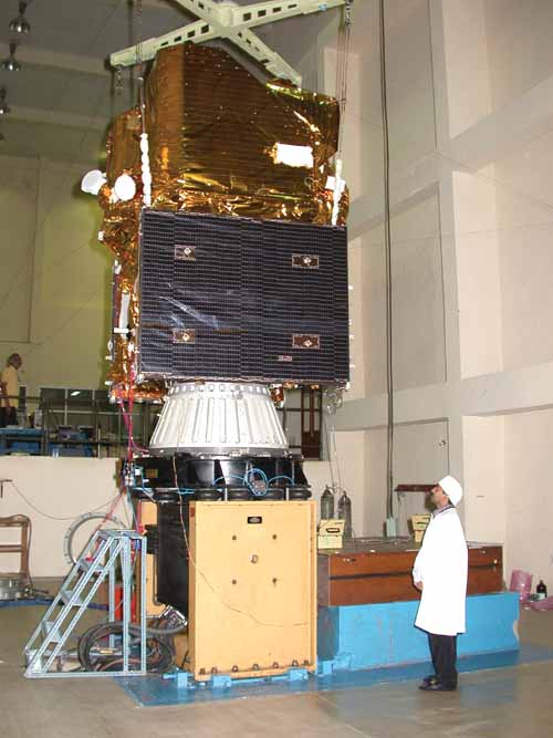 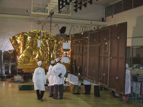 CARTOSAT
2 is a 680-kg photo-imaging spacecraft that provides panchromatic images
at one-meter resolution to aid civil planning and other cartographic needs.
It is an advanced remote sensing satellite capable of providing scene-specific
spot imagery. It is the twelfth spacecraft in the Indian Remote Sensing
(IRS) satellite series, it joins the other six IRS satellites which are
in service: IRS
1C, IRS
1D, OceanSat
1, TES, ResourceSat
and Cartosat 1. CartoSat-2
carries a Panchromatic camera to provide imageries with a spatial resolution
of better than one metre and a swath of 9.6 km. The satellite can be steered
up to 45 degress along as well as across the track. The data from the satellite
are used for cartographic applications at cadastral level, urban and rural
infrastructure development and management, as well as applications in Land
Information System and Geographical Information System. CARTOSAT
2 is a 680-kg photo-imaging spacecraft that provides panchromatic images
at one-meter resolution to aid civil planning and other cartographic needs.
It is an advanced remote sensing satellite capable of providing scene-specific
spot imagery. It is the twelfth spacecraft in the Indian Remote Sensing
(IRS) satellite series, it joins the other six IRS satellites which are
in service: IRS
1C, IRS
1D, OceanSat
1, TES, ResourceSat
and Cartosat 1. CartoSat-2
carries a Panchromatic camera to provide imageries with a spatial resolution
of better than one metre and a swath of 9.6 km. The satellite can be steered
up to 45 degress along as well as across the track. The data from the satellite
are used for cartographic applications at cadastral level, urban and rural
infrastructure development and management, as well as applications in Land
Information System and Geographical Information System. |
| Launch: |
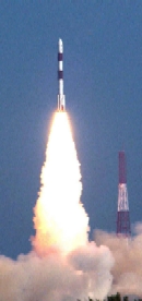 ISROs
Polar Satellite Launch Vehicle (PSLV-C7) lifted off from the first launch
pad at SDSC SHAR, at 9h23 (local time) with the ignition of the core first
stage and four of the six strap-on motors. This four-stage launch is 44
meters tall and has a lift-off mass of 295 tonnes. The remaining two strap-on
motors were ignited 25 seconds after lift-off. This tenth flight conducted
from Satish Dhawan Space Centre (SDSC) SHAR, Sriharikota, successfully
launched four satellites. For the first time, a Dual Launch Adopter (DLA)
was used in PSLV to accommodate two primary satellites in tandem.
The main payload, CARTOSAT-2, was the first satellite
to be injected into orbit 981.3 seconds after lift-off at an altitude of
639 km. About 45 seconds later, DLA with the PEHUENSAT-1
mounted on it, was separated. 120 seconds later, the Space capsule Recovery
Experiment (SRE-1) mounted inside DLA was separated
and finally, 190 seconds later, the LAPAN-TUBSAT,
mounted on the equipment bay of PSLV fourth stage was separated. The four
satellites have been placed in a polar orbit at an altitude of 637 km with
an inclination of 97.9 degrees with respect to the equator. ISROs
Polar Satellite Launch Vehicle (PSLV-C7) lifted off from the first launch
pad at SDSC SHAR, at 9h23 (local time) with the ignition of the core first
stage and four of the six strap-on motors. This four-stage launch is 44
meters tall and has a lift-off mass of 295 tonnes. The remaining two strap-on
motors were ignited 25 seconds after lift-off. This tenth flight conducted
from Satish Dhawan Space Centre (SDSC) SHAR, Sriharikota, successfully
launched four satellites. For the first time, a Dual Launch Adopter (DLA)
was used in PSLV to accommodate two primary satellites in tandem.
The main payload, CARTOSAT-2, was the first satellite
to be injected into orbit 981.3 seconds after lift-off at an altitude of
639 km. About 45 seconds later, DLA with the PEHUENSAT-1
mounted on it, was separated. 120 seconds later, the Space capsule Recovery
Experiment (SRE-1) mounted inside DLA was separated
and finally, 190 seconds later, the LAPAN-TUBSAT,
mounted on the equipment bay of PSLV fourth stage was separated. The four
satellites have been placed in a polar orbit at an altitude of 637 km with
an inclination of 97.9 degrees with respect to the equator. |
| Source: |
Jonathan
Space Report No. 576
; Spacewarn No. 639
; National Space Science Data Center's
2007-001B
; Skyrocket's Cartosat-2
; ISRO's Cartosat-2
& 10 Jan
07 ; Spaceflight Now's 10
Jan 07 ; |
|
|
.
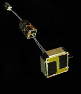
SRE-1
| Spacecraft: |
Space capsule Recovery Experiment |
| Chronologies: |
2007 payload #2 ; 2007-001C ; 6,493rd spacecraft. |
| Type: |
Material Processing |
| Families: |
|
| Ranks: |
|
| Sponsor: |
Indian Space Research Organisation (ISRO) |
|
 |
| Launch: |
10 January 2007 at 3h53 UTC,
from Sriharikota's Satish Dhawan Space Centre SHAR (LC-1), by a PSLV. |
| Orbit: |
Initial: 486 km x 643 km x 97.9° x 95.9
min. |
| Recovery: |
22 January 2007 at 4h14 UTC |
| Mission: |
  Space
Recovery Experiment 1 (SRE 1) is India's first recoverable capsule. The
550 kg (or 615 kg) capsule intended to demonstrate the technology of an
orbiting platform for performing experiments in microgravity conditions.
It is also a technology demonstrator for the planned 2010 launch of a lunar
mission, with adequate heat shield, deceleration and floatation systems.
The mission provide valuable experience in such important fields like navigation,
guidance and control during the re-entry phase, hypersonic aero-thermodynamics
facilitating the development of reusable thermal protection system, recovery
through deceleration and floatation besides acquisition of basic technology
for reusable launch vehicles. It carries out microgravity experiments:
an Isothermal Heating Furnace and a Biomimetic (Biomineralisation of Inorganic
materials). The first experiments is related to study of metal melting
and crystallisation under micro gravity conditions. The second experiment
is intended to study the synthesis of nano-crystals under microgravity
conditions. This experiment can help in designing better biomaterials having
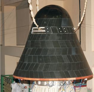
closest proximity with natural biological products. The capsule,
made of mild steel, has a sphere-cone-flare configuration with a spherical
nose of about 0.5 meter radius, base diameter of 2 meters and 1.6 meters
height. Space
Recovery Experiment 1 (SRE 1) is India's first recoverable capsule. The
550 kg (or 615 kg) capsule intended to demonstrate the technology of an
orbiting platform for performing experiments in microgravity conditions.
It is also a technology demonstrator for the planned 2010 launch of a lunar
mission, with adequate heat shield, deceleration and floatation systems.
The mission provide valuable experience in such important fields like navigation,
guidance and control during the re-entry phase, hypersonic aero-thermodynamics
facilitating the development of reusable thermal protection system, recovery
through deceleration and floatation besides acquisition of basic technology
for reusable launch vehicles. It carries out microgravity experiments:
an Isothermal Heating Furnace and a Biomimetic (Biomineralisation of Inorganic
materials). The first experiments is related to study of metal melting
and crystallisation under micro gravity conditions. The second experiment
is intended to study the synthesis of nano-crystals under microgravity
conditions. This experiment can help in designing better biomaterials having
closest proximity with natural biological products. The capsule,
made of mild steel, has a sphere-cone-flare configuration with a spherical
nose of about 0.5 meter radius, base diameter of 2 meters and 1.6 meters
height.
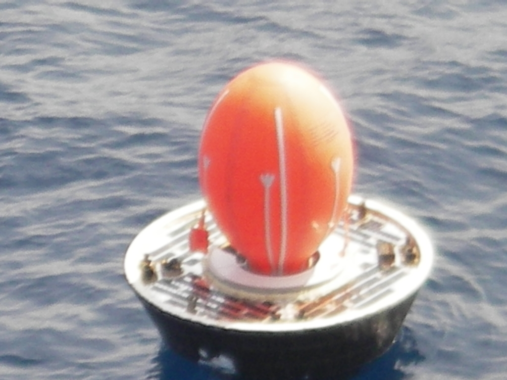
During its 12 days
in orbit, the two experiments on board SRE-1 were successfully conducted.
The craft was placed into a 620 x 640 km polar orbit that was lowered to
485 x 643 km on 20 January. Its capsule re-entered in the Bay of Bengal
precisely as planned at 150 km east of Sriharikota, and was hauled by a
helicopter from a coast guard vessel. The 10-minute deorbit burn began
at 3h30 UTC on 22 January, with entry at 4h07 and splashdown at 4h16 UTC.
The main parachute was deployed at about 2 km altitude and finally, SRE-1
splashed down in the Bay of Bengal with a velocity of 12 m/sec (about 43
km per hour) at 9h46. The flotation system, which immediately got triggered,
kept the capsule floating. Recovery operations were supported and carried
out by the Indian Coast Guard and Indian Navy using ships, aircraft and
helicopters.
The successful launch,
in-orbit operation of the on board experiments and reentry and recovery
of SRE-1 has demonstrated Indias capability in important technologies
like aero-thermo structures, deceleration and flotation systems, navigation,
guidance and control. SRE-1 is an important beginning for providing a low
cost platform for micro-gravity experiments in space science and technology
and return specimen from space. |
| Source: |
Jonathan
Space Report No. 576
; Spacewarn No. 639
; National Space Science Data Center's
2007-001C
; Skyrocket's SRE
1 ; ISRO's SRS-1&
10
Jan 07 & 22
Jan 07 ; Spaceflight Now's
10
Jan 07 ; |
|
|
.
LAPAN-TUBSat
| Spacecraft: |
|
| Chronologies: |
2007 payload #3 ; 2007-001A ; 6,494th spacecraft. |
| Type: |
Earth imaging |
| Families: |
|
| Ranks: |
|
| Sponsor: |
Indonesian National Institute of Aeronautics
and Space (LAPAN) and Technical University of Berlin (TUB)
(LAPAN stands for Lembaga Penerbangan dan
Antariksa Nasional) |
|
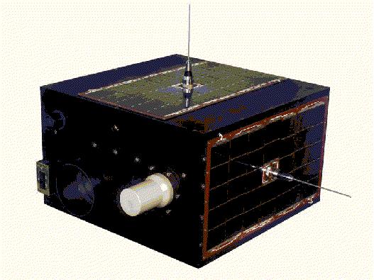 |
Anatomy of LAPAN-TUBSAT (Source: TUB)
| Launch: |
10 January 2007 at 3h53 UTC,
from Sriharikota's Satish Dhawan Space Centre SHAR (LC-1), by a PSLV. |
| Orbit: |
Initial: 620 km x 638 km x 97.9° x 97.3
min. |
| Mission: |
LAPAN-TUBsat is Indonesia's first
research satellite and a technology demonstrator that carries two color
cameras. It is a cooperative venture between the Technical University of
Berlin and the Indonesian National Institute of Aeronautics and Space.
This 56-kg microsatellite is an Earth observation satellite besides a technical
demonstrator in control systems. The 45 x 45 x 47 cm craft carries two
Charge Coupled Device (CCD) cameras with ground resolutions of 5 meter
and 200 mete, as well as an experiment for message store and forward system. |
| Source: |
Jonathan
Space Report No. 576
; Spacewarn No. 639
; National Space Science Data Center's
2007-001A
; Skyrocket's LAPAN-Tubsat
; ISRO's LAPAN-TUBSAT
& 10 Jan
07 ; TUB Satellites
; Spaceflight Now's 10
Jan 07 ; |
|
|
|
|
.
PEHUENSAT-1 / PehuenSat-OSCAR-63
(PO-63)
| Spacecraft: |
|
| Chronologies: |
2007 payload #4 ; 2007-001D ; 6,495th spacecraft. |
| Type: |
Amateur/Student |
| Families: |
|
| Ranks: |
|
| Sponsor: |
University of Comahue of Argentina, Amateur
Satellite Association of Argentina and Argentina Association for Space
Technology |
|
 |
| Launch: |
10 January 2007 at 3h53 UTC,
from Sriharikota's Satish Dhawan Space Centre SHAR (LC-1), by a PSLV. |
| Orbit: |
Initial: 621 km x 641 km x 97.9° x 97.3
min. |
| Mission: |
PEHUENSAT-1 is a 6.1-kg picosatellite that
is intended to enable experience building and tracking satellites. Developed
by University of Comahue of Argentina, Amateur Satellite Association of
Argentina and Argentina Association for Space Technology, it is intended
to provide an experiment platform to perform amateur radio experiments
between colleges and universities. The craft remained attached to the PSLVs
Dual Launch Adapter. |
| Source: |
Jonathan
Space Report No. 576
; Spacewarn No. 639
; National Space Science Data Center's
2007-001D
; Skyrocket's PehuenSat
1 ; ISRO's PEHUENSAT-1
& 10 Jan
07 ; Spaceflight Now's 10
Jan 07 ; |
|
|
.
Progress M-59 / ISS
24P
| Spacecraft: |
Progress M (7K-TGM) No. 359 |
| Chronologies: |
2007 payload #5 ; 2007-002A ; 6,496th spacecraft. |
| Type: |
Cargo delivery to the International Space
Station (463rd piloted spaceship) |
| Families: |
114th Progress
cargoship (24th to ISS) ; |
| Ranks: |
|
| Sponsor: |
Russian Federal Space Agency |
|
Source: NASA
|
| Launch: |
18 January 2007 at 2h12 UTC,
from Baykonur Cosmodrome's LC-1, by a Soyuz
U. |
| Orbit: |
Initial: 193.3 km x 246.4 km x 51.65°
x 88.6 min.
322 km x 352 km x 51.6° x 91.3 min. |
| Deorbited: |
1 August 2007 at 18h42 UTC" |
| Mission: |
Progress M-59 is a Russian automatic cargo
carrier that was launched toward the International Space Station. It delivered
2.56 tons of various cargoes, including 1,120 kg of propellant, 51 kg of
oxygen, 266 kg of food, 344 kg of atmospheric revitalization system equipment
(including Electron system oxygen generators and solid fuel oxygen generators),
100 kg of crew health care aids, parcels for the crew. Following a two-day
free flight, the craft docked with the Pirs module of the ISS at 3h03 UTC
on 20 January. The approach and docking were performed in the automatic
mode. The ISS orbital complex, weighing about 217 tonnes, is in an
orbit of 326.4 km x 370.4 km, accomplished in 91.2 min.
The Progress M-59 cargo ship
undocked from the Pirs module on 1st August 2007 at 14h07 UTC and was deorbited
over the Pacific at 18h42 UTC. |
| Source: |
Jonathan
Space Report No. 576
& 583
; Spacewarn No. 639
; National Space Science Data Center's
2007-002A
; Skyrocket's Progress
M-59 ; RSC Energia's 18
Jan 07 & 20
Jan 07 ; |
|
|
.
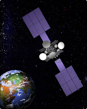
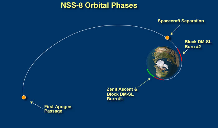
NSS 8
| Spacecraft: |
|
| Chronologies: |
2007 payload #6 ; 2007 1st loss ; 6,497th
spacecraft. |
| Type: |
Communications |
| Families: |
|
| Ranks: |
|
| Sponsor: |
SES New Skies |
|
Source: Boeing
|
The Zenit launcher preparations on the
Odyssey plaftform. (Source:
Boeing)
| Launch: |
30 January 2007 at 23h22 UTC,
from Odyssey launch platform, by a Zenit
3SL.
(The Odyssey Launch Platform was stationed
at 154° West Longitude on the Equator.) |
| Orbit: |
None. |
| Mission: |
 The
sixth satellite in the SES NEW SKIES fleet, NSS-8 was a 5,920 kg high-power
craft that would had provide coverage to two-thirds of the worlds population,
serving countries in Europe, Africa, the Middle East, the Indian subcontinent
and Asia. It was a Boeing 702 spacecraft that carries 56 C-band and 36
Ku-band transponders designed to replace the existing NSS-703
satellite as the centerpiece of NEW SKIES strategic Indian Ocean contribution
to SES global communications network. NSS-8 would had support a wide range
of functions, including corporate communications, government and military
operations, broadband Internet services and broadcast applications
Designed for a 15-year lifespan, NSS-8 was to had been placed into geosynchronous
orbit at 57° East Longitude. (A successful launch of NSS-8 would had
subsequently allow for NSS-703
to be re-deployed to the Atlantic Ocean region at 340° East, further
boosting the global coverage and connectivity provided by the 40 plus strong
fleet of satellites in the SES Group. The launch failure of NSS-8 means
that NSS-703 will now
stay at 57° East in order to continue to serve existing customers until
at least 2009. ) The
sixth satellite in the SES NEW SKIES fleet, NSS-8 was a 5,920 kg high-power
craft that would had provide coverage to two-thirds of the worlds population,
serving countries in Europe, Africa, the Middle East, the Indian subcontinent
and Asia. It was a Boeing 702 spacecraft that carries 56 C-band and 36
Ku-band transponders designed to replace the existing NSS-703
satellite as the centerpiece of NEW SKIES strategic Indian Ocean contribution
to SES global communications network. NSS-8 would had support a wide range
of functions, including corporate communications, government and military
operations, broadband Internet services and broadcast applications
Designed for a 15-year lifespan, NSS-8 was to had been placed into geosynchronous
orbit at 57° East Longitude. (A successful launch of NSS-8 would had
subsequently allow for NSS-703
to be re-deployed to the Atlantic Ocean region at 340° East, further
boosting the global coverage and connectivity provided by the 40 plus strong
fleet of satellites in the SES Group. The launch failure of NSS-8 means
that NSS-703 will now
stay at 57° East in order to continue to serve existing customers until
at least 2009. ) |
| Launch: |
 The
Zenit-3SL launch vehicle suffered a dramatic launch pad explosion when
it failed just after ignition and fell back onto its floating launch platform,
destroying the NSS 8 communications satellite payload. Video showed the
launch platform enveloped in a spectacular explosion, but Sea Launch reports
that the damage is not critical. (See video.) The
Zenit-3SL launch vehicle suffered a dramatic launch pad explosion when
it failed just after ignition and fell back onto its floating launch platform,
destroying the NSS 8 communications satellite payload. Video showed the
launch platform enveloped in a spectacular explosion, but Sea Launch reports
that the damage is not critical. (See video.)
In the final five
seconds, the launch team announcer was heard calling out "main engine start
command" and then "go inertial" as typically expected. But as the smoke
and steam billowed from the RD-171 engine firing to life, the rocket didn't
begin its normal quick rise skyward. Instead it fell out of the camera
view as the entire platform was enveloped in the explosionl, triggering
a hellish fireball that engulfed the floating Odyssey platform. Whether
the rocket tipped over, fell downward from the platform or collapsed was
inconclusive from the video seen live. Sea Launch immediately switched
its broadcast to a company graphic and then signed off. A brief Sea Launch
statement said that "all personnel are safe and accounted for." The platform
was cleared of all workers before the rocket was fueled, with the launch
team stationed aboard a command ship three miles away.
A preliminary assessment
of the Odyssey Launch Platform indicates that, while it has sustained limited
damage, the integrity and functionality of essential marine, communications
and crew support systems remains intact. The vessel is operating on its
own power and is currently manned by the full marine crew. This team is
performing a comprehensive assessment of all aspects of the vessel, including
its structural integrity and sea-worthiness, in anticipation of identifying
and planning the next steps. The team on the Sea Launch Commander is in
excellent condition and is supporting these activities. The Commander incurred
no damage during yesterday's launch attempt, as it was positioned four
miles from the Launch Platform at the time of lift-off.
This flight would
have been the 24th for Sea Launch since debuting in 1999. It was the second
total failure for the Zenit 3SL vehicle configuration. The first occurred
on 12 March 2000 during Sea Launch's third mission when a mis-configured
valve caused a pressure loss in the second stage. The vehicle was unable
to reach orbit and fell back to Earth, destroying an ICO mobile communications
satellite. There also was an incident in June 2004 when the Block DM-SL
upper stage shut down early, leaving the Telstar 18 satellite in a lower
than planned orbit. But the satellite was able to overcome the shortfall.
Sea Launch had planned to conduct six commercial satellite deployment missions
in 2007, with Tuesday's flight being the first. The schedule included the
Thuraya 3 mobile communications satellite, direct-to-home broadcasting
spacecraft for DirecTV and EchoStar, plus the Spaceway 3 broadband satellite
and Galaxy 19 for Intelsat.
Investigators traced
the cause of the failure to a piece of metallic debris lodged inside the
engine's liquid oxygen turbopump, according to a Sea Launch. "This object
ignited and burned as a result of friction-induced heat," the statement
said. "The combustion set off a string of events that led to the destruction
of the (liquid oxygen) pump, RD-171M engine and ultimately the Zenit 3SL." |
| Source: |
Jonathan
Space Report No. 576
; Skyrocket's NSS
8 ; Sea Launch's
1
Feb 07 ; SES New Skies's
15
Jan 07 & 30
Jan 07 ; Boeing's NSS-8
; Spaceflight Now's
30
Jan 07 &
1
Feb 07 ; Dwayne
A. Day Essay ; |
|
|
.
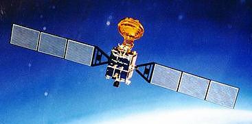
Beidou 4
| Spacecraft: |
Beidou 2A, Beidou 1D, Beidou
G1
(Fourth Beidou)
Beidou means Big Dipper |
| Chronologies: |
2007 payload #7 ; 2007-003A ; 6,498th spacecraft. |
| Type: |
Navigation |
| Families: |
|
| Ranks: |
|
| Sponsor: |
China Academy of Space Technology |
|
 |
| Launch: |
2 February 2007 at 16h28 UTC,
from Xichang Satellite Launch Center, by a Chang
Zheng 3A |
| Orbit: |
Geostationary |
| Mission: |
According to China press reports, China successfully
launched its fourth Beidou experimental navigation satellite. The spacecraft
is serving as a backup satellite for the Beidou navigation system and may
replace the first Beidou satellite
when necessary.
Beidou 2A was the
first of a series of improved Beidou geosynchronous navigation satellites,
following the Beidou 1 series launched during 2000-2003. A Long March 3A
launch vehicle successfully placed the spacecraft into a geosynchronous
transfer orbit of approximately 195 km by 41,775 km with an inclination
of 25°. The spacecraft, with a dry mass of about 1100 kg and 1200 kg
of propellant, appears to have suffered a failure at about the time of
its first apogee late on 2 February, when itss liquid-propellant main
engine would be expected to ignite. The U.S. Space Surveillance Network
(SSN) detected 70-100 debris soon after the breakup. Later, China reported
that the failure had not been catastrophic, and the spacecraft eventually
reached geosynchronous Earth orbit.
On 11 April 2007,
China
Daily (Xinhua) reports that Chinese scientists and technicians have
fixed a glitch on the Beidou satellite number 4 after 60 days of hard work,
according to the Xi'an Satellite Control Center. The satellite was
unable to deploy its solar panels correctly after launch, but the control
center now reported that it is once again functioning normally. This 4th
Beidou finally reached geostationary orbit in early April 2007 following
deployment problems with its solar panels and reports of US detection of
a debris cloud at the time of the original expected apogee firing.
The Beidou satellites
provide all-weather and all-day navigation and positioning information.
According to Chinese press, the system is operating well and has played
a significant role in cartography, telecommunications, water conservation,
transportation, fishery, prospecting, forest fire monitoring and national
security. The three previous Beidou satellites were sent in space on 31
October 2000, 21 December
2000 and 28 May 2003 respectively.
China is thus establishing
a Compass Navigation Satellite System wuich will in 2008 fully meet the
demand of satellite navigation for clients in China and neighboring regions.
The system will gradually extend to be a global navigation and positioning
system after network building and experiments, experts said. It will
be mainly used for economic purposes, providing efficient navigation and
positioning services in transportation, meteorology, petroleum prospecting,
forest fire monitoring, disaster forecast, telecommunications and public
security. |
| Source: |
Jonathan
Space Report No. 577
& 579
; Spacewarn No. 640
; National Space Science Data Center's
2007-003A
; Skyrocket's BD
1D ; Spaceflight Now's 2
Feb 07 ; NASA Orbital Debris
Quaterly News, April
2007 ; China Daily Online's
3
Feb 07 & 11
Apr 07 ; |
|
|
.
THEMIS P1
| Spacecraft: |
Time History of Events and Macroscale
Interactions during Substorms (MIDEX 5A) |
| Chronologies: |
2007 payload #8 ; 2007-004A ; 6,499th spacecraft. |
| Type: |
Earth Sciences |
| Families: |
|
| Ranks: |
|
| Sponsor: |
NASA |
|
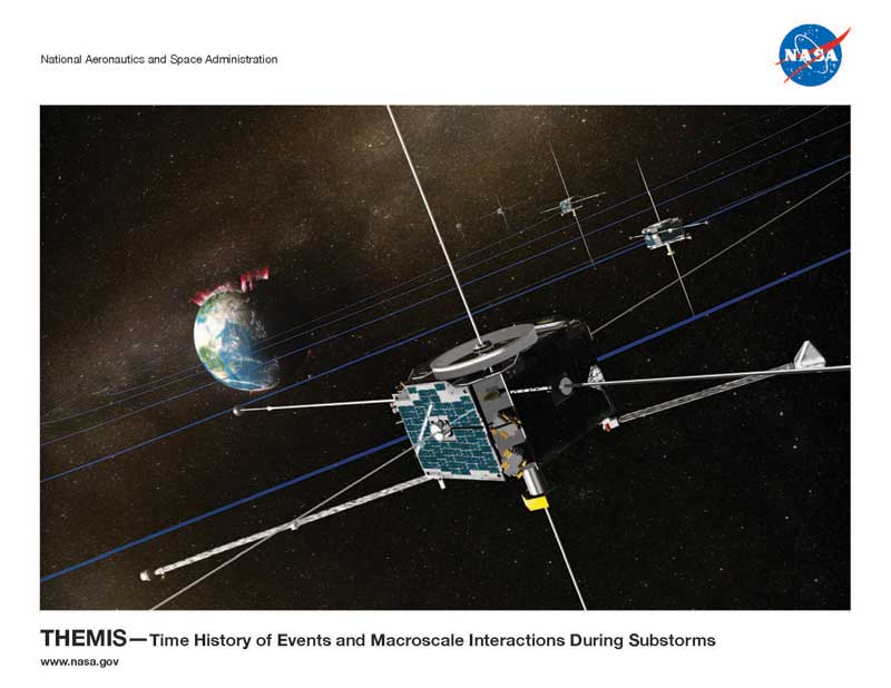 |
| Launch: |
17 February 2007 at 23h01 UTC,
from Cape Canaveral Air Force Station's SLC-17B, by a Delta
II 7925. |
| Orbit: |
Initial: 470 km x 87,330 km x 16.0° x
1,870 min. |
| Mission: |
THEMIS are a fleet of five 126-kg magnetospheric
satellites that carries identical instrumentation to measure particles
and fields to study magnetospheric storms. The mission is a NASA MIDEX
Explorer led by University of California at Berkeley. Built by Swales Aerospace,
each craft is 0.8-meter across with booms spanning 40.2 meter and a 76-kg
dry (125 kg fully fuelled) mass.
The mission consists
of several phases. In the first phase, the five THEMIS will all orbit as
a tight cluster in the same orbital plane with apogee at 15.4 Earth radii
(RE). In the second phase, also called the Dawn Phase, the apogee of THEMIS
1 will be at 30 RE, of THEMIS 2 at 20 RE, of THEMIS 3 and 4 at 12 RE, and
of THEMIS 5 at 10 RE. The orbits will continue to be in the dawn-dusk plane,
approximately. Because of the Earth's rotation around the Sun, during the
third phase (also known as the Tail Phase) the orbits will be in the noon-midnight
plane, with all apogees on the night side at the same altitudes as during
the second phase. The fourth phase is called the Dusk Phase, with all apogees
on the dusk side, and at the same altitudes as in the third phase. In the
fifth and final phase, the apogees will shift to the sunward side. In all
phases the perigee will remain at around 450 km, and inclination at about
16°. |
| Source: |
Jonathan
Space Report No. 577
; Spacewarn No. 640
; National Space Science Data Center's
2007-004A
; Skyrocket's THEMIS
P1 ; NASA's THEMIS
& Press
Kit; |
|
|
.
THEMIS P2 / ARTEMIS
P1
| Spacecraft: |
Time History of Events and Macroscale
Interactions during Substorms (MIDEX 5B) |
| Chronologies: |
2007 payload #9 ; 2007-004B ; 6,500th spacecraft. |
| Type: |
Earth Sciences |
| Families: |
|
| Ranks: |
|
| Sponsor: |
NASA |
|
|
| Launch: |
17 February 2007 at 23h01 UTC,
from Cape Canaveral Air Force Station's SLC-17B, by a Delta
II 7925. |
| Orbit: |
Initial: 470 km x 87,330 km x 16.0° x
1,870 min. |
| Mission: |
THEMIS are a fleet of five 126-kg magnetospheric
satellites that carries identical instrumentation to measure particles
and fields to study magnetospheric storms. The mission is a NASA MIDEX
Explorer led by University of California at Berkeley. Built by Swales Aerospace,
each craft is 0.8-meter across with booms spanning 40.2 meter and a 76-kg
dry (125 kg fully fuelled) mass.
The mission consists
of several phases. In the first phase, the five THEMIS will all orbit as
a tight cluster in the same orbital plane with apogee at 15.4 Earth radii
(RE). In the second phase, also called the Dawn Phase, the apogee of THEMIS
1 will be at 30 RE, of THEMIS 2 at 20 RE, of THEMIS 3 and 4 at 12 RE, and
of THEMIS 5 at 10 RE. The orbits will continue to be in the dawn-dusk plane,
approximately. Because of the Earth's rotation around the Sun, during the
third phase (also known as the Tail Phase) the orbits will be in the noon-midnight
plane, with all apogees on the night side at the same altitudes as during
the second phase. The fourth phase is called the Dusk Phase, with all apogees
on the dusk side, and at the same altitudes as in the third phase. In the
fifth and final phase, the apogees will shift to the sunward side. In all
phases the perigee will remain at around 450 km, and inclination at about
16°.
In 2009, the second
and third THEMIS spacecrafts were coopted for ARTEMIS lunar mission, following
the end of their primary magnetospheric research missions. Their onboard
propulsion systems were used to raise their orbits starting in July 2009
and, in the Spring of 2010, they were both operating beyond the orbit of
the Moon. The second THEMIS made lunar flybys on 31 January and 13 February
2010, and third THEMIS made a lunar flyby on 28 March 2010. The THEMIS
and ARTEMIS missions are led by a team at University of California-Berkeley.
The spacecraft studied the solar wind, the distant magnetotail, and the
lunar wake, and will end up in lunar orbit. |
| Source: |
Jonathan
Space Report No. 577,
628
;
Spacewarn No. 640
; National Space Science Data Center's
2007-004B
; Skyrocket's THEMIS
P2 ; NASA's THEMIS
; |
|
|
.
THEMIS P3 / ARTEMIS
P2
| Spacecraft: |
Time History of Events and Macroscale
Interactions during Substorms (MIDEX 5C) |
| Chronologies: |
2007 payload #10 ; 2007-004C ; 6,501st spacecraft. |
| Type: |
Earth Sciences |
| Families: |
|
| Ranks: |
|
| Sponsor: |
NASA |
|
|
| Launch: |
17 February 2007 at 23h01 UTC,
from Cape Canaveral Air Force Station's SLC-17B, by a Delta
II 7925. |
| Orbit: |
Initial: 470 km x 87,330 km x 16.0° x
1,870 min. |
| Mission: |
THEMIS are a fleet of five 126-kg magnetospheric
satellites that carries identical instrumentation to measure particles
and fields to study magnetospheric storms. The mission is a NASA MIDEX
Explorer led by University of California at Berkeley. Built by Swales Aerospace,
each craft is 0.8-meter across with booms spanning 40.2 meter and a 76-kg
dry (125 kg fully fuelled) mass.
The mission consists
of several phases. In the first phase, the five THEMIS will all orbit as
a tight cluster in the same orbital plane with apogee at 15.4 Earth radii
(RE). In the second phase, also called the Dawn Phase, the apogee of THEMIS
1 will be at 30 RE, of THEMIS 2 at 20 RE, of THEMIS 3 and 4 at 12 RE, and
of THEMIS 5 at 10 RE. The orbits will continue to be in the dawn-dusk plane,
approximately. Because of the Earth's rotation around the Sun, during the
third phase (also known as the Tail Phase) the orbits will be in the noon-midnight
plane, with all apogees on the night side at the same altitudes as during
the second phase. The fourth phase is called the Dusk Phase, with all apogees
on the dusk side, and at the same altitudes as in the third phase. In the
fifth and final phase, the apogees will shift to the sunward side. In all
phases the perigee will remain at around 450 km, and inclination at about
16°.
In 2009, the second
and third THEMIS spacecrafts were coopted for ARTEMIS lunar mission, following
the end of their primary magnetospheric research missions. Their onboard
propulsion systems were used to raise their orbits starting in July 2009
and, in the Spring of 2010, they were both operating beyond the orbit of
the Moon. The second THEMIS made lunar flybys on 31 January and 13 February
2010, and third THEMIS made a lunar flyby on 28 March 2010. The THEMIS
and ARTEMIS missions are led by a team at University of California-Berkeley.
The spacecraft studied the solar wind, the distant magnetotail, and the
lunar wake, and will end up in lunar orbit. |
| Source: |
Jonathan
Space Report No. 577,
628;
Spacewarn
No. 640
; National Space Science Data Center's
2007-004C
; Skyrocket's THEMIS
P3 ; NASA's THEMIS
; |
|
|
.
THEMIS P4
| Spacecraft: |
Time History of Events and Macroscale
Interactions during Substorms (MIDEX 5D) |
| Chronologies: |
2007 payload #11 ; 2007-004D ; 6,502nd spacecraft. |
| Type: |
Earth Sciences |
| Families: |
|
| Ranks: |
|
| Sponsor: |
NASA |
|
|
| Launch: |
17 February 2007 at 23h01 UTC,
from Cape Canaveral Air Force Station's SLC-17B, by a Delta
II 7925. |
| Orbit: |
Initial: 470 km x 87,330 km x 16.0° x
1,870 min. |
| Mission: |
THEMIS are a fleet of five 126-kg magnetospheric
satellites that carries identical instrumentation to measure particles
and fields to study magnetospheric storms. The mission is a NASA MIDEX
Explorer led by University of California at Berkeley. Built by Swales Aerospace,
each craft is 0.8-meter across with booms spanning 40.2 meter and a 76-kg
dry (125 kg fully fuelled) mass.
The mission consists
of several phases. In the first phase, the five THEMIS will all orbit as
a tight cluster in the same orbital plane with apogee at 15.4 Earth radii
(RE). In the second phase, also called the Dawn Phase, the apogee of THEMIS
1 will be at 30 RE, of THEMIS 2 at 20 RE, of THEMIS 3 and 4 at 12 RE, and
of THEMIS 5 at 10 RE. The orbits will continue to be in the dawn-dusk plane,
approximately. Because of the Earth's rotation around the Sun, during the
third phase (also known as the Tail Phase) the orbits will be in the noon-midnight
plane, with all apogees on the night side at the same altitudes as during
the second phase. The fourth phase is called the Dusk Phase, with all apogees
on the dusk side, and at the same altitudes as in the third phase. In the
fifth and final phase, the apogees will shift to the sunward side. In all
phases the perigee will remain at around 450 km, and inclination at about
16°. |
| Source: |
Jonathan
Space Report No. 577
; Spacewarn No. 640
; National Space Science Data Center's
2007-004D
; Skyrocket's THEMIS
P4 ; NASA's THEMIS
; |
|
|
.
THEMIS P5
| Spacecraft: |
Time History of Events and Macroscale
Interactions during Substorms (MIDEX 5E) |
| Chronologies: |
2007 payload #12 ; 2007-004E ; 6,503rd spacecraft. |
| Type: |
Earth Sciences |
| Families: |
|
| Ranks: |
|
| Sponsor: |
NASA |
|
|
| Launch: |
17 February 2007 at 23h01 UTC,
from Cape Canaveral Air Force Station's SLC-17B, by a Delta
II 7925. |
| Orbit: |
Initial: 470 km x 87,330 km x 16.0° x
1,870 min. |
| Mission: |
THEMIS are a fleet of five 126-kg magnetospheric
satellites that carries identical instrumentation to measure particles
and fields to study magnetospheric storms. The mission is a NASA MIDEX
Explorer led by University of California at Berkeley. Built by Swales Aerospace,
each craft is 0.8-meter across with booms spanning 40.2 meter and a 76-kg
dry (125 kg fully fuelled) mass.
The mission consists
of several phases. In the first phase, the five THEMIS will all orbit as
a tight cluster in the same orbital plane with apogee at 15.4 Earth radii
(RE). In the second phase, also called the Dawn Phase, the apogee of THEMIS
1 will be at 30 RE, of THEMIS 2 at 20 RE, of THEMIS 3 and 4 at 12 RE, and
of THEMIS 5 at 10 RE. The orbits will continue to be in the dawn-dusk plane,
approximately. Because of the Earth's rotation around the Sun, during the
third phase (also known as the Tail Phase) the orbits will be in the noon-midnight
plane, with all apogees on the night side at the same altitudes as during
the second phase. The fourth phase is called the Dusk Phase, with all apogees
on the dusk side, and at the same altitudes as in the third phase. In the
fifth and final phase, the apogees will shift to the sunward side. In all
phases the perigee will remain at around 450 km, and inclination at about
16°. |
| Source: |
Jonathan
Space Report No. 577
; Spacewarn No. 640
; National Space Science Data Center's
2007-004E;
Skyrocket's
THEMPS
P4 ; NASA's THEMIS
; |
|
|
.
IGS Radar-2
| Spacecraft: |
Information Gathering Satellites
Radar-2 |
| Chronologies: |
2007 payload #13 ; 2007-005A ; 6,504th spacecraft. |
| Type: |
Radar Surveillance |
| Families: |
|
| Ranks: |
|
| Sponsor: |
Japan Defense Ministry (Cabinet Satellite
Intelligence Center, CSICE) |
|
 |
| Launch: |
24 February 2007 at 4h41 UTC,
from Tanegashima Space Center's YLP-1, by a H-2A. |
| Orbit: |
Initial: 481 km x 494 km x 97.2° x 94.4
min. |
| Mission: |
This pair of Japanese military reconnaissance
satellites are intended to provide early warning of impending hostile launches
in the neighborhood. One of them uses a radar and the other optical telescopes
to sight such launches, but the capabilities are not matched to the names.
After an initial checkout phase by JAXA, the satellites are operated by
the Cabinet Satellite Intelligence Center (CSICE, Naikaku Eisei Joho Center)
of Tokyo via its main Kitaura Fuku Center ground station in Ibaraki prefecture.
Optical-1and
Radar-1
were launched in March 2003; two satellites lost in Novvember 2003 would
have been Optical-2 and Radar-2once
reaching orbit (although those are not official names). In an effort to
recover quickly, a second Optical-2
was launched on its own in September 2006 while the new Radar-2 was still
being completed. |
| Source: |
Jonathan
Space Report No. 577
& 578
; Spacewarn No. 640
; National Space Science Data Center's
2007-005A
; Skyrocket's IGS-Radar
3 ; |
|
|
.
IGS Optical-3V
| Spacecraft: |
Information Gathering Satellites
Optical-3 Verification |
| Chronologies: |
2007 payload #14 ; 2007-005B ; 6,505th spacecraft. |
| Type: |
Radar Surveillance |
| Families: |
|
| Ranks: |
|
| Sponsor: |
Japan Defense Ministry (Cabinet Satellite
Intelligence Center, CSICE) |
|
|
| Launch: |
24 February 2007 at 4h41 UTC,
from Tanegashima Space Center's YLP-1, by a H-2A. |
| Orbit: |
Initial: 481 km x 494 km x 97.2° x 94.4
min. |
| Mission: |
This pair of Japanese military reconnaissance
satellites are intended to provide early warning of impending hostile launches
in the neighborhood. One of them uses a radar and the other optical telescopes
to sight such launches, but the capabilities are not matched to the names.
The Optical-3 Verification satellite is an experimental satellite on a
six-month engineering mission to test out improvements to the earlier Japanese
optical spy satellites, which performed less well than hoped. The true
Optical-3 satellite will fly in 2009, followed by launch of Radar-3 and
Optical-4 in around 2011. |
| Source: |
Jonathan
Space Report No. 577
& 578
; Spacewarn No. 640
; National Space Science Data Center's
2007-005B
; Skyrocket's IGS-Optical 4V ; |
|
|
.
STPSat-1 (Orbital Express)
| Spacecraft: |
Space Test Program satellites |
| Chronologies: |
2007 payload #15 ; 2007-006D ; 6,506th spacecraft. |
| Type: |
Technology |
| Families: |
|
| Ranks: |
|
| Sponsor: |
U.S. Defense Advanced Research Projects Agency
DARPA) |
|
Source: DARPA
|
 |
 |
Left: Boeing technicians perform
a post-integration inspection of the Orbital Express program. Right: the
STP 1 payload, with Orbital Express above and the four smaller spacecrafts.
(Source: DARPA) |
 |
| Launch: |
9 March 2007 at 3h10 UTC, from
Cape Canaveral Air Force Station's SLC-41, by an Atlas
V. |
| Orbit: |
Initial: 499 km x 491 km x 46.03° x 94.5
min. |
| Mission: |
STPSat 1 is a 158-kg military satellite that
collects atmospheric data and demonstrate spacecraft technology advances.
Built by AeroAstro, it carries experiments to study the Earth's atmosphere,
ionosphere and radiation environment. STPSat also ejects two small
MEPSI
picosatellites for the Aerospace Corp.
The goal of the
Orbital Express Space Operations Architecture program is to validate the
technical feasibility of robotic, autonomous on-orbit refueling and reconfiguration
of satellites to support a broad range of future U.S. national security
and commercial space programs. Refueling satellites will enable frequent
maneuver to improve coverage, change arrival times to counter denial and
deception and improve survivability, as well as extend satellite lifetime.
Electronics upgrades on-orbit can provide regular performance improvements
and dramatically reduce the time to deploy new technology on-orbit. The
Orbital Express advanced technology demonstration will design, develop
and test on-orbit a prototype servicing satellite (ASTRO) and a surrogate
next generation serviceable satellite (NextSat). NASA's Space Launch
Initiative (SLI) is partnering with DARPA in the Orbital Express demonstration
in order to reduce technical risks associated with developing autonomous
rendezvous capabilities. |
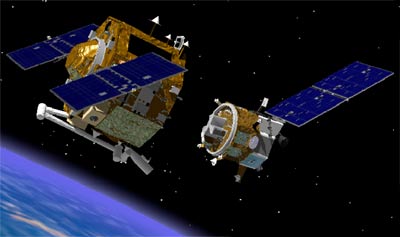
| Launch: |
The US Air Force STP-1 mission carries the
Orbital Express with the two linked satellites ASTRO
and NextSat. They were deployed into a 490 x 498
km x 46.0° orbit. It also carried the first ESPA (EELV Secondary
Payload Adapter) ring with four smaller satellites attached. Midstar-1
was ejected into a 494 x 498 km x 46.0° orbit and than the Centaur
stage made two burns to raise the orbit, entering a 397 x 3,435 km x 44°
fast transfer orbit 34 minutes after launch and then a 557 x 560 km x
35.4° orbit 13 minutes later. The remaining three satellites were then
deployed. |
| Source: |
Jonathan
Space Report No. 578
; Spacewarn No. 641
; National Space Science Data Center's
2007-006D
; Skyrocket's STPSat-1
; DARPA's Orbital
Express, Fact
Sheet & Mission
Updates ; |
|
|
.
ASTRO / OE-ASTRO
| Spacecraft: |
Autonomous Space Transporter
and Robotic Orbiter |
| Chronologies: |
2007 payload #16 ; 2007-006A ; 6,507th spacecraft. |
| Type: |
Science & Technology |
| Families: |
|
| Ranks: |
|
| Sponsor: |
U.S. National Research Laboratory (NRL) |
|
Source: Skyrocket
|
Orbital Express ASTROo-NextStar systems
(Source: DARPA)
|
.
NextSat / OE-NextSat
| Spacecraft: |
|
| Chronologies: |
2007 payload #17 ; 2007-006C ; 6,508th spacecraft. |
| Type: |
Technology |
| Families: |
|
| Ranks: |
|
| Sponsor: |
U.S. Defense Advanced Research Projects Agency
(DARPA) |
|

Source: DARPA
|
|
.
MidSTAR-1
| Spacecraft: |
|
| Chronologies: |
2007 payload #18 ; 2007-006E ; 6,509th spacecraft. |
| Type: |
Science & Technology |
| Families: |
|
| Ranks: |
|
| Sponsor: |
U.S. Naval Academy |
|

Source: Skyrocket
|
|
.
CFESat
| Spacecraft: |
|
| Chronologies: |
2007 payload #19 ; 2007-006F ; 6,510th spacecraft. |
| Type: |
Science & Technology |
| Families: |
|
| Ranks: |
|
| Sponsor: |
U.S. Los Alamos National Laboratory (LANL) |
|
Source: Skyrocket
|
| Launch: |
9 March 2007 at 3h10 UTC, from
Cape Canaveral Air Force Station's SLC-41, by an Atlas
V. |
| Orbit: |
Initial: 558 km x 560 km x 35.4° x 95.8
min. |
| Mission: |
CFESat is a 156-kg military satellite that
tests technology advances such as an on-board supercomputer to process
data. Built by Surrey Satellite for the Los Alamos Laboratories, it carries
the Cibola Flight Experiment to survey the radio spectrum and study the
ionosphere and lightning. |
| Source: |
Jonathan
Space Report No. 578
; Spacewarn No. 641
; National Space Science Data Center's
2007-006F
; Skyrocket's CFESat
; |
|
|
.
FalconSat-3
| Spacecraft: |
|
| Chronologies: |
2007 payload #20 ; 2007-006E ; 6,511th spacecraft. |
| Type: |
Science & Technology |
| Families: |
|
| Ranks: |
|
| Sponsor: |
U.S. Air Force Academy |
|
Source: Skyrocket
|
|
.
MEPSI Picosat 4A
| Spacecraft: |
Microelectromechanical systems
(MEMS)-based Picosat Inspector |
| Chronologies: |
2007 payload #21 ; 2007-006 ; 6,512th spacecraft. |
| Type: |
Technology |
| Families: |
|
| Ranks: |
|
| Sponsor: |
U.S. Defense Advanced Research Projects Agency
(DARPA) |
|
|
| Launch: |
9 March 2007 at 3h10 UTC, from
Cape Canaveral Air Force Station's SLC-41, by an Atlas
V. |
| Orbit: |
|
| Mission: |
The MEPSI series is a pair of tethered picosatellites,
based on the CubeSat design, that are manufactured for DARPA by the Aerospace
Corporation in collaboration with the NASA Jet Propulsion Laboratory. The
two spacecraft are cubic in shape, weight 1 kg each, and are connected
via a 15.2-meter tether in order to facilitate detection and tracking via
ground-based radar. The spacecraft carry a cold gas propulsion system,
with 0.1-N thrust with 5 thrusters. The aim of the MEPSI series is to developing
autonomous small sub-spacecraft that can be carried for remote inspection
and servicing. |
| Source: |
Jonathan
Space Report No. 578
; Skyrocket's MEPSI
4A ; |
|
|
.
MEPSI Picosat 4B
| Spacecraft: |
Microelectromechanical systems
(MEMS)-based Picosat Inspector |
| Chronologies: |
2007 payload #22 ; 2007-006 ; 6,513th spacecraft. |
| Type: |
Technology |
| Families: |
|
| Ranks: |
|
| Sponsor: |
U.S. Defense Advanced Research Projects Agency
(DARPA) |
|
|
| Launch: |
9 March 2007 at 3h10 UTC, from
Cape Canaveral Air Force Station's SLC-41, by an Atlas
V. |
| Orbit: |
|
| Mission: |
The MEPSI series is a pair of tethered picosatellites,
based on the CubeSat design, that are manufactured for DARPA by the Aerospace
Corporation in collaboration with the NASA Jet Propulsion Laboratory. The
two spacecraft are cubic in shape, weight 1 kg each, and are connected
via a 15.2-meter tether in order to facilitate detection and tracking via
ground-based radar. The spacecraft carry a cold gas propulsion system,
with 0.1-N thrust with 5 thrusters. The aim of ht MEPSI series is to developing
autonomous small sub-spacecraft that can be carried for remote inspection
and servicing. |
| Source: |
Jonathan
Space Report No. 578
; Skyrocket's MEPSI
4B ; |
|
|
.
Skynet 5A
| Spacecraft: |
|
| Chronologies: |
2007 payload #23 ; 2007-007B ; 6,514th spacecraft. |
| Type: |
Communications (Secure military communications) |
| Families: |
|
| Ranks: |
|
| Sponsor: |
United Kingdom's Ministry of Defence (MoD) |
|
 |
| Launch: |
11 March 2007 at 22h03 UTC, from
Kourou Space Center's ELA-3, by an Ariane
5 ECA. |
| Orbit: |
Initial (orbital injection): 249.8 km x 35,952
km x 4.5°
Geostationary at 1° West longitude. |
| Mission: |
Skynet 5A is a British military communications
spacecraft, the highest power X-Band satellite in orbit. It is nuclear-
and laser-hardened to demanding NATO standards. Its anti-jamming
antenna is extremely effective against hostile or non-hostile interference.
All transmit beams are steerable and the active antenna forms multiple
complex receive beam patterns to maximise terminal performance. Skynet
5A is being orbited on behalf of EADS Astrium, which is delivering the
satellite in orbit for the private company Paradigm Secure Communications
wich offer secure communications services for the British armed forces,
NATO and other countries. Built by Astrium, the satellite weigh about 4,700
kg at launch. It is a 3-axis stabilized, 4.5 x 2.9 x 3.7 meters (with 34
meter wingspan in orbit) EUROSTAR E3000S platforme with a planned operational
life time of 15 years.
Skynet 5 is the
groundbreaking next generation military satellite communications programme
to provide end-to-end, resilient, secure Beyond Line of Site communications
services, including welfare, to the UK MoD and other non-UK MoD and multinational
customers until 2020. Skynet 5A is the first of three satellites that will
form a new constellation to meet the UK MoDs milsatcoms requirements until
2020. One of the three satellites will be an in-orbit spare, to guard against
satellite loss. The programme provides delivery of information services
between the UKs Defence Fixed Network and in-theatre networks and users.
Secure communications services will be delivered by the owner and operator
- Paradigm Secure Communications with the system, including the satellites,
designed and built by Astrium Satellites. Both companies are wholly owned
by Astrium, a subsidiary of EADS, European Aeronautic Defence and Space
company. The MoD contract, which is now worth £3.6 billion was placed
with Paradigm in October 2003. It is the UK MoDs largest and most complex
PFI contract to date. |
| Note: |
This was the 31st Ariane 5 launch, which
carried a total payload of 8,600 kg, including 7,785 for the two satellites.
Skynet 5A is the 26th military payload entrusted to Ariane, which has already
orbited the Skynet 4B, 4C, 4E and 4F satellites for the British MoD and
NATO. Arianespace has two more MoD satellites in its launch backlog, Skynet
5B and Skynet 5C. |
| Source: |
Jonathan
Space Report No. 578
; Spacewarn No. 641
; National Space Science Data Center's
2007-007B
; Skyrocket's Skynet
5A ; Paradigmsn'
10
May 07 ; Arianespace's
11
Mar 07 & Flight
175 Press Kit ; Astrium EADS's
Press
Kit ; Spaceflight Now's 11
Mar 07 ; Chronologie
Ariane 2007 ; |
|
|
.
Insat 4B
| Spacecraft: |
|
| Chronologies: |
2007 payload #24 ; 2007-007A ; 6,515th spacecraft. |
| Type: |
Communications |
| Families: |
|
| Ranks: |
|
| Sponsor: |
Indian Space Research Organization (ISRO) |
|
Source: ISRO
|
Left: Insat 4B antennas. Center: Insat
4B components. Right: mission profile. (Source: ISRO)
| Launch: |
11 March 2007 at 22h03 UTC, from
Kourou Space Center's ELA-3, by an Ariane
5 ECA. |
| Orbit: |
Initial (orbital injection): 249.8 km x 35,952
km x 4.5°
Geostationary at 93.5° East longitude
(over the Indian Ocean) |
| Mission: |
Insat 4B is dedicated to television and telecommunications
services, with 12 Ku-band transponders and 12 C-band transponders. Primarily
covering the Indian sub-continent, the spacecraft further augment the INSAT
capacity for Direct-To-Home (DTH) television services and other communication
and TV services. It is the second satellite in the INSAT-4 series designed
to augment the communication services in C-band and Ku-band. Designed,
assembled and integrated by the Indian Space Research Organization in Bangalore,
the craft weigh 3,028 kg at launch (1.335 kg dry mass). Insat 4B
is a 3-axis stabilized, 3.10 x 1.77 x 2.0 meters (with 15.4 meters with
its solar arrays fully deployed in orbit). The satellites two solar arrays
together generate 5,860 Watt of electrical power. Designed for a mission
life of 12 years, it is co-located in geosynchronous orbit with INSAT-3A
satellite at 93.5° East longitude. It is the 13th ISRO satellite to
use the European launcher.
The INSAT system,
which was established in 1983, is the largest domestic communication satellite
system in the Asia-Pacific region comprising nine satellites -- INSAT-2E,
INSAT-3A, INSAT-3B, INSAT-3C, INSAT-3E, KALPANA-1, GSAT-2, EDUSAT and INSAT-4A
-- providing 175 transponders besides meteorological instruments. INSAT-4B
will further augment the INSAT system capacity for DTH services. |
| Source: |
Jonathan
Space Report No. 578
; Spacewarn No. 641
; National Space Science Data Center's
2007-007A
; Skyrocket's Insat
4B ; ISRO's INSAT
4B, 12 Mar
07, 13 Mar
07 , 14 Mar
07 & 16
Mar 07 ; Arianespace's 11
Mar 07 & Flight
175 Press Kit ; Astrium EADS's
Press
Kit ; Spaceflight Now's 11
Mar 07 ; |
|
|
.
DemoFlight 2
| Spacecraft: |
LCT2 / AFSS |
| Chronologies: |
2007 payload #25 ; 2007 2nd loss ; 6,516th
spacecraft. |
| Type: |
Technology (Launch vehicle test) |
| Families: |
|
| Ranks: |
|
| Sponsor: |
SpaceX, Defense Advanced Research Projects
Agency and NASA |
|
|
| Launch: |
21 March 2007 at 1h10 UTC, from
Omelek Island, by a Falcon 1.
(Omelek Island is part of a U.S. Army base
at Kwajalein Atoll in the Marshall Islands.) |
| Orbit: |
None. |
| Mission: |
DemoFlight-2 is a launch vehicle evaluation
payload containing two small experiments from NASA. The first expriement
is Low Cost TDRSS Transceiver, which woudl allow relay of telemetry to
the ground through the agency's TDRS satellites. The goal of the LCT2 effort
is to produce a transceiver that will significantly lower the flight hardware
costs required to communicate through NASA's Tracking and Data Relay Satellite
System. The second experiment is the Autonomous Flight Safety System, a
real-time onboard system for tracking and possible flight termination.
AFSS is designed primarily for small expendable vehicles at remote launch
sites where providing traditional ground-based range safety infrastructure.
Engineers also planned to demonstrate the Falcon 1's satellite separation
system by jettisoning a small 2-kg aluminum ring after arriving in orbit.
The DemoFlight-2
payload was to had remained attached to the Falcon-1 second stage, but
it did not reach orbit due to a problem with this stage. But for
SpaceX, this launch was a success or, as Jonathan McDowell puts it, the
Falcon flight reached an orbit of around -4200 km x 289 km x 9°. |
| Launch: |
  After a dramatic last-second abort an hour prior to actual launch -- a
pad abort declared during main engine start at 0h05 UTC --, the Falcon
1 rocket, a gleaming symbol of hopes to revolutionize space exploration
through private industry, took its second shot at orbit at 1h10 UTC. The
rocket was targeting an orbit of 330 x 680 km as engineers had programmed
the second stage to conduct a second burn about 45 minutes into the flight
to demonstrate its engine capability to reignite.
After a dramatic last-second abort an hour prior to actual launch -- a
pad abort declared during main engine start at 0h05 UTC --, the Falcon
1 rocket, a gleaming symbol of hopes to revolutionize space exploration
through private industry, took its second shot at orbit at 1h10 UTC. The
rocket was targeting an orbit of 330 x 680 km as engineers had programmed
the second stage to conduct a second burn about 45 minutes into the flight
to demonstrate its engine capability to reignite.
After first stage
separation, within three minutes of lift-off, the second stage fired its
engine for a planned 6½ minutes burn. But engineers stopped receiving
live radio signals some 10 minutes into the flight. "We did encounter,
late in the second stage burn, a roll-control anomaly," reports Elon Musk,
founder and CEO of SpaceX. (See launch
video)
But Musk said he
was pleased with the mission: "I think I'll characterize this as a very
good day for SpaceX. We successfully reached space and really retired almost
all the risk associated with the rocket. So I feel very good about where
things are
It definitely could have gone a little better today, but if
we've retired almost all the risk associated with the rocket, I think it
is hard to characterize that as anything but a success, at least in my
book, because this is a test launch of the rocket and not a satellite launch."
SpaceX's second
launch came a year after the Falcon 1 rocket suffered a major failure during
its maiden flight. Investigators
traced the cause of that accident to a corroded aluminum nut in the first
stage propulsion system, which triggered a fuel leak that led to a premature
shutdown of the Merlin engine about 30 seconds after liftoff. The next
launch of the Falcon 1 was scheduled for August carrying the TacSat 1 tactical
research satellite for the Naval Research Laboratory. A subsequent mission
to launch a Malaysian Earth-observation spacecraft was planned for late
this year. |
| Source: |
Jonathan
Space Report No. 579
; Skyrocket's Demosat
; SpaceX's Log
: Spaceflight Now's 20
Mar 07, 28
Mar 07 & Mission
Status ; |
Onboard camera views of the launch of
the second Falcon 1. (Source:
SpaceX)
|
|
.
Soyuz TMA-10 / ISS 14S
| Spacecraft: |
Soyuz 11F732 (7K-STMA) No. 220 |
| Chronologies: |
2007 payload #26 ; 2007-008A ; 6,517th spacecraft. |
| Type: |
Piloted Spaceship |
| Families: |
|
| Ranks: |
|
| Sponsor: |
Russian Space Agency |
|

Source : NASA
|
| Launch: |
7 April 2007 at 17h31 UTC, from
Baykonur LC-1, by a Soyuz-FG. |
| Orbit: |
330 km x 345 km x 51.6° x 91.3 min. |
| Landed: |
21 October 2007 at 10h36 UTC |
| Mission: |
Soyuz TMA-10 is a Russian passenger craft
that carried two cosmonauts and a tourist to the International Space Station.
Aboard are Expedition 15
Commander Fyodor Yurchikin and Flight Engineer Oleg Kotov, as well as Visting
Mission 12 (EP-12) tourist Charles Simonyi. Born in Hungary as Simonyi
Karoly, Simonyi is a former Microsoft executive. For the Soyuz flight,
Kotov is commander and Yurchikin is flight engineer; as Station crewmembers
their roles switch. The Expedition 15 and EP-12 crewmembers joined the
Expedition
14 crew of Mike Lopez-Alegria, Mikhail Tyurin and Sunita Williams when
Soyuz TMA-10 docked with the Zarya module on 9 April at 19h10 UTC.
Soyuz TMA-10 undocked
from Zarya on 27 October 2007 at 19h20 UTC and docked with Zvezda at 19h47
UTC. Soyuz TMA-10, with Expedition 15 crew (Yurchikin and Kotov) and visitor
Muszaphar Shukor, undocked from ISS Zvezda port on 21 October 2007 at 7h14
UTC. The craft fired its deorbit engines at 9h47 and, after a ballistic
reentry, landed in Kazakhstan. |
| Source: |
Jonathan
Space Report No. 579,
586
& 587
; Spacewarn No. 642
; National Space Science Data Center's
2007-008A
; Skyrocket's Soyuz
TMA-10 ; Spaceflight.Now's
9
Apr 07 ; |
|
|
.
Anik F3
| Spacecraft: |
|
| Chronologies: |
2007 payload #27 ; 2007-009A ; 6,518th spacecraft. |
| Type: |
Communications |
| Families: |
|
| Ranks: |
|
| Sponsor: |
Telesat Canada |
|
Source: EADS
Astrium
|
| Launch: |
9 April 2007 at 22h54 UTC, from
Baykonur Cosmodrfome, by a Proton-M/Briz. |
| Orbit: |
Geostationary at 118.7° West longitude. |
| Mission: |
  Anik
F3 is a 4.6-tonne, 10-kW communications spacecraft that carries 32 Ku-band,
24 C-band and two Ka-band transponders to provide voice and video transmissions
throughout North America. It is an EADS Astrium Eurostar 3000 model satellite
with a launch mass of 4634 kg, a solar array span of 36 metres once deployed
in orbit, and spacecraft power of 10 kW at end of it 15-year life. Anik
F3 provide broadcasting and telecommunications capacity and business communications
throughout North America and also carry a Ka-band payload to supplement
services now being carried on the Anik
F2 satellite. It provides services to EchoStar Satellite for
DTH distribution in the US market, as well as broadcasting and 2-way Internet
services. Telesat is also in discussion with several companies regarding
the use of the C-band capacity in both Canada and the US. Anik
F3 is a 4.6-tonne, 10-kW communications spacecraft that carries 32 Ku-band,
24 C-band and two Ka-band transponders to provide voice and video transmissions
throughout North America. It is an EADS Astrium Eurostar 3000 model satellite
with a launch mass of 4634 kg, a solar array span of 36 metres once deployed
in orbit, and spacecraft power of 10 kW at end of it 15-year life. Anik
F3 provide broadcasting and telecommunications capacity and business communications
throughout North America and also carry a Ka-band payload to supplement
services now being carried on the Anik
F2 satellite. It provides services to EchoStar Satellite for
DTH distribution in the US market, as well as broadcasting and 2-way Internet
services. Telesat is also in discussion with several companies regarding
the use of the C-band capacity in both Canada and the US. |
| Source: |
Jonathan
Space Report No. 579
; Spacewarn No. 642
; National Space Science Data Center's
2007-009A
; Skyrocket's Anik
F3 ; Telesat Canada's 10
Apr 07 & 1
May 07 ; EADS Astrium's Anik
F3 ; Spaceflight.Now's 10
Apr 07 ; |
|
|
.
Haiyang 1B / HY-1B
| Spacecraft: |
|
| Chronologies: |
2007 payload #28 ; 2007-010A ; 6,519th spacecraft. |
| Type: |
Earth Imagning |
| Families: |
|
| Ranks: |
|
| Sponsor: |
China |
|
 |
| Launch: |
11 April 2007 at 3h27 UTC, from
Taiyuan Satellite Launch Center, by a Chang
Zheng 2C. |
| Orbit: |
782 km x 815 km x 98.6° x 100.84 min.
783 km x 813 km x 98.6° |
| Mission: |
Haiyang 1B is an oceanographic/ocean-imaging
surveillance satellite that carries a 10-band ocean color scanner, a 4-band
CCD imager with 250-meter resolution and an infrared water profile radiometer.
This crucial component of China's three-dimensional oceanic survey system
is an upgraded version of the Haiyang-1A,
which was launched in 2002. HY-1A was launched as a secondary payload on
a CZ-4B launch, while HY-1B was the primary payload on its lighter CZ-2C
version. Five more such launches are planned before 2009. |
| Notes: |
Contracts were signed on 18 September 2002
for the development of a second oceanic satellite, Haiyang 1-B. This
satellite will be an advanced version of Haiyang
1-A, with improved technologies including memory capacity. It is scheduled
to be launched in 2005 on a Long March 2 carrier rocket. |
| Source: |
Jonathan
Space Report No. 579
; Spacewarn No. 642
; National Space Science Data Center's
2007-010A
; Skyrocket's HY
1B ; Spaceflight.Now's 11
Apr 07 ; China Daily Online's
12
Apr 07 ; Xinhuas 18
Sep 02 ; |
|
|
.
Beidou 5
| Spacecraft: |
Beidou M1, Beidou G1 |
| Chronologies: |
2007 payload #29 ; 2007-011A ; 6,520th spacecraft. |
| Type: |
Navigation |
| Families: |
|
| Ranks: |
|
| Sponsor: |
China |
|
|
| Launch: |
13 April 2007 at 20h11 UTC, from
Xichang Satellite Launch Center, by a Chang
Zheng 3A. |
| Orbit: |
21,519 km x 21,545 km x 55.3° x 773.4
min. |
| Mission: |
Beidou M1, the 5th Beidou satellite, is a
navigation satellite belonging to the COMPASS constellation of position-providing
satellites. It is the first to be targeted for a GPS-like 12-hour,
55° inclination, 21,000 km altitude orbit. When the COMPASS constellation
is completed, it will have five geostationary and 30 low-earth orbit satellites,
enabling location with an accuracy of 10 metres and velocity with an accuracy
of 0.2 m/s. |
| Source: |
Jonathan
Space Report No. 579
; Spacewarn No. 642
; National Space Science Data Center's
2007-011ASkyrocket's
BD 2A ; Spaceflight.Now's
14
Apr 07 ; |
|
|
.
EgyptSat 1 / Misr 1
(MirsSat 1)
| Spacecraft: |
|
| Chronologies: |
2007 payload #30 ; 2007-012A ; 6,521st spacecraft. |
| Type: |
Earth Remote Sensing |
| Families: |
|
| Ranks: |
|
| Sponsor: |
Egypt's National Authority for Remote Sensing
and Space Sciences |
|
 |
| Launch: |
17 April 2007 at 6h46 or 7h02
UTC, from Baikonur Cosmodrome, by a Dnepr. |
| Orbit: |
658 km x 666 km x 98.1° x 98.0 min.
657 km x 665 km x 98.1° x 97.97 min. |
| Mission: |
 EgyptSat
1 is Egypt's first Earth remote-sounding satellite. The 100-kg craft is
carrying an infrared sensing device and a high resolution multispectral
imager together with forward communications payload. (It is suspected by
Israeli officials to be a spy satellite.) The spacecraft has been jointly
developed by Egypt's National Authority for Remote Sensing and Space Sciences
and the Yuzhnoye Design Bureau in Ukraine. The craft is based on the Yuzhnoes
MS-1TK platform and was deisgned to operate in a solar-synchronous orbit.
Ukraine was also responsible for the development and maintenance of a ground
control station in Egypt, as well as for training of Egyptian flight control
personel. EgyptSat 1 is the first in a series of three satellites for scientific
research and remote sensing applications, the second and the third will
be named Egyptsat 2 and Sahrasat. EgyptSat
1 is Egypt's first Earth remote-sounding satellite. The 100-kg craft is
carrying an infrared sensing device and a high resolution multispectral
imager together with forward communications payload. (It is suspected by
Israeli officials to be a spy satellite.) The spacecraft has been jointly
developed by Egypt's National Authority for Remote Sensing and Space Sciences
and the Yuzhnoye Design Bureau in Ukraine. The craft is based on the Yuzhnoes
MS-1TK platform and was deisgned to operate in a solar-synchronous orbit.
Ukraine was also responsible for the development and maintenance of a ground
control station in Egypt, as well as for training of Egyptian flight control
personel. EgyptSat 1 is the first in a series of three satellites for scientific
research and remote sensing applications, the second and the third will
be named Egyptsat 2 and Sahrasat. |
| Source: |
Jonathan
Space Report No. 579
; Spacewarn No. 642
; National Space Science Data Center's
2007-012A
; Skyrocket's EgyptSat
1 ; NSAU's Dnepr
mission & EgyptSat
1 ; Russian Space's Dnepr
mission ; (NARSS) ; Spaceflight.Now's
17
Apr 07 ;KB Yuzhnoye's 27
Apr 07 ; |
|
|
.
Saudisat 3
| Spacecraft: |
|
| Chronologies: |
2007 payload #31 ; 2007-012B ; 6,522nd spacecraft. |
| Type: |
Earth Remote Sensing |
| Families: |
|
| Ranks: |
|
| Sponsor: |
Saudi Arabian's students and faculty of King
Abdulaziz City for Science and Technology (KACST) |
|
 |
| Launch: |
17 April 2007 at 6h46 or 7h02
UTC, from Baikonur Cosmodrome, by a Dnepr. |
| Orbit: |
656 km x 679 km x 98.1° x 98.1 min,
656 km x 678 km x 98.1° x 98.094 min. |
| Mission: |
 SaudiSat
3 is a 200-kg satellite that carries a high resolution imager built in
collaboration with the King Abdulaziz City for Science and Technology's
faculty and students. The craft is the largest satellite to date for KACST
space research center in Riyadh. SaudiSat 3 is a follow-on to the
earlier Saudisat projects, larger than its precedessors. SaudiSat
3 is a 200-kg satellite that carries a high resolution imager built in
collaboration with the King Abdulaziz City for Science and Technology's
faculty and students. The craft is the largest satellite to date for KACST
space research center in Riyadh. SaudiSat 3 is a follow-on to the
earlier Saudisat projects, larger than its precedessors. |
| Source: |
Jonathan
Space Report No. 579
; Spacewarn No. 642
; National Space Science Data Center's
2007-012B
; Skyrocket's Saudisat
3 ; Spaceflight Now's 17
Apr 07 ; |
|
|
.
SaudiComsat-3
| Spacecraft: |
|
| Chronologies: |
2007 payload #32 ; 2007-012J ; 6,523rd spacecraft. |
| Type: |
Communications (store/dump) |
| Families: |
|
| Ranks: |
|
| Sponsor: |
Saudi Arabian's students and faculty of King
Abdulaziz City for Science and Technology (KACST) |
|
 |
|
.
SaudiComsat-4
| Spacecraft: |
|
| Chronologies: |
2007 payload #33 ; 2007-012L ; 6,524th spacecraft. |
| Type: |
Communications (store/dump) |
| Families: |
|
| Ranks: |
|
| Sponsor: |
Saudi Arabian's students and faculty of King
Abdulaziz City for Science and Technology (KACST) |
|
|
|
.
SaudiComsat-5
| Spacecraft: |
|
| Chronologies: |
2007 payload #34 ; 2007-012H ; 6,525th spacecraft. |
| Type: |
Communications (store/dump) |
| Families: |
|
| Ranks: |
|
| Sponsor: |
Saudi Arabian's students and faculty of King
Abdulaziz City for Science and Technology (KACST) |
|
|
|
.
SaudiComsat-6
| Spacecraft: |
|
| Chronologies: |
2007 payload #35 ; 2007-012E ; 6,526th spacecraft. |
| Type: |
Communications (store/dump) |
| Families: |
|
| Ranks: |
|
| Sponsor: |
Saudi Arabian's students and faculty of King
Abdulaziz City for Science and Technology (KACST) |
|
|
|
.
SaudiComsat-7
| Spacecraft: |
|
| Chronologies: |
2007 payload #36 ; 2007-012C ; 6,527th spacecraft. |
| Type: |
Communications (store/dump) |
| Families: |
|
| Ranks: |
|
| Sponsor: |
Saudi Arabian's students and faculty of King
Abdulaziz City for Science and Technology (KACST) |
|
|
|
.
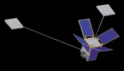
MAST - GADGET
| Spacecraft: |
Multiple Application Survivable
Tether experiment |
| Chronologies: |
2007 payload #37 ; 2007-012K ; 6,528th spacecraft. |
| Type: |
Amateur/Student Technology |
| Families: |
|
| Ranks: |
|
| Sponsor: |
Tethers Unlimited Inc. and Stanford University
students |
|
|
| Launch: |
17 April 2007 at 6h46 or 7h02
UTC, from Baikonur Cosmodrome, by a Dnepr. |
| Orbit: |
647 km x 782 km x 98.1° x 99.1 min. |
| Mission: |
MAST is a triplet of 1-kg Cubesats that demonstrate
space tether survivability. It consists of TED (the Tether Deployer) satellite,
with a 1-km deployable multi-strand Hoytether; RALPH, the small end mass
satellite and between them GADGET, an Inspector satellite which can crawl
up and down the tether. Before deployment, the MAST is 0.3-meter x 0.1-meter.
Built by Stanford University students, it is intended to study damage to
the multiple-wire tether due to meteoric impacts and UV-engendered degradation.
The lifetimes of current single-line tethers are limited by damage due
to meteorite and orbital debris impactors to periods on the order of weeks.
The Hoytether is a tether structure composed of multiple lines with redundant
interlinking that is able to withstand many impacts. GADGET slowly crawl
up and down the tether, taking pictures of the tether as it goes. These
pictures will be transmitted to a ground station for analysis to determine
how quickly the tether experiences damage due to impacts by micrometeoroids
and orbital debris, as well as due to erosion by atomic oxygen and UV light.
Two of the three craft were to separate as freeflyers. All three picosatellites
contain GPS receivers and data from these receivers will be collected to
provide information on the dynamics of tethered formations of spacecraft
and the performance of tether deployment technologies. |
| Source: |
Jonathan
Space Report No. 579
; Spacewarn No. 642
; National Space Science Data Center's2007-012K
; Skyrocket's MAST
; Spaceflight Now's 17
Apr 07 ; |
|
|
.
MAST - TED
| Spacecraft: |
Multiple Application Survivable
Tether experiment |
| Chronologies: |
2007 payload #38 ; 2007-012K ; 6,529th spacecraft. |
| Type: |
Amateur/Student Technology |
| Families: |
|
| Ranks: |
|
| Sponsor: |
Tethers Unlimited Inc. and Stanford University
students |
|
|
| Launch: |
17 April 2007 at 6h46 or 7h02
UTC, from Baikonur Cosmodrome, by a Dnepr. |
| Orbit: |
647 km x 782 km x 98.1° x 99.1 min. |
| Mission: |
MAST is a triplet of 1-kg Cubesats that demonstrate
space tether survivability. It consists of TED (the Tether Deployer) satellite,
with a 1-km deployable multi-strand Hoytether; RALPH, the small end mass
satellite and between them GADGET, an Inspector satellite which can crawl
up and down the tether. Before deployment, the MAST is 0.3-meter x 0.1-meter.
Built by Stanford University students, it is intended to study damage to
the multiple-wire tether due to meteoric impacts and UV-engendered degradation.
The lifetimes of current single-line tethers are limited by damage due
to meteorite and orbital debris impactors to periods on the order of weeks.
The Hoytether is a tether structure composed of multiple lines with redundant
interlinking that is able to withstand many impacts. GADGET slowly crawl
up and down the tether, taking pictures of the tether as it goes. These
pictures will be transmitted to a ground station for analysis to determine
how quickly the tether experiences damage due to impacts by micrometeoroids
and orbital debris, as well as due to erosion by atomic oxygen and UV light.
Two of the three craft were to separate as freeflyers. All three picosatellites
contain GPS receivers and data from these receivers will be collected to
provide information on the dynamics of tethered formations of spacecraft
and the performance of tether deployment technologies. |
| Source: |
Jonathan
Space Report No. 579
; Spacewarn No. 642
; National Space Science Data Center's
2007-012K
; Skyrocket's MAST
; Spaceflight Now's 17
Apr 07 ; |
|
|
.
MAST - RALPH
| Spacecraft: |
Multiple Application Survivable
Tether experiment |
| Chronologies: |
2007 payload #39 ; 2007-012K ; 6,530th spacecraft. |
| Type: |
Amateur/Student Technology |
| Families: |
|
| Ranks: |
|
| Sponsor: |
Tethers Unlimited Inc. and Stanford University
students |
|
|
| Launch: |
17 April 2007 at 6h46 or 7h02
UTC, from Baikonur Cosmodrome, by a Dnepr. |
| Orbit: |
647 km x 782 km x 98.1° x 99.1 min. |
| Mission: |
MAST is a triplet of 1-kg Cubesats that demonstrate
space tether survivability. It consists of TED (the Tether Deployer) satellite,
with a 1-km deployable multi-strand Hoytether; RALPH, the small end mass
satellite and between them GADGET, an Inspector satellite which can crawl
up and down the tether. Before deployment, the MAST is 0.3-meter x 0.1-meter.
Built by Stanford University students, it is intended to study damage to
the multiple-wire tether due to meteoric impacts and UV-engendered degradation.
The lifetimes of current single-line tethers are limited by damage due
to meteorite and orbital debris impactors to periods on the order of weeks.
The Hoytether is a tether structure composed of multiple lines with redundant
interlinking that is able to withstand many impacts. GADGET slowly crawl
up and down the tether, taking pictures of the tether as it goes. These
pictures will be transmitted to a ground station for analysis to determine
how quickly the tether experiences damage due to impacts by micrometeoroids
and orbital debris, as well as due to erosion by atomic oxygen and UV light.
Two of the three craft were to separate as freeflyers. All three picosatellites
contain GPS receivers and data from these receivers will be collected to
provide information on the dynamics of tethered formations of spacecraft
and the performance of tether deployment technologies. |
| Source: |
Jonathan
Space Report No. 579
; Spacewarn No. 642
; National Space Science Data Center's
2007-012K
; Skyrocket's MAST
; Spaceflight Now's 17
Apr 07 ; |
|
|
.
Fit-check of Cubesatellites at CalPoly
(Source: CAPE Team)
.
CAPE 1
| Spacecraft: |
Cajun Advanced Picosatellite
Experiment |
| Chronologies: |
2007 payload #40 ; 2007-012P ; 6,531st spacecraft. |
| Type: |
Amateur/Student Technology |
| Families: |
|
| Ranks: |
|
| Sponsor: |
University of Louisiana students |
|
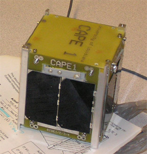 |
| Launch: |
17 April 2007 at 6h46 or 7h02
UTC, from Baikonur Cosmodrome, by a Dnepr. |
| Orbit: |
646 km x 793 km x 98.1° x 99.2 min. |
| Mission: |
 CAPE
1 is a 1-kg, 10-cm CubeSat that collect and store data on the ambient ionosphere
and relay it to students of the University of Louisiana, Lafayette.
The purpose of this satellite is to gather data while orbiting in space
and transmit them to the ground station on Lafayette campus. The team of
engineering students runs experiments and maintain the satellite while
in orbit. CAPE
1 is a 1-kg, 10-cm CubeSat that collect and store data on the ambient ionosphere
and relay it to students of the University of Louisiana, Lafayette.
The purpose of this satellite is to gather data while orbiting in space
and transmit them to the ground station on Lafayette campus. The team of
engineering students runs experiments and maintain the satellite while
in orbit. |
| Source: |
Jonathan
Space Report No. 579
; Spacewarn No. 642
; National Space Science Data Center's
2007-012P
; Skyrocket's CAPE
1 ; Spaceflight Now's 17
Apr 07 ; University of Lousiana's CAPE
; |
|
|
.
Aerocube 2 (Object S)
| Spacecraft: |
|
| Chronologies: |
2007 payload #41 ; 2007-012S ; 6,532nd spacecraft. |
| Type: |
Technology |
| Families: |
|
| Ranks: |
|
| Sponsor: |
U.S. Aerospace Corporation |
|
|
|
.
CSTB 1 / CubeSat TestBed
1 (Object R)
| Spacecraft: |
|
| Chronologies: |
2007 payload #42 ; 2007-012R ; 6,533rd spacecraft. |
| Type: |
Technology |
| Families: |
|
| Ranks: |
|
| Sponsor: |
U.S. Boeing IDS Advanced Systems |
|
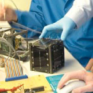
|
| Launch: |
17 April 2007 at 6h46 or 7h02
UTC, from Baikonur Cosmodrome, by a Dnepr. |
| Orbit: |
649 km x 770 km x 98.1° x 99.0 min. |
| Mission: |
The CubeSat TestBed 1 (CSTB 1) is a 1.5-kg
nanosatellite developed to evaluate miniature spacecraft technologies.
It was built by the Boeing company, Huntington Beach, Calif, to test attitude
control by means of sensing the magnetic field. During the CSTB 1
demonstrations, Boeing will test several new technologies, software designs
and on-orbit operations for nano-satellite functions. The satellite consists
of four microcontrollers as the brains, redundant communication systems
with two independent radios, two high-capacity lithium-ion rechargeable
batteries, a deployable antenna, a sophisticated control system that determines
the attitude of the spacecraft using sun and magnetic field sensors, a
simple attitude control system using magnetic torque coils and multi-functional
boards containing sensors and electronics. |
| Source: |
Jonathan
Space Report No. 579
; Spacewarn No. 642
; National Space Science Data Center's
2007-012R
; Skyrocket's CSTB
1 ; Spaceflight Now's 17
Apr 07 ; |
|
|
.
CP 3 / CalPoly 3
| Spacecraft: |
|
| Chronologies: |
2007 payload #43 ; 2007-012M ; 6,534th spacecraft. |
| Type: |
Amateur/Student Technology |
| Families: |
|
| Ranks: |
|
| Sponsor: |
California Polytechnic State University at
San Luis Obispo |
|
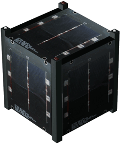
Source: CalPoly
|
| Launch: |
17 April 2007 at 6h46 or 7h02
UTC, from Baikonur Cosmodrome, by a Dnepr. |
| Orbit: |
646 km x 793 km x 98.1° x 99.2 min. |
| Mission: |
CalPoly 3 (CP 3) is a 1-kg student-built
CubeSat picosatellite. Its primary mission is to implement an attitude
control system using only magnetic torquers embedded within the side panels.
Attitude determination will be performed using the two axis magnetometers
on each side panel. As with all of our CubeSats, a primary mission
is also education. This Cal Poly's third satellite came on about
4 hours after launch but students were unable to send a beacon signal. |
| Source: |
Jonathan
Space Report No. 579
; Spacewarn No. 642
; National Space Science Data Center's
2007-012M
; Skyrocket's CP
3 ; CalPoly CP-3 &
14
May 07 ; Spaceflight Now's
17
Apr 07 ; |
|
|
.
CP 4 / CalPoly 4 (CP
2 or CP 2.1) (Object T)
| Spacecraft: |
|
| Chronologies: |
2007 payload #44 ; 2007-012T ; 6,535th spacecraft. |
| Type: |
Amateur/Student Technology |
| Families: |
|
| Ranks: |
|
| Sponsor: |
California Polytechnic State University at
San Luis Obispo |
|
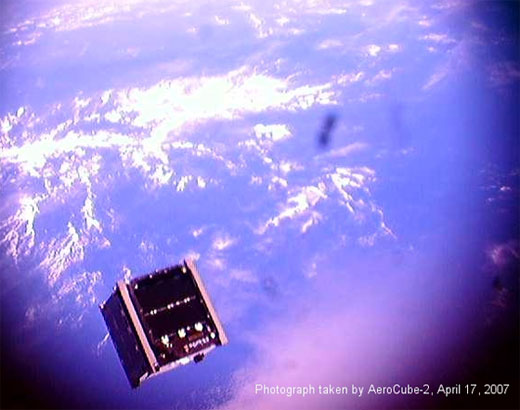
This picture
of CP4 was taken by AeroCube-2.
|
| Launch: |
17 April 2007 at 6h46 or 7h02
UTC, from Baikonur Cosmodrome, by a Dnepr. |
| Orbit: |
649 km x 770 km x 98.1° x 99.0 min. |
| Mission: |
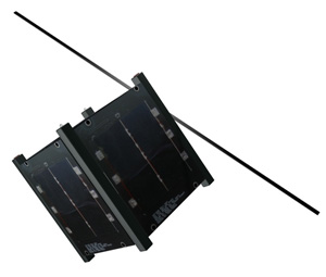 CP
4 (CalPoly 4) is a picosatellite that was designed by college students
at California Polytech. It carries a three-axis attitude determination
and control system, and a substantial data processing and storage system.
The craft is sometime refered to as CP2 or CP2.1 because, since CP2
was destroyed in the previous Dnepr launch failure, this a the second flight
unit of CP2 and studends had to declare the name as CP4 to Kosmotras. But,
in reallity, the satellite is CP2. CP
4 (CalPoly 4) is a picosatellite that was designed by college students
at California Polytech. It carries a three-axis attitude determination
and control system, and a substantial data processing and storage system.
The craft is sometime refered to as CP2 or CP2.1 because, since CP2
was destroyed in the previous Dnepr launch failure, this a the second flight
unit of CP2 and studends had to declare the name as CP4 to Kosmotras. But,
in reallity, the satellite is CP2. |
| Source: |
Jonathan
Space Report No. 579
; Spacewarn No. 642
; National Space Science Data Center's
2007-012T
; Skyrocket's CP
4 ; CalPoly's CP4
; Spaceflight Now's 17
Apr 07 ; |
|
|
.
Libertad
| Spacecraft: |
|
| Chronologies: |
2007 payload #45 ; 2007-012N ; 6,536th spacecraft. |
| Type: |
Amateur/Student Technology |
| Families: |
|
| Ranks: |
|
| Sponsor: |
Colombia's Universidad Sergio Arboleda students |
|
|
|
.
AGILE
| Spacecraft: |
Astrorivelatore Gamma ad Imagini
Leggero,
(Light Gamma-Ray Imaging Astronomical Detector) |
| Chronologies: |
2007 payload #46 ; 2007-013A ; 6,537th spacecraft. |
| Type: |
Astronomy |
| Families: |
|
| Ranks: |
|
| Sponsor: |
Italian Space Agency (ASI) |
|
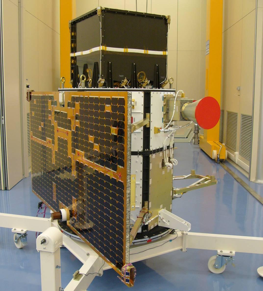 |
| Launch: |
23 April 2007 at 10h00 UTC, from
Satish Dhawan Space Centre SHAR's Second Launch Pad (SLP-2), by a PSLV. |
| Orbit: |
524 km x 553 km x 2.5° x 95.4 min.
523 km x 552 km x 2.5° |
| Mission: |
AGILE is a 325-kg (352 kg) Italian astronomical
satellite that carries X-ray and gamma ray spectrometers to study astronomical
objects in the Galaxy. It carries the GRID 0.3-200 MeV wide-field gamma
ray imager and the Super-AGILE 15-45 keV detector which will give the best
look yet at the hard X-ray sky. The design, development and fabrication
of the satellite were led by Carlo Gavazzi Space, Milan. |
| Note: |
In its eleventh
flight, PSLVs C8 mission was unique in many respects. For the first time,
the lanucher was flown without the six strap-on motors of the first stage.
Also, for the first time, it launched a satellite into an equatorial circular
orbit of 550 km and it was the first major commercial launch the contract
which was won against stiff international competition. |
| Source: |
Jonathan
Space Report No. 579
; Spacewarn No. 642
; National Space Science Data Center's
2007-013A
; Skyrocket's AGILE
; ASI's Agile ;
ISRO's
23
Apr 07 ; Spaceflight.Now'
23
Apr 07 ; |
|
|
.
AVM
| Spacecraft: |
Advanced Avionics Module |
| Chronologies: |
2007 payload #47 ; 2007-013B ; 6,538th spacecraft. |
| Type: |
Technology |
| Families: |
|
| Ranks: |
|
| Sponsor: |
Indian Space Research Organisation (ISRO) |
|
|
|
.
NFIRE
| Spacecraft: |
Near Field InfraRed Experiment |
| Chronologies: |
2007 payload #48 ; 2007-014A ; 6,539th spacecraft. |
| Type: |
Anti-satellite Technology |
| Families: |
|
| Ranks: |
|
| Sponsor: |
U.S. Department of Defense (U.S. Missile
Defense Agency) |
|
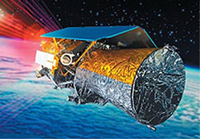 |
| Launch: |
24 April 2007 at 6h48 UTC, from
Wallops Island's LA-0B, by a Minotaur 1. |
| Orbit: |
255 km x 464 km x 48.2° x 91.7 min.
NFIRE was launched into a 255 x 465 km x
48.2° orbit; from 3 to 18 May 2007, then the orbit was raised to 489
x 497 km and it remained in that orbit on 2 August. On 9 August, the orbit
was lowered again to 243 x 487 km and by 23 August it was in a 219
x 450 km orbit. |
| Mission: |
 NFIRE
is is a military satellite designed to carry a kill vehicle (KV) to aim
at any rocket that is launched directly against it. Its instruments can
distinguish the exhaust plume at the launch phase from the rocket body.
Its primary payload is the Track Sensor Payload which will observe missiles
specially launched to fly close to it, and attempt to distinguish between
the missile itself and its hot rocket exhaust plume - a technology relevant
to proposed missile interceptors. NFIRE also has a secondary payload for
laser communications and a hydrazine propulsion system. The Missile Defense
Agency will launch two ballistic missiles toward NFIRE from Vandenberg
AFB to test the NFIRE/KV performances. These data will help validate the
MDAs choice of kill vehicles and tracking sensors for boost-phase missile
defense, and help improve the guidance and homing ability of ground-based
interceptors. The satellite is 494 kg full (380 kg dry), 2.7-meter
long and 1.3-meter diameter NFIRE
is is a military satellite designed to carry a kill vehicle (KV) to aim
at any rocket that is launched directly against it. Its instruments can
distinguish the exhaust plume at the launch phase from the rocket body.
Its primary payload is the Track Sensor Payload which will observe missiles
specially launched to fly close to it, and attempt to distinguish between
the missile itself and its hot rocket exhaust plume - a technology relevant
to proposed missile interceptors. NFIRE also has a secondary payload for
laser communications and a hydrazine propulsion system. The Missile Defense
Agency will launch two ballistic missiles toward NFIRE from Vandenberg
AFB to test the NFIRE/KV performances. These data will help validate the
MDAs choice of kill vehicles and tracking sensors for boost-phase missile
defense, and help improve the guidance and homing ability of ground-based
interceptors. The satellite is 494 kg full (380 kg dry), 2.7-meter
long and 1.3-meter diameter
NFIRE carries a
German laser communications terminal, Tesat, as a secondary payload, but
its main instrument is TSP, the Track Sensor Payload, which includes visible
and short, medium and long wave infrared sensors to track missiles and
their rocket plumes, and is designed to distinguish between the missile
and its plume.
In a major test
of the satellite, a Minotaur II rocket, TLV-7, was launched on 23 August
2007 at 8h30 UTC from Vandenberg's LF06 silo as NFIRE Mission 2a. On each
of the two planned Mission 2 flights, the rocket will be aimed to pass
within 4 and 20 km of the NFIRE satellite while its third stage motor is
burning, allowing NFIRE to get a close look at the rocket and its exhaust.
The Missile Defense Agency reported that the Mission 2a flyby was successful.
The spacecraft
cost about $65 million. The Missile Defense Agency satellite was
built by General Dynamics' Gilbert, Arizona (former Spectrum Astro) unit
based on its SA-200 bus and is managed by the USAF Missile Defense Space
Systems Office (SMC/SS) at Los Angeles Air Force Base, which is also responsible
for the STSS space tracking satellite program. Two more NFIREs are under
construction. |
| Source: |
Jonathan
Space Report No. 580
&
585
; Spacewarn No. 642
; National Space Science Data Center's
2007-014A
; Skyrocket's NFIRE
; Spaceflight.Now's 24
Apr 07 ; NASA's NFIRE
; |
|
|
.
AIM
| Spacecraft: |
Aeronomy of Ice in the Mesosphere
(SMEX 9) |
| Chronologies: |
2007 payload #49 ; 2007-015A ; 6,540th spacecraft. |
| Type: |
Earth/Space Science |
| Families: |
|
| Ranks: |
|
| Sponsor: |
NASA |
|
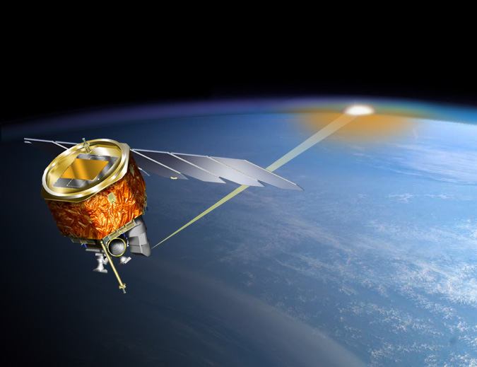
Source: NASA
|
| Launch: |
25 April 2007 at 20h26 UTC, from
Vandenberg Air Force Base, by a Pegasus XL. |
| Orbit: |
586 km x 600 km x 97.8° x 96.5 min. |
| Mission: |
 AIM
is a 197-kg Small Explorer satellite designed to study Polar Mesospheric
Clouds (PMCs) that form about 80 km above the Earth's surface in summer
and mostly in the polar regions. AIM measures the thermal, chemical and
dynamical environment in which PMCs form to resolve why PMCs form and why
they vary. This will allow the connection to be made between these clouds
and the meteorology of the polar mesosphere. The craft carries three scientific
instruments to study polar mesospheric clouds: a solar occultation camera,
an ultraviolet imager and a cosmic dust experiment. It is a triaxially
stabilized crart that can store data gathered for 50 hours. AIM
is a 197-kg Small Explorer satellite designed to study Polar Mesospheric
Clouds (PMCs) that form about 80 km above the Earth's surface in summer
and mostly in the polar regions. AIM measures the thermal, chemical and
dynamical environment in which PMCs form to resolve why PMCs form and why
they vary. This will allow the connection to be made between these clouds
and the meteorology of the polar mesosphere. The craft carries three scientific
instruments to study polar mesospheric clouds: a solar occultation camera,
an ultraviolet imager and a cosmic dust experiment. It is a triaxially
stabilized crart that can store data gathered for 50 hours. |
| Source: |
Jonathan
Space Report No. 580
; Spacewarn No. 642
; National Space Science Data Center's
2007-015A
; Skyrocket's AIM
; Spaceflight.Now's 25
Apr 07 ; NASA's AIM
; |
|
|
.
Astra 1L
| Spacecraft: |
|
| Chronologies: |
2007 payload #50 ; 2007-016A ; 6,541st spacecraft. |
| Type: |
Communications |
| Families: |
|
| Ranks: |
|
| Sponsor: |
SES Astra |
|
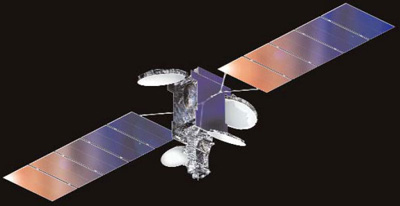 |
| Launch: |
4 May 2007 at 22h29 UTC, from
Kourou Space Center's ELA-3, by an
Ariane
5 ECA. |
| Orbit: |
Initial: 248.2 km x 35,958 km x 5.9°
Geostationary at 19.2° East longitude. |
| Mission: |
Astra 1L is a 4.5-tonne (with fuel) geostationary
communications satellite that carries 29 Ku-band and two Ka-band transponders
to provide video and voice links direct-to-home in all of Europe. Built
by Lockheed Martin Commercial Space Systems (LMCSS) using an A2100 AX platform,
the spacecraft weigh4 4,97.5 kg at lift-off (with a dry mass of 2,253 kg).
The caaft is a 3-axis stabilized, 7.7 x 2.62 x 3.62 metre (with a 27-meter
span in orbit) and has a design life of approximately 15 years.
SES Astra is the
leading direct-to-home (DTH) broadcast system in Europe, serving more than
109 million households via DTH and cable networks. Satellites in the SES
Astra fleet transmit 1,864 TV and radio stations. Astra 1L is the
ninth SES Astra satellite to be launched by Arianespace. |
| Source: |
Jonathan
Space Report No. 580
; Spacewarn No. 643
; National Space Science Data Center's
2007-016A
; Skyrocket's Astra
1L ; Arianespace's 4
May 07 & Flight
176 Press Kit ; Chronologie
Ariane 2007 ; |
|
|
.
Galaxy 17
| Spacecraft: |
|
| Chronologies: |
2007 payload #51 ; 2007-016B ; 6,542nd spacecraft. |
| Type: |
Communications |
| Families: |
|
| Ranks: |
|
| Sponsor: |
Intelsat |
|
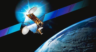 |
| Launch: |
4 May 2007 at 22h29 UTC, from
Kourou Space Center's ELA-3, by an
Ariane
5 ECA. |
| Orbit: |
Initial: 248.2 km x 35,958 km x 5.9°
Geostationary at 74° West longitude (or
91° West (or 99° West) |
| Mission: |
Galaxy 17 is a 4.1-tonne (with fuel), 9.5-kW
communications satellite that carries 24 C-band and 24 Ku-band transponders
to provide telephone and television services to South and North America
and Europe. Built by Thales Alenia Space using a Spacebus 3000 B3 platform,
the craft weighing 4,100 kg at lift-off (dry mass 1,749 kg). Its design
life is about 15 years. It is a 3-axis stabilized, 3.75 x 1.8 x 2.3 metre
craft with a 36.9 metre wingspan in orbit.
The Galaxy satellite
fleet, once owned by Hughes Communications and then Panamsat, is now operated
by Intelsat (which is currently the world's largest supplier of fixed satellite
services ). Galaxy 17 is the 45th Intelsat satellite to use an Ariane
launcher since 1983. More than 60% of the Intelsat satellites in service
today were orbited by the European launch vehicle. |
| Source: |
Jonathan
Space Report No. 580
; Spacewarn No. 643
; National Space Science Data Center's
2007-016B
; Skyrocket's Galaxy
17 ; Arianespace's 4
May 07 & Flight
176 Press Kit ; |
|
|
.
Progress M-60 / ISS
25P
| Spacecraft: |
Progress M (7K-TGM) No. 360 |
| Chronologies: |
2007 payload #52 ; 2007-017A ; 6,543rd spacecraft. |
| Type: |
Cargo delivery to the International Space
Station |
| Families: |
|
| Ranks: |
|
| Sponsor: |
Russian Federal Space Agency |
|

Source: NASA
|
| Launch: |
12 May 2007 at 3h25 UTC, from
Baykonur Cosmodrome's LC-1, by a Soyuz
U. |
| Orbit: |
Initial: 192.9 km x 245.0 km x 51.66°
x 88.5 min.
330.2 km x 353.8 km x 51.6° x 91.1 min. |
| Deorbited: |
25 September 2007 at 19h01 UTC |
| Mission: |
Progress M-60 is an automatic cargo carrier
that delivers to ISS more than 2.56 tonnes of various cargoes necessary
to maintain the space station operation in manned mode. This space transportation
logistics vehicle carries 815 kg of propellant, 420 kg of potable water,
241 kg of containers with food, 136 kg of cargoes of equipment for various
space station systems, 63 kg of equipment for scientific experiments, on-board
documentation and parcels for the crew. 377 kg of the cargos intended for
the US segment of the ISS. It docked automatically with the Zarya
module on 15 May 2007 at 5h10 UTC. The International Space Station, with
a mass of 218.1 tonnes, is flying in an orbit of 330.2 km x 353.8 km x
51.6° x 91.1 min.
Progress M-60 undocked
from Zvezda on 19 September 2007 at 0h37 UTC and was used for plasma depletion
experiments before being deorbited over the Pacific on 25 September. |
| Source: |
Jonathan
Space Report No. 580
& 586
; Spacewarn No. 643
; National Space Science Data Center's
2007-017A
; Skyrocket's Progres
M-60 ; RSC Energia's 12
May 07 & 15
May 07 ; |
|
|
.
Nigcomsat 1
| Spacecraft: |
|
| Chronologies: |
2007 payload #53 ; 2007-018A ; 6,544th spacecraft. |
| Type: |
Communications |
| Families: |
|
| Ranks: |
|
| Sponsor: |
Nigerian Communications Satellite Ltd. |
|
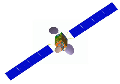 |
| Launch: |
13 May 2007 at 16h01 UTC, from
Xichang Satellite Launch Center, by a Chang
Zheng 3B. |
| Orbit: |
Geostationary at 42.5° East longitude. |
| Mission: |
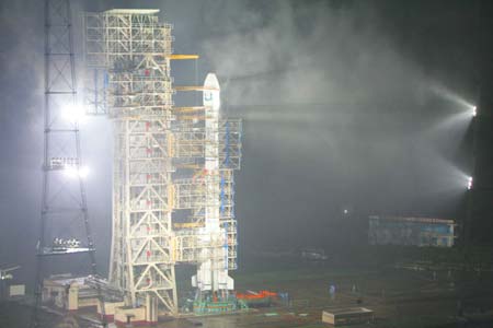 NigComSat,
China's second DFH-4 comsat, is a 5,150-kg (with fuel) communications satellite
that carries 4 C-band, 18 Ku-band, 4 Ka-band, and 2 L-band transponders
to provide voice, video, and data links to all of Africa and southern Europe.
Based on the DFH-4, China's latest satellite platform, the craft was manufactured
by the China Academy of Space Technology (CAST). It is the first of its
kind in Africa and the first time a foreign buyer has purchased a Chinese
satellite and its launching service. It thus mark a breakthrough for China's
international commercial space programme with this country becoming both
a manufacturer and launcher of satellites for foreign customers. In addition
to launching the satellite, China will also train technicians and build
a ground station in Nigeria. NigComSat,
China's second DFH-4 comsat, is a 5,150-kg (with fuel) communications satellite
that carries 4 C-band, 18 Ku-band, 4 Ka-band, and 2 L-band transponders
to provide voice, video, and data links to all of Africa and southern Europe.
Based on the DFH-4, China's latest satellite platform, the craft was manufactured
by the China Academy of Space Technology (CAST). It is the first of its
kind in Africa and the first time a foreign buyer has purchased a Chinese
satellite and its launching service. It thus mark a breakthrough for China's
international commercial space programme with this country becoming both
a manufacturer and launcher of satellites for foreign customers. In addition
to launching the satellite, China will also train technicians and build
a ground station in Nigeria. |
| Source: |
Jonathan
Space Report No. 580
& 581;
Spacewarn
No. 643
; National Space Science Data Center's
2007-018A
; Skyrocket's NIGCOMSAT
1 ; China Daily Online's
2
Jul 05 $ 14
May 07 ; |
|
|
.
Yaogan 2 / JB-5 2
| Spacecraft: |
YaoGan WeiXing 2 or Remote Sensing
Satellite 2 |
| Chronologies: |
2007 payload #54 ; 2007-019A ; 6,545th spacecraft. |
| Type: |
Earth Remote Sensing |
| Families: |
|
| Ranks: |
|
| Sponsor: |
China Academy of Space Technology |
|
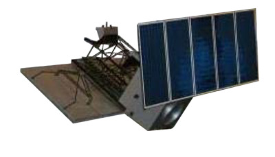 |
| Launch: |
25 May 2007 at 7h12 UTC, from
Jiuquan Satellite Launch Center, by a Chang
Zheng 2D. |
| Orbit: |
Initial: 631 km x 655 km x 97.85° x 97.6
min. |
| Mission: |
 Yaogan
2 is China's second Synthetic Aperture Radar (SAR) remote sensing satellite
which is used, according to the China Academy of Space Technology (the
main developer of the satellite), for scientific research, land resources
surveying, crop yield estimation and disaster forecasting. The data from
the satellite will help in crop estimates and disaster alert/remedy efforts.
Some sources have claimed that the Yaogan series also has a military role
under the codename Jianbing-5. China launched a similar satellite known
as Remote Sensing Satellite 1 (YaoGan
WeiXing 1) in 2006, which was later identified as the JianBing 5 synthetic
aperture radar satellite operated by the PLA for military reconnaissance
role. The new satellite could be a similar design. According to Chinese
media reports, the satellite weights 2,700 kg. It entered a 601 km x 621
km x 97.8° initial orbit which was raised on May 1 to a 628 km x 629
km x 97.8° orbit. Yaogan
2 is China's second Synthetic Aperture Radar (SAR) remote sensing satellite
which is used, according to the China Academy of Space Technology (the
main developer of the satellite), for scientific research, land resources
surveying, crop yield estimation and disaster forecasting. The data from
the satellite will help in crop estimates and disaster alert/remedy efforts.
Some sources have claimed that the Yaogan series also has a military role
under the codename Jianbing-5. China launched a similar satellite known
as Remote Sensing Satellite 1 (YaoGan
WeiXing 1) in 2006, which was later identified as the JianBing 5 synthetic
aperture radar satellite operated by the PLA for military reconnaissance
role. The new satellite could be a similar design. According to Chinese
media reports, the satellite weights 2,700 kg. It entered a 601 km x 621
km x 97.8° initial orbit which was raised on May 1 to a 628 km x 629
km x 97.8° orbit. |
| Source: |
Jonathan
Space Report No. 581
& 582
; Spacewarn No. 643
; National Space Science Data Center's
2007-019A
; SkyRocket's Yaogan
2 ; China Daily Online's
25
May 07 ; |
|
|
.
MEMS-Pico / Zheda Pixing
1
| Spacecraft: |
|
| Chronologies: |
2007 payload #55 ; 2007-019B ; 6,546th spacecraft. |
| Type: |
Technology |
| Families: |
|
| Ranks: |
|
| Sponsor: |
China's Zhejiang University |
|
|
| Launch: |
25 May 2007 at 7h12 UTC, from
Jiuquan Satellite Launch Center, by a Chang
Zheng 2D. |
| Orbit: |
631 km x 655 km x 97.85° x 97.6 min. |
| Mission: |
The 1-kg experimental picosatellite Zheda
Pixing 1 is for microelectronics research. It is probably the MEMS-Pico
previously announced under development by Zhejiang University and Shanghai
Institute of Microsystem and Information Technology. The original propose
of this satellite was to provide a testbed in near-Earth space for MEMS
devices, such as accelerometer, micro-gyros and infrared sensors, being
developed in China. MEMS-Pico is a 26-face object covered by solar cells
and containing an infrared sensor, a S-band transceiver and a CMOS camera.
It validates design of microelectronic components. It is designed as a
tumbling satellite with neither attitude control nor propulsion. It consists
of no moving parts, only solid-state electronics and its structure. The
solar cells are expect to provide 2 Watt of electrical power in orbit. |
| Source: |
Jonathan
Space Report No. 581
; Spacewarn No. 643
; National Space Science Data Center's
2007-019B
; Skyrocket's Zheda
Pixing 1 ; |
|
|
.
Globalstar FM65
| Spacecraft: |
|
| Chronologies: |
2007 payload #56 ; 2007-020A ; 6,547th spacecraft. |
| Type: |
Communications |
| Families: |
|
| Ranks: |
|
| Sponsor: |
Globalstar |
|
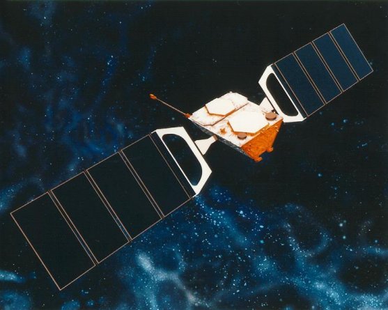 |
| Launch: |
29 May 2007 at 20h31 UTC, from
Baykonur, by a Soyuz-FG/Fregat. |
| Orbit: |
905 km x 923 km x 52° x 103.5 min. |
| Mission: |
These four satellites are the latest Globalstar
communications crafts in the fleet that provides two-way transmission of
voice and data from mobile and fixed stations. Together with the additional
four ground spare satellites due to be launched shortly, these satellites
augment the current operating constellation and improve the Globalstar
quality of two-way voice and data service through the launch of the second-generation
satellite constellation. Each satellite have a dry mass of 350 kg like
the older 52 craft in the fleet.
Globalstar, which
is is a leading provider of mobile satellite voice and data services, has
invested $120 million in order to launch these four satellites plus the
remaining four ground spares. It considers these eight satellites to represent
the beginning of its next-generation constellation, because they will not
only help bridge the gap today, but last long into and seamlessly operate
with, its second-generation constellation. In December 2006, the company
signed a EURO 661 million contract with Thales Alenia Space for the design,
manufacture and delivery of 48 new satellites for the second-generation
Globalstar, with deliveries scheduled to begin in the summer of 2009. The
satellites are being designed to provide service until at least 2025. |
| Source: |
Jonathan
Space Report No. 581
; Spacewarn No. 643
; National Space Science Data Center's
2007-020A
; SkyRocket's Globalstar
65 ; Globalstar's 30
May 07 ; Arianespace's 30
Mah 07 & Press
Kit ; |
|
|
.
Globalstar FM69
| Spacecraft: |
|
| Chronologies: |
2007 payload #57 ; 2007-020B ; 6,548th spacecraft. |
| Type: |
Communications |
| Families: |
|
| Ranks: |
|
| Sponsor: |
Globalstar |
|
|
| Launch: |
29 May 2007 at 20h31 UTC, from
Baykonur, by a Soyuz-FG/Fregat. |
| Orbit: |
905 km x 923 km x 52° x 103.5 min.
914 km x 931 km x 52.0° |
| Mission: |
These four satellites are the latest Globalstar
communications crafts in the fleet that provides two-way transmission of
voice and data from mobile and fixed stations. Together with the additional
four ground spare satellites due to be launched shortly, these satellites
augment the current operating constellation and improve the Globalstar
quality of two-way voice and data service through the launch of the second-generation
satellite constellation. Each satellite have a dry mass of 350 kg like
the older 52 craft in the fleet. |
| Source: |
Jonathan
Space Report No. 581
; Spacewarn No. 643
; National Space Science Data Center's
2007-020B
; SkyRocket's Globalstat
69 ; Globalstar's 30
May 07 ; Arianespace's 30
Mah 07 & Press
Kit ; |
|
|
.
Globalstar FM71
| Spacecraft: |
|
| Chronologies: |
2007 payload #58 ; 2007-020C ; 6,549th spacecraft. |
| Type: |
Communications |
| Families: |
|
| Ranks: |
|
| Sponsor: |
Globalstar |
|
|
| Launch: |
29 May 2007 at 20h31 UTC, from
Baykonur, by a Soyuz-FG/Fregat. |
| Orbit: |
905 km, x 923 km x 52° x 103.5 min. |
| Mission: |
These four satellites are the latest Globalstar
communications crafts in the fleet that provides two-way transmission of
voice and data from mobile and fixed stations. Together with the additional
four ground spare satellites due to be launched shortly, these satellites
augment the current operating constellation and improve the Globalstar
quality of two-way voice and data service through the launch of the second-generation
satellite constellation. Each satellite have a dry mass of 350 kg like
the older 52 craft in the fleet. |
| Source: |
Jonathan
Space Report No. 581
; Spacewarn No. 643
; National Space Science Data Center's
2007-020C
; SkyRocket's Globalstar
71 ; Globalstar's 30
May 07 ; Arianespace's 30
Mah 07 & Press
Kit ; |
|
|
.
Globalstar FM72
| Spacecraft: |
|
| Chronologies: |
2007 payload #59 ; 2007-020D ; 6,550th spacecraft. |
| Type: |
Communications |
| Families: |
|
| Ranks: |
|
| Sponsor: |
Globalstar |
|
|
| Launch: |
29 May 2007 at 20h31 UTC, from
Baykonur, by a Soyuz-FG/Fregat. |
| Orbit: |
905 km, x 923 km x 52° x 103.5 min. |
| Mission: |
These four satellites are the latest Globalstar
communications crafts in the fleet that provides two-way transmission of
voice and data from mobile and fixed stations. Together with the additional
four ground spare satellites due to be launched shortly, these satellites
augment the current operating constellation and improve the Globalstar
quality of two-way voice and data service through the launch of the second-generation
satellite constellation. Each satellite have a dry mass of 350 kg like
the older 52 craft in the fleet. |
| Source: |
Jonathan
Space Report No. 581
; Spacewarn No. 643
; National Space Science Data Center's
2007-020D
; SkyRocket's Globalstar
72 ; Globalstar's 30
May 07 ; Arianespace's 30
Mah 07 & Press
Kit ; |
|
|
.
Xinnuo 3 / SinoSat 3
| Spacecraft: |
|
| Chronologies: |
2007 payload #60 ; 2007-021A ; 6,551st spacecraft. |
| Type: |
Communications |
| Families: |
|
| Ranks: |
|
| Sponsor: |
China's Sino Satellite Communications Co.
Ltd. (SinoSat) |
|
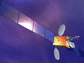 |
| Launch: |
31 May 2007 at 16h08 UTC, from
Xichang Satellite Launch Center, by a Chang
Zheng 3A. |
| Orbit: |
Geostationary at 125° East longitude. |
| Mission: |
Xinnuo 3, or Sinosat 3, is a commercial
Direct-to-Home broadcasting satellite which carries 10 C-band transponders
to provide voice and video links to much of eastern Asia. The craft is
a DFH-3 class Chinese C-band communications satellite which was manufactured
by the China Academy of Space Technology under the China Aerospace Science
and Technology Corporation. It is not clear whether SinoSat-3 will replace
part of the service offered by the failed SinoSat-2.
China has 12.6 million digital TV subscribers and 400 million television
sets, suggesting a huge potential market for satellite TV. |
| Launcher: |
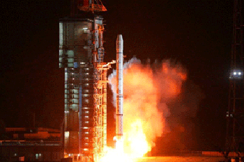 The
CZ-3A vehicle used to orbit Xinnuo-3 was the 100th launch of a Chang
Zheng-class rocket, including two CZ-1 launches (unrelated vehicle)
but not counting 11 launches of the related Feng
Bao vehicle and at least 9 launches of the suborbital DF-5 missile
on which the CZ-2 and later series is based. The
CZ-3A vehicle used to orbit Xinnuo-3 was the 100th launch of a Chang
Zheng-class rocket, including two CZ-1 launches (unrelated vehicle)
but not counting 11 launches of the related Feng
Bao vehicle and at least 9 launches of the suborbital DF-5 missile
on which the CZ-2 and later series is based. |
| Source: |
Jonathan
Space Report No. 581
; Spacewarn No. 643
; National Space Science Data Center's
2007-021A
; SkyRocket's Sinosat
3 ; Spaceflight Now's 31
May 07 : People's Daily Online's
1
Jun 07 ; |
|
|
.
Kosmos 2427 / Kobalt-M
#3
| Spacecraft: |
Yantar-4K2M #3 |
| Chronologies: |
2007 payload #61 ; 2007-022A ; 6,552nd spacecraft. |
| Type: |
Surveillance |
| Families: |
|
| Ranks: |
|
| Sponsor: |
Russian Defense Ministry |
|
|
| Launch: |
7 June 2007 at 18h00 UTC, from
Plesetsk, by a Soyuz U. |
| Orbit: |
Initial: 170 km x 297 km x 67° x 89 min.
180 km x 360 km x 67.15° x 89.6 min. |
| Landed: |
22 August 2007 at around 21h00 UTC |
| Mission: |
Kosmos 2427 is a new Kobalt-M optical reconnaissance
satellite. This is the third Kobalt-M launch, previous ones took place
in September 2004 (Kosmos 2410)
and in May 2006 (Kosmos 2420).
Kobalt-M satellites, like their Yantar-4S2/Kobalt predecessors, use returnable
film capsules to deliver information to the Earth. Nominal lifetime of
these satellites is about 60 days.
Kosmos 2427 completed
its mission and re-entered on 23 August 2007. The satellite worked on orbit
for 76 days, which is somewhat shorter than usual operational life of about
120 days. The Space Forces representative was quoted as saying that the
craft completed its mission successfully. In what appears to be a normal
procedure, it shed some fragments shortly before landing. The fragments
re-entered shortly thereafter. |
| Source: |
Jonathan
Space Report No. 581,
582
&
585
;
Spacewarn No. 644
; National Space Science Data Center's
2007-022A
; SkyRocket's
Kosmos
2427 ; Spaceflight Now's 7
Jun 07 ; RSNF's 7
Jun 07 & 23
Aug 07 ; |
|
|
.
COSMO-Skymed 1 / COSMO-1
| Spacecraft: |
COSMO stands for Constellation
of Satellites for Mediterranean Basin Observation. |
| Chronologies: |
2007 payload #62 ; 2007-023A ; 6,553rd spacecraft. |
| Type: |
Radar Surveillance |
| Families: |
|
| Ranks: |
|
| Sponsor: |
Italian Space Agency and Italian Ministry
of Defence |
|
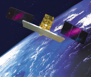 |
| Launch: |
8 June 2007 at 2h34 UTC, from
Vandenberg Air Force Base's SLC-2, by a Delta
II 7420-10. |
| Orbit: |
Initial: 622 km x 623 km x 97.9° x 97
min. |
| Mission: |
COSMO-SkyMed 1, or COSMO-1, is a 1.7-tonne,
3.6-kW Italian Earth-imaging radar satelllite. It is the first of a four-satellite
constellation and carries an X-band radar. The swath width is variable
and provides images at a resolution between three to 100 meters.
The satellite collects data on floods, droughts, earthquakes and landslides.
It takes imagery of the Earth using an X-Band Synthetic Aperture Radar
instrument capable of operating in all visibility conditions at the request
of institutional and commercial users, including members of the defence,
civil and scientific communities. This satellite system was developed under
an agreement between the Italian Space Agency (ASI) and the Italian Ministry
of Defense, and built under the prime contractorship of Thales Alenia Space;
COSMO 1's mass has been variously reported as 1,700 kg or 1,900 kg. |
| Source: |
Jonathan
Space Report No. 581
; Spacewarn No. 644
; National Space Science Data Center's
2007-023A
; SkyRocket's
COSMOS
1 ; ASI's
COSMO-Skymed
; |
|
|
.
STS-117 / ISS 13A
| Spacecraft: |
Atlantis' 28th flight |
| Chronologies: |
2007 payload #63 ; 2007-024A ; 6,554th spacecraft. |
| Type: |
Piloted Spaceship |
| Families: |
|
| Ranks: |
|
| Sponsor: |
NASA |
|
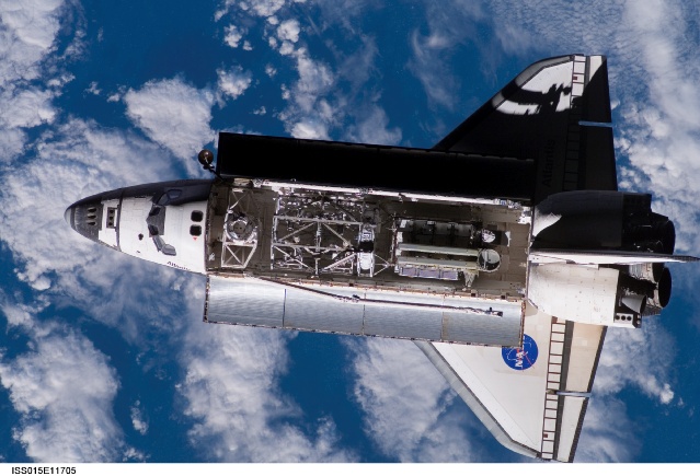
Source: NASA
|
Artist's rendering of ISS after Atlantis'
undocking and departure
| Launch: |
8 June 2007 at 23h38 UTC, from
Kennedy Space Center's LC-39A, by the Space
Shuttle. |
| Orbit: |
Initial: 334 km x 354 km x 51.6° x 91.4
min. |
| Landed: |
22 June at 19h49 UTC at Edwards Air Force
Base |
| Mission: |
 STS-117
is a piloted mission which carried a crew of seven American astronauts
and 19 tonnes of material to the International Space Station. Also, Expedition
15s Sunita Williams was replaced by Clay Anderson. Atlantis docked with
ISS on 10 June at 19h38 UTC. The crew made four spacewalks to install two
trusses (ITS-S3/S4) and two more solar panels
on the ISS, and to repair the damaged insulation on the tail section of
Atlantis. The truss was added to the end of the S1 (starboard) truss
on 11 June at 18h03 UTC. Installation of the new solar array apparently
caused a major break-down in the mission-critical Russian computers which
were repaired by ground commands. Atlantis undocked from ISS on 19 June
at 14h42 UTC. Landing was delayed by a day due to bad weather at Cape Canaveral,
until it could occur on Edwards AFB in California on 22 June at 19h49 UTC. STS-117
is a piloted mission which carried a crew of seven American astronauts
and 19 tonnes of material to the International Space Station. Also, Expedition
15s Sunita Williams was replaced by Clay Anderson. Atlantis docked with
ISS on 10 June at 19h38 UTC. The crew made four spacewalks to install two
trusses (ITS-S3/S4) and two more solar panels
on the ISS, and to repair the damaged insulation on the tail section of
Atlantis. The truss was added to the end of the S1 (starboard) truss
on 11 June at 18h03 UTC. Installation of the new solar array apparently
caused a major break-down in the mission-critical Russian computers which
were repaired by ground commands. Atlantis undocked from ISS on 19 June
at 14h42 UTC. Landing was delayed by a day due to bad weather at Cape Canaveral,
until it could occur on Edwards AFB in California on 22 June at 19h49 UTC. |
| Source: |
Jonathan
Space Report No. 581
; Spacewarn No. 644
; National Space Science Data Center's
2007-024A
; SkyRocket's
STS-117;
Spaceflight
Now's 8
Jun 07 ; STS-117
Press Kit ; |
|
|
.
ITS S3/S4
| Spacecraft: |
ITS-S3/S4 stands for Integrated
Truss System (ITS) Starboard 3/Starboard 4 (S3/S4). |
| Chronologies: |
2007 payload #64 ; 2007 n/a ; 6,555th spacecraft. |
| Type: |
Space Station Component |
| Families: |
|
| Ranks: |
|
| Sponsor: |
NASA |
|
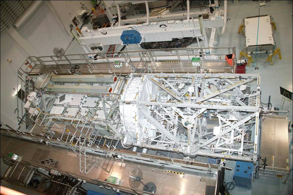
|
|
.
'Ofeq 7 ('OFEK 7)
| Spacecraft: |
|
| Chronologies: |
2007 payload #65 ; 2007-025A ; 6,556th spacecraft. |
| Type: |
Surveillance |
| Families: |
|
| Ranks: |
|
| Sponsor: |
Israel Defense Ministry |
|
|
| Launch: |
10 June 2007 at 23h40 UTC, from
Palmahim Air Base, by a
Shavit. |
| Orbit: |
Initial: 339 km x 575 km x 141.8° x 93.7
min. |
| Mission: |
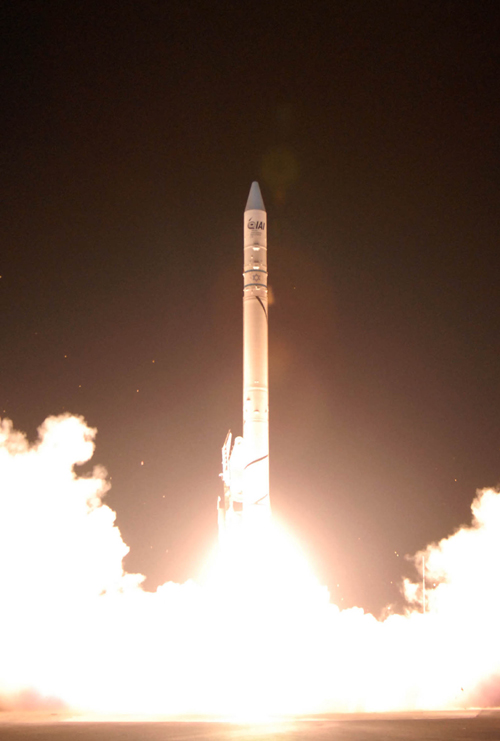 'Ofeq
7 is an Israeli, 30-kg military reconnaissance satellite replacing 'Ofek
5, which life has been extended to five years after the loss of its
planned replacement, 'Ofek 6,
two years ago. The 'Ofeq 7 satellite is a military observation satellite
built by Israel Aerospace Industries for Israel Ministry of Defense.
According to IMOD, 'OFEK 7' is an advanced technology remote sensing satellite.
It is 2.3-meter height by 1.2-meter diameter (3.6-meter with deployed solar
array) with a dry mass of 30 kg and with an expected operational lifetime
of 4 years minimum. Israel's Army Radio said its resolution was high
enough to detect objects of 70 cm on the ground. The chief of Israels
Defense Ministry space program, Haim Eshed, suggested that the satellite
could be used to counter Iran's efforts to develop a nuclear weapon. When
asked if the satellite could be used to strike Iran, Eshed said ''Intelligence
is intelligence and you can do with the intelligence what the leaders decide.
'But this is definitely intelligence on the best level that it's possible
to obtain from satellite systems. The spacecraft was orbited by a Shavit
launcher more capable and reliable than the one used for 'Ofeq 5 in 2002. 'Ofeq
7 is an Israeli, 30-kg military reconnaissance satellite replacing 'Ofek
5, which life has been extended to five years after the loss of its
planned replacement, 'Ofek 6,
two years ago. The 'Ofeq 7 satellite is a military observation satellite
built by Israel Aerospace Industries for Israel Ministry of Defense.
According to IMOD, 'OFEK 7' is an advanced technology remote sensing satellite.
It is 2.3-meter height by 1.2-meter diameter (3.6-meter with deployed solar
array) with a dry mass of 30 kg and with an expected operational lifetime
of 4 years minimum. Israel's Army Radio said its resolution was high
enough to detect objects of 70 cm on the ground. The chief of Israels
Defense Ministry space program, Haim Eshed, suggested that the satellite
could be used to counter Iran's efforts to develop a nuclear weapon. When
asked if the satellite could be used to strike Iran, Eshed said ''Intelligence
is intelligence and you can do with the intelligence what the leaders decide.
'But this is definitely intelligence on the best level that it's possible
to obtain from satellite systems. The spacecraft was orbited by a Shavit
launcher more capable and reliable than the one used for 'Ofeq 5 in 2002. |
| Source: |
Jonathan
Space Report No. 581
; Spacewarn No. 644
; National Space Science Data Center's
2007-025A
; SkyRocket's Ofeq 7 ; Spaceflight
Now's 11 Jun
07 ; IAI's |
|
|
.
TerraSAR-X
Astrium GmbH
| Spacecraft: |
|
| Chronologies: |
2007 payload #66 ; 2007-026A ; 6,557th spacecraft. |
| Type: |
Earth Observation |
| Families: |
|
| Ranks: |
|
| Sponsor: |
Germany |
|
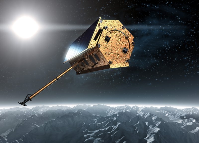 Source:
Astrium GmbH
Source:
Astrium GmbH
|
| Launch: |
15 June 2007 at 2h14 UTC, from
Baikonur Cosmodrome, by a .Dnepr |
| Orbit: |
Initial: 507 km x 510 km x 97.5° x 95
min. |
| Mission: |
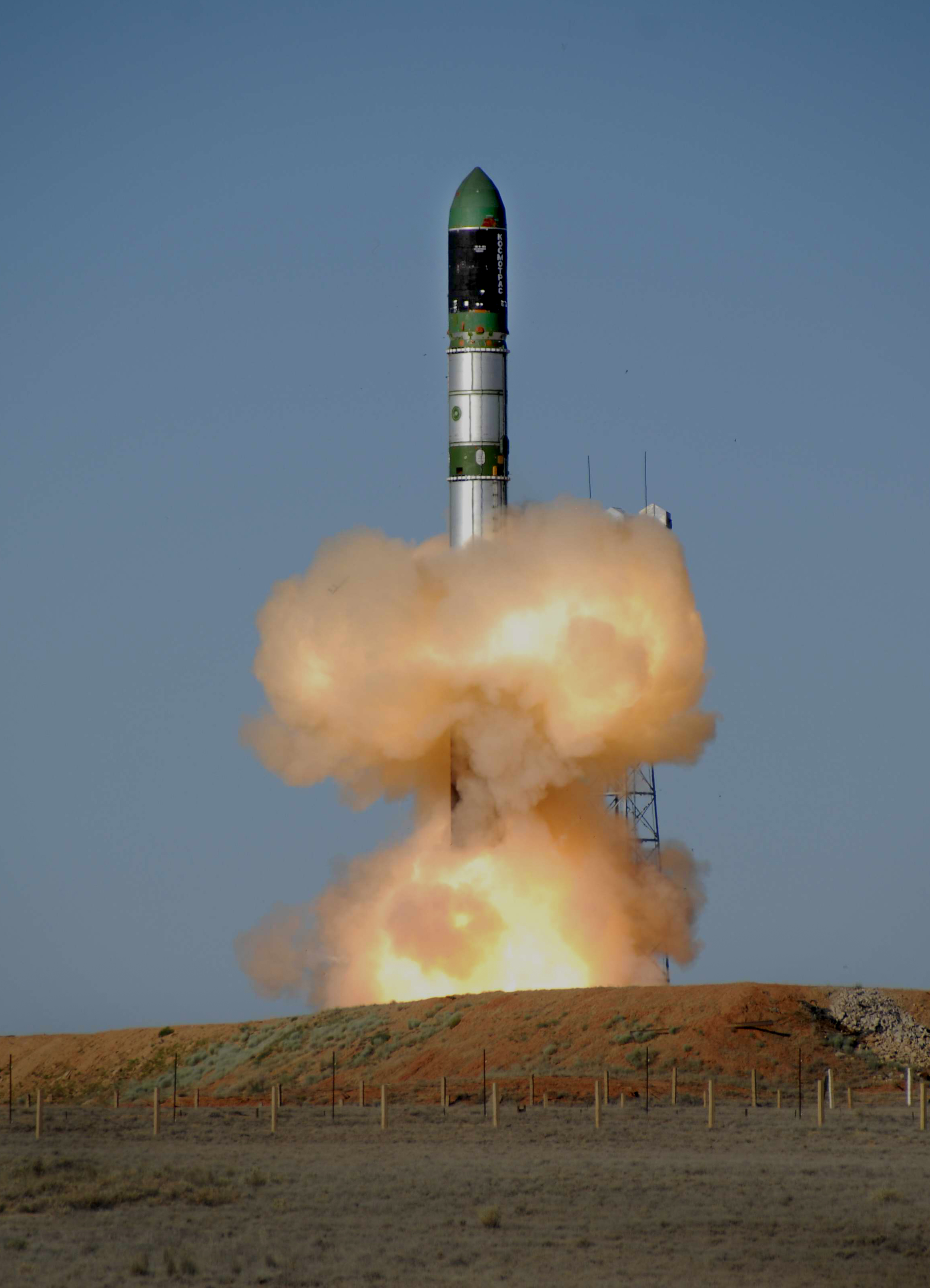 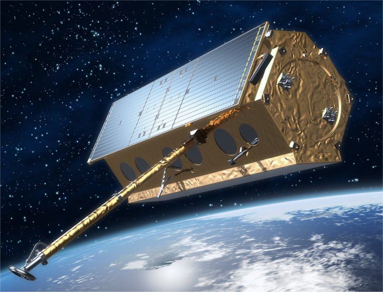 Terra
SAR-X is a 1-tonne German Synthetic Aperture Radar that maps the Earth
and oceans at a rate of one million square-km/day, providing scientific
data such as sea ice coverage, vegetation/crop estimates and military reconnaissance
information, all at 1.0-meter resolution. The craft has a height of 5.0
meters and a diameter of 2.3 meters and carries 394 kg of payload. The
SAR antenna, which measure 4.8 m x 0.80 m x 0.15 m, provide a resolution
of 1 meter for 5 x 10 km scene. TerraSAR-X will provide a continuous stream
of remote sensing data for at least 5 years. In a public/private
partnership, the German Aerospace Center (DLR) and EADS Astrium GmbH have
agreed to jointly bear the costs of constructing and implementing this
X-band radar satellite. Infoterra GmbH, a 100 % EADS-Astrium subsidiary,
was established specifically to conduct the commercial exploitation of
the satellite. The total cost of the TerraSAR-X programme is approximately
€ 130 million. Terra
SAR-X is a 1-tonne German Synthetic Aperture Radar that maps the Earth
and oceans at a rate of one million square-km/day, providing scientific
data such as sea ice coverage, vegetation/crop estimates and military reconnaissance
information, all at 1.0-meter resolution. The craft has a height of 5.0
meters and a diameter of 2.3 meters and carries 394 kg of payload. The
SAR antenna, which measure 4.8 m x 0.80 m x 0.15 m, provide a resolution
of 1 meter for 5 x 10 km scene. TerraSAR-X will provide a continuous stream
of remote sensing data for at least 5 years. In a public/private
partnership, the German Aerospace Center (DLR) and EADS Astrium GmbH have
agreed to jointly bear the costs of constructing and implementing this
X-band radar satellite. Infoterra GmbH, a 100 % EADS-Astrium subsidiary,
was established specifically to conduct the commercial exploitation of
the satellite. The total cost of the TerraSAR-X programme is approximately
€ 130 million. |
| Source: |
Jonathan
Space Report No. 581
; Spacewarn No. 644
; National Space Science Data Center's
2007-026A
; SkyRocket's
Terra-SAR-X
1 ; Infoterra TerraSAR-X &
Background
;
Spaceflight Now's 15
Jun 07 : KB Yuzhnoye's 18
Jun 07 ; |
|
|
.
NROL-30 / NOSS 3-4A
(USA 194)
| Spacecraft: |
|
| Chronologies: |
2007 payload #67 ; 2007-027A ; 6,558th spacecraft. |
| Type: |
Ocean Surveillance |
| Families: |
|
| Ranks: |
|
| Sponsor: |
U.S. National Reconnaissance Office |
|
|
| Launch: |
15 June 2007 at 15h12 UTC, from
Cape Canaveral Air Force Station's SLC-41, by an Atlas
V. |
| Orbit: |
|
| Mission: |
NROL-30, or USA 194, is a secret National
Reconnaissance Office mission, believed to be a U.S. Navy intelligence
mission to monitor and track ships using their radio emissions.
The NRO confirm
early reports that the Atlas V AV-009 had a problem in the second burn
of the Centaur upper stage, leaving the spacecraft in a somewhat low, probably
elliptical orbit. Atlas booster performance was nominal, NRO indicated.
[But] the Centaur upper stage had a technical anomaly which resulted in
minor performance degradation. [Payload/launch] vehicle separation was
nominal and the NRO is confident in the performance of its mission. It
is believed that two spacecraft were to be deployed into 1,150 km altitude,
63° inclination orbits. Based on optical observations, the satellite
could actually be in an orbit of 776 x 1,246 km. The payloads are expected
to reach the original planned orbit using on-board propulsion. It's possible
that the payloads remain attached to each other until reaching the target
orbit.
According to Aviation
Week & Space Technology, this NRO payload consist of two ocean
surveillance spacecraft that are critical to tracking ships that may conceal
al Qaeda terrorists. The new spacecraft will also track Iranian and
Chinese sea-based military operations. The magazine also reports that
the spacecraft were fired into the wrong orbit when the Atlas V
rocket they were riding on stopped firing too early in space following
launch. The top secret satellites separated safely from the malfunctioning
booster, however, and have enough rocket propellant to continue their mission,
an official said on background. The U.S. Air Force, which managed the Atlas
V launch, and the NRO have begun an official investigation into the launch
and malfunction. "The Atlas V people have a lot of explaining to do," the
official said on background. The flight was the first NRO secret mission
for the new Atlas V Evolved xpendable Launch Vehicle.
The Atlas V first
stage fired normally and then fell away. The vehicle flew north off the
U.S. east coast toward a high-inclination orbit. The Centaur was then ignited
for the first of two irings. The Centaur completed the first firing normally
to place the spacecraft in a correct initial orbit. The vehicle then coasted
about halfway around the world where the Centaur RL10 engine was fired
a second time about an hour after liftoff. This time, however, the Centaur
did not fire for as long as it was scheduled to. The exact parameters involved
are still secret. The spacecraft may have to use their onboard propellant
to maneuver into a higher orbit, which could affect their mission life.It
is not yet known whether the malfunction occurred in the engine itself
or in electronics associated with the engine and overall stage. |
| Source: |
Jonathan
Space Report No. 581
; Spacewarn No. 644
; National Space Science Data Center's
2007-027A
; SkyRocket's
NROL-30
; NRO's
15
Jun 07 & 18
Jun 07 ; AW&ST's
15
Jun 07 ; |
|
|
.
NROL-30 / NOSS 3-4B
| Spacecraft: |
|
| Chronologies: |
2007 payload #68 ; 2007-027 ; 6,559th spacecraft. |
| Type: |
Ocean Surveillance |
| Families: |
|
| Ranks: |
|
| Sponsor: |
U.S. National Reconnaissance Office |
|
|
| Launch: |
15 June 2007 at 15h12 UTC, from
Cape Canaveral Air Force Station's SLC-41, by an Atlas
V |
| Orbit: |
|
| Mission: |
According to Aviation
Week & Space Technology, this NRO payload consist of two ocean
surveillance spacecraft that are critical to tracking ships that may conceal
al Qaeda terrorists. The new spacecraft will also track Iranian and Chinese
sea-based military operations. |
| Source: |
Jonathan
Space Report No. 581
; SkyRocket's NROL-30
; NRO's
15
Jun 07 ; AW&ST's
15
Jun 07 ; |
|
|
.
Genesis II
| Spacecraft: |
|
| Chronologies: |
2007 payload #69 ; 2007-028A ; 6,560th spacecraft. |
| Type: |
Technology |
| Families: |
|
| Ranks: |
|
| Sponsor: |
Bigelow Aerospace Corp. |
|
 |
| Launch: |
28 June 2007 at 15h02 UTC, from
ISC Kosmotras Yasny Spaceport's Silo 1-1, by a Dnepr. |
| Orbit: |
Initial: 533 km x 540 km x 64.5° x 96
min.
555 km x 562 km x 64.5° |
| Mission: |
Genesis 2 is a 1.9-meter diameter, 1.36-tonne
inflatable craft that was inflated to a diameter of 3.8 meters after launch.
It's a technology demonstrator envisioning an affordable space tourism
market. Genesis II is the second 1.300-kg Bigelow Aerospaces pathfinder
module designed to test and confirm systems for future manned commercial
space modules. The craft is a one-third scale model of modules Bigelow
eventually plans to orbit. It employs a unique architecture with a flexible
outer surface that is wrapped around a central core at launch and expands
into orbit through air inflation. Compressed air from several on-board
gas tanks had inflatited the module shortly after arriving in orbit as
Genesis 2 also deployed its solar panels. The craft features more than
11 cubic meters of usable interior volume, similar to the size of a typical
sports utility vehicle. Its identical in size and appearance to Genesis
I: approximately 4.4 meters in length and 1.9 meters in diameter at
launch, expanding to 2.5 meters in diameter after expansion in orbit. It
follows Genesis I, which
was launched in 2006 and continues to successfully return data and images
from Earth orbit. Genesis II includes a suite of additional sensors
and avionics that didnt fly on Genesis I. Genesis II outer surface is
made of several layers that include proprietary impact-resistant materials.
According to Bigelow Aerospace, testing on the ground has shown that the
expandable shells are much more resistant to space debris than the modules
on the International Space Station. Twenty-two cameras mounted both inside
and outside Genesis 2 beam back imagery. The interior cameras take pictures
of floating photos and trinkets sent in by customers for a fee of less
than $300 per object. Genesis 2 also carries Biobox, a more capable animal
habitat housing colonies of ants, cockroaches and scorpions, and a bingo
game complete with a mechanism to randomly select numbered balls.
Bigelow expects
both Genesis I and II to continue operating well into the next decade,
but the company is already working to develop the next generation of inflatable
modules as a stepping stone to the company's ultimate goal: creating a
fleet of orbiting private space complexes for clients to visit. Called
Galaxy, the next module will serve as a test bed for an array of new systems,
including advanced avionics, high-speed communications equipment, and larger
solar panels. Galaxy will also carry elements of Bigelow's life support
system, and the spacecraft will feature structural upgrades to make the
module more robust. The craft will have 45 percent more internal volume
than the Genesis modules. The Galaxy module should be ready for launch
by late 2008, according to Bigelow's projections. In 2010, Bigelow
plans to roll out the Sundancer, the company's first spacecraft capable
of supporting a human crew. A year later, plans call for a node and service
module to be launched to Sundancer. The combination will be joined by the
first BA 330 module in 2012. |
| Source: |
Jonathan
Space Report No. 582
; Spacewarn No. 644
; National Space Science Data Center's
2007-028A
; SkyRocket's Genesis
II ; Bigelow Aerospace's
Updates
; Spaceflight Now's 28
Jun 07 ; |
|
|
.
Kosmos 2428
| Spacecraft: |
Tselina-2 |
| Chronologies: |
2007 payload #70 ; 2007-029A ; 6,561st spacecraft. |
| Type: |
Electronic intelligence |
| Families: |
|
| Ranks: |
|
| Sponsor: |
Russian Defence Ministry |
|
|
| Launch: |
29 June 2007 at 10h00 UTC, from
Baykonur Cosmodrome's LC-45/1, by a Zenith
2M. |
| Orbit: |
Initial:, 824 km x 834 km x 71° x 102
min.
846 km x 856 km x 71.0° |
| Mission: |
 Kosmos
2428 is reportedly the last Tselina-2 electronic intelligence satellite
launched by Russia. This program began in the 1970s and the first satellite
was launched in 1984 (Kosmos
1603). The previous satellite of this type, Kosmos
2406, was launched in June 2004. Tselina-2, as well as the US-PU
naval electronic intelligence system, is expected to be replaced by the
Liana system, with the first launch expected in 2008. The launch marks
the first flight of the Zenit booster since it suffered a catastrophic
failure on a sea-going launch pad in January. The
Zenit 2M version was flying on its first mission. The updated booster includes
an upgraded control system and modernized engines that will be used commercially
by Sea Launch for flights from Baikonur beginning early next year. Kosmos
2428 is reportedly the last Tselina-2 electronic intelligence satellite
launched by Russia. This program began in the 1970s and the first satellite
was launched in 1984 (Kosmos
1603). The previous satellite of this type, Kosmos
2406, was launched in June 2004. Tselina-2, as well as the US-PU
naval electronic intelligence system, is expected to be replaced by the
Liana system, with the first launch expected in 2008. The launch marks
the first flight of the Zenit booster since it suffered a catastrophic
failure on a sea-going launch pad in January. The
Zenit 2M version was flying on its first mission. The updated booster includes
an upgraded control system and modernized engines that will be used commercially
by Sea Launch for flights from Baikonur beginning early next year. |
| Source: |
Jonathan
Space Report No. 582
; Spacewarn No. 644
; National Space Science Data Center's
2007-029A
; SkyRocket's Kosmos
2424 &
Tselina-2
; RSNF's 29
Jun 07 ; Spaceflight Now's
29
Jun 07 ; |
|
|
.
SAR-Lupe 2
| Spacecraft: |
|
| Chronologies: |
2007 payload #71 ; 2007-030A ; 6,562nd spacecraft. |
| Type: |
Radar Surveaillance |
| Families: |
|
| Ranks: |
|
| Sponsor: |
German Ministry of Defense and the Federal
Office of Defense Technology and Procurement |
|
Source: EO
|
SAR-Lupe deployment (Source: OHB-System)
| Launch: |
2 July 2007 at 19h38 UTC, from
Plesetsk, by a Kosmos-3M. |
| Orbit: |
Initial: 471 km x 500 km x 98.2° x 94.3
min. |
| Mission: |
SAR Lupe 2 is a 770-kg military reconnaissance
satellite that carries a large Synthetic Aperture Radar (SAR) to provide
1-meter resolution images. It is the second of five such craft that will
eventually comprise the SAR Lupe fleet. (The first
satellite has been in orbit since December 2006 and is supplying superb
high-resolution images and is operating very successfully and reliably.)
The spacecraft has a size of about 4 meters x 3 meters x 2 meters with
an antenna size of 3.3 meters x 2.7 meters. Spacecraft design life is 10
years. The programme is managed by the German government, in particular
the German Ministry of Defense (BMVg) and the Federal Office of Defense
Technology and Procurement, referred to as BWB. Overall objective is to
provide high-resolution radar imagery to German defense forces over a period
of ten years starting in 2005. |
| Source: |
Jonathan
Space Report No. 582
; Spacewarn No. 645
; National Space Science Data Center's
2007-030A
; SkyRocket's SAR-Lupe
2 ; OHB-System's 's 3
Jul 07, SAR-Lupe
& SAR-Lupe
2 ; EO's
SAR-Lupe
; Spaceflight Now's
3
Jul 07 ; |
Launch of SAR-Lupe 2 from Plesetsk Cosmodrome
(Source : OHB
System)
|
|
.
ZX 6B / Zhongxing 6B
(ChinaSat 6B)
| Spacecraft: |
|
| Chronologies: |
2007 payload #72 ; 2007-031A ; 6,563rd spacecraft. |
| Type: |
Communications (Multi-Service) |
| Families: |
|
| Ranks: |
|
| Sponsor: |
China Satellite Telecom Group |
|
 |
| Launch: |
5 July 2007 at 12h08 UTC, from
Xichang Satellite Launch Center, by a Chang
Zheng 3B. |
| Orbit: |
Geostarionary at 115.5° East longitude. |
| Mission: |
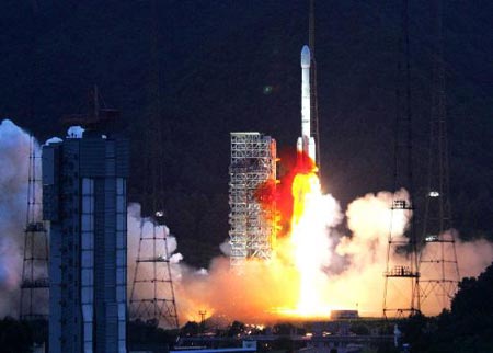 Zhongxing
6B, or ChinaSat 6B, is a 4.6-tonne, 8.70-kW communications satellite that
carries 38 C-band transponders to provide voice and video services to Asia-Pacific
and Oceania. Dedicated to television broadcasting, this satellite will
enable ChinaSatcom to expand its services in China, allowing easy reception
of up to 300 television programs across China, south east Asia, the Pacific
and Oceania. Based on the Thales Alenia Space Spacebus 4000 C2 platform,
the satellite is designed with a lifetime of more than 15 years Chinasat
6B was the second contract awarded by ChinaSatcom to Thales Alenia Space,
after Chinasat 9. Zhongxing
6B, or ChinaSat 6B, is a 4.6-tonne, 8.70-kW communications satellite that
carries 38 C-band transponders to provide voice and video services to Asia-Pacific
and Oceania. Dedicated to television broadcasting, this satellite will
enable ChinaSatcom to expand its services in China, allowing easy reception
of up to 300 television programs across China, south east Asia, the Pacific
and Oceania. Based on the Thales Alenia Space Spacebus 4000 C2 platform,
the satellite is designed with a lifetime of more than 15 years Chinasat
6B was the second contract awarded by ChinaSatcom to Thales Alenia Space,
after Chinasat 9. |
| Source: |
Jonathan
Space Report No. 582
; Spacewarn No. 645
; National Space Science Data Center's
2007-031A
; SkyRocket's ZX-6B;
China
Daily Online's 6
Jul 07 ; Spaceflight Now's
5
Jul 07 ; Thales' 5
Jul 07 : |
|
|
.
DirecTV 10
| Spacecraft: |
|
| Chronologies: |
2007 payload #73 ; 2007-032A ; 6,564th spacecraft. |
| Type: |
Communications (Direct-to-Home services) |
| Families: |
|
| Ranks: |
|
| Sponsor: |
DirectTV |
|

Source: Boeing
|
| Launch: |
7 July 2007 at 1h16 UTC, from
Baykonour Cosmodromt, by a Proton/Briz-M. |
| Orbit: |
Geostationary at 102.8° West longitude. |
| Mission: |
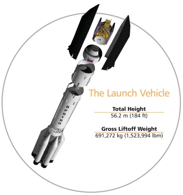 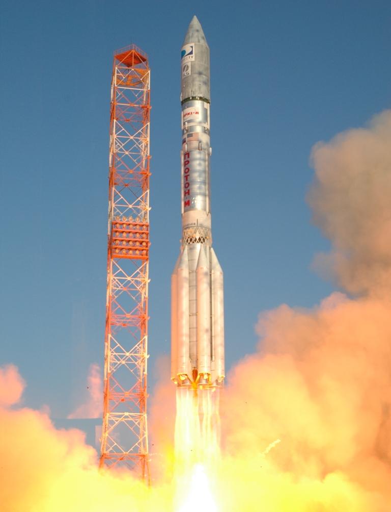 DirecTV
10 is a 5.9-tonne (including 2.2 tonnes of fuel) television broadcasting
satellite that carries 32 broad beam Ka-band transponders and 55 spot-beam
Ka-band transponders to provide direct-to-home high-definition video (HDTV)
and internet services throughout the USA. The craft is a Boeing 702
model with a launch mass of 6,060 kg (in-orbit: 3,700 kg). The new spacecraft
will enable DIRECTV to provide consumers unprecedented local and national
HDTV. Together with DIRECTV 11, it will enable the company to significantly
expand broadcasting to its customers across the continental United States,
Hawaii, and Alaska. These crafts will allow DIRECTV to broadcast local
HDTV to 90 percent of its customers. The satellite is powered by a massive
solar array that spans more than 48 meters. Boeing has built eight satellites
for DIRECTV since 1993. DirecTV
10 is a 5.9-tonne (including 2.2 tonnes of fuel) television broadcasting
satellite that carries 32 broad beam Ka-band transponders and 55 spot-beam
Ka-band transponders to provide direct-to-home high-definition video (HDTV)
and internet services throughout the USA. The craft is a Boeing 702
model with a launch mass of 6,060 kg (in-orbit: 3,700 kg). The new spacecraft
will enable DIRECTV to provide consumers unprecedented local and national
HDTV. Together with DIRECTV 11, it will enable the company to significantly
expand broadcasting to its customers across the continental United States,
Hawaii, and Alaska. These crafts will allow DIRECTV to broadcast local
HDTV to 90 percent of its customers. The satellite is powered by a massive
solar array that spans more than 48 meters. Boeing has built eight satellites
for DIRECTV since 1993. |
| Source: |
Jonathan
Space Report No. 582
; Spacewarn No. 645
; National Space Science Data Center's
2007-032A
; SkyRocket's DirecTV
10 ; ILS's
Blog,
Press
Kit & 7
Jul 07 ; DirectTV
; ; Boeing's 7
Jul 2007 & Fact
Sheet ; |
|
|
.
Progress M-61 / ISS
26P
| Spacecraft: |
Progress M (7K-TGM) No. 361 |
| Chronologies: |
2007 payload #74 ; 2007-033A ; 6,565th spacecraft. |
| Type: |
Cargo delivery to the International Space
Station |
| Families: |
|
| Ranks: |
|
| Sponsor: |
Russian Federal Space Agency |
|

Siyrce: NASA
|
Progress M-61 preparations (Source: RSC
Energia's Photos
1, Series
2 and Photos
3)
| Launch: |
2 August 2007 at 19h34 UTC, from
Baykonur Cosmodrome's LC-1, by a Soyuz
U. |
| Orbit: |
Initial: 191.4 km x 267.9 km x 51.64°
x 88.8 min.
337.0 km x 356.8 km x 51.6° x 91.3 min |
| Deorbit: |
22 January 2008 |
| Mission: |
Progress M-61 is a Russian transport logistics
vehicle that delivers more than 2.5 tons of various cargoes to the International
Space Station. Cargo consists of supplies of oxygen, water and food, propellant,
consumables, scientific equipment and hardware, including 459 kg of equipment
for the US Segment. Following a three-day free flight, Progress M-61 docked
on Pirs port on 5 August at 22h40 Moscow time. It undocked 22 December
2007 at 3h59 UTC and was deorbited over the Pacific on 22 January 2008,
after a month of free flight carrying out the Plazma-Progress experiment. |
| Source: |
Jonathan
Space Report No. 583,
590
&
591
;
Spacewarn No. 646
; National Space Science Data Center's
2007-033A
; SkyRocket's Progess-M
61 ; RSC Energia's 2
Aug 07 & 5
Aug 08 ; |
|
Progress M-61 launched by a Soyuz U at
21h33:48 Moscow Time. (Source:
RSC
Energia)
|
.
Phoenix / Phoenix Mars
Mission
| Spacecraft: |
|
| Chronologies: |
2007 payload #75 ; 2007-034A ; 6,566th spacecraft. |
| Type: |
Planetary Probe |
| Families: |
|
| Ranks: |
|
| Sponsor: |
NASA |
|
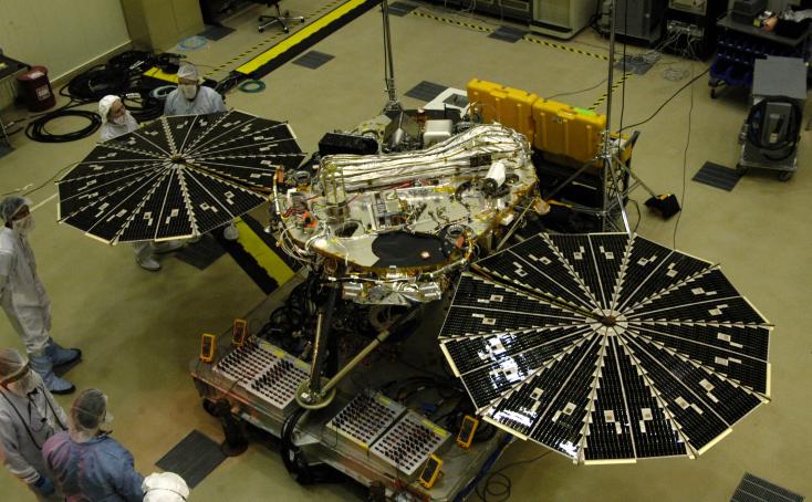
Source: PIA09701
|
|
|
Some of the first Phoenix
photos
Photos from NASA.
|
| Launch: |
4 August 2007 at 9h26 UTC, from
Cape Canaveral Air Force Station's LC-17A, by a Delta
II. |
| Orbit: |
Heliocentric orbit toward Mars. |
| Mission: |
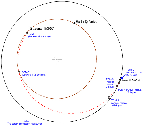 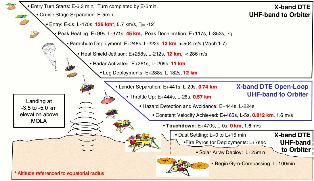 NASA's
Phoenix Mars Mission is scheduled to land in the Martian Arctic, at Vastitas
Borealis, by 68.4° North and 233.0° East, near the Scandia Colles
hills, on 25 May 2008 to do a close-up examination of the surface of the
polar region and studies the presence of water. Its robotic arm will dig
to an icy layer believed to lie just beneath the surface. The mission will
study, during a 3-month primary mission, the history of the water in the
ice, monitor weather of the polar region, and investigate whether the subsurface
environment in the far-northern plains of Mars has ever been favorable
for sustaining microbial life. Samples of soil and ice collected
by the lander's robotic arm will be analyzed by instruments mounted on
the deck. One key instrument will check for water and carbon-containing
compounds by heating soil samples in tiny ovens and examining the vapors
that are given off. Another will test soil samples by adding water
and analyzing the dissolution products. Cameras and microscopes will provide
information on scales spanning 10 powers of 10, from features that could
fit by the hundreds into a period at the end of a sentence to an aerial
view taken during descent. A weather station will provide information about
atmospheric processes in the arctic region. Phoenix uses the main body
of a lander originally made for the Mars Surveyor 2001 mission that was
cancelled before launch. Total Phoenix mass is 680 kg, including
a 350 kg lander; the remaining mass includes a cruise stage, aeroshell,
backshell, parachute system and propellant. This mission is the first of
NASA's Mars Scout missions, supplementing the agency's core Mars Exploration
Program, whose theme is "follow the water." The University of Arizona was
selected to lead the mission in August 2003 and is the first public university
to lead a Mars exploration mission. NASA's
Phoenix Mars Mission is scheduled to land in the Martian Arctic, at Vastitas
Borealis, by 68.4° North and 233.0° East, near the Scandia Colles
hills, on 25 May 2008 to do a close-up examination of the surface of the
polar region and studies the presence of water. Its robotic arm will dig
to an icy layer believed to lie just beneath the surface. The mission will
study, during a 3-month primary mission, the history of the water in the
ice, monitor weather of the polar region, and investigate whether the subsurface
environment in the far-northern plains of Mars has ever been favorable
for sustaining microbial life. Samples of soil and ice collected
by the lander's robotic arm will be analyzed by instruments mounted on
the deck. One key instrument will check for water and carbon-containing
compounds by heating soil samples in tiny ovens and examining the vapors
that are given off. Another will test soil samples by adding water
and analyzing the dissolution products. Cameras and microscopes will provide
information on scales spanning 10 powers of 10, from features that could
fit by the hundreds into a period at the end of a sentence to an aerial
view taken during descent. A weather station will provide information about
atmospheric processes in the arctic region. Phoenix uses the main body
of a lander originally made for the Mars Surveyor 2001 mission that was
cancelled before launch. Total Phoenix mass is 680 kg, including
a 350 kg lander; the remaining mass includes a cruise stage, aeroshell,
backshell, parachute system and propellant. This mission is the first of
NASA's Mars Scout missions, supplementing the agency's core Mars Exploration
Program, whose theme is "follow the water." The University of Arizona was
selected to lead the mission in August 2003 and is the first public university
to lead a Mars exploration mission. |
| Source: |
Jonathan
Space Report No. 583
; Spacewarn No. 646
; National Space Science Data Center's
2007-034A
; SkyRocket's Phoenix
; NASA JPL & Press
Kit ; NASA's 2010-2014
NASA News Releases ; |
|
|
|
Phoenix launched by a Delta II (Source:
NASA/KSC: 2163,
2165,
2169,
2170
& 2173)
|
.
STS-118 / ISS 13A.1
| Spacecraft: |
Endeavour (OV-105), 20th flight |
| Chronologies: |
2007 payload #76 ; 2007-035A ; 6,567th spacecraft. |
| Type: |
Piloted Spaceship |
| Families: |
|
| Ranks: |
|
| Sponsor: |
NASA |
|
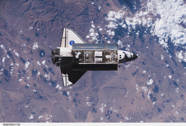
Source: NASA
|
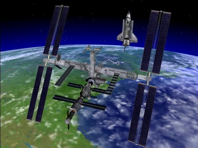 |
 |
| ISS as it will appear after Endeavour undocks. |
Endeavour's payloads |
Endeavour as viewed while approchaing
ISS
| Launch: |
8 August 2007 at 22h36 UTC, from
Kennedy Space Center LC-39A, by the Space Shuttle. |
| Orbit: |
Initial : 57 km x 225 km x 51.6°, and
then 229 km x 317 km
About circular at 400 km |
| Landed: |
21 August 2007 at 16h32 UTC at Kennedy Space
Center's Runway 15. |
| Mission: |
This mission is the 119th Space Shuttle flight,
the 20th for Endeavour and the 22nd U.S. flight to the International Space
Station. It's also Endeavour's first flight in more than four years. The
Orbiter underwent extensive modifications, including the addition of safety
upgrades already added to Discovery and Atlantis.
Endeavour carry
a crew of 7 astronauts (Scott Kelly, Charles Hobaugh, Tracy Caldwell, Rick
Mastracchio, Dafydd Williams, Barbara Morgan and Al Drew) as well as the
ITS-S5
truss. The Orbiter docked at the PMA-2 adapter on 10 August at 18h02 UTC
and the hatches to the Station were opened at 20h04 UTC. The Shuttle Canadarm
(RMS 201) lifted the S5 truss from the payload bay on 10 August at 20h50
UTC and later handed it to the Station's Canadarm2 which attached it to
the main truss at 17h30 UTC on 11 August.
Four spacewalks
were performed during the mission. On 11 August, Mastracchio and
Williams supervised the S5 attachment process and completed fitting it
out. On 13 August, they went outside to replace one of the gyroscopes in
the Z1 truss segment (CMG-3). On 15 August, Mastracchio and Anderson relocated
the SASA antenna and the two CETA carts were moved from S1 to P1. Mastracchio
discovered minor damage on his spacesuit glove, and the spacewalk was cut
short. On 18 August, Williams and Anderson retrieved two MISSE exposure
packs and installed an EWIS communications antenna on Destiny. They also
installed mounting brackets for the OBSS (Orbiter Boom Sensor System) on
the S1 truss.
A small gouge on
a tile underneath the Orbiter caused some concern during the mission, but
it was decided that a repair spacewalk was not required. Finally,
Endeavour landed as schedule on 21 August. |
| Source: |
Jonathan
Space Report No. 584
& 585
; Spacewarn No. 646
; National Space Science Data Center's
2007-035A
; SkyRocket's STS-118
; STS-118
Press Kit ; |
|
|
The International Space Station at the arrival
of Endeavour (first three photos) and at departure a week later.
.
ITS-S5
| Spacecraft: |
ITS-S5 stands for Integrated
Truss Structure - Starboard 5 |
| Chronologies: |
2007 payload #77 ; 2007 n/a ; 6,568th spacecraft. |
| Type: |
Space Station Component |
| Families: |
|
| Ranks: |
|
| Sponsor: |
NASA |
|
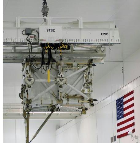 |
Left: the ITS-S5 is grappled by Station's Canadarm2
and installed at the end of the ITS main truss. Center: the box-shape ITS-S5
is about the size of a small compact-car. Right: ITS-S5 shows installed
in the lower foreground. (Source: NASA STS-118
Press Kit, p. 57)
| Launch: |
8 August 2007 at 22h36 UTC, from
Kennedy Space Center LC-39A, by the Space Shuttle.
Mated to the International Space Station's
ITS truss on 11 August 2007 at 17h30 UTC. |
| Orbit: |
Part of the International Space Station. |
| Mission: |
The ITS-S5 short spacer is part of the 11-segment
Integrated Truss Structure (ITS) which forms ISS's backbone with mountings
for unpressurized logistics carriers, radiators, solar arrays and various
other elements. It is the third starboard (right-side) truss segment
to be delivered. It is attached to the Starboard 4 (S4) truss element.
ITS-S5 is used primarily to connect power, cooling lines and serve as a
spacer between the S4 and S6 photovoltaic modules. The Boeing-built segment
measure 3.37 meters x 4.55 meters x 4.24 meters, weight 1,819 kg and cost
$10,971,693. The girder-like structure is made of mostly aluminum and provides
several extravehicular aids, robotic interfaces and ammonia servicing hardware. |
| Source: |
Jonathan
Space Report No. 584
; SkyRocket's ITS-S5
; STS-118
Press Kit ; |
|
|
.
SPACEWAY 3
| Spacecraft: |
|
| Chronologies: |
2007 payload #78 ; 2007-036A ; 6,569th spacecraft. |
| Type: |
Communications |
| Families: |
|
| Ranks: |
|
| Sponsor: |
Hughes Network Systems, LLC |
|
 |
At left, SPACEWAY 3 satellite in stowed position
and, at right, in-orbit 41-meter-span deplyed.
|
.
BSAT-3a
| Spacecraft: |
|
| Chronologies: |
2007 payload #79 ; 2007-036B ; 6,570th spacecraft. |
| Type: |
Communications (Direct-to-Home Services) |
| Families: |
|
| Ranks: |
|
| Sponsor: |
Japan Broadcasting Satellite Systems Corp.
(BSAT) |
|
 |
|
.
Insat 4CR
| Spacecraft: |
|
| Chronologies: |
2007 payload #80 ; 2007-037A ; 6,571st spacecraft. |
| Type: |
Communications (Direct-to-Home Broadcasting) |
| Families: |
|
| Ranks: |
|
| Sponsor: |
Indian Space Research Organisation |
|
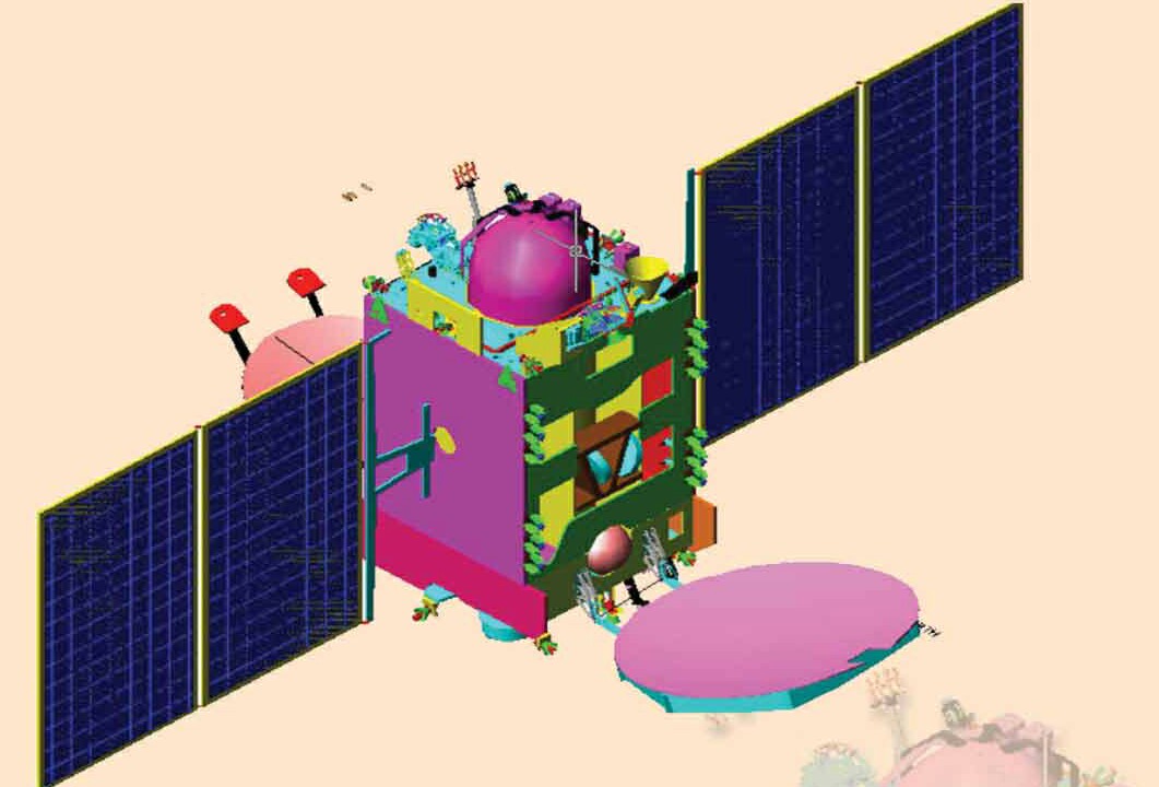
Source : ISRO
|
Insat 4CR launch preparation (Source:
ISRO)
| Launch: |
2 September 2007 at 12h50 UTC,
from Dhawan Space Centre SHAR's Second Pad, by a GSLV. |
| Orbit: |
Initial: 168 km x 34,710 km x 20.7°
Geostationary at 74° East longitude |
| Mission: |
Insat 4CR is a 2,140-kg (including fuel),
2.9-kW Direct-To-Home communications satellite. It is an exclusive Ku-band
comsat carrying 12 high-power Ku-band transponders designed to provide
DTH television services, Video Picture Transmission (VPT) and Digital
Satellite News Gathering (DSNG) during its 10-year lifetime. It was built
to replace an identical satellite, Insat
4C, that was lost due to the failure of GSLV-F02 in July 2006. Insat
4CR was developed by ISRO Satellite Centre, Bangalore. Its payloads were
developed by Space Applications Centre, Ahmedabad. The satellite
reached orbit with lower-than-planned apogee but it has enough fuel to
reach an operational geostationary orbit on its own. The Insat-4 series
is planned to have seven satellites, with Insat-4D as a spare. It is planned
that, by 2007, the system will have about 250 transponders in various bands
catering to a demand. |
| Launch: |
GSLV-F04 put the satellite in a 196 km x
31,878 km x 15.8° transfer orbit. The apogee was a little lower
than the standard 35,800 km GTO apogee, but the satellite on-board apogee
engine was able to make up the difference and, by 6 September 2007, Insat
4CR was in a 32,579 km x 35,226 km x 0.3° orbit approaching geostationary
altitude. |
| Source: |
Jonathan
Space Report No. 585
; Spacewarn No. 647
; National Space Science Data Center's
2007-037a
; SkyRocket's Insat
4CR ; ISRO's
INSAT
4CR &
2
Sep 07 ; |
|
GSLV-F04 launch wiht Insat 4CR (Photos
ISRO)
|
.
JCSAT 11
| Spacecraft: |
|
| Chronologies: |
2007 payload #81 ; 2007 3rd loss ; 6,572nd
spacecraft. |
| Type: |
Communications |
| Families: |
|
| Ranks: |
|
| Sponsor: |
Japan's JSAT Corp |
|
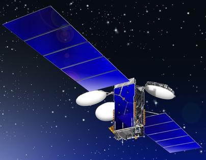
Source: ILS
|
| Launch: |
5 September 2007 at 23h43 UTC,
from Baykonur's LC-200/39, by a Proton-M/Briz. |
| Orbit: |
n/a |
| Mission: |
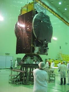 JCSAT-11
was a 4,007-kg communication satellite built on a Lockheed Martin A2100
bus. Lockheed Martin has been awarded a contract in October 2005 to build
this comsat. JCSAT-11 would have been reserved entirely in orbit as a backup
satellite for other JCSAT satellites following its launch. A replacement
was ordered on the day it was lost, for a launch in 2009. JCSAT-11
was a 4,007-kg communication satellite built on a Lockheed Martin A2100
bus. Lockheed Martin has been awarded a contract in October 2005 to build
this comsat. JCSAT-11 would have been reserved entirely in orbit as a backup
satellite for other JCSAT satellites following its launch. A replacement
was ordered on the day it was lost, for a launch in 2009. |
| Launch: |
Proton-M serial 53522 took off with its Briz-M
No. 88522 upper stage. The first stage separated 2 minutes after launch.
It seems there was some kind of problem with second stage ignition, and
the vehicle fell back to Earth from an altitude of around 75 km. |
| Source: |
Jonathan
Space Report No. 585
; Spaceflight Now's
5
Sep 07 ; SkyRocket's JCSAT
11 ; ILS's
6
Sep 07, Blog & Overview
; |
|
|
.
Kosmos 2429
| Spacecraft: |
Parus |
| Chronologies: |
2007 payload #82 ; 2007-038A ; 6,573rd spacecraft. |
| Type: |
Navigation |
| Families: |
|
| Ranks: |
|
| Sponsor: |
Russian Defense Ministry |
|
 |
| Launch: |
11 September 2007 at 13h05 UTC,
from Plesetsk Cosmodrome's LC-132/1, by a Kosmos-3M. |
| Orbit: |
943 km x 1008 km x 83.0°
970 km x 1010 km x 82.96° x 105 min. |
| Mission: |
Kosmos 2429 is a Parus-class navigation satellite.
The primary function of these satellites is to provide location information
for the Parus navigation system. The satellites are also reported to be
relays for data of the US-P (EORSAT) ocean surveillance satellites and
store-dump communication services. With the introduction of the GLONASS
(Uragan) navigation system, the relay role may be now the primary function.
Previous
launch of a Parus satellite,
Kosmos
2414, took place in January 2005. |
| Source: |
Jonathan
Space Report No. 585
; Spacewarn No. 647
; National Space Science Data Center's
2007-038A
; Spaceflight Now's
11
Sep 07 ; SkyRocket's Kosmos
2429 ; RSNF's
11
Sep 07 ; |
|
|
.
SELENE / Kaguya
| Spacecraft: |
SELENE stands for SELenological
and ENgineering Explorer. |
| Chronologies: |
2007 payload #83 ; 2007-039A ; 6,574th spacecraft. |
| Type: |
Lunar Probe |
| Families: |
|
| Ranks: |
|
| Sponsor: |
Japan Aerospace Exploration Agency (JAXA) |
|
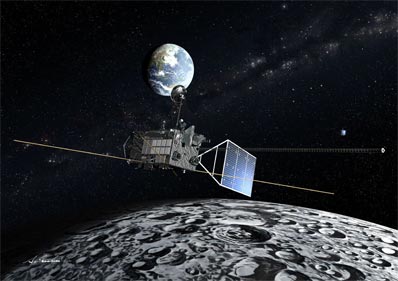 |
Artist concepts of SELENE in flight (Source:
JAXA)
| Launch: |
14 September 2007 at 1h31 UTC,
from Tanegashima Space Center, by a H-IIA. |
| Orbit: |
100 km x 100 km x 95° Lunar orbit |
| Mission: |
Kaguya, also known by its pre-launch name
SELENE, is 2.9-tonne, 3.5-kW Japanese lunar orbiter that observed the surface
of the Moon from a circular 100-km polar orbit for a one-year period to
obtain detailed knowledge of topography and mineral composition. It carries
13 instruments, including imagers, a radar sounder, laser altimeter, X-ray
fluorescence spectrometer and gamma-ray spectrometer to study the origin,
evolution, and tectonics of the Moon. The mission consists of three separate
crafts: Kaguya (the main orbiter), Okina
(a small relay satellite) and Ouma (a small interferometry
satellite). The orbiter is a rectangular box which measures about
2.1 meter by 4.2 meter, and has a mass of roughly 1,600 kg.
On 3 October 2007,
the Moon probe entered a 101 km x 11,741 km x 95° lunar orbit. It then
lowered its altitude to 100 km circular from which it will carry out observations
for approximately one year. It previously ejected its two subsatellites. |
| Launch: |
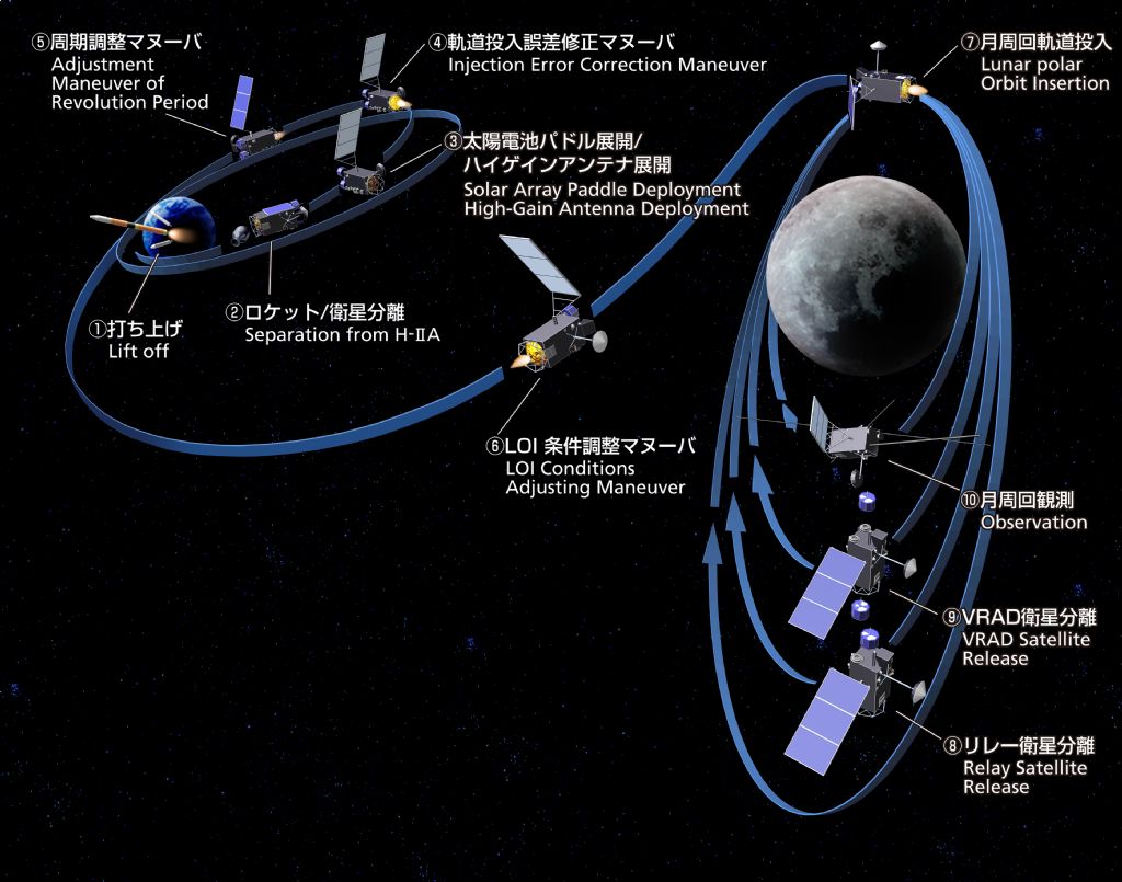 Following
its launch, SELENE was placed into a 281 km x 23,2805 km x 29.9° Earth
orbit, from which it was inject into a lunar-transfer orbit, The probe
had taken 5 days to reach the Moon, where it was placed into an initial
120 km x 13,000 km orbit at an inclination of 95°. The Rstar relay
satellite was released into a 100 x 2,400 km orbit and then the Vstar satellite
was released into a 100 x 800 km orbit. The orbiter was then lowered to
its nominal 100 km circular orbit. Following
its launch, SELENE was placed into a 281 km x 23,2805 km x 29.9° Earth
orbit, from which it was inject into a lunar-transfer orbit, The probe
had taken 5 days to reach the Moon, where it was placed into an initial
120 km x 13,000 km orbit at an inclination of 95°. The Rstar relay
satellite was released into a 100 x 2,400 km orbit and then the Vstar satellite
was released into a 100 x 800 km orbit. The orbiter was then lowered to
its nominal 100 km circular orbit. |
| Source: |
Jonathan
Space Report No. 585
& 586
; Spacewarn No. 647
; National Space Science Data Center's
2007-039A
; Spaceflight Now's 14
Sep 07 ; JAXA's SELENE,
Kaguyta
/ SELENE, Press
Release ; SkyRocket's SELENE
; |
|
|
Spectacular Earth rise as seen from the
Moon by Kaguya orbiter (Source: JAXA)
.
Rstar / Okina
| Spacecraft: |
Rstar stands for Relay Satellite |
| Chronologies: |
2007 payload #84 ; 2007-039B ; 6,575th spacecraft. |
| Type: |
Lunar Probe |
| Families: |
|
| Ranks: |
|
| Sponsor: |
Japan Aerospace Exploration Agency (JAXA) |
|
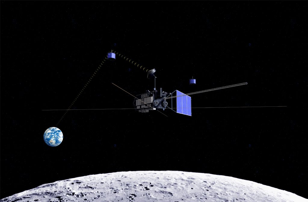
Source: JAXA
|
| Launch: |
14 September 2007 at 1h31 UTC,
from Tanegashima Space Center, by a H-IIA.
The subsatellite was ejected from Kaguya,
in lunar orbit, on 6 October 2007 at 0h36 UTC. |
| Orbit: |
115 km x 2399 km lunar orbit. |
| Mission: |
Okina, or Rstar, is a 50-kg (45 kg) lunar
relay satellite for the Japanese SELENE mission, It is intended to maintain
communications link between Earth and Kaguya.
The octagonal prism satellite provides four-way Doppler measurements of
Kaguya orbiter by using Relay Satellite for far-side gravity field for
the first time. It uplinks radio wave from Usuda is relayed to the Main
Orbiter via the relay satellite, which is returned to Usuda via relay satellite
again. Then the Doppler frequency is measured at Usuda. Orbits of the sub-satellites
are precisely determined by tracking the radio sources onboard sub-satellites
with differential VLBI, which contributes the accuracy of the gravity field,
especially on the lunar limb areas. |
| Source: |
Jonathan
Space Report No. 586
; Spacewarn No. 647
; National Space Science Data Center's
2007-039B
; SkyRocket's Rstar
; |
|
|
.
Vstar / VRAD / Ouma
| Spacecraft: |
VRAD stdnds for Very-Long-Baseline-Interferometer
Radio source |
| Chronologies: |
2007 payload #85 ; 2007-039C ; 6,576th spacecraft. |
| Type: |
Lunar Probe |
| Families: |
|
| Ranks: |
|
| Sponsor: |
Japan Aerospace Exploration Agency (JAXA) |
|
 |
| Launch: |
14 September 2007 at 1h31 UTC,
from Tanegashima Space Center, by a H-IIA.
The subsatellite was ejected from Kaguya,
in lunar orbit, on 12 October 2007 at 4h28 UTC |
| Orbit: |
127 km x 795 km lunar orbit. |
| Mission: |
Ouma, or VRAD, is a 50-kg (45 kg) Japanese
subsatellite for the Japanese SELENE mission, This prism-shape satellite
is used to conduct precise position and precession of the Moon. Orbits
of the Rstar and Vstar subsatellites are precisely determined by tracking
the radio sources onboard each craft that are tracked by the five Earth-based
Very Long Baseline Interferometer stations. Its precise orbital positions
can help unfold the gravity field of the Moon. |
| Source: |
Jonathan
Space Report No. ; Spacewarn
No. 647
; National Space Science Data Center's
2007-039C
; SkyRocket's Vstar
; |
|
|
.
Foton M-3
| Spacecraft: |
|
| Chronologies: |
2007 payload #86 ; 2007-040A ; 6,577th spacecraft. |
| Type: |
Material Processing |
| Families: |
|
| Ranks: |
|
| Sponsor: |
Russia/Europe |
|
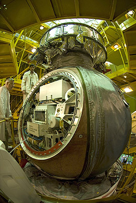
Source: ESA
|
Source: ESA
(See also two
Flash video)
| Launch: |
14 September 2007 at 11h00 UTC,
from Baykonur Cosmodrome, by a Soyuz-U. |
| Orbit: |
258 km x 280 km x 62.9° x 90 min |
| Recovered: |
26 September 2007 at 7h58 UTC |
| Mission: |
Foton M-3 is a 6,410-kg Russian/European
microgravity satellite that carries ESA experiments. The 6.2-meter
high and 2.5-meter diameter satellite carries a 2.5 tonne capsule which
contain 400 kg of experiments for microgravity fluid physics and crystal
growth experiments, and radiation tests on living bodies, including 10
gerbils. Foton-M is an improved version of the Foton microgravity spacecraft;
it has an increased battery capacity using lithium cells, better thermal
control and a new telemetry and telecommand unit for increased data flow
rate. Orbital life time is 15 days. The first
launch failed when the Soyuz-U carrier rocket exploded few seconds after
launch. ESA has contracted for two more flights in 2005 and 2006. The Foton
M-3 capsule made a successful landing on the Russian-Kazakhstan border
on 26 September 2007. The capsule was deorbited at 7h23 UTC and landed
at 7h58 UTC, returing its payload to Earth. |
| Source: |
Jonathan
Space Report No. 585
& 586
; Spacewarn No. 647
; National Space Science Data Center's
2007-040A
; SpaceflightNow's 15
Sep 07 ; SkyRocket's Foton-M
3 ; |
|
Source: ESA 1
& 2
|
.
YES-2 / Fotino
| Spacecraft: |
YES2 stands for Young Engineers'
Satellite 2 |
| Chronologies: |
2007 payload #87 ; 2007-040B ; 6,578th spacecraft. |
| Type: |
Technology |
| Families: |
|
| Ranks: |
|
| Sponsor: |
ESA / students |
|
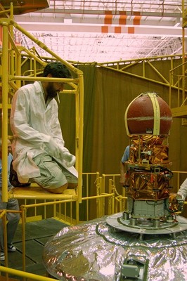
Source: ESA
|
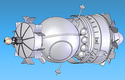 |
YES2 has three components:
Fotino: a small 6 kg capsule which will
return to Earth.
Mechanical data Acquisition Support System
(MASS): an 8 kg carrier which holds Fotino in place with four straps. MASS
will burn up in the atmosphere on re-entry.
Foton LOcated YES2 Deployer (FLOYD): a
22 kg carrier bolted onto Foton-M3, which will eject MASS and Fotino towards
Earth. Inside FLOYD is a spool with 30 km of 0.5 mm thick Dyneema tether
which is connected to MASS. |
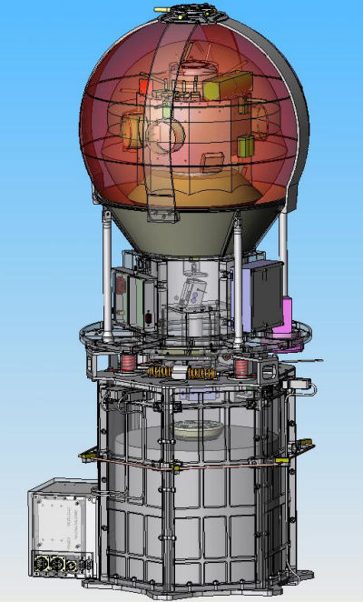 |
| Photo: ESA |
|
Photo: ESA |
| Launch: |
14 September 2007 at 11h00 UTC,
from Baykonur Cosmodrome, by a Soyuz-U. |
| Orbit: |
258 km x 280 km x 62.9° |
| Mission: |
YES2 and Fotino are 35-kg and 5-kg ESA/student-built
minisatellites. This second Young Engineers Satellite is an educational
project in which European students build and fly the first re-entry vehicle
with a 30-km tether. It is an initiative of the ESA Education Office together
with the Dutch space company Delta-Utec SRC. YES2 is providing hundreds
of university students with a highly exciting, motivating technical and
educational experience; The mission involves the first use of a tether
to return a payload from space, paving the way for low-cost return capability
that will offer an alternative to conventional rocket propulsion.
The tether experiment
was released on 25 September 2007 However, the experiment failed. The tether
was deployed at 4h47 UTC and was then severed at about 7h20 UTC, after
it had reached only 8.5 km of its planned 30 km length. The tiny Fotino
reentry capsule separated shortly afterwards but was never recovered. |
| Source: |
Jonathan
Space Report No. 585
; Spacewarn No. 647
; SpaceflightNow's 15
Sep 07 & 25
sep 07 ; ESA's YES-2,
YES-2
Blog ; SkyRocket's YES2
; |
|
|
.
WorldView 1
| Spacecraft: |
|
| Chronologies: |
2007 payload #88 ; 2007-041A ; 6,579th spacecraft. |
| Type: |
Earth Observations |
| Families: |
|
| Ranks: |
|
| Sponsor: |
DigitalGlobe |
|
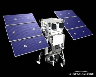 |
| Launch: |
18 September 2007 at 18h35 UTC,
from Vandenberg Air Force Base's SLC-2W, by a Delta
II. |
| Orbit: |
493 km x 495 km, x 97.5° x 94.5 min. |
| Mission: |
WorldView 1 is a 2500-kg commercial imaging
craft that carries a camera to provide 0.5 meter resolution panchromatic
images (which is four times greater than any previous commercial imaging
satellite) and two-meter resolution multicolor images. WorldView-1 carries
a 0.6-meter aperture imaging telescope/camera for high resolution Earth
imaging. DigitalGlobe's main customer is the U.S. National Geospatial Intelligence
Agency (NGA). WorldView 1 is the first element in the Defense Depts NextView
reconnaissance satellite program that combines commercial remote sensing
with much more powerful optics funded in part by the Pentagon.
The National Geospatial
Intelligence Agency (NGA) awarded $500 million contracts each to DigitalGlobe
team and GeoEye/General Dynamics team to develop half-meter resolution
capability spacecraft. The first WorldView 1 operates on in a black &
white panchromatic mode, but its second spacecraft (set for launch in late
2008) will have eight multispectral bands. Ball Aerospace & Technologies
is teamed with DigitalGlobe to build WorldView 1 which is the worlds only
half-meter resolution commercial imaging satellite. Also, WorldView 1 is
able to shoot far more images in the short span of time while passing over
any given target area at orbital velocity. Combined with DigitalGlobes
existing QuickBird 2 satellite,
the companys imaging constellation is able of collecting more than 4.5
times the imagery of any current commercial imaging system. WorldView 1
alone is capable of collecting up to 500,000 square kilometers per day
of half-meter imagery. The satellite is also equipped with state-of-the-art
geo-location accuracy capability and will exhibit stunning agility with
rapid targeting and efficient in-track stereo collection. This launch marked
the 75th straight launch success by a Delta II since 1997. |
| Source: |
Jonathan
Space Report No. 585
; Spacewarn No. 647
; National Space Science Data Center's
2007-041A
; SpaceflightNow's 18
Sep 07 ; SkyRocket's WorldView
1 ; |
|
|
.
CBERS-2B / Zi Yuan 2B
(ZY-2B)
| Spacecraft: |
CBERS stands for China-Brazil
Earth-Resources Satellite |
| Chronologies: |
2007 payload #89 ; 2007-042A ; 6,580th spacecraft. |
| Type: |
Earth Remote Sensing |
| Families: |
|
| Ranks: |
|
| Sponsor: |
China National Space Administration (CNSA)
and the Brazilian Space Agency (AEB) |
|
|
| Launch: |
19 September 2007 at 3h26 UTC,
from Taiyuan Satellite Launch Center, by a Chang
Zheng 4B. |
| Orbit: |
Initial: 773 km x 774 km x 98.6° x 100.3
min. |
| Mission: |
CBERS 2B, also known as Zi Yuan 2B, is a
1,450-kg China-Brazil joint craft that carries a low 20-meter resolution,
and a higher 2.5-meter resolution camera. The data will help in crop estimation,
urban planning, water resource management and military intelligence. CBERS-2B
is the third China-Brazil environmental research satellite.
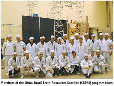 In July 1988, in a joint effort to develop capacity in Earth observation
from space, China and Brazil signed an agreement for the development and
launch of two remote sensing satellites. This was followed by the setting
up of the China-Brazil Earth-Resources Satellite (CBERS) program, coordinated
by the China National Space Administration (CNSA) and the Brazilian Space
Agency (AEB), and executed by the China Academy of Space Technology (CAST)
and the Brazilian National Institute for Space Research (INPE). The CBERS
program has witnessed the successful launch and operation of the two satellites
and two nations signed another agreement in November 2002 for the manufacture
and launch of two new satellites - CBERS-3 & 4 - with improved characteristics.
This new generation of Sino-Brazilian remote sensing satellites are to
be launched in 2009 and 2011 respectively.
In July 1988, in a joint effort to develop capacity in Earth observation
from space, China and Brazil signed an agreement for the development and
launch of two remote sensing satellites. This was followed by the setting
up of the China-Brazil Earth-Resources Satellite (CBERS) program, coordinated
by the China National Space Administration (CNSA) and the Brazilian Space
Agency (AEB), and executed by the China Academy of Space Technology (CAST)
and the Brazilian National Institute for Space Research (INPE). The CBERS
program has witnessed the successful launch and operation of the two satellites
and two nations signed another agreement in November 2002 for the manufacture
and launch of two new satellites - CBERS-3 & 4 - with improved characteristics.
This new generation of Sino-Brazilian remote sensing satellites are to
be launched in 2009 and 2011 respectively.
In order to
avoid a data gap between
CBERS-2
and CBERS-3, China and Brazil signed a complementary protocol in November
2004 for manufacturing the CBERS-2B satellite, to be launched in September
2007.
CBERS are equipped
with cameras for earth observation in different spectral bands. Each satellite
also carries a transponder for data collection, to support the Brazilian
Environmental Data Collection System. The CBERS-3 & 4 satellites will
be equipped with a more sophisticated payload than those on onboard the
CBERS-1 & 2 satellites.
These remote sensing
satellites have brought significant scientific advances to Brazil. Over
15,000 users from more than 1,500 organizations are registered as active
CBERS users, while 300,000 CBERS images are distributed at the approximate
rate of 250 every day.
Its images are used in important areas such
as fire control in the Amazon region, water resources monitoring, urban
growth, land use and education.
The Medium Resolution
Imaging Camera (CCD), with its 20-m medium spatial resolution in four spectral
bands and one panchromatic band, is suited for observation of phenomena
and objects whose details are important. With 120-km field of view, it
is suited for city and region studies. Its bands are located in the spectral
zone of the visible and near infrared, which allow good contrast between
vegetation and other type of objects. Potential CCD application fields
include vegetation, agriculture, environment, water, cartography, geology
and soil, and education.
The IRMSS (Infrared
Multispectral Scanner) camera, present in CBERS-1 and 2, has two spectral
bands in the medium infrared region and a panchromatic band with an 80-m
spatial resolution, plus one 160-m band in the thermal infrared region.
Its applications are the same as those of the CCD camera with proper adaptations.
Additional applications are analysis of phenomena that present surface
temperature modifications, and the generation of state region mosaics and
image charts.
The WFI (Wide Field Imager) can image large
territorial extensions, up to 890 km wide. This makes WFI very useful for
observing phenomena whose magnitude or interest lie in the macro-regional
or state scale.
This wide spatial
coverage gives its temporal resolution an advantage - it can generate images
of a certain region within less than five days' interval. Some of its applications
are generation of state region and national mosaics, generation of vegetation
indexes for monitoring purposes, and monitoring dynamic phenomena like
agricultural harvests and persistent fires.
The HRC (High-Resolution Panchromatic Camera)
scans a relatively narrow strip of 27 km with a high 2.4 m pixel resolution.
The operation mode is based on a 130-day revisit, making it possible to
obtain at least two complete images of the country per year. Its applications
include detailed national or regional mosaics, update of thematic maps,
and urban and intelligence inputs. |
| Source: |
Jonathan
Space Report No. 585
&
586
;
Spacewarn No. 647
; National Space Science Data Center's
2007-042A
; SpaceflightNow's 19
Sep 07 ; SkyRocket's CBERS
2B ; China Daily's 7
Sep 07 & 16
Sep 07 ; |
|
|
.
DAWN
| Spacecraft: |
|
| Chronologies: |
2007 payload #90 ; 2007-043A ; 6,581st spacecraft. |
| Type: |
Planetary Probe |
| Families: |
|
| Ranks: |
|
| Sponsor: |
NASA |
|
Source ; NASA/UCLA
|
| Launch: |
27 September 2007 at 11h34 UTC,
from Cape Canaveral Air Force Station's LC-17B, by a Delta
II. |
| Orbit: |
Heliocentru orbit (between Earth and Jupiter). |
| Mission: |
Dawn is a planetary probe that will study
shape, surface topography and tectonic history, elemental and mineral composition
as well as seek out water-bearing minerals on Ceres and Vesta, the two
most massive residents of the Main Belt Asteroids, located between Mars
and Jupiter. Dawn will arrive at Vesta on 14 August 2011 and depart from
it on 22 May 2012. It will then arrive at Ceres on 1st February 2015,
with an end of mission scheduled for July 2015. The probe weight 1,217.7
kilograms at launch, consisting of a 747.1-kg spacecraft, 425 kg of xenon
propellant and 45.6 kg of hydrazine propellant. It measure 1.64 meter long,
1.27 meter wide and 1.77 meter high. When deployed, its solar array is
20 meters long tip to tip.
The asteroid Vesta
and the recently categorized dwarf planet Ceres have been selected because,
while both speak to conditions and processes early in the formation of
the Solar system, they developed into two different kinds of bodies. Vesta
is a 578 x 560 x 458 kilometers dry, differentiated object with a surface
that shows signs of resurfacing. It resembles the rocky bodies of the inner
Solar system, including Earth. Ceres (a 975 x 909 kilometers body) has,
by contrast, a primitive surface containing water-bearing minerals, and
may possess a weak atmosphere. It appears to have many similarities to
the large icy moons of the outer solar system. Vesta is a rocky body, while
Ceres is believed to contain large quantities of ice. The profound differences
in geology between these two protoplanets that formed and evolved so close
to each other form a bridge from the rocky bodies of the inner Solar system
to the icy bodies, all of which lay beyond in the outer Solar system.
DAWN Mission cost $357.5 million
total (not including launch vehicle), consisting of $281.7 million spacecraft
development and $75.8 million mission operations. |
| Source: |
Jonathan
Space Report No. 586
& 587
; Spacewarn No. 647
; National Space Science Data Center's
2007-043A
; SkyRocket's DAWN
; NASA's DAWN wetsite & Press
Kit ; NASA's 2010-2014
NASA News Releases ; Marc
Raymans lecture, 4 December 2014. |
|
|
.
Intelsat 11
| Spacecraft: |
|
| Chronologies: |
2007 payload #91 ; 2007-044B ; 6,582nd spacecraft. |
| Type: |
Communications |
| Families: |
|
| Ranks: |
|
| Sponsor: |
Intelsat |
|

Source: OSC
|
| Launch: |
5 October 2007 at 22h02 UTC,
from Kourou Space Center's ELA-3, by an Ariane
5GS. |
| Orbit: |
Geostationary at 43° West longitude. |
| Mission: |
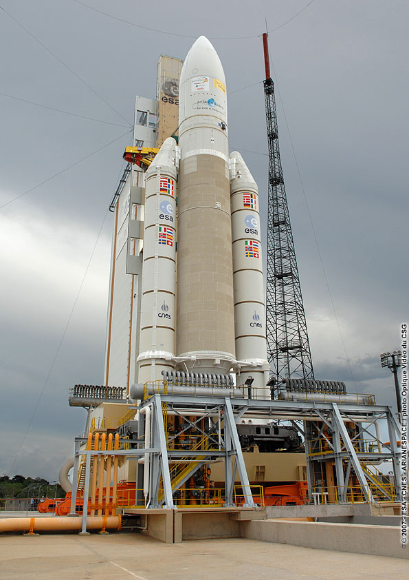 Intelsat
11, or Intelsat IS-11 or PAS-11, is a 2,450-kg communications satellite
that carries 25 C-band and 18 Ku-band transponders to provide direct-to-home
(DTH) voice and video transmissions in Latin America. It will be phased-in
to eventually replace Intelsat's 6B and 3R satellites. Built by Orbital
Sciences, using a 3-axis stabilized Star 2 platform, it measure 4.1 x 3.3
x 2.3 meters with a 22.4 meters wingspan in orbit. It has a 15 years
design lifespan. Intelsat
11, or Intelsat IS-11 or PAS-11, is a 2,450-kg communications satellite
that carries 25 C-band and 18 Ku-band transponders to provide direct-to-home
(DTH) voice and video transmissions in Latin America. It will be phased-in
to eventually replace Intelsat's 6B and 3R satellites. Built by Orbital
Sciences, using a 3-axis stabilized Star 2 platform, it measure 4.1 x 3.3
x 2.3 meters with a 22.4 meters wingspan in orbit. It has a 15 years
design lifespan.
The 178th Ariane
launch, with Ariane 5GS vehicle L526, is the 34th Ariane 5 launch. It carries
a total payload of 5,857 kg, including 4,832 kg for two satellites. |
| Source: |
Jonathan
Space Report No. 586
& 587
; Spacewarn No. 648
; National Space Science Data Center's
2007-044B
; SkyRocket's Intelsat
11 ; Arianespace's 5
Oct 07 & Press
Kit ; Intelsat's 5
Oct 07 ; OSC Intelsat
11/Optus D2 ; Spaceflight Now's
5
Oct 07 ; Chronologie
Ariane 2007 ; |
|
|
|
|
.
Optus D2
| Spacecraft: |
|
| Chronologies: |
2007 payload #92 ; 2007-044A ; 6,583rd spacecraft. |
| Type: |
Communications |
| Families: |
|
| Ranks: |
|
| Sponsor: |
SingTel Optus |
|

Source: OSC
|
| Launch: |
5 October 2007 at 22h02 UTC,
from Kourou Space Center's ELA-3, by an Ariane
5GS. |
| Orbit: |
Geostationary at 152°. East longitude. |
| Mission: |
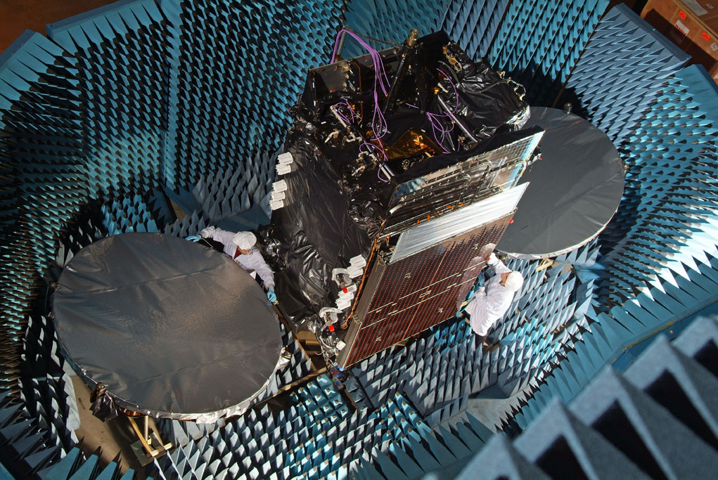 Optus
D2 is a 2,350-kg (with fuel), 3.8-kW communications satellite that carries
24 Ku-band transponders which provide direct-to-home (DTH) television services,
Internet, telephone and data transmission services for Australia and New
Zealand. Built by Orbital Sciences, it is a 3-axis stabilized craft which
measure 4.0 x 3.2 x 2.4 meters with a wingspan of 22.4 meters in orbit.
It has a design life of 15 years. The first two satellites of the Optus-D
series are based on Orbital's Star-2 platform and carries 24 Ku-band transponders,
with 8 back-up channels also available, to provide fixed communications
and direct television broadcasting services to Australia and New Zealand.
(Optus D3 was ordered for launch in 2009.) Optus
D2 is a 2,350-kg (with fuel), 3.8-kW communications satellite that carries
24 Ku-band transponders which provide direct-to-home (DTH) television services,
Internet, telephone and data transmission services for Australia and New
Zealand. Built by Orbital Sciences, it is a 3-axis stabilized craft which
measure 4.0 x 3.2 x 2.4 meters with a wingspan of 22.4 meters in orbit.
It has a design life of 15 years. The first two satellites of the Optus-D
series are based on Orbital's Star-2 platform and carries 24 Ku-band transponders,
with 8 back-up channels also available, to provide fixed communications
and direct television broadcasting services to Australia and New Zealand.
(Optus D3 was ordered for launch in 2009.) |
| Source: |
Jonathan
Space Report No. 586
& 587
; Spacewarn No. 648
; National Space Science Data Center's
2007-044A
; SkyRocket's Optus
D2 ; Arianespace's 5
Oct 07 & Press
Kit ; Spaceflight Now's 5
oct 07 ; |
|
|
.
Soyuz TMA-11 / ISS 15S
| Spacecraft: |
Soyuz 11F732 (7K-STMA) No. 221 |
| Chronologies: |
2007 payload #93 ; 2007-045A ; 6,584th spacecraft. |
| Type: |
Piloted Spaceship |
| Families: |
|
| Ranks: |
|
| Sponsor: |
Russian Space Agency |
|
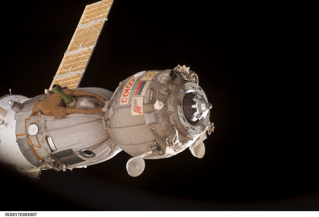
Source: NASA
|
| Launch: |
10 October 2007 at 13h22 UTC,
from Baykonur Cosmodrome's LC-1, by a Soyuz-FG. |
| Orbit: |
340 km x 344 km x 51.64° x 91.4 min. |
| Landed: |
19 April 2008 at 4h30 EDT |
| Mission: |
Soyuz TMA-11 is a passenger transport craft
that carried a Russian, an American and a Malaysian toward the International
Space Station. It carries the crew of ISS Expedition 16 (Commander
Peggy Whitson and Flight Engineer-1 Yuri Malenchenko) as well as the 13th
visiting (VC-13) Spaceflight Participant Sheikh Muszaphar Shukor.
During the flight of the Soyuz, Malenchenko caommands the craft and Wilson
is his flight engineer. It docked with the Zarya module on 12 October 2007
at 14h50 UTC. Aboard the station, Whitson takes command as Expedition 16
commander with Malenchenko as first flight engineer, together with second
flight engineer Clay Anderson who has been aboard since August.
Soyuz TMA-11, carrying
Expedition 16 crew plus the South-Korean Spaceflight Participant Yi Soyeon,
landed successfully on 19 April 2008 in the steppes of Kazakhstan, approximately
450 km west of the prime landing area in the ballistic mode zone. The
Expediion 16 crew is reported in excellent condition after 192 days in
space (190 docked to ISS). |
| Source: |
Jonathan
Space Report No. 586
; Spacewarn No. 648
; National Space Science Data Center's
2007-045A
; SkyRocket's Soyiz-TMA
11 ; RSC Energia's 10
Oct 07 & 12
Oct 07 ; |
|
|
.
WGS F1 / WGS SV-1 (USA
195)
| Spacecraft: |
WGS stands for Wideband Global
SATCOM |
| Chronologies: |
2007 payload #94 ; 2007-046A ; 6,586th spacecraft. |
| Type: |
Communications |
| Families: |
|
| Ranks: |
|
| Sponsor: |
U.S. Deparment of Defense |
|
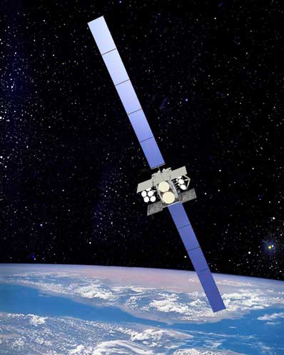
Source: Boeing
|
| Launch: |
11 October 2007 at 0h22 UTC,
from Cape Canaveral Air Force Station's LC-41, by an Atlas
V. |
| Orbit: |
Geostationary |
| Mission: |
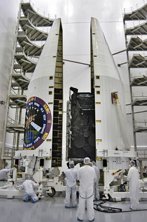 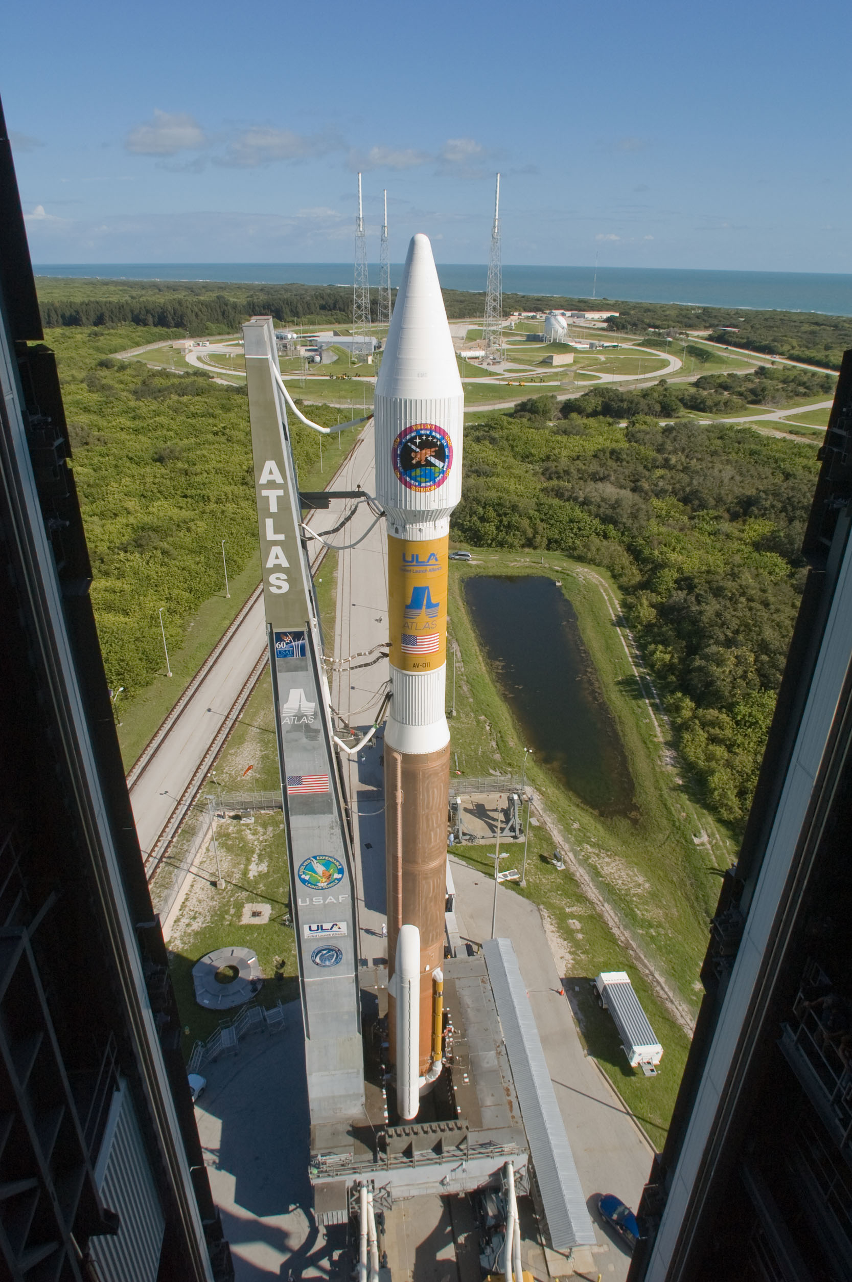 WGS
F1 is an advanced military communication satellite. It is the the first
of five Wideband Global SATCOM satellite that operates at both X-band and
Ka-band frequencies. It provides many important operational features that
are not available from any other military communications satelltes system.
For example, it has 18 reconfigurable coverage areas and the ability to
broadcast or multicast transmissions into the various coverage areas and
connect users between any and all coverage areas even when operating on
different frequency bands. The craft is the first of five Boeing 702 spacecraft
that helps meet the growing demand for military communications by providing
a 10-fold increase in telecommunications capacity over the satellite it
will replace, the Defense Satellite Communication System constellation
as well as the Global Broadcast Service function currently provided by
the U.S. Navy's Ultra High Frequency Follow-On satellites. Based on the
Boeing BSS-702 bus, the 5,987-kg satellite have a dry mass of more than
3,000 kg and will produce more than 11 kilowatts of power at the end of
its 14-year design life. This high-capacity satellite communications system
is intended to support the warfighter with newer and far greater capabilities
than provided by current systems. A joint-service program funded
by the U.S. Air Force and Army, WGS will augment DoD communications services
currently provided by the Defense Satellite Communications System (DSCS),
which provides Super High Frequency (SHF) wideband communications, and
by the Ka-band Global Broadcast Service (GBS) WGS 1 was initiaaly
placed into a 477 x 66,847 km x 20.1° transfer orbit, from which it
presumably went into geostationary orbit. WGS
F1 is an advanced military communication satellite. It is the the first
of five Wideband Global SATCOM satellite that operates at both X-band and
Ka-band frequencies. It provides many important operational features that
are not available from any other military communications satelltes system.
For example, it has 18 reconfigurable coverage areas and the ability to
broadcast or multicast transmissions into the various coverage areas and
connect users between any and all coverage areas even when operating on
different frequency bands. The craft is the first of five Boeing 702 spacecraft
that helps meet the growing demand for military communications by providing
a 10-fold increase in telecommunications capacity over the satellite it
will replace, the Defense Satellite Communication System constellation
as well as the Global Broadcast Service function currently provided by
the U.S. Navy's Ultra High Frequency Follow-On satellites. Based on the
Boeing BSS-702 bus, the 5,987-kg satellite have a dry mass of more than
3,000 kg and will produce more than 11 kilowatts of power at the end of
its 14-year design life. This high-capacity satellite communications system
is intended to support the warfighter with newer and far greater capabilities
than provided by current systems. A joint-service program funded
by the U.S. Air Force and Army, WGS will augment DoD communications services
currently provided by the Defense Satellite Communications System (DSCS),
which provides Super High Frequency (SHF) wideband communications, and
by the Ka-band Global Broadcast Service (GBS) WGS 1 was initiaaly
placed into a 477 x 66,847 km x 20.1° transfer orbit, from which it
presumably went into geostationary orbit. |
| Source: |
Jonathan
Space Report No. 586
; Spacewarn No. 648
; National Space Science Data Center's
2007-046A
; SkyRocket's WGS
1 ; Boeing's WGS
& 11
Oct 07 ; ULA's Press
Kit ; |
|
|
.
Navstar 56 (USA 196)
| Spacecraft: |
Navstar SVN 55 / GPS 2R-17
(Navstar stands fo Navigation System using
Timing And Ranging) |
| Chronologies: |
2007 payload #95 ; 2007-047A ; 6,586th spacecraft. |
| Type: |
Navigation |
| Families: |
|
| Ranks: |
|
| Sponsor: |
U.S. Department of Defense |
|
|
| Launch: |
17 October 2007 at 12h23 UTC,
from Cape Canaveral Air Force Station's SLC-17A, by a Delta
II. |
| Orbit: |
Initial: 192 km x 20,369 km x 40° x 356.6
min.
20,149 km x 20,213 km x 54.9°. |
| Mission: |
Navstar 60, also known as GPS 2R-17 (SVN
55, Block IIR(M)-17), is the latest addition to the American fleet of navigational
satellites. This is 4th 2,032-kg IIR(M) satellite replacing the aging GPS
2A-14 in Plane F and Slot 2. Navstar-2R are the third evolution stage of
the second generation of the Navstar GPS satellites. Block IIR satellites
provided dramatic improvements over previous blocks. They could determine
their own position by performing inter-satellite ranging with other IIR
vehicles. They also had reprogramable satellite processors enabling problem
fixes and upgrades in flight, increased satellite autonomy, and radiation
hardness. They are replenishment satellites produced by General Electric
Astrospace (later Martin Marietta and Lockheed Missiles & Space) under
a contract which included 21 satellites based on the commercial AS-4000
bus. These provided improved navigation accuracy and longer autonomous
satellite operation than earlier model GPS satellites. |
| Source: |
Jonathan
Space Report No. 587
; Spacewarn No. 648
; National Space Science Data Center's
2007-047A
; SkyRocket's Navstar-2RM
4 ; |
|
|
.
Globalstar FM66
| Spacecraft: |
|
| Chronologies: |
2007 payload #96 ; 2007-048A ; 6,587th spacecraft. |
| Type: |
Communications |
| Families: |
|
| Ranks: |
|
| Sponsor: |
Globalstar Inc. |
|
|
| Launch: |
20 October 2007 at 20h12 UTC,
from Baikonur Cosmocrome's LC-6, by a Soyuz-FG/Fregat. |
| Orbit: |
Initial: 914 km x 930 km x 51.98° x 103.47
min.
920 km x 920 min x 52.0 ° |
| Mission: |
These four Globalstar satellites (FM 66,
67, 68 and 70), each of mass 420 kg, are the last of the first generation
of global mobile communications network which offers global, digital real
time voice, data and fax via a constellation of 48 spacecraft. This
launch completes the first generation fleet of 40 satellites (+8 spares),
with further additions from second generation models. The fleet services
mobile telephones and fixed point transmitters carrying voice and data
transmissions by an array of C-band transponders and mediated by dedicated
ground stations. The constellation operates in a 1410-km orbit inclined
at 52 degrees.
Each first-generation
Globalstar satellite, designed by Space Systems/Loral, is a three-axis
stabilized spacecraft consisting of a trapezoidal main body, two solar
arrays, and a boom-mounted magnetometer. The satellite's trapezoidal body
is fabricated from rigid aluminum honeycomb. The trapezoidal shape was
selected to conserve volume and to allow the mounting of multiple satellites
under the launch vehicle's payload fairing. The heart of a Globalstar satellite
is its communications systems. There are C-band antennas for communications
with Globalstar gateways, and L- and S-band antennas for communications
with user terminals. These antennas are of a phased array design that projects
a pattern of 16 spot beams on the Earth's surface, covering a service area,
or "footprint", of several thousand kilometers in diameter. The solar panels
provide the satellite with 1,100 watts of power, and they automatically
track the sun as the satellite orbits the EarMass of the satellite is approximately
450 kilograms. The Globalstar constellation experience indicates these
first generation spacecraft will operate beyond their 7.5- year engineered
design life. |
| Source: |
Jonathan
Space Report No. 587
; Spacewarn No. 648
; National Space Science Data Center's
2007-048C
; SkyRocket's Globalstar
66 ; Starsem's Press
Kit ; |
|
|
.
Globalstar FM67
| Spacecraft: |
|
| Chronologies: |
2007 payload #97 ; 2007-048B ; 6,588th spacecraft. |
| Type: |
Communications |
| Families: |
|
| Ranks: |
|
| Sponsor: |
Globalstar Inc. |
|
|
| Launch: |
20 October 2007 at 20h12 UTC,
from Baikonur Cosmocrome's LC-6, by a Soyuz-FG/Fregat. |
| Orbit: |
Initial: 914 km x 930 km x 51.98° x 103.47
min.
920 km x 920 min x 52.0 ° |
| Mission: |
These four Globalstar satellites (FM 66,
67, 68 and 70), each of mass 420 kg, are the last of the first generation
of global mobile communications network which offers global, digital real
time voice, data and fax via a constellation of 48 spacecraft. This
launch completes the first generation fleet of 40 satellites (+8 spares),
with further additions from second generation models. The fleet services
mobile telephones and fixed point transmitters carrying voice and data
transmissions by an array of C-band transponders and mediated by dedicated
ground stations. The constellation operates in a 1410-km orbit inclined
at 52 degrees.
Each first-generation
Globalstar satellite, designed by Space Systems/Loral, is a three-axis
stabilized spacecraft consisting of a trapezoidal main body, two solar
arrays, and a boom-mounted magnetometer. The satellite's trapezoidal body
is fabricated from rigid aluminum honeycomb. The trapezoidal shape was
selected to conserve volume and to allow the mounting of multiple satellites
under the launch vehicle's payload fairing. The heart of a Globalstar satellite
is its communications systems. There are C-band antennas for communications
with Globalstar gateways, and L- and S-band antennas for communications
with user terminals. These antennas are of a phased array design that projects
a pattern of 16 spot beams on the Earth's surface, covering a service area,
or "footprint", of several thousand kilometers in diameter. The solar panels
provide the satellite with 1,100 watts of power, and they automatically
track the sun as the satellite orbits the EarMass of the satellite is approximately
450 kilograms. The Globalstar constellation experience indicates these
first generation spacecraft will operate beyond their 7.5- year engineered
design life. |
| Source: |
Jonathan
Space Report No. 587
; Spacewarn No. 648
; National Space Science Data Center's
2007-046A
; SkyRocket's Globalstar
67 ; Starsem's Press
Kit ; |
|
|
.
Globalstar FM68
| Spacecraft: |
|
| Chronologies: |
2007 payload #98 ; 2007-048C ; 6,589th spacecraft. |
| Type: |
Communications |
| Families: |
|
| Ranks: |
|
| Sponsor: |
Globalstar Inc. |
|
|
| Launch: |
20 October 2007 at 20h12 UTC,
from Baikonur Cosmocrome's LC-6, by a Soyuz-FG/Fregat. |
| Orbit: |
Initial: 914 km x 930 km x 51.98° x 103.47
min.
920 km x 920 min x 52.0 ° |
| Mission: |
These four Globalstar satellites (FM 66,
67, 68 and 70), each of mass 420 kg, are the last of the first generation
of global mobile communications network which offers global, digital real
time voice, data and fax via a constellation of 48 spacecraft. This
launch completes the first generation fleet of 40 satellites (+8 spares),
with further additions from second generation models. The fleet services
mobile telephones and fixed point transmitters carrying voice and data
transmissions by an array of C-band transponders and mediated by dedicated
ground stations. The constellation operates in a 1410-km orbit inclined
at 52 degrees.
Each first-generation
Globalstar satellite, designed by Space Systems/Loral, is a three-axis
stabilized spacecraft consisting of a trapezoidal main body, two solar
arrays, and a boom-mounted magnetometer. The satellite's trapezoidal body
is fabricated from rigid aluminum honeycomb. The trapezoidal shape was
selected to conserve volume and to allow the mounting of multiple satellites
under the launch vehicle's payload fairing. The heart of a Globalstar satellite
is its communications systems. There are C-band antennas for communications
with Globalstar gateways, and L- and S-band antennas for communications
with user terminals. These antennas are of a phased array design that projects
a pattern of 16 spot beams on the Earth's surface, covering a service area,
or "footprint", of several thousand kilometers in diameter. The solar panels
provide the satellite with 1,100 watts of power, and they automatically
track the sun as the satellite orbits the EarMass of the satellite is approximately
450 kilograms. The Globalstar constellation experience indicates these
first generation spacecraft will operate beyond their 7.5- year engineered
design life. |
| Source: |
Jonathan
Space Report No. 587
; Spacewarn No. 648
; National Space Science Data Center's
2007-047D
; SkyRocket's Globalstar
68 ; Starsem's Press
Kit ; |
|
|
.
Globalstar FM70
| Spacecraft: |
|
| Chronologies: |
2007 payload #99 ; 2007-048D ; 6,590th spacecraft. |
| Type: |
Communications |
| Families: |
|
| Ranks: |
|
| Sponsor: |
Globalstar Inc. |
|
|
| Launch: |
20 October 2007 at 20h12 UTC,
from Baikonur Cosmocrome's LC-6, by a Soyuz-FG/Fregat. |
| Orbit: |
Initial: 914 km x 930 km x 51.98° x 103.47
min.
920 km x 920 min x 52.0 ° |
| Mission: |
These four Globalstar satellites (FM 66,
67, 68 and 70), each of mass 420 kg, are the last of the first generation
of global mobile communications network which offers global, digital real
time voice, data and fax via a constellation of 48 spacecraft. This
launch completes the first generation fleet of 40 satellites (+8 spares),
with further additions from second generation models. The fleet services
mobile telephones and fixed point transmitters carrying voice and data
transmissions by an array of C-band transponders and mediated by dedicated
ground stations. The constellation operates in a 1410-km orbit inclined
at 52 degrees.
Each first-generation
Globalstar satellite, designed by Space Systems/Loral, is a three-axis
stabilized spacecraft consisting of a trapezoidal main body, two solar
arrays, and a boom-mounted magnetometer. The satellite's trapezoidal body
is fabricated from rigid aluminum honeycomb. The trapezoidal shape was
selected to conserve volume and to allow the mounting of multiple satellites
under the launch vehicle's payload fairing. The heart of a Globalstar satellite
is its communications systems. There are C-band antennas for communications
with Globalstar gateways, and L- and S-band antennas for communications
with user terminals. These antennas are of a phased array design that projects
a pattern of 16 spot beams on the Earth's surface, covering a service area,
or "footprint", of several thousand kilometers in diameter. The solar panels
provide the satellite with 1,100 watts of power, and they automatically
track the sun as the satellite orbits the EarMass of the satellite is approximately
450 kilograms. The Globalstar constellation experience indicates these
first generation spacecraft will operate beyond their 7.5- year engineered
design life. |
| Source: |
Jonathan
Space Report No. 587
; Spacewarn No. 648
; National Space Science Data Center's
2007-046B
; SkyRocket's Globalstar
70 ; Starsem's Press
Kit ; |
|
|
.
Kosmos 2430
| Spacecraft: |
US-RS 73D6 |
| Chronologies: |
2007 payload #100 ; 2007-049A ; 6,591st spacecraft. |
| Type: |
Missile Early-Warning |
| Families: |
|
| Ranks: |
|
| Sponsor: |
Russia Defense Ministry |
|
|
| Launch: |
23 October 2007 at 4h39 UTC,
from Plesetsk Cosmodrome, by Molniya
M. |
| Orbit: |
Initial: 522 km x 39,170 km x 62.8° x
704 min.
560 km x 39,200 km x 62.8° x 702 min. |
| Mission: |
Kosmos 2430 is a new 73D6 satellite of the
US-KS early-warning system (also known as Oko). It is deployed in an orbital
plane that has about opposite to that occupied by the only US-KS satellite
that has been in operation on highly-elliptical orbit, Kosmos
2422, launched in July 2006. But even after the Kosmos 2430 begins
operations, the Russian early-warning system will not be able to maintain
24-hour coverage of the U.S. territory. The US-KS (Oko) satellites are
built by NPO Lavochkin and has diameter of 1.7 meter. Total mass of a satellite
at launch is estimated to be 2,400 kg, of which 1,250 kg is dry mass. |
| Source: |
Jonathan
Space Report No. 587
; Spacewarn No. 648
; National Space Science Data Center's
2007-049A
; SkyRocket's Kosmos
2430 ; RSNF's 23
Oct 07 ; |
|
|
.
STS 120 / ISS 10A
| Spacecraft: |
Discovery (OV-103) |
| Chronologies: |
2007 payload #101 ; 2007-050A ; 6,592nd spacecraft. |
| Type: |
Piloted Spaceship |
| Families: |
|
| Ranks: |
|
| Sponsor: |
NASA |
|
|
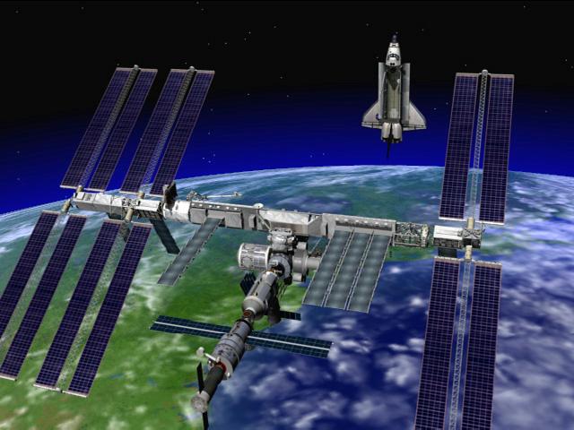 |
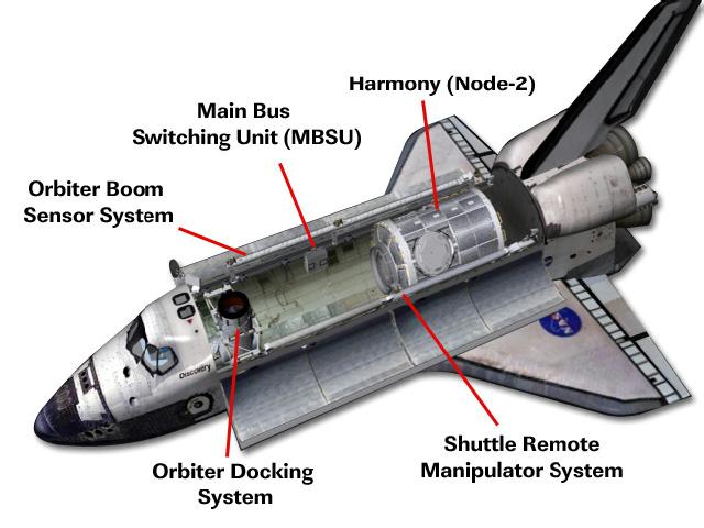 |
 |
| ISS as it will appear after Discovery undocks
following rolocation of ITS-P5 abd delivery of Harmony. |
Discovery Orbiter with its payloads. |
ISS with the Note 2 Harmony attached on its
front (in the middle of this drawing) |
| Launch: |
23 October 2007 at 15h38 UTC,
from Kennedy Space Center's LC-39A, by the Space
Shuttle. |
| Orbit: |
340 km x 344 km x 51.6° x 91.4 min. |
| Mission: |
STS-120 carried seven astronauts (Pam Melroy,
George Zamka, Scott Parazynski, Stephanie Wilson, Doug Wheelock, Paulo
Nespoli, Daniel Tani) and several tonnes of material (including the Harmony
Node-2) to the International Space Station. Discovery docked with the PMA-2
port on Destiny on 25 October 2007 at 12h40 UTC.
Four spacewalks
were conducted during the mission. On the first EVA, On 26 October Parazynski
and Wheelock prepared the ITS-P6 truss for separation from ITS-Z1, and
supervised the installation of Harmony. Thie module was unberthed from
Discovery's payload bay by the ISS Canadarm2 and installed on Node-1 Unity
at 15h38 UTC. On 28 October at 11h03 UTC, the ITS-P6 truss was unberthed
from Z1 and moved to a park position. Parazynski and Tani.then installed
handrails and a grapple fixture on Harmony and inspected the malfunctioning
Solar Array Rotary Joint (SARJ) on the ITS-S3/S4 truss. They discovered
that it is in need of repair/replacement. On 29 October, the Shuttle RMS
grappled ITS-P6 and the Station arm released it; then the Station arm on
its MBS truck moved along the truss and regrappled P6. The following morning,
the Station arm moved P6 to near the end of P5. On 30 October, Parazynski
and Wheelock supervised the mating of P6 to P5 which was completed at 11h10
UTC. The P6 Solar Array Wing-2B as well as the SAW-4B (on the other side
of P6) were deployed, but a tear developed in the 4B solar array and the
process was halted. On 3 November, Parazynski and Wheelock made a fourth
spacewalk to repair the SAW-4B. Parazynski was moved to the vicinity of
the solar array tear. He then installed five 'cuff-link' straps to strengthen
the solar array and prevent further tearing. The array was then fully extended,
ensuring an adequate electrical power supply for the Station in the near
term, The SARJ problem was deferred until the next Shuttle mission. The
contemplated additional inspection of the shuttle tiles was also determined
to be ignorable. Additionnally, Daniel Tani replaced Clayton Anderson as
ISS Flight Engineer 2 and remain aboard the station with Whitson
and Malenchenko.
Discovery undocked
from ISS on 5 November at 10h32 UTC. The deorbit burn occured on 7 November
at 16h58 UTC, with lands at Kennedy Space Center runway 33 at 18h01 UTC. |
| Source: |
Jonathan
Space Report No. 587
&
588
;
Spacewarn No. 648
; National Space Science Data Center's
2007-051A
; SkyRocket's STS-120
; Press
Kit ; |
|
|
.
Node
2 Harmony
| Spacecraft: |
Integrated Truss Segment (ITS)
Starboard 5 (S5) |
| Chronologies: |
2007 payload #102 ; n/a ; 6,593rd spacecraft. |
| Type: |
|
| Families: |
|
| Ranks: |
|
| Sponsor: |
|
|
|
| Launch: |
23 October 2007 at 15h38 UTC,
from Kennedy Space Center's LC-39A, by the Space
Shuttle.
Harmony was installed on Node-1 Unity on
26 October 2007 at 15h38 UTC. |
| Orbit: |
Part of the International Space Station. |
| Mission: |
 Harmony
is an aluminum node (Node 2) 7.2 meters long and 4.4 meters in diameter
that provides a passageway between four station science experiment facilities:
the U.S. Destiny Laboratory, the Kibo Japanese Experiment Module, the European
Columbus Laboratory and the Centrifuge Accommodation Module. It also provides
connecting ports for Multi-Purpose Logistics Modules, the Japanese HTV
and the Pressurized Mating Adapter 2 to which Space Shuttles dock. Its
pressurized volume is 70 cubic meters, and its launch weight is approximately
13,600 kilograms. It was built bu Alenia Spazio under contract of the Italian
Space Agency. It was built for NASA under a barter agreement with the European
Space Agency in exchange for the launch of the European Columbus Laboratory.
The installation of Node 2 denotes the U.S. Core Complete stage of International
Space Station assembly and increases the living and working space inside
the station to approximately 500 cubic meters. Harmony
is an aluminum node (Node 2) 7.2 meters long and 4.4 meters in diameter
that provides a passageway between four station science experiment facilities:
the U.S. Destiny Laboratory, the Kibo Japanese Experiment Module, the European
Columbus Laboratory and the Centrifuge Accommodation Module. It also provides
connecting ports for Multi-Purpose Logistics Modules, the Japanese HTV
and the Pressurized Mating Adapter 2 to which Space Shuttles dock. Its
pressurized volume is 70 cubic meters, and its launch weight is approximately
13,600 kilograms. It was built bu Alenia Spazio under contract of the Italian
Space Agency. It was built for NASA under a barter agreement with the European
Space Agency in exchange for the launch of the European Columbus Laboratory.
The installation of Node 2 denotes the U.S. Core Complete stage of International
Space Station assembly and increases the living and working space inside
the station to approximately 500 cubic meters. |
| Source: |
Jonathan
Space Report No. 587
; SkyRocket's
Node
2 ; NASA STS-120
Press Kit ; |
|
|
.
Chang'e 1
| Spacecraft: |
|
| Chronologies: |
2007 payload #103 ; 2007-051A ; 6,594th spacecraft. |
| Type: |
Planetary Probe (Lunar) |
| Families: |
|
| Ranks: |
|
| Sponsor: |
China |
|
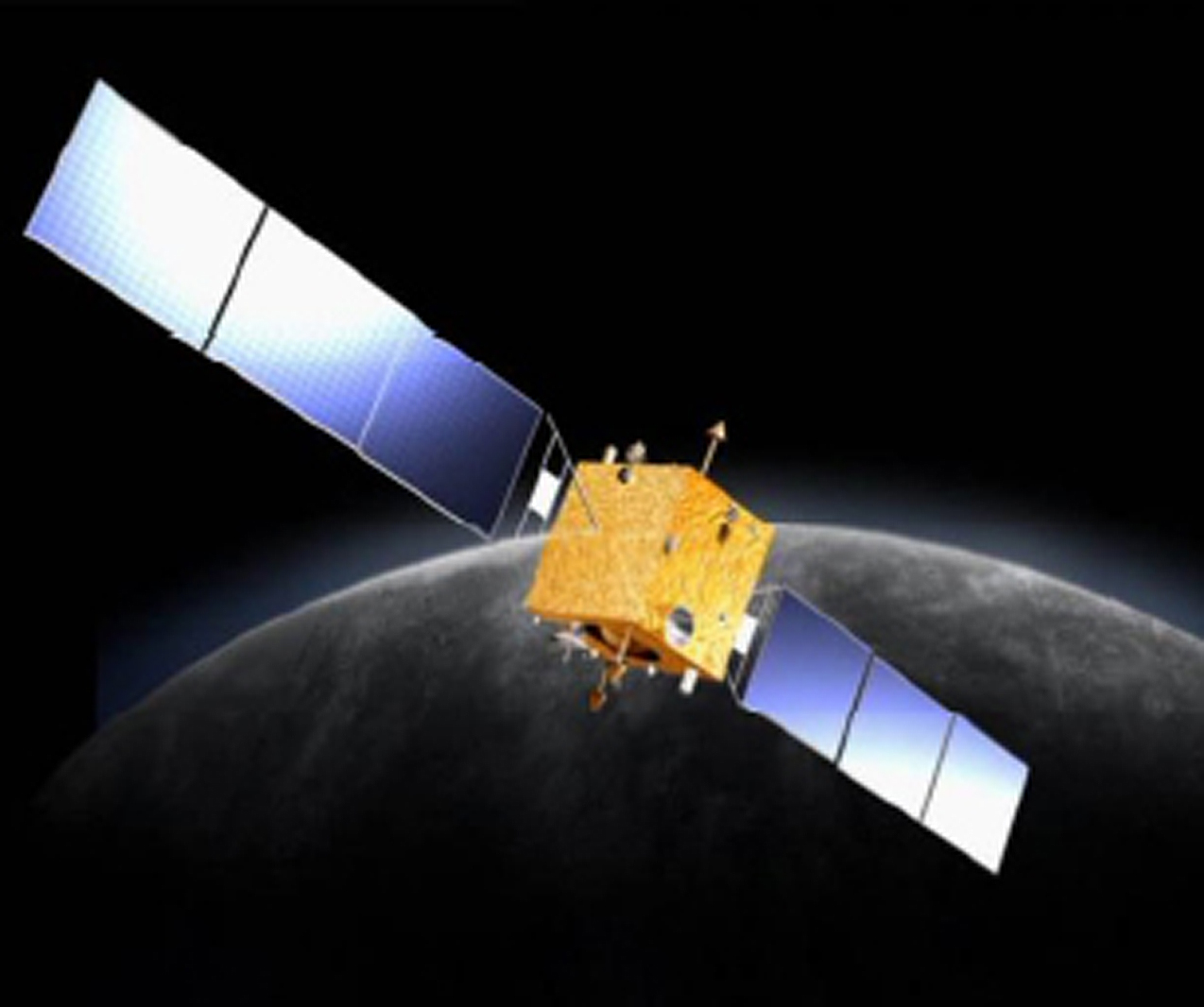 |
| Launch: |
24 October 2007 at 10h05 UTC,
from Xichang Satellite Launch Center's LC-3, by a Chang
Zheng 3A. |
| Orbit: |
|
| Mission: |
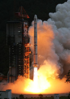 Chang'e
1 (named after a Chinese goddess who flew to the Moon) is the first Chinese
lunar-orbit mission, It is also China's first deep space/ probe.
The 2.3 tonne (with fuel) craft is based on the DFH-3 Comsat Bus,
It will map the lunar surface to get three-dimensional images. The mission
will also analyze the content and distribution of minerals on the lunar
surface, measure the density of lunar soil and explore the lunar space
environment. Chang'e 1 entered a 210 x 8600 km polar lunar orbit on 5 November
2007 at 3h37 UTC, after three Earth orbits with perigee augmentation each
time. Chang'e
1 (named after a Chinese goddess who flew to the Moon) is the first Chinese
lunar-orbit mission, It is also China's first deep space/ probe.
The 2.3 tonne (with fuel) craft is based on the DFH-3 Comsat Bus,
It will map the lunar surface to get three-dimensional images. The mission
will also analyze the content and distribution of minerals on the lunar
surface, measure the density of lunar soil and explore the lunar space
environment. Chang'e 1 entered a 210 x 8600 km polar lunar orbit on 5 November
2007 at 3h37 UTC, after three Earth orbits with perigee augmentation each
time.
After orbiting for
494 days and intentionally crashing onto the lunar surface, Chang'e-1 sent
back 1.37 terabytes of data, producing China's first complete moon picture. |
| Source: |
Jonathan
Space Report No. 587
& 588
; Spacewarn No. 648
; National Space Science Data Center's
2007-051A
; SkyRocket's Chang'e
1 ; China Daily's 9
Oct 01, 14
Oct 01, 24
Oct 07, 1
Oct 10 ; Xinhuas 7
Dec 03, 9
Dec 13,; |
|
|
.
Kosmos 2431
| Spacecraft: |
Glonass-M 718 |
| Chronologies: |
2007 payload #104 ; 2007-052A ; 6,595th spacecraft. |
| Type: |
Navigation |
| Families: |
|
| Ranks: |
|
| Sponsor: |
Russia |
|
|
| Launch: |
26 October 2007 at 7h35 UTC,
from Baikonur Cosmodrome's LC-81/24, by a Proton
K / Block DM. |
| Orbit: |
19,120 km x 19130 km x 64.8° |
| Mission: |
Three Uragan-M navigation satellites (Nos.
718, 719 and 720) are the latest craft to join the Russian Glonass fleet
of navigational satellites. The satellites were given Kosmos cover names
after deployment. GLONASS (Global Orbiting Navigation Satellite System)
is a Soviet space-based navigation system comparable to the American GPS
system, which consistsi of Uragan spacecraft. The operational system contains
21 satellites in 3 orbital planes, with 3 on-orbit spares. GLONASS provides
100 meters accuracy with its C/A (deliberately degraded) signals and 10-20
meter accuracy with its P (military) signals. The Glonass fleet will be
completed in 2008, expanded to 24 satellites from the current 13, to become
fully operational at all hours of the day. This launch had been delayed
until Kazakhstan lifted the ban on Proton launches after the explosion
of a Proton-M (on 06 September) spilled 219 tonnes of toxic heptyl fuel. |
| Source: |
Jonathan
Space Report No. 587
; Spacewarn No. 648
; National Space Science Data Center's
2007-052C
; SkyRocket's Kosmos
2431 ; |
|
|
.
Kosmos 2432
| Spacecraft: |
Glonass-M 719 |
| Chronologies: |
2007 payload #105 ; 2007-052B ; 6,596th spacecraft. |
| Type: |
Navigation |
| Families: |
|
| Ranks: |
|
| Sponsor: |
Russia |
|
|
| Launch: |
26 October 2007 at 7h35 UTC,
from Baikonur Cosmodrome's LC-81/24, by a Proton
K / Block DM. |
| Orbit: |
19,120 km x 19130 km x 64.8° |
| Mission: |
Three Uragan-M navigation satellites (Nos.
718, 719 and 720) are the latest craft to join the Russian Glonass fleet
of navigational satellites. The satellites were given Kosmos cover names
after deployment. GLONASS (Global Orbiting Navigation Satellite System)
is a Soviet space-based navigation system comparable to the American GPS
system, which consistsi of Uragan spacecraft. The operational system contains
21 satellites in 3 orbital planes, with 3 on-orbit spares. GLONASS provides
100 meters accuracy with its C/A (deliberately degraded) signals and 10-20
meter accuracy with its P (military) signals. The Glonass fleet will be
completed in 2008, expanded to 24 satellites from the current 13, to become
fully operational at all hours of the day. This launch had been delayed
until Kazakhstan lifted the ban on Proton launches after the explosion
of a Proton-M (on 06 September) spilled 219 tonnes of toxic heptyl fuel. |
| Source: |
Jonathan
Space Report No. 587
; Spacewarn No. 648
; National Space Science Data Center's
2007-052A
; SkyRocket's Kosmos
2432 ; |
|
|
.
Kosmos 2433
| Spacecraft: |
Glonass-M 720 |
| Chronologies: |
2007 payload #106 ; 2007-052C ; 6,597th spacecraft. |
| Type: |
Navigation |
| Families: |
|
| Ranks: |
|
| Sponsor: |
Russia |
|
|
| Launch: |
26 October 2007 at 7h35 UTC,
from Baikonur Cosmodrome's LC-81/24, by a Proton
K / Block DM. |
| Orbit: |
19,120 km x 19130 km x 64.8° |
| Mission: |
Three Uragan-M navigation satellites (Nos.
718, 719 and 720) are the latest craft to join the Russian Glonass fleet
of navigational satellites. The satellites were given Kosmos cover names
after deployment. GLONASS (Global Orbiting Navigation Satellite System)
is a Soviet space-based navigation system comparable to the American GPS
system, which consistsi of Uragan spacecraft. The operational system contains
21 satellites in 3 orbital planes, with 3 on-orbit spares. GLONASS provides
100 meters accuracy with its C/A (deliberately degraded) signals and 10-20
meter accuracy with its P (military) signals. The Glonass fleet will be
completed in 2008, expanded to 24 satellites from the current 13, to become
fully operational at all hours of the day. This launch had been delayed
until Kazakhstan lifted the ban on Proton launches after the explosion
of a Proton-M (on 06 September) spilled 219 tonnes of toxic heptyl fuel. |
| Source: |
Jonathan
Space Report No. 587
; Spacewarn No. 648
; National Space Science Data Center's
2007-052A
; SkyRocket's Kosmos
2433 ; |
|
|
.
SAR-Lupe 3
| Spacecraft: |
SAR means Synthetic Aperture
Radar and Lupe magnifying glass. |
| Chronologies: |
2007 payload #107 ; 2007-053A ; 6,598th spacecraft. |
| Type: |
Surveillance (radar |
| Families: |
|
| Ranks: |
|
| Sponsor: |
Germany Defense Ministry |
|
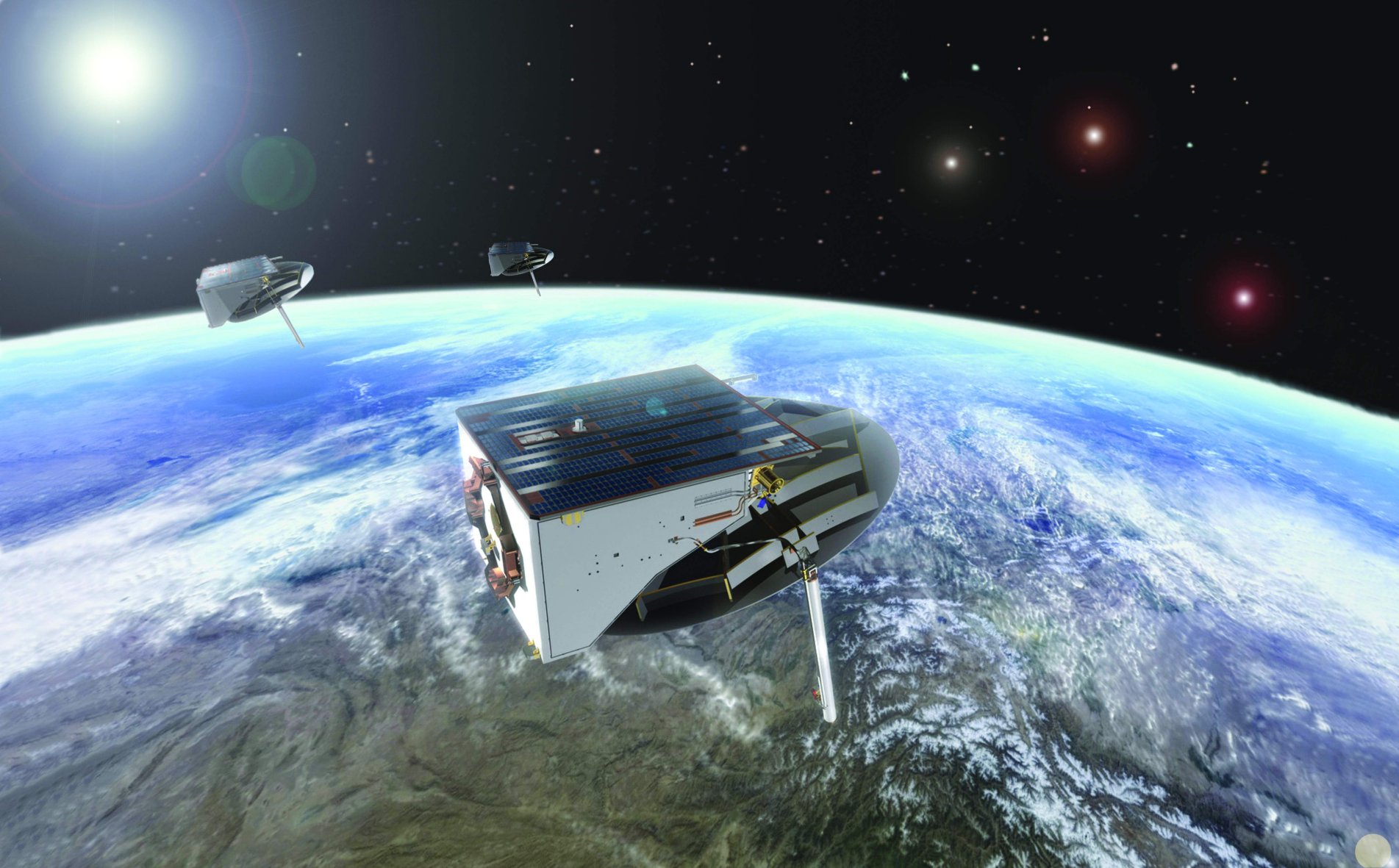
Source: OHB-System
|
|
.
DSP-23 (USA 197)
| Spacecraft: |
DSP-23 means Defense Support
Program-23 |
| Chronologies: |
2007 payload #108 ; 2007-054A ; 6,599th spacecraft. |
| Type: |
Missile Early Warning |
| Families: |
|
| Ranks: |
|
| Sponsor: |
U.S. Air Force |
|

Source: Northrop
Grumman
|
| Launch: |
11 November 2007 at 1h50 UTC,
from Cape Canaveral's SLC-39, by a Delta IV Heavy |
| Orbit: |
Geostationary |
| Mission: |
àDSP-23 is the final 2.5-tonne Defense
Support Program satellite which provide early warning for intercontinental
ballistic missile launches. It will be especially useful in providing vital
intelligence on new Chinese as well as Iranian missiles and tactics.
The spacecraft is expected to function until 2022, thus bridging the gap
between the DSP system and the new Space Based Infrared (Sbirs) system
satellites. Total cost of the flight is about $700 million, with the DSP
worth $400 million of that amount.
DSP-23 is also carrying
a special 25-kg payload designed specifically to detect even extremely
small nuclear tests that might be done in space, the kind that could be
attempted covertly by Iran or North Korea. This special Space Atmospheric
Burst Reporting System (Sabrs) package is to prove out hardware that is
to be added at a later date to the Sbirs GEO-3 spacecraft. The device has
five miniature nuclear detection sensors that will be used on Sbirs to
replace the heavier detectors carried on all DSPs.
DSP satellites use
infrared sensors to detect heat from missile and booster plumes against
the Earths background. The key is innovative analysis of infrared
missile plume and other signatures from the DSPs' 6,000-detector mercury
cadmium telluride infrared telescope. The instrument rotates at 6 rpm.
The launch of DSP-23
extends the service of a constellation that has been the nation's eyes
in the sky for 35 years. On average, DSP have operated four times beyond
their specified design. Most DSPs launched since 1991 have had at least
a 15-year lifetime, despite just a 3 to 5-year operational specification.
This longevity has provided an extra 162 satellite-years on-orbit to date,
the equivalent of delivering 30 to 50 additional satellites.
This launch also
marks the first operational mission for the United Launch Alliance Delta
IV Heavy, which flew a partially successful first mission in December 2004. |
| Source: |
Jonathan
Space Report No. 588
& 589
; Spacewarn No. 649
; National Space Science Data Center's
2007-054A
; SkyRocket's DSP
23 ; ULA's Aviation
Week Blogs' 9
Nov 07 & Press
Kit ; Northrop Grumman's
11
Nov 07 ; |
Source: United Launch Alliance
|
|
.
Yaogan III
| Spacecraft: |
|
| Chronologies: |
2007 payload #109 ; 2007-055A; 6,600th spacecraft. |
| Type: |
Radar Surveillance or Earth Remote Sensing
? |
| Families: |
|
| Ranks: |
|
| Sponsor: |
China |
|
|
| Launch: |
11 November 2007 at 22h48 UTC,
, from Taiyuan Satellite Launch Center, by a Chang
Zheng 4C |
| Orbit: |
|
| Mission: |
According to Chinese report, the 2,700-kg
Yaogan III remote sensing satellite will be used for scientific research,
land surveys, crop yield estimates and disaster prevention and relief.
Both the satellite and the carrier rocket were developed by the Shanghai
Academy of Spaceflight Technology, which is affiliated to the China Aerospace
Science and Technology Corporation.
This mission marks
the first launch of a a new variant of the Chang Zheng (Long March) rocket.
The CZ-4C is like the CZ-4B but includes a restart capability in the upper
stage. It also has a new interstage adapter between the first and second
stages. |
| Source: |
Jonathan
Space Report No. 588
& 589
; Spacewarn No. 649
; National Space Science Data Center's
2007-055A
; SkyRocket's Yaogan
3 ; China Daily's 12
Nov 07 ; |
|
The Yoagan III launch by a Chang Zheng 4C. (Source
China Daily |
.
Skynet 5B
| Spacecraft: |
|
| Chronologies: |
2007 payload #110 ; 2007-056A ; 6,601st spacecraft. |
| Type: |
Communications |
| Families: |
|
| Ranks: |
|
| Sponsor: |
United Kingdom Ministry of Defense |
|
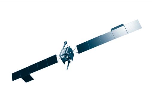 |
|
.
Star One C1
| Spacecraft: |
|
| Chronologies: |
2007 payload #111 ; 2007-056B ; 6,602nd spacecraft. |
| Type: |
Communications |
| Families: |
|
| Ranks: |
|
| Sponsor: |
Star One |
|
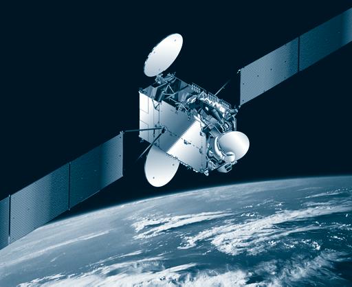 |
|
.
Sirius 4
| Spacecraft: |
|
| Chronologies: |
2007 payload #112 ; 2007-057A ; 6,603rd spacecraft. |
| Type: |
Communications |
| Families: |
|
| Ranks: |
|
| Sponsor: |
SES Sirius |
|

Source: ILS
|
|
.
Kosmos 2434 (Raduga
1-8)
| Spacecraft: |
Globus-1/Raduga-1 |
| Chronologies: |
2007 payload #113 ; 2007-058A ; 6,604th spacecraft. |
| Type: |
Communications |
| Families: |
|
| Ranks: |
|
| Sponsor: |
Russia Defense Ministry |
|
|
|
.
COSMO SkyMed-2
| Spacecraft: |
|
| Chronologies: |
2007 payload #114 ; 2007-059A ; 6,605th spacecraft. |
| Type: |
Radar Surveillance |
| Families: |
|
| Ranks: |
|
| Sponsor: |
Italian Space Agency and Italian Ministry
of Defence |
|
|
|
.
NROL-24 (USA 198)
| Spacecraft: |
|
| Chronologies: |
2007 payload #115 ; 2007-060A ; 6,606th spacecraft. |
| Type: |
Communications (Data Relay) |
| Families: |
|
| Ranks: |
|
| Sponsor: |
U.S. National Reconnaissance Office |
|
|
|
.
Radarsat 2
| Spacecraft: |
|
| Chronologies: |
2007 payload #116 ; 2007-061A ; 6,607th spacecraft. |
| Type: |
Earth Remote Sensing (Radar) |
| Families: |
|
| Ranks: |
|
| Sponsor: |
Canadiian Space Agency |
|

Source: CSA
|
Radarsat 2 launched by a Soyuz rocket
(Photos: CSA)
|
.
Navstar 57 (USA 199)
| Spacecraft: |
Navstar SVN 57 / GPS 2R-18 |
| Chronologies: |
2007 payload #117 ; 2007-062A ; 6,608th spacecraft. |
| Type: |
Navigation |
| Families: |
|
| Ranks: |
|
| Sponsor: |
U.S. Department of Defense |
|
|
|
.
RASCOM-QAF1
| Spacecraft: |
|
| Chronologies: |
2007 payload #118 ; 2007-063A ; 6,609th spacecraft. |
| Type: |
Communications |
| Families: |
|
| Ranks: |
|
| Sponsor: |
RASCOMSTAR-QAF |
|
|
| Launch: |
21 December 2007 at 21h42 UTC,
from Kourou Space Center's ELA-3, by an Ariane
5 GS. |
| Orbit: |
Geostarionary at 2.85° East longitude. |
| Mission: |
On 4 February 2008,
Thales Alenia Space announced today that the RASCOM-QAF1 satellite has
been placed in its final geostationary orbit at 2.85° East longitude.
This final injection has been made from the LEOP procedure that make the
best possible use of the remaining helium pressurant. This 4-week process
has started by a first apogee boost completed by the main apogee boost
motor, followed by 18 additional apogee manoeuvres completed by smaller
thrusters. The satellite's lifetime is subject to further refinement,
but is expected to be slightly over 2 years. |
| Source: |
Jonathan
Space Report No. 589&
590
;
Spacewarn No. 650
; National Space Science Data Center's
2007-063A
; SkyRocket's RASCOM-QAF1
; Chronologie
Ariane 2007 ; Thales Alenia Space's 4
Feb 08 ; |
|
|
.
Horizons-2
| Spacecraft: |
|
| Chronologies: |
2007 payload #119 ; 2007-063B ; 6,610th spacecraft. |
| Type: |
Communications |
| Families: |
|
| Ranks: |
|
| Sponsor: |
Horizons Satellite LLC (Intelsat/JSAT) |
|
|
|
.
Progress M-62 / ISS
27P
| Spacecraft: |
Progress M (7K-TGM) No. 362 |
| Chronologies: |
2007 payload #120 ; 2007-064A ; 6,611th spacecraft. |
| Type: |
Cargo delivery to the International Space
Station |
| Families: |
|
| Ranks: |
|
| Sponsor: |
Russian Federal Space Agency |
|
|
|
.
Kosmos 2435
| Spacecraft: |
Uragan-M No. 21 / Glonass-M
No. 21 |
| Chronologies: |
2007 payload #121 ; 2007-065A ; 6,612th spacecraft. |
| Type: |
Navigation |
| Families: |
|
| Ranks: |
|
| Sponsor: |
Russia Defense Ministry |
|
|
|
.
Kosmos 2436
| Spacecraft: |
Uragan-M No. 22 / Glonass-M
No. 22 |
| Chronologies: |
2007 payload #122 ; 2007-065B ; 6,613th spacecraft. |
| Type: |
Navigation |
| Families: |
|
| Ranks: |
|
| Sponsor: |
Russia Defense Ministry |
|
|
|
.
Kosmos 2437
| Spacecraft: |
Uragan-M No. 23 / Glonass-M No.
23 |
| Chronologies: |
2007 payload #123 ; 2007-065C ; 6,614th spacecraft. |
| Type: |
Navigation |
| Families: |
|
| Ranks: |
|
| Sponsor: |
Russia Defense Ministry |
|
|
|
|


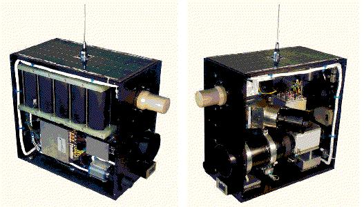

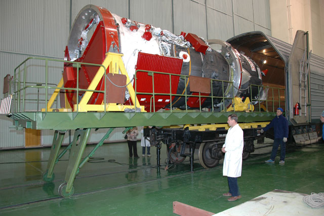
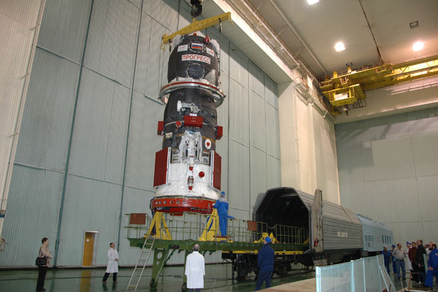
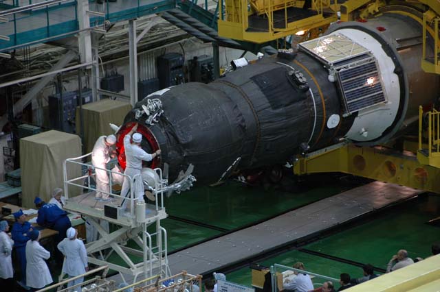

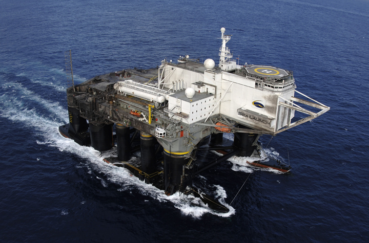
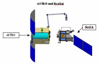
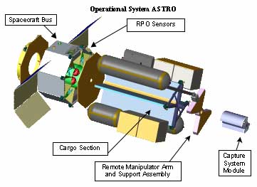
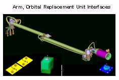
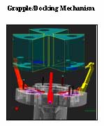
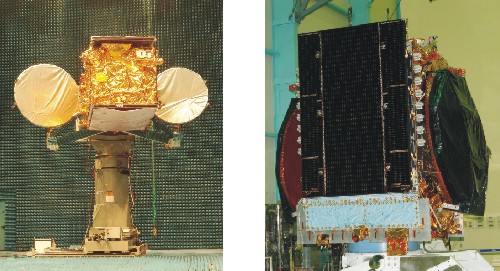
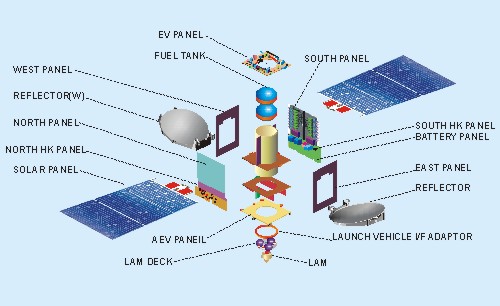

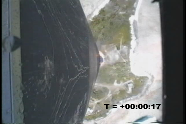

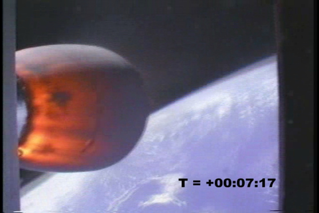
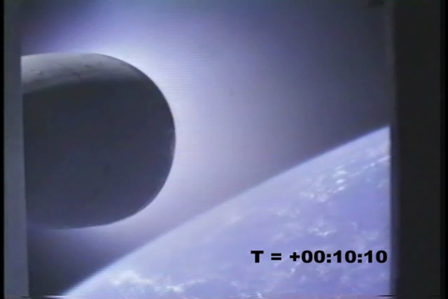
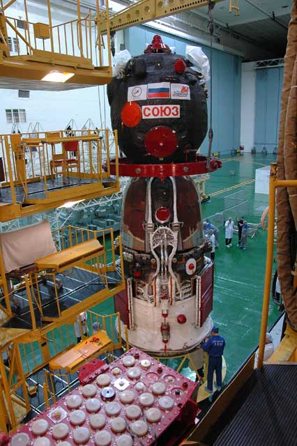
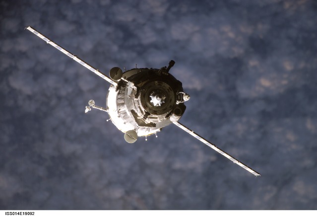
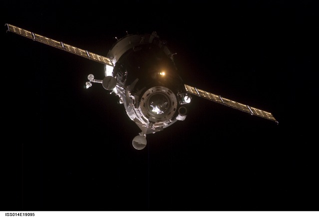
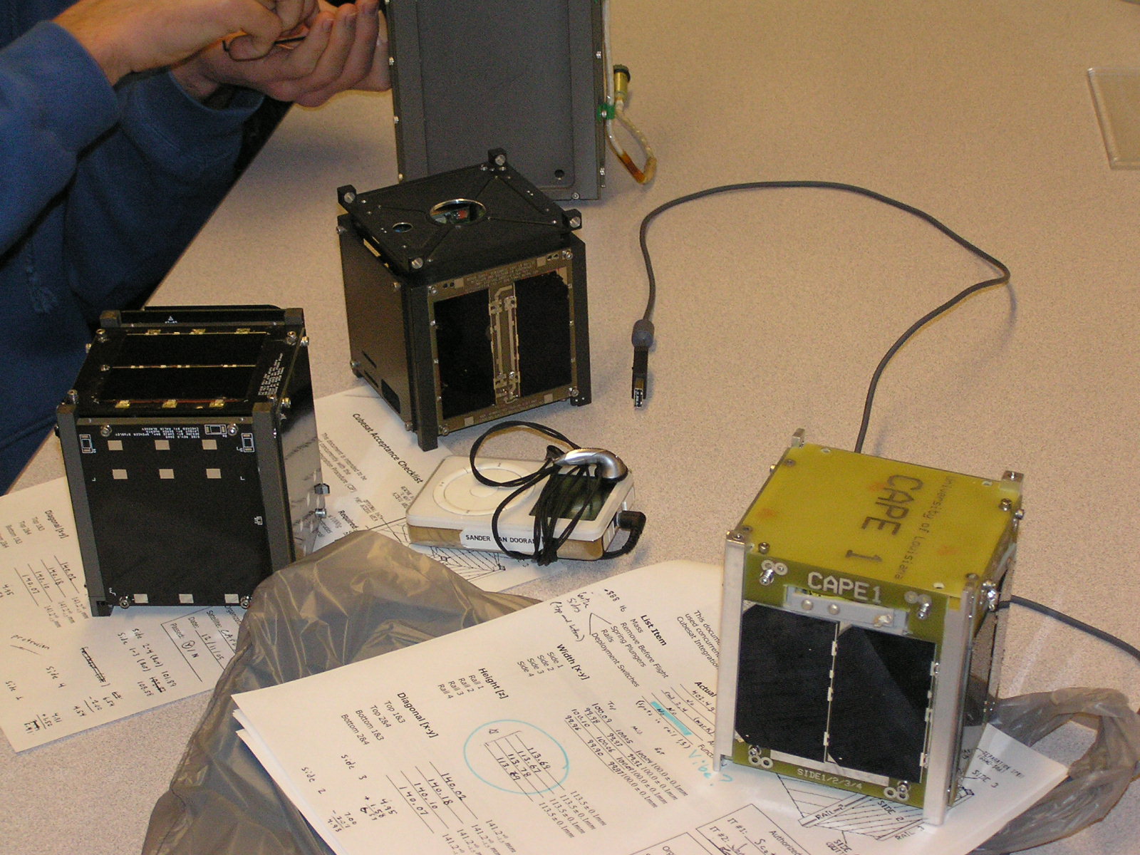
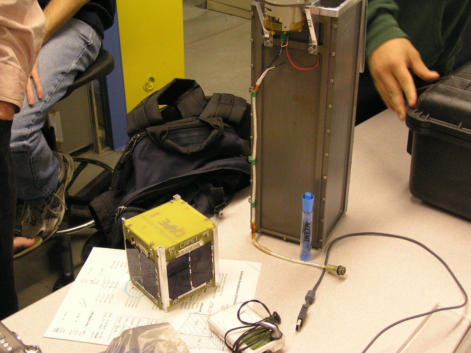

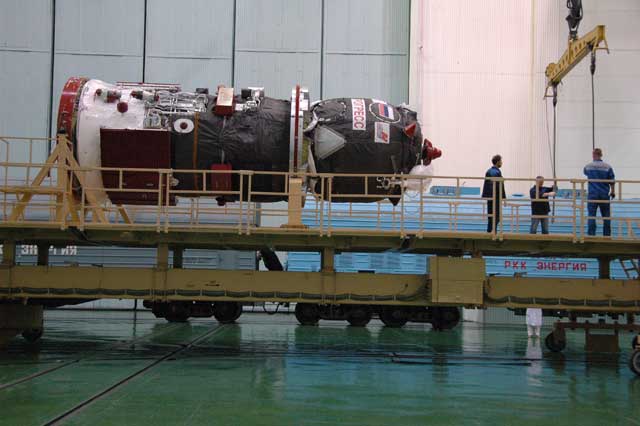
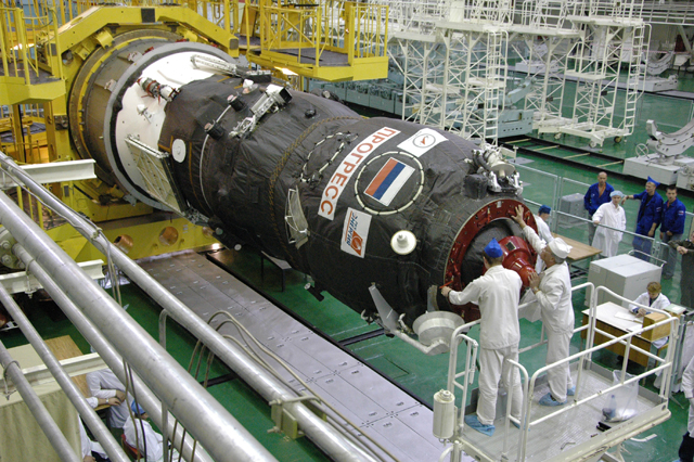
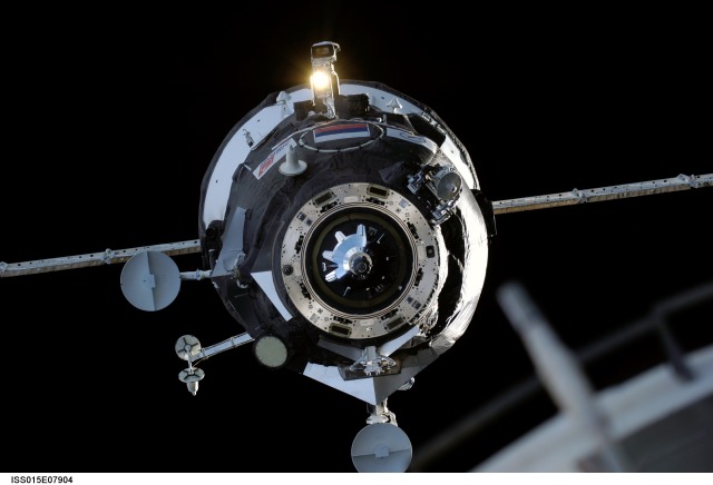
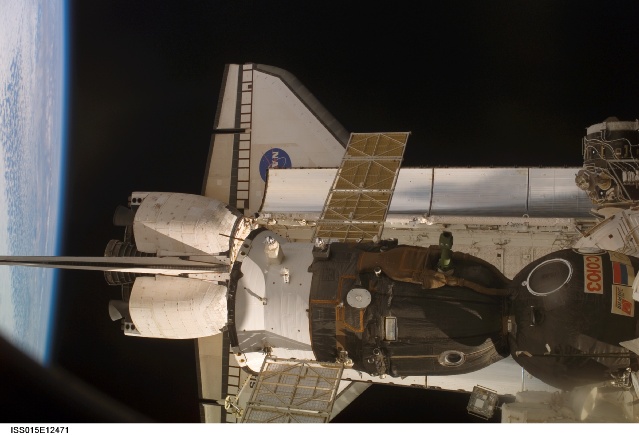
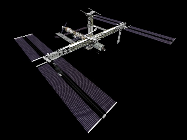
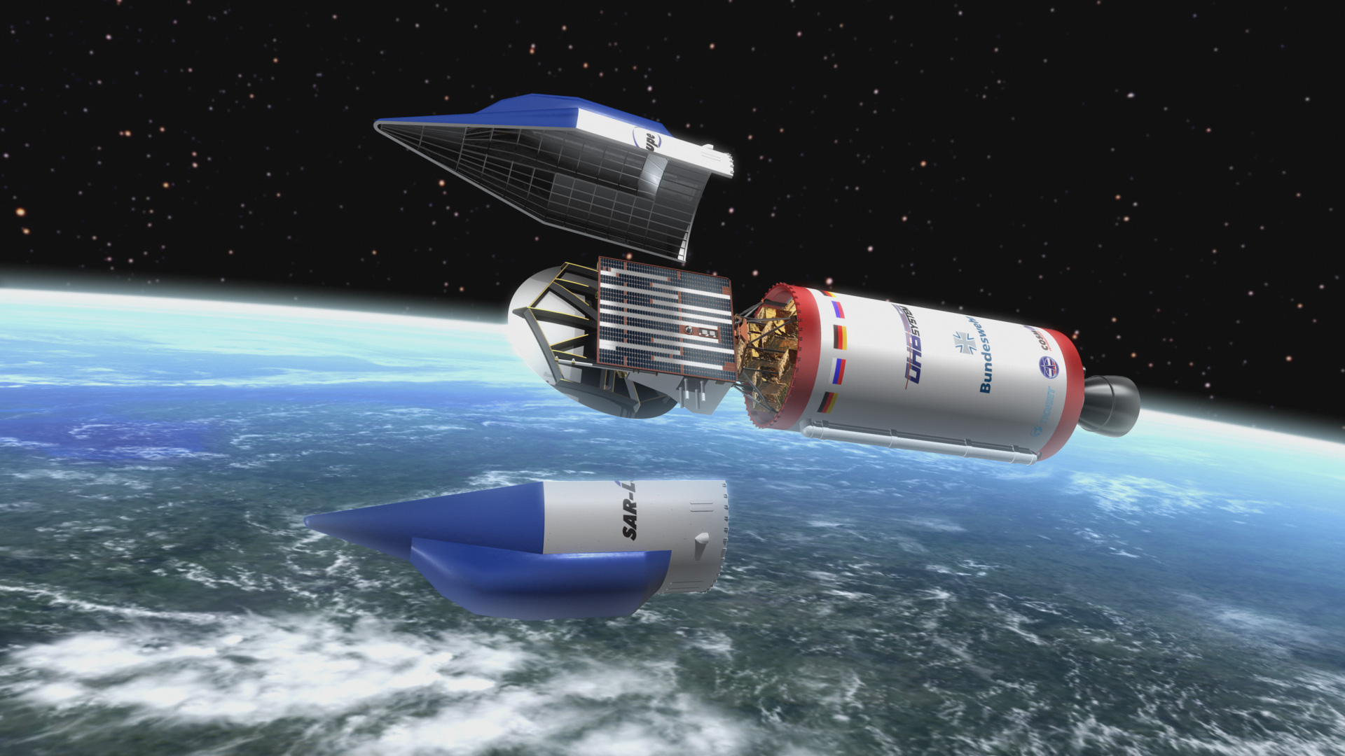
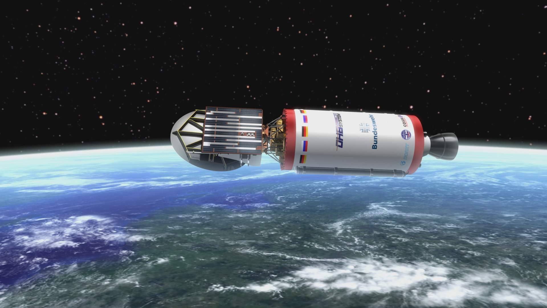
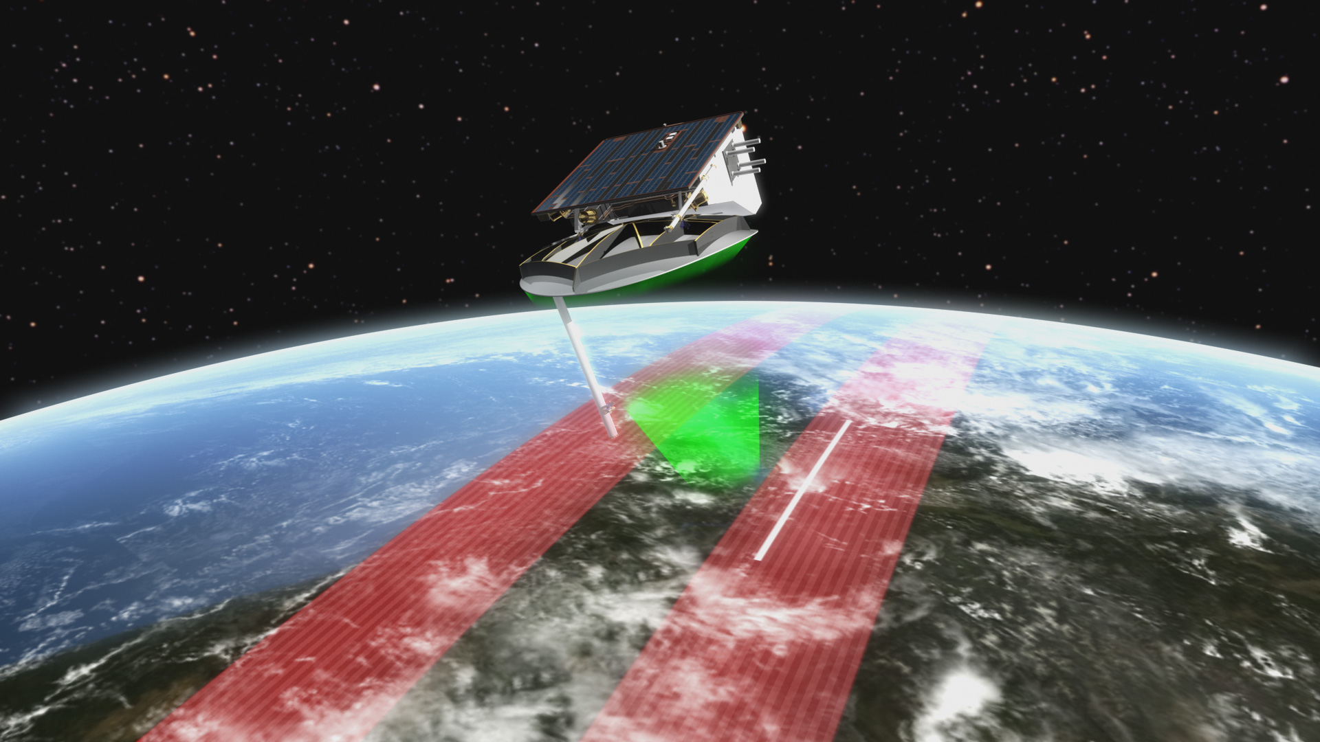
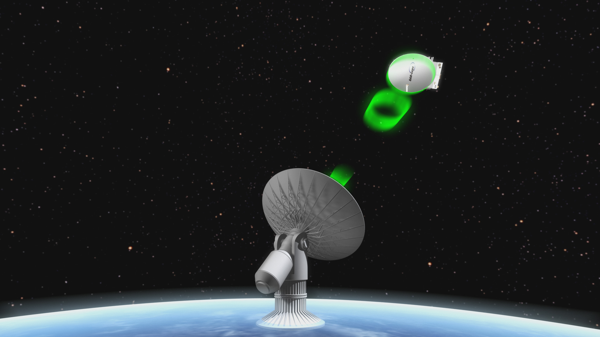
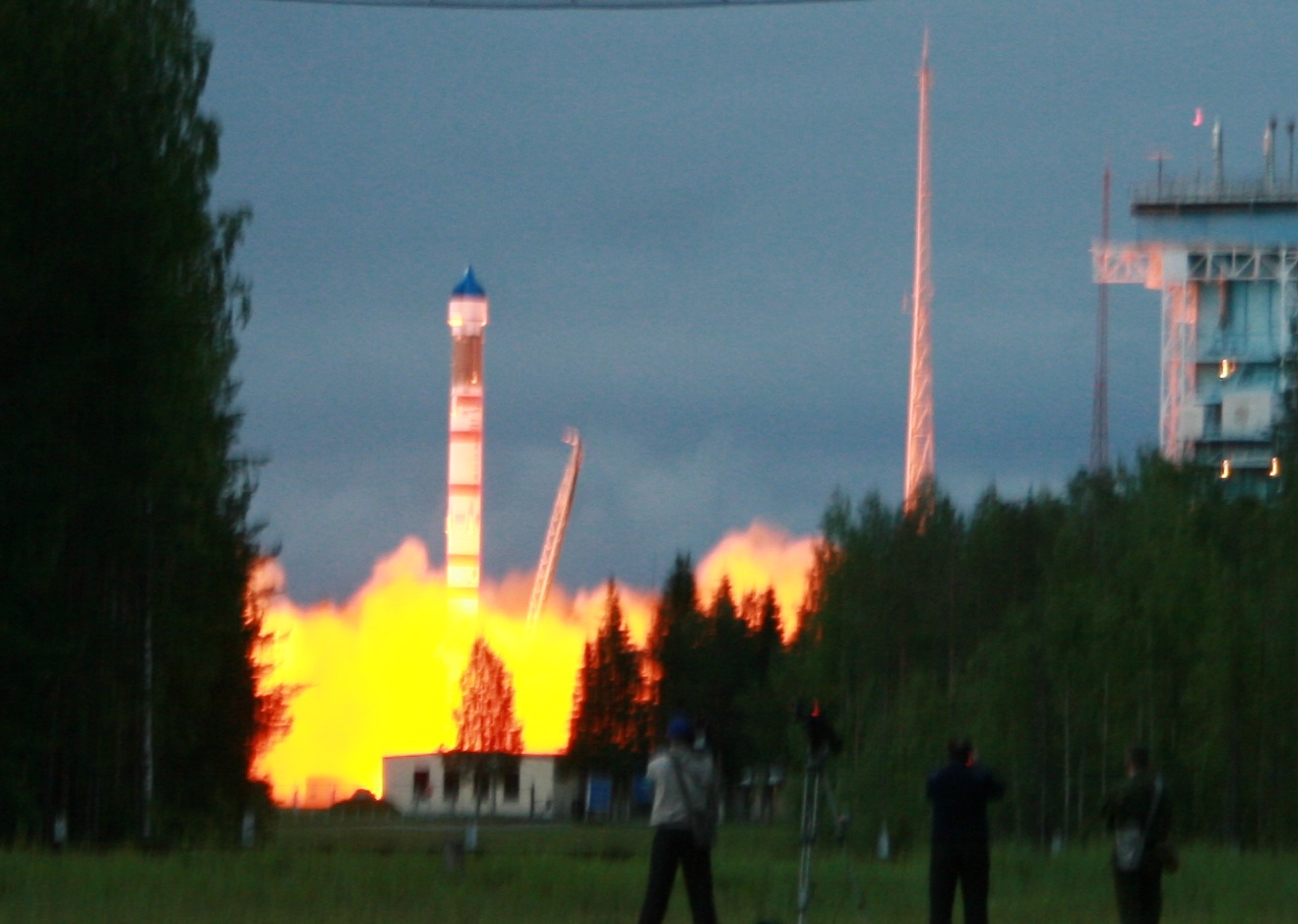
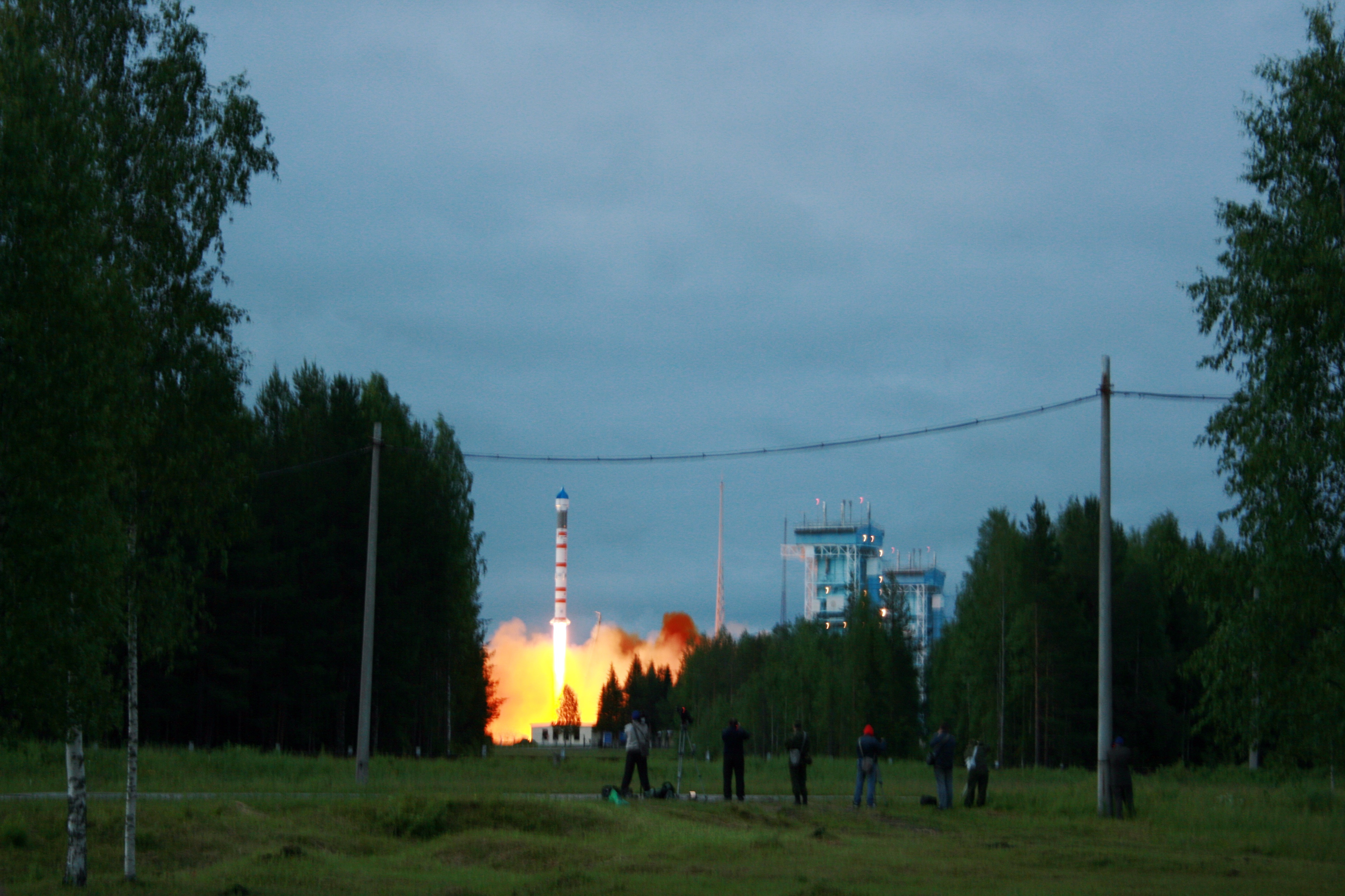

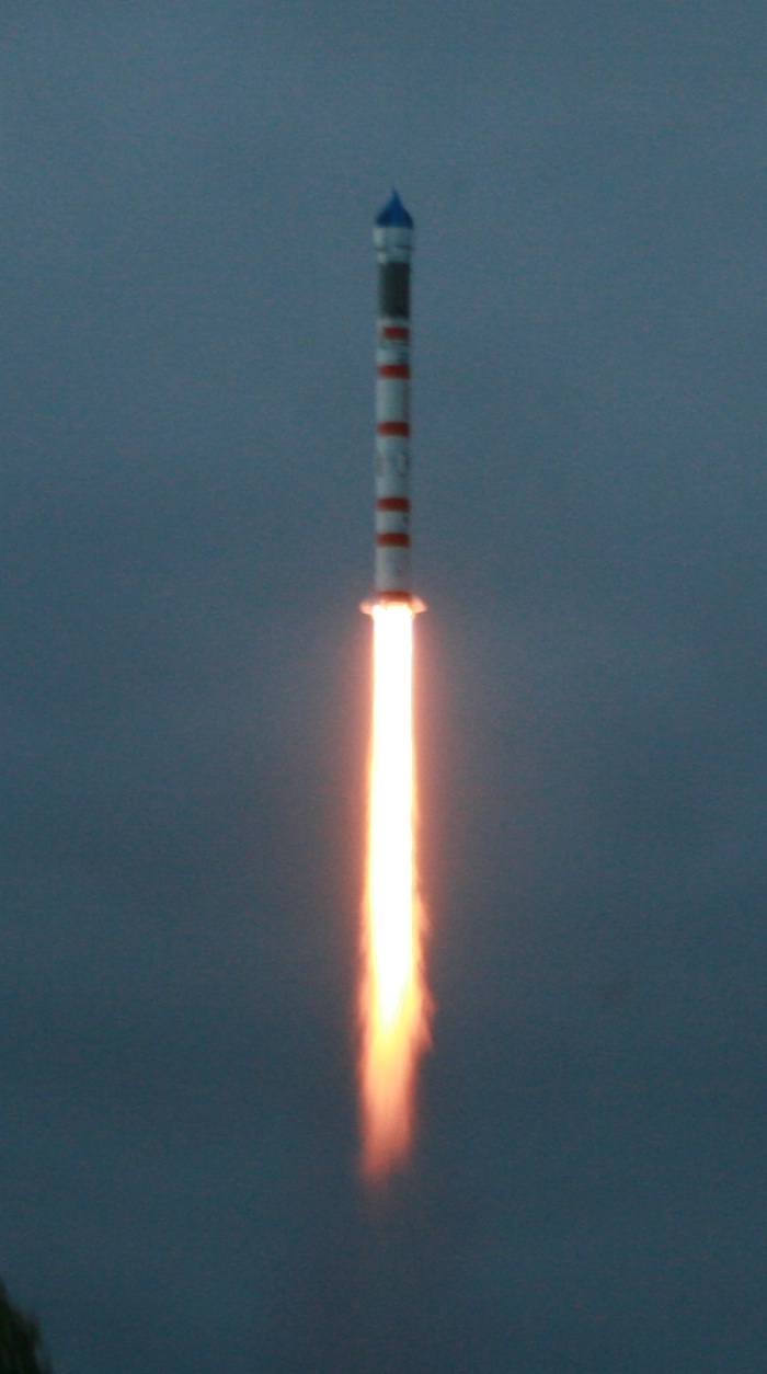

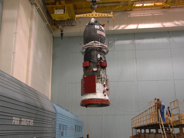
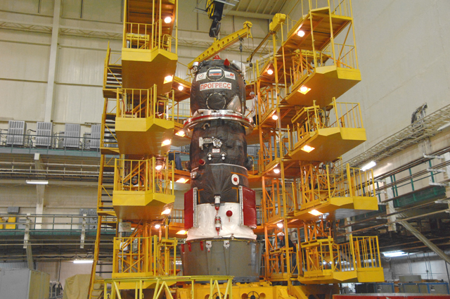
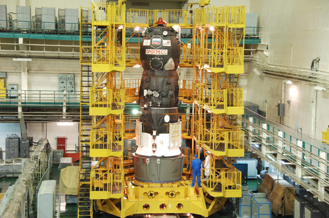
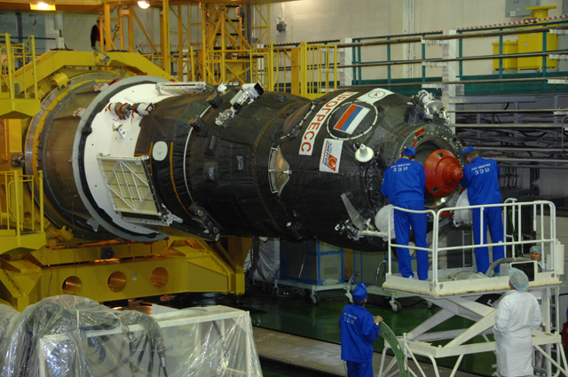
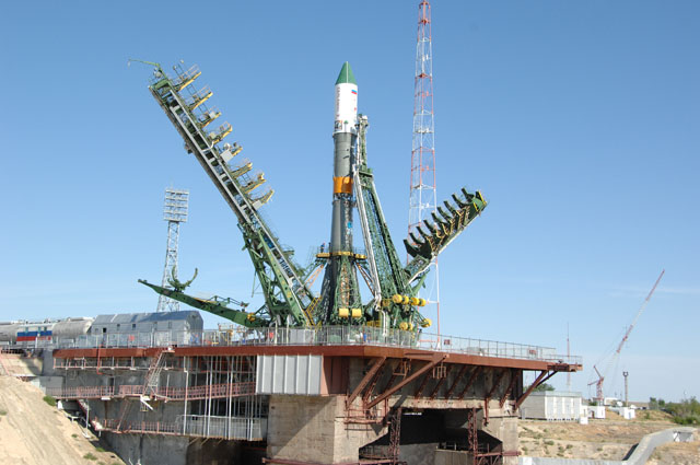

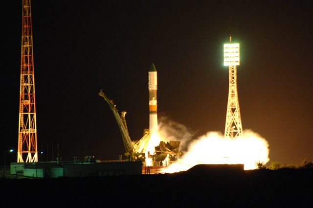

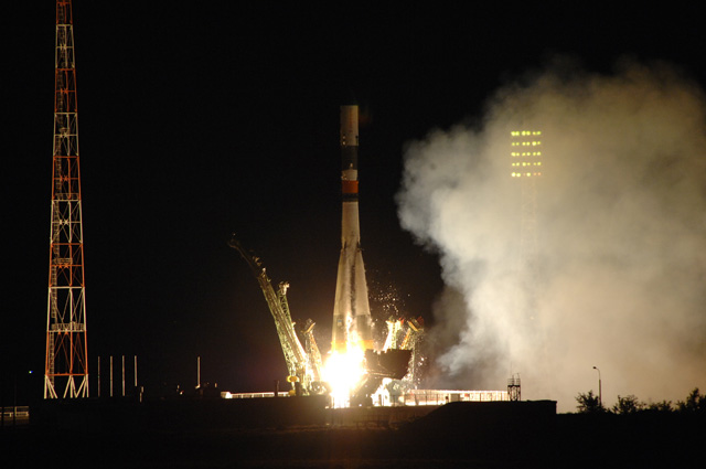


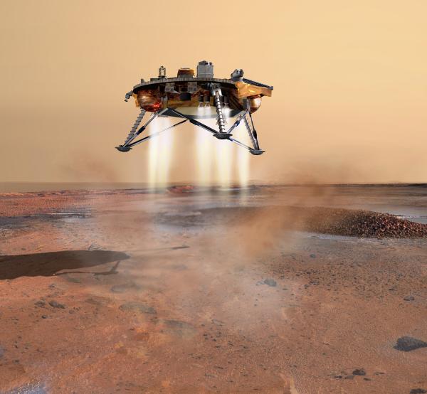
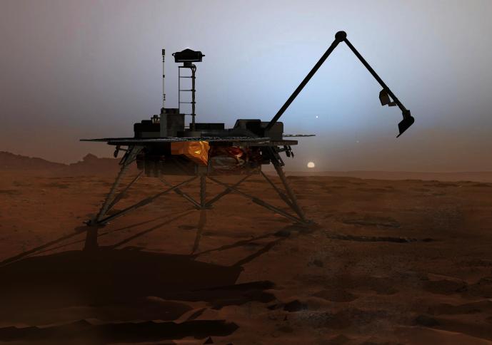

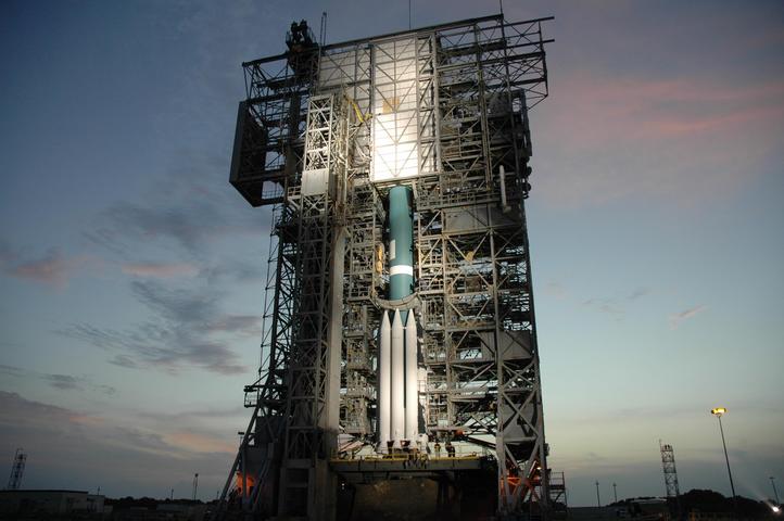
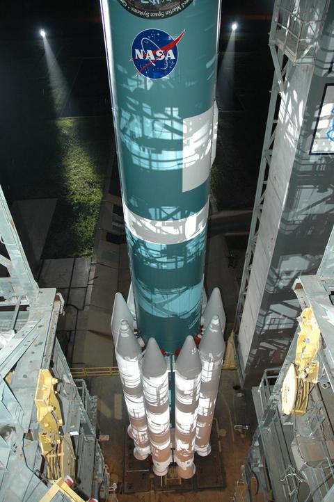
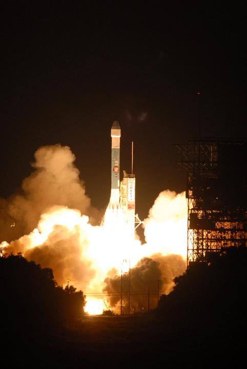
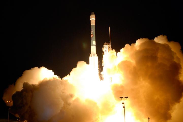
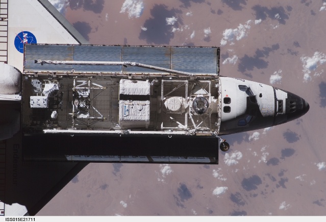
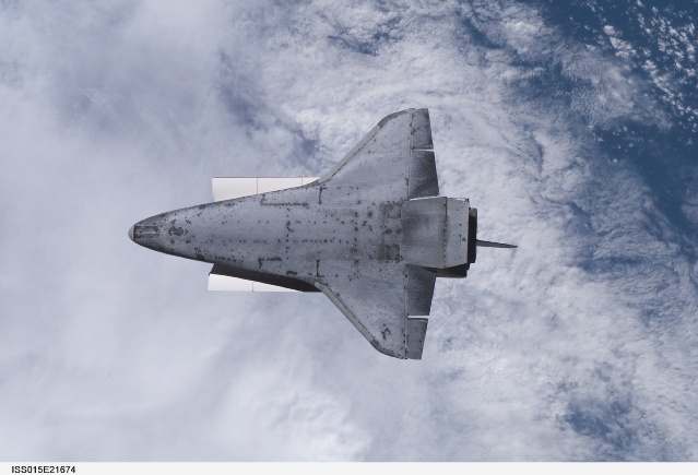

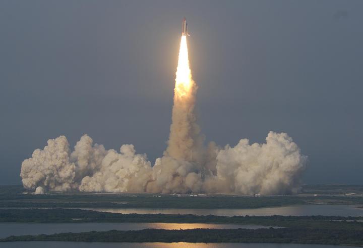
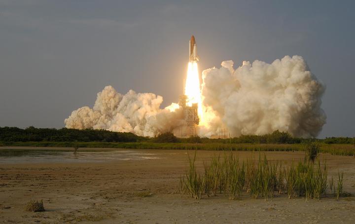
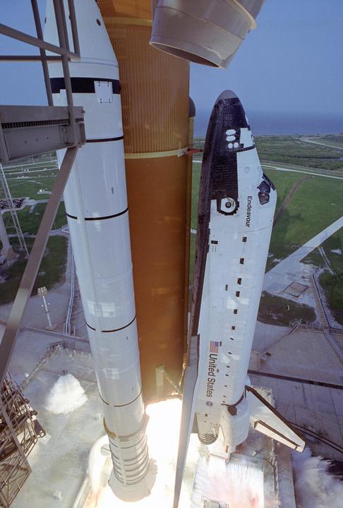
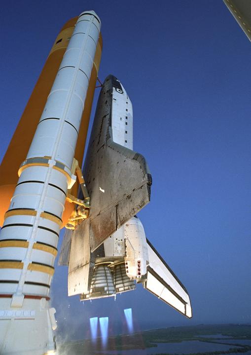
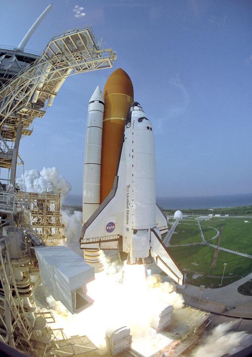
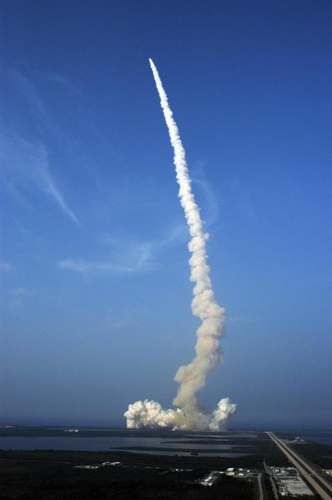
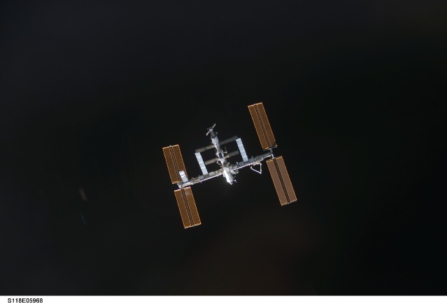


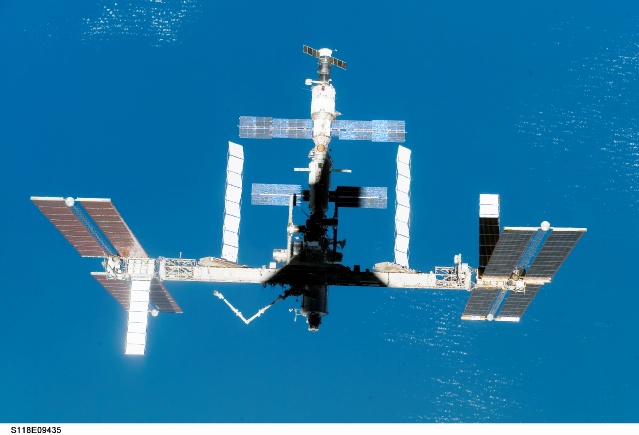

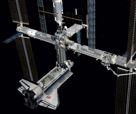
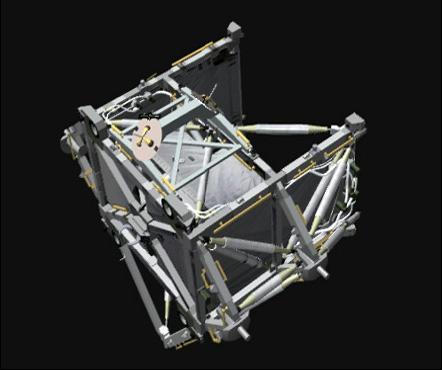

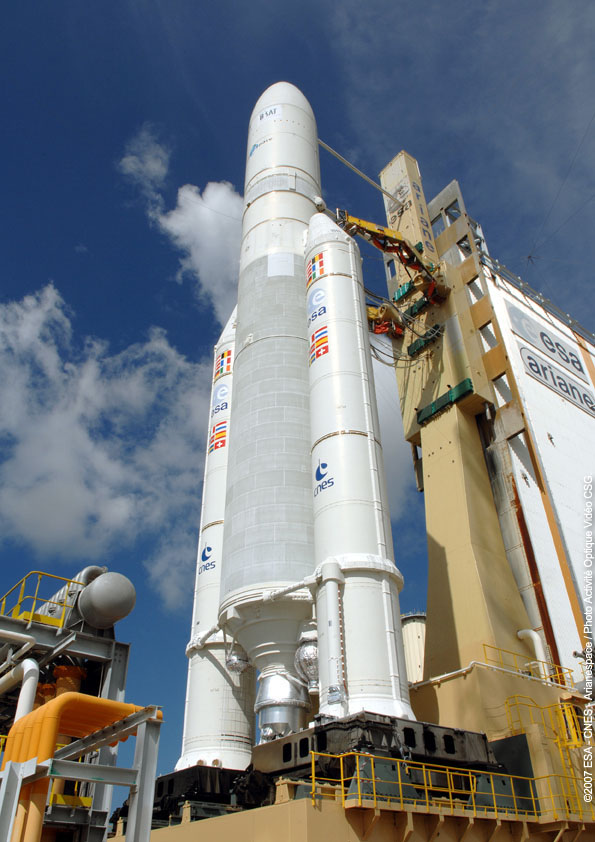
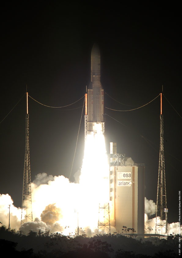
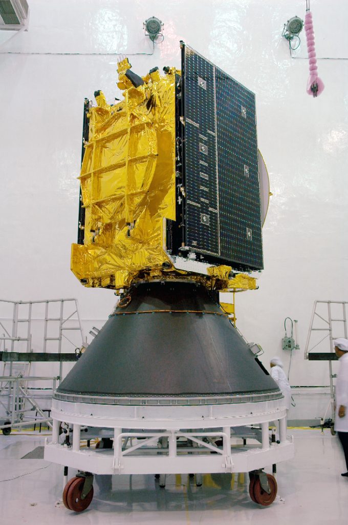
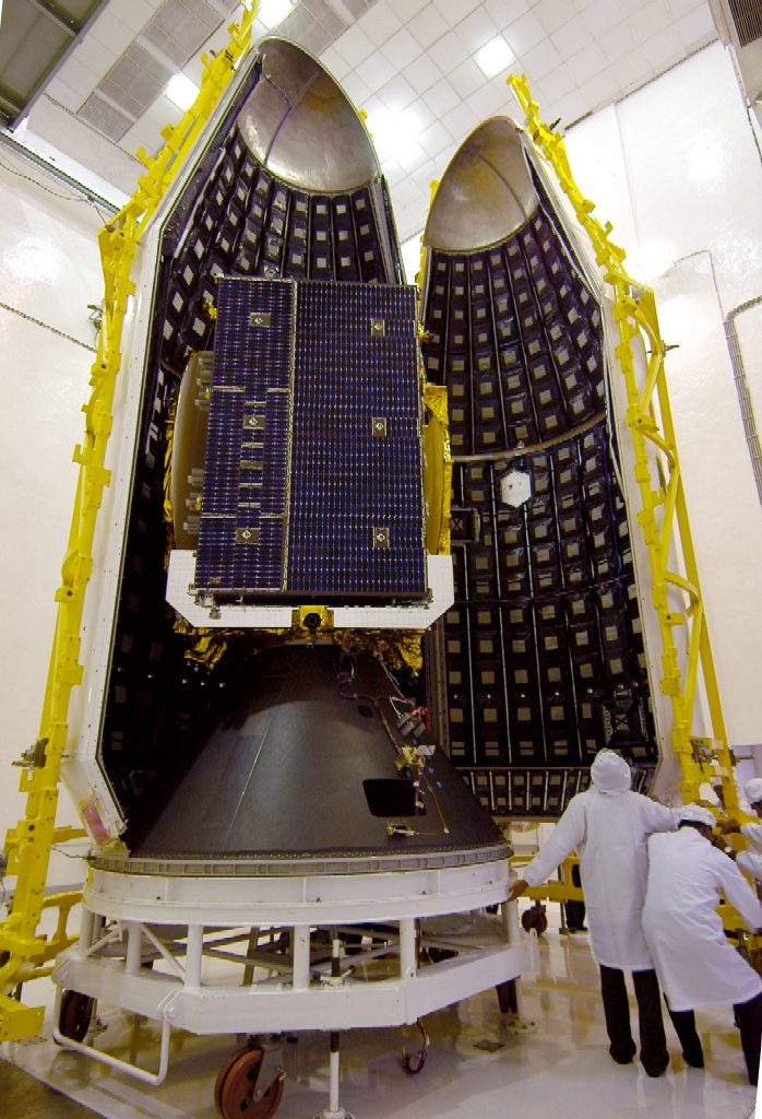
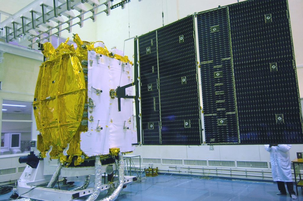
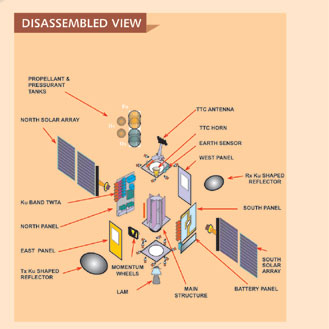
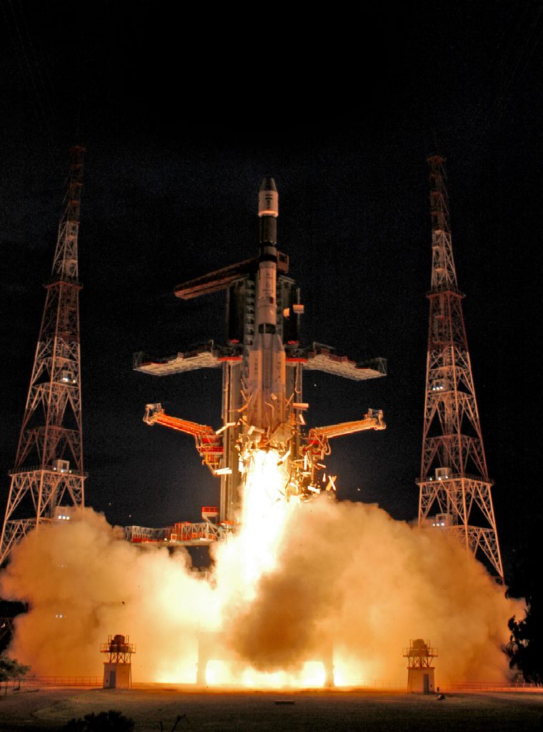
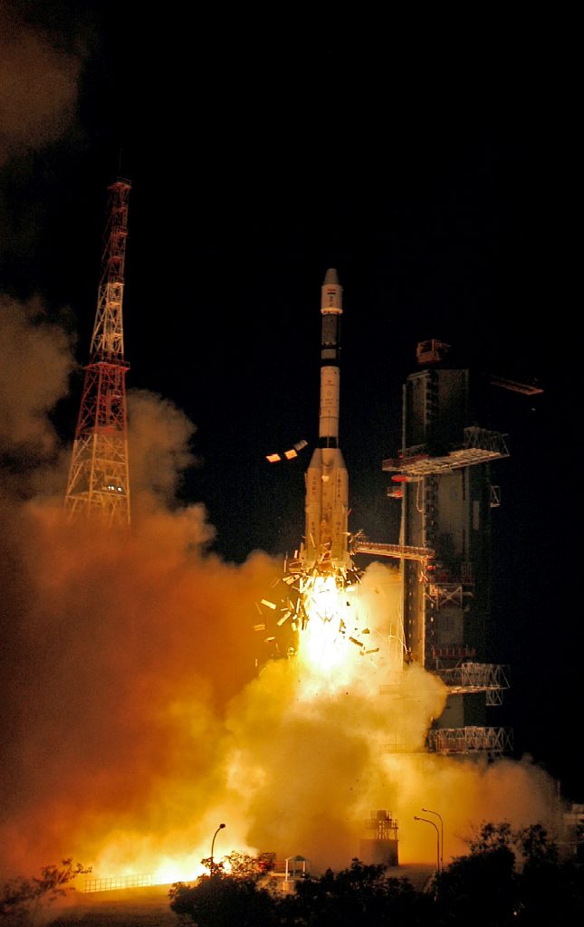
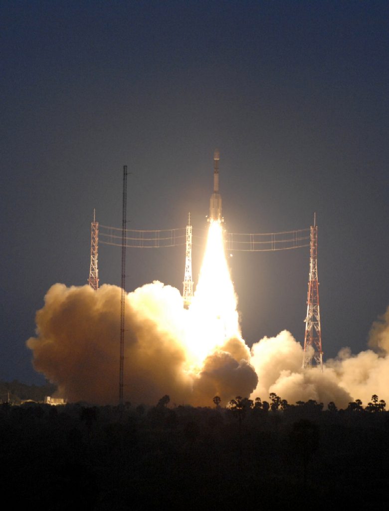

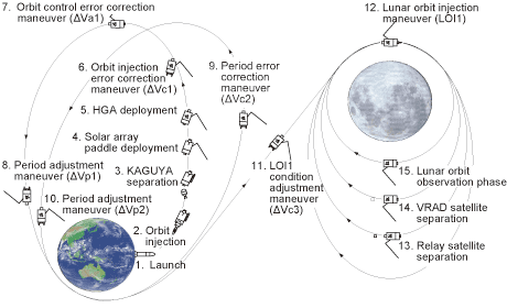


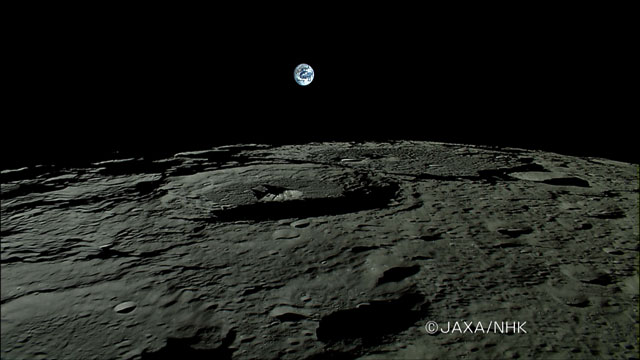

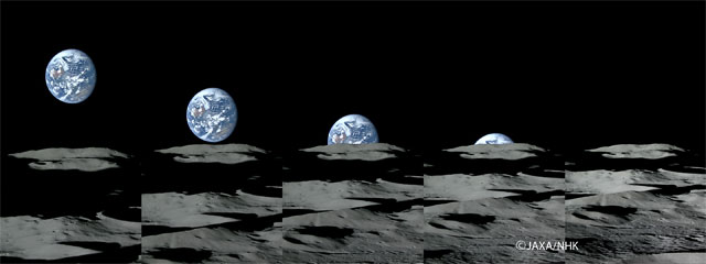
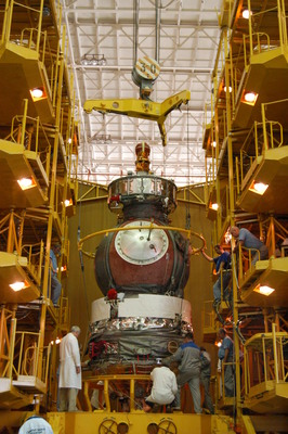
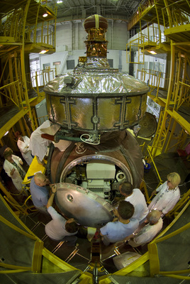

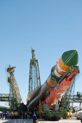
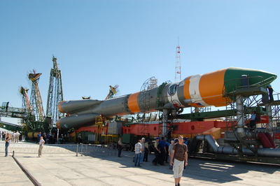
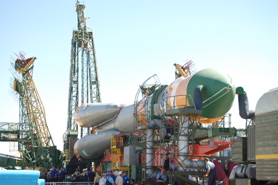
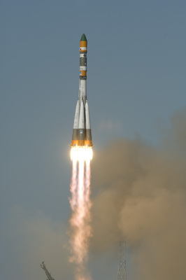
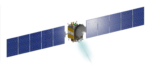
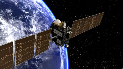
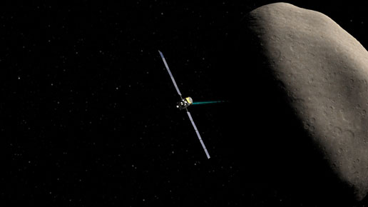


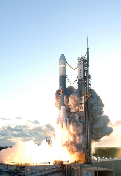
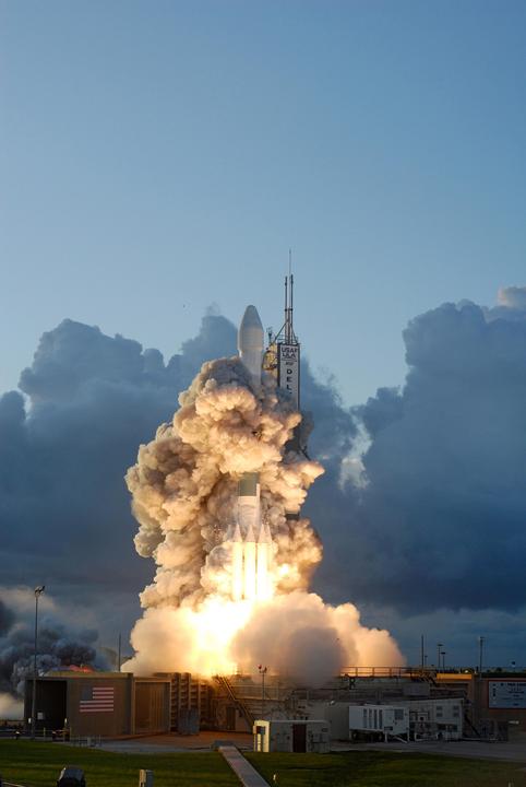
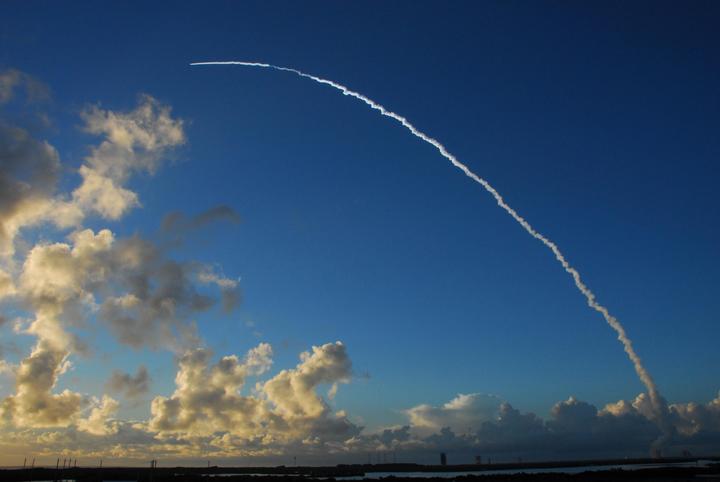
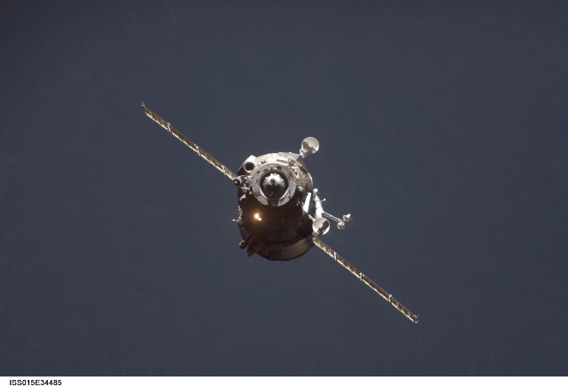
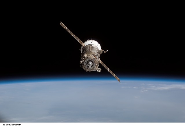
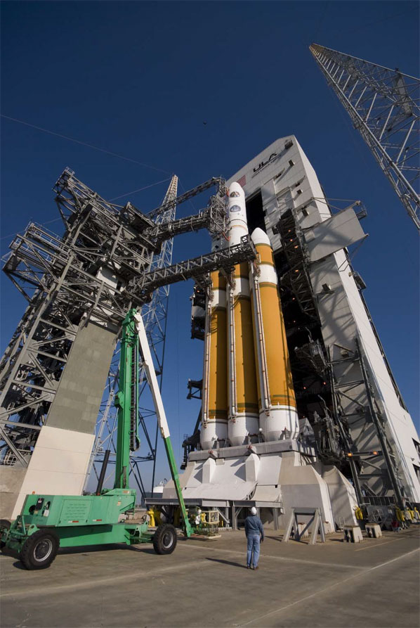
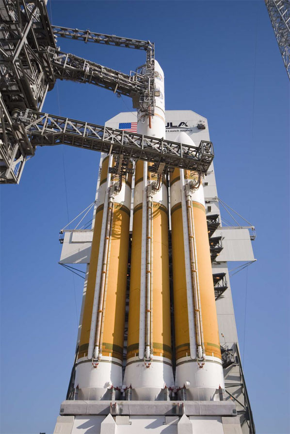

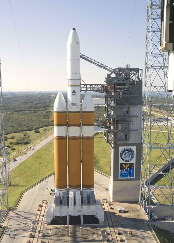
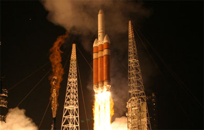
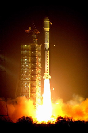
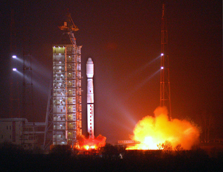
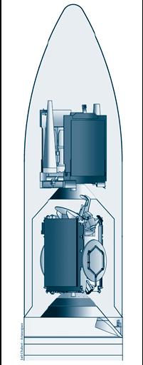
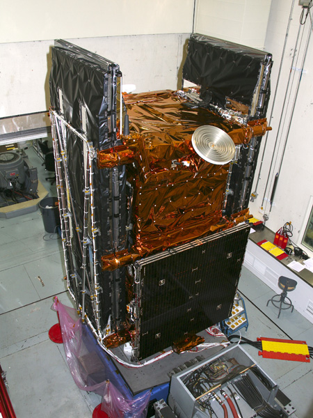
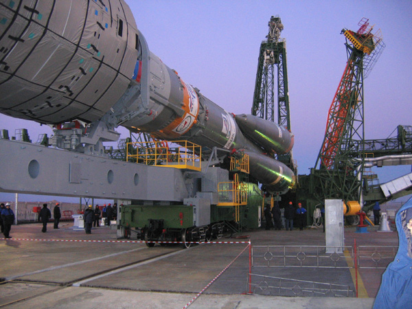
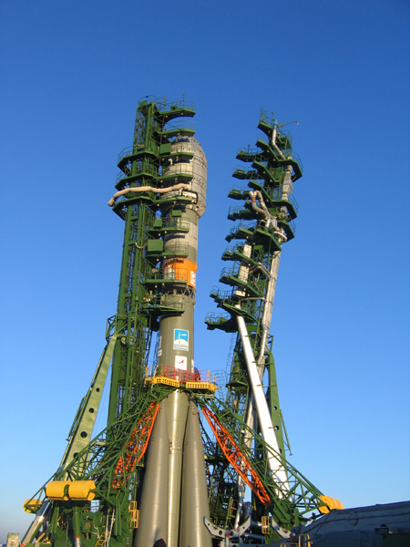


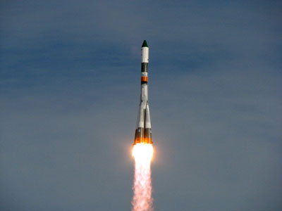