|
The
77 Spacecrafts launched in 2004 :
Spacecraft
Entries
.
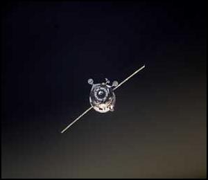
Telstar 14 / Estrela
do Sul 1
| Spacecraft: |
Note: some reports spell the
satellite name as "Estrela du Sol". |
| Chronologies: |
2004 payload #1 ; 2004-001A ; 6221st spacecraft. |
| Type: |
Communications (multi-services) |
| Families: |
|
| Ranks: |
510th Commercial
spacecraft ; 717th geostationary
satellite ; |
| Sponsor: |
Loral Skynet do Brazil |
|
|
| Launch: |
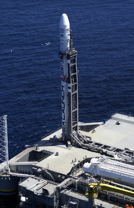
11 January 2004 at 4h13 UTC,
from Odyssey Launch Platform, by a Zenith 3SL. |
| Orbit: |
Geostarionary at 63° West longitude |
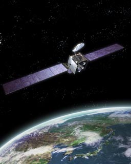
| Mission: |
Estrela do Sul (Telstar 14) is a Brazilian
communications that carries 41 Ku-band transponders. 50% of the satellite's
power will be focused on coverage over Brazil, providing a dedicated Ku-band
solution for the Brazilian marketplace. The other beams will cover the
Americas and the North Atlantic Ocean, where Connexion by Boeing will use
the satellite to provide its Internet-to-aircraft service. The 4694-kg
Loral LS-1300 spacecraft is designed for a 15-year lifespan. Reports
indicate there have been problems deploying one of the solar panels. |
|
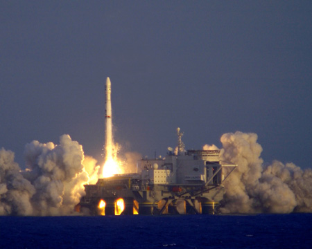
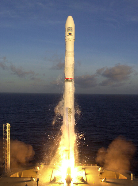
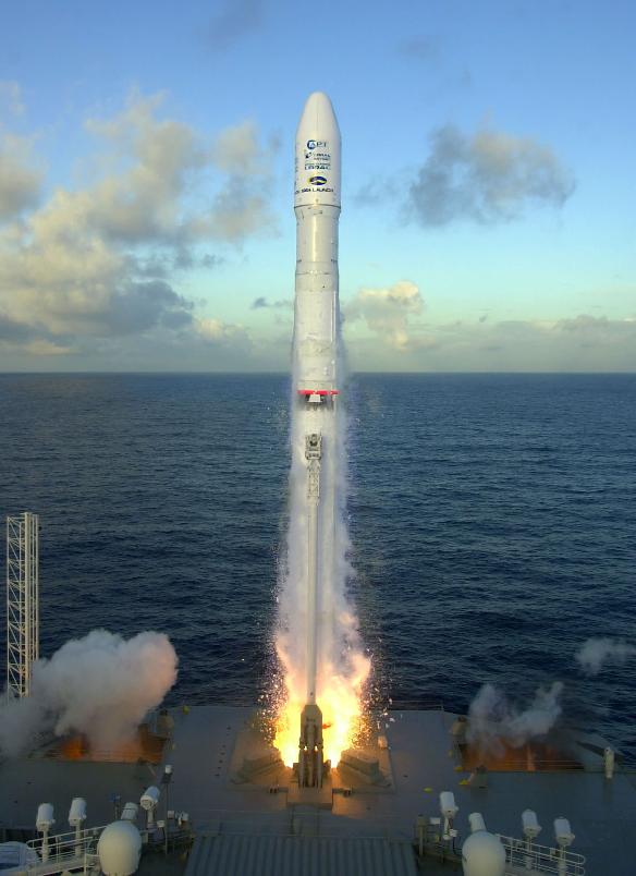
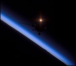
Telstar 14/Estrela do Sul 1 satellite
launch (Sea Launch
Photos)
|
| Launch: |
Launch was carried by Sea Launch, from the
floating Odyssey Launch Platform floating at 154° West longitude on
the equatorial Pacific Ocean, near the Christmas Island. The launch was
performed by the twelfth two-stage Zenith-2SL carrying a DM-SL. It was
the 243rd successful flight of a DM(D)-type upper stages. |
| Source: |
Jonathan
Space Report No. 518
; Spacewarn No. 603
; National Space Science Data Center's
2004-001A
; Energiya RSC's News
: Sea Launch's News
; Loral's News
; |
|
|
..
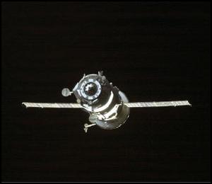
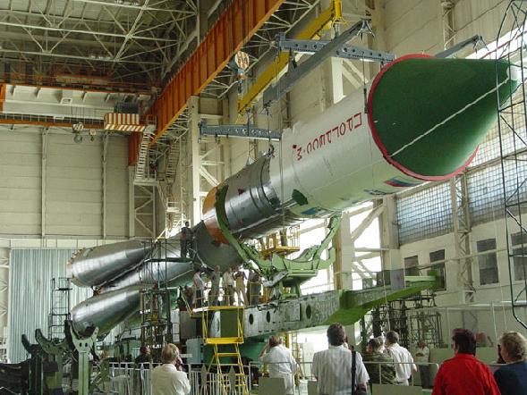
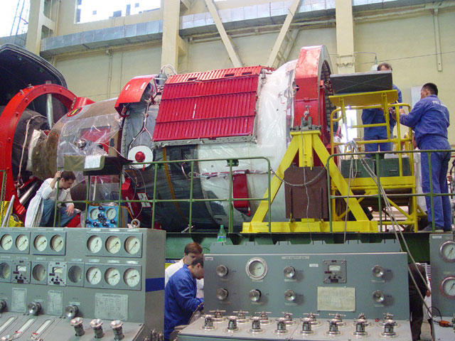
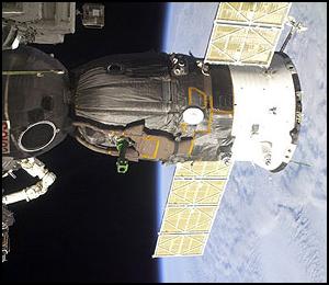
Progress M1-11 / ISS
13P
| Spacecraft: |
Progress M1 (7K-TGM) no. 260 |
| Chronologies: |
2004 payload #2 ; 2004-002A ; 6222nd spacecraft. |
| Type: |
Cargo delivery to the International Space
Station |
| Families: |
103rd Progress (13th toward ISS) |
| Ranks: |
3419th Russian
spacecraft (1046th civilian) : |
| Sponsor: |
Russia Space Agency |
|
 |
| Launch: |
29 January 2004 at 11h58 UTC,
from Baykonur Cosmodrome's LC-1, by an A-2/Soyuz-U. |
| Orbit: |
Initial: 191.1 km x 262.4 km x 51.65°
x 88.73 min
Docked on ISS: 364.9 km x 390.7 km x 51.65°
x 91.8 min |
| Decayed: |
3 June 2004 |
|
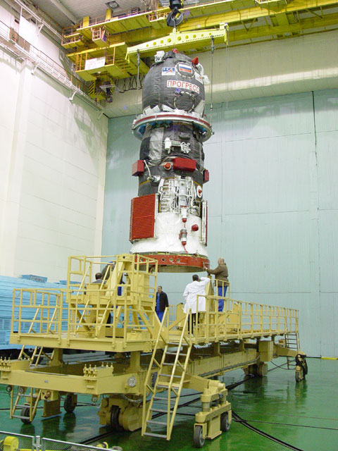
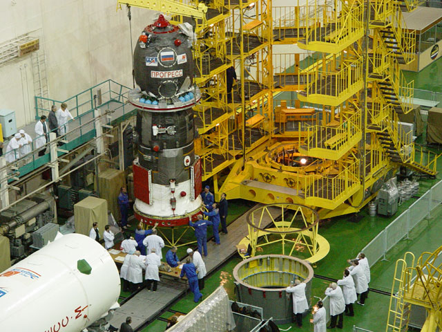
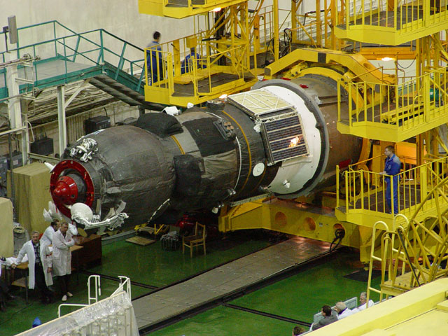
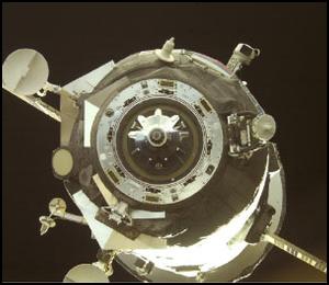
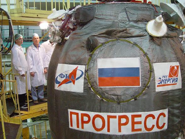
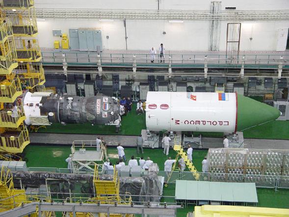
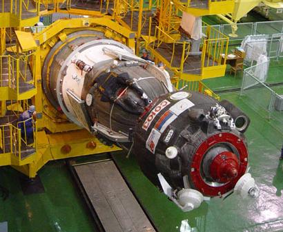
Progress M1-11 processing
(Source: RSC Energiya)
|
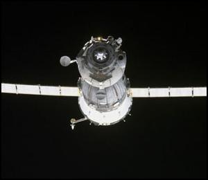
| Mission: |
 Progress
M1-11 carries about 2.4 tonnes of the cargoes, including propellant to
satisfy the station needs, potable water, oxygen and food products, crew
life support systems, equipment for resupply and maintenance of the station
onboard systems. The vehicle also delivers to the station scientific instruments
and equipment to conduct the European Space Agency (ESA) program-specific
activities and work under the Dutch and Japanese projects, as well as support
the future mission program of ESA astronaut André Kuipers, which
is to be implemented during the Russian Expedition 6 to the ISS slated
to begin next April. It also carries two new Orlan spacesuits (serials
M-25 and M-26), a replacement flexhose for the Destiny lab window (culprit
in last month's air leak) and equipment to be installed on Zvezda to support
docking by the new European ATV cargo ship Jules Verne. The cargo vehicle
docked to the Service Module Zvezda axial port on 31 January 2004 at 13h13
UTC. The cargoship was evacuated from the Station on 24 May 2004, carrying
all the trash from the ISS, and was destined for a controlled burn on 3
June. Progress
M1-11 carries about 2.4 tonnes of the cargoes, including propellant to
satisfy the station needs, potable water, oxygen and food products, crew
life support systems, equipment for resupply and maintenance of the station
onboard systems. The vehicle also delivers to the station scientific instruments
and equipment to conduct the European Space Agency (ESA) program-specific
activities and work under the Dutch and Japanese projects, as well as support
the future mission program of ESA astronaut André Kuipers, which
is to be implemented during the Russian Expedition 6 to the ISS slated
to begin next April. It also carries two new Orlan spacesuits (serials
M-25 and M-26), a replacement flexhose for the Destiny lab window (culprit
in last month's air leak) and equipment to be installed on Zvezda to support
docking by the new European ATV cargo ship Jules Verne. The cargo vehicle
docked to the Service Module Zvezda axial port on 31 January 2004 at 13h13
UTC. The cargoship was evacuated from the Station on 24 May 2004, carrying
all the trash from the ISS, and was destined for a controlled burn on 3
June. |
| Source: |
Jonathan
Space Report No. 520
; Spacewarn No. 603
& 607
& 608
; National Space Science Data Center's
2004-002A
; RSC Energiya's News of 29
Jan 04 & 31
Jan 04 ; |
|
|
.
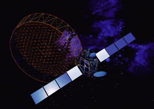
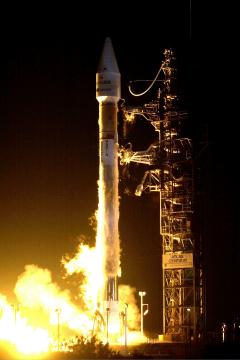
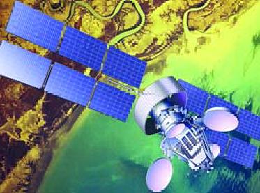
AMC-10 / Americom 10
(GE-10)
| Spacecraft: |
|
| Chronologies: |
2004 payload #3 ; 2004-003A ; 6223rd spacecraft. |
| Type: |
Communications (DBS) |
| Families: |
|
| Ranks: |
511th Commercial
spacecraft ; 718th geostationary
satellite ; |
| Sponsor: |
SES Americom |
| Launch: |
5 February 2004 at 23h46 UTC, from Cape Canaveral's
SLC-36A, by an Atlas IIAS (AC-165). |
| Orbit: |
Geostationary at 135° West longitude |
|

Source : Lockheed
Martin
|
| Mission: |
AMC 10 is a 1.8-tonne satellite
which provides high-definition digital video channels to North America
through its 24 C-band, and several direct-to-home Ku-band transponders.
It replaces the current GE Satcom
C 4. The satellite is a Lockheed A2100 with a launch mass of
2,315 kg and 907 kg dry. |
| Launch: |
The AC-165 launch rocket was the 27th flown
in the Atlas IIAS configuration; three more Atlas IIAS vehicles are scheduled
to launch this year before the model is retired. The Atlas IIAS can lift
3,700 kg to geosynchronous transfer orbit. The Atlas II, III and V series
have achieved 100% success through 69 consecutive launches. |
| Source: |
Jonathan
Space Report No. 520
; Spacewarn No. 604
; National Space Science Data Center's
2004-003A
; SES Americom's AMC-10
& AMC-11 ; ILS
News ; Lockheed Martin News
; |
|
|
..
DSP
22 (USA 176)
| Spacecraft: |
Defense Support Program |
| Chronologies: |
2004 payload #4 ; 2004-004A ; 6224th spacecraft. |
| Type: |
Missile easly warning |
| Families: |
22nd DSP (9th Phase 3) |
| Ranks: |
1685th American
spacecraft (1097th military) ;:719th geostationary
satellite ; |
| Sponsor: |
U.S. Department of Defense |
|
Source : Skyrocket
|
| Launch: |
14 February 2004 at 18h50 UTC,
from Cape Canaveral Air Force Base's SLC-40, by a Titan 4B/IUS (Titan 4B-39,
IUS-10). |
| Orbit: |
Geostationary |
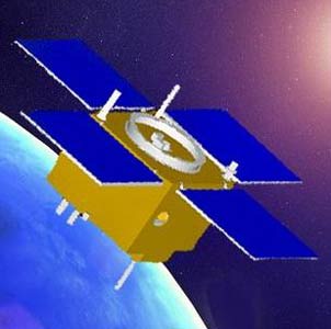
| Mission: |
This DSP Block-3 satellite is a third-generation
of DSP early warning satellites that spin slowly (6 rpm) about the nadir
axis to permit scanning of the Earth by the detector system. Four solar
panels deploy to generate roughly 1,300 Watts. The DSP spacecrafts are
radiation hardened. The payload is classified, but is probably a telescope
with 6000 element IR array, nuclear explosion detectors, particle detection
monitors. A DPS Block-3 weights 2,386 kg and costs about $180 millions.
These Air Force Space Command-operated satellites are a key part of North
America's early warning systems. In their geosynchronous orbits, they help
protect the United States and its allies by detecting missile launches,
space launches and nuclear detonations. |
| Source: |
Jonathan
Space Report No. 521
; Spacewarn No. 604
; National Space Science Data Center's
2004-004A
; Skyrocket's DSP
Phase 3 ; Air Force Factsheet
; |
|
|
.
Molniya
1-93 ("Kosmos 2405")
| Spacecraft: |
Molniya 1T |
| Chronologies: |
2004 payload #5 ; 2004-0005A ; 6225th spacecraft. |
| Type: |
Communications |
| Families: |
|
| Ranks: |
3420th Russian
spacecraft (1047th civilian) : |
| Sponsor: |
Russian Defense ministry |
|
|
|
.
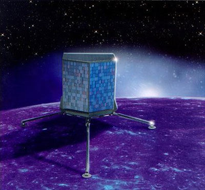
Rosetta
| Spacecraft: |
|
| Chronologies: |
2004 payload #6 ; 2004-006A ; 6226th spacecraft. |
| Type: |
Planetary probe (Comet) |
| Families: |
|
| Ranks: |
238th European
spacecraft ; |
| Sponsor: |
ESA |
| Launch: |
2 March 2004 at 7h17 UTC, from Kourou Space
Center's ELA-3, by an Ariane 5 (Ariane 517, V158). |
|
Images: ESA
|
| Orbit: |
Heliocentric orbit: 0.885 AU
x 1.094 AU x 0.4° |
| Mission: |
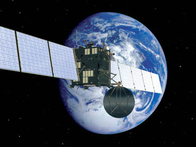
Rosetta is a 3-ton planetary
probe, the first ever designed to enter orbit around a comet and release
a lander onto its surface. For over a year, the $1.7 billion spacecraft
will conduct a thorough study of this remnant of the primitive nebula which
gave birth to our Solar System about 5 billion years ago.
The spacecraft is
a cubical box (2.8 meters x 2.1 meters x 2.0 meters) with two solar panels
of 14 meters x 2.3 meters. It was built by Astrium/Friedrichshafen and
carries the lander Philae, the OSIRIS camera, ultraviolet, visible, infrared
and microwave spectrographs, neutral and ion mass spectrometers and gas
chromatograph, dust detectors and analysers, comet plasma analysers, and
the CONSERT radar sounder to study the interior of the nucleus.
Discovered in 1969,
comet 67P/Churyumov-Gerasimenko is a frozen remnant of the primordial material
used to build the Solar System. This minor planet circles the Sun in an
elliptical orbit extending nearly 800 million kilometres from the Sun at
its apohelion (beyond the orbit of Jupiter) to a point between the orbits
of Earth and Mars (perihelion), some 185 million kilometres from the Sun.
The comet measures a few kilometres across and rotates every 12.7 hours.
The European Space
Agency had originally planned to build a comet sample return mission in
partnership with NASA, but the U.S. space agency pulled out because of
budget constraints and ESA ultimately decided to launch Rosetta instead,
approving the project in 1993.
To reach 67P/Churyumov-Gerasimenko,
the space probe had to carry out four planetary flybys - an Earth flyby
in March 2005, a Mars flyby in February 2007, two more Earth flybys in
November 2007 and November 2009 - using the gravity of these planets to
accelerate to move out into deep space.
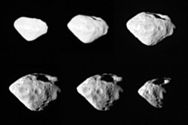
Along the way, it
flew past two asteroids - (2867) Steins on 5 September 2008 and (21) Lutetia
on 10 July 2010 -, sending back high-resolution pictures and other observations
(see at right).
 By the summer of 2011, Rosetta was too far from the Sun for its solar arrays
to generate enough electricity to power all of its instruments and subsystems.
Flight controllers ordered the probe to put itself into electronic hibernation,
shutting down all non-essential systems, including its radio. For
the next two-and-a-half years, Rosetta flew in silence. Finally,
on 20 January 2014, it woke up and phoned home, ready for the final leg
of its long space odyssey.
By the summer of 2011, Rosetta was too far from the Sun for its solar arrays
to generate enough electricity to power all of its instruments and subsystems.
Flight controllers ordered the probe to put itself into electronic hibernation,
shutting down all non-essential systems, including its radio. For
the next two-and-a-half years, Rosetta flew in silence. Finally,
on 20 January 2014, it woke up and phoned home, ready for the final leg
of its long space odyssey.
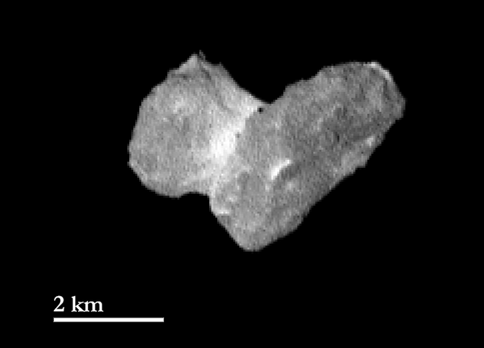
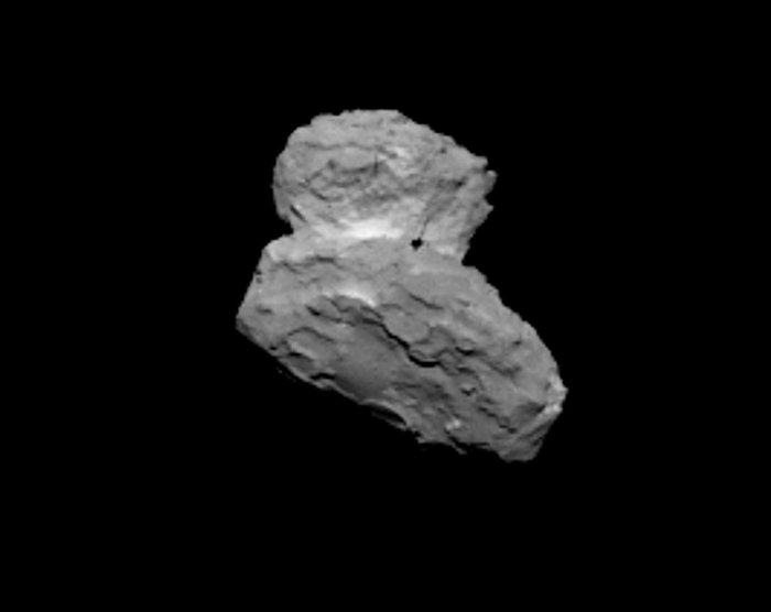
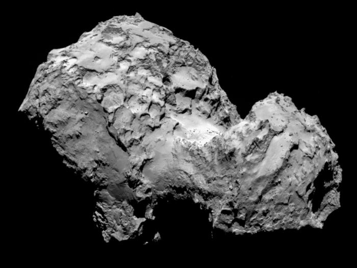
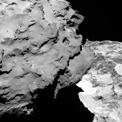
Images of 67P taken
by the spacecraft's OSIRIS camera at the end of July/early August 2014
revealed a heavily cratered nucleus with two distinct lobes, showing house-size
boulders strewn across relatively smooth plains and towering, sharply etched
cliffs150 meters high (see below). |
 |
|
 |
| Asteroid Steins |
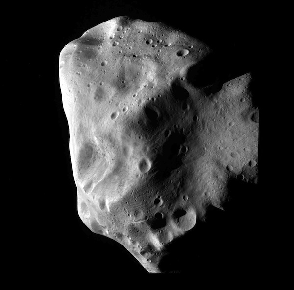 |
| Asteroid Lutetia |
|
|
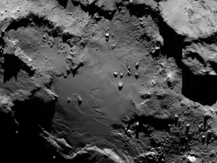
First pictures taken
by Rosetta as it arrived at Comet 67P/Churyumov-Gerasimenko.
Credit: ESA's Rosetta
photos.
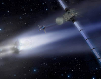
Finally, Rosetta
caught up with comet 67P on 6 August 2014, precisely matching its orbit,
after a 10-year, 6 billion-kilometer voyage around the Sun. The final maneuver
needed for Rosetta to match the comet trajectory, racing through space
at some 55,000 km/h, began at 9h00 UT and lasted six minutes and 26 seconds.
The probe positioned itself just 100 km ahead of the nucleus to study its
surface, the evolution of its coma (the nebulous cloud that envelops a
comet as it warms up) and the eventual development of dust and ion tails.
It is studying 67P with a battery of cameras and instruments to map its
surface, to study its composition and to characterize the coma.
A major objective
of the early observations is to find a good landing site for the Philae
lander, a small craft mounted on the side of Rosetta that carries its own
suite of cameras and instruments. If all goes well, Rosetta will
release Philae on 11 November 2014, allowing it to slowly descend to the
surface, anchoring itself in the crust for the first in situ observations
of a comet as it warms up and spews dust and electrically charged ions
in tenuous tails of debris. No one knows how long the lander might
survive, but scientists are hoping for several months of close-range observations
as the nucleus heats up and spews debris.
If all goes well,
Rosetta will fly in tandem with 67P while the comet reaces its perihelion
in August 2015, continuing its observations through the end of the year. |
| Launch: |
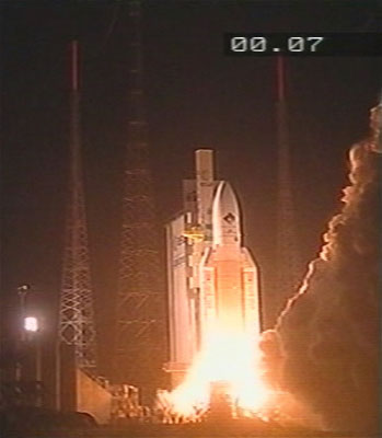 Rosettas
mission began at 7h17 UTC when an Ariane 5 launch vehicle lifted off from
the Guiana Space Centre, in Kourou, French Guiana. The Ariane 518G (flight
V158) was the first Ariane 5G+, with an improved EPS upper stage. The EPC
core stage entered a 45 km x 3,849 km x 5.7° orbit 9 minutes after
launch. It completed one orbit and reentered at perigee over the eastern
Pacific. The EPS second stage ignited on the descending leg of the orbit
at 9h14 and burned for 17 minutes. The launcher successfully placed its
upper stage and payload into an eccentric coast orbit (200 x 4,000 km).
About two hours later, at 9h14, the upper stage ignited its own engine
to reach an escape velocity in order to leave the Earths gravity field
and enter heliocentric orbit. Rosetta was released 18 minutes later. The
probe left the Earth's gravitational sphere of influence early on March
5. Rosettas
mission began at 7h17 UTC when an Ariane 5 launch vehicle lifted off from
the Guiana Space Centre, in Kourou, French Guiana. The Ariane 518G (flight
V158) was the first Ariane 5G+, with an improved EPS upper stage. The EPC
core stage entered a 45 km x 3,849 km x 5.7° orbit 9 minutes after
launch. It completed one orbit and reentered at perigee over the eastern
Pacific. The EPS second stage ignited on the descending leg of the orbit
at 9h14 and burned for 17 minutes. The launcher successfully placed its
upper stage and payload into an eccentric coast orbit (200 x 4,000 km).
About two hours later, at 9h14, the upper stage ignited its own engine
to reach an escape velocity in order to leave the Earths gravity field
and enter heliocentric orbit. Rosetta was released 18 minutes later. The
probe left the Earth's gravitational sphere of influence early on March
5. |
| Notes: |
On 14 February 1965, Dr. Fred Whipple, director
of the Smithsonian Asirophysical Observatory, Cambridge, had suggested
landing on a comet. He speculated that, if a space vehicle were sent near
a comet, scientists could use a low-velocity probe that could be put into
an orbit in the comets vicinity for a week or more to study the velocities
of gas and dust particles boiled off the comet by solar radiation. The
probe would also be able to take core samples of the comet to give direct
measurement of one of the oldest physical processes in the solar system,
Dr. Whipple said. |
| Source: |
Jonathan
Space Report No. 522,
630
;
Spacewarn No. 605
; National Space Science Data Center's
2004-006A
; ESA's
Rosetta,
PR 14-2004, 20
Jan 14, 18
Jul 14, 1
Aug 14, 1
Aug 14, 5
Aug 14, 6
Aug 14, ; Spaceflight Now's
2014
Stories, 2015 Stories
; Aeronautics
and Astronautics, 1965, p. 67 ; |
|
|
.
Philae
| Spacecraft: |
|
| Chronologies: |
2004 payload #7 ; 2004-006B ; 6227th spacecraft. |
| Type: |
Comet lander |
| Ramilies: |
|
| Ranks: |
239th European
spacecraft ; |
| Sponsor: |
ESA |
| Launch: |
2 March 2004 at 7h17 UTC, from Kourou Space
Center's ELA-3, by an Ariane 5 (Ariane 517, V158). |
|
Source: ESA
|
| Orbit: |
Heliocentric orbit: 0.885 AU
x 1.094 AU x 0.4° |
| Mission: |
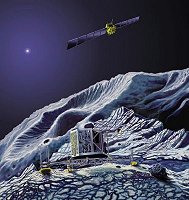 TOn
12 November 2014, the 85-kg Philae lander was ejected from Rosetta at 8h35
UT, 22 km from comet 67P/Churyumov-Gerasimenko. The lander hit the comets
surface at 15h33 UTC, at the Agilkia landing site, but the harpoons intended
to lock it to the surface did not deploy. Philae then bounced off the surface,
up to one kilometer, then touchdown again at 17h26 UT and bounced
to finally lands at 17h33 UT. Exact landing site is unknown. The lander
is apparently tilted, with one of its three legs off the surface. (Some
reports said that the three legs are on the soil.) Unfortunately,
Philae is in the shadow of a cliff and not receiving enough sunlight to
recharge its 2.5-day-life batteries. It had transmited a panoramic photo
that show mainly a dark region. Science data was received during two days
and the lander ceased transmitting at 0h36 UT on 14 November. The mission
is considered a success, but not as successful as hope for. TOn
12 November 2014, the 85-kg Philae lander was ejected from Rosetta at 8h35
UT, 22 km from comet 67P/Churyumov-Gerasimenko. The lander hit the comets
surface at 15h33 UTC, at the Agilkia landing site, but the harpoons intended
to lock it to the surface did not deploy. Philae then bounced off the surface,
up to one kilometer, then touchdown again at 17h26 UT and bounced
to finally lands at 17h33 UT. Exact landing site is unknown. The lander
is apparently tilted, with one of its three legs off the surface. (Some
reports said that the three legs are on the soil.) Unfortunately,
Philae is in the shadow of a cliff and not receiving enough sunlight to
recharge its 2.5-day-life batteries. It had transmited a panoramic photo
that show mainly a dark region. Science data was received during two days
and the lander ceased transmitting at 0h36 UT on 14 November. The mission
is considered a success, but not as successful as hope for. |
| Source: |
Spacewarn
No. 605,
705
; National Space Science Data Center's
2004-006A
; Spaceflight Now's 2014
Stories, 2015 Stories
; |
|
|
.
MBSAT
| Spacecraft: |
Mobile Broadcasting Satellite |
| Chronologies: |
2004 payload #8 ; 2004-007A ; 6228th spacecraft. |
| Type: |
Communications (DBS) |
| Families: |
|
| Ranks: |
512th Commercial
spacecraft ; 720th geostationary
satellite ; |
| Sponsor: |
Japan's MBCO / Mobile Broadcasting Corporation |
| Launch: |
13 March 2004 at 5h40 UTC, from Cape Canaveral
Air Force Station's SLC-36B, by an Atlas IIIA (AC-202). |
|
Source : MBCO
|
| Orbit: |
Geostationary at 144° East
longitude. |
| Mission: |
 MBSAT
delivers high-quality music, video and data to mobile users in Japan and
Korea through a variety of mobile terminals, including those in cars, ships,
trains, handheld terminals, personal digital assistants, cellular phones
and home portables. It provides about 60 audio channels of various music
in genre and other sound programs, about 10 video channels including sports,
news, music, kids program and download channels all over Japan. A very
small antenna is sufficient to receive these broadcast signals even inside
buildings and in vehicles moving at high speeds. The satellite carries
two high-power transponders for direct broadcasting services, with one
transponder providing coverage for Japan and the other for Korea. Two additional
transponders provide links to terrestrial repeater networks, which augment
the satellite broadcast signal. The spacecraft is a three-axis attitude
stabilized geostationary satellite designed and manufactured by Space Systems/Loral.
The MBSAT design is based on the SS/L 1300 bus. MBSAT is a joint venture
between Mobile Broadcasting Co. of Tokyo and SK Telecom of Seoul. Mobile
Broadcasting Corporation (MBCO) was founded in May 1998 to provide world-first
satellite multimedia service by the spring of 2004 in Japan. The service
includes audio, video and interactive service for people who stay away
from home. (Launch
video/photos.) MBSAT
delivers high-quality music, video and data to mobile users in Japan and
Korea through a variety of mobile terminals, including those in cars, ships,
trains, handheld terminals, personal digital assistants, cellular phones
and home portables. It provides about 60 audio channels of various music
in genre and other sound programs, about 10 video channels including sports,
news, music, kids program and download channels all over Japan. A very
small antenna is sufficient to receive these broadcast signals even inside
buildings and in vehicles moving at high speeds. The satellite carries
two high-power transponders for direct broadcasting services, with one
transponder providing coverage for Japan and the other for Korea. Two additional
transponders provide links to terrestrial repeater networks, which augment
the satellite broadcast signal. The spacecraft is a three-axis attitude
stabilized geostationary satellite designed and manufactured by Space Systems/Loral.
The MBSAT design is based on the SS/L 1300 bus. MBSAT is a joint venture
between Mobile Broadcasting Co. of Tokyo and SK Telecom of Seoul. Mobile
Broadcasting Corporation (MBCO) was founded in May 1998 to provide world-first
satellite multimedia service by the spring of 2004 in Japan. The service
includes audio, video and interactive service for people who stay away
from home. (Launch
video/photos.) |
| Source: |
Jonathan
Space Report No. 522
; Spacewarn No. 605
; National Space Science Data Center's
2004-007A
; MBSAT
; ILS
; |
|
|
.
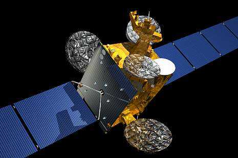
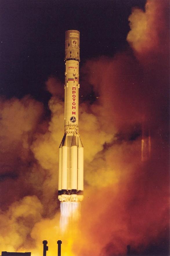
Eutelsat
W3A
| Spacecraft: |
|
| Chronologies: |
2004 payload #9 ; 2004-008A ; 6229th spacecraft. |
| Type: |
Communications (DBS) |
| Families: |
|
| Ranks: |
240th European
spacecraft ; 721st geostationary
satellite ; |
| Sponsor: |
Eutelsat |
|
|
| Launch: |
15 March 2004 at 23h06 UTC, from
Baykonur Cosmodrome, by a Proton-M/Briz-M (Proton-M 53503 / Briz-M 88507). |
| Orbit: |
Geostationary at 7° East longitude. |
| Mission: |
 Eutelsat
W3A provides communications for Eutelsat to Europe, the Middle East, and
Africa. The 4.4 tonne satellite carries a total of 58 Ku-band transponders
and a few steerable transmission beams to provide direct-to-home voice,
data, and video channels to Europe, Middle East and Africa. It replaces
the Eutelsat
W3 satellite at 7° E longitude. The spacecraft is the first
Astrium Eurostar 3000S model, a larger version of the long-running Eurostar
series. Eutelsat
W3A provides communications for Eutelsat to Europe, the Middle East, and
Africa. The 4.4 tonne satellite carries a total of 58 Ku-band transponders
and a few steerable transmission beams to provide direct-to-home voice,
data, and video channels to Europe, Middle East and Africa. It replaces
the Eutelsat
W3 satellite at 7° E longitude. The spacecraft is the first
Astrium Eurostar 3000S model, a larger version of the long-running Eurostar
series. |
| Launch: |
This is the third launch of Proton-M, which
has a more powerful first stage and improved systems than the usual Proton-K.
(Launch video/photos.) |
| Source: |
Jonathan
Space Report No. 522,524
&
536
; Spacewarn No. 605
; National Space Science Data Center's
2004-008A
; |
|
|
.
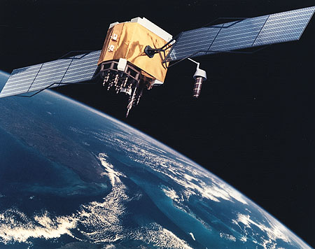
Navstar 50 (USA 177)
| Spacecraft: |
Navstar SVN 59 / GPS IIR-11 |
| Chronologies: |
2004 payload #10 ; 2004-009A ; 6230th spacecraft. |
| Type: |
Navigation |
| Families: |
54th Navstar |
| Ranks: |
1686th American
spacecraft (1098th military) ; |
| Sponsor: |
U.S. Department of Defense |
| Launch: |
20 March 2004 at 17h53 UTC, from Cape Canaveral's
SLC-17B, by a Delta II 7925. |
|
|
| Orbit: |
20,090 km x 20,277 km x 55.1°
x 708 min. |
| Mission: |
Navstar 54, also known as USA 177 and as
GPS 2R-11, is an American navigational satellite in the GPS fleet. It takes
Slot 3 in Plane C, replacing the aging Navstar
2-19. The fleet consists of 24 operational satellites (plus
a few spares) located in six (inertial) planes with four slots in each. |
| Source: |
Jonathan
Space Report No. 523
; Spacewarn No. 605
; National Space Science Data Center's
2004-009A
; |
|
|
.
Raduga 1-7 ("Kosmos
2406")
| Spacecraft: |
Globus 17L |
| Chronologies: |
2004 payload #11 ; 2004-010A ; 6231st spacecraft. |
| Type: |
Communications |
| Families: |
|
| Ranks: |
3421sh Russian
spacecraft (1048th civilian) : 722nd geostationary
satellite ; |
| Sponsor: |
Russia Defense ministry |
|
|
| Launch: |
27 March 2004 at 3h30 UTC, from
Baykonur Cosmodrome's PL-81, by a Proton-K/DM-2?. |
| Orbit: |
Geostationary at 85.0° East longitude. |
| Mission: |
The spacecraft was first labelled Kosmos-2406
but later renamed Raduga 1. It is a Globus military communications satellite
(the previous Globus was launched
in October 2001). Earlier Globus launches were given the Raduga-1 cover
name, but it looks like the Russian Defense Ministry may be consolidating
all its launches under the Kosmos cover name now (as for last month's Kosmos-2405
launch). |
| Notes: |
WDC-A and Space Command are reporting the
satellite as Kosmos-2407, presumably because the original Russian launch
schedule stated the now-delayed Zenit-2 launch would be Kosmos-2406. However,
after launch Novosti called the new satellite Kosmos-2406, implying that
the Kosmos numbers will continue to be assigned in launch order, and so
provisional numbers released before launch may change. This makes sense
since the Kosmos numbers are used purely for public consumption, with internal
classified military names used in all technical documentation, so changing
the Kosmos number at a late date doesn't break anything. |
| Source: |
Jonathan
Space Report No. 523,
524,
526
&
528
; Spacewarn No. 605
; National Space Science Data Center's
2004-010A
; |
|
|
.
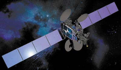
Superbird 6 / Superbird
A2
| Spacecraft: |
|
| Chronologies: |
2004 payload #12 ; 2004-011A ; 6232nd spacecraft. |
| Type: |
Communications (multi-services) |
| Families: |
|
| Ranks: |
513th Commercial
spacecraft ; 723rd geostationary
satellite ; |
| Sponsor: |
Japan's Space Communications Corp. |
| Launch: |
16 March 2004 at 0h45 UTC, from Cape Canaveral's
SLC-36A, by an Atlas IIAS (AC-163). |
|
Source: Boeing
|
| Orbit: |
Geostationary at 158° East
longitude |
| Mission: |
Superbird 6 is a 3.2-tonne, 4.4-kW communications
satellite that provides high data-rate transmissions for television and
internet access to the Asia-Pacific region through its 23 Ku-band, and
four Ka-band transponders. It is the fifth operational Superbird, after
the current list of Superbird
A, -B2,
-C,
and -D. Superbird 6 satellite, a Boeing BSS-601 model, provide Ka and Ku
band communications for Japan's Space Communications Corp. with the operational
name of Superbird A2. |
| Launch: |
The Lockheed Martin Atlas IIAS was placed
into a 150 x 396 km parking orbit and then restarted to reach a 167 x 122,343
km x 26.3° highly elliptical orbit. This high apogee orbit allows
the spacecraft to lower its inclination to equatorial with a minimum usage
of fuel, and only then lower its orbital height to the 357,80 km geostationary
altitude.
According to a report
in Space News, the Superbird 6 communications satellite was damaged
on a lower than expected first perigee passage. The spacecraft was launched
into an orbit with around 200 km perigee, but lunar perturbations - which
reportedly had not been taken into account - lowered the perigee to around
100 km during the first orbit. An engine firing raised the perigee to over
1,000 km, and later burns up to 10 May 2004 put the satellite in a near-geosynchronous
drift orbit at 35,834 x 35,964 km x 0.1° over the Pacific at 157°
East longitude. |
| Source: |
Jonathan
Space Report No. 524
& 526
; Spacewarn No. 606
; National Space Science Data Center's
2004-011A
; Boeing
Co. ; |
|
|
.
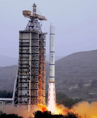
Shiyan 1 (SY 1) / Tansuo
1 (TS 1)
| Spacecraft: |
Tansuo means Experimentsat. |
| Chronologies: |
2004 payload #13 ; 2004-012A ; 6233rd spacecraft. |
| Type: |
Earth remote sensing |
| Families: |
|
| Ranks: |
81st Chinese
spacecraft ; |
| Sponsor: |
China |
| Launch: |
18 April 2004 at 15h59 UTC, from Xichang
Satellite Launch Center, by a Chang Zheng-2C. |
|
|
| Orbit: |
Initial: 600 km x 615 km x 97.7°
x 96.8 min.
599 km x 615 km x 97.7° |
| Mission: |
Shiyan 1 ('Experiment') is a microsatellite
developed by the Harbin Institute of Technology, with a stereo imager to
carry out land resource mapping. The 204-kg Tansuo 1satellite provides
stereographic maps of land resources in China. |
| Launch: |
This was the first polar launch from the
low-latitude Xichang launch site; previous Chinese sun-synchronous missions
were from Taiyuan. |
| Source: |
Jonathan
Space Report No. 524
; Spacewarn No. 606
; National Space Science Data Center's
2004-012A
; |
|
|
.
Naxing 1
| Spacecraft: |
Naxing is a contraction of Nami
Weixing, meaning nanosatellite. |
| Chronologies: |
2004 payload #14 ; 2004-012B ; 6234th spacecraft. |
| Type: |
Technology |
| Families: |
|
| Ranks: |
82nd Chinese
spacecraft ; |
| Sponsor: |
China |
| Launch: |
18 April 2004 at 15h59 UTC, from Xichang
Satellite Launch Center, by a Chang Zheng-2C. |
|
|
|
.
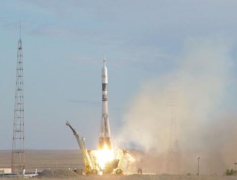
Soyuz TMA-4 / ISS 8S
| Spacecraft: |
Soyuz 11F732 (7K-STMA) No. 214 |
| Chronologies: |
2004 payload #15 ; 2004-013A ; 6235th spacecraft. |
| Type: |
Piloted spaceship |
| Families: |
|
| Ranks: |
3422th Russian
spacecraft (1046th civilian) : |
| Sponsor: |
Russian's Federal Space Agency & NASA |
| Launch: |
19 April 2004 at 3h19 UTC, from Baykonur
Cosmodrome's LC-1, by a Soyuz-FG. |
|
Source: NASA
|
| Orbit: |
Circular at ~400 km x 51.6°. |
| Recovered: |
4 October 2004 |
| Mission: |
 Soyuz
TMA-4 is a Russian passenger transport spacecraft that carried three astronauts
to the International Space Station (ISS): Expedition 9 crew of Gennadiy
Padalka and Michael Fincke, together with the ESA/Netherlands DELTA mission
crewmember André Kuipers. The Dutch astronaut returned to Earth
with the Expedition 8 crew of Michael Foale and Aleksandr Kaleri on Soyuz
TMA-3, leaving Expedition 9 in charge of the station. Soyuz
TMA-4 docked with the nadir port on Zarya on 21 April 2004 at 5h01 UTC. Soyuz
TMA-4 is a Russian passenger transport spacecraft that carried three astronauts
to the International Space Station (ISS): Expedition 9 crew of Gennadiy
Padalka and Michael Fincke, together with the ESA/Netherlands DELTA mission
crewmember André Kuipers. The Dutch astronaut returned to Earth
with the Expedition 8 crew of Michael Foale and Aleksandr Kaleri on Soyuz
TMA-3, leaving Expedition 9 in charge of the station. Soyuz
TMA-4 docked with the nadir port on Zarya on 21 April 2004 at 5h01 UTC.
On 23 October 2004,
the Soyuz TMA-4, with Expedition 9 crew and VE-7's Shargin undocked at
21h08 UTC from ISS and made a small separation burn at 21h11 UTC. At 23h42
UTC, the deorbit burn lowered the orbit from 353 km x 366 km to -23 km
x 355 km, and the descent module separated at 0h08 UTC on 24 October 2004,
with landing at 50.47° Norht and 67.12° East near Arkalyk
at 0h36 UTC. |
| Note: |
Russia has split the Rosaviakosmos agency
into separate aviation and space parts; the new Russian space agency is
the Federal Space Agency ("Federal'noe kosmicheskoye agentstvo"). |
| Source: |
Jonathan
Space Report No. 524
& 537
; Spacewarn No. 606
& 612
; National Space Science Data Center's
2004-013A
; |
|
|
.
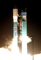
Gravity Probe B
| Spacecraft: |
|
| Chronologies: |
2004 payload #16 ; 2004-014A ; 6236th spacecraft. |
| Type: |
Science (fundamental physics) |
| Families: |
|
| Ranks: |
1687th American
spacecraft (589th civilian) ; |
| Sponsor: |
NASA |
| Launch: |
20 April 2004 at 16h57 UTC, from Vandenberg
Air Force Base's SLC-2W, by a Delta 7920. |
|

|
| Orbit: |
641 km x 645 km x 90.01°
x 97.6 min. |
| Mission: |
Gravity Probe-B aim is to verify a derivative
consequence of the General Relativistic Gravitation (GRG) theory, according
to which a spinning body such as the Earth makes the space-time around
it to rotate around, though extremely slowly. The satellite carries a telescope,
embedded with four 4-cm quartz spheres that spin at a rate of 10,000 rpm
as freely suspended gyroscopes. The prediction is that the orientation
of the spin axes will move by 42 milliseconds-of-arc during a year of orbiting.
The reference point is a bright star named HR 8703, also known as IM Pegasus,
in the Pegasus constellation that will remain sighted by the telescope.
NASA's Gravity Probe
B satellite was finally launched after 40 years of development. The 3,145
kg spacecraft carries 4 gyroscopes kept at 1.8 Kelvin by a liquid helium
dewar, laser retroreflectors and 2 GPS receivers for orbit determination,
a drag compensation system, and a 14 cm aperture quartz telescope. The
challenging physics experiment, developed by Stanford University together
with Lockheed Martin, will observe the 5th magnitude star IM Peg for over
a year, attempting to measure the tiny shifts in the gyroscopes' orientation
caused by the Lense-Thirring gravitomagnetic (or `frame-dragging') effect
predicted by general relativity. The frame-dragging caused by the Earth's
rotation will make the orbital plane rotate by 40.9 millarcseconds per
year. GP-B's polar orbital inclination of 90.01 degrees was chosen to minimize
the orbital plane rotation due to the Newtonian effect of the Earth's polar
flattening, which is proportional to the cosine of the inclination. GP-B
will also make an accurate measurement of the well-established gravitostatic
warping of spacetime due to the Earth's mass, which is a much larger effect
of 6.6 arcseconds per year in a perpendicular (in-plane) direction. |
| Note: |
Gravity Probe A was a NASA suborbital (Apogee:
10,230 km) probe that was launched onboard a Scout D-1 (S193C) on 18 June
1976. |
| Source: |
Jonathan
Space Report No. 524
; Spacewarn No. 606
; National Space Science Data Center's
2004-014A
; |
|
|
.
Ekspress AM-11
| Spacecraft: |
|
| Chronologies: |
2004 payload #17 ; 2004-015A ; 6237th spacecraft. |
| Type: |
Communications (multi-services) |
| Families: |
|
| Ranks: |
3423th Russian
spacecraft (1050th civilian) : 724th geostationary
satellite ; |
| Sponsor: |
Russia |
| Launch: |
26 April 2004 at 20h37 UTC, from Baykonur
Cosmodrome's LC-200/39, by a Proton-K/DM-01 (Proton-K serial 410-08, Blok
DM 11S861-01 serial 14L). |
|
|
| Orbit: |
Geostarionary |
| Mission: |
Express AM-11 carries many transponders to
provide digital television, telephone and broadband internet links to Russia
and its neighbors, Southeast Asia, and Australia. It has a launch mass
of 2,542 kg; built by NPO PM, it has a payload from the French company
Alcatel with Ku and C band communications transponders. |
| Source: |
Jonathan
Space Report No. 525
; Spacewarn No. 606
; National Space Science Data Center's
2004-015A
; |
|
|
.
DirecTV-7S
| Spacecraft: |
|
| Chronologies: |
2004 payload #18 ; 2004-016A ; 6238th spacecraft. |
| Type: |
Communications (DBS) |
| Families: |
|
| Ranks: |
514th Commercial
spacecraft ; 725th geostationary
satellite ; |
| Sponsor: |
DirecTV |
| Launch: |
4 May 2004 at 12h42 UTC, from Odyssey Launch
Platform, by a Zenit-3SL. |
|
|
| Orbit: |
Geostionary at 119° West
longitude. |
| Mission: |
DirecTV 7S is a 13-kW communications satellite
tha provides direct-to-home television service to American homes through
its 54 transponders and 27 spot-beams or, in another mode, through its
44 transponders and 30 spot-beams. It is the second spot-beam satellite
in the DirecTV fleet, after DirecTV
4S launched in 2001. The spacecraft is a 5483-kg Loral-1300 communications
satellite. |
| Launch: |
DirecTV 7S was launched from the floating
platform Odyssey moored at 154° W in the equatorial Pacific ocean.
It was placed in equatorial geostationary transfer orbit with a single
direct-ascent burn of the Zenit-3SL's Blok DM-SL third stage. Usually the
Zenit-3SL enters parking orbit and makes a second burn to GTO, but the
large mass of DirectTV-7S required the direct-ascent approach. The Zenit-3SL
rocket has two lower stages made by the Ukrainian Yuzhnoe company and the
upper DM-SL stage made by Energiya, and is launched from a floating platform
on the equator. |
| Source: |
Jonathan
Space Report No. 525
; Spacewarn No. 607
; National Space Science Data Center's
2004-016A
; |
|
|
.
AMC-11 / Americom 11
| Spacecraft: |
|
| Chronologies: |
2004 payload #19 ; 2004-017A ; 6239th spacecraft. |
| Type: |
Communications (DBS) |
| Families: |
|
| Ranks: |
515th Commercial
spacecraft ; 726th geostationary
satellite ; |
| Sponsor: |
SES Americom |
| Launch: |
19 May 2004 at 22h22 UTC, from Cape Canaveral's
SLC-36B, by an Atlas IIAS (AC-166). |
| Orbit: |
Geostationary at 131° West longitude |
|
|
|
.
ROCSAT-2
| Spacecraft: |
|
| Chronologies: |
2004 payload #20 ; 2004-018A ; 6240th spacecraft. |
| Type: |
Earth remote sensing |
| Families: |
|
| Ranks: |
|
| Sponsor: |
Taiwan's National Space Program Office |
| Launch: |
20 May 2004 at 17h47 UTC, from Vandenberg
Air Force Base's 576-E, by a Taurus XI (7). |
|
|
| Orbit: |
Initial: 764 km x 767 km x 99.1°
x 100.1 min
720 km x 742 km x 99.1°. |
| Mission: |
ROCSAT-2 is a remote sensing satellite for
Taiwan's National Space Program Office. The 750-kg satellite carries
imaging instruments to take pictures of crop yields in Taiwan, natural
disasters and oil spills on land and ocean, and to image high altitude
red lightning strokes called sprites. The satellite was built by Astrium
(Toulouse) and uses the Leostar 500XO bus. It has a 0.60-meter diameter
telescope with a 2-meter resolution black-and-white imager and an 8-meter
resolution color imager as well as a detector to study lightning 'sprites'. |
| Launch: |
This Taurus flight 7 was the first Taurus
XL model. The Taurus 3210 model has a Castor 120 solid motor lower stage,
and the three motors from the Pegasus XL - Orion 50SXL, Orion 50XL and
Orion 38 - as upper stages. The Orion 50XL stage burnt out in a -2836 x
714 km x 99° suborbital trajectory four minutes after launch; the final
stage and payload coasted to apogee, and at 11 minute after launch the
Orion 38 motor fired to put ROCSAT-2 in a 720 x 742 km x 99.1°. The
satellite will use its onboard propulsion system (with about 50 kg of hydrazine)
to raise its orbit to around 890 km. |
| Source: |
Jonathan
Space Report No. 526
; Spacewarn No. 607
; National Space Science Data Center's
2004-018A
; |
|
|
.
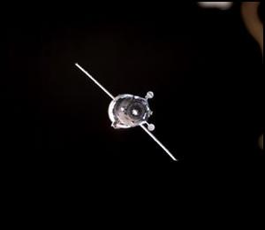
Progress M-49 / ISS
14P
| Spacecraft: |
Progress M (7K-TGM) No. 249 |
| Chronologies: |
2004 payload #21 ; 2004-019A ; 6241st spacecraft. |
| Type: |
Cargo delivery to the International Space
Station |
| Families: |
|
| Ranks: |
3424th Russian
spacecraft (1051st civilian) : |
| Sponsor: |
Russian's Federal Space Agency |
| Launch: |
25 May 2004 at 12h34 UTC, from Baykonur Cosmodrome's
LC-1, by a Soyuz-U. |
|
Source: NASA
|
Progress M-49 arrival (and depart) from
ISS, photos taken by Expedition 9 crew. (Photo: NASA)
| Orbit: |
Initial: 236 km x 246 km x 51.6°
x 89.3 min.
Circular at ~400 km x 51.6° |
| Dacayed: |
30 July 2004. |
| Mission: |
Progress-M 49 is a Russian cargo carrier
that carries 2.5 tonnes of supplies (including spacesuit Orlan-M No. 27),
water, food and fuel to the International Space Station (ISS). It docked
automatically with the Zvezda module of the ISS on 27 May 2004 at 13:55
UTC.
The Progress M-49 cargo ship undocked on
30 July 2004 at 6h05 UTC and carried out a deorbit burn at 10h39 UTC, leading
to reentry over the Pacific starting at 11h14 UTC. |
| Source: |
Jonathan
Space Report No. 527
& 532
; Spacewarn No. 607
; National Space Science Data Center's
2004-019A
; |
|
|
.
Kosmos 2405
| Spacecraft: |
US-PU |
| Chronologies: |
2004 payload #22 ; 2004-020A ; 6242nd spacecraft. |
| Type: |
Electronic intelligence |
| Families: |
|
| Ranks: |
3425th Russian
spacecraft (2373rd military) : |
| Sponsor: |
Russian Defense ministry |
|
|
|
.
Kosmos
2406
| Spacecraft: |
Tselina-2 |
| Chronologies: |
2004 payload #23 ; 2004-021A ; 6243rd spacecraft. |
| Type: |
Electronic intelligence |
| Families: |
|
| Ranks: |
3426th Russian
spacecraft (2375th military) : |
| Sponsor: |
Russian Defense ministry |
|
|
|
.
Intelsat
10-02
| Spacecraft: |
|
| Chronologies: |
2004 payload #24 ; 2004-022A ; 6244th spacecraft. |
| Type: |
Communications (multi-services) |
| Families: |
|
| Ranks: |
516th Commercial
spacecraft ; 727th geostationary
satellite ; |
| Sponsor: |
Intelsat |
| Launch: |
16 June 2004 at 22h27 UTC, from Baykonur
Cosmodrome's LC-200/39, by a Proton-M/Briz-Ml (Proton-M 53506 / Briz-M
88509). |
|
Source: Astrium
|
| Orbit: |
Geostationary at 359° East
(1° West longitude) |
| Mission: |
Intelsat 10-02 is a 3-tonne communications
spacecraft in the (recently privatized) Intelsat fleet that provides digital
broadcasting, telephone and broadband internet access to users in Europe,
Africa and the Middle East and, additionally, as far east as Asia (India)
and as far west as South and North America, through its 36 Ku-band and
70 C-band transponders. Built by EADS Astrium, it is the second Eurostar
E3000 model to be launched and is the largest Eurostar satellite built
to date as well as the largest and most powerful satellite ever ordered
by Intelsat. With a launch mass of 5,575 kg and a wingspan of 45-meter
once deployed in orbit, it is also one of the largest communications satellite
ever built. |
| Source: |
Jonathan
Space Report No. 528
& 536
; Spacewarn No. 608
; National Space Science Data Center's
2004-022A
; Astrium
; |
|
|
.
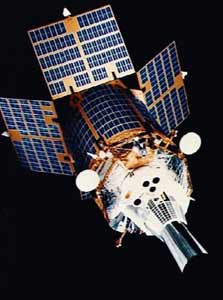
Navstar 51 (USA 178)
| Spacecraft: |
Navstar SVN 60 / GPS 2R-12 |
| Chronologies: |
2004 payload #25 ; 2004-023A ; 6245th spacecraft. |
| Type: |
Navigation |
| Families: |
55th Navstar |
| Ranks: |
1688th American
spacecraft (1099th military) ; |
| Sponsor: |
U.S. Department of Defense |
| Launch: |
23 June 2004 at 22h54 UTC, from Cape Canaveral's
SLC-17B, by a Delta 7925. |
|
|
|
..
Telstar 18 / Apstar
5
| Spacecraft: |
|
| Chronologies: |
2004 payload #26 ; 2004-024A ; 6246th spacecraft. |
| Type: |
Communications (multi-services) |
| Families: |
|
| Ranks: |
517th Commercial
spacecraft ; 728th geostationary
satellite ; |
| Sponsor: |
Loral Skynet & APT Satellite Inc. |
| Launch: |
29 June 2004 at 3h59 UTC, from Odyssey Launch
Platform, by a Zenit-3SL. |
|
 |
| Orbit: |
Geostarionary at 138° East
longitude |
| Mission: |
Telstar 18/Apstar 5 provides Ku-band voice,
video and data services to China, Hawaii and East Asia, and C-band services
to other parts of the Asia-Pacific region, including Australia and Hawaii.
The satellite is also used to provide space-based Internet backbone services
for the main cities of Asia to and from the U.S. through Hawaii. Part of
the spacecraft payload is operated by Loral Skynet, which calls the satellite
Telstar 18. Another part of the payload is operated by APT Satellite Inc.,
of Hong Kong,, which calls it Apstar 5. (In consideration for funding a
portion of the satellite projects cost, APT initially acquires use of
68.5% of Telstar 18s capacity for Apstar V services. The number of transponders
used by APT will be reduced over time, ultimately to 54% of the satellites
capacity.) The spacecraft replace the aging Apstar
1 satellite at its geostationary orbital. It is a high-powered
C/Ku-band hybrid satellite based on Space Systems/Loral's LS-1300 platform.
It will have total beginning-of-life power of 10.6 kW with a separated
mass of approximately 4,845 kg, and 9.5 kW of end-of-life power. Built
by Space Systems/Loral (SS/L) and operated by Loral Skynet (both subsidiaries
of Loral Space & Communications), Telstar 18 carries a total of 54
active transponders, 16 high-power Ku-band transponders and 38 C-band transponders. |
| Launch: |
 Boeing
Sea Launch Zenit-3SL's second burn, intended to reach a 756 x 35929 km
orbit, shut down 54 seconds early, and the satellite only reached a 722
km x 21,618 km x 0.05° transfer orbit. "According to Sea Launch, the
spacecraft separated from the rockets upper stage prematurely and was
placed into a lower than expected transfer orbit, reports Loral Skynet.
However, current data indicates the satellite has sufficient on-board fuel
to bring it to its final orbital position and exceed its 13-year specified
life." Boeing
Sea Launch Zenit-3SL's second burn, intended to reach a 756 x 35929 km
orbit, shut down 54 seconds early, and the satellite only reached a 722
km x 21,618 km x 0.05° transfer orbit. "According to Sea Launch, the
spacecraft separated from the rockets upper stage prematurely and was
placed into a lower than expected transfer orbit, reports Loral Skynet.
However, current data indicates the satellite has sufficient on-board fuel
to bring it to its final orbital position and exceed its 13-year specified
life." |
| Source: |
Jonathan
Space Report No. 530
; Spacewarn No. 608
; National Space Science Data Center's
2004-024A
; Loral Skynet
: APSTAR : |
|
|
.
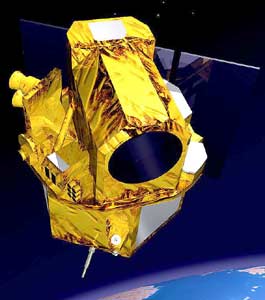
Demeter
| Spacecraft: |
Detection of Electro-Magnetic
Emissions Transmitted from Earthquake Regions |
| Chronologies: |
2004 payload #27 ; 2004-025C ; 6247th spacecraft. |
| Type: |
Earth sciences |
| Families: |
|
| Ranks: |
241st European
spacecraft ; |
| Sponsor: |
France's CNES |
| Launch: |
29 June 2004 at 6h30 UTC, from Baykonur Cosmodrome's
LC-109, by a Dnepr. |
|
Source: CNES
|
| Orbit: |
696 km x 722 km x 98.3° |
| Mission: |
DEMATER is a French minisatellite (125 kg)
that monitors the electromagnetic activity in the ionosphere during and
after earthquakes. The scientific satellite measures electrical effects
generated by seismic events, it studies the ionospheric disturbances related
to seismic activity, the ionospheric disturbances related to human activity,
the pre- and post-seismic effects in the ionosphere that contribute to
understand the mechanisms generating those disturbances, and give global
information on the Earth's electromagnetic environment at the satellite
altitude. This 100-kg spacecraft is the first project in the Centre National
d'Études Spatiales' microsatellite series. |
| Launch: |
 |
 The
Dnepr upper stage releases eight payloads while still firing
successively Demeter, Saudisat-2, SaudiComsat-1, Latinsat-C, SaudiComsat-2,
Unisat-3, Amsat-Echo and Latinsat-D and so
they ended up in orbits with 698 km perigees and apogees increasing in
order of separation time. At left, the Dnepr launch and, at right, the
8-satellite payload. (Photos: AMSAT).
According to Spacewarn,
Celestis 04/SL-24 (2004-25B) is just a monitor that was attached to the
final stage of the Dnieper booster to log the performance of that stage. The
Dnepr upper stage releases eight payloads while still firing
successively Demeter, Saudisat-2, SaudiComsat-1, Latinsat-C, SaudiComsat-2,
Unisat-3, Amsat-Echo and Latinsat-D and so
they ended up in orbits with 698 km perigees and apogees increasing in
order of separation time. At left, the Dnepr launch and, at right, the
8-satellite payload. (Photos: AMSAT).
According to Spacewarn,
Celestis 04/SL-24 (2004-25B) is just a monitor that was attached to the
final stage of the Dnieper booster to log the performance of that stage. |
|
| Source: |
Jonathan
Space Report No. 530
; Spacewarn No. 609
; National Space Science Data Center's
2004-025C
; CNES : |
|
|
.
SaudiSat-2
| Spacecraft: |
|
| Chronologies: |
2004 payload #28 ; 2004-025F ; 6248th spacecraft. |
| Type: |
Earth remote sensing |
| Families: |
|
| Ranks: |
|
| Sponsor: |
Saudi Arabia's KACST (King Abdulaziz City
for Science & Technology) |
| Launch: |
29 June 2004 at 6h30 UTC, from Baykonur Cosmodrome's
LC-109, by a Dnepr. |
|
 |
| Orbit: |
699 km x 734 km x 98.3° |
| Mission: |
Saudisat 2 is a Saudi Arabian scientific
satellite. The 30-kg spacecraft is designed to perform some experimental
technologies that includes taking images with resolution better than 15
meter for remote sensing. The orbit is sun synchronized at 700 km. The
Saudi Laser Station, part of the Space Research Institute, is going to
track the satellite with high accuracy of 3 to 1,000 meters. |
| Source: |
Jonathan
Space Report No. 530
; Spacewarn No. 609
; National Space Science Data Center's
2004-025F
; KACST : |
|
|
.
SaudiComsat-1
| Spacecraft: |
|
| Chronologies: |
2004 payload #29 ; 2004-025D ; 6249th spacecraft. |
| Type: |
Communications (data relay) |
| Families: |
|
| Ranks: |
518th Commercial
spacecraft ; |
| Sponsor: |
Saudi Arabia's KACST (King Abdulaziz City
for Science & Technology) |
| Launch: |
29 June 2004 at 6h30 UTC, from Baykonur Cosmodrome's
LC-109, by a Dnepr. |
|
 |
| Orbit: |
699 km x 749 km x 98.3° |
| Mission: |
SaudiComsat 1 is an experimental communications
satellite. Together with SaudiComsat 2, it
is the first generation of low-orbit micro-communication satellites (12
kg each) for commercial use (store and forward messagery). They are among
24 satellites planed to be launched in the future with different orbits
to cover large parts of the world. |
| Source: |
Jonathan
Space Report No. 530
; Spacewarn No. 609
; National Space Science Data Center's
2004-025D
; KACST : |
|
|
.
LatinSat C / Aprizesat-1
| Spacecraft: |
|
| Chronologies: |
2004 payload #30 ; 2004-025G ; 6250th spacecraft. |
| Type: |
Communications (data relay) |
| Families: |
|
| Ranks: |
519th Commercial
spacecraft ; |
| Sponsor: |
SpaceQuest/Aprize Argentina |
| Launch: |
29 June 2004 at 6h30 UTC, from Baykonur Cosmodrome's
LC-109, by a Dnepr. |
| Orbit: |
699 km x 765 km x 98.3° |
|
 Source: Aprizesat
 |
| Mission: |
Aprize Satellite Inc. is developing
a low-cost wireless network that will provide asset tracking and data-monitoring
services worldwide. These Aprizesat satellites will allow the company to
evaluate the operational performance and end-to-end reliability of the
Aprize monitoring device and customer data distribution system for U.S.
applications. Aprize plans to deploy a constellation of up to 24 satellites
to provide low-cost data tracking and monitoring services worldwide. The
cost of the Aprize satellites is approximately one-tenth of what it would
cost other satellite companies to deploy a similar system. |
| Source: |
Jonathan
Space Report No. 530
; Spacewarn No. 609
; National Space Science Data Center's
2004-025G
; Aprizesat
: |
|
|
.
SaudiComsat-2
| Spacecraft: |
|
| Chronologies: |
2004 payload #31 ; 2004-025E ; 6251st spacecraft. |
| Type: |
Communications (data relay) |
| Families: |
|
| Ranks: |
520th Commercial
spacecraft ; |
| Sponsor: |
Saudi Arabia's KACST (King Abdulaziz City
for Science & Technology) |
| Launch: |
29 June 2004 at 6h30 UTC, from Baykonur Cosmodrome's
LC-109, by a Dnepr. |
|
|
| Orbit: |
698 km x 782 km x 98.3° |
| Mission: |
SaudiComsat 2 is an experimental communications
satellite. Together with SaudiComsat 1, it
is the first generation of low-orbit micro-communication satellites (12
kg each) for commercial use (for store and forward messagery). Those satellite
are among 24 satellites planed to be launched in the future with different
orbits to cover large parts of the world. |
| Source: |
Jonathan
Space Report No. 530
; Spacewarn No. 609
; National Space Science Data Center's
2004-025E
; KACST : |
|
|
.
Unisat-3
| Spacecraft: |
|
| Chronologies: |
2004 payload #32 ; 2004-025H ; 6252nd spacecraft. |
| Type: |
Technology |
| Families: |
|
| Ranks: |
94th amateurs/students
spacecraft : |
| Sponsor: |
Italy |
| Launch: |
29 June 2004 at 6h30 UTC, from Baykonur Cosmodrome's
LC-109, by a Dnepr. |
|
Source: AMSAT |
|
.
AMSAT-Echo / OSCAR 51
(AO-51)
| Spacecraft: |
Amsat-Oscar E |
| Chronologies: |
2004 payload #33 ; 2004-025K ; 6253rd spacecraft. |
| Type: |
Communications (radio-amateur) |
| Families: |
|
| Ranks: |
95th amateurs/students
spacecraft : |
| Sponsor: |
SpaceQuest/AMSAT-NA |
| Launch: |
29 June 2004 at 6h30 UTC, from Baykonur Cosmodrome's
LC-109, by a Dnepr. |
|
Source: AMSAT |
|
.
Latinsat D / Aprizesat-2
| Spacecraft: |
|
| Chronologies: |
2004 payload #34 ; 2004-025A ; 6254th spacecraft. |
| Type: |
Communications (data relay) |
| Families: |
|
| Ranks: |
521st Commercial
spacecraft ; |
| Sponsor: |
SpaceQuest/Aprize Argentina |
| Launch: |
29 June 2004 at 6h30 UTC, from Baykonur Cosmodrome's
LC-109, by a Dnepr. |
| Orbit: |
695 km x 852 km x 98.3° |
|
Source: Aprizesat
|
| Mission: |
Latinsat D is an experimental
Argentinean communications satellite that provides messaging services sponsored
by Aprize Satellite Inc. which is developing a low-cost wireless network
that will provide asset tracking and data-monitoring services worldwide.
These Aprizesat satellites will allow the company to evaluate the operational
performance and end-to-end reliability of the Aprize monitoring device
and customer data distribution system for U.S. applications. Aprize plans
to deploy a constellation of up to 24 satellites to provide low-cost data
tracking and monitoring services worldwide. The cost of the Aprize satellites
is approximately one-tenth of what it would cost other satellite companies
to deploy a similar system. |
| Source: |
Jonathan
Space Report No. 530
; Spacewarn No. 609
; National Space Science Data Center's
2004-025A
; Aprizesat
; |
|
|
.
Aura
/ EOS Chemistry-1
| Spacecraft: |
|
| Chronologies: |
2004 payload #35 ; 2004-026A ; 6255th spacecraft. |
| Type: |
Earth sciences |
| Families: |
|
| Ranks: |
1689th American
spacecraft (590th civilian) ; |
| Sponsor: |
NASA |
| Launch: |
15 July 2004 at 10h02 UTC, from Vandenberg
Air Force Base's SLC-2W, by a Delta 7920. |
|
Source : NASA
|
| Orbit: |
673 km x 681 km x 98.2° |
| Mission: |
 Aura
is EOS Chemistry-1, the third large satellite in the Earth Observing System
series. This remote sensing satellite monitors ozone and related
molecules in the stratosphere and troposphere, as an extension of the previous
observations by UARS and TOMS missions. It carries an infrared radiometer
and spectrometer, an ultraviolet/visible ozone monitoring spectrometer
and a microwave sounder to study ozone and pollutants in the atmosphere.
Aura form part of the "A-Train", a constellation of remote sensing satellites
in the same afternoon-ascending-node, sun-synchronous, orbital plane providing
coordinated observations. Aqua
leads the A-train, with Aura trailing; smaller satellites will be launched
inbetween the two. The 2.97 tonne, 4.6 kW, 2.7 meters x 2.3 meters x 6.9
meters size satellite is built by Northrop Grumman Space Technology (formerly
TRW). Llaunch mass was 3,112 kg. Aura
is EOS Chemistry-1, the third large satellite in the Earth Observing System
series. This remote sensing satellite monitors ozone and related
molecules in the stratosphere and troposphere, as an extension of the previous
observations by UARS and TOMS missions. It carries an infrared radiometer
and spectrometer, an ultraviolet/visible ozone monitoring spectrometer
and a microwave sounder to study ozone and pollutants in the atmosphere.
Aura form part of the "A-Train", a constellation of remote sensing satellites
in the same afternoon-ascending-node, sun-synchronous, orbital plane providing
coordinated observations. Aqua
leads the A-train, with Aura trailing; smaller satellites will be launched
inbetween the two. The 2.97 tonne, 4.6 kW, 2.7 meters x 2.3 meters x 6.9
meters size satellite is built by Northrop Grumman Space Technology (formerly
TRW). Llaunch mass was 3,112 kg. |
| Source: |
Jonathan
Space Report No. 531;
Spacewarn
No. 609
; National Space Science Data Center's
2004-026A
; NASA : |
|
|
.
Anik F2
| Spacecraft: |
Anik means "little brother" in
the Inuit language. |
| Chronologies: |
2004 payload #36 ; 2004-027A ; 6256th spacecraft. |
| Type: |
Communications (multi-services) |
| Families: |
|
| Ranks: |
25th Canadian
spacecraft ; 729th
geostationary
satellite ; |
| Sponsor: |
Telesat Canada |
| Launch: |
18 July 2004 at 0h44 UTC, from Kourou Space
Center's ELA-3, by an Ariane 5G+ (Ariane 519, V163). |
|
Source : Boeing
|
| Launch: |
Geostationary at 111.1° West
longitude. |
| Mission: |
Anik F2 Anik F2 is a communications satellite
that provides broadband and telemedicine to northern US states and Canada.
The 5.95-tonne (with fuel), 16-kW, 7.3 meters x 3.8 meters x 3.4 meters
size satellite carries 38 Ka-band transponders, 32 Ku-band transponders
and 24 C-band transponders. It has a launch mass of 5,950 kg, a solar array
spanning 48 metres and spacecraft power of 15 kw at end of life. It provides
commercial services for an estimated 15 years, enabling access to two-way,
high-speed Internet services for consumers and businesses as well as providing
new capacity for a wide range of broadcasting and telecommunications services
across North America. It carries a xenon ion propulsion system for
orbit trims when needed. According to Telesat, Anik F2 is the worlds largest
commercial communications satellite and is also the first satellite to
fully commercialize the Ka frequency band. It represents Telesats fifteenth
successful satellite launch. |
| Source: |
Jonathan
Space Report No. 531
; Spacewarn No. 609
; National Space Science Data Center's
2004-027A
; Telesat
: Boeing
; |
|
|
.
Kosmos 2407
| Spacecraft: |
Parus (11F627) |
| Chronologies: |
2004 payload #37 ; 2004-028A ; 6257th spacecraft. |
| Type: |
Navigation |
| Families: |
|
| Ranks: |
3427th Russian
spacecraft (2376th military) : |
| Sponsor: |
Russian Defense ministry |
|
|
|
.
TC-2 / Tan Ce 2 / DSP-P
| Spacecraft: |
Double Star Program-Polar / Tan
Ce mest Explorer or Probe
( also known as Double Star 2, Explorer 2
and as Tan Ce 2 (TC 2)) |
| Chronologies: |
2004 payload #38 ; 2004-029A ; 6258th spacecraft. |
| Type: |
Earth upper atmosphere studies |
| Families: |
|
| Ranks: |
83rd Chinese
spacecraft ; |
| Sponsor: |
CNSA-ESA / Chinese National Space Administration/European
Space Agency |
|
|
| Launch: |
25 July 2004 at 7h05 UTC, from
Taiyuan Satellite Launch Center, by a Chang Zheng 2C/SM. |
| Orbit: |
682 km x 38,279 km x 90.1°
654 x 38,573 km x 90.0° (with apogee
over the Arctic Circle). |
| Mission: |
 Tan
Ce 2, a European-Chinese satellite, is the second joint mission of the
Double Star program. It is the second probe (polar) in this magnetospheric
research program, complementing the 28° equatorial Tan
Ce 1 and the four European Cluster
satellites in deeper Earth orbits. Tan Ce 2 has a mass of 343 kg. Alongside
with ESAs quartet of Cluster satellites, Tan Ce 1 and 2 closely studies
the interaction between the solar wind and the Earths magnetic field.
They provide the most detailed view to date. The positions and orbit of
the Double Star satellites have been carefully defined to enable exploration
of the magnetosphere on a larger scale than is possible with Cluster alone.
The duo are much closer to Earth, TC-1 being in an elliptical orbit (550
x 63,780 Tan
Ce 2, a European-Chinese satellite, is the second joint mission of the
Double Star program. It is the second probe (polar) in this magnetospheric
research program, complementing the 28° equatorial Tan
Ce 1 and the four European Cluster
satellites in deeper Earth orbits. Tan Ce 2 has a mass of 343 kg. Alongside
with ESAs quartet of Cluster satellites, Tan Ce 1 and 2 closely studies
the interaction between the solar wind and the Earths magnetic field.
They provide the most detailed view to date. The positions and orbit of
the Double Star satellites have been carefully defined to enable exploration
of the magnetosphere on a larger scale than is possible with Cluster alone.
The duo are much closer to Earth, TC-1 being in an elliptical orbit (550
x 63,780  km)
where it will operates for 18 months, ans TC-2 being in polar orbit (700
x 39,000 km) where it will operates for 12 months. One example of the coordinated
activity between these satellites is the study of the substorms that produce
aurorae. The exact region where these emissions of brightness form is still
unclear, but the simultaneous high-resolution measurements combined under
these two missions are expected to provide an answer. TC-1 is already returning
a wealth of scientific data. Back in January 2004, Cluster and TC-1 tracked
a coronal mass ejection from the Sun and gathered valuable data about the
Earth's bow shock. (The launch of TC 2 took place one day earlier than
schedule in order to avoid adverse weather conditions expected in the days
to come.) km)
where it will operates for 18 months, ans TC-2 being in polar orbit (700
x 39,000 km) where it will operates for 12 months. One example of the coordinated
activity between these satellites is the study of the substorms that produce
aurorae. The exact region where these emissions of brightness form is still
unclear, but the simultaneous high-resolution measurements combined under
these two missions are expected to provide an answer. TC-1 is already returning
a wealth of scientific data. Back in January 2004, Cluster and TC-1 tracked
a coronal mass ejection from the Sun and gathered valuable data about the
Earth's bow shock. (The launch of TC 2 took place one day earlier than
schedule in order to avoid adverse weather conditions expected in the days
to come.) |
| Source: |
Jonathan
Space Report No. 531
& 532
; Spacewarn No. 609
; National Space Science Data Center's
2004-029A
; ESA
; |
|
|
.
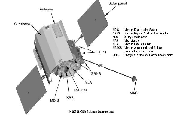
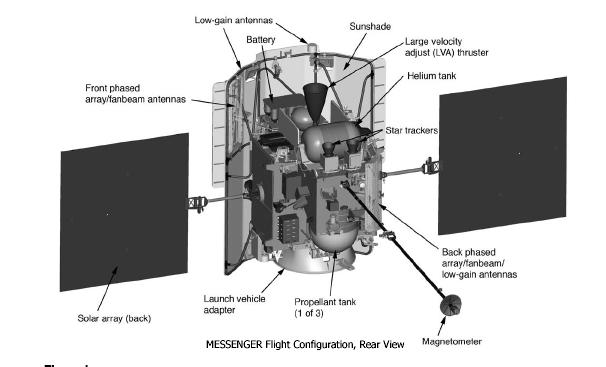
MESSENGER
| Spacecraft: |
MESSENGER stands for MErcury
Surface, Space ENvironment, GEochemistry, and Ranging. |
| Chronologies: |
2004 payload #39 ; 2004-030A ; 6259th spacecraft. |
| Type: |
Mercury probe |
| Families: |
Discovery-7 mission |
| Ranks: |
1690th American
spacecraft (591st civilian) ; |
| Sponsor: |
NASA / Johns Hopkins University's APL |
| Launch: |
3 August 2004 at 6h16 UTC, from Cape Canaveral
Air Force Station's LC-17B, by a Delta II 7925H. |
|

Source: NASA
|
| Orbit: |
Heliocentric (inner Solar system),
initial: 0.92 x 1.08 AU x 6.4°
Mercury's initial orbit: 200 km x 15,193
km x 80° x 12 hr. |
|
|
| Mission: |
MESSENGER, the second probe launched to study
the planet Mercury (after
Mariner
10), will conduct an in-depth study of the Suns closest neighbor.
Carrying seven scientific instruments, the probe will provide the first
images of the entire planet and collect detailed information on the composition
and structure of Mercurys crust, its geologic history, the nature of its
thin atmosphere and active magnetosphere, and the makeup of its core and
polar materials. MESSENGER pass lunar orbit on 4 Auigust 2004 at 6h00 UTC
and leave the Earth's sphere of influence on 5 August 2004 at around 18h00
UTC. But, before arriving at Mercury in March 2011, MESSENGER will perform
a 7.9-billion kilometer journey through the inner Solar system that includes
15 loops around the Sun, It will past Earth once (in August 2005), Venus
twice (in October 2006 and June 2007) and Mercury three times (in January
2008, October 2008 and September 2009) before easing into orbit around
its target planet.
After 6½
years and 7.9 billions kilometres of flight around the Sun, MESSENGER became
the first spacecraft ever to entere Mercury's orbit on 18 March 2011. The
orbit
insertion burn began at 0h45 UT and was completed
at 01h00 UT. |
| Source: |
Jonathan
Space Report No. 532,
640
; Spacewarn No. 610
; National Space Science Data Center's
2004-030A
; NASA's MESSENGER
; Astronomy Now's 18
Marc 10 ; NASA's 2010-2014
NASA News Releases ; Spaceflight Now's 2014
Stories, ; |
|
|
.
Amazonas 1
| Spacecraft: |
|
| Chronologies: |
2004 payload #40 ; 2004-031A ; 6260th spacecraft. |
| Type: |
Communications (multi-services) |
| Families: |
|
| Ranks: |
242nd European
spacecraft ; 730th geostationary
satellite ; |
| Sponsor: |
Spain's Hispasat |
| Launch: |
4 August 2004 at 22h32 UTC, from Baykonur
Cosmodrome, by a Proton M Breeze M (Proton-M 53507 / Briz-M 88508). |
|
 |
| Orbit: |
Geostationary at 61° West
longitude. |
| Mission: |
Amazonas is a Spanish communications satellite
that provides broad-band video and internet services to the North and South
American continents and western Europe. With 51 transponders, the Amazonas
Latin American satellite provides a full range of telecommunications services
to Brazil, North and South America, and a transatlantic link for Europe.
It provide both fixed and broadcast communications services through 32
transponders in Ku-band and 19 transponders in C-band, over a 17.5-year
mission lifetime. The services offered includes TV broadcasting, business
services (including VSAT) and data broadcasting. The spacecraft had a launch
mass of 4,545 kg, a solar array span of 35 metres and a spacecraft power
of more than 9.5 kW at end of life. It is the fifth and most powerful satellite
launched for the Spanish telecommunications satellite organisation Hispasat
and it is built by EADS Astrium. |
| Source: |
Jonathan
Space Report No. 532
& 536
; Spacewarn No. 610
; National Space Science Data Center's
2004-031A
; EADS
Astrium : |
|
|
.
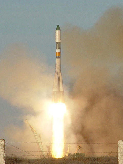
Progress M-50 / ISS
15P
| Spacecraft: |
Progress M (7K-TGM) No. 250 |
| Chronologies: |
2004 payload #41 ; 2004-032A ; 6261st spacecraft. |
| Type: |
Cargo delivery to the International Space
Station |
| Families: |
|
| Ranks: |
3428th Russian
spacecraft (1052nd civilian) : |
| Sponsor: |
Russian's Federal Space Agency |
| Launch: |
11 August 2004 at 5h03 UTC, from Baykonur
Cosmodrome's LC-1, by a Soyuz-U. |
|
 Photo: NASA
|
|
Progress M-50 processing at the Baikonur
cosmodrome. (Photos :
Energia)
|
| Orbit: |
354 km x 378 km x 51.6° x 91.6 min |
| Reentry |
23 December 2004 |
| Mission: |
  Progress-M
50 is a Russian cargo carrier that delivers almost three tons of food,
fuel, oxygen, water and supplies to the residents of the International
Space Station. Its refueling propellants compartment accommodates 442 kg
of fuel, 28 kg of oxygen, 21 kg of air and 420 kg of potable water. Its
cargo bay contains some 1.4 tons of dry cargoes: food products, equipment
and facilities for the station onboard systems, medical equipment, underclothes,
personal hygiene and individual protection aids, sets of onboard documentation,
video and photographic materials, parcels for crewmembers, structural members,
payloads for the USOS, equipment and materials for conducting space experiments.
(The spacecraft was launched at 9 hours 3 minutes 7 seconds Moscow Time.)
The cargoship docked with Zvezda on 14 August 2004 at 5h01 UTC. The resupply
vehicle docked to the axial docking port of Zvezda on 14 August 2004 at
5h01 UTC. On 22 December 2004, Progress M-50 cleared the docking
port of ISS at 19h34 UTC.and, following a controllable de-orbit in the
assigned area of the Pacific Ocean, the vehicle was burned. It was deorbited
over the Pacific at 22h32 UTC. Progress-M
50 is a Russian cargo carrier that delivers almost three tons of food,
fuel, oxygen, water and supplies to the residents of the International
Space Station. Its refueling propellants compartment accommodates 442 kg
of fuel, 28 kg of oxygen, 21 kg of air and 420 kg of potable water. Its
cargo bay contains some 1.4 tons of dry cargoes: food products, equipment
and facilities for the station onboard systems, medical equipment, underclothes,
personal hygiene and individual protection aids, sets of onboard documentation,
video and photographic materials, parcels for crewmembers, structural members,
payloads for the USOS, equipment and materials for conducting space experiments.
(The spacecraft was launched at 9 hours 3 minutes 7 seconds Moscow Time.)
The cargoship docked with Zvezda on 14 August 2004 at 5h01 UTC. The resupply
vehicle docked to the axial docking port of Zvezda on 14 August 2004 at
5h01 UTC. On 22 December 2004, Progress M-50 cleared the docking
port of ISS at 19h34 UTC.and, following a controllable de-orbit in the
assigned area of the Pacific Ocean, the vehicle was burned. It was deorbited
over the Pacific at 22h32 UTC. |
|
Processing of Progress M-50 and its launcher
at Baikonur. (Photos : Energia)
|
| Source: |
Jonathan
Space Report No.533
& 541
; Spacewarn No. 610
; National Space Science Data Center's
2004-032A
; Energiay
RSC :PR-24
Dec 04,; |
|
|
.
FSW
3-2
| Spacecraft: |
Fanhuishi Shiyan Weixing |
| Chronologies: |
2004 payload #42 ; 2004-033A ; 6262nd spacecraft. |
| Type: |
|
| Families: |
84th Chinese
spacecraft ; |
| Ranks: |
Reconnaissance |
| Sponsor: |
China |
|
|
| Launch: |
29 August 2004 at 7h50 UTC, from
Jiuquan Satellite Launch Center, by a Chang Zheng-2C. |
| Orbit: |
165 km x 490 km x 63.0° x 91 min. |
| Recovered: |
24 September 2004 at 23h55 UTC |
| Mission: |
FSW-3 2 is a Chinese recoverable imaging
satellite that provides mapping and land surveying data.. It is the 19th
launch of such recoverable satellites. It is expected to return a capsule
to Earth after 27 days in space. It has the highest apogee of any
FSW series flight. |
| Notes: |
Surprinzingly, this mission used the
CZ-2C rather than the beefed-up CZ-2D which was used for the last three
FSW launches. The CZ-2C was used for the older FSW-1 model, rather than
the more modern FSW-2 and JB-4 models. It could be that the CZ-2C
is one of the stretched ones left over from the Iridium program, and may
have a larger payload capacity.. |
| Source: |
Jonathan
Space Report No. 534
& 536
; Spacewarn No. 611
& 613
; National Space Science Data Center's
2004-033A
; |
|
|
.
NROL-1
(USA 179)
| Spacecraft: |
|
| Chronologies: |
2004 payload #43 ; 2004-034A ; 6263rd spacecraft. |
| Type: |
Communications (data relay) |
| Families: |
|
| Ranks: |
1691st American
spacecraft (1100th military) ; |
| Sponsor: |
U.S. National Reconnaissance Office |
| Launch: |
31 August 2004 at 23h17 UTC, from Cape Canaveral's
LC-36, by an Atlas IIAS (AC-167). |
|
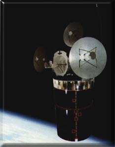 Source: NRO
|
| Orbit: |
~400 x ~40,000 km x 63° |
| Mission: |
 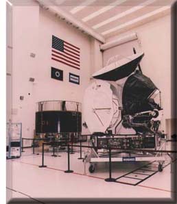 The
satellite is reported to provide relay services to the several low-altitude,
high-latitude photo-reconnaissance satellites, from its high apogee in
the northern hemisphere. The launch was given the codename NROL-1, and
the USA 179 satellite is the second elliptical orbit NRO Atlas launch,
following
Capricorn
in Jannuary 1998. Two geostationary NRO Atlas launches ("Great
Bear" in December 2000 and "Aquila"
in October 2001) might be part of the same data relay satellite series.
Note that the three photos above depicted, according to NRO,
"views of a communications relay satellite" (s that NROL-1?). The
satellite is reported to provide relay services to the several low-altitude,
high-latitude photo-reconnaissance satellites, from its high apogee in
the northern hemisphere. The launch was given the codename NROL-1, and
the USA 179 satellite is the second elliptical orbit NRO Atlas launch,
following
Capricorn
in Jannuary 1998. Two geostationary NRO Atlas launches ("Great
Bear" in December 2000 and "Aquila"
in October 2001) might be part of the same data relay satellite series.
Note that the three photos above depicted, according to NRO,
"views of a communications relay satellite" (s that NROL-1?). |
| Launch: |
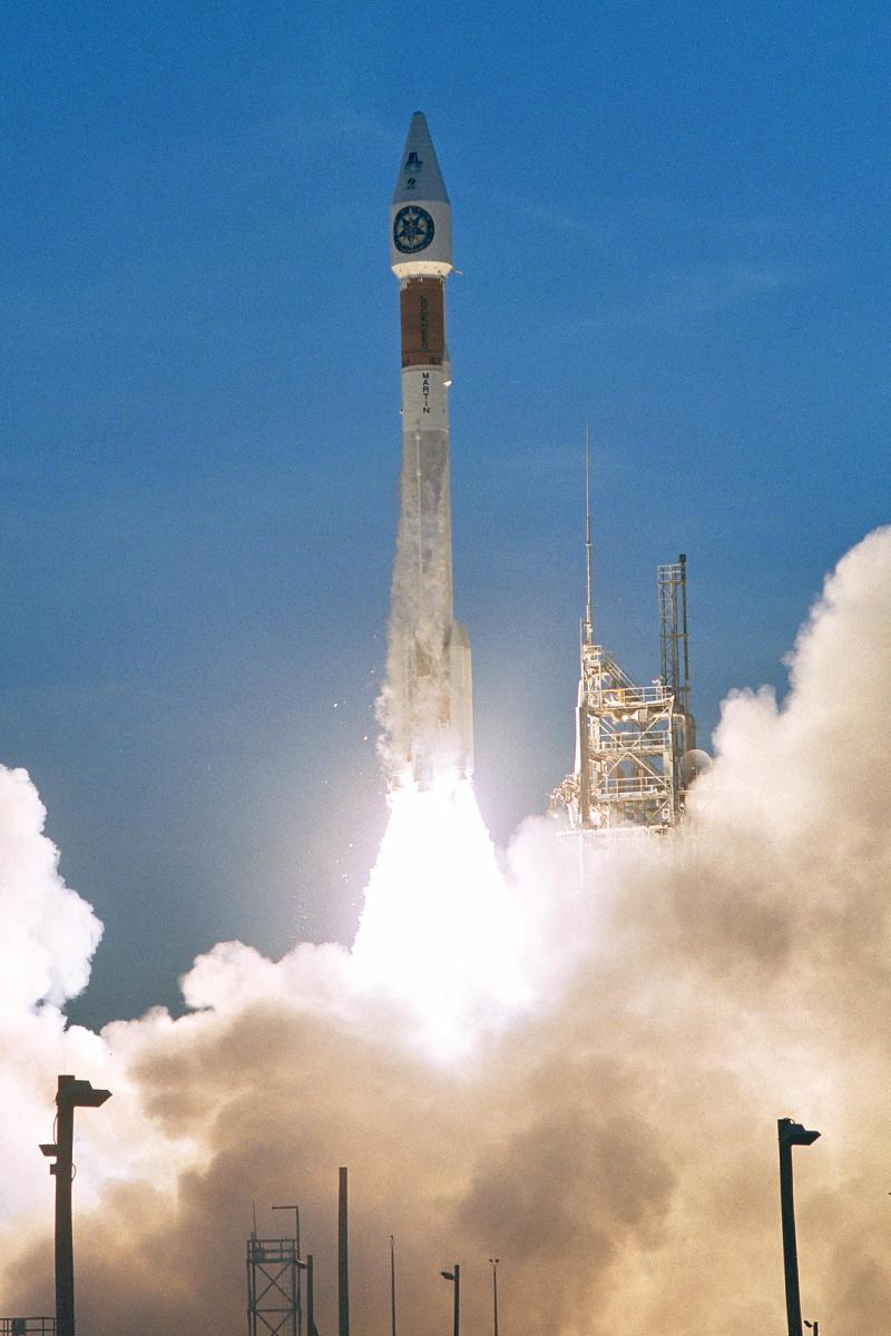 This
is the final launch for the Atlas 2, capping 13 years of service for the
Lockheed Martin-built booster with a 100 percent success rate. The flight
also marked the last time a rocket would liftoff from pad 36A at Cape Canaveral,
after 42 years of services and 69 launches, This
is the final launch for the Atlas 2, capping 13 years of service for the
Lockheed Martin-built booster with a 100 percent success rate. The flight
also marked the last time a rocket would liftoff from pad 36A at Cape Canaveral,
after 42 years of services and 69 launches,
This launch was the fifth attempt in as many
days for the classified NROL-1 satellite. Battery concerns with the spacecrafts
booster scrubbed its first Aug. 27 attempt, then the inadvertent venting
of 10,000 pounds of liquid oxygen fuel led to a second scrub 24 hours later.
Poor weather grounded two additional launch attempts before today's space
shot.
Note that reports
from observers indicate that the Centaur AC-167 rocket is in a lower apogee
orbit than anticipated, around 255 x 15370 km x 57.4°. A prelaunch
announcement that the Centaur would deliver the payload to an 'ascent trajectory'
suggests that this is the intended transfer orbit (rather than a failure)
and the payload will probably use (or has already used) an onboard engine
to reach a final orbit which it is expect to have an apogee of around 39000
km. |
| Source: |
Jonathan
Space Report No. 534&
535
; Spacewarn No. 611
; National Space Science Data Center's
2004-034A
; ILS
and also
; |
|
|
.
'Ofeq
6
| Spacecraft: |
|
| Chronologies: |
2004 payload #44 ; 2004 1st loss ; 6264th
spacecraft. |
| Type: |
Reconnaissance |
| Families: |
|
| Ranks: |
9th Isrealian
spacecraft ; 684th failure ; |
| Sponsor: |
Israel Defense ministry |
|
|
| Launch: |
6 September 2004 at 10h53 UTC,
from Palmachim, by a Shavyit . |
| Orbit: |
n/a |
| Mission: |
The 'Ofeq-6 spy satellite failed to reach
orbit. According to the Jerusalem Post, the third stage of the Shavyit
launch vehicle failed to operate and the payload fell in the Mediterranean.
The launch time was reported as 13h53 local. The lower two stages separated
and at 11h02 UTC and 260 km high the AUS-51 third stage was meant to fire
for 92 seconds to put the satellite in a retrograde 260 km x 770 km x 143.5°
orbit. (Most countries launch east to gain energy from the Earth's rotation,
but Israel launches west over the Mediterranean to avoid misunderstandings
with its eastern neighbours.) Without the third stage burn, the vehicle
would have impacted around 11h06 UTC, probably somewhere south of Crete. |
| Source: |
Jonathan
Space Report No. 534
; |
|
|
.
SJ-6A / Shi Jian 6A
| Spacecraft: |
|
| Chronologies: |
2004 payload #45 ; 2004-035A ; 6265th spacecraft. |
| Type: |
Earth sciences |
| Families: |
|
| Ranks: |
85th Chinese
spacecraft ; |
| Sponsor: |
China |
|
|
|
.
SJ-6B / Shi Jian 6B
| Spacecraft: |
|
| Chronologies: |
2004 payload #46 ; 2004-035B; 6266th spacecraft. |
| Type: |
Earth sciences |
| Families: |
|
| Ranks: |
86th Chinese
spacecraft ; |
| Sponsor: |
China |
|
|
| Launch: |
8 September 2004 at 23h14 UTC,
from Taiyuan Satellite Launch Center, by a Chang Zheng Initial : 590 km
x 602 km x 97.7°4B |
| Orbit: |
Initial: 590 km x 602 km x 97.7°
Circular at 602 km x 97.7° x 96.6 min |
| Mission: |
SJ 6A and SJ 6B are two Chinese space radiation
monitoring satellites. |
| Source: |
Jonathan
Space Report No. 535
; Spacewarn No. 611
; National Space Science Data Center's
2004-035B
; |
|
|
.
EDUSAT / GSAT-3
| Spacecraft: |
|
| Chronologies: |
2004 payload #47 ; 2004-036A ; 6267th spacecraft. |
| Type: |
Communications |
| Families: |
|
| Ranks: |
39th Indian
spacecraft ; 731st
geostationary
satellite ; |
| Sponsor: |
India's ISRO / Indian Space Research Organization |
|
|
| Launch: |
20 September 2004 at 10h31 UTC,
from Satish Dhawan Space Center (Sriharikota), by a GSLV (F04 / GSLV-F-01). |
| Orbit: |
Geostationary at 74° East longitude. |
| Mission: |
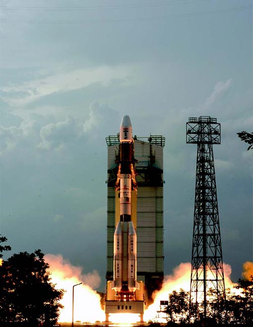 Edusat
is a 2.0-tonne, 2.0-kW satellite that provides interactive educational
programs to thousands of schools in different linguistic regions via five
spot-beams from its five Ku-band transponders, and via wider beams from
six extended C-band transponders. The satellite is 2.4 x 1.6-meter across
at launch with a 10.9-meter span across the deployed solar panels, (It
is a 820-kg satellite carrying 1,130 kg of propellant.) It is the fourth
launch of the GSLV rocket which carries a Russian-made motor on its cryogenic
third stage. Edusat
is a 2.0-tonne, 2.0-kW satellite that provides interactive educational
programs to thousands of schools in different linguistic regions via five
spot-beams from its five Ku-band transponders, and via wider beams from
six extended C-band transponders. The satellite is 2.4 x 1.6-meter across
at launch with a 10.9-meter span across the deployed solar panels, (It
is a 820-kg satellite carrying 1,130 kg of propellant.) It is the fourth
launch of the GSLV rocket which carries a Russian-made motor on its cryogenic
third stage. |
| Source: |
Jonathan
Space Report No. 535
; Spacewarn No. 611
; National Space Science Data Center's
2004-036A
; |
|
|
.
Kosmos 2408
| Spacecraft: |
Strela-3 |
| Chronologies: |
2004 payload #48 ; 2004-037A ; 6268th spacecraft. |
| Type: |
Communications |
| Families: |
|
| Ranks: |
3429th Russian
spacecraft (2377th military) : |
| Sponsor: |
Russia Desenfe ministry |
|
|
| Launch: |
23 September 2004 at 15h07 UTC,
from Plesetsk Cosmodrome, by a Kosmos 3M. |
| Orbit: |
1470 km x 1495 km x 82.5°
1468 km x 1490 km x 82.5° x 116 min. |
| Mission: |
These two military communications spacecrafts
were the 127th and 128th Strela-3 satellites to be launched. Strela-3 missions
launched from 1985 to 2001 went into lower 1400 x 1420 km orbits in groups
of 6 aboard Tsiklon-3 rockets, but the switch to launching in pairs aboard
Kosmos-3M rockets in 2002 also saw a transition to the slightly higher
orbit, with one pair being launched each year. |
| Source: |
Jonathan
Space Report No. 535
& 536
; Spacewarn No. 611
; National Space Science Data Center's
2004-037A
; |
|
|
.
Kosmos 2409
| Spacecraft: |
Strela-3 |
| Chronologies: |
2004 payload #49 ; 2004-037B ; 6269th spacecraft. |
| Type: |
Military communications |
| Families: |
|
| Ranks: |
3430th Russian
spacecraft (2378th military) : |
| Sponsor: |
Russian Desenfe ministry |
|
|
| Launch: |
23 September 2004 at 15h07 UTC,
from Plesetsk Cosmodrome, by a Kosmos 3M. |
| Orbit: |
1470 km x 1495 km x 82.5°
1468 km x 1490 km x 82.5° x 116 min. |
| Mission: |
These two military communications spacecrafts
were the 127th and 128th Strela-3 satellites to be launched. Strela-3 missions
launched from 1985 to 2001 went into lower 1400 x 1420 km orbits in groups
of 6 aboard Tsiklon-3 rockets, but the switch to launching in pairs aboard
Kosmos-3M rockets in 2002 also saw a transition to the slightly higher
orbit, with one pair being launched each year. |
| Source: |
Jonathan
Space Report No. 535
& 536;
Spacewarn
No. 611
; National Space Science Data Center's
2004-037B
; |
|
|
.
Kosmos 2410
| Spacecraft: |
Kobal't / Yantar'-4KS2 |
| Chronologies: |
2004 payload #50 ; 2004-038A ; 6270th spacecraft. |
| Type: |
Reconnaissance |
| Families: |
|
| Ranks: |
3431st Russian
spacecraft (2379th military) : |
| Sponsor: |
Russian Defense ministry |
|
|
| Launch: |
24 September 2004 at 16h50 UTC,
from Plesetsk Cosmodrome's LC-16, by a Soyuz-U. |
| Orbit: |
Initial: 165 km x 358 kmx 67.7°
162 km x 332 km x 67° x 89 min. |
| Recovered: |
9 January 2005 |
| Mission: |
Kosmos 2410 initial orbit is typical of Kobal't
(Yantar'-4KS2) reconnaissance satellites, but the later orbit is higher
than usual. The orbit decayed to 159 km x 312 km by 1st October 2004, when
it raised to 213 km x 330 km. On 15 October, the orbit was 206 km x 304
km. This is consistent with press reports that the new satellite is an
improved Kobal't with a longer orbital lifetime. The spacecraft was developed
by the TsSKB-Progress design bureau and the Arsenal production plant. The
old version of the satellite had a main reentry vehicle and two small SpK
recoverable film capsules; it's not clear if the new version carries extra
capsules as originally planned in the mid-1990s. Another variant, the 17F12
Don, which had 8 small capsules and a 4 month duration, was last launched
in 2003 from Baykonur and
uses a very similar orbit to Kosmos 2410; if it wasn't for the press reports
claiming this was a new vehicle, it would have identified this as the first
Plesetsk-launched Don mission.
The test flight of the
improved Kobal't spy satellite came to an end after 107 days, about half
its expected lifetime. The main recovery vehicle was deorbited from its
orbit around 7h00 UTC on 9 January 2005 and is presumed to have landed
in Russia around 7h20 UTC, but has not been found by Russian forces. Two
objects were ejected from the satellite on 8 January into low orbits
and reentered within a day; they may have been unused small film recovery
capsules, two of which were carried on earlier Kobal't models. |
| Source: |
Jonathan
Space Report No. 536
& 544
; Spacewarn No. 611
; National Space Science Data Center's
2004-038A
; |
|
|
.
FSW 3-3
| Spacecraft: |
Fanhui Shei Weixing. |
| Chronologies: |
2004 payload #51 ; 2004-039A ; 6271st spacecraft. |
| Type: |
Reconnaissance. |
| Families: |
|
| Ranks: |
87th Chinese
spacecraft ; |
| Sponsor: |
China |
|
|
| Launch: |
27 September 2004 at 8h00 UTC,
from Jiuquan Satellite Launch Center, by a Chang Zheng 2D. |
| Orbit: |
201 km x 315 km x 63° x 89.8 min. |
| Recovered: |
15 October 2004 at 2h48 UTC |
| Mission: |
FSW 3 is a recoverable, photo-imaging spacecraft
It is reportsd that the satellite was "used in scientific research, geological
surveying and mapping". This is the 20th launch of such recoverable satellites.
The spacecraft was placed into a 205 km x 297 km x 63.0° orbit and
raised its apogee the next day to 206 km x 320 km. In comparison, FSW
19, which was launched on 29 August 2004, was in a 167 km x 553 km
x 63.0° orbit; analysts have assumed both are FSW type 3 (JB-4) models,
but it is not sure, perhaps one is a leftover FSW-2 model.
The spacecraft recoverable
capsule returned to Earth on 15 October 2004, falling through the roof
of a house in the village of Penglai, Sichuan province. |
| Source: |
Jonathan
Space Report No. 536
& 537
; Spacewarn No. 611
& 613
; National Space Science Data Center's
2004-039A
; |
|
|
..
Soyuz TMA-5 / ISS 9S
| Spacecraft: |
Soyuz 11F732 No. 215 |
| Chronologies: |
2004 payload #52 ; 2004-040A ; 6272nd spacecraft. |
| Type: |
Piloted spaceship |
| Families: |
|
| Ranks: |
3432nd Russian
spacecraft (1053rd civilian) : |
| Sponsor: |
Russian Federal Space Agency |
|
|
| : |
The Soyuz TMA-5 preparations at Baykonur
Cosmodrome. (Photos:
RSC
Energiya)
|
| Launch |
14 October 2004 at 3h06 UTC, from Baykonur
Cosmodrome's LC-1, by a Soyuz-FG. |
| Orbit: |
Initial: 238.1 km x 204.0 km x 51.67°
x 88.6 min.
355 km x 367 km x 51.6° x 87.1 min. |
| Landing: |
24 April 2005 at 22h07:27 UTC |
| Mission: |
Soyuz TMA-5 is a passenger transportation
craft that carried two Russian cosmonauts and one American astronaut to
the International Space Station. The purpose of the mission is tho deliver
to ISS the crew of Expedition 10, the scheduled rotation of the Expedition
9 crew and replaced the Soyuz TMA-4, which has
been providing assured crew return functionality as a part of the space
station since 23 April 2004. The crew is composed of commander Salizhan
Sharipov, flight engineer-1 Leroy Chiao and flight engineer-2 Yuriy Shargin.
It docked with the PIRS module on 16 October 2004 at 4h16 UTC with manual
control by the commander after it was determined to be approaching the
ISS at an excessive speed. NASA astronaut Chiao then becomes ISS Expedition
10 Commander, Sharipov becomes Expedition 10 Flight Engineer, and Shargin
is Visting Crew 7 (EP-7) Flight Engineer. The Expedition 10 will spend
a six-month residency at the station.
Soyuz TMA-5 landed with Sharipov,
Chiao and Vittori on 24 April 2005 at 22h07:27 UTC, after undocking from
Zarya at 18h45 UTC and a deorbit burn at 21h17 UTC. The crew landed on
muddy ground in Kazakhstan at 51 03° North, 67 18° East. |
|
Preparations of the Soyuz launcher
and launch of Soyuz TMA-5 (Photos: RSC
Energiya)
|
| Source: |
Jonathan
Space Report No. 536,537
&
547
; Spacewarn No. 612
; National Space Science Data Center's
2004-040A
; |
|
|
.
AMC 15 / AMERICOM 15
| Spacecraft: |
|
| Chronologies: |
2004 payload #53 ; 2004-041A ; 6273rd spacecraft. |
| Type: |
Communications (DBS) |
| Families: |
|
| Ranks: |
522nd Commercial
spacecraft ; 732nd geostationary
satellite |
| Sponsor: |
SES Americom |
|
|
| Launch: |
14 October 2004 at 21h23 UTC,
from Baykonur Cosmodrome, by a Proton-M/Briz-M (Proton-M 53508 / Briz-M
88510). |
| Orbit: |
Geostarionary at 105° West longitude. |
| Mission: |
 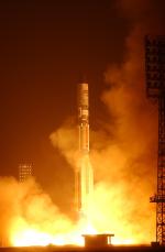 AMC
15, also known as AMERICOM 15, is a 4.05-tonne (4021 kg) communications
satellite that carries 24 Ku-band transponders and 12 spot-beam, Ka-band
transponders to provide direct-to-home video, voice, and internet services
to North America. An A2100 model built by Lockheed Martin Commercial Space
Systems, it is the first satellite dedicated to AMERICOM2Home® and
has been optimized to provide both direct-to-home video and broadband services
into a single dish. The spacecraft delivers service to all 50 U.S. states
as the first satellite committed to EchoStar Communications' DISH Network
satellite TV service. The Proton launch is the ninth mission of the year
for International Launch Services (ILS). AMC
15, also known as AMERICOM 15, is a 4.05-tonne (4021 kg) communications
satellite that carries 24 Ku-band transponders and 12 spot-beam, Ka-band
transponders to provide direct-to-home video, voice, and internet services
to North America. An A2100 model built by Lockheed Martin Commercial Space
Systems, it is the first satellite dedicated to AMERICOM2Home® and
has been optimized to provide both direct-to-home video and broadband services
into a single dish. The spacecraft delivers service to all 50 U.S. states
as the first satellite committed to EchoStar Communications' DISH Network
satellite TV service. The Proton launch is the ninth mission of the year
for International Launch Services (ILS). |
| Source: |
Jonathan
Space Report No. 536;
Spacewarn
No. 612
; National Space Science Data Center's
2004-041A
; SES AMERICOM
: ILS
(see also)
; |
|
|
.
FY-2C
/ Fengyun 2C
| Spacecraft: |
|
| Chronologies: |
2004 payload #54 ; 2004-042A ; 6274th spacecraft. |
| Type: |
Meteorology |
| Families: |
|
| Ranks: |
88th Chinese
spacecraft ; 733rd
geostationary
satellite |
| Sponsor: |
China |
|
|
| Launch: |
19 October 2004 at 1h20 UTC,
from Xichang Satellite Launch Center, by a Chang Zheng 3A. |
| Orbit: |
Geostationary at 105° East longitude. |
| Mission: |
Fengyun 2C is a 1.38-tonne weather satellite
that carries imagers in visible and infra-red bands to monitor droplet
sizes on cloud tops, ocean temperature, dust storms and forest fires over
one-third of the global surface. This third Fengyun-2 weather satellite
is the first of the operational 'batch 2' model. Xinhua reports that the
prelaunch name of the satellite is FY-2 04, and the postlaunch name is
FY-2C. (Note that FY-2 01 spacecraft was destroyed in ground fire in 1994,
FY-2
02 (FY-2A), launched in 1997, in in reserve since May 2000 at 86°
East longitude, and FY-2 03
(FY-2B), launched in 2000, is in operation at 123° East longitude.)
According to the
Xinhua News Agency, FY-2C was deorbited on 13 December 2014; this could
means that all instruments of the satellite were closed. The news
agency reports that FY-2C stopped operation on 25 November 2009 and then
it had been in backup status. FY-2C was the first Chinese geostationary
meteorological satellite which achieved continuous and stable operation
in-orbit. As of December 2014, there were three FY-2 geostationary in operation. |
| Source: |
Jonathan
Space Report No. 537
; Spacewarn No. 612
; Xinhua's 26
Dec 14 ; National Space Science
Data Center's
2004-042A
; |
|
|
.
Express-AM1
| Spacecraft: |
|
| Chronologies: |
2004 payload #55 ; 2004-043A ; 6275th spacecraft. |
| Type: |
Communications (multi-services) |
| Families: |
|
| Ranks: |
3433rd Russian
spacecraft (1054th civilian) : 734th geostationary
satellite ; |
| Sponsor: |
Russian Satellite Communications Company
(RSCC) |
|
|
| Launch: |
29 October 2004 at 22h11 UTC,
from Baykonur Cosmodrome, by a Proton-K/DM-2M (11S861-01). |
| Orbit: |
Geostationary at 40° East longitude. |
| Mission: |
Express-AM1 is a communications satellite
that provides digital TV, radio broadcasting, video-conference and wide-band
internet services to most of Russia. The 2,600-kg, 4,200-watts spacecraft
carries one L-band transponder, nine C-band transponders and eighteen Ku-band
transponders. The satellite is built by Reshetnev (NPO PM) ans it's comms
payload by the Japanese companies NEC and Toshiba. The spacecraft is owned
and operated by the Russian Satellite Communications Company (RSCC). It
is the third out of five Express satellites and has a 12- year design life.
The spacecraft is produced in the context of the Program for Renovation
of National Constellation to be executed over a time period of 20022005.
The Ekspress series has had three generations: Ekspress, Ekspress A and
Ekspress AM. Ekspress-AM uses an improved Ekspress-M or 727M bus, first
used on the Sesat satellite (launched
in 2000), while the earlier models use the KAUR-4 MSO-2500 bus. |
| Source: |
Jonathan
Space Report No. 538
; Spacewarn No. 612
; National Space Science Data Center's
2004-043A
; RSCC's Express-AM1
; |
|
|
.
ZY-2C / Ziyuan-2 3
| Spacecraft: |
|
| Chronologies: |
2004 payload #56 ; 2004-044A ; 6276th spacecraft. |
| Type: |
Reconnaissance |
| Families: |
|
| Ranks: |
89th Chinese
spacecraft ; |
| Sponsor: |
China |
|
|
| Launch: |
4 November 2004 at 3h10 UTC,
from Taiyuan Satellite Launch Center, by a Chang Zheng 4B. |
| Orbit: |
472 km x 483 km x 97.3° x 94.2 min |
| Mission: |
This third ZY-2 satellite is a low-orbit
digital imaging spacecraft used by the Chinese government, probably for
both civilian and military reconnaissance purposes. It is expected to enable
better land surveying, crop yield assessment and disaster monitoring. |
| Source: |
Jonathan
Space Report No. 538
; Spacewarn No. 613
; National Space Science Data Center's
2004-044A
; |
|
|
.
Navstar 52 (USA 180)
| Spacecraft: |
GPS SVN 61 / GPS IIR-13 |
| Chronologies: |
2004 payload #57 ; 2004-045A ; 6277th spacecraft. |
| Type: |
Navigation |
| Families: |
56th Navstar |
| Ranks: |
1692nd American
spacecraft (1101st military) ; |
| Sponsor: |
U.S. Department of Defense |
|
|
| Launch: |
6 November 2004 at 5h39 UTC,
from Cape Canaveral Air Force Station's SLC-17B, by a Delta II 7925. |
| Orbit: |
Initial: 19,810 km x 20,412 km x 54.8°
x 715.1 min
19,794 km x 20,486 km x 54.9° |
| Mission: |
Navstar 56 is a navigational satellite that
is part of the 24-element GPS fleet and it replaces the oldest member of
the fleet, Navstar
2A-02 launched in July 1991. It is located in Plane D, Slot
1. This GPS Block IIR spacecraft is built by Lockheed Martin/Sunnyvale. |
| Source: |
Jonathan
Space Report No. 538
& 539;Spacewarn
No. 613
; National Space Science Data Center's
2004-045A
; |
|
|
.
Oblik
| Spacecraft: |
|
| Chronologies: |
2004 payload #58 ; 2004 n/a ; 6278th spacecraft. |
| Type: |
Technology |
| Families: |
|
| Ranks: |
3434th Russian
spacecraft (1055th civilian) : |
| Sponsor: |
Russia |
|
|
| Launch: |
8 November 2004 at 18h30 UTC,
from Plesetsk Cosmodrome's LC-43/4, by a Soyuz-2-1A . |
| Orbit: |
|
| Mission: |
This mission is the first launch of the improved
Soyuz-2-1A rocket to be carried out. Thes launcher carried a leftover Oblik
spy satellite, carrying launch vehicle monitoring equipment to record accelerations,
vibrations and temperatures. (It is presumably stripped of the normal camera
equipment.) It is, in fact a derivative of the original Vostok/Zenit spy
satellite and was last launched on a civilian mapping mission ten years
ago
Prelaunch reports
indicated that the rocket would reach orbit, but it now appears that it
only reached a suborbital path; which makes it hard for outside observers
to judge whether or not the launch was in fact successful. According to
the rocket manufacturers, the rocket only reached a suborbital trajectory,
with both 11S510 stage and payload falling in the Pacific.
The Soyuz-2-1A is
very similar to the standard Soyuz-U or Soyuz-FG rocket, but carries improved
digital avionics and uses 14D21 and 14D22 engines. . |
| Source: |
Jonathan
Space Report No. 538
& 539
; |
|
|
.
Shiyan 2 / Tansuo 2
| Spacecraft: |
|
| Chronologies: |
2004 payload #59 ; 2004-046A ; 6279th spacecraft. |
| Type: |
Earth remote sensing / reconnaissance? |
| Families: |
|
| Ranks: |
90th Chinese
spacecraft ; |
| Sponsor: |
China's DFH Satellite Co |
|
|
| Launch: |
18 November 2004 at 10h45 UTC,
from Xichang Satellite Launch Center, by a Chang Zheng 2C. |
| Orbit: |
Initial: 695.2 km x 711.4 km x 98.1°
x 98.8 min
694 km x 711 km x 98.2° |
| Mission: |
Shiyan-2 is a 300-kg remote sensing payload.
It's not clear if it's the same design as the Harbin-developed Shiyan
1 launched in April. Also know as Tansuo 2 (or as Shijan Weixing 2
and as Experimental Satellite 2), the spacecraft tests some technology
developments and also surveyed and monitored the geographical environment.
( This is the 8th Chinese launch this year, a record for the country.) |
| Source: |
Jonathan
Space Report No. 539
; Spacewarn No. 613
; National Space Science Data Center's
2004-046A
; |
|
|
.
Swift
| Spacecraft: |
|
| Chronologies: |
2004 payload #60 ; 2004-047A ; 6280th spacecraft. |
| Type: |
Astronomy |
| Families: |
|
| Ranks: |
1693rd American
spacecraft (592nd civilian) ; |
| Sponsor: |
NASA |
|
|
| Launch: |
20 November 2004 at 17h16 UTC,
from Cape Canaveral Air Force Station's SLC-17A, by a Delta 2 7320-10C. |
| Orbit: |
584 km x 604 km x 20.6° |
| Mission: |
Swift is a 1,470-kg, 1,040-W Gamma-ray astrophysics
satellite that houses three telescopes and associated detectors and electronics.
This Swift Gamma Ray Burst Explorer carries the Burst Alert Telescope (BAT),
which can see ten percent of the sky at once and, when a gamma ray burst
occurs, will immediately trigger the satellite to point roughly at the
site of the burst so that the X-ray Telescope (XRT) and the 30-cm aperture
Ultraviolet/Optical Telescope (UVOT) will catch the resulting light and
can locate the burst more exactly. The accurate positions obtained by XRT
and UVOT will also be flashed to astronomers worldwide, who will then rush
to follow up the afterglow before it fades by using ground-based telescopes
and other satellites. XRT and UVOT also take spectra to measure the glow's
redshift and physical properties. Swift is the third launched NASA Midex
(medium-class Explorer) mission, following IMAGE
and MAP, and the mission is led
by NASA-Goddard's Neil Gehrels. |
| Source: |
Jonathan
Space Report No. 539
; Spacewarn No. 613
; National Space Science Data Center's
2004-047A
; NASA's 2010-2014 NASA
News Releases ; See NASA videos Highlights
of Swift's Decade of Discovery and Swift:
A Decade of Game-changing Astrophysics, NASA Goddard, November 2014. |
|
|
.
AMC 16
| Spacecraft: |
|
| Chronologies: |
2004 payload #61 ; 2004-048A ; 6281st spacecraft. |
| Type: |
Communications (DBS) |
| Families: |
|
| Ranks: |
523rd Commercial
spacecraft ; 735th geostationary
satellite ; |
| Sponsor: |
SES Americom |
|
|
| Launch: |
17 December 2004 at 12h07 UTC,
from Cape Canaveral's SLC-41, by an Atlas 521 (AV-005) |
| Orbit: |
Geostationary at 85° West longitude. |
| Mission: |
AMC 16 is a communications satellite that
carries 24 Ku-band transponders to provide direct-to-home video communications
to all of North America. It is a Lockheed Martin A2100AX hybrid Ku-band/Ka-band
communications spacecraft. |
| Notes: |
The satellite was launched by AV-005, the
fourth Atlas 5 mission to be launched. The Atlas 521 rocket has two solid
rocket boosters, the Atlas 5 core stage, and a single-engine Centaur second
stage with a 5-meter fairing. |
| Source: |
Jonathan
Space Report No. 5xx
; Spacewarn No. 614
; National Space Science Data Center's
2004-048A
; |
|
|
.
Helios 2A
| Spacecraft: |
|
| Chronologies: |
2004 payload #62 ; 2004-049A ; 6282nd spacecraft. |
| Type: |
Reconnaissance |
| Families: |
|
| Ranks: |
243rd European
spacecraft ; |
| Sponsor: |
Rrance/Europe |
|
|
| Launch: |
18 December 2004 at 16h26 UTC,
from Kourou Space Center's ELA-3, by an Ariane 5G+ (Ariane 520, V165). |
| Orbit: |
Initial: 681 km x 683 km x 98.1° x 98
min |
| Mission: |
Helios 2A is a military, photo-reconnaissance
satellite that, for the first time, provide the European Union an independent
military intelligence capability. It is a French-managed European reconnaissance
satellite built by EADS-Astrium/Toulouse, with a mass of 4,200 kg. The
satellite carries imagers in the visible and infrared bands. |
| Source: |
Jonathan
Space Report No. 541
; Spacewarn No. 614
; National Space Science Data Center's
2004-049A
; |
|
|
.
Parasol
| Spacecraft: |
Polarization and Anisotropy of
Reflectances for Atmospheric Science coupled with Observations from LIDAR |
| Chronologies: |
2004 payload #63 ; 2004-049G ; 6283rd spacecraft. |
| Type: |
Earth upper atmosphere studies |
| Families: |
|
| Ranks: |
244th European
spacecraft ; |
| Sponsor: |
France's CNES |
|
|
| Launch: |
18 December 2004 at 16h26 UTC,
from Kourou Space Center's ELA-3, by an Ariane 5G+ (Ariane 520, V165). |
| Orbit: |
657 km x 666 km x 98.1° x 98 min. |
| Mission: |
PARASOL is a 120-kg satellite that provides
data on the physical properties of clouds and aerosols. It studies cloud
and aerosol formation as part of the A-train satellite formation with a
wide-field polarization imager |
| Source: |
Jonathan
Space Report No. 541
; Spacewarn No. 614;
National
Space Science Data Center's
2004-049G
; |
|
|
.
Nanosat
| Spacecraft: |
|
| Chronologies: |
2004 payload #64 ; 2004-049B ; 6284th spacecraft. |
| Type: |
Technology |
| Families: |
|
| Ranks: |
245th European
spacecraft ; |
| Sponsor: |
Spain's INTA |
|
|
| Launch: |
18 December 2004 at 16h26 UTC,
from Kourou Space Center's ELA-3, by an Ariane 5G+ (Ariane 520, V165). |
| Orbit: |
657 km x 666 km x 98.1° x 98 min. |
| Mission: |
Nanosat 1, a Spanish nanosatellite, is a
15-kg, 20-W spacecraft that will help maintain contact with the Spanish
zone in Antarctica. |
| Source: |
Jonathan
Space Report No. 541
; Spacewarn No. 614;
National
Space Science Data Center's
2004-049B
; |
|
|
.
Essaim 1
| Spacecraft: |
|
| Chronologies: |
2004 payload #65 ; 2004-049C ; 6285th spacecraft. |
| Type: |
Signal intelligence |
| Families: |
|
| Ranks: |
246th European
spacecraft ; |
| Sponsor: |
France |
|
|
| Launch: |
18 December 2004 at 16h26 UTC,
from Kourou Space Center's ELA-3, by an Ariane 5G+ (Ariane 520, V165). |
| Orbit: |
657 km x 666 km x 98.1° x 98 min. |
| Mission: |
Essaim 1 is one of the four 120-kg French
military microsatellites that demonstrate models to map the "electro-magnetic
environment of the Earth's surface". The design of the next generation
Essaims will be based on the performance of the models. |
| Source: |
Jonathan
Space Report No. 541
; Spacewarn No. 614
; National Space Science Data Center's
2004-049C
; |
|
|
.
Essaim 2
| Spacecraft: |
|
| Chronologies: |
2004 payload #66 ; 2004-049D ; 6286th spacecraft. |
| Type: |
Signal intelligence |
| Families: |
|
| Ranks: |
247th European
spacecraft ; |
| Sponsor: |
France |
|
|
| Launch: |
18 December 2004 at 16h26 UTC,
from Kourou Space Center's ELA-3, by an Ariane 5G+ (Ariane 520, V165). |
| Orbit: |
657 km x 666 km x 98.1° x 98 min. |
| Mission: |
Essaim 2 is one of the four 120-kg French
military microsatellites that demonstrate models to map the "electro-magnetic
environment of the Earth's surface". The design of the next generation
Essaims will be based on the performance of the models. |
| Source: |
Jonathan
Space Report No. 541
; Spacewarn No. 614
; National Space Science Data Center's
2004-049D
; |
|
|
.
Essaim 3
| Spacecraft: |
|
| Chronologies: |
2004 payload #67 ; 2004-049E ; 6287th spacecraft. |
| Type: |
Signal intelligence |
| Families: |
|
| Ranks: |
248th European
spacecraft ; |
| Sponsor: |
France |
|
|
| Launch: |
18 December 2004 at 16h26 UTC,
from Kourou Space Center's ELA-3, by an Ariane 5G+ (Ariane 520, V165). |
| Orbit: |
657 km x 666 km x 98.1° x 98 min. |
| Mission: |
Essaim 3 is one of the four 120-kg French
military microsatellites that demonstrate models to map the "electro-magnetic
environment of the Earth's surface". The design of the next generation
Essaims will be based on the performance of the models. |
| Source: |
Jonathan
Space Report No. 541
; Spacewarn No. 614
; National Space Science Data Center's
2004-049E
; |
|
|
.
Essaim 4
| Spacecraft: |
|
| Chronologies: |
2004 payload #68 ; 2004-049F ; 6288th spacecraft. |
| Type: |
|
| Families: |
|
| Ranks: |
249th European
spacecraft ; |
| Sponsor: |
France |
|
|
| Launch: |
18 December 2004 at 16h26 UTC,
from Kourou Space Center's ELA-3, by an Ariane 5G+ (Ariane 520, V165). |
| Orbit: |
657 km x 666 km x 98.1° x 98 min. |
| Mission: |
Essaim 4 is one of the four 120-kg French
military microsatellites that demonstrate models to map the "electro-magnetic
environment of the Earth's surface". The design of the next generation
Essaims will be based on the performance of the models. |
| Source: |
Jonathan
Space Report No. 541
; Spacewarn No. 614
; National Space Science Data Center's
2004-049F
; |
|
|
.
Demosat (USA 181)
| Spacecraft: |
HLVOLSDP / Heavy Lift Vehicle
Operational Launch Service Demonstration Payload |
| Chronologies: |
2004 payload #69 ; 2004-050A (failure) ;
6289th spacecraft. |
| Type: |
Technology |
| Families: |
|
| Ranks: |
1694th American
spacecraft (1102nd militar) ; 685th failure
; |
| Sponsor: |
U.S. Air Force Evolved Expendable Launch
Vehicle Program |
|
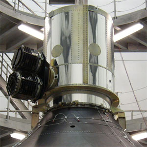 |
| Launch: |
21 December 2004 at 21h50 UTC,
from Cape Canaveral Air Force Station's SLC-39B, by a Delta IV Heavy. |
| Orbit: |
19,041 km x 36,420 km x 13.5° x 1,045
min.
19 027 km x 36 406 km x 13.5° |
| Mission: |
Demosat is a 6.1-tonne dummy/mockup of an
American military satellite that was launched on the maiden flight of Delta
4-Heavy (720 tonne, 23-story high) rocket. Also called the HLVOLSDP (Heavy
Lift Vehicle Operational Launch Service Demonstration Payload), it was
based on a demonstration payload constructed for the maiden Delta-4 flight
(not used), as a real payload was available. DemoSat is a cylindrical outer
aluminium structure 1.95-m high and 1.38 m diameter. The inner ballast
consists of sixty brass rods, stiffeners, fasteners and fittings. It is
an aluminum cylindrical structure (2-meter height and 1.4-meter diameter)
designed to ensure complete burn-out of the craft during reentry.
The Delta IV Heavy
lifted off from Space Launch Complex 37B, Cape Canaveral Air Force Station,
Fla., at 16h50 EST, on a demonstration launch for the Air Force's Evolved
Expendable Launch Vehicle (EELV) program. The demonstration satellite was
deployed following a 5-hour and 50-minute flight.
This demonstration
satellite did not reach its intended orbit, a preliminary review of the
data indicates that a shorter than expected first-stage burn led to the
low orbit. However, according to the Air Force EELV program office, the
primary flight objectives were accomplished in this all-up test of the
new launch vehicle. It is considered that this booster achieved the major
test objectives despite placing its demonstration satellite in a lower
than expected orbit. |
| Notes: |
The Delta IV Heavy, Boeing's new large rocket,
consists of three CBC (Common Booster Core) rockets strapped together,
with a new 5-meter diameter Delta second stage. This new second stage is
a larger version of the 4-meter stage pioneered on Delta III and used on
earlier Delta IV launches; it has a single RL10B-2 LH2/LOX engine. The
outboard CBCs separated 4 minutes after launch at an altitude of around
75 km; they probably reached around 90 km before falling back into the
Atlantic. The center CBC separated shortly after 5 minutes into the mission
at an altitude of about 100 km and made a suborbital flight.
The Delta stage 2 cut off about 13 minutes
into flight and put the spacecraft in an initial orbit of only around 105
km, compared to the expected 180 km x 240 km orbit. The Nanosat payloads
separated at this point, and quickly reentered. Then the Delta fired again
to enter geostationary transfer orbit of 288 km x 36,428 km x 27.2°.
A final burn expected at 3h27 UTC on 22 December was to put the Demosat
in a 36,350 km circular orbit just below geosynchronous.
However, it appears the CBC stages underperformed,
and consequently the second stage used more fuel than expected, leading
to a long first burn, a short final burn to fuel depletion, and a lower
than planned final orbit of 19,027 x 36,406 km x 13.5°.
Boeing are calling this a mostly successful
flight, but a typical comms payload (assuming no apogee fuel, since the
Delta was meant to make the apogee burn) would have to use up almost its
entire service-life fuel load to reach the target orbit. |
| Source: |
Jonathan
Space Report No. 541
; Spacewarn No. 614
; National Space Science Data Center's
2004-050A
; Boeing's News
; |
|
|
.
3CS-1 / Sparky
| Spacecraft: |
3CS = Three Corner Satellite |
| Chronologies: |
2004 payload #70 ; 2004 2nd loss ; 6290th
spacecraft. |
| Type: |
Technology |
| Families: |
|
| Ranks: |
96th amateurs/students
spacecraft :; 686th failure ; |
| Sponsor: |
Arizona State University, Colorado University
and New Mexico State University |
|
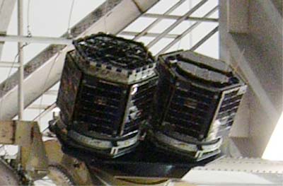 |
| Launch: |
21 December 2004 at 21h50 UTC,
from Cape Canaveral Air Force Station's SLC-39B, by a Delta IV Heavy. |
| Orbit: |
None. |
| Mission: |
3Csat 1 and 2 were to have been dropped off
at a low 180 km x 240 km orbit and were due to reenter after 2-3 days.
But, because of the underperformance of the Delta-4H, they entered orbit
at a height of only 105 km, which lead to a rapid decay. Also named Sparky
(3CSAT 1) and Ralphie (3CSAT 2), these 15-kg nanosatellites were designed
and built mostly by undergraduate students at three universities. (A third
3CSat, Petey, was not launched.) They were to fly as a secondary payload
on the Space Shuttle, but has been changed to a piggy back launch on the
maiden flight of the Delta-4H rocket. Their primary missions include stereoscopic
imaging, formation flying, and end-to-end command and data handling. |
| Source: |
Jonathan
Space Report No. 541
; Spacewarn No. 614; |
|
|
.
3CS-2 / Ralphie
| Spacecraft: |
3CS - Three Corner Satellite |
| Chronologies: |
2004 payload #71 ; 2004 3rd loss ; 6291th
spacecraft. |
| Type: |
Technology |
| Families: |
None. |
| Ranks: |
97th amateurs/students
spacecraft : 687th failure
; |
| Sponsor: |
Arizona State University, Colorado University
and New Mexico State University |
|
|
| Launch: |
21 December 2004 at 21h50 UTC,
from Cape Canaveral Air Force Station's SLC-39B, by a Delta IV Heavy. |
| Orbit: |
|
| Mission: |
3Csat 1 and 2 were to have been dropped off
at a low 180 km x 240 km orbit and were due to reenter after 2-3 days.
But, because of the underperformance of the Delta-4H, they entered orbit
at a height of only 105 km, which lead to a rapid decay. Also named Sparky
(3CSAT 1) and Ralphie (3CSAT 2), these 15-kg nanosatellites were designed
and built mostly by undergraduate students at three universities. (A third
3CSat, Petey, was not launched.) They were to fly as a secondary payload
on the Space Shuttle, but has been changed to a piggy back launch on the
maiden flight of the Delta-4H rocket. Their primary missions include stereoscopic
imaging, formation flying, and end-to-end command and data handling. |
| Source: |
Jonathan
Space Report No. 541;
Spacewarn
No. 614
; |
|
|
.
Progress M-51 / ISS
16P
| Spacecraft: |
Progress M (7K-TGM) No. 351 |
| Chronologies: |
2004 payload #72 ; 2004-051A ; 6292nd spacecraft. |
| Type: |
Cargo delivery to the International Space
Station |
| Families: |
|
| Ranks: |
3435th Russian
spacecraft (1056th civilian) : |
| Sponsor: |
Russian's Federal Space Agency |
|
|
| Launch: |
23 December 2004 at 22h19 UTC,
from Baykonur Cosmodrome's LC-1, by a Soyuz U. |
| Orbit: |
Initial: 193.0 km x 255.1 km x 51.66°
x 55.58 min.
At docking: 351.6 km x 372.9 km x 51.6°
x 91.5 min. |
| Reentry |
9 March 2005 |
| Mission: |
The Progress M-51 transport cargo vehicle
is the 16th flight of Progress cargo vehicles to the International Space
Station. It carries 480 kg of propellant, 28 kg of oxygen, 21 kg of air
and 420 kg of potable water in the refueling compartment. In the vehicle
cargo compartment, there are about 1.35 tons of dry cargoes consisting
of foods, equipments and facilities for the station onboard systems, medical
equipments, underwears, personal hygiene items and individual protection
gears, flight-data files, video and photo materials, parcels for the crew,
structural elements, payloads, hardware and materials for space experiments.
On 25 December 2004
at 23h38 UTC, following a two-day flight, Progress M-51 docked to the International
Space Station's axial docking port of the Russian Service Module Zvezda.
The docking were performed in the automatic mode. Progress M-51 was
vacated from its port on 27 February 2005 at 16h06 UTc to deorbit eventually
after 10 days in free orbit.
Progress M-51 undocked
from the Zvezda module on 27 February 2005 at 16h06 UTC. It lowered its
orbital perigee at around 18h30 UTC and remained in orbit for several days,
with an engine firing dumping it in the Pacific on 9 March 2005. |
| Source: |
Jonathan
Space Report No. 541,
542
&
545;
Spacewarn
No. 614
& 616
; National Space Science Data Center's
2004-051A
; Energiya RSC PR-24
Dec 04 & 26
Dec 04 ; |
|
|
.
Sich-1M
| Spacecraft: |
|
| Chronologies: |
2004 payload #73 ; 2004-052A ; 6293rd spacecraft. |
| Type: |
Earth remote sensing |
| Families: |
|
| Ranks: |
|
| Sponsor: |
Ukraine |
|
|
| Launch: |
24 December 2004 at 11h20 UTC,
from Plesetsk Cosmodrome's LC-32, by a Tsiklon-3 . |
| Orbit: |
Initial: 281 km x 637 km x 82.6° x 97
min.
280 km x 640 km x 82.6° |
| Mission: |
SICH 1M is a 2223-kg Ukranian (or Russo-Ukrainian?)
Earth surveying minisatellite that carries imaging instruments to survey
the surface environment and locate natural disasters. One of the tasks
of Sich-1M satellite is the support of Variant experiment - investigation
of earthquake precursors. The launch took place at the same time with Demeter
French microsatellite launch which main scientific task is the monitoring
of active seismic phenomena in ionosphere. The concurrent observations
at two points of space will create fundamentally new favorable conditions
to set new tasks and to increase authenticity of the results of experiment.
Within the scientific program of Demeter and Sich-1M satellite, the coordinated
ground experiments and remote sensing experiments will be performed which
will be coordinated by their time with the TIMEDsatellite
and ground support means operation schedule.
Although the intended
orbit was around 640 km circular, initial US orbital data put it in a 280
km x 640 km orbit, suggesting that the second burn of the upper stage
was a partial failure. Russian authorities have confirmed that Sich-1M
did not reach its planned orbits. As the Tsiklon-3 launch vehicles third
stage fired a second time, to raising the perigee point from 78 km to 280
km, the velocity increase was about 100 m/s too small to get to the desired
650 km circular orbit. |
| Source: |
Jonathan
Space Report No. 541
& 542
; Spacewarn No. 614
; National Space Science Data Center's
2004-052A
; |
|
|
.
MK-1TS Mikron
| Spacecraft: |
KS5MF2 |
| Chronologies: |
2004 payload #74 ; 2004-052C ; 6294th spacecraft. |
| Type: |
Imaging |
| Families: |
|
| Ranks: |
3436th Russian
spacecraft (1057th civilian) |
| Sponsor: |
Russo-Ukrainian |
|
|
| Launch: |
24 December 2004 at 11h20 UTC,
from Plesetsk Cosmodrome's LC-32, by a Tsiklon-3 |
| Orbit: |
Initial: 282 km x 636 km x 82.6° 94 mohn.
280 km x 640 km x 82.6° |
| Mission: |
Mikronis a 66-kg Russo-Ukrainian Earth surveying
minisatellite that carries imaging instruments to survey the surface environment
and locate natural disasters. It acccies a miniature visible-band camera.
The MK-1TS subsatellite was attached to Sich-1M and ejected from it on
25 December 2004 at about 21h00 UTC. |
| Source: |
Jonathan
Space Report No. 541
& 542
; Spacewarn No. 614
; National Space Science Data Center's
2004-052C
; |
|
|
.
Kosmos 2411
| Spacecraft: |
Uragan No. 796 |
| Chronologies: |
2004 payload #75 ; 2004-053A ; 6295th spacecraft. |
| Type: |
Navigation |
| Families: |
|
| Ranks: |
3437th Russian
spacecraft (2380th military) ; |
| Sponsor: |
Russian Ministry of Defense |
|
|
| Launch: |
26 December 2004 at 13h53 UTC,
from Baykonur Cosmodrome's LC81/23, by a Proton-K/DM-2 (410-09 / 11S861
No. 104L). |
| Orbit: |
Initial: 19,137 km x 19,145 km x 64.85°
x 673 min. |
| Mission: |
These three Kosmos are the latest of the
Russian satellites to join the GLONASS fleet of navigational satellites,
which is the Russian equivalent of the GPS system. They were placed in
Slots 1, 7, and 8 of Plane 1. Two of the satellites (No 796 and 797) are
standard Uragan satellites built by Polyot/Omsk. This was the 33rd launch
in the GLONASS program, and the third with an Uragan-M test flight. |
| Source: |
Jonathan
Space Report No.542
; Spacewarn No. 614
; National Space Science Data Center's
2004-053B
; |
|
|
.
Kosmos 2412
| Spacecraft: |
Uragan No. 797 |
| Chronologies: |
2004 payload #76 ; 2004-053B ; 6296th spacecraft. |
| Type: |
Navigation |
| Families: |
|
| Ranks: |
3438th Russian
spacecraft (2381st military) ; |
| Sponsor: |
Russian Ministry of Defense |
|
|
| Launch: |
26 December 2004 at 13h53 UTC,
from Baykonur Cosmodrome's LC81/23, by a Proton-K/DM-2 (410-09 / 11S861
No. 104L). |
| Orbit: |
Initial: 19,137 km x 19,145 km x 64.85°
x 673 min. |
| Mission: |
These three Kosmos are the latest of the
Russian satellites to join the GLONASS fleet of navigational satellites,
which is the Russian equivalent of the GPS system. They were placed in
Slots 1, 7, and 8 of Plane 1. Two of the satellites (No 796 and 797) are
standard Uragan satellites built by Polyot/Omsk. This was the 33rd launch
in the GLONASS program, and the third with an Uragan-M test flight.. |
| Source: |
Jonathan
Space Report No.542
; Spacewarn No. 614
; National Space Science Data Center's
2004-053C
; |
|
|
.
Kosmos 2413
| Spacecraft: |
Uragan-M No., 712 |
| Chronologies: |
2004 payload #77 ; 2004-053C ; 6297th spacecraft. |
| Type: |
Navigation |
| Families: |
|
| Ranks: |
3439th Russian
spacecraft (2382nd military) ; |
| Sponsor: |
Russian Ministry of Defense |
|
|
| Launch: |
26 December 2004 at 13h53 UTC,
from Baykonur Cosmodrome's LC81/23, by a Proton-K/DM-2 (410-09 / 11S861
No. 104L). |
| Orbit: |
Initial: 19,137 km x 19,145 km x 64.85°
x 673 min. |
| Mission: |
These three Kosmos are the latest of the
Russian satellites to join the GLONASS fleet of navigational satellites.
They were placed in Slots 1, 7, and 8 of Plane 1. This spacecraft.is the
Uragan-M, no. 712, with an uprated Glonass-M payload, built by Reshetnev
NPO-PM/Krasnoyarsk. |
| Source: |
Jonathan
Space Report No.542
; Spacewarn No. 614
; National Space Science Data Center's
2004-053A
; |
|
|
|