The
98 spacecrafts launched in 2003 :
.
Spacecraft
Entries
.
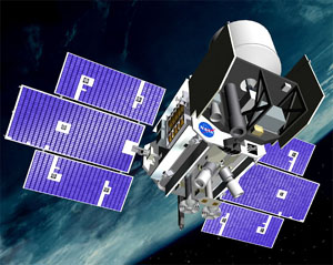
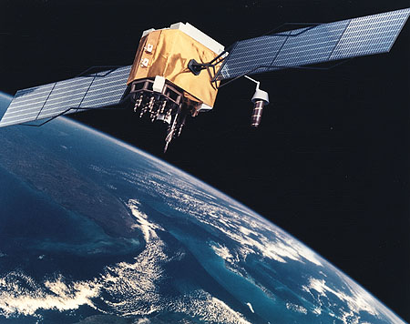
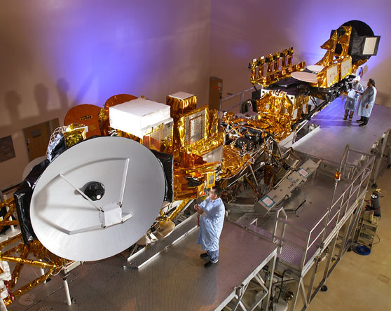
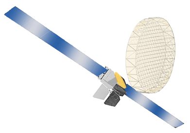
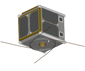
Coriolis
| Spacecraft: |
P98-2 |
| Chronologies: |
2003 payload #1 ; 2003-001A : 6123rd spacecraft. |
| Type: |
Earth environment |
| Sponsor: |
U.S. Air Force |
|
 |
| Launch: |
6 January 2003 at 14h19 UTC,
from Vandenberg Air Force Base's SLC-4W, by a Titan 23G (23G-4). |
| Orbit: |
Initial: 822 km x 842 km x 98.7° x 101.6
min
489 km x 849 km x 98.7° |
| Mission: |
Coriolis is mission P98-2 in the USAF Space
Test Program, and carries two instruments which may be used in the joint
civil/military NPOESS weather satellite program: the Naval Research Lab's
Windsat polarimetric radiometer measures microwave radiation to study the
strength and direction of ocean surface winds; the Solar Mass Ejection
Imager uses a precisely calibrated camera to take pictures of solar eruptions
which can affect the ionosphere. Coriolis is a Spectrum Astro SA-200HP
spacecraft with a mass of 745 kg plus 82 kg of hydrazine propellant. The
3.0-meter diameter, 6.9-meter high, triaxially-stabilized spacecraft carried
340 kg of instruments. |
| Ressources: |
See SpectrumAstro
Coriolis web page. |
| Source: |
Jonathan
Space Report No. 492
; Spacewarn No. 591
; National Space Science Data Center's
2003-001A
; |
|
|
.
ICESAT
| Spacecraft: |
Formerly EOS Laser ALT-1 |
| Chronologies: |
2003 payload #2 ; 2003-002A : 6124th spacecraft. |
| Type: |
Earth observations |
| Sponsor: |
NASA |
|
 |
| Launch: |
13 January 2003 at 0h45 UTC,
from Vandenberg Air Force Base's SLC-2W, by a Delta 7320-10. |
| Orbit: |
Initial: 579 km x 595 km x 94° x 96.4
min
586 km x 594 km x 94.0° |
| Mission: |
ICESAT is part of NASA's Earth science program.
It carries a single instrument: the Geoscience Laser Altimeter System (GLAS),
a 1-meter telescope with a laser for lidar observations which enables accurate
surface level measurements of ice sheets. The precise altitude of the spacecraft
is determined with the help of the GPS constellation of satellites. Ice
surface variations in Greenland and Antarctica are important predictors
of global warming. ICESAT is a Ball BCP-2000 spacecraft with a mass of
959 kg full and 882 kg dry and with 300 kg of science instrument. |
| Ressources: |
See ICESAT
web site |
| Source: |
Jonathan
Space Report No. 492
& 493
; Spacewarn No. 591
; National Space Science Data Center's
2003-002A
; |
|
|
.
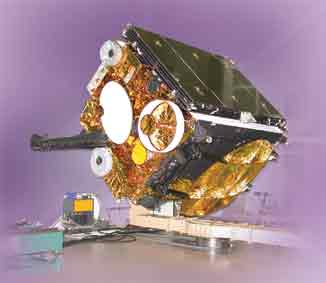
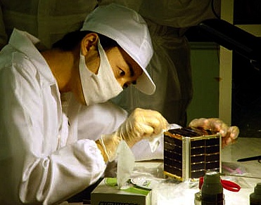
Chips / CHIPSat
| Spacecraft: |
CHIPS / Cosmic Hot Interstellar
Spectrometer |
| Chronologies: |
2003 payload #3 ; 2003-002B : 6125th spacecraft. |
| Type: |
Astronomy |
| Sponsor: |
NASA/University of California at Berkeley |
|
 |
| Launch: |
13 January 2003 at 0h45 UTC,
from Vandenberg Air Force Base's SLC-2W, by a Delta 7320-10. |
| Orbit: |
Initial: 578 km x 594 km x 94° x 96.4
min
586 km x 594 km x 94.0° |
| Mission: |
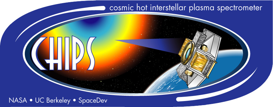 CHIPSat
is a NASA University Explorer (UNEX) mission, led by UC Berkeley and carrying
the Cosmic Hot Interstellar Plasma instrument. The triaxially-stabilized
spacecraft has a spectrograph which has a 5 x 26 degree field of view and
will obtain spectra of the diffuse EUV background in the 90-260 Angstrom
range. The targets are the hot and diffuse nebulae at about a million degrees
temperature. One of the key goals is to find out which spectral lines dominate
the emission from hot gas in the solar neighbourhood. CHIPSat was built
by SpaceDev and has a mass of 60 kg. CHIPSat
is a NASA University Explorer (UNEX) mission, led by UC Berkeley and carrying
the Cosmic Hot Interstellar Plasma instrument. The triaxially-stabilized
spacecraft has a spectrograph which has a 5 x 26 degree field of view and
will obtain spectra of the diffuse EUV background in the 90-260 Angstrom
range. The targets are the hot and diffuse nebulae at about a million degrees
temperature. One of the key goals is to find out which spectral lines dominate
the emission from hot gas in the solar neighbourhood. CHIPSat was built
by SpaceDev and has a mass of 60 kg. |
| Ressources: |
See CHIPsat
web site. |
| Source: |
Jonathan
Space Report No. 492
; Spacewarn No. 591
; National Space Science Data Center's
2003-002B
; |
|
|
.
STS-107
| Spacecraft: |
Space Shuttle #113 ; Columbia
(28th (and last) flight) |
| Chronologies: |
2003 payload #4 ; 2003-003A : 6126th spacecraft
; loss on recovery. |
| Type: |
Piloted spaceflight (science oriented mission) |
| Sponsor: |
NASA |
|
 |
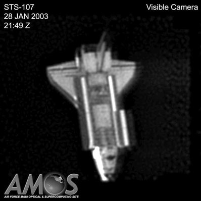
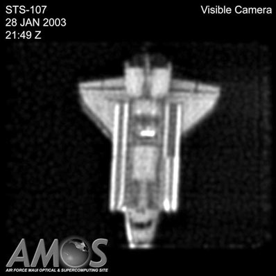
Tthree images of Columbia taken by the U.S. Air
Force Maui Optical and Supercomputing Site on January 28 as the spacecraft
flew above the island of Maui in the Hawaiian Islands. (Source: Spaceflight
Now)
| Launch: |
16 January 2003 at 15h39 UTC,
from Kennedy Space Center's LC-39, by the Space Shuttle |
| Orbit: |
Initial : 270 km x 285 km x 39° x 90,1
min |
| End of mission |
Vehicle lost on 1st February 2003 at ~14h00
UTC. After a 16-day mission, the Orbiter began its reentry, but communications
failed when Columbia was at an altitude of 60 km with a speed of 20,100
km/hr. The Orbiter was lost 15 minutes before its scheduled landing at
the Kennedy Space Center. The seven astronauts were killed when the left
wing failed and the spaceship broke apart. Debris has been found over a
wide area centered in east Texas near Palestine. |
| Mission: |
STS-107 was the first flight in recent years
that was not related to the International Space Station. It carried seven
astronauts who helped oversee 80 microgravity experiments on board. These
ranged from K-12 interest to significant commercial and scientific potential. |
| Source: |
Jonathan
Space Report No. 493
; Spacewarn No. 591
; National Space Science Data Center's
2003-003A
; |
|
|
.
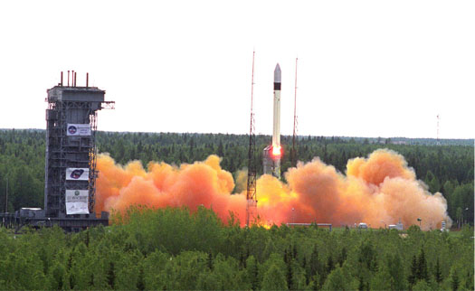
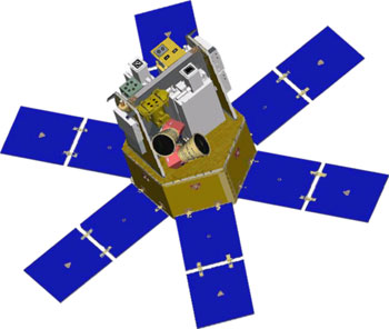
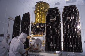
SORCE
| Spacecraft: |
SOlar Radiation and Climate Experiment |
| Chronologies: |
2003 payload #5 ; 2003-004A : 6127th spacecraft. |
| Type: |
Sun-Earth observatory |
| Sponsor: |
NASA/University of Colorado/Boulder |
|
 |
| Launch: |
25 January 2003 at 20h13 UTC,
from Cape Canaveral Air Force Station's RW-30/12, by a Pegasus XL. |
| Orbit: |
Initial: 612.8 km x 652.5 km x 40.0°
x 93.4 min
610 km x 649 km x 40.0° |
| Mission: |
SORCE is to measure solar irradiance in a
number of wavelength-bands through three spectrometers and a photometer.
It carries two main instruments
TSIM (Total
Solar Irradiance Monitor) and SOLSTICE (Solar-Stellar Intercomparison Experiment)
to study the total solar output for climate studies. It is operated by
the University of Colorado/Boulder. The satellite was built by Orbital
Sciences and uses the LeoStar-2 bus; its mass is 290 kg. |
| Note: |
The L-1011 carrier plane took off from the
Cape Canaveral Skid Strip runway at 19h17 UTC on January 25. Drop over
the Atlantic at 20h13 UTC was followed by successful burn of all three
Pegasus XL stages and orbit insertion at 20h22 UTC. |
| Ressources: |
See SORCE
web site |
| Source: |
Jonathan
Space Report No. 493
; Spacewarn No. 591
; National Space Science Data Center's
2003-004A
; Spaceflight Now's 2014
Stories ; |
|
|
.
Navstar 47 (USA 166)
| Spacecraft: |
Navstar SVN 56 / GPS IIR-8 |
| Chronologies: |
2003 payload #6 ; 2003-0 : 6128th spacecraft. |
| Type: |
Navigation |
| Families: |
51st Navstar (8th second-generation replacement) |
| Sponsor: |
U.S. Department of Defense |
|
 Source:
Boeing
Source:
Boeing
|
| Launch: |
29 January 2003 at 18h06 UTC,
from Cape Canaveral Air Force Station's SLC-17, by a Delta 7925. |
| Orbit: |
Initial: 173 km x 20,351 km x 39.1° x
356 min
20 155 km x 20 344 km x 55.0° |
| Mission: |
Navstar 51 is the latest to join the fleet
of Global Positioning Satellites. The fleet is operating in full capacity
with 24 spacecraft (in six planes, with four satellites in each). GPS 2R-8
will replace the aging GPS 2A-18, which will be shifted away in its Plane-B
and then retired. |
| Source: |
Jonathan
Space Report No. 493
; Spacewarn No. 591
; National Space Science Data Center's
2003-005A
; |
|
|
.
XSS-10
| Spacecraft: |
|
| Chronologies: |
2003 payload #7 ; 2003-005B : 6129th spacecraft. |
| Type: |
Technology |
| Sponsor: |
U.S. Department of Defense/AFRL |
|
 |
| Launch: |
29 January 2003 at 18h06 UTC,
from Cape Canaveral Air Force Station's SLC-17, by a Delta 7925. |
| Orbit: |
Initial : 518 km x 805 km x 39.75° x
98 min
703 km x 806 km x 39.6° |
| Mission: |
XSS-10 is an AFRL/DoD technology demonstration
microsatellite (28 kg). At around 10h00 UTC on January 30, the Air Force
Research Lab's XSS-10 experimental inspector satellite separated from the
Delta' second stage and made a series of 35-meter re-approaches to the
stage, using a hydrazine propulsion system for stationkeeping and an experimental
camera to image the stage. It will also monitor the second stage of Delta
2. Its battery-powered operational life was 24 hours. |
| Ressources: |
See Air Force Research Laboratory's XSS-10
Micro-sat. |
| Source: |
Jonathan
Space Report No. 493;
Spacewarn
No. 591
; National Space Science Data Center's
2003-005B
; |
|
|
.
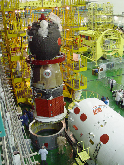
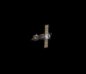
Progress M-47 / ISS
10P
| Spacecraft: |
Progress M (7K-TGM) no. 247 |
| Chronologies: |
2003 payload #8 ; 2003-006A : 6130th spacecraft. |
| Type: |
Cargo delivery to the International Space
Station |
| Sponsor: |
Russia Space Agency |
|
 |
| Launch: |
2 February 2003 at 12h59 UTC,
from Baykonur Cosmodrome's LC-1, by an A-2/Soyuz-U. |
| Orbit: |
~400-km circular x 51,6° |
| Deorbit: |
27 August 2003 |
| Mission: |
Progress M-47 transported food, fuel, and
equipment to the ISS and docked automatically with the Zvezda module of
the ISS on 4 February 2003 at 14h49 UT, delivering enough supplies to keep
the Station crew aboard until June if need be. It is the 100th launch of
the Progress craft series (with 43 Progress, 46 Progress M, nine Progress
M1, and one Progress M-SO1). |
| Source: |
Jonathan
Space Report No. 493
& 508;
Spacewarn
No. 592
; National Space Science Data Center's
2003-006A
; |
|
|
.
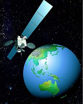
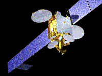
Intelsat 907
| Spacecraft: |
|
| Chronologies: |
2003 payload #9 ; 2003-007A : 6131st spacecraft. |
| Type: |
Communications (multi-services) |
| Sponsor: |
Intelsat / International Telecommunications
Satellite Organization |
|
 |
| Launch: |
15 February 2003 at 7h00 UTC,
from Kourou Space Center's ELA-2, by an Ariane 44L (V159). |
| Orbit: |
Geostationary over 27.5° West longitude |
| Mission: |
The 4.7 tonne spacecraft will provide international
telephone and TV transmission links for the Americas, Europe and Africa
through its array of C- and K-band transponders. It replaces the aging
Intelsat 605. Mass of the Loral-built Intelsat 907 is 1473 kg dry and carries
1947 kg of propellant. |
| Note: |
This is the last and 116th launch of the
Ariane 4 series which will be replaced by the Ariane 5 series. In all,
there were 144 launches of the Ariane 1, 2, 3 and 4 series rockets, including
7 launch failures. |
| Source: |
Jonathan
Space Report No. 494
; Spacewarn No. 592
; National Space Science Data Center's
2003-007A
; |
|
|
.
DSCS III A-3 (USA 167)
| Spacecraft: |
Defense Satellite Communications
System III |
| Chronologies: |
2003 payload #10 ; 2003-008A : 6132nd spacecraft. |
| Type: |
Communications |
| Sponsor: |
U.S. Air Force |
|
 |
| Launch: |
11 March 2003 at 0h59 UTC, from
Cape Canaveral Air Force Station's SLC-37B, by a Delta IVM (2, IABS-9). |
| Orbit: |
Geostationary (parking longitude is unavailable). |
| Mission: |
DSCS III A-3 carries X-band and UHF transponders
operated by the Defense Information Systems Agency. It is one of the first
production models of the DSCS III series, in storage for decades and enhanced
for this launch by Lockheed Martin/Sunnyvale. The DSCS 3 constellation
provides very secure global links to the military. Thesy are triaxially-stabilized
spacecraft with solar power of 1.24 kW. They operate at six SHF frequencies
between 40 and 85 MHz. |
| Note: |
Boeing launched the second Delta IV rocket;
this launch used the simple Delta IVM variant with a CBC first stage and
the 4-meter second stage, as opposed to the first launch which had additional
solid boosters. |
| Ressources: |
See DSCS
III web site. |
| Source: |
Jonathan
Space Report No. 495
; Spacewarn No. 593
; National Space Science Data Center's
2003-008A
; |
|
|
.
IGS-1a
| Spacecraft: |
Information Gathering Satellites
/ "IGS Optical-1" |
| Chronologies: |
2003 payload #11 ; 2003-009A : 6133rd spacecraft. |
| Type: |
Reconnaissance (optical) |
| Sponsor: |
Japanese Defense Ministry |
|
 |
| Launch: |
28 March 2003 at 1h27 UTC, from
the Tanegashima Space Center, by a H-2A 2024. |
| Orbit: |
Initial: 485,5 km x 490,9 km x 97.3°
x 94,4 min sun-synchronous. (Amateur tracking puts IGS-1a in a 483 km x
495 km x 97.4° orbit.) |
| Mission: |
Japanese first two military surveillance
satellites; these Information Gathering Satellites include an optical imager
and a radar imager. These satellites may be used to monitor for nuclear
explosions and missile launches in nearby countries in addition to global
natural disasters and hurricanes. As such, according to the Japanese Defense
Ministry, the launch is not in violation of the Japan-North Korea declaration
of September 2002. IGS-1a uses optical cameras with a resolution of one
meter. |
| Source: |
Jonathan
Space Report No. 496
& 498
; Spacewarn No. 593
; National Space Science Data Center's
2003-009A
; |
|
|
.
IGS-1b
| Spacecraft: |
Information Gathering Satellites
/ "IGS Radar-1"
(Jouhoushushu eisei Reda 1 gouki satellite,
Information Gathering Satellite 1b) |
| Chronologies: |
2003 payload #12 ; 2003-09B : 6134th spacecraft. |
| Type: |
Reconnaissance (radar) |
| Sponsor: |
Japanese Defense Ministry |
|
|
| Launch: |
28 March 2003 at 1h27 UTC, from
the Tanegashima Space Center, by a H-2A (2024). |
| Orbit: |
Initial: 485,5 km x 490,9 km x 97.3°
x 94,4 min. sun-synchronous. (Amateur tracking puts IGS-1b at 489 x 500
km x 97.4°.) |
| Reentry: |
26 July 2012 |
| Mission: |
Japanese first two military surveillance
satellites, which include an optical imager and a radar imager. These two
Japanese reconaissance satellites may be used to monitor for nuclear explosions
and missile launches in nearby countries in addition to global natural
disasters and hurricanes. As such, according to the Japanese Defense Ministry,
the launch is not in violation of the Japan-North Korea declaration of
September 2002. IGS-1b uses synthetic aperture radar to provide images
at a resolution of a few meters.
IGS Radar-1 reentered
on 26 July 2012 over the Pacific. The 1200 kg satellite lost power in 2007. |
| Notes: |
Amateur observers report that the secret
Japanese IGS-1b satellite lowered its perigee on 22 April 2003. |
| Source: |
Jonathan
Space Report No. 496498
&
664;
Spacewarn
No. 593
; National Space Science Data Center's
2003-009B
; |
|
|
.
Navstar 48 (USA 168)
| Spacecraft: |
Navstar SVN 45 / GPS IIR-9 |
| Chronologies: |
2003 payload #13 ; 2003-010A : 6135th spacecraft. |
| Type: |
Navigation |
| Families: |
52nd Navstar (9th second-generation replacement) |
| Sponsor: |
U.S. Air Force |
|
Source:
Boeing
|
|
.
Molniya 1-92
| Spacecraft: |
Molniya-1T |
| Chronologies: |
2003 payload #14 ; 2003-011A : 6136th spacecraft. |
| Type: |
Communications (multi-services) |
| Sponsor: |
Russia |
|
 |
|
.
Milstar DFS-6 (USA 169)
| Spacecraft: |
Milstar DFS-6 / MILitary Strategic
and TActical Relay satellite 6 |
| Chronologies: |
2003 payload #15 ; 2003-012A : 6137th spacecraft. |
| Type: |
Communications |
| Sponsor: |
U.S. Department of Defense |
|
 |
| Launch: |
8 April 2003 at 13h43 UTC, from
Cape Canaveral Air Force Station's SLC-40, by a Titan 4-Centaur (Titan
4 B-35/Centaur TC-23). |
| Orbit: |
Geostationary |
| Mission: |
Milstar DFS-6, super-secure communications
satellite
is the fourth of the Milstar II series carrying both LDR (low data rate)
and MDR (medium data rate) payloads to be used for global communications
capacity by the US armed forces. The 4,5 tonne satellite was built by Lockheed
Martin/Sunnyvale. With the end of the cold war, Milstars are no longer
engineered for "heroic survivability". |
| Ressources: |
See Milstar
News Center web site. |
| Source: |
Jonathan
Space Report No. 497
; Spacewarn No. 594
; National Space Science Data Center's
2003-012A
; |
|
|
.
Insat 3A
| Spacecraft: |
|
| Chronologies: |
2003 payload #16 ; 2003-013A : 6138th spacecraft. |
| Type: |
Communications and meteorology |
| Sponsor: |
ISRO / Indian Space Research Organization |
|
 |
| Launch: |
9 April 2003 at 9h52 UTC, from
Kourou Space Center's ELA-3, by an Ariane 5G (Ariane
514G, V160). |
| Orbit: |
Geostationary at 93.5° East longitude |
| Mission: |
 Insat
3A is an Indian geostationary communications and weather-monitoring satellite.
It carries a communications, weather imaging and search-and-rescue payload
together with a bipropellant liquid apogee engine. Its bus is 2.8 x 2.0
x 1.8 meter in size with a 13-meters solar panel span; the satellite has
a dry mass of 1350 kg and a launch mass of 2958 kg. It carries 12 C-band,
6 Extended C-band, and 6 Ku-band transponders to provide voice, video and
data transmission to West Asia, East Asia, and India. INSAT 3A carries
also the usual INSAT package of sensors in visual, infrared and water vapor
bands to monitor clouds and storms. The spatial resolution at visual wavelengths
is 2 km, and at infrared 1 km. The satellite also carries a separate transponder
for the international search and rescue program. Insat
3A is an Indian geostationary communications and weather-monitoring satellite.
It carries a communications, weather imaging and search-and-rescue payload
together with a bipropellant liquid apogee engine. Its bus is 2.8 x 2.0
x 1.8 meter in size with a 13-meters solar panel span; the satellite has
a dry mass of 1350 kg and a launch mass of 2958 kg. It carries 12 C-band,
6 Extended C-band, and 6 Ku-band transponders to provide voice, video and
data transmission to West Asia, East Asia, and India. INSAT 3A carries
also the usual INSAT package of sensors in visual, infrared and water vapor
bands to monitor clouds and storms. The spatial resolution at visual wavelengths
is 2 km, and at infrared 1 km. The satellite also carries a separate transponder
for the international search and rescue program. |
| Ressources: |
See ISRO's
Insat-3A web site. |
| Source: |
Jonathan
Space Report No. 497
; Spacewarn No. 594
; National Space Science Data Center's
2003-013A
; |
|
|
.
Galaxy XII / Galaxy
12
| Spacecraft: |
|
| Chronologies: |
2003 payload #17 ; 2003-013B : 6139th spacecraft. |
| Type: |
Communications (multi-services) |
| Sponsor: |
U.S.' PanAmSat Corp. |
|
 |
| Launch: |
9 April 2003 at 9h52 UTC, from
Kourou Space Center's ELA-3, by an Ariane 5G (Ariane
514G, V160). |
| Orbit: |
Geostationary at 72° West longitude |
| Mission: |
Galaxy 12 is an Orbital Star-2 small class
communications satellite with a Japanese-developed liquid apogee engine.
It carries 24 C-band transponders to provide voice, video and data transmissions
to North and South America. Launch mass is 1760 kg and dry mass is 800
kg; bus size is 1.5 x 3.3 x 1.9 meter with 12.6 meter solar panel span. |
| Ressources: |
See: PanAmSat
(Galaxy XII) web site. |
| Source: |
Jonathan
Space Report No. 497;
Spacewarn
No. 594;
National
Space Science Data Center's
2003-013B
; |
|
|
.
Asiasat 4
| Spacecraft: |
|
| Chronologies: |
2003 payload #18 ; 2003-014A : 6140th spacecraft. |
| Type: |
Communications (DBS) |
| Sponsor: |
Hong Kong-based Asiasat |
|
 |
| Launch: |
12 April 2003 at 0h47 UTC, from
Cape Canaveral Air Force Station's SLC-36B, by an Atlas IIIB/SEC (AC-205). |
| Orbit: |
Geostationary at 122° East longitude |
| Mission: |
The 9.5 kW satellite will provide direct-to-home
voice and video broadcast to about 40 countries from the Middle East to
New Zealand through its 28 C-band, and 20 Ku-band transponders. Asiasat
4 is 4042 kg at launch and probably around 1900 kg dry; the Boeing 601HP
satellite with a C-band and Ku-band communications payload will replace
Asiasat 1. |
| Note: |
International Launch Services performed this
launch with an Atlas IIIB/SEC (single engine Common Centaur variant). |
| Ressources: |
See Asiasat
web site. |
| Source: |
Jonathan
Space Report No. 497
; Spacewarn No. 594
; National Space Science Data Center's
2003-014A
; |
|
|
.
Kosmos 2397
| Spacecraft: |
71Kh6 US-KMO |
| Chronologies: |
2003 payload #19 ; 2003-015A : 6141st spacecraft. |
| Type: |
Missile early warning |
| Sponsor: |
Russian Defense Ministry |
|
|
| Launch: |
24 April 2003 at 4h23 UTC, from
Baykonur Cosmodrome's LC-81/24, by a D-1-e/Proton-K/DM2. |
| Orbit: |
Geostationary |
| Mission: |
Kosmos-2397 is believed to be a geostationary
early warning satellite built by NPO Lavochkin. The Moscow Kommersat uses
the name US-KMO for the series of four such spacecraft in geostationary
orbit, and US-KS for the older eight in highly elliptical orbit, all of
which are for early warning of missile launches. It also reports that Cosmos
2397 will ensure total global coverage of missile launches, filling out
a gap over the Pacific region. |
| Source: |
Jonathan
Space Report No. 498
; Spacewarn No. 594
; National Space Science Data Center's
2003-015A
; |
|
|
.
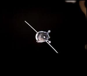
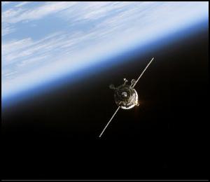
Soyuz TMA-2 / ISS 6S
| Spacecraft: |
Soyuz 11F732 (7K-STMA) no. 212 |
| Chronologies: |
2003 payload #20 ; 2003-016A : 6142nd spacecraft. |
| Type: |
Piloted spaceflight toward the International
Space Station |
| Sponsor: |
Rosaviakosmos/NASA |
|
 Source : NASA
|
| Launch: |
26 April 2003 at 3h53 UTC, from
Baykonur Cosmodrome's LC1/5, by an A-2/Soyuz-FG. |
| Orbit: |
~400 km-circular x 51,6° |
| Landing: |
28 October 2003 at ~2h41 UTC |
| Mission: |
Soyuz TMA-2 is a Russian passenger transport
craft carrying the new ISS Expedition 7 crew of Yury Malenchenko and Edward
Lu for a six-month stay at the International Space Station (ISS). The spacecraft
docked with the nadir port on the Zarya module on 28 April 2003 at 5h56
UTC.
Soyuz TMA-2 undocked
from the Zarya module on 27 October 2003 at 23h17 UTC with Yuriy Malenchenko,
Ed Lu and Pedro Duque aboard. It fired its deorbit engines on 28 October
at 1h47 UTC and landed near Arkalyk in Kazakhstan. Happily, there was no
repetition of the reentry anomaly which caused Soyuz
TMA-1 to land off course. |
|
|
| Source: |
Jonathan
Space Report No. 498
& 513
; Spacewarn No. 594
; National Space Science Data Center's
2003-016A
; |
|
|
.
GALEX
| Spacecraft: |
GALaxy Evolution eXplorer |
| Chronologies: |
2003 payload #21 ; 2003-017A : 6143rd spacecraft. |
| Type: |
Ultraviolet astronomy |
| Sponsor: |
NASA |
|
 |
| Launch: |
28 April 2003 at 11h59 UTC, from
Cape Canaveral Air Force Station's RW-30/12, by a Pegasus XL. |
| Orbit: |
690 km x 702 km x 29° |
| Mission: |
GALEX is a NASA Small Explorer (SMEX) mission
with principal investigator Chris Martin of Caltech. It is a 280 kg, 290
W, triaxially-stabilized satellite. It carries a 0.50-meter telescope and
two ultraviolet microchannel plate cameras (one for the far UV 135-180
nm, and one for the near UV 180-300 nm), and will carry out an all-sky
survey as well as deeper surveys in selected regions. This will be the
first all-sky survey in the ultraviolet band since the much less sensitive
TD
1A satellite in 1972 the all sky limit
in the far UV band will be over 3000 times more sensitive, about 25 microJansky
compared to about 0.08 Jy for TD-1. GALEX is the seventh SMEX mission,
following SAMPEX
(trapped radiation), FAST
(auroral studies), TRACE
(solar imaging), SWAS
(submillimeter astronomy), WIRE
(infrared survey, failed) and HESSI
(solar flare studies). |
| Notes: |
The Orbital Sciences Pegasus rocket was launched
from the company's L-1011 Stargazer aircraft which took off from the Skid
Strip runway at Cape Canaveral at 11h03 UTC on April 28. Galex was
switched off on 28 June 2013 |
| Source: |
Jonathan
Space Report No. 499,
500
, 681
; Spacewarn No. 594
; National Space Science Data Center's
2003-017A
; GALEX Project : NASA's 2010-2014
NASA News Releases ; |
|
|
.
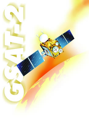
GSAT-2
| Spacecraft: |
|
| Chronologies: |
2003 payload #22 ; 2003-018A : 6144th spacecraft. |
| Type: |
Technology (Communications and monitoring) |
| Sponsor: |
ISRO / Indian Space Research Organization |
|
 |
| Launch: |
8 May 2003 at 11h28 UTC, from
the Satish Dhawan Space Center (in Sriharikota), by a GSLV (GSLV-D2). |
| Orbit: |
Geostationary at 48° East longitude |
| Mission: |
GSat 2 is an Indian geostationary communications
and space monitoring spacecraft; it is a test satellite. The main mission
was to test for the second time the rocket configuration, with the proven
PSLV lower stages and a cryogenic third stage that uses a Russian motor.
The 1.9-tonne, 1.4-kW spacecraft carries four C-band and two Ku-band transponders
to provide voice and video transmissions to India and neighboring countries,
a Coherent RAdio Beacon EXperiment (CRABEX) of ionospheric interest, a
SOlar X-ray Spectrometer (SOXS) to monitor 4 keV-10 MeV x-rays, an external
Total Radiation Dose Monitor (TRDM), an internal radiation monitor called
RADiation sensitive Field Effect Transistor (RADFET), and a Surface Charge
Monitor (SCM). |
| Source: |
Jonathan
Space Report No. 499
; Spacewarn No. 595
; National Space Science Data Center's
2003-018A
; GSAT-2 Project
: |
|
|
.
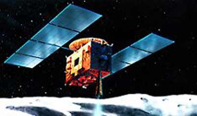
MUSES C / Hayabusa
| Spacecraft: |
Hayabusa means Falcon |
| Chronologies: |
2003 payload #23 ; 2003-019A : 6145th spacecraft. |
| Type: |
Asteroid sample-return probe |
| Sponsor: |
Japan ISAS |
|
 |
| Launch: |
9 May 2003 at 4h29 UTC, from
the Kagoshima Space Center, by a M-V-5. |
| Orbit: |
About 1.0 AU x 1.6 AU x 1.5° x 560 days
heliocentric |
| Mission: |
This 510-kg Japanese asteroid explorer is
expected to arrive at the 700 x 300 meters asteroid 1998SF36 in June 2005
(after an encounter with Earth in June 2004 to obtain a gravity assisted
boost), and orbit around it at an altitude of 19 km from its surface. After
several months of orbiting, it will be maneuvered to skim on the surface
a few times and gather a total of one gram of surface material from several
sites. The sample collection will be enabled by firing tiny metal projectiles
on the surface. The material will be funneled into a capsule to be returned
to Earth by a parachute in Australia in June 2007. In all, Hayabusa
would have done over two orbits around the Sun before re-entering Earth.
Iit will leave a 10-cm ball on the asteroid containing the names of 870,000
human Earthlings from many countries. MUSES C was named Hayabusa (Falcon)
after launch. |
| Notes: |
This is the last launch by ISAS. In October
2003 ISAS, NASDA, and the National Aerospace Laboratory will be merged
into a single new agency named Space Aeronautics Research and Development
Agency (probably with SARADA as the acronym). On 19 May 2004, the Hayabusa
probe made an Earth flyby with a closest approach altitude of 3725 km at
6h23 UTC. It is expected to reach asteroid (25143) Itokawa in 2005.
Hayabusa departed
the Itokawa vicinity in February 2007 and, as contollers coaxed limited
function out of its faltering ion drives, set course for Earth. By April
2010, the probe was 24 million km from home, and began a series of course
corrections to target it for landing. It entered the Earth's gravitational
sphere of influence on 11 June 2010, approaching Earth on a hyperbola trajectory.
At 10h51 UT, the Hayabusa return capsule separated from the main spacecraft.
Nominal entry was at 200 km altitude at 13h51 UT, over about 125° East
and 28° South, travelling at 12.2 km/sl. The capsule landed in the
Woomera range area at around 14h12 UTC. |
| Ressources: |
See Hayabusa
mission web site |
| Source: |
Jonathan
Space Report No. 500,
526,
629
;
Spacewarn No. 595
; National Space Science Data Center's
2003-019A
; |
|
|
.
MINERVA
| Spacecraft: |
MIcro/Nano Experimental Robot
Vehicle for Asteroid |
| Chronologies: |
2003 payload #24 ; 2003-019B : 6146th spacecraft. |
| Type: |
Asteroid exploration |
| Sponsor: |
Japan ISAS (JAXA) |
|
|
| Launch: |
9 May 2003 at 4h29 UTC, from
the Kagoshima Space Center, by a M-V-5. |
| Orbit: |
|
| Mission: |
MINERVA is a 0.6-kg robot lander that will
investigate the surface of Itokwas asteroids using three small color cameras.
It will detach from Hayabusa, land on Itokawa, and survey it while moving
around its surface. Two cameras make up a stereo pair that can observe
the detailed surface conditions at the landing area. The third camera will
see further away to observe more distant regions of the surface. These
cameras have an image resolution of less than 1 mm and can observe minerals
making up a rock. They can investigate the size of regolith grains covering
the surface of Itokawa. Thermal sensors on MINERVA will measure the surface
temperature, which will permit to determine whether the surface of Itokawa
is rich in sands or rocks. MINERVA is designed to hop gently across Itokawa's
surface, using its own momentum by accelerating a weight inside itself.
On 12 December 2005,
Hayabusa probe successfully performed a close approach to the surface of
Itokaw, but the attempt to send the mini-robot MINERVA failed. The robot
was deployed at 15h24 Japan time, from a distance of about 200 meters.
Hayabusa was then able to establish radio contact with the free-flying
MINERVA, but JAXA officials said the robot drifted away from Itokawa and
not fall to the surface as planned. Preliminary indications that the deployment
command happened to arrive at Itokawa during a period when Hayabusa was
drifting away from the surface. Consequently, MINERVA was sent on a flight
path that took it away from the asteroid. |
| Source: |
Jonathan
Space Report No. ; Spacewarn
No. ; National Space Science Data
Center's
2003-019A
; ISAS's Minerva
; |
|
|
.
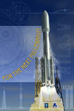
Hellas Sat 2
| Spacecraft: |
|
| Chronologies: |
2003 payload #25 ; 2003-020A : 6147th spacecraft. |
| Type: |
Communications (DBS) |
| Sponsor: |
Joint Greek/Cypriot Hellas Sat consortium |
|
 |
| Launch: |
13 May 2003 at 22h10 UTC, from
Cape Canaveral Air Force Station's SLC-41, by an Atlas V 401 (AV-002). |
| Orbit: |
Geosynchronous at 39° East longitude |
| Mission: |
Hellas Sat 2 is an Astrium Eurostar 2000+
satellite for the Greek/Cypriot Hellas Sat consortium based in Athens.
The 3.45-tonne satellite carries 30 Ku-band transponders to provide direct-to-home
voice and video transmissions to much of Europe, North Africa and the Middle
East. (Hellas Sat 1 is the old Kopernikus
DFS-3 satellite launched in 1992 and leased by HellasSat in
2002.) |
| Notes: |
Lockheed Martin launched AV-002, the second
Atlas V that uses a single-engine Common Centaur upper stage. |
| Source: |
Jonathan
Space Report No. 500
; Spacewarn No. 595
; National Space Science Data Center's
2003-020A
; Hellas Sat Corp ; |
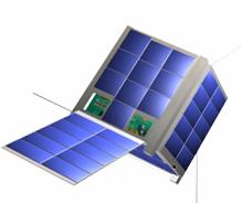
|
|
.
Beidou 3
| Spacecraft: |
Beidou
1C, Beidou 2A
Beidou Navigation Test Satellites |
| Chronologies: |
2003 payload #26 ; 2003-021A : 6148th spacecraft. |
| Type: |
Navigation |
| Sponsor: |
China |
|
|
| Launch: |
24 May 2003 at 16h34 UTC, from
Xichang , by a Chang Zheng 3A. |
| Orbit: |
Geostationary |
| Mission: |
This third Beidou navigation satellite joins
two others, Beidou 1A and Beidou
1B that were launched in 2000 and reportedly enables a viable global
positioning constellation. Besides enabling positioning. The launching
of the third satellite marks the formation of a complete and sound satellite
navigation and positioning system to ensure all-weather navigation and
positioning information, Chinese source reports. The China-made system
will play an important role in economic matters, offering efficient navigation
and positioning services for the sectors of transportation, meteorology,
petroleum production, forest fire prevention, disaster forecast, telecommunications
and public security. The craft is also used in weather monitoring and
telecommunications. Both the satellite and the carrier rocket were developed
by the Chinese Research Institute of Space Technology and China Academy
of Launch Vehicle Technology, which are under the China Space Science and
Technology Group. |
| Notes: |
According to Chinese sources: This launch
may have been insignificant for the general public in and outside China,
but it marked a milestone for Chinese rocket experts. Long Lehao, a member
of the Chinese Academy of Engineering and general-commander of the rocket
project, said the successful launch lifted the success rate of the Long
March rocket series from 89 to 90 percent, an internationally accepted
benchmark for carrier rockets. The success rates of similar models
of the rocket, such as the Delta rocket of the United States and those
of Europe, stand at around 93 percent. |
| Source: |
Jonathan
Space Report No. 500
; Spacewarn No. 595
; National Space Science Data Center's
2003-021A;
Xinhua's
25
May 03, 3
Jun 13, 30
Dec 03 ; |
|
|
.
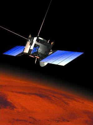
Mars Express
| Spacecraft: |
|
| Chronologies: |
2003 payload #27 ; 2003-022A : 6149th spacecraft. |
| Type: |
Mars orbiter |
| Sponsor: |
ESA / European Space Agency |
| Launch: |
2 June 2003 at 17h45 UTC, from Baykonur Cosmodrome's
LC-31, by an A-2/Soyuz-FG/Fregat. |
| Orbit: |
Eart-Mars trajectory: 1.014 AU x 1.531 AU
x 0.2° Solar orbit.
Initial Mars orbit: 3585 km x 130 000 km
x 13°
Operational Mars orbit: 250° x 10243
km x 89° |
|
Source: ESA
|
| Mission: |
Europe's first Mars probe. The
1.5 x 1.8 x 1.4 meter spacecraft consists of a Mars Orbiter and a lander
named Beagle 2 that will be released from the orbiter when it reaches the
planet's vicinity in December 2003. It has a mass of 637 kg dry including
science payload and Beagle separation device together with 480 kg of propellant
and the 69 kg Beagle 2 lander for a total of 1186 kg. Instruments include
MARSIS, the first subsurface radar sounder flown on a probe since Apollo
17; HRSC, a high resolution color camera; OMEGA, an infrared sensor; Planetary
Fourier Spectrometer, operating in the millimeter range for molecular studies;
SPICAM, studying an ultraviolet ozone absorption line and an infrared water
line; ASPERA-3 measuring the particle environment; and the Mars Radio Science
experiment using the radio transmitter. Mars Express carries a 400N propulsion
engine similar to those used on Spacebus communications satellites.
Mars Express probe entered
orbit around Mars on 25 December 2003 at 3h21 UTC, completing a 34 minute
engine burn begun at 2h47 UTC.
ESA 2004 report on the
Beagle 2 Mars lander failure was not been publicly released, but a press
release indicates several areas identified as possible contributors to
the failure: problems due to shocks from pyro firings in spacecraft separation
events; problematic cross-connected wiring; possible collision between
the lander and its jettisoned heat shield, and possible air bag or parachute
failure. |
| Notes: |
Mars Express was launched by a Starsem Soyuz-FG
with a Fregat upper stage. |
| Source: |
Jonathan
Space Report No. 501,
502,517
& 527
; Spacewarn No. 596
; National Space Science Data Center's
2003-022A
; |
|
|
.
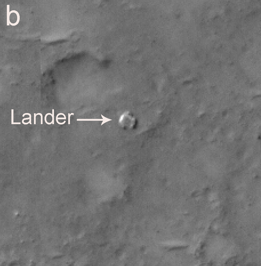
Beagle-2
| Spacecraft: |
|
| Chronologies: |
2003 payload #28 ; 2003-022C : 6150th spacecraft. |
| Type: |
Mars lander |
| Sponsor: |
ESA-UK |
|
 |
| Launch: |
2 June 2003 at 17h45 UTC, from
Baykonur Cosmodrome's LC-31, by an A-2/Soyuz-FG/Fregat. |
| Orbit: |
Crash on Mars on 25 December 2003. |
| Mission: |
Beagle 2 is a 65-kg, 0.95-meter diameter,
clam-shaped lander that was released when the Mars Express reaches the
Martian vicinity in December 2004.
On 19 December 2003,
Beagle-2 lander was ejected from Mars Express at 8h31 UTC, on a trajectory
that will impact Mars on Dec 25. Beagle-2 lander reached the surface of
Mars on 25 December 2003 at 2h52 UTC, but no signals have been received
from it. The heatshield-encapsulated Beagle-2 entered the Martian atmosphere
(at a fiducial height of 120 km) at 2h47 UTC, at a speed of 5.5 km/s. Over
the next two minutes, it decelerated to a few hundred meters per second.
If the descent went as planned, Beagle bounced onto the surface at 2h52
UTC.Even with its lost, Beagle-2 is still the first non-US, non-Soviet
artifact to reach the surface of Mars (note: Japan's Hiten
impacted the Moon in April 1993).
Beagle-2 was supposed
to make in situ analysis of the soil, after landing at 10.6° North
and 270° West in the sedimentary basin known as Isidis Planitia. The
lander carries a maneuverable robotic arm. Its soil collection would habe
been be by a "mole" in the PAW (Position Adjustable Workbench) of the arm,
and the rock collection by a corer in the PAW. Four cameras were mounted
on the robotic arm. A pair of them was to have provide a 3-D view of the
neighborhood and to watch the sample collection. Another camera would have
provide a wide-angle view of the vicinity even before the robotic arm is
deployed. The fourth camera is part of a microscope that would have image
fresh rock surfaces (after cleaning the surface by a grinder), at a resolution
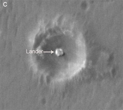
of four microns. |
| Ressources: |
See: Beagle-2
web site |
| Source: |
Jonathan
Space Report No. 501,
516
&
517
; Spacewarn No. 596
& 602
; National Space Science Data Center's
2003-022C
; |
|
|
.
Kosmos 2398
| Spacecraft: |
Parus? |
| Chronologies: |
2003 payload #29 ; 2003-023A : 6151st spacecraft. |
| Type: |
Navigation |
| Sponsor: |
Russian Defense Ministry |
|
|
|
.
AMC-9 / Americom-9
| Spacecraft: |
|
| Chronologies: |
2003 payload #30 ; 2003-024A : 6152nd spacecraft. |
| Type: |
Communications (DBS) |
| Sponsor: |
SES Americom |
|
|
| Launch: |
6 June 2003 at 22h15 UTC, from
Baykonur Cosmodrome's LC-200/39, by a D-1-e/Proton-K/Briz-M. |
| Orbit: |
Geostationary at 85° West longitude |
| Mission: |
AMC-9 provides direct-to-home digital TV
and data transfer in USA and Canada, through its 24 C-band and 24 Ku-band
transponders. It is an Alcatel Spacebus 3000B3 with C and Ku band communications
payloads. Launch mass was 4100 kg; dry mass probably around 2000 kg. |
| Notes: |
The Americom series continues the original
US domestic communications satellites, the RCA Americom 'Satcom' series
first launched in 1975. Americom has been through several owners, and is
now a subsidiary of the Luxembourg-based Société Européene
des Satellites (SES) which was originally formed to run the Astra network.
Launched was performed the International Launch Services. |
| Source: |
Jonathan
Space Report No. 502
; Spacewarn No. 596
; National Space Science Data Center's
2003-024A
; AMC-9
Press Release ; |
|
|
.
Progress M1-10 / ISS-11P
| Spacecraft: |
Progress M1 (7K-TGM) no. 259 |
| Chronologies: |
2003 payload #31 ; 2003-025A : 6153rd spacecraft. |
| Type: |
Cargo to the International Space Station |
| Sponsor: |
Rosaviakosmos / Russian Space Agency |
|
 |
| Launch: |
8 June 2003 at 10h34 UTC, from
Baykonur Cosmodrome's LC-1, by an A-2/Soyuz-U. |
| Orbit: |
~400 km circular x 51,6° |
| Deorbit: |
3 October 2003 at 11h58 UTC. |
| Mission: |
Progress M1-10 docked with the nadir port
on Pirs on 11 June 2003 at 11h15 UTC and delivered 2.3 tonnes of food,
fuel, water, and scientific/engineering equipment. Launch mass was 7270
kg. The spacecraft undocked from the
Pirs module on 4 September 2003 and remains
on orbit to carry out remote sensing of the Earth with its onboard TV camera
system. |
| Source: |
Jonathan
Space Report No. 502,
508
&
510;
Spacewarn
No. 596
; National Space Science Data Center's
2003-025A
; |
|
|
.
Thuraya 2
| Spacecraft: |
|
| Chronologies: |
2003 payload #32 ; 2003-026A : 6154th spacecraft. |
| Type: |
Communications (phone) |
| Sponsor: |
United Arab Emirate's Thuraya Satellite |
|
 |
| Launch: |
10 June 2003 at 13h56 UTC, from
the Odyssey platform, by a Zenit-3SL. |
| Orbit: |
Geostationary at 44° East longitude |
| Mission: |
Thuraya 2 is a Boeing GEM spacecraft (modified
BSS-702), which features a large (12 meters) antenna for L-band mobile
communications. The 5.2-tonne (with fuel), 11-kW satellite carries many
transponders to relay mobile telephone calls from/to countries in and around
the Middle East and the Indian subcontinent. Its 200 spot beams can be
steered to meet the varying call densities, and will enable it to handle
13,750 calls simultaneously. The satellite has a launch mass of 5177 kg. |
| Notes: |
The Boeing Sea Launch Zenit-3SL was launched
from the Odyssey platform floating at 154 °W, 0 °N in the Pacific
ocean. |
| Source: |
Jonathan
Space Report No. 502
; Spacewarn No. 596
; National Space Science Data Center's
2003-026A
; Thuraya
2, 3 satellites ; |
|
|
.
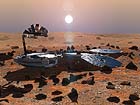
MER-A (carrier)
| Spacecraft: |
Mars Exploration Rover A |
| Chronologies: |
2003 payload #33 ; 2003-027A : 6155th spacecraft. |
| Type: |
Mars lander |
| Sponsor: |
NASA |
|
 |
| Launch: |
10 June 2003 at 17h59 UTC, from
Cape Canaveral Air Force Station's SLC-17A, by a Delta 7925. |
| Orbit: |
Initial: 1.042 AU x 1.550 AU x 0.26°
Solar orbit
On Mars: |
| Mission: |
The MER-A carrier soft-landed on 4 January
2004 at 4h26 UTC, on the Gusev crater at 15° south of the equator,
and nudge out a robotic rover named Spirit to do geology observations.
The spacecraft entered the Martian atmosphere at 4h20 UTC at 5.4 km/s,
with an entry angle was 11.5°. The landing site is an ellipse centered
on 14.640° South and, 184.702° West. The landing site has been
renamed the Columbia Memorial Station.
MER-A consists of
the 174-kg Spirit rover, the 365-kg MER-2 lander, the 198-kg backshell
and 90-kg heatshield which encapsulate lander and rover during Mars atmosphere
entry, and the 183-kg Cruise stage which carries 52 kg of propellant, for
a total launch mass of 1062 kg. Other than releasing Spirit, MER-A
has no other significant functionality. |
| Notes: |
This spacecraft is in fact the second MER;
the first flight article completed checkout later and has been assigned
to the MER-B mission to be launched later. |
| Source: |
Jonathan
Space Report No. 502
; Spacewarn No. 596
; National Space Science Data Center's
2003-027A
; |
|
|
.
Spirit (rover)
| Spacecraft: |
|
| Chronologies: |
2003 payload #34 ; 2003-027 : 6156th spacecraft. |
| Type: |
Mars rover |
| Sponsor: |
NASA |
|
 |
|
.
BSAT-2c
| Spacecraft: |
|
| Chronologies: |
2003 payload #35 ; 2003-028A : 6157th spacecraft. |
| Type: |
Communications (DBS) |
| Sponsor: |
Japan's Broadcasting Satellite System Corp. |
|
 |
|
.
Optus and Defence C1
| Spacecraft: |
|
| Chronologies: |
2003 payload #36 ; 2003-028B : 6158th spacecraft. |
| Type: |
Communications (multi-services) |
| Sponsor: |
Australia's Singtel Optus Pty and the Australian
Departement of Defense |
|
 |
| Launch: |
11 June 2003 at 22h38 UTC, from
Kourou Space Center's ELA-3, by an Ariane 5G (515G, V161). |
| Orbit: |
Geostationary at 156° East longitude |
| Mission: |
Optus and Defence C1 is a dual-use (civil/military)
satellite that carries 24 Ku-band civilian transponders and eight military
transponders. The civilian part of the payload will enable video and internet
links to Australia, New Zealand and East Asia. The satellite is jointly
owned by Singtel Optus Pty and the Australian Department of Defense. Previous
satellites in the series were simply named Optus and didn't carry the extra
defence comms payload. Prime contractor is Mitsubishi, using a Loral FS-1300
bus with a UHF, X-band and Ka-band communications payload. |
| Source: |
Jonathan
Space Report No. 502
; Spacewarn No. 596
: National Space Science Data Center's
2003-028B
; Loral's Optus
C1, |
|
|
.
Molniya 3-53
| Spacecraft: |
Molniya-3 No. 65? |
| Chronologies: |
2003 payload #37 ; 2003-029A : 6159th spacecraft. |
| Type: |
Communications (multi-services) |
| Sponsor: |
Russia |
|
|
| Launch: |
19 June 2003 at 20h00 UTC, from
Plesetsk Cosmodrome's LC-43/3, by an A-2/Molniya-M. |
| Orbit: |
631 km x 39 789 km x 62.9° x 719.1 minutes. |
| Mission: |
Molniya 3-53 is a two-tonne Russian military
communications spacecraft; it will be the last in the Molniya 3 series.
This Molnoya-3 may possibly be Molniya-3 No. 65. US sources list it as
Molniya 3-53 because it is the 53rd satellite to be given the Molniya-3
name, but the 3-53 designation is not used in official Russian sources.
The first Molniya-3 was Molniya-3 No. 11 launched in Nov 1974 (Molniya
3-1); satellite series built by NPO Prikladnoi Mekhaniki always start
with No. 11 perhaps Nos. 1 to 10 are reserved for ground test articles
or something. Subsequent satellites were launched somewhat out of production
order and No. 14 was never launched, so we can't really guess the correct
designation. 54 Molniya-3 satellites and one Molniya-3K have now been launched,
including two satellites which were stranded in parking orbit and given
Kosmos designations. |
| Source: |
Jonathan
Space Report No. 503
; Spacewarn No. 596
; National Space Science Data Center's
2003-029A
; |
|
|
.
Orbview-3
| Spacecraft: |
|
| Chronologies: |
2003 payload #38 ; 2003-030A : 6160th spacecraft. |
| Type: |
Earth imaging |
| Sponsor: |
Orbimage |
|
 |
| Launch: |
26 June 2003 at 18h53 UTC, from
Vandenberg Air Force Base's RW-30/12, by a Pegasus XL. |
| Orbit: |
366 km x 430 km x 97.3° |
| Mission: |
Orbview-3 is a 1-meter-resolution commercial
imaging satellite. The satellite carries high-resolution cameras to enable
black-and-white images at 1.0 meter resolution and color images at 4.0
meter resolution. The spacecraft, which uses an Orbital Leostar bus and
has a launch mass of 304 kg (probably including of order 50 kg of hydrazine
for orbit raising). |
| Notes: |
The satellite was launched by Orbital Sciences'
L-1011 carrier plane which took off from Vandenberg AFB at 17h57 UTC and
dropped the Pegasus XL rocket at 18h53 UTC, probably over the standard
Pacific drop zone at 36.0 °N and 123.0 °W. |
| Source: |
Jonathan
Space Report No. 503
; Spacewarn No. 596
; National Space Science Data Center's
2003-030A
; Orbview-3, |
|
|
.
Monitor-E GVM
| Spacecraft: |
"Monitor-Earth" mockup + Breeze-KM
upper stage |
| Chronologies: |
2003 payload #39 ; 2003-031A : 6161st spacecraft. |
| Type: |
Technology |
| Sponsor: |
Russia's Krunichev State Research and Production
Space Center |
|
|
|
|
| Launch: |
30 June 2003 at 14h15 UTC, from
Plesetsk's LC-133, by a Rokot-Briz-KM (UR-100N). |
| Orbit: |
Initial: 696 km x 633 km x 98,7° x 100,1
min
Later: 250 km x 830 km x 98.4° |
| Mission: |
The largest payload of this nine-satellite
launch is Krunichev's mockup of its earth-observation satellite Monitor-E
("Monitor-E(arth)"). The mockup transmited mission profile simulation data
during its entire flight. It remained on the Breeze upper stage and was
to de-orbit with it. |
| Notes: |
The Eurockot Launch Services, Bremen, performed
this Multiple Orbit Mission (MOM), launching a total of eight scientific
micro- and nano-satellites for different agencies and institutes in addition
to a mock-up of the Russian MONITOR satellite, mounted on Breeze. The mission
was based on the multiple re-ignition capability of the Breeze upper stage.
It is the first sun-synchronous mission of Rockot. |
| Ressources: |
Rockot
Multiple Orbit Mission hits different Orbits ; |
| Source: |
Jonathan
Space Report No. 504
; Spacewarn No. 597
; National Space Science Data Center's
2003-031A
; Russian Space Agency fact
sheet ; |
|
|
.
Mimosa
| Spacecraft: |
Micromeasurements of Satellite
Acceleration |
| Chronologies: |
2003 payload #40 ; 2003-031B : 6162nd spacecraft. |
| Type: |
Earth sciences |
| Sponsor: |
Astronomical Institute of the Czech Academy
of Sciences |
|
 |
| Launch: |
30 June 2003 at 14h15 UTC, from
Plesetsk's LC-133, by a Rokot-Briz-KM (UR-100N). |
| Orbit: |
316 km x 844 km x 96.8° x 96,3 min |
| Mission: |
Mimosa is nearly spherical with 28 sides
and carries a microaccelerometer to monitor the atmospheric density profile
by sensing the atmospheric drag. It provides data on the density of the
upper atmosphere using the highly sensitive MACEK accelerometer. The 65-kg
spacecraft was built by Space Devices Ltd. of Praha and is operated by
the Astronomicky ustav AV CR. The apogee of its orbit permits the use of
the solar radiation pressure for calibration of the accelerometer; the
perigee assured the penetration of the spacecraft into denser layers of
the atmosphere. |
| Source: |
Jonathan
Space Report No. 504
; Spacewarn No. 597
; National Space Science Data Center's
2003-031B
; MIMOSA
Summary ; |
|
|
.
DTUSat
| Spacecraft: |
Denmark Technical University
satellite |
| Chronologies: |
2003 payload #41 ; 2003-031C : 6163rd spacecraft. |
| Type: |
Technology |
| Sponsor: |
Technical University of Denmark |
|
 |
| Launch: |
30 June 2003 at 14h15 UTC, from
Plesetsk's LC-133, by a Rokot-Briz-KM (UR-100N). |
| Orbit: |
818 km x 830 km x 98.7° x 101,4 min |
| Mission: |
DTUsat is a picosatellite (1-kg) designed
and built by students from the Technical University of Denmark (DTU). Its
main payload is an electrodynamic tether for dumping the satellite. The
tether is deployed using a novel yo-yo system, greatly simplifying construction
and deployment. A calibrated test transmitter is flown as secondary payload.
The satellite is 3-axis stabilized using magnetorquers, while attitude
determination is done by a combination of a 3-axis magnetometer and 5 chip
scale dual-axis sun angle sensors designed and built for this satellite. |
| Source: |
Jonathan
Space Report No. 504
; Spacewarn No. 597
; National Space Science Data Center's
2003-031C
; DTUSat project : |
|
|
.
MOST
| Spacecraft: |
Microvariability and Oscillations
of Stars |
| Chronologies: |
2003 payload #42 ; 2003-031D : 6164th spacecraft. |
| Type: |
Astronomy |
| Sponsor: |
CSA / Canadian Space Agency |
| Launch: |
30 June 2003 at 14h15 UTC, from Plesetsk's
LC-133, by a Rokot-Briz-KM (UR-100N). |
|
 |
| Orbit: |
819 km x 832 km x 98.7° x
101,4 min. |
| Mission: |
MOST is Canada's first space telescope. The
65 x 65 x 30 cm, 51-kg spacecraft carries a 60-cm aperture reflecting telescope
to monitor the brightness variations in a star caused by soundwaves on
its surface, or from reflections from an orbiting planet. It makes photometric
observations of stars down to magnitude 6 that will help to set a limit
on the age of the Universe and probe the properties of planets around other
stars. (Because of its light weight and low cost, MOST has been dubbed
as "Humble Telescope".) |
| Source: |
Jonathan
Space Report No. 504
; Spacewarn No. 597
; National Space Science Data Center's
2003-031D
; The
MOST project ; |
|
|
.
CUTE-I / Cubesat-TiTech
| Spacecraft: |
CUbical Titech Engineering satellite-I |
| Chronologies: |
2003 payload #43 ; 2003-031E : 6165th spacecraft. |
| Type: |
Technology |
| Sponsor: |
Tokyo Institute of Technology Laboratory
for Space Systems (LSS) |
|
 |
| Launch: |
30 June 2003 at 14h15 UTC, from
Plesetsk's LC-133, by a Rokot-Briz-KM (UR-100N). |
| Orbit: |
819 km x 831 km x 98.7° x 101,4 min. |
| Mission: |
CUTE-I, a 10-cm cube weighing 1 kg CubeSat,
carries engineering tests and was built by the Tokyo Kogyo Daigaku.
It carries a 100 mW beacon at 436.8375 MHz. This educational project has
for mission to validate fundamental nano-satellite technology including
original communication protocol check, solar paddle deployment with a small
mechanism and original CMOS sun sensor validation. |
| Launch: |
The six CubeSat satellites were launched
by the EUROCKOT Launch Services GmbH. |
| Source: |
Jonathan
Space Report No. 504;
Spacewarn
No. 597
; National Space Science Data Center's
2003-031E
; CUTE Projet
; A Brief
History of Amateur Satellites ; |
|
|
.
Quakesat
| Spacecraft: |
|
| Chronologies: |
2003 payload #44 ; 2003-031F : 6166th spacecraft. |
| Type: |
Technology (Earth imaging) |
| Sponsor: |
Stanford University/Quakesat LLC |
|
 |
| Launch: |
30 June 2003 at 14h15 UTC, from
Plesetsk's LC-133, by a Rokot-Briz-KM (UR-100N). |
| Orbit: |
821 km x 833 km x 98.7° x 101,4 min |
| Mission: |
QuakeSat is a very small satellite (10 x
10 x 30 cm) that was launched to provide a proof-of-concept for collecting
ELF earthquake precursor signals from space. This 3-kg satellite is based
on a triple-CubeSat design, |
| Source: |
Jonathan
Space Report No. 504
; Spacewarn No. 597
; National Space Science Data Center's
2003-031F
; Quakesat Project
: |
|
|
.
AAU-CubeSat
| Spacecraft: |
|
| Chronologies: |
2003 payload #45 ; 2003-031G : 6167th spacecraft. |
| Type: |
Technology (Earth imaging) |
| Sponsor: |
Danish's University of Aalborg (AAU) |
|
 |
| Launch: |
30 June 2003 at 14h15 UTC, from
Plesetsk's LC-133, by a Rokot-Briz-KM (UR-100N). |
| Orbit: |
818 km x 830 km x 98.7° x 101,4 min |
| Mission: |
The AAU CubeSat, a small 1-kg spacecraft,
carries a 100-meter-resolution Earth imaging camera. The project was initiated
in the Summer of 2001 to give students a unique chance to experience a
real engineering project with real engineering problems. |
| Source: |
Jonathan
Space Report No. 504
; Spacewarn No. 597
; National Space Science Data Center's
2003-031G
; AAU-Cubesat Project : |
|
|
.
Can X-1
| Spacecraft: |
Canadian
Advanced Nanospace eXperiments |
| Chronologies: |
2003 payload #46 ; 2003-031H : 6168th spacecraft. |
| Type: |
Technology (Earth imaging) |
| Sponsor: |
Canada's University of Toronto |
|
 |
| Launch: |
30 June 2003 at 14h15 UTC, from
Plesetsk's LC-133, by a Rokot-Briz-KM (UR-100N). |
| Orbit: |
817 km x 830 km x 98.7° x 101,4 min |
| Mission: |
The CanX-1 PicoSatellite
Mission is the first in a series of CubeSat Missions at the University
of Toronto to promote the development and testing of low-cost space technologies
and push the envelope of performance that can be achieved with small low-power
devices. This first mission will demonstrate key enabling technologies
for future missions. CanX-1 is a small 1-kg CubeSat that carries
a camera for attitude determination. |
| Source: |
Jonathan
Space Report No. 504
; Spacewarn No. 597
; National Space Science Data Center's
2003-031H
; The CanX-1 PicoSatellite
Mission ; |
|
|
.
CubeSat XI-IV
| Spacecraft: |
|
| Chronologies: |
2003 payload #47 ; 2003-031J : 6169th spacecraft. |
| Type: |
Technology |
| Sponsor: |
Japan's University of Tokyo's Intelligent
Space Systems Laboratory (ISSL) |
|
 |
| Launch: |
30 June 2003 at 14h15 UTC, from
Plesetsk's LC-133, by a Rokot-Briz-KM (UR-100N). |
| Orbit: |
821 km x 831 km x 98.7° x 101,4 min. |
| Mission: |
 The
mission of this CubeSat is the on-orbit verification of the super small
satellite (nano-satellite) bus system using commercial-off-the-shell components.
It carries an 80 mW beacon at 436.8475 MHz, the operating frequency in
the amateur communication band. It is the first satellite of the University
of Tokyo Intelligent Space Systems Laboratory (ISSL) where 20 space-engineering
students conduct the project as an education program. The satellite is
a 10-cm cube weighing 1 kg. The
mission of this CubeSat is the on-orbit verification of the super small
satellite (nano-satellite) bus system using commercial-off-the-shell components.
It carries an 80 mW beacon at 436.8475 MHz, the operating frequency in
the amateur communication band. It is the first satellite of the University
of Tokyo Intelligent Space Systems Laboratory (ISSL) where 20 space-engineering
students conduct the project as an education program. The satellite is
a 10-cm cube weighing 1 kg. |
| Notes: |
This CubeSat is said "XI" ([sai]; X-factor
Investigator); this derives from its cubic shape (XI means domino in Japanese).
It is the fourth model of the CubeSat XI series, hence it's name Cubesabt
XI-IV. |
| Source: |
Jonathan
Space Report No. 504;
Spacewarn
No. 597
; National Space Science Data Center's
2003-031J
; Cubesat
XI-IV project ; About
Cubesats : |
|
|
.
MER-B (carrier)
| Spacecraft: |
Mars Exploration Rover B |
| Chronologies: |
2003 payload #48 ; 2003-032A : 6170th spacecraft. |
| Type: |
Mars lander |
| Sponsor: |
NASA |
|
|
| Launch: |
8 July 2003 at 3h18 UTC, from
Cape Canaveral Air Force Station's SLC-17B, by a Delta 7925H. |
| Orbit: |
On Mars |
| Mission: |
The Mars Explorer Rover-B (MER-B) is an exact
copy of
MER-A and carries the
same set of instruments. It lands successfully on Mars on 25 January 2004
at 4h54:33 UTC. The landing site is known as Meridiani Planum (2.060°
South and 5.992° West), located about halfway around the planet from
the site for MER-A. The landing site has been renamed the Challenger Memorial
Station. The lander came to rest inside a small (20-meter diameter) crater. |
| Notes: |
This spacecraft is in fact the first MER. |
| Source: |
Jonathan
Space Report No. 504
& 519
; Spacewarn No. 597
; National Space Science Data Center's
2003-032A
; |
|
|
.
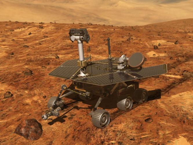
Opportunity (rover)
| Spacecraft: |
|
| Chronologies: |
2003 payload #49 ; 2003-032 : 6171st spacecraft. |
| Type: |
Mars rover |
| Sponsor: |
NASA |
|
 |
| Launch: |
8 July 2003 at 3h18 UTC, from
Cape Canaveral Air Force Station's SLC-17B, by a Delta 7925H. |
| Orbit: |
On Mars |
| Mission: |
On 27 July 2014,
Opportunity, working on Mars since January 2004, passed 40 kilometers of
total driving on the mission's 3,735th Martian day, or sol. The rover now
holds Solar system's distance record for off-Earth driving. The previous
record holder was Lunokhod 2 rover, which landed on the Moon in January
1973 and drove about 39 kilometers in less than five months (five lunar
days). "This is so remarkable considering Opportunity was intended to drive
about one kilometer and was never designed for distance, " said John Callas,
Mars Exploration Rover Project Manager. The rover had driven more than
32 kilometers before arriving at Endeavour Crater, where it has examined
outcrops on the craters rim containing clay and sulfate-bearing minerals.
The sites are yielding evidence of ancient environments with less acidic
water than those examined at Opportunitys landing site. |
| Source: |
Jonathan
Space Report No. 504
; Spacewarn No. 597
; National Space Science Data Center's
2003-032A
; NASA's 23
Jan 14 ; Spaceflight Now's
2013
Stories,
2014 Stories
; NASA's 2010-2014News
Releases ; |
|
|
.
Rainbow 1
| Spacecraft: |
|
| Chronologies: |
2003 payload #50 ; 2003-033A : 6172nd spacecraft. |
| Type: |
Communications (DBS) |
| Sponsor: |
U.S. Cablevision Systems Corp. |
|
|
| Launch: |
17 July 2003 at 23h45 UTC, from
Cape Canaveral Air Force Station's SLC-41, by an Atlas V (AV-003). |
| Orbit: |
Geostationary at 62° West longitude.
(35 644 km x 35 931 km x 0.1° x 24 hr) |
| Mission: |
Rainbow 1 is a 4.3-tonne communications satellite
that provides direct-to-home television services in the contiguous United
States through its several transponders. Built by Lockheed Martin in Sunnyvale,
the spacecraft is a A2100AX class satellite that has a launch mass of 4,328
kg. |
| Notes: |
 Lockheed
Martin launched AV-003, the first 500-series Atlas V. It is a 521 variant
with a 5-meter fairing, two Aerojet strapon solid boosters and a single-engine
Common Centaur upper stage. (The previous two Atlas V launches were 400-series
missions using a smaller fairing and no strapons.) This was the first flight
of the Aerojet Atlas V SRM boosters, which with a mass of 46 tons and a
size of 19.2-meter long, 1.6-meter diameter are comparable to the first
stage of the MX/Peacekeeper ICBM (shorter and fatter at 10.7-meter long,
2.3-meter diameter) -- much bigger than the Delta GEM strapons, but much
smaller than the Ariane 5 and Titan 4 SRBs. Lockheed
Martin launched AV-003, the first 500-series Atlas V. It is a 521 variant
with a 5-meter fairing, two Aerojet strapon solid boosters and a single-engine
Common Centaur upper stage. (The previous two Atlas V launches were 400-series
missions using a smaller fairing and no strapons.) This was the first flight
of the Aerojet Atlas V SRM boosters, which with a mass of 46 tons and a
size of 19.2-meter long, 1.6-meter diameter are comparable to the first
stage of the MX/Peacekeeper ICBM (shorter and fatter at 10.7-meter long,
2.3-meter diameter) -- much bigger than the Delta GEM strapons, but much
smaller than the Ariane 5 and Titan 4 SRBs. |
| Source: |
Jonathan
Space Report No. 505
; Spacewarn No. 597
; National Space Science Data Center's
2003-033A
; Lockheed Martin's Atlas
Facts ; |
|
|
.
Echostar IX / Telstar
13
| Spacecraft: |
Echostar 9 |
| Chronologies: |
2003 payload #51 ; 2003-034A ; 6173rd spacecraft. |
| Type: |
Communications (DBS) |
| Sponsor: |
Echostar/Loral |
|
|
| Launch: |
8 August 2003 at 3h31 UTC, from
the Odyssey platform, by a Zenit-3SL. |
| Orbit: |
Geostationary at 121° West longitude. |
| Mission: |
Echostar 9 carries a Ku- and Ka-band communications
payload for Echostar, and 24 C-band transponders currently owned by Loral
Skynet but about to be sold to Intelsat. The transponders provide direct-to-home
and cable-fed high definition television programs to all regions of North
America. Loral calls the satellite Telstar 13. Mass of Echostar 9 was 4,737
kg at launch. |
| Notes: |
The Sea Launch Zenit-3SL put the satelites
into a 0.03° geostationary transfer orbit. This inclination to the
equator is the lowest of any Sea Launch flight to date and could be the
lowest inclination initial orbit insertion ever. |
| Source: |
Jonathan
Space Report No. 506
; Spacewarn No. 598
; National Space Science Data Center's
2003-034A
; |
|
|
.
Kosmos 2399
| Spacecraft: |
Don |
| Chronologies:x |
2003 payload #52 ; 2003-035A ; 6174th spacecraft. |
| Type: |
Reconnaissance |
| Sponsor: |
Russian Defense Ministry |
|
|
| Launch: |
12 August 2003 at 14h20 UTC,
from Baykonur Cosmodrome's LC-31/6, by an A-2/Soyuz-U (115A11U). |
| Orbit: |
170 km x 311 km x 65.0° |
| Destroyed: |
21 December 2003 |
| Mission: |
Military photo-reconnaissance satellite using
capsule to retrieve film. This spysat continues in orbit after the release
of five small pieces in low orbit around 19 November, 99 days into its
mission. The Don class satellites do not normally release objects until
the end of their mission, when they are sometimes destroyed by deliberate
explosion. The expected lifetime of Kosmos-2399 based on recent flights
is 100-130 days. According to Kommersant newspaper, the Russian
Space Forces have announced that the five debris pieces are from a failed
film capsule recovery. Several of the pieces are extremely long and thin
unreeled photographic film, flapping free in low orbit. The capsule is
probably object 2003-35E, which decayed most slowly and reentered on Nov
30. Kosmos-2399 was destroyed in orbit on Dec 9 after completing its mission.
At least 21 debris pieces were cataloged by US sensors and all have now
reentered. |
| Source: |
Jonathan
Space Report No. 506,
507,
514,
515
& 516
: Spacewarn No. 598
; National Space Science Data Center's2003-035A
; |
|
|
.
Scisat-1
| Spacecraft: |
|
| Chronologies: |
2003 payload #53 ; 2003-036A ; 6175th spacecraft. |
| Type: |
Earth upper atmosphere studies |
| Sponsor: |
CSA / Canadian Space Agency |
|
|
| Launch: |
13 August 2003 at 2h09 UTC, from
Vandenberg Air Force Base's RW-30/12, by a Pegasus XL. |
| Orbit: |
641 km x 654 km x 73.9° deg. |
| Mission: |
Scisat-1 is a Canadian atmospheric research
satellite which carries the ACE-FTS spectrometer to study the chemistry
of the upper troposphere and stratosphere, as well as the MAESTRO instrument
to study ozone and aerosol levels in the atmosphere. The 152-kg, 70-Watts
"bias momentum stabilized" spacecraft points to the Sun at one degree accuracy
and its instruments monitor the atmospheric ozone and dust composition
in the 4-100 km altitude range. |
| Launch: |
Orbital Sciences' L-1011 Stargazer carrier
aircraft took off from Vandenberg AFB at 1h13 UTC on 13 August 2003 carrying
a Pegasus rocket, and headed out over the Pacific. At 2h09 UTC, probably
at the standard drop location of 36° North and 123° West, the Pegasus
was released at an altitude of about 12 km and ignited its first stage
motor 5 seconds later. At 2h17 UTC the third stage and its Scisat-1 payload
reached orbit. |
| Source: |
Jonathan
Space Report No. 506
; Spacewarn No. 598
; National Space Science Data Center's
2003-036A
; |
|
|
.
Kosmos 2400
| Spacecraft: |
Strela-3 |
| Chronologies: |
2003 payload #54 ; 2003-037A ; 6176th spacecraft. |
| Type: |
Communications |
| Sponsor: |
Russia's Defense ministry |
|
|
|
.
Kosmos 2401
| Spacecraft: |
Strela-3 |
| Chronologies: |
2003 payload #55 ; 2003-037B ; 6177th spacecraft. |
| Type: |
Communications |
| Sponsor: |
Russia's Defense ministry |
|
|
|
.
SATEC
| Spacecraft: |
|
| Chronologies: |
2003 payload #56 ; 2003 1st loss ; 6178th
spacecraft. |
| Type: |
Technology |
| Sponsor: |
Brazil |
|
|
| Launch: |
22 August 2003 at 16h30 UTC,
from the Alcantara Launch Center, by a VLS-1 (V03). |
| Orbit: |
n/a |
| Mission: |
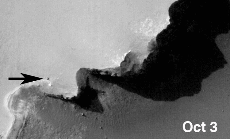
The Brazilian satellite launch vehicle VLS-1
exploded on the launch pad during prelaunch tests; it appears that one
of the strapon boosters ignited by accident. 21 rocket technicians were
killed.
The report on the accidental
explosion of a rocket that killed 21 engineers and technicians three days
before launch, published on 16 Mars 2004, confirmed that an electrical
flaw triggered one of the VLS-1 VO3 rocket's four solid fuel boosters during
final preparations at the remote seaside launch pad. Sabotage was ruled
out. The investigation team said it could not determine the nature of the
electrical problem and that further investigation is under way. `We observed
a lack of formal, detailed risk management, especially in the conduct of
operations involving preparations for launch,'' the report said. Defense
Minister Jose Viegas hopes Brazil will be capable of launching a rocket
capable with a satellites by 2006. at the end of President Luiz Inacio
Lula da Silva's first term. |
| Source: |
Jonathan
Space Report No. 507
& 508
; The New York Times, 17 March 2004. |
|
|
.
UNOSAT
| Spacecraft: |
|
| Chronologies: |
2003 payload #57 ; 2003 2nd loss ; 6179th
spacecraft. |
| Type: |
Technology? |
| Sponsor: |
Brazil |
|
|
| Launch: |
22 August 2003 at 16h30 UTC,
from the Alcantara Launch Center, by a VLS-1 (V03). |
| Orbit: |
n/a |
| Mission: |
The Brazilian satellite launch vehicle exploded
on the launch pad during prelaunch tests; it appears that one of the strapon
boosters ignited by accident. 21 rocket technicians were killed. |
| Source: |
Jonathan
Space Report No. 507
& 508
; |
|
|
.
Spitzer Space Telescope
/ SIRTF
| Spacecraft: |
Space Infrared Telescope Facility |
| Chronologies: |
2003 payload #58 ; 2003-038A ; 6180th spacecraft. |
| Type: |
Astronomy |
| Sponsor: |
NASA/JPL |
|
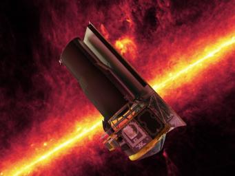 Source : NASA
|
| Launch: |
25 August 2003 at 5h35 UTC, from
Cape Canaveral's SLC-17B, by a Delta 7920H (2). |
| Orbit: |
Heliocentric at about 0.996 AU x 1.019 AU
x 1.14° x 369 days |
| Mission: |
The Space Infrared Telescope Facility (SIRTF)
is the last of NASA's four Great Observatories (the other being the Hubble
Space Telescope, the Compton
Gamma-ray Observatory and the Chandra
X-ray Observaroty). This infrared observatory follows the
IRAS
sky survey satellite and ISO
observatory (MSX
was another notable IR mission which made a galactic plane survey).
SIRTF has a 0.85-meter
infrared telescope, with a liquid-helium cooled focal plane carryingthree
main instruments: IRAC, IRS and MIPS. IRAC is a near infrared camera imaging
in the 3 to 8 micron range, IRS is a spectrograph covering the mid infrared
5 to 40 micron range, and MIPS far infrared Multiband Imaging Photometer
that covers the 12 to 160 micron range. The spacecraft is 4.45 meters high
and 2.1 -meters in diameter. It has solar arrays which are mounted along
one side of the telescope and act as a sunshield. The spacecraft has a
dry mass of 851 kg. At launch it carries 50 kg of helium cryogen, 16 kg
of nitrogen for attitude control, and a 6 kg telescope cover which were
ejected into solar orbit, for a total mass of 923 kg. It is built by Lockheed
Martin/Sunnyvale with the Cryogenic Telescope Assembly (CTA) built by Ball;
management is by JPL.
In December 2003,
the SIRTF has been renamed the Spitzer Space Telescope, after astronomer
Lyman Spitzer Jr. (1914-1997), who championed the idea of telescopes in
space starting in 1946 and is credited with being the driving force behind
OAO and HST. |
| Launch: |
SIRTF was launched by the second Delta II
Heavy (the first, a model 7925H, put the MER-B
Mars Exploration Rover into space in July). |
| Source: |
Jonathan
Space Report No. 507
& 516
; Spacewarn No. 598
; National Space Science Data Center's
2003-038A
; NASA's 2010-2014 News
Releases ; Spaceflight Now's
2013
Stories, 2014 Stories
; |
|
|
.
Progress M-48 / ISS-12P
| Spacecraft: |
Progress M (7K-TGM) no. 248 |
| Chronologies: |
2003 payload #59 ; 2003-039A ; 6181st spacecraft. |
| Type: |
Cargo delivery to the International Space
Station |
| Sponsor: |
Russia Space Agency |
|
 |
| Launch: |
29 August 2003 at 1h48 UTC, from
Baykonur Cosmodrome, by an A-2/Soyuz-U. |
| Orbit: |
~400 km circulat x 51.6° |
| Deorbit: |
28 January 2004 at 13h11 UTC. |
| Mission: |
Progress M-48 carries cargo (food, fuel,
water and equipmen) to the International Space Station. It docked automatically
with Zvezda on 31 August 2003 at 3h45 UTC and undocks five months later,
on 28 January 2004 at 8h36 UTC. |
| Source: |
Jonathan
Space Report No. 508
& 520
: Spacewarn No. 598
; National Space Science Data Center's
2003-039A
; |
|
|
.
DSCS III B-6 (USA 170)
| Spacecraft: |
DSCS 3B6 / Defense Satellite
Communications System |
| Chronologies: |
2003 payload #60 ; 2003-040A ; 6182nd spacecraft. |
| Type: |
Communications |
| Sponsor: |
U.S. Air Force |
|
|
| Launch: |
29 August 2003 at 23h13 UTC,
from Canaveral Air Force Base's SLC-37B, by a Delta IVM. |
| Orbit: |
Geostationary |
| Mission: |
DSCS 3B6 is a super-secure communication
satellite. It is the 10th and final member of the DSCS phase 3 fleet enabling
worldwide links among the American military personnel. It was originally
built by GE/Valley Forge for launch on the Space Shuttle, and was extensively
modified after the
Challenger
accident and the acquisition of GE's space division by Lockheed Martin. |
| Launch: |
This was the third launch of a Delta IV rocket
(all have been successful) |
| Source: |
Jonathan
Space Report No. 508
; Spacewarn No. 598
; National Space Science Data Center's
2003-040A
; |
|
|
.
"Advanced ORION 3"
(USA 171)
| Spacecraft: |
|
| Chronologies: |
2003 payload #61 ; 2003-041A ; 6183rd spacecraft. |
| Type: |
Electronic intelligence |
| Sponsor: |
U.S. National Reconnaissance Office |
|
|
| Launch: |
9 September 2003 at 4h29 UTC,
from Cape Canaveral Air Force Base's SLC-40, by a Titan 4B/Centaur (Titan
B-36 / Centaur TC-20). |
| Orbit: |
Geostationary |
| Mission: |
Analysts speculate that the payload is a
successor to the USA
110 and USA
139 satellites launched in May 1995 and May 1998, and referred
to as "Advanced ORION" by those who don't know the real name. These satellites
are thought to be successors to the RHYOLITE missions of the 1970s. |
| Note: |
This was the last launch of a Titan-Centaur.
There have
been 23 Titan-Centaur missions; TC-1 to TC-7
were civilian missions using the Titan 3E (23E) and the D-1T model Centaur,
while TC-8 to TC-23 were military missions on Titan 4 using a large diameter
Centaur. (TC-21 was used for the NASA/ESA Cassini-Huygens launch.) |
| Source: |
Jonathan
Space Report No. 509
; Spacewarn No. 599
; National Space Science Data Center's
2003-041A
; |
|
|
.
PS2
| Spacecraft: |
|
| Chronologies: |
2003 payload #62 ; 2003 3rd loss ; 6184th
spacecraft. |
| Type: |
Technology |
| Sponsor: |
CASIC (China Aerospace Science and Industry
Corp)? |
|
|
| Launch: |
16 September 2003, from Taiyuan
, by a KT-1. |
| Orbit: |
n/a |
| Mission: |
The Chinese solid-fuel launch vehicle KT-1
was launched one year after the first KT-1
launch failure, as a test flight. It is reported that the launch was intended
to place a 40-kg microsatellite called PS2 into a 300 x 300 km polar orbit.
(See also: China
develops first solid-fuel launch vehicle, China View, 24 September
2003.) |
| Source: |
Jonathan
Space Report No. 510
; |
|
|
.
Mozhaets-4 (Mozhayets
4)
| Spacecraft: |
|
| Chronologies: |
2003 payload #63 ; 2003-042A ; 6185th spacecraft. |
| Type: |
Technology |
| Sponsor: |
Russia |
|
|
| Launch: |
27 September 2003 at 6h12 UTC,
from Plesetsk Cosmodrome's LC-132, by a Kosmos-3M. |
| Orbit: |
674 km x 696 km x 98.2° |
| Mission: |
Mozhayets 4 is a Russian cadets' training
satellite that helps in laser-assisted geodesic measurements via its optical
reflectors.
It is a modified NPO-PM Strela-1M satellite
carrying experiments built by students at the Mozhaiskiy space engineering
academy. |
| Source: |
Jonathan
Space Report No. 510
; Spacewarn No. 600;
National
Space Science Data Center's
2003-042D
; |
|
|
.
Rubin-4-DSI
| Spacecraft: |
|
| Chronologies: |
2003 payload #64 ; 2003-042B ; 6186th spacecraft. |
| Type: |
Technology |
| Sponsor: |
Germany |
|
|
| Launch: |
27 September 2003 at 6h12 UTC,
from Plesetsk Cosmodrome's LC-132, by a Kosmos-3M. |
| Orbit: |
674 km x 696 km x 98.2° |
| Mission: |
Rubin-4-DSI is a German instrument package
attached to the Kosmos-3M final stage to measure the launch environment.
It monitors its position, velocity, and acceleration. The Rubin packages
are built by OHB System of Bremen, the European partner in the commercialization
of the Kosmos-3M rocket. |
| Source: |
Jonathan
Space Report No. 510
;
Spacewarn No. 600
; National Space Science Data Center's
2003-042A
; |
|
|
.
NigeriaSat-1
| Spacecraft: |
|
| Chronologies: |
2003 payload #65 ; 2003-042C ; 6187th spacecraft. |
| Type: |
Earth imaging (Disaster Monitoring Constellation) |
| Sponsor: |
Nigeria's National Space Research and Development
Agency |
|
|
| Launch: |
27 September 2003 at 6h12 UTC,
from Plesetsk Cosmodrome's LC-132, by a Kosmos-3M. |
| Orbit: |
674 km x 696 km x 98.2° |
| Mission: |
One of three satellites built by Surrey Satellite
for the Disaster Monitoring Constellation. It carries imaging cameras for
disaster monitoring, urban planning and agriculture. |
| Source: |
Jonathan
Space Report No. 510
; Spacewarn No. 600
; National Space Science Data Center's
2003-042F
; |
|
|
.
UK-DMC / BNSCSat
| Spacecraft: |
British National Science Center
SATellite |
| Chronologies: |
2003 payload #66 ; 2003-042D ; 6188th spacecraft. |
| Type: |
Earth imaging (Disaster Monitoring Constellation) |
| Sponsor: |
British National Space Center |
|
|
| Launch: |
27 September 2003 at 6h12 UTC,
from Plesetsk Cosmodrome's LC-132, by a Kosmos-3M. |
| Orbit: |
674 km x 696 km x 98.2° |
| Mission: |
One of three satellites built by Surrey Satellite
for the Disaster Monitoring Constellation. Besides disaster monitoring,
it will help in urban planning and agriculture surveys. |
| Notes: |
The DMC is run by an organization of seven
countries (UK, Algeria, China, Nigeria, Thailand, Turkey, and Vietnam)
with the satellites built at Surrey, UK.
See: The
Disaster Monitoring Constellation. |
| Source: |
Jonathan
Space Report No. 510
; Spacewarn No. 600
; National Space Science Data Center's
; |
|
|
.
BILSAT-1
| Spacecraft: |
|
| Chronologies: |
2003 payload #67 ; 2003-042E ; 6189th spacecraft. |
| Type: |
Earth imaging (Disaster Monitoring Constellation) |
| Sponsor: |
Turky's TUBITAK-ODTU-BILTEN (the Information
Tech and Electronics Research Institute of Middle East Technical University
in Ankara) |
|
|
| Launch: |
27 September 2003 at 6h12 UTC,
from Plesetsk Cosmodrome's LC-132, by a Kosmos-3M. |
| Orbit: |
674 km x 696 km x 98.2° |
| Mission: |
One of three satellites built by Surrey Satellite
for the Disaster Monitoring Constellation. It is testing a cold-gas propulsion
system. The 130-kg satellite carries five imaging cameras to monitor natural
disasters at a resolution of 26 meters in color by four cameras (operating
in red, green, blue, and infrared colors) and another at 4-meter resolution
in black-and-white. BilSat 1 will also help in agriculture and urban
planning. |
| Source: |
Jonathan
Space Report No. 510
& 513
; Spacewarn No. 600
; National Space Science Data Center's
2003-042G
; |
|
|
.
Larets
| Spacecraft: |
|
| Chronologies: |
2003 payload #68 ; 2003-042F ; 6190th spacecraft. |
| Type: |
Radar calibration? |
| Sponsor: |
Russia |
|
|
| Launch: |
27 September 2003 at 6h12 UTC,
from Plesetsk Cosmodrome's LC-132, by a Kosmos-3M. |
| Orbit: |
674 km x 696 km x 98.2° |
| Mission: |
Larets is a small Russian (0.2-meter) sphere
covered with laser retroreflectors for calibration and geodesy. Carrying
reflectors for ground-based laser rangers, it will help "tuning ground
radars". |
| Source: |
Jonathan
Space Report No. 510
& 513
: Spacewarn No. 600
; National Space Science Data Center's
2003-042B
; |
|
|
.
STSat-1 (KAISTSAT-4)
| Spacecraft: |
Korea Advanced Institute of Science
and Technology SATellite 4 |
| Chronologies: |
2003 payload #69 ; 2003-042G ; 6191st spacecraft. |
| Type: |
Astronomy |
| Sponsor: |
South Korea |
|
|
| Launch: |
27 September 2003 at 6h12 UTC,
from Plesetsk Cosmodrome's LC-132, by a Kosmos-3M. |
| Orbit: |
674 km x 696 km x 98.2° |
| Mission: |
The 120-kg satellite carries a special UV
imaging spectrograph to monitor gas clouds in the Galaxy. It will complete
a full-sky mapping in about a year, by scanning a one-degree strip every
day. Additionally, it may also aim the telescope downward to image auroral
displays. |
| Source: |
Jonathan
Space Report No. 510
; Spacewarn No. 600
; National Space Science Data Center's
; |
|
|
.
Insat 3E
| Spacecraft: |
|
| Chronologies: |
2003 payload #70 ; 2003-043E ; 6192nd spacecraft. |
| Type: |
Communications (multi-services) |
| Sponsor: |
India |
|
|
| Launch: |
27 September 2003 at 23h14 UTC,
from Kourou Space Center's ELA-3, by an Ariane 5G (Ariane 516, V162). |
| Orbit: |
Geostationary at 55° East longitude |
| Mission: |
Insat 3E joins the currently operational
India's four communications satellites fleet (Insat
2E, Insat
3A, Insat 3B and
Insat
3C). The 2.8-tonne, triaxially-stabilized satellite carries 24 C-band
and 12 extended C-band transponders to provide communications and television
services to the Indian subcontinent.
In april 2014, it
was reported that Insat 3E has failed. Orbital data shows that the craft
began to slowly drift off station in late March 2014 and its orbit was
lowered, drifting two degrees east per day. The Hindu newspaper reported
on 2 April 2014 that the satellite has been decommissioned and that the
orbit will later be raised to a higher 'graveyard' orbit. |
| Source: |
Jonathan
Space Report No. 510,
596
; Spacewarn No. 600
; National Space Science Data Center's
2003-043E
; |
|
|
.
e-Bird
| Spacecraft: |
|
| Chronologies: |
2003 payload #71 ; 2003-043B ; 6193rd spacecraft. |
| Type: |
Communications (multi-services) |
| Sponsor: |
Eutelsat |
|
 Source : Boeing
|
| Launch: |
27 September 2003 at 23h14 UTC,
from Kourou Space Center's ELA-3, by an Ariane 5G (V516, V162). |
| Orbit: |
Geostationary at 33° East longitude |
| Mission: |
e-Bird is a Boeing BSS 376 class satellite
owned by Eutelsat that provides data transmission in Europe. The 888-kg,
1.6 kW satellite carries 20 Ku-band transponders to provide video and data
transmissions to Europe and Turkey through four antenna beams. |
| Source: |
Jonathan
Space Report No. 510
; Spacewarn No. 600
; National Space Science Data Center's
2003-043A
; |
|
|
.
SMART-1
| Spacecraft: |
Small Missions for Advanced Research
in Technology 1 |
| Chronologies: |
2003 payload #72 ; 2003-043G ; 6194th spacecraft. |
| Type: |
Lunar probe |
| Sponsor: |
ESA |
|
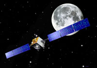 Source: ESA
Gallery
Source: ESA
Gallery
|
| Launch: |
27 September 2003 at 23h14 UTC,
from Kourou Space Center's ELA-3, by an Ariane 5G (V516, V162). |
| Orbit: |
Earth orbit. |
|
SMART-1 preparation
(left) and artist concepts. (Source: ESA
Gallery)
|
| Mission: |
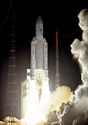 SMART
1 is a lunar mission to test solar electric propulsion technology and to
ascertain the surface minerals on the Moon. The 367-kg, 1.9 kW satellite
uses the electrical power from solar panels to ionize and accelerate heavy
ions (from 82 kg of Xenon gas) that are then ejected at high speeds from
the rear end of the satellite. Besides testing the novel propulsion system,
it carries a few small packages of instruments to map the mineralogy of
the lunar surface by remote sensing. The controlled propulsion will enable
a slow spiraling of the orbit to the final ellipse with periselene at 300
km, and aposelene at 10,000 km altitude, with an inclination of nearly
90°. SMART 1 uses ion drive to reach lunar orbit; it was built by the
Swedish Space Corp. On 5 November 2003, the lunar probe was in a 3,058
km x 38,624 km x 6.9° Earth orbit compared to its initial 672 km x
35,829 km x 6.9° trajectory. SMART
1 is a lunar mission to test solar electric propulsion technology and to
ascertain the surface minerals on the Moon. The 367-kg, 1.9 kW satellite
uses the electrical power from solar panels to ionize and accelerate heavy
ions (from 82 kg of Xenon gas) that are then ejected at high speeds from
the rear end of the satellite. Besides testing the novel propulsion system,
it carries a few small packages of instruments to map the mineralogy of
the lunar surface by remote sensing. The controlled propulsion will enable
a slow spiraling of the orbit to the final ellipse with periselene at 300
km, and aposelene at 10,000 km altitude, with an inclination of nearly
90°. SMART 1 uses ion drive to reach lunar orbit; it was built by the
Swedish Space Corp. On 5 November 2003, the lunar probe was in a 3,058
km x 38,624 km x 6.9° Earth orbit compared to its initial 672 km x
35,829 km x 6.9° trajectory.
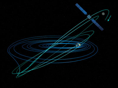 On 15 November 2004, the probe entered a 4962 x 51477 km orbit around the
Moon inclined at 81 degrees to the lunar equator. This is the most loosely
bound lunar orbit ever achieved, with its highest point close to the Earth-Moon
gravitational boundary. SMART-1's ion engine was restarted at orbit insertion
to lower the orbital altitude and bind it more tightly the Moon; final
orbit will be reached in January. SMART-1 lunar probe entered lunar orbit
on 15 November 2004 in a 4,962 km x 51,477 km x 81.1° orbit. Its ion
engine lowered the orbit to 1,014 km x 5,204 km x 87.9°.
On 15 November 2004, the probe entered a 4962 x 51477 km orbit around the
Moon inclined at 81 degrees to the lunar equator. This is the most loosely
bound lunar orbit ever achieved, with its highest point close to the Earth-Moon
gravitational boundary. SMART-1's ion engine was restarted at orbit insertion
to lower the orbital altitude and bind it more tightly the Moon; final
orbit will be reached in January. SMART-1 lunar probe entered lunar orbit
on 15 November 2004 in a 4,962 km x 51,477 km x 81.1° orbit. Its ion
engine lowered the orbit to 1,014 km x 5,204 km x 87.9°. |
| Source: |
Jonathan
Space Report No. 510,
514,
532,
538
&
543
;
Spacewarn No. 600
; National Space Science Data Center's
2003-043C
; ESA News 24
Mar 04 ; |
|
|
.
Galaxy 13 / Horizons-1
| Spacecraft: |
|
| Chronologies: |
2003 payload #73 ; 2003-044A ; 6195th spacecraft. |
| Type: |
Communications (multi-services) |
| Sponsor: |
U.S. Panansat & Japanese JSAT |
|
|
| Launch: |
1st October 2003 at 4h03 UTC,
from Odyssey platform, by a Zenit-3SL. |
| Orbit: |
Geostationary at 127° West longitude |
| Mission: |
Horizons 1/Galaxy 13 is a joint American-Japanese
communications spacecraft. The 2.6-tonne (4.06 tonnes including fuel),
9.9 kW satellite carries 24 transponders each in the C- and Ku-bands to
provide digital video, internet and data services to the countries on either
side of the Pacific Ocean. The C-band payload is referred to as Galaxy
13, the Ku-band payload is called Horizons-1. The satellite is a Boeing
601HP model with a launch mass of 4,090 kg. |
| Launch: |
The satellite was launched on from the floating
Odyssey platform at 154° West and 0° North in the Pacific. |
| Source: |
Jonathan
Space Report No. 511
; Spacewarn No. 600
; National Space Science Data Center's
2003-044A; |
|
|
.
Shenzhou 5
| Spacecraft: |
Shenzhou means "Divine Vessel". |
| Chronologies: |
2003 payload #74 ; 2003-045A ; 6196th spacecraft. |
| Type: |
Piloted spacecraft |
| Sponsor: |
China |
|
|
| Launch: |
15 October 2003 at 1h00 UTC,
from the Jiuquan Satellite Launch Center, by a Chang Zheng 2F. |
| Orbit: |
200 km x 350 km x 42.4° |
| Landing: |
15 October 2003 at 22h23 UTC. |
| Mission: |
Shenzhou 5 is China's first manned spacecraft.
It carriied the first "taikonaut": Yang Liwei. The 8.5-tonne ship (consisting
of three modules: the descent module, the propulsion module and the orbital
module) orbited the Earth for over 20 hours. At the end of the mission,
at 21h36 UTC, the orbital module separated to remain in orbit. The propulsion
module fired at 21h38 UTC to lower perigee into the atmosphere. It then
separated at 21h59 UTC and burnt up on reentry, leaving the descent module
with its heat shield exposed to the atmosphere. SZ-5 landed in China's
Nei Monggol Zizhiqu (Inner Mongolia) province, at Dorbod Xi near Siziwang,
100 km North of Hohhot. The recovery crew reached the capsule ten minutes
later and Yang emerged safely, although there have been some rumours of
problems during the flight. |
| Notes: |
As usual in Chinese culture, Yang is the
astronaut's family name ("Lt-Col. Yang"). He is the first individual to
fly in space who was a Chinese citizen at the time of launch. Wang Gunjin
(Taylor Wang) was born in Shanghai but was a
US citizen at the time of his Shuttle flight. Two other US astronauts were
born in China: Shannon Wells Lucid (Shanghai)
and William Anders (Hong Kong). |
| Source: |
Jonathan
Space Report No. 512
; Spacewarn No. 600
; National Space Science Data Center's
2003-045A
; |
|
|
.
SZ-5 OM / Shenzhou 5
Orbital Module
| Spacecraft: |
|
| Chronologies: |
2003 payload #75 ; 2003-045G ; 6197th spacecraft. |
| Type: |
Reconnaissance? |
| Sponsor: |
China |
|
|
| Launch: |
15 October 2003 at 1h00 UTC,
from Jiuquan, by a Chang Zheng 2F. |
| Orbit: |
200 km x 350 km x 42.4° |
| Mission: |
At the end of the Shenzhou 5 mission, on
15 October 2003 at 21h36 UTC, the orbital module separated to remain in
orbit. It continued to carry out experiments using large optical cameras
thought to be for military surveillance. |
| Source: |
Jonathan
Space Report No. 512
; Spacewarn No. 600
; National Space Science Data Center's
2003-045A
; |
|
|
.
IRS-P6 / ResourceSat
| Spacecraft: |
|
| Chronologies: |
2003 payload #76 ; 2003-046A ; 6198th spacecraft. |
| Type: |
Earth remote sensing |
| Sponsor: |
India |
|
|
| Launch: |
17 October 2003 at 4h52 UTC,
from Satish Dhawan Space Center at Sriharikota, by a PSLV (PSLV-C5). |
| Orbit: |
802 km x 875 km x 98.7° |
| Mission: |
The 1,360 kg IRS-P6 imaging satellite carries
high-resolution imaging instruments to monitor agricultural, land and water
resources. It replaces
IRS-1C
and IRS-1D,
and carries three cameras for remote sensing, the highest resolution one
being the 6-meter LISS-4 imager. |
| Notes: |
The IRS series of satellites included the
original IRS-1 series launched mostly on Russian rockets and the IRS-P
series launched on Indian rockets. |
| Source: |
Jonathan
Space Report No. 512
; Spacewarn No. 600
; National Space Science Data Center's
2003-046A
; |
|
|
.
Soyuz TMA-3 / ISS-7S
| Spacecraft: |
Soyuz 11F732 (7K-STMA) no. 213 |
| Chronologies: |
2003 payload #77 ; 2003-047A ; 6199th spacecraft. |
| Type: |
Piloted spacecraft |
| Sponsor: |
Russia Space Agency |
|
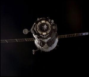 Source : NASA
|
| Launch: |
18 October 2003 at 5h38 UTC,
from Baykonur Cosmodrome, by an A-2/Soyuz-FG. |
| Orbit: |
~400 km circular x 51,6° |
| Landed: |
30 April 2004 at 0h12 UTC in Kazakhstan |
| Mission: |
The Soyuz TMA-3 carried the Expedition 8
crew of Mike Foale and Aleksandr Kaleri and the "Cervantes" mission crewmember
Pedro Duque. It docked with the Pirs module on 20 October 2003 at 7h16
UTC. Duque carries out a set of European Space Agency and Spanish experiments
dubbed Cervantes. He returned to Earth a week later with the Expedition-7
crew (Malenchenko and Lu) aboard Soyuz TMA-2.
The Soyuz TMA-3
spaceship landed in Kazakhstan, returning the Expedition 8 and ESA DELTA
crews to Earth. Mike Foale, Aleksandr Kaleri and Andre Kuipers entered
TMA-3 from the Station's Pirs module and closed the hatches on 29 April
2004 at 17h47 UTC. They undocked from Pirs at 20h52 UTC and fired their
deorbit engines at 23h20 UTC. The 115 m/s burn near apogee lasted 4 min,
23 s. and lowered the orbit from 354 x 371 km to about -32 x 369 km. The
orbital and propulsion modules were jettisoned at 23h45 UTC, and the descent
module landed near 50° North and 67° Eest at 0h12 UTC on Apr 30. |
| Source: |
Jonathan
Space Report No. 512
& 525
; Spacewarn No. 600
; National Space Science Data Center's
2003-047A
; |
|
|
.
DMSP Block 5D-3 F-16
(USA 172)
| Spacecraft: |
DMSP Block 5D-3 F-16 / DMSP F-16
(Defense Meteorological Satellite Program F-16) |
| Chronologies: |
2003 payload #78 ; 2003-048A ; 6200th spacecraft. |
| Type: |
Meteorology |
| Sponsor: |
U.S. Department of Defense |
|

Source : A,
Parsch
|
| Launch: |
18 October 2003 at 16h17 UTC,
from Vandenberg Air Force Base's, by a Titan 23G (23G-9). |
| Orbit: |
850 km x 856 km x 98.8° |
| Mission: |
The DMSP Block 5D-3 F-16 weather satellite
was launched after several years of delays. It carries instruments
to monitor oceans and clouds in the visible and infrared bands at moderate
resolution to enable strategic and tactical planning needs of the military.
It is also likely to carry auroral energetic particle monitors, like all
the previous DMSP satellites. |
| Notes: |
Last Titan 23G rocket.
The Defense Meteorological
Satellite Program began launches in 1962, originally under National Reconnaissance
Office auspices, and in the late 1960s provided tactical weather support
to US forces in Vietnam. DMSP was later declassified under Strategic Air
Command oversight, and the system is now being combined with the NOAA civil
weather satellite system. According to one NOAA website, the satellite
is actually production number S-20; satellites S-16 to S-19 remain to be
launched. (The "S" numbers are the production order, while the "F" numbers
are the launch order). |
| Source: |
Jonathan
Space Report No. 512
; Spacewarn No. 600
; National Space Science Data Center's
2003-048A
; |
|
|
.
ZY-1 2 (CBERS 2)
| Spacecraft: |
Zi Yuan 1 No. 2 or "second Resources-1
satellite" ;
CBERS / China Brazil Earth Resources Satellite |
| Chronologies: |
2003 payload #79 ; 2003-049A ; 6201st spacecraft. |
| Type: |
Earth remote sensing |
| Sponsor: |
China-Brazil |
|
|
| Launch: |
21 October 2003 at 3h16 UTC,
from Taiyuan, by a Chang Zheng 4B. |
| Orbit: |
773 km x 773 km x 98.5° |
| Mission: |
The second 1,550-kg Sino-Brazilian Earth
remote sensing satellite was designed to monitor Earth's land resources
change, survey arable lands and grasslands, monitor natural and human disasters,
offer information on aquatic farming and environmental pollution, and explore
mineral resources. The satellite was developed by China Academy of Space
Technology in cooperation with Brazilian National Institute for Space Research.
It has a designed service life of two years ans is expected to be more
reliable than the first one (launched in 1999) and still operational after
two years. It was under Chinese control for 18 months, and later under
Brazilian control during the remaining lifetime (of six or more months).
China bore 70 percent of the costs of the resources satellites the two
countries developed, while Brazil bore 30 percent. Brazil was responsible
for the development of a CCD imaging system in the satellite, while China
was responsible for the application platform and two other payloads. |
| Source: |
Jonathan
Space Report No. 512
& 514
; Spacewarn No. 600
; National Space Science Data Center's
2003-049A
; Xinhuas 28
Nov 02, 21
Oct 03, 21
Oct 03, 21
Oct 03 ; China Daily's
5
Mar 02 ; |
|
|
.
CX-1 / Chuangxin 1
| Spacecraft: |
Chuangxin means "innovation" |
| Chronologies: |
2003 payload #80 ; 2003-049B ; 6202nd spacecraft. |
| Type: |
Technology |
| Sponsor: |
China |
|
|
| Launch: |
21 October 2003 at 3h16 UTC,
from Taiyuan, by a Chang Zheng 4B. |
| Orbit: |
730 km x 750 km x 98.5° |
| Mission: |
Chuangxin 1 is 100-km prototype of an advanced
telecommunication satellite with potentials for environmental protection,
oil and gas transportation, flood prevention and earthquake monitoring.
It has adopted a series of advanced telecommunication technologies which,
according to Chinese sources, can play a big role in data transmission
to help traffic control, environmental protection, oil and gas transportation,
flood prevention and earthquake monitoring, It is China's first
satellite weighing less than 100 kg and mars that China is now able to
develop micro-satellites
It marks a new phase in China's aerospace technology,
Chuangxin I was developed by the Chinese Academy of Sciences (CAS). |
| Source: |
Jonathan
Space Report No. 512
; Spacewarn No. 600
; National Space Science Data Center's
2003-049B
; Xinhuas 21
Oct 03, 21
Oct 13 ; |
|
|
.
SERVIS-1
| Spacecraft: |
Space Environment Reliability
Verification of Integrated System |
| Chronologies: |
2003 payload #81 ; 2003-050A ; 6203rd spacecraft. |
| Type: |
Technology |
| Sponsor: |
Japanese USEF (and possibly the Japanese
Ministry of Trade and Industry). |
|
|
| Launch: |
30 October 2003 at 33h43 UTC,
from Plesetsk Cosmodrome, by a Rokot. |
| Orbit: |
982 km x 1015 km x 99,5° x 105 min |
| Mission: |
This 900-kg, 1.4 x 1.4 x 2.3 m, 1.2 kW Japanese
test satellite carries mostly commercially available off-the-shelf household
items like PCs and cell phones so as to ascertain the viability of such
inexpensive equipments. SERVIS-1 is to flight-qualify a variety of spacecraft
components (including navigation, computer, star tracker, battery and laser
gyro). It also measures the degradation due to gamma rays and energetic
particles. The satellite was built by Mitsubishi. |
| Launch: |
Eurockot/Krunichev has launched a UR-100N
Rokot two-stage refurbished missile with a Briz-KM upper stage |
| Source: |
Jonathan
Space Report No. 513
; Spacewarn No. 600
; National Space Science Data Center's
2003-050A
; |
|
|
.
JB-4 / Jianbin 4 (FSW-3
1)
| Spacecraft: |
Jianbin 4 or "Pathfinder". |
| Chronologies: |
2003 payload #82 ; 2003-051C ; 6204th spacecraft. |
| Type: |
Reconnaissance |
| Sponsor: |
China Defense ministry |
|
|
| Launch: |
3 November 2003 at 7h20 UTC,
from Jiuquan, by a Chang Zheng 2D. |
| Orbit: |
191 km x 330 km x 63° x 89,7 min |
| Recovery: |
21 November at 2h04 UTC in Sichuan province |
| Mission: |
The satellite is thought to be a successor
to the FSW (Fanhui Shi Weixing) series; it is a recoverable spacecraft
which is a modified version of the FSW-2 satellite and includes a camera
payload which will probably be used for both military reconnaissance and
Earth resources studies. Chinese space expert Chen Lan reports that it
is called Jianbin 4 and Phillip Clark says that the earlier FSW satellites
were JB-1 and that the ZY-2 satellites are also designated JB-3.
The JB-4 made small orbit
raising maneuvers on 8 and 14 November 2003. The reentry vehicle separated
from the main satellite on 21 November at around 1h42 UTC and landed in
Sichuan province. After separation, the main satellite was tracked in a
higher orbit of 192 km x 357 km. |
| Source: |
Jonathan
Space Report No. 513
& 514
; Spacewarn No. 601
; National Space Science Data Center's
2003-051C
; |
|
|
.
Zhongxing-20
| Spacecraft: |
|
| Chronologies: |
2003 payload #83 ; 2003-052A ; 6205th spacecraft. |
| Type: |
Communications |
| Sponsor: |
China Defense ministry |
|
|
| Launch: |
14 November 2003 at 16h01 UTC,
from the Xichang Satellite Launch Center, by a Chang Zheng 3A. |
| Orbit: |
Geostationary at 103° East longitude. |
| Mission: |
This new communications satellite is probably
part of the Feng Huo military communications system. |
| Note: |
This is the fourth Chinese launch in a month. |
| Source: |
Jonathan
Space Report No. 514
; Spacewarn No. 601
; National Space Science Data Center's
2003-052A
; |
|
|
.
Yamal 201 / Yamal-200
KA-1
| Spacecraft: |
|
| Chronologies: |
2003 payload #84 ; 2003-053A ; 6206th spacecraft. |
| Type: |
Communications (multi-services) |
| Sponsor: |
Gazprom Space Systems (GKS), Russia |
|
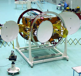 (Source: Energiya)
|
| Launch: |
24 November 2003 at 6h22 UTC,
from Baykonur Cosmodrome's PL81/23, by a D-1-e/Proton-K/DM-2M. |
| Orbit: |
Geostationary at 90° East longitude. |
| Mission: |
 Yamal
202 and Yamal 201 are a pair of Russian geostationary communications satellite
with a mass of 1.3 tonne and power of 3.6 kW. Yamal 201 carries nine C-band
and six Ku-band transponders. These Yamal-200 satellites (SC-1 and SC-2)
are designed for transmission of large amounts of data between regions
of Russian Federation in the interests of the Gasprom company and other
users, including TV broadcasts. They were manufactured at RSC Energia Corp.
They are based on the multi-purpose satellite bus (the first version of
which (Yamal
100) has been in operation since September 1999. The mass of
SC-1 is 1,360 kg ant the satellite is designed to operate in orbit for
more than 12 years. Yamal
202 and Yamal 201 are a pair of Russian geostationary communications satellite
with a mass of 1.3 tonne and power of 3.6 kW. Yamal 201 carries nine C-band
and six Ku-band transponders. These Yamal-200 satellites (SC-1 and SC-2)
are designed for transmission of large amounts of data between regions
of Russian Federation in the interests of the Gasprom company and other
users, including TV broadcasts. They were manufactured at RSC Energia Corp.
They are based on the multi-purpose satellite bus (the first version of
which (Yamal
100) has been in operation since September 1999. The mass of
SC-1 is 1,360 kg ant the satellite is designed to operate in orbit for
more than 12 years.
Yamal-201 malfunctioned
on 5 June 2014 and is deemed lost. Built by RSC Energia, it was supposed
to operate until 2015. its signals covered 95% of Russias territory and
Yamal-201s traffic has been referred to other Gazprom Space Systems satellites.
It was the oldest among the GKS space assets. |
| Source: |
Jonathan
Space Report No. 515
; Spacewarn No. 602
; National Space Science Data Center's
2003-053A
; ITAR-TASS' 16
Jul 14 ; Energiya's Yamal
Communications satellites |
|
|
.
Yamal 202 / Yamal-200
KA-2
| Spacecraft: |
|
| Chronologies: |
2003 payload #85 ; 2003-053B ; 6207th spacecraft. |
| Type: |
Communications (multi-services) |
| Sponsor: |
Gazprom Space Systems (GKS), Russia |
|
(Source: Energiya)
|
| Launch: |
24 November 2003 at 6h22 UTC,
from Baykonur Cosmodrome's PL81/23, by a D-1-e/Proton-K/DM-2M. |
| Orbit: |
Geostationary at 49° East longitude. |
| Mission: |
Yamal
202 and Yamal 201 are a pair of Russian geostationary communications satellite
with a mass of 1.3 tonne and power of 3.6 kW. Yamal 202 carries 18 C-band
transponders. These Yamal-200 satellites (SC-1 and SC-2) are designed for
transmission of large amounts of data between regions of Russian Federation
in the interests of the Gasprom company and other users, including TV broadcasts.
They were manufactured at RSC Energia Corp. They are based on the multi-purpose
satellite bus (the first version of which (Yamal
100) has been in operation since September 1999. The mass of
SC-2 is 1,320 kg ant the satellite is designed to operate in orbit for
more than 12 years. |
| Source: |
Jonathan
Space Report No. 515
; Spacewarn No. 602
; National Space Science Data Center's
2003-053B
; Energiya's Yamal
Communications satellites |
|
|
.
IGS-2a
| Spacecraft: |
|
| Chronologies: |
2003 payload #86 ; 2003 4rd loss ; 6208th
spacecraft. |
| Type: |
Reconnaissance |
| Sponsor: |
Japanese Defense Ministry |
|
|
| Launch: |
29 November 2003 at 4h33 UTC,
from Tanegashima Space Center, by a H-IIA 2024. |
| Orbit: |
n/a |
| Mission: |
IGS-2a and IGS-2b were classified Information
Gathering Satellites built by Mitsubishi, one with an optical imaging payload
and the other with a radar payload. They would have joined IGS-1a
and IGS-1b in orbit to form an operational Japanese
space reconnaissance system. |
| Launch failure: |
The H-IIA rocket was destroyed 11 minutes
after launch, half way into the second-stage burn. Reports indicate that
one of the two massive (10-tonne) solid boosters failed to separate from
the first stage as planned less than two minutes after launch, possibly
because leaking hot gas burned through the command wires. The extra mass
decreased the first stage's acceleration. This stage and the attached booster
fell away about 6 minutes after launch, leaving the second stage to operate
normally but starting off low and slow. According to the Kyodo news agency,
the H-IIA F6 reached an altitude of 422 km. This is similar to the planned
altitude, but with the extra mass during first stage burn, the rocket's
velocity would have been far too low to reach orbit. This is the first
failure of the H-IIA, developed as an improved and simplified version of
the H-II rocket. |
| Source: |
Jonathan
Space Report No. 515
; |
|
|
.
IGS-2b
| Spacecraft: |
|
| Chronologies: |
2003 payload #87 ; 2003 5th loss ; 6209th
spacecraft. |
| Type: |
Reconnaissance |
| Sponsor: |
Japanese Defense Ministry |
|
|
| Launch: |
29 November 2003 at 4h33 UTC,
from Tanegashima Space Center, by a H-IIA (2024). |
| Orbit: |
n/a |
| Mission: |
IGS-2a and IGS-2b were classified Information
Gathering Satellites built by Mitsubishi, one with an optical imaging payload
and the other with a radar payload. They would have joined IGS-1a
and IGS-1b in orbit to form an operational Japanese
space reconnaissance system. |
| Source: |
Jonathan
Space Report No. 515
; |
|
|
.
NOSS (USA 173)
| Spacecraft: |
NOSS / Naval Ocean Surveillance
System |
| Chronologies: |
2003 payload #88 ; 2003-054A ; 6210th spacecraft. |
| Type: |
Ocean su rveillance |
| Sponsor: |
U.S. National Reconnaissance Office |
|
|
| Launch: |
2 December 2003 at 10h04 UTC,
from Vandenberg Air Force Base's SLC-3E, by an Atlas IIAS. |
| Orbit: |
Initial: 160 km x 1200 km transfer orbit.
Operational orbit: 1010 km x 1210 km x 63.4° |
| Mission: |
The NRO L-18 "Libra" launch is thought to
carry the second in a series of ocean reconnaissance systems developed
by Lockheed Martin/Denver. The ocean reconnaissance satellites are believed
to be the follow-ons to a series begun in 1976 which used three satellites
flying in formation, using radio interferometry to locate ships by their
transmissions. It was therefore expected that the new Atlas-launched series
would also use three satellites, but only two objects were seen in addition
to the Centaur on the first launch in September 2001 (USA
160). A failure was rumoured on that mission, so observers were expecting
to see three satellites this time too (or maybe four, if a separate dispenser
was placed in orbit). However, since only two objects were seen, we conclude
that the new series uses a different technical approach involving only
two satellites. The satellites are operated by the SIGINT (signals intelligence)
branch of the National Reconnaissance Office. |
| Source: |
Jonathan
Space Report No. 515
& 516
; Spacewarn No. 602
; National Space Science Data Center's
2003-054A
; |
|
|
.
SSU
| Spacecraft: |
|
| Chronologies: |
2003 payload #89 ; 2003-054 ; 6211th spacecraft. |
| Type: |
Ocean surveillance |
| Sponsor: |
U.S. National Reconnaissance Office |
|
|
|
.
Gruzomaket
| Spacecraft: |
|
| Chronologies: |
2003 payload #90 ; 2003-055A ; 6212th spacecraft. |
| Type: |
Technology |
| Sponsor: |
|
|
|
| Launch: |
5 December 2003 at 6h00 UTC,
from Baykonur LC-132 Cosmodrome's PL-132, by a Strela. |
| Orbit: |
452 km x 461 km x 67.1° |
| Mission: |
The first launch of NPO Mashinostroenie's
Strela space rocket was successful. The Strela is a UR-100NU ballistic
missile with avionics added to the MIRV bus to turn it into a third stage.
Launch placed the APB third stage and a dummy payload into low orbit. No
name has been released for the satellite; Space Command is calling it Gruzomaket
("payload mockup"), a plausible name for it. Some Russian sources indicate
the satellite is a mockup of Kondor-E, a proposed commercial radar satellite.
(Another space rocket based on the UR-100NU is the Rokot, which uses a
more sophisticated Briz third stage and is marketed by Krunichev.) |
| Source: |
Jonathan
Space Report No. 516
; Spacewarn No. 602
; National Space Science Data Center's
2003-055A; |
|
|
.
Kosmos 2402
| Spacecraft: |
Uragan satellites 794 |
| Chronologies: |
2003 payload #91 ; 2003-056A ; 6213th spacecraft. |
| Type: |
Navigation |
| Sponsor: |
Russian Defense ministry |
|
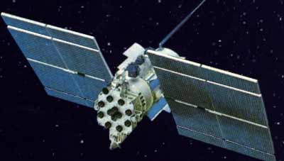 Source : Skyrocket
|
| Launch: |
10 December 2003 at 17h42 UTC,
from Baykonur Cosmodrome's PL-81, by a D-1-e/Proton-K/Briz. |
| Orbit: |
18 930 km x 19 330 km x 65.1° |
| Mission: |
A Proton Breeze M launch vehicle successfully
deployed a trio of Uragan satellites for the Glonass satellite navigation
system. This was the fourth Proton launch in 2003. GLONASS is the Russian
version of GPS and the satellites are built by the Polyot company in Omsk. |
| Ressources: |
See GLONASS
Constellation status. |
| Source: |
Jonathan
Space Report No. 516
; Spacewarn No. 602
; National Space Science Data Center's
2003-056A
; ILS
News (10 Dec 03) |
|
|
.
Kosmos 2403
| Spacecraft: |
Uragan satellites 795 |
| Chronologies: |
2003 payload #92 ; 2003-056B ; 6214th spacecraft. |
| Type: |
Navigation |
| Sponsor: |
Russian Defense ministry |
|
Source : Skyrocket
|
| Launch: |
10 December 2003 at 17h42 UTC,
from Baykonur Cosmodrome's PL-81, by a D-1-e/Proton-K/Briz. |
| Orbit: |
18 930 km x 19 330 km x 65.1° |
| Mission: |
A Proton Breeze M launch vehicle successfully
deployed a trio of Uragan satellites for the Glonass satellite navigation
system. This was the fourth Proton launch in 2003. GLONASS is the Russian
version of GPS and the satellites are built by the Polyot company in Omsk. |
| Source: |
Jonathan
Space Report No. 516
; Spacewarn No. 602
; National Space Science Data Center's
2003-056B
; |
|
|
.
Kosmos 2404
| Spacecraft: |
Uragan satellite 701 |
| Chronologies: |
2003 payload #93 ; 2003-056C ; 6215th spacecraft. |
| Type: |
Navigation |
| Sponsor: |
Russian Defense ministry |
|
Source : Skyrocket
|
| Launch: |
10 December 2003 at 17h42 UTC,
from Baykonur Cosmodrome's PL-81, by a D-1-e/Proton-K/Briz. |
| Orbit: |
18 930 km x 19 330 km x 65.1° |
| Mission: |
A Proton Breeze M launch vehicle successfully
deployed a trio of Uragan satellites for the Glonass satellite navigation
system. This was the fourth Proton launch in 2003. GLONASS is the Russian
version of GPS and the satellites are built by the Polyot company in Omsk. |
| Source: |
Jonathan
Space Report No. 516
; Spacewarn No. 602
; National Space Science Data Center's
2003-056C
; |
|
|
.
UFO F11 (USA 174)
| Spacecraft: |
"UFO" has been identified as
the acronym for UHF Follow-On. |
| Chronologies: |
2003 payload #94 ; 2003-057A ; 6216th spacecraft. |
| Type: |
Communications |
| Sponsor: |
U.S. Navy Space and Naval Warfare Systems
Command (SPAWAR) |
|
|
| Launch: |
18 December 2003 at 2h30 UTC,
from Cape Canaveral's SLC-36B, by an Atlas IIIB (AC-203). |
| Orbit: |
Geostationary at 172° East longitude |
| Mission: |
The 1.4-tonne satellite is the eleventh and
final of the UFO constellation which provide secure communications in UHF
band of frequencies among ships, aircraft, mobile ground terminals even
during severe weather conditions. This Boeing 601 satellite is the 11th
in the series called UHF Follow-On (UFO). Atlas vehicles have launched
all 11 UFO satellites, beginning in 1993. |
| Notes: |
A Lockheed Martin Atlas III rocket, launched
by International Launch Services (ILS), carried a Navy communications
satellite into orbit. The Atlas III launch vehicle left the pad at 21h30
EST (2h30 UITC on 18 December), depositing the satellite into an elliptical
transfer orbit about 32 minutes later. |
| Source: |
Jonathan
Space Report No. 516
; Spacewarn No. 602
; National Space Science Data Center's
2003-057A
; ILS
News (17 Dec 03); |
|
|
.
Navstar 49 (USA 175)
| Spacecraft: |
Navstar SVN 47 / GPS 2R-10 |
| Chronologies: |
2003 payload #95 ; 2003-058A ; 6217th spacecraft. |
| Type: |
Navigation |
| Families: |
53rd Navstar (10th second-generation replacement) |
| Sponsor: |
U.S. Department of Defense |
|
Source:
Boeing
|
| Launch: |
21 December 2003 at 8h05 UTC,
from Cape Canaveral's SLC-17A, by a Delta 7925. |
| Orbit: |
About 20 100 km x 20 300 km x 55.0° |
| Mission: |
This Block IIR Global Positioning System
(GPS) satellite is the tenth Block IIR (replenishment) launch and the 49th
GPS launch since Navstar 1
in 1978. It will replace the aging but still operational Navstar
2-10 craft in Plane-E and Slot-2. |
| Notes: |
The GPS constellation consists of 24 satellites
split into six orbital planes with four in each plane, all in circular
orbits of altitude 20,200 km, and inclination of 55°. There are also
four additional satellites orbiting as reserves. The full list is available
at Global
Positioning System. |
| Source: |
Jonathan
Space Report No. 516
; Spacewarn No. 602
; National Space Science Data Center's
2003-058A
; |
|
|
.
AMOS-2
| Spacecraft: |
|
| Chronologies: |
2003 payload #96 ; 2003-059A ; 6218th spacecraft. |
| Type: |
Communications (multi-services) |
| Sponsor: |
Israel |
|
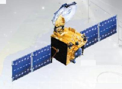 Source : IAI
PK
Source : IAI
PK
|
| Launch: |
27 December 2003 at 21h30 UTC,
from Baykonur Cosmodrome's PL-31/6, by an A-2/Soyuz-FG/Fregat. |
| Orbit: |
Geostationary at 4,0° West longitude |
| Mission: |
Israel's second communications satellite,
AMOS 2, is equipped with Ku-band transponders to provide a wide range of
broadcast and communication services (Direct To Home (DTH) television distribution,
TV distribution to cable companies, distribution of internet services,
and data transmission) over Israel and the Middle-East, Europe and the
East Coast of the U.S.A. AMOS-2 is co-located along with the AMOS
1. The 1,374-kg, three-axis stabilized spacecraft, built by
the MBT Space Division of Israel Aircraft Industries (IAI), has a design
lifetime of 12 years. |
| Note: |
 Source: Arianespace
|
AMOS-2 launch operation was conducted by
Starsem. This Flight ST12 was reported to be the 1,684th mission for a
Soyuz family vehicle. Launch occurred at 2h30 local time. |
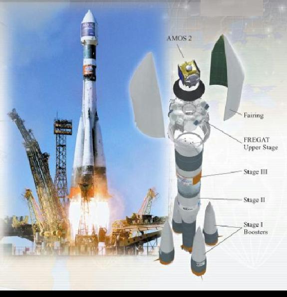 Source: IAI
PK
Source: IAI
PK
|
|
| Source: |
Jonathan
Space Report No. 517
; Spacewarn No. 602
; National Space Science Data Center's
2003-059A
; IAI
News ; Arianespace
News : AMOS
2 Press Kit (AIA). |
|
|
.
Ekspress AM-22
| Spacecraft: |
|
| Chronologies: |
2003 payload #97 ; 2003-060A ; 6219th spacecraft. |
| Type: |
Communications (multi-services) |
| Sponsor: |
Russian Satellite Communications Company
(RSCC) |
|
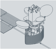 RSCC
RSCC
|
| Launch: |
28 December 2003 at 23h00 UTC,
from Baikonus Cosmodrome's PL-200/39, by a D-1-e/Proton-K/DM-2M (410-04). |
| Orbit: |
Geostationary at 53° East longitude. |
| Mission: |
Express-AM22 is a new broadcasting and communications
satellite built by NPO Prikladnoi Mechaniki jointly with Alcatel Space.
The 2.6-tonne, 6 kW satellite is designed to provide communications
services (digital TV, telephony, videoconferencing, data transmission,
Internet access) in Ku-band. The new vehicles service life on orbit is
12 years. It is the first satellite of the Ekspress-AM family that kicks
off a new generation of telecommunications satellites; it is the first
in a five-satellite campaign to enhance the Russian national system capacity
by the end of 2005. |
| Notes: |
The launch was performed by ILS under the
Federal Space Program of Russia and concluded a successful year for the
Proton launch vehicle with five launches in 2003. RSC Energiya reports
that the Proton's upper stage used for this mission (Upper Stage DM 11C861-01)
"is the 242nd successful flight of US of D and DM types." |
| Source: |
Jonathan
Space Report No. 517
; Spacewarn No. 602
; National Space Science Data Center's
2003-060A
; RCSS Factsheet : ILS
News (29 Dec 03) : RSC
Energiay News (29 Dec 03) ; |
|
|
.
TC-1 / DSP-E
| Spacecraft: |
TC-1 or Tan Ce 1 means Explorer
1 orProbe No. 1 in Chinese.
DSP-E stands for Double Star Program-Equatorial. |
| Chronologies: |
2003 payload #98 ; 2003-061A ; 6220th spacecraft. |
| Type: |
Earth upper atmosphere studies |
| Sponsor: |
CNSA-ESA / Chinese National Space Administration/European
Space Agency |
|
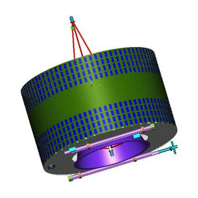 ESA/CNSA
|
| Launch: |
29 December 2003 at 19h06 UTC,
from Xichang Satellite Launch Center, by a Chang Zheng 2C. |
| Orbit: |
Initial: 551 km x 74,017 km x 28.2°
555 km x 78 051 km x 28.5° |
| Mission: |
 Ten
Ce-1 is a 330-kg Earth's magnetosphere study satellite. It is the
equatorial member of a pair of Chinese-European research satellites of
the Double StaR project, follow-on to ESAs Cluster
mission to study the interaction between the solar wind and the Earths
magnetic field. The project consists of two satellites, one equatorial
(DSP-p) placed in a 550 x 60,000 kilometres orbit inclined at 28.5°
degrees to the Equator, and a polar satellite (DSP-P),
placed on a 350 x 25,000 kilometres orbit inclined at 90°. TC-1 is
the highest flying satellite China has ever launched. The duo will
be capable of probing, in three dimensions, the incidence and development
of space storms, in a bid to find ways to improve safety for space activities.
The craft is a 2.1 metres-diamater cylindrer with a height of 1.4 metre
and spins at a rate of 15 rpm. It carries eight instruments, five
from European Spae Agence and three from Chinese Academy of Sciences. The
"Double Star" project is the first China-Europe joint satellite probe. Ten
Ce-1 is a 330-kg Earth's magnetosphere study satellite. It is the
equatorial member of a pair of Chinese-European research satellites of
the Double StaR project, follow-on to ESAs Cluster
mission to study the interaction between the solar wind and the Earths
magnetic field. The project consists of two satellites, one equatorial
(DSP-p) placed in a 550 x 60,000 kilometres orbit inclined at 28.5°
degrees to the Equator, and a polar satellite (DSP-P),
placed on a 350 x 25,000 kilometres orbit inclined at 90°. TC-1 is
the highest flying satellite China has ever launched. The duo will
be capable of probing, in three dimensions, the incidence and development
of space storms, in a bid to find ways to improve safety for space activities.
The craft is a 2.1 metres-diamater cylindrer with a height of 1.4 metre
and spins at a rate of 15 rpm. It carries eight instruments, five
from European Spae Agence and three from Chinese Academy of Sciences. The
"Double Star" project is the first China-Europe joint satellite probe. |
| Notes: |
This is the first CZ-2C launch from Xichang
(it has flown from both Jiuquan and Taiyuan in the past). |
| Source: |
Jonathan
Space Report No. 517
; Spacewarn No. 602
; National Space Science Data Center's
2003-061A
; ESA
News (29 Dec 03) : China Dailys
28
Mar 01 ; Xinhuas
27
Dec 03, 30
Dec 03 ; |
|
|
|