The
128 spacecrafts launched in 1964:
.
Spacecraft
Entries
.
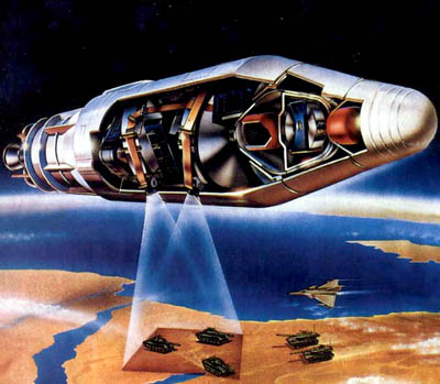
"Ferret"
| Spacecraft: |
FTV 2354 / Agena D 2354 |
| Chronologies: |
1964 payload #1 ; 1964-001A ; 353rd
spacecraft,
727th space object catalogued. |
| Type: |
Electronic Intelligence |
| Sponsor: |
U.S. Army-U.S. Navy |
|
|
| Launch: |
11 January 1964 at 20h07 UT,
from Vandenberg Air Force Base's LC-75-3-5, by a Thor-Agena
D (Thor 2A 390 / Agena D 2354). |
| Orbit: |
906 km x 936 km x 69.92° x 103.5 min.
906 km x 937 km x 69.9°x 103.50 min. |
| Decayed: |
(Still in orbit.) |
| Mission: |
Historical reports: 1964-001A was
a U.S. Army-U.S. Navy classified military spacecraft launched into low
Earth orbit. Mass: 700 kg.
USAF launched Thor-Agena
D booster from PMR with unidentified satellite payload. It was later disclosed
that five satellites were orbited with the single booster.
Official objective:
Develop spaceflight techniques and technology. First known successful
orbiting of 5 satellites with one launch vehicle.
* * * * *
Current overview: This satellite was
a U.S. Army-U.S. Navy classified military spacecraft launched from WSMC
into low earth orbit. [That is to say that, even today, we know nothing
about this satellite.] |
| Source: |
Jonathan
McDowell's
Master
List ; Mark
Wades Encyclopedia Astronautica's 1964
Chronology ; National Space Science
Data Center's 1964-001A
; Astronautics
and Aeronautics 1964, p. 10, 446 ; |
|
|
.
GGSE 1 / POPPY 3 SV3
| Spacecraft: |
GGSE stands for Gravity Gradient
Stabilization Experiment ; S00728 NRL
True appellations: Poppy 3C (NRL-PL
134, GGSE 1) |
| Chronologies: |
1964 payload #2 ; 1964-001B ; 354th
spacecraft,
728th space object catalogued. |
| Type: |
Electronic Intelligence |
| Sponsor: |
National Reconnaissance Office (NRO) |
|
|
| Launch: |
11 January 1964 at 20h07 UT,
from Vandenberg Air Force Base's LC-75-3-5, by a Thor-Agena
D (Thor 2A 390 / Agena D 2354). |
| Orbit: |
901 km x 941 km x 69.96° x 103.5 min.
899 km x 916 km x 69.9° x 103.20 min. |
| Decayed: |
(Still in orbit.) |
| Mission: |
Historical reports: Official objective:
Develop spaceflight techniques and technology.
* * * * *
Current overview: GGSE-1 was a 39-kg technology
satellite, the first in the series that developed designs and deployment
techniques later applied to the NOSS/Whitecloud reconnaisance satellites.
New gravity gradient stabilization system utilizing Earths gravitational
field to orient the satellite and Earths magnetic field to assist in damping
was developed by General Electric and recently tested onboard a U.S. Navy
satellite, orbited Jan. 11. Within three days, the system stabilized the
satellite to accuracy of +/-5 degrees.
Decades later, it
was revealed that this satellite was in fact a Poppy electronic intelligence
spacecraft that collects radar emissions from Soviet air and missile defense
radars. This was a National Reconnaissance Office (NRO) program but the
satelites were designed, developed and operated by the Naval Research Laboratory
(NRL) as data were analyzed by the National Security Agency (NSA). The
Poppy program operated from December 1962 through August 1977; seven Poppy
were launched, with an average useful life of 34 months for each craft.
Many Poppy carried a secondary payload and were thus known to the public
(while their Poppy mission remaining secret). |
| Source: |
Jonathan
McDowell's
Master
List ; Mark
Wades Encyclopedia Astronautica's 1964
Chronology ; National Space Science
Data Center's 1964-001B
; Astronautics
and Aeronautics 1964, p. 68, 446 ; Gunter's
POPPY
; NORAD's
SATCAT
(1964) ; |
|
|
.
EGRS 1 / Secor 1
| Spacecraft: |
EGRS I Secor Type
II S/N 2
SECOR stands for SEquential
COllation of Range
EGRS stands for Electronic
& Geodetic Ranging Satellite. |
| Chronologies: |
1964 payload #3 ; 1964-001C
; 355th
spacecraft, 729th space
object catalogued. |
| Type: |
Geodesy |
| Sponsor: |
U.S. Army & U.S. Navy |
|
|
| Launch: |
11 January 1964
at 20h07 UT, from Vandenberg Air Force Base's LC-75-3-5, by a Thor-Agena
D (Thor 2A 390 / Agena D 2354). |
| Orbit: |
906 km x 936 km x 69.90°
x 103.5 min.
904 km x 922 km x 69.9°
x 103.30 min. |
| Decayed: |
(Still in orbit.) |
| Mission: |
Historical reports:
On 18 February 1964, Dr. Albert C. Hall, Deputy Director for Space, Defense
Research and Engineering, disclosed that the Army had secretly launched
SECOR last month and that it was performing exceptionally well. On 21
February 1964, DOD announced Army Corps of Engineers SECOR geodetic satellite
was performing exceptionally well, confirming Dr. Albert Halls disclosure
of Feb. 18. The 18-kg satellite was orbiting at about 950-km altitude in
periods of about 100 min. SECOR system tests were being conducted by Armys
Geodesy, Intelligence and Mapping Research and Development Agency (GIMRADA),
which had contracted for the satellite from ITT Federal Laboratories. GIMRADA
ground stations were measuring distances by sending and receiving signals
through satellites onboard transponder, then acquiring ranging data for
use in automatic data reduction process by Army Map Service to determine
station positions.
The
SECOR/EGRSsatelites were part of an all-weather geodetic survey system
which consisted of a satellite and four ground stations: three at geographical
points where the co-ordinates had been surveyed accurately and the fourth
at an unknown location. Radio waves were flashed from the ground stations
to the satellite and returned. The position of the satellite at any time
was fixed by the measured ranges from the three known stations. Using these
precisely established satellite positions as a base, ranges from the satellite
to the unknown station were used to compute the position of the unknown
station.
On
27 October 1964, U.S. Armys use of orbiting satellite to pinpoint exact
locations of land bodies separated by large expenses of ocean was described
by DOD. Using SECOR system with the satellite and overseas ground
stations, Army Corps of Engieneers Army Map Service was for the first
time obtaining distance measurments of up to a thousand miles [1500 km]
to an accuracy within 30 meters. Nine unknown points were expected to be
located in the Pacific during the first year of operations.
Official
objective: Develop spaceflight techniques and technology.
On 31 March 1965,
U.S. Army disclosed it had orbited a three-satellite earth-mapping system,
with two of the spacecraft circling the earth from west to east and the
third traveling from pole to pole. The satellites were of the Secor type.
Two were fired into orbit earlier this month; the other was launched Jan.
11, 1964. The three spacecraft, each with a radio receiver and transmitter,
were helping pinpoint locations on earth that were widely separated by
large bodies of water.
* * * * *
Current overview: SECOR
1 was a 18-kg geodetic satellite used to precisely determine points on
the Earth. The SECOR/EGRS series was used to precisely determine points
on the Earth, allowing continents and islands to be brought within the
same
geodetic global grid. It was a joint venture of the U.S. Army and Navy
to locate Pacific islands. Experiments with these led to Timation and finally
to the GPS Navstar system |
| Source: |
Jonathan
McDowell's
Master
List ; Mark
Wades Encyclopedia Astronautica's 1964
Chronology ; National Space Science
Data Center's 1964-001C
; Astronautics
and Aeronautics 1964, p. 68, 74, 365, 446 ;; Astronautics
and Aeronautics 1965, p. 158 ; Gunter's
Secor
/ EGRS ; NORAD's
SATCAT
(1964) ; |
|
|
.
Solrad 7A / GRAB /
POPPY 3 SV1
| Spacecraft: |
SR 7A.
True appellations: Poppy 3A (NRL-PL 124,
Solrad 7A |
| Chronologies: |
1964 payload #4 ; 1964-001D ; 356th
spacecraft,
730th space object catalogued. |
| Type: |
Sun observations |
| Sponsor: |
National Reconnaissance Office (NRO) |
|
|
| Launch: |
11 January 1964 at 20h07 UT,
from Vandenberg Air Force Base's LC-75-3-5, by a Thor-Agena
D (Thor 2A 390 / Agena D 2354). |
| Orbit: |
906 km x 936 km x 69.89° x 103.5 min.
902 km x 920 km x 69.9° x 103.20 min. |
| Decayed: |
(Still in orbit.) |
| Mission: |
Historical reports:GREB
5 was a 45.4-kg Solar X-ray monitoring satellite. It contained five X-ray
photometers, four UV photometers and two systems to accurately determine
the solar aspect angle. Its purposes were to monitor the soft component
of solar X-rays and the low-frequency portion of the solar hydrogen Lyman-alpha
emission spectrum.
The satellite was
placed into orbit with its spin axis roughly perpendicular to the Sun-satellite
direction with an initial spin rate of about 2 cps. The craft was constructed
so that the moments of inertia favored stable rotation about the spin axis.
However, the magnetic brooms produced varying torques by interacting with
the Earth's magnetic field. This resulted in a slow precession of the spin
axis. The orbit was nearly circular at 900 km and each pass provided 10
to 20 minutes of data at a ground station.
Several European
observatories successfully recorded the telemetry. The satellite transmitted
data continuously until September 1964. Sporadic data were received until
February 1965.
On 4 February 1964,
U.S. Committee for International Quiet Sun Year (IQSY) and U.S. Navy announced
satellite to monitor solar x-ray emission, instrumented by Naval Research
Laboratory scientists, was launched recently to initiate continuous watch
on the sun during IQSY (1964-65). First signals from the satellite showed
the sun now is close to its minimum activity, reported NRL scientists Robert
W. Kreplin, Talbot A. Chubb, and Herbe& Friedman. Any solar activity
that occurs this year should be isolated and relatively uncomplicated,
permitting the satellite to record individual stonn centers, in contrast
to IGY which was marked by succession of overlapping storms. Observatories
in 14 countries joined U.S. in preparing to utilize continuous data transmissions
from the satellite.
On 10 Januay 1965,
it was reported that data from SOLRAD, the Naval Research Laboratorys
satellite monitoring the suns x-ray behavior during the 1964-65 International
Years of the Quiet Sun (IQSY), indicated that the sun was at its quietest
during May, June, and July, 1964. Information from SOLRAD also suggested
that the x-ray region of the corona, instead of being a homogeneous region
of a million miles or so, was a series of small cells that flared up to
emit hard x-rays and then decayed rapidly. What was seen on earth was the
net effect of many knots of very hot, flashing gas giving the appearance
of a homogeneous region.
Official
objective: Develop spaceflight techniques and technology.
* * * * *
Current overview: Decades later,
it was revealed that this satellite was in fact a Poppy electronic intelligence
spacecraft that collects radar emissions from Soviet air and missile defense
radars. This was a National Reconnaissance Office (NRO) program but the
satelites were designed, developed and operated by the Naval Research Laboratory
(NRL) as data were analyzed by the National Security Agency (NSA). The
Poppy program operated from December 1962 through August 1977; seven Poppy
were launched, with an average useful life of 34 months for each craft.
Many Poppy carried a secondary payload and were thus known to the public
(while their Poppy mission remaining secret). |
| Source: |
Jonathan
McDowell's
Master
List ; Mark
Wades Encyclopedia Astronautica's 1964
Chronology ; National Space Science
Data Center's 1964-001D
; Astronautics
and Aeronautics 1964, p. 45, 446 ; Astronautics
and Aeronautics 1965, p. 10 ; Gunter's
POPPY
; NORAD's
SATCAT
(1964) ; |
|
|
.
GRAB 5 / POPPY 3 SV2
| Spacecraft: |
True appellations: Poppy 3B (NRL-PL
135) |
| Chronologies: |
1964 payload #5 ; 1964-001E ; 357th
spacecraft,
731st space object catalogued. |
| Type: |
Electronic intelligence |
| Sponsor: |
National Reconnaissance Office (NRO) |
|
|
| Launch: |
11 January 1964 at 20h07 UT,
from Vandenberg Air Force Base's LC-75-3-5, by a Thor-Agena
D (Thor 2A 390 / Agena D 2354). |
| Orbit: |
893 km x 951 km x 69.88° x 103.5 min.
902 km x 919 km x 69.9° x 103.20 min. |
| Decayed: |
(Still in orbit.) |
| Mission: |
Historical reports: GREB 5 was a
joint U.S. Army-U.S. Navy venture launched from along with SOLRAD 7A, Secor
1, and GSSE.
Official
objective: Develop spaceflight techniques and technology.
* * * * *
Current overview: Decades later, it was
revealed that this satellite was in fact a Poppy electronic intelligence
spacecraft that collects radar emissions from Soviet air and missile defense
radars. This was a National Reconnaissance Office (NRO) program but the
satelites were designed, developed and operated by the Naval Research Laboratory
(NRL) as data were analyzed by the National Security Agency (NSA). The
Poppy program operated from December 1962 through August 1977; seven Poppy
were launched, with an average useful life of 34 months for each craft.
Many Poppy carried a secondary payload and were thus known to the public
(while their Poppy mission remaining secret). |
| Source: |
Jonathan
McDowell's
Master
List ; Mark
Wades Encyclopedia Astronautica's 1964
Chronology
; National Space Science Data Center's
1964-001E
; Gunter's POPPY
; NORAD's
SATCAT
(1964) ; |
|
|
.
P-35-6 / DAPP 6
| Spacecraft: |
OPS 3367A / AFP-43 / DSAP-1 F6
DAPP stands for Data Acquisition and Processing
Program.
DSAP-1 stands for Defense Satellite Application
Program Block 1. |
| Chronologies: |
1964 payload #6 ; 1964-002B ; 358th
spacecraft,
734th space object catalogued. |
| Type: |
Technology |
| Sponsor: |
National Reconnaissance Office (NRO) |
|
|
| Launch: |
19 January 1964 At 11h00 UT,
from Vandenberg Air Force Base's LC-75-1-2, by a Thor-Agena
D (Thor 2A 384 / Agena D 2303). |
| Orbit: |
789 km x 810 km x 99.0° x 100.90 min. |
| Decayed: |
(Still in orbit.) |
| Mission: |
Historical reports: This U.S. Air
Force spacecraft was launched from Vandenberg AFB aboard a Thor-Agena D
rocket. Mass: 130 kg. USAF launched Thor-Agena D booster from Vandenberg
AFB with unidentified satellite. It was later disclosed that two satellites
were placed in orbit.
Official
objective: Develop spaceflight techniques and technology.
* * * * *
Current overview: The DSAP-1 satellites
series, also known as P-35, were 45- to 55-kg (or 130 kg?) meteorologal
satellites for the National Reconnaissance Office (NRO). Smaller and lighter
than the original TIROS, these TIROS-derived craft were a 10-sided polyhedron
shape, 58-cm across and 53-cm high. The RCA television camera (a photosensitive
vidicon tube) was pointed directly at the Earth once each time the satellite
rotated and took a picture of an 2,000-suare-kilometers area below. The
image was recorded on tape for later transmission. The DASP-1 system would
provide 100 percent daily coverage of the Northern Hemisphere at latitudes
above 60 degrees, and 55 percent coverage at the equator. |
| Source: |
Jonathan
McDowell'sMaster
List ; Mark
Wades Encyclopedia Astronautica's 1964
Chronology ; National Space Science
Data Center's 1964-002B
; Astronautics
and Aeronautics 1964, p. 17 ; Gunter's
DSAP-1
; NORAD's
SATCAT
(1964) ; |
|
|
.
P-35-7 / DAPP 7
| Spacecraft: |
OPS 3367B / AFP-43 / DSAP-1 F7
DAPP stands for Data Acquisition and Processing
Program.
DSAP-1 stands for Defense Satellite
Application Program Block 1. |
| Chronologies: |
1964 payload #7 ; 1964-002C ; 359th
spacecraft,
735th space object catalogued. |
| Type: |
Technology |
| Sponsor: |
National Reconnaissance Office (NRO) |
|
|
| Launch: |
19 January 1964 At 11h00 UT,
from Vandenberg Air Force Base's LC-75-1-2, by a Thor-Agena
D (Thor 2A 384 / Agena D 2303). |
| Orbit: |
791 km x 815 km x 99.0° x 100.90 min. |
| Decayed: |
(Still in orbit.) |
| Mission: |
Historical reports: This U.S. Air
Force spacecraft was launched from Vandenberg AFB aboard a Thor-Agena D
rocket. Mass: 130 kg. USAF launched Thor-Agena D booster from Vandenberg
AFB with unidentified satellite. It was later disclosed that two satellites
were placed in orbit.
* * * * *
Current overview: The DSAP-1 satellites
series, also known as P-35, were 45- to 55-kg (or 130 kg?) meteorologal
satellites for the National Reconnaissance Office (NRO). Smaller and lighter
than the original TIROS, these TIROS-derived craft were a 10-sided polyhedron
shape, 58-cm across and 53-cm high. The RCA television camera (a photosensitive
vidicon tube) was pointed directly at the Earth once each time the satellite
rotated and took a picture of an 2,000-suare-kilometers area below. The
image was recorded on tape for later transmission. The DASP-1 system would
provide 100 percent daily coverage of the Northern Hemisphere at latitudes
above 60 degrees, and 55 percent coverage at the equator. |
| Source: |
Jonathan
McDowell's
Master
List ; Mark
Wades Encyclopedia Astronautica's 1964
Chronology ; National Space Science
Data Center's 1964-002C
; Astronautics
and Aeronautics 1964, p. 17 ; Gunter's
DSAP-1
; NORAD's
SATCAT
(1964) ; |
|
|
.
Relay 2
| Spacecraft: |
Relay B (A-16) |
| Chronologies: |
1964 payload #8 ; 1964-003A ; 360th
spacecraft,
737th space object catalogued. |
| Type: |
Communications |
| Sponsor: |
NASA-Office of Space Science Applications |
|
|
| Launch: |
21 January 1964 at 21h15 UT,
from Cape Canaveral Air Force Station's LC-17B, by a Delta
DSV-3B (Thor Delta B 373 / Delta 23). |
| Orbit: |
2,088 km x 2,411 km x 46.3° x 195 min.
1,961 km x 7,540 km x 46.4° x 194.70
min |
| Decayed: |
(Still in orbit.) |
| Mission: |
Relay II is a 183.5-kg (or 78 kg?) active
communications satellite that continues communications tests of Relay
I and provides evaluation of improvements in the new comsat. The spacecraft
was equipped for transmitting one-way wideband communications (one-way
TV, 300 one-way voice channels or high-speed data) or two-way narrow-band
communications (12 two-way telephone conversations or teletype, photo-facsimile
and data). Unlike its predecesor, It has no automatic cutoff device and
was equipped with solar cells with greater resistance to radiation than
Relay 1s cells. Although principally a communications satellite, Relay
2 carried particle experiments designed to map the trapped radiation belt.
Relay II completed
its first communications test during its first orbit, receiving radio signals
and TV test pattern from Mojave, Calif., ground station and beaming them
back to Earth. First intercontinental communications tests conducted with
Relay II, on 22 January 1964, were successful: NASA officials described
the satellites performance as excellent. The tests were conducted between
ground stations at Nutley, N.J., and Raisting, West Germany, consisted
of voice transmissions and radio signals.
On 29 January 1964,
Relay II transmitted portions of Soviet-American championship hockey game
of the 1964 Winter Olympics at Innsbruck, Austria, to the U.S., the first
public demonstration of Relay II. By this time numerous communications
tests of the satellite had been made, and NASA scientists said that all
communications experiments were of excellent quality. The satellite was
also sending back information on radiation collected by onboard instrumentation.
On 25 March 1964,
first TV transmission from Japan to U.S. was made, using Relay II. Quality
of the live pictures as well as the sound was excellent. In the telecast
Prime Minister Hayato Ikeda offered his countrys apologies directly to
the U.S. for the unfortunate coincidence of the stabbing of U.S. Ambassador
Edwin Reischauer by a deranged Japanese youth the previous day. The eight-minute
telecast was seen simultaneously on the three national networks.
First two-way telephone call between U.S. and Japan via a communications
satellite was conducted on 21 May 1964 by personnel of NASA Goddard Space
Flight Center and Radio Research Laboratory Station, in Japan, using Relay
II.
Current overview: Relay 2 was physically
similar to Relay 1 but but it improved its performance to the point where
response to spurious commands was essentially eliminated. One of the two
onboard transponders operated normally until 20 November 1966. From that
time until its failure on 20 January 1967, it required a longer time than
normal to come on. The other transponder continued to operate until 9 June
1967, when it too failed to operate normally. |
| Notes: |
Relay II was 22nd straight launch success
for the Thor-Delta launch vehicle. |
| Source: |
Jonathan
McDowell's
Master
List ; Mark
Wades Encyclopedia Astronautica's 1964
Chronology ; National Space Science
Data Center's 1964-003A
; Astronautics
and Aeronautics 1964, p. 19-20, 22, 32, 115, 185 ; Gunter's
Relay
1, 2 ; NORAD's
SATCAT
(1964) ; |
|
|
.
Echo 2
| Spacecraft: |
Echo C (A-12) |
| Chronologies: |
1964 payload #9 ; 1964-004A ; 361st
spacecraft,
740th space object catalogued. |
| Type: |
Communications |
| Sponsor: |
NASA Office of Space Science Applications |
|
|
| Launch: |
25 January 1964 at 13h59 UT,
from Vandenberg Air Force Base's LC-75-1-1, by a Thor-Agena
B (Thor 397 / Agena B 6301 (TA2)). |
| Orbit: |
1,033 km x 1,313 km x 81.5° x 109 min.
1,030 km x 1,315 km x 81.5° x 108.80
min |
| Decayed: |
7 June 1969. |
| Mission: |
Echo II is a 243-kg (or 256 kg) passive communications
satellite, a 41-metre diameter, laminated mylar plastic and aluminum balloon.
for testing propagation, tracking, and communication techniques. Instrumentation
included a beacon telemetry system that provided a tracking signal, monitored
spacecraft skin temperature and internal pressure. (Skin temperature were
mesaure between -120 °C and +16 °C.)
Early telemetry
and radar reports indicated Echo II appeared to be losing its spherical
shape and high reflectivity, NASA spokesman announced. Telemetry showed
Echo II pressure has decreased more rapidly than anticipated. However,
optical observations tell us we have a beautiful balloon. Analysis of
TV photographs taken by camera mounted on Agena stage showed sphere had
inflated properly; but inflating gas apparently leaked out after two hours
instead of lasting for 20 hours as planned. However, quality of radio signals
between Rome, N.Y., and reported to be good. Spokesman indicated telemetry
reports of pressure decrease could be false due to possible error in the
observations.
On 29 January 1964,
NASA spokesman said Echo II was still operating with great success despite
preliminary radar reports that it was deflating and losing its reflectivity.
On 29 February 1964, Echo II was used for transmission of two radiophotos
between Britains Jodrell Bank Experimental Station at Manchester and Gorki
Universitys radioastronomy observatory at Zimenki. A third space telegram
was sent from Jodrell Bank to Zimenki via the moon, and its quality was
comparable to those received via Echo II. The U.S. satellite was termed
by TASS commentator the Friendship Sputnik.
In addition to fulfilling
its communications mission, the spacecraft was used for global geometric
geodesy: Soviet ground stations were tracking Echo II, in first joint U.S.-U.S.S.R.
space experiment. The spacecraft re-entered the atmosphere on 7 June 1969.
An articIe published
in The New Scientist on 30 January 1965 reported that experts at
the Royal Radar Establishment at Malvern, England, believed that Echo II
had been pierced by its own launching canister shortly after injection
into orbit. According to The New Scientist, the shape of Echo II
after launching was flabby and elongated rather than the perfect sphere
wanted for some of its communication experiments. Analysis of Malverns
radar tracks on the satellite revealed writhing echoes that, according
to their theory, arose when the very short radar pulses entered a hole
and rebounded from the aluminum-coated interior of the balloon. The Malvern
team thought the balloon had a puncture about 46 cm long and 69 cm wide
in one side.
NASA spokesmen said
they did not believe Echo II had been punctured by either its launching
canister or its launching vehicle and that sightings from more than a dozen
radar stations had contradicted the Malvern theory. They added that Echo
IIs ability to reflect radio signals had not been seriously impaired and
many messages had been bounced off in the last year.
On 17 February 1965,
Dr. Hugh L. Dryden. NASA Deputy Administrator reports that the project
involving the observation and use of Echo II in cooperation with the Soviet
is completed. The Soviet side observed the critical inflation phase of
the satellite optically and forwarded the data to us; although not including
radar data, which would have been most desirable. Communications via Echo
II between the U.K. and the U.S.S.R. were carried out in only one direction
instead of two, at less interesting frequencies than we would have liked,
and with some technical limitations at the ground terminals used. On the
other hand, the Soviets provided very complete recordings and other data
of their reception of the transmissions. |
| Notes: |
On 12 August 1963, NASA announced G.C. Schieldahl
Co. had been selected to build Echo II satellite, scheduled to be placed
in orbit during the 1963-64 winter. Under $362,000 contract, Schieldahl
would build three models, one for static-inflation tests, one for orbital
flight. and one for back-up. Echo II would be larger and more rigid than
its predecessor, Echo 1. |
| Source: |
Jonathan
McDowell's
Master
List ; Mark
Wades Encyclopedia Astronautica's 1964
Chronology ; National Space Science
Data Center's 1964-004A
; Astronautics
and Aeronautics
1963, p. 305 ; Astronautics
and Aeronautics 1964, p. 24, 27, 30, 33, 85 ; Astronautics
and Aeronautics 1965, p. 41-2, 76 ; Gunter's
Echo
2 ; NORAD's
SATCAT
(1964) ; |
|
|
.
Saturn SA-5
| Spacecraft: |
|
| Chronologies: |
1964 payload #10 ; 1964-005A ; 362nd
spacecraft,
744th space object catalogued. |
| Type: |
Technology |
| Sponsor: |
NASA Office of Manned Space Flight |
|
|
| Launch: |
29 January 1964 at 16h25 UT,
from Cape Canaveral Air Force Station's LC-37B, by a Saturn
I (SA-5). |
| Orbit: |
274 km x 740 km x 31.4° x 94.80 min. |
| Decayed: |
30 April 1966. |
| Mission: |
Saturn I SA-5 was a launch vehicle development
test. It was the fifth flight of a Saturn rocket and the first of the Block
II Saturn. It was also the first live flight of the LOX/LH2 fueled second
stage (S-IV). More than 11,000 measurements were taken. (Mass: 17,554.2
kg)
Saturn I SA-5 was
first successful flight test of both stages of the rocket. The 680-ton-thrust
S-I stage performed as planned and the 40-ton-thrust upper stage (S-IV)
powered by six liquid-hydrogen RL-10 engines separated and burned properly
for eight minutes, attaining orbital speed. The orbited body (spent S-IV
stage, instrument unit, payload adapter, Jupiter nose cone, and 5,200 kg
of sand ballast) weighed 17,100 kg, nearly 9,000 kg of which was payload.
As the first of
the Block II Saturn Is, SA-5 was first flight test of both Saturn stages
and only the second flight test of a liquid-hydrogen powered rocket stage
(after Centaur AC-2, on 27
November 1963). The five Block II Saturn 1s differ from Block I predecessors
in that they have live upper stages, S-I propellant tanks are extended
to provide 45,000 kg usable propellant, and tail fins are added for stability.
During the flight
eight onboard motion picture cameras photographed various operations of
the rocket and a TV camera provided real-time photographs of separation
and ignition of S-IV stage. Shortly after S-I burnout, the motion picture
cameras were ejected, impacting downrange where pararescue men recovered
seven of them.
This test of the
worlds largest known rocket proved flight capability of Saturn Is liquid-hydrogen,
clustered-engine upper stage and demonstrated the vehicles capability
to orbit 9-ton payload.
Preliminary evaluation
of Saturn I SA-5 flight indicated there was no significant deviation or
malfunction. Because insertion velocity was slightly greater than predicted,
the 19,100-kg orbiting body was in an Earth orbit slightly higher than
expected: apogee 100-km higher than expected and perigee 10=km higher than
expected. Timing of all significant actions in the launch sequence vaned
no more than half a second from prediction. First stage cutoff occurred
after slightly more than 146 sec., S-IV stage ignited at 148 sec., and
insertion into orbit occurred at 639 sec. [10 min. 39 sec].
Following
successful launching of Saturn I two-stage SA-5, President Johnson issued
statement saying U.S. had now proved we have the capability of putting
great payloads into space.
We have come a long way from the 14-kg of Explorer
I on January 31, 1958, to the some 16,700-kg which has just been placed
into orbit by Saturn I. We have demonstrated not only enormous boost
capability, but we have proved the effectiveness and the practical use
of liquid hydrogen as a rocket fuel for space flight
NASA Associate Administrator,
Dr. Robert C. Seamans stated, There is little question that it took us
ahead of the Russians in our capability. He noted that payload equivalent
of SA-5s orbiting body was between 8,600 to 9,000 kg, far exceeding the
6,482 kg reported for heaviest Soviet satellites.
Rep. J. Edward Roush
(D.-Ind.) said in the House: On Wednesday, we saw the successful launching
of the Saturn rocket carrying into orbit around the Earth 18 tons. This
included the largest payload ever placed in orbit by man and exceeds the
largest Russian payload by 11 tons. For several years now this Nation has
been plagued with the uncomfortable knowledge that the Russians were ahead
of us in the space effort. This has been based primarily on the fact that
they had a greater lift capability. The United States is now ahead in lift
capability and in every other phase of the space program.
|
| Source: |
Jonathan
McDowell's
Master
List ; Mark
Wades Encyclopedia Astronautica's 1964
Chronology ; National Space Science
Data Center's 1964-005A
; Astronautics
and Aeronautics 1964, p. 32, 35, 49 ; Gunter'sSaturn
SA-5 ; NORAD's
SATCAT
(1964) ; |
|
|
.
Elektron 1
| Spacecraft: |
2D No. 1 |
| Chronologies: |
1964 payload #11 ; 1964-006A ; 363rd
spacecraft,
716th space object catalogued. |
| Type: |
Earth/space Sciences |
| Sponsor: |
Soviet Union |
|
|
| Launch: |
30 January 1964 at 9h45 UT, from
Baykonur Cosmodromes LC-1, by an A-1/"Vostok"
(8A92). |
| Orbit: |
406 km x 7,100 km x 61° x 2-hr. 49 min.
413 km x 6,439 km x 60.9° x 161.00 min. |
| Decayed: |
(Still in orbit.) |
| Mission: |
Elektron 1 was a 329-kg Earth/space sciences
satellite which studied Earth's inner and outer radiation belts, cosmic
rays and upper atmosphere. It was launched with Electron
2 by a single launch vehicle in order to perform simultaneous investigations
of the external and internal zones of the Earth's radiation belt. Soviet
news agency TASS said the satellites were studying the internal and external
radiation belts of the Earth and physical phenomena connected with them.
The 350-kg spacecraft had a cylindrical body that was 0.75 m in diameter
and 1.3 m long and from which antennas and six solar cell panels were extended.
The spacecraft was placed into an eccentric orbit that enabled it to study
the internal zone of the radiation belt. It was equipped with micrometeorite
detectors, a mass spectrometer, a proton detector, and instruments for
recording the corpuscular emission and energy spectrum of electrons. A
memory device was included so that observations over several orbits could
be obtained by Soviet telemetry stations when the satellite was within
communications range.
On 2 February 1964,
TASS announced Electron I and Electron II scientific
satellites were continuing their elliptical orbits of the Earth. By 6:00
p.m. Moscow time Feb. 1, Electron I had passed repeatedly through the inner
radation belt in its 19 orbits and Electron II had moved four times through
the outer radiation belt in its two orbits. TASS said the following studies
were being made with aid of onboard equipment: outer and inner radiation
belts; charged particles having low energy; concentrations of electrons
and positive ions; magnetic fields and radiation belts of the earth; nuclear
component of cosmic radiation; shortwave solar radiation; propagation of
radio waves; radio-radiation of galaxies; and densities of meteoritic material.
TASS said the studies, being accomplished under a unified program in various
areas of outer space, were being conducted for the first time. These studies
were important for conducting the program of the IQSY and for permitting
collection of data to assure radiation safety of manned space flights.
TASS said all onboard equipment was functioning normally and ground stations
were receiving scientific data from the satellites.
In July 1965, Electron
I and Electron II were among the new exhibits in the Kosmos Pavillion
at the Soviet exposition on achievements of the U.S.S.R. national economy.
These satellites were said to have made it possible for Soviet scientists
to safeguard the cosmonauts during their flights in this region. |
| Source: |
Jonathan
McDowell's
Master
List ; Mark
Wades Encyclopedia Astronautica's 1964
Chronology ; National Space Science
Data Center's 1964-006A
; Astronautics
and Aeronautics 1964, p. 35, 43, 54, 62 ; Astronautics
and Aeronautics 1965, p. ; Gunter's
Elektron
1, 3 ; NORAD's
SATCAT
(1964) ; |
|
|
.
Elektron 2
| Spacecraft: |
2D No. 2 |
| Chronologies: |
1964 payload #12 ; 1964-006B ; 364th
spacecraft,
748th space object catalogued. |
| Type: |
Earth/space Sciences |
| Sponsor: |
Soviet Union |
|
|
| Launch: |
30 January 1964 at 9h45 UT, from
Baykonur Cosmodromes LC-1, by an A-1/"Vostok"
(8A92). |
| Orbit: |
460 km x 68,200 km x 61° x 22-hr. 40
min. |
| Decayed: |
20 April 1997. |
| Mission: |
Elektron 2 was a 444-kg Earth/space science
satellite which studied Earth's inner and outer radiation belts, cosmic
rays and outer space. It was launched with Electron
1 by a single launch vehicle in order to perform simultaneous investigations
of the external and internal zones of the Earth's radiation belt. Soviet
news agency TASS said the satellites were studying the internal and external
radiation belts of the earth and physical phenomena connected with them.
The 445-kg spacecraft had a cylindrical body that was 0.75 m in diameter
and 1.3 m long and from which antennas and six solar cell panels were extended.
The spacecraft was placed into an eccentric orbit that enabled it to study
the internal zone of the radiation belt. It was equipped with micrometeorite
detectors, a mass spectrometer, a proton detector, and instruments for
recording the corpuscular emission and energy spectrum of electrons. A
memory device was included so that observations over several orbits could
be obtained by Soviet telemetry stations when the satellite was within
communications range.
On 2 February 1964,
TASS announced Electron I and Electron II scientific satellites were continuing
their elliptical orbits of the earth. By 6:00 p.m. Moscow time Feb. 1,
Electron I had passed repeatedly through the inner radation belt in its
19 orbits and Electron II had moved four times through the outer radiation
belt in its two orbits. TASS said the following studies were being made
with aid of onboard equipment: outer and inner radiation belts; charged
particles having low energy; concentrations of electrons and positive ions;
magnetic fields and radiation belts of the earth; nuclear component of
cosmic radiation; shortwave solar radiation; propagation of radio waves;
radio-radiation of galaxies; and densities of meteoritic material. TASS
said the studies, being accomplished under a unified program in various
areas of outer space, were being conducted for the first time. These studies
were important for conducting the program of the IQSY and for permitting
collection of data to assure radiation safety of manned space flights.
TASS said all onboard equipment was functioning normally and ground stations
were receiving scientific data from the satellites.
In July 1965, Electron
I and Electron II were among the new exhibits in the Kosmos Pavillion
at the Soviet exposition on achievements of the U.S.S.R. national economy.
These satellites were said to have made it possible for Soviet scientists
to safeguard the cosmonauts during their flights in this region. |
| Source: |
Jonathan
McDowell's
Master
List ; Mark
Wades Encyclopedia Astronautica's 1964
Chronology ; National Space Science
Data Center's 1964-006B
; Astronautics
and Aeronautics 1964, p. 35, 43, 54, 62 ; Astronautics
and Aeronautics 1965, p. 360 ; Gunter's
Elektron
2, 4 ; NORAD's
SATCAT
(1964) ; |
|
|
.
Ranger 6
| Spacecraft: |
P-53 / Ranger-A (RA-6) |
| Chronologies: |
1964 payload #13 ; 1964-007A ; 365th
spacecraft,
747th space object catalogued. |
| Type: |
Planetary Probe (Moon) |
| Sponsor: |
NASA Jet Propulsion Laboratory |
|
 Photo: NASA
|
| Launch: |
30 January 1964 at 15h49 UT,
from Cape Canaveral Air Force Station's LC-12, by an Atlas-Agena
B (Atlas LV-3A 199D / Agena B 6008). |
| Orbit: |
Earth-Moon trajectory until impact on the
Moon. |
| impacted on the Moon: |
2 February 1964. |
| Mission: |
Historical reports: Ranger VI was
a 365-kg lunar probe that would impact the lunar surface. The only scientific
instruments onboard spacecraft were six TV cameras, designed to provide
more than 3,000 photographs of the lunar surface during the last 10 min.
of the 66-hr. flight. This was the first Ranger launch since October
1962, when extensive review of the Ranger project was undertaken because
of previous Ranger failures. For Ranger VI, changes were made in subsystems
to improve reliability and provide redundancy in some areas; also, sterilization
requirements for Ranger spacecraft were relaxed, since excessive heat was
suspected of causing some previous malfunctions. Target for the lunar spacecraft:
Sea of Tranquility.
On 2 February 1964,
Ranger VI crashed onto the moon on target in the Sea of Tranquility, but
its onboard camera system failed to return TV photographs of the lunar
surface. Indications were that the two TV systems responded to Central
Computer and Sequencer (CCS~Sc) command to warm up, but the cameras did
not complete the warm-up to picture taking. Ranger VIs cameras (two wide-angle
and four narrow-angle) were to have made more than 3,000 photographs during
its last 10 min. The photographs were to have provided scientific data
on lunar topography and supported the Surveyor unmanned soft-landing spacecraft
and Apollo manned lunar landing program.
Ranger VI impacted
the Moon withing 30-km of its target and within one third of a second of
the predicted afrival time. Sir Bernard Lovell, Director of Jodrell
Bank Experimental Station which tracked Ranger VI on its course to the
Moon, said of the spacecrafts accurate impact of the Moon: I think this
represents a very great achievement for American rocket engineers. This
achievement is underlined by the fact that it is now four and a half years
since either the Russians or the Americans have made a direct hit of this
nature on the lunar surface, despite repeated attempts. (NASA planned
three more Ranger TV flights this year.)
On 2 April 1964,
NASA Administrator, James E. Webb, detailed possible causes of failure
of Ranger VI. Although not yet identified any specific cause for failure
were identified, Mr. Webb outlined five major faults in the spacecraft:
1. The two oaboard TV systems were more complex than required and were
not completely redundant. They included a number of common components in
which a single failure would lead to disablement of both television systems.
2. Possibilities of failure
increased as a result of practices employed
in the design and construction of the spacecraft.
3. Preflight ground
testing may have obscured potentially dangerous situations which could
have enhanced accidental triggering of critical control circuits. 4. The
antenna for transmitting the lunar photographs had never been tested with
the TV transmitters. 5. Because of reluctance to risk possible damage
to the space vehicle, pre-launch systems verification was not complete.
On 27 April 1964,
Dr. Homer E. Newell, NASA Associate Administrator for Space Sciences and
Applications, said before House Subcommittee on NASA Oversight about Project
Ranger:
From the outset, the concept was advanced. It was conceived
to seize the initiative in space exploration from the Soviet as well as
to obtain important information about the moon. Had it succeeded, it certainly
would have been a major first for this country, and it may still obtain
that objective. The spacecraft itself is quite complex.
It is comparable
to the most sophisticated launch vehicles in terms of electromechanical
system complexity. Launch vehicles developed in this country have typically
taken 20 or more flights to achieve 50% reliability. Some have not done
much better than this after many more firings. Indeed, we have read recently
that last year there were 13 consecutive failures of the Atlas. In addition,
the Discoverer project took 13 attempts to recover its first payload from
orbit. Polaris experienced 5 initial failures before its first success.
Skybolt experienced 5 flights without achieving complete mission success.
In each of these projects, partial success in early flights helped improve
later flights. Although I believe Skybolt was dropped for other reasons,
Atlas, Discoverer, and Polaris all went on to become vital elements in
the defense posture of this country.
Ranger is going
through this same process. We have solved some of our launch vehicle problems
to the point where the reliability is improving appreciably. The basic
spacecraft bus has been retained and has now demonstrated its capabiIity
to deliver a payload to a precise spot on the lunar surface. We now must
make the payload work. The payload also is pushing the state of the art
in high power television telemetry. This was necessary to obtain high resolution
photographs
Our reviews of the Ranger system continue to convince us of
its capability of performing the mission. While we how we cannot have100%
reliability with launch vehicle, spacecraft, or payload, we expect to achieve
at least one complete success with the remaining three flights.
Ranger is a tough job. Although success
has eluded us, it is within our grasp. We must have the fortitude to proceed.
Space will only be conquered by those who do have such fortitude. It might
be well to point out that our competitors in this area of exploration are
not lacking in this respect. It is reported that the Soviet Union has failed
in from 15 to 20 consecutive lunar and planetary mission attempts since
Lunik IIIphotographed the back side of the moon in 1959.
Even should subsequent Rangers fail through
unforeseen causes, we must move ahead. We must look at the totality of
the space program.
The over-all picture is very good and is most convincing
of this countrys capability to successfully complete these undertakings.
The trends are all in our favor.
* * * * *
Current overview: Ranger VI was a 365-kg
(or 362 or 381 kg) lunar probe designed to transmit high-resolution photographs
of the lunar surface during the final minutes of flight up to its impact.
The spacecraft carried six television cameras, 2 full-scan cameras (one
wide-angle and one narrow-angle) and 4 partial scan cameras (two wide-angle,
two narrow-angle). The cameras were arranged in two separate chains, each
self-contained with separate power supplies, timers and transmitters so
as to afford the greatest reliability and probability of obtaining high-quality
pictures. No other experiments were carried on the spacecraft.
Rangers 6 was the
first of the so-called Block III versions of the Ranger spacecraft. It
consisted of a hexagonal aluminum frame base, 1.5 meter across, on which
was mounted the propulsion and power units, topped by a truncated conical
tower which held the TV cameras. Two solar panel wings, each 73.9 cm wide
by 153.7 cm long, extended from opposite edges of the base with a full
span of 4.6 meters, and a pointable high gain dish antenna. A cylindrical
antenna was seated on top of the conical tower. The overall height of the
spacecraft was 3.6 meters. (Total research, development, launch, and support
costs for the Ranger series of spacecraft (Rangers 1 through 9) was approximately
$170 million. )
Ranger 6 was injected
on a lunar trajectory and the midcourse trajectory correction was accomplished.
On 2 February 1964, 65.5 hours after launch, Ranger 6 impacted the Moon
on the eastern edge of Sea of Tranquility at 9.358° North, 21.480°
East. Unfortunately, no video signal was received and no camera data obtained.
A review board determined the most likely cause of failure was due to an
arc-over in the TV power system when it inadvertently turned on for 67
seconds approximately 2 minutes after launch during the period of booster-engine
separation. |
| Source: |
Jonathan
McDowell's
Master
List ; Mark
Wades Encyclopedia Astronautica's 1964
Chronology ; National Space Science
Data Center's 1964-007A
; Astronautics
and Aeronautics 1964, p. 34-5, 36, 41, 61, 126, 150-1 ; Gunter's
Ranger
Block III ; NORAD's
SATCAT
(1964) ; Siddiqi,
A
Chronology of Deep Space and Planetary Probes, 19582000, NASA SP-2002-4524,
p. 41 ; |
|
|
| |
|
|
|
.
Discoverer 72 / KH-4A
3 / CORONA 76
| Spacecraft: |
KH-4A 1004 / CORONA J-5
/ OPS 3444 |
| Chronologies: |
1964 payload #14 ; 1964-008A ; 366th
spacecraft,
752nd space object catalogued. |
| Type: |
Military Earth Surveillance |
| Sponsor: |
U.S. National Reconnaissance Office (NRO) |
|
 |
|
.
Zond / 3MV-1A #2
| Spacecraft: |
3MV-1 No. 2 SA (+ Spuskaemiy
apparat 3MV-1 No. 2 SA) |
| Chronologies: |
1964 payload #15 ; 1964 1st loss ; 367th
spacecraft. |
| Type: |
Venus probe |
| Sponsor: |
Soviet Union (Korolev's Design Bureau) |
|
|
| Launch: |
19 February 1964 at 5h47 UT,
from Baykonur Cosmodrome's LC-1, by an A-2-e/"Molniya"
(8K78M). |
| Orbit: |
N/a. |
| Destroyed: |
19 February 1964. |
| Mission: |
Historical reports: U.S.S.R.s unsuccessful
attempts to send payloads to Venus Feb. 26 and Mar. 4 were reported in
the U.S. press on 30 March 1964. Failures were attributed by U.S. military
officials to difliculties with upper-stage rocket supposed to send the
spacecraft out of parking orbit and onto its interplanetary course. [Note:
no Soviet probe were launched around 4 March, but one on 27 March: see
Kosmos
27 below.]
* * * * *
Current overview: Spacecraft 3MV-1A (no.
4A), weighing around 800 kg, was another Soviet deep space probe that failed
to accomplish its mission to fly by Venus. It failed to reach Earth orbit
due to a malfunction in the Molniya launch vehicles third stage. Later
investigation indicated that a liquid oxygen leak through an unpressurized
valve seal froze propellant in the main pipeline. As a result, the pipeline
cracked, leading to an explosion in the third stage. |
| Source: |
Jonathan
McDowell's
Master
List ; Mark
Wades Encyclopedia Astronautica's 1964
Chronology ; Astronautics
and Aeronautics 1964, p. 120, ; Gunter's
Zond
; Siddiqi, A
Chronology of Deep Space and Planetary Probes, 19582000, NASA SP-2002-4524,
p. 41 ; |
|
|
.
KH-7 5 / Gambit-1 5
| Spacecraft: |
KH-7 no. 5 / GAMBIT SV 955 /
OPS 2423 ; AFP-206 SV 955 |
| Chronologies: |
1964 payload #16 ; 1964-009A ; 368th
spacecraft,
754th space object catalogued. |
| Type: |
Military Earth Surveillance |
| Sponsor: |
U.S. National Reconnaissance Office (NRO) |
|
|
| Launch: |
25 February 1964 at 19h00 UT,
from Vandenberg Air Force Base (Point Arguello)'s LC2-3, by an Atlas-Agena
D (Atlas LV-3A 285D / Agena D S01A 4803). |
| Orbit: |
173 km x 190 km x 95.7°
135 km x 135 km x 95.6° x 87.20 min. |
| Recovered: |
1st March 1964 (1 day). |
| Mission: |
Historical reports: USAF launched
Atlas-Agena D combination from Vandenberg AFB with undisclosed payload.
* * * * *
Current overview: Fifth KH 7 Gambit surveillance
satellite for the National Reconnaissance Office (NRO). These Keyhole 7,
codenamed Gambit-1, spacecraft weight approximately 2,000 kg and was a
long cylinder, 1.5 meter in diameter and about 5 meters long, ending with
a reentry capsule (SRV). The SRV was a 0.8 m long, 0.7 m diameter rounded
cone with a mass of about 160 kg. This was the first successful space reconnaissance
program, which provide identification of targets such as missiles and aircraft
(in contrast to the lower resolution CORONA system which was only able
to locate such targets). |
| Source: |
Jonathan
McDowell's
Master
List ; Mark
Wades Encyclopedia Astronautica's 1964
Chronology ; National Space Science
Data Center's 1964-009A
; Jonathan
McDowell's USAF
imaging programs' Satellite
Summary: KH-7 (Program 206) ; Astronautics
and Aeronautics 1964, p. 79 ; Gunter's
KH-7
Gambit-1 ; NORAD's
SATCAT
(1964) ; |
|
|
.
Kosmos 25 / DS-P1 #4
| Spacecraft: |
DS-P1 No. 4 |
| Chronologies: |
1964 payload #17 ; 1964-010A ; 369th
spacecraft,
757th space object catalogued. |
| Type: |
Military Science & Technology |
| Sponsor: |
Soviet Union's Defense ministry |
|
|
| Launch: |
27 February 1964 at 13h26 UT,
from Kapustin Yar Cosmodrome's Mayak-2, by a Kosmos
B-1 (63S1). |
| Orbit: |
272 km x 526 km x 49° x 92.27 min.
260 km x 495 km x 49.1° x 92.10 min. |
| Decayed: |
21 November 1964. |
| Mission: |
Historical reports: Cosmos XXV scientific
earth satellite was orbited from unidentified site in Soviet Union. Scientific
equipment and communication systems onboard the satellite were said to
be functioning normally.
* * * * *
Current overview: Kosmos 25 was a 355-kg
satellite which served as a prototype for anti-ballistic missile (ABM)
radar target and supported development of ABM systems. It was a DS
type: DS-P1 serial number 4. These Dnepropetrovsk Sputnik were small
satellites built by OKB-586 / KB Yuzhnoye of Ukraine and used for a wide
range of military and scientific research as well as component proving
tests. |
| Source: |
Jonathan
McDowell's
Master
List ; Mark
Wades Encyclopedia Astronautica's 1964
Chronology ; National Space Science
Data Center's 1964-010A
; Astronautics
and Aeronautics 1964, p. 82 ; Gunter's
DS-P1
; NORAD's
SATCAT
(1964) ; |
|
|
.
Ferret 5
| Spacecraft: |
OPS 3722 |
| Chronologies: |
1964 payload #18 ; 1964-011A ; 370th
spacecraft,
759th space object catalogued. |
| Type: |
Electronic intelligence |
| Sponsor: |
U.S. Air Force |
|
|
| Launch: |
28 February 1964 at 3h20 UT,
from Vandenberg Air Force Base's LC-75-3-5, by a Thor-AgenaD
(Thor 2C 402 / Agena D 2316). |
| Orbit: |
491 km x 516 km x 82.1°x 94.70 min. |
| Decayed: |
19 February 1969. |
| Mission: |
Historical reports: USAF launched
Thor-Agena D launch vehicle from Vandenberg AFB, Calif., with unidentified
satellite payload.
* * * * *
Current overview: This electronic intelligence
satellite is sometime called Ferret 4 or Ferret 5, "Heavy Ferrets" or Samos-F3.
It was reportedly the first of three Samos-F3, which weight around 1,500
kg and served to catalogued Soviet air defence radars, eavesdropped on
voice communications and taped missile and satellite telemetry. (It also
could be a military naval signals reconnaisance satellite.) The
Samos-F3 satellites were known for decades as "Heavy Ferrets" and were
an improved version of the preceding Samos-F2 series based on the improved
Agena-D stage. |
| Source: |
Jonathan
McDowell's
Master
List ; Mark
Wades Encyclopedia Astronautica's 1964
Chronology ; National Space Science
Data Center's 1964-011A
; Astronautics
and Aeronautics 1964, p. 85 ; Gunter's
Samos-F3
; NORAD's
SATCAT
(1964) ; |
|
|
.
KH-7 6 / Gambit-1 6
| Spacecraft: |
KH-7 no. 6 / GAMBIT SV 956 /
OPS 3435 ; AFP-206 SV 956 |
| Chronologies: |
1964 payload #19 ; 1964-012A ; 371st
spacecraft,
764th space object catalogued. |
| Type: |
Military Earth Surveillance |
| Sponsor: |
U.S. National Reconnaissance Office (NRO) |
|
|
| Launch: |
11 March 1964 at 20h14UT, from
Vandenberg Air Force Base (Point Arguello)'s LC2-3, by an Atlas-Agena
D (Atlas LV-3A 296D / Agena D S01A 4804). |
| Orbit: |
163 km x 203 km x 95.7°
163 km x 203 km x 95.7° x 88.20 min. |
| Recovered: |
16 March 1964 (4.3 days). |
| Mission: |
Historical reports: USAF announced
Atlas-Agena D launch from Pt. Arguello, Calif., with undisclosed satellite
payload.
* * * * *
Current overview: Sixth KH 7 Gambit surveillance
satellite for the National Reconnaissance Office (NRO). These Keyhole 7,
codenamed Gambit-1, spacecraft weight approximately 2,000 kg and was a
long cylinder, 1.5 meter in diameter and about 5 meters long, ending with
a reentry capsule (SRV). The SRV was a 0.8 m long, 0.7 m diameter rounded
cone with a mass of about 160 kg. This was the first successful space reconnaissance
program, which provide identification of targets such as missiles and aircraft
(in contrast to the lower resolution CORONA system which was only able
to locate such targets). |
| Source: |
Jonathan
McDowell's
Master
List ; Mark
Wades Encyclopedia Astronautica's 1964
Chronology ; National Space Science
Data Center's 1964-012A
; Jonathan
McDowell's USAF
imaging programs' Satellite
Summary: KH-7 (Program 206) ; Astronautics
and Aeronautics 1964, p. 102 ; Gunter's
KH-7
Gambit ;
NORAD's
SATCAT
(1964) ; |
|
|
.
Kosmos 26 / DS-MG #1
| Spacecraft: |
DS-MG No. 1 |
| Chronologies: |
1964 payload #20 ; 1964-013A ; 372nd
spacecraft,
766th space object catalogued. |
| Type: |
Earth/space Sciences |
| Sponsor: |
Soviet Union |
|
|
|
.
Beacon Explorer A
| Spacecraft: |
BE-A / S-66 |
| Chronologies: |
1964 payload #21 ; 1964 2nd loss ; 373rd
spacecraft. |
| Type: |
Earth/space Sciences |
| Sponsor: |
NASA |
|
|
| Launch: |
19 March 1964 at 11h13 UT, from
Cape Canaveral Air Force Station's LC-17A, by a Delta
DSV-3B (Thor Delta B 391 / Delta 24). |
| Orbit: |
n/a |
| Destroyed: |
19 March 1964. |
| Mission: |
Beacon Explorer A (5-66) was a 55-kg satellite
designed to transmit data on the ionosphere directly to worldwide network
of ground stations. In addition to making major ionosphere studies, the
satellite was to have served as test bed for two geodesic experiments:
reflection of a laser beam directed from Wallops Island, Va., and transmission
on two frequencies permitting ground stations to study Doppler method of
satellite tracking and influence of ionosphere on Doppler tracking. Unfortunately,
its launch failed when third stage of Delta launch vehicle burned for only
22 sec. instead of normal 40. This was only the second Delta failure and
followed 22 consecutive successes. |
| Source: |
Jonathan
McDowell's
Master
List ; Mark
Wades Encyclopedia Astronautica's 1964
Chronology ; National Space Science
Data Center's EXP-66A
; Astronautics
and Aeronautics 1964, p. 109 ; Gunter's
Explorer:
BE ; |
|
|
.
Luna / Ye-6 #4
| Spacecraft: |
E-6 No. 4 SA (+ ALS E-6 No. 6
SA) |
| Chronologies: |
1964 payload #22 ; 1964 3rd loss ; 374th
spacecraft. |
| Type: |
Planetary Probe (Moon) |
| Sponsor: |
Soviet Union (Korolev's Design Bureau) |
|
|
| Launch: |
21 March 1964 at 8h16 UT, from
Baykonur Cosmodrome's LC-1, by an A-2-e/"Molniya"
(8K78M T15000-20). |
| Orbit: |
N/a. |
| Destroyed: |
21 March 1964 |
| Mission: |
This Ye-6 (no. 6), weighing around 1,420
kg, was the fourth Soviet attempt to land a craft on the Moon. The
probe failed to reach Earth orbit because the Molniya launchers third-stage
engines main liquid oxygen valve failed to open when the valve rod broke
off. As a result, the third-stage engine never reached full thrust and
eventually cut off prematurely at 8 minutes and 9 seconds into the flight. |
| Source: |
Jonathan
McDowell's
Master
List ; Mark
Wades Encyclopedia Astronautica's 1964
Chronology ;; Gunter's
Luna
Ye-6 ; Siddiqi, A
Chronology of Deep Space and Planetary Probes, 19582000, NASA SP-2002-4524,
p. 42 ; |
|
|
.
Discoverer 73 / KH-4A
4 / CORONA 77
| Spacecraft: |
KH-4A 1003 / CORONA J-6 / OPS
3467 |
| Chronologies: |
1964 payload #23 ; 1964 4th loss ; 375th
spacecraft. |
| Type: |
Military Earth Surveillance (NRO) |
| Sponsor: |
U.S. National Reconnaissance Office |
|
|
|
.
ORBIS 1
| Spacecraft: |
LPARL Aurora 1964 |
| Chronologies: |
1964 payload #24 ; 1964 5th loss ; 376th
spacecraft. |
| Type: |
Technology? |
| Sponsor: |
U.S. Air Force? |
|
|
|
.
Kosmos 27 / 3MV-1 #1
| Spacecraft: |
3MV-1 No. 3 SA (+ Spuskaemiy
apparat 3MV-1 No. 3 SA) |
| Chronologies: |
1964 payload #25 ; 1964-014A ; 377th
spacecraft,
772nd space object catalogued. |
| Type: |
Planetary Probe (Venus) |
| Sponsor: |
Soviet Union (Korolev's Design Bureau) |
|
|
| Launch: |
27 March 1964 at 3h25 UT, from
Baykonur Cosmodrome's LC-1, by an A-2-e/"Molniya"
(8K78M T15000-22). |
| Orbit: |
192 km X 237 km x 64.8° x 88.7 min.
197 km x 209 km x 64.8° x 88.50 min. |
| Decayed: |
29 March 1964. |
| Mission: |
Historical reports: Soviet news agency
TASS said that Cosmos XXVII carried scientific instrumentation intended
for the further study of outer space in accordance with the program announced
by TASS, March 16, 1962, as well
as radio transmitter and telemetering systems. All onboard equipment was
functioning normally.
U.S.S.R.s unsuccessful
attempts to send payloads to Venus Feb. 26 and Mar.
4 were reported in the U.S. press on 30 March 1964. Failures were attributed
by U.S. military officials to difliculties with upper-stage rocket supposed
to send the spacecraft out of parking orbit and onto its interplanetary
course.
* * * * *
Current overview: This 3MV-1 (no. 5),
weighing 948 kg (or 890 kg), was designed for atmospheric entry into Venus.
It reached Earth orbit but failed to leave for planetary cruise when, during
the coast in parking orbit, the Molniya launchers escape stage (Block
L) lost stable attitude due to a loss of the power circuit of the pneumatic
valves of the attitude control and stabilization system. The failure, disguise
as a Kosmos scientific satellite, burned up in Earths atmosphere the following
day. |
| Notes: |
Beginning in 1962, the name Cosmos was given
to Soviet spacecraft which remained in Earth orbit, regardless of whether
that was their intended final destination. The designation of this mission
as an intended planetary probe is based on evidence from Soviet and non-Soviet
sources and historical documents. Typically Soviet planetary missions were
initially put into an Earth parking orbit as a launch platform with a rocket
engine and attached probe. The probes were then launched toward their targets
with an engine burn with a duration of roughly 4 minutes. If the engine
misfired or the burn was not completed, the probes would be left in Earth
orbit and given a Cosmos designation. |
| Source: |
Jonathan
McDowell's
Master
List ; Mark
Wades Encyclopedia Astronautica's 1964
Chronology ; National Space Science
Data Center's 1964-014A
; Astronautics
and Aeronautics 1964, p. 114, 120 ; Gunter's
Zond
1 ; NORAD's
SATCAT
(1964) ; Siddiqi,
A
Chronology of Deep Space and Planetary Probes, 19582000, NASA SP-2002-4524,
p. 42 ; |
|
|
.
Ariel 2
| Spacecraft: |
UK-C |
| Chronologies: |
1964 payload #26 ; 1964-015A ; 378th
spacecraft,
771st space object catalogued. |
| Type: |
eARTH/SPACE sCIENCES |
| Sponsor: |
United Kingdom |
|
|
| Launch: |
27 March 1964 at 17h25 UT, from
Wallops Island's LA-3, by a Scout (X-3 S127R). |
| Orbit: |
290 km X 1,356 km x 52° x 101 min.
287 km x 1,349 km x 51.7° x 101.30 min. |
| Decayed: |
18 November 1967. |
| Mission: |
Ariel 2 is a 68-kg satellites which carried
3 British experiments to measure galactic radio noise. ItI is the second
in series of three U.S.-U.K. Earth sciences satellites. Under overall administrative
responsibility of the British Office of the Minister for Science, the three
onboard experiments were designed and built by the U.K. to measure vertical
distribution of ozone in the upper atmosphere, measure galactic radio noise,
and detect micrometeoroids encountered by the satellite. The experiments
were chosen by the British National Committee on Space Research, chaired
by Sir Harrie Massey, in consultation with NASA. NASA Goddard Space Flight
Center built and tested the spacecraft and contracted with Westinghouse
Electric Corp. for subsystems. |
| Source: |
Jonathan
McDowell's
Master
List ; Mark
Wades Encyclopedia Astronautica's 1964
Chronology ; National Space Science
Data Center's 1964-015A
; Astronautics
and Aeronautics 1964, p. 114 ; Gunter's
Ariel
1, 2 ; NORAD's
SATCAT
(1964) ; |
|
|
.
Zond 1 / 3MV-1 #2
| Spacecraft: |
3MV-1 No. 4 SA (+ Spuskaemiy
apparat 3MV-1 No. 4 SA) |
| Chronologies: |
1964 payload #27 ; 1964-016A ; 379th
spacecraft,
785th space object catalogued. |
| Type: |
Planetary Probe (Venus) |
| Sponsor: |
Soviet Union (Korolev's Design Bureau) |
|
|
| Launch: |
2 April 1964 at 2h42 UT, from
Baykonur Cosmodromes LC-1, by an A-2-e/"Molniya"
(8K78M T15000-23). |
| Orbit: |
Solar orbit. |
| Decayed: |
Forever in space. |
| Mission: |
Historical reports: U.S.S.R. launched
Zond I space probe for the purppose of developing a space system for distant
interplanetary flights. Final stage of improved booster rocket placed
an Earth satellite into parking orbit; then a rocket took off from the
satellite and propelled the Zond I to escape velocity, sending it into
flight trajectory close to the computed one. There was no indication
as to what the computed course was, and no details of the probes weight,
size, or destination were given. The probe was said to be in a flight
trajectory corresponding with a high degree of accuracy to the predetermined
program. Soviet scientist Sergei Vernon said at Moscow press conference
that the Zond I space probe was launched to study radiation hazards in
space. The probe would provide information about more remote areas of
space we know little about.
On 15 April 1964,
Soviet news agency TASS said 25 communication sessions had been held with
Zond I since April 2, and a great deal of interesting experimental data
on the operation of onboard systems and individual units had been obtained.
By 6:00 pm., Moscow time, Zond I had reached 4,250,000 km from Earth.
On 14 May 1964,
Zond I made a course correction maneuver 13 million km from Earth, according
to Soviet news agency TASS, boosting the spacecrafts speed by about 180
km/h. TASS said the maneuvers of the test session were performed successfully,
thereby allowing the solution of problems connected with the prmise correction
of trajeotory of the automatic cosmic apparatuses.
On 11 July 1964,
Sir Bernard Lovell, director of Jodrell Bank Radio Experimental Station,
reported that it was probable that Zond I was nearing Venus and would try
to send back the first close-up television pictures of that planet. British
scientists at the Jodrell Bank radio astronomy station were reported searching
the skies for Zond I which was believed to be approaching Venus. The Russians
had never revealed the precise mission of the probe and refused to supply
the Jodrell Bank scientists with the radio frequencies on which it was
operating, but it was believed that the probe would closely approach Venus
during the 72-hr. period beginning July 17.
On 25 July 1964,
it was reported that Zond I apparently was unsuccessful in its mission
to land on or fly by Venus, according to unidentified official in Washington.
Western scientists had predicted Zond I would reach Venus between July
18 and 25, but no Soviet announcement had been made.
* * * * *
Current overview: This 3MV-1 (no. 4),
weighing 948 kg was a Venus impact probe that was successfully sent toward
Venus from a rockets upper stage, a Tyazheliy Sputnik (1964-016A). The
spacecraft consisted of a fly-by probe and a 90-cm spherical landing capsule,
containing experiments for chemical analysis of the atmosphere, gamma-ray
measurements of surface rocks, a photometer, temperature and pressure gauges,
and a motion/rocking sensor in case it landed in a liquid. Dut during its
coast to the planet, ground controllers discovered a series of major malfunctions
in the spacecraft. These included depressurization of the main spacecraft
bus when the glass cover of a solar-stellar attitude-control sensor cracked.
Additionally, the internal radio transmitters of the spacecraft were automatically
switched on at the wrong time, during depressurization, when the gas discharge
created high-voltage currents that shorted out the system.
Contact was maintained
with the still-pressurized 290-kilogram lander module until 25 May 1964,
by which time controllers had managed to conduct two major course corrections
(at 560,000 kilometers and at 13 to 14 million kilometers from Earth, respectively),
the first time such actions had been performed on a Soviet interplanetary
spacecraft. The inert spacecraft eventually flew by Venus on 14 July 1964
at a range of 110,000 kilometers and is in a Solar orbit. The Soviets later
published some data on cosmic-ray flux measured by Zond 1. |
| Source: |
Jonathan
McDowell's
Master
List ; Mark
Wades Encyclopedia Astronautica's 1964
Chronology ; National Space Science
Data Center's 1964-016A
; Astronautics
and Aeronautics 1964, p. 124, 127, 128, 131, 138, 165, 176, 199,
249, 253, 262 ; Gunter's Zond
1 ; NORAD's
SATCAT
(1964) ; Siddiqi,
A
Chronology of Deep Space and Planetary Probes, 19582000, NASA SP-2002-4524,
p. 42-2 ; |
|
|
.
Kosmos 28 / Zenit-2
#16
| Spacecraft: |
Zenit-2 11F61 s/n 16 |
| Chronologies: |
1964 payload #28 ; 1964-017A ; 380th
spacecraft,
779th space object catalogued. |
| Type: |
Military Earth Surveillance |
| Sponsor: |
Soviet Union's Defense ministry |
|
|
|
.
Gemini 1 / GT-1
| Spacecraft: |
GT-1 / Gemini-Titan I ; Gemini
spacecraft No. 1. |
| Chronologies: |
1964 payload #29 ; 1964-018A ; 381st
spacecraft,
782nd space object catalogued. |
| Type: |
Piloted Spaceship Test |
| Sponsor: |
NASA |
|
|
| Launch: |
8 April 1964 at 16h00 UT, from
Cape Canaveral Air Force Station's LC-19, by a Titan
2 (GLV GT-1). (First Titan (first Titan 2) ever launched.) |
| Orbit: |
160 km x 328 km x 89.27 min.
154 km x 299 km x 32.6° x 89.00 min. |
| Decayed: |
12 April 1964. |
| Mission: |
Historical reports: Titan II launched
unmanned Gemini spacecraft into orbit in first Project Gemini flight (GT-1),
a test of Titan II launch vehicle system, Gemini spacecraft structural
integrity, and spacecraft-launch vehicle compatibility. After an uninterrupted
countdown at Cape Kennedy, the Titan II lifted off and placed the spacecraft
in orbit. Walter C. Willianis said all systems functioned well within
manned tolerances. Only imperfection in the flight was Titan IIs 22.5
km/h excess speed (28,212 instead of 28,190 km/h), sending spacecraft 34
km higher than planned. However, this was within tolerance and, on manned
flight, crewmen could easily correct the extra height. The 3,200-kg spacecraft
was not separated from the spent rocket casing. It re-entered the Earths
atmosphere on 12 April 1964 and disintegrated midway between South America
and Africa.
* * * * *
Current overview: Gemini 1 is a 5,170-kg
(or 3,187 kg or 3,851 kg) piloted spaceship (unmanned), the first production
Gemini spacecraft. The mission's primary purpose was to verify the structural
integrity of the Titan II and the Gemini capsule, as well as to demonstrate
the launcher's ability to place the spacecraft into a prescribed Earth
orbit. However, an excess speed at launch of 22.5 km/h. sent the Gemini
capsule 33.6 km higher than planned. Mission plans did not include separation
of spacecraft from the Titan second stage, so both orbited as a single
unit. The planned mission included only three orbits and ended about 4
hours 50 minutes after launch with the third pass over Cape Kennedy. The
spacecraft was tracked until it reentered the atmosphere and disintegrated
on the 64th orbital pass over the southern Atlantic on 12 April 1964. The
systems functioned well within planned tolerances and the mission was deemed
a successful test. |
| Source: |
Jonathan
McDowell's
Master
List ; Mark
Wades Encyclopedia Astronautica's 1964
Chronology ; National Space Science
Data Center's 1964-018A
; Astronautics
and Aeronautics 1964, p. 128, 134 ; Gunter'sGemini
1 ; NORAD's
SATCAT
(1964) ; |
|
|
.
Polyot 2
| Spacecraft: |
I-1B No. 112 |
| Chronologies: |
1964 payload #30 ; 1964-019A ; 382nd
spacecraft,
784th space object catalogued. |
| Type: |
Technology (ASAT) |
| Sponsor: |
Soviet Union's Defense ministry |
|
|
| Launch: |
12 April 1964 at 9h30 UT, from
Baykonur Cosmodrome'ss LC-31, by a Polyot
(11A59). |
| Orbit: |
303 km x 479 km x 58.1° x 92.30 min. |
| Decayed: |
8 June 1966. |
| Mission: |
Historical reports: Purposes of the
steerable Polet II spacecraft were said to be to further improve space
vehicles capable of maneuvering extensively in all directions, and to work
out questions concerning the problem of space rendezvous. After being
placed in initial orbit, Polet II was maneuvered in various directions
by means of special engine system. As a result of one of these maneuvers
in the area of the equator, the space vehicle substantially changed the
angle of inclination of its orbital plane. After the programed space maneuvers,
Polet II was in a 310 x 500 km orbit, inclined at 58.06 degrees to the
equator, and with an orbital period of 92.4 min.
* * * * *
Late in 1963 and again
in 1964, the Russians flew payloads with the name Polet, and these were
heralded as but the first ones of a large series. In actual fact, no more
flights occurred with exactly the same characteristics, and the name itself
was not used again.
What was distinctive
about these flights was that they came early enough in the Soviet program
and were ambitious enough in performance for their being an application
of the A vehicle. They were launched from Tyuratam. Each was advertised
to have made extensive changes of altitude and also of orbital plane. However,
the amount of plane change was not specified, and it is doubtful that it
was very large. Neither flight left a separated carrier rocket in orbit
as a guide to how extreme the subsequent maneuvers were of the final payload.
So, apparently the A-l or A-2 were not used for these launches, but some
experimental maneuvering stage which remained attached to the payload.
Either this combination did not work out as hoped, or the "m" stage subsequently
has been incorporated into other hardware, to be discussed later. SSP,
1976
* * * * *
Current overview: Polyot 2 was a 600-kg
(or 1,400-kg) technology satellite. It was the second of two craft fitted
with control systems for maneuverability experiments in space. The craft
was able to change inclination as well as apogee and perigee of its orbit.
Polyot 2 also carried scientific instruments, a telemetry system and radio
transmitters. It was in fact a mission to test the propulsion system of
the I2P anti-satellite spacecraft, but it did not conduct any interception. |
| Source: |
Jonathan
McDowell's
Master
List ; Mark
Wades Encyclopedia Astronautica's 1964
Chronology ; National Space Science
Data Center's 1964-019A;
Astronautics
and Aeronautics 1964, p. 134 ; Congression Reseach Service, Soviet
Space Program, 1971-75, 1976, p. 52 ; Gunter's
Polyot
2 ; NORAD's
SATCAT
(1964) ; |
|
|
.
Luna / Ye-6 #5
| Spacecraft: |
ALS / E-6 No. 5 SA (+ALS E-6
No. 5 SA) |
| Chronologies: |
1964 payload #31 ; 1964 6th loss ; 383rd
spacecraft. |
| Type: |
Planetary Probe (Moon) |
| Sponsor: |
Soviet Union (Korolev's Design Bureau) |
|
|
| Launch: |
20 April 1964 at 8h08 UT, from
Baykonur Cosmodrome's LC-1, by an A-2-e/"Molniya"
(8K78M T15000-21). |
| Orbit: |
n/a |
| Destroyed: |
20 April 1964. |
| Mission: |
Historical reports: Unnamed NASA
officials were quoted in New York Times as saying U.S. had detected
Soviet failure within the last week in an attempt to launch a probe to
the Moon. Failure was said to have occurred within minutes after rocket
booster rose from launch pad near the Aral Sea.
* * * * *
Current overview: This Ye-6 (no. 5), weighing
around 1,420 kg, was the fifth Soviet attempt at a lunar soft-landing.
The mission was aborted early when, during the ascent to Earth orbit, the
Molniya launch vehicles third-stage engine prematurely shut down (at
5 minutes and 40 seconds into the flight). A subsequent investigation indicated
that the engine cut off due to loss of power when a circuit between a battery
in the fourth stage (which powered the third-stage engine and the I-100
guidance unit) was broken. |
| Source: |
Jonathan
McDowell's
Master
List ; Mark
Wades Encyclopedia Astronautica's 1964
Chronology ; Astronautics
and Aeronautics 1964, p. 156 ; Gunter's
Luna
Ye-6 ; Siddiqi, A
Chronology of Deep Space and Planetary Probes, 19582000, NASA SP-2002-4524,
p. 43 ; |
|
|
.
Transit 5BN3
| Spacecraft: |
Transit VBN-3 |
| Chronologies: |
1964 payload #32 ; 1964 7th loss ; 384th
spacecraft. |
| Type: |
Navigation |
| Sponsor: |
U.S. Navy |
|
|
| Launch: |
21 April 1964 at 18h50 UT, from
Vandenberg Air Force Base's LC-75-1-1, by a Thor-Able-Star
(Thor Ablestar 379 AB014). |
| Orbit: |
N/a. |
| Destroyed: |
21 April 1964. |
| Mission: |
Transit 5BN-3 was a 75-kg experimental navigation
satellite that was lost following an undisclosed Delta launch failure.
it carried a SNAP-9A nuclear power source and, after this launch failure,
it was decided that operational Transits would be solar-powered only.
On 7 May 1964, the
Atomic Energy Commission announced a satellite carrying small SNAP-9A atomic
generator had been launched on Thor-Able-Star booster from Vandenberg AFB
last April 21, but it did not go into orbit. Preliminary data indicated
the satellite burned up upon re-entry into Earths atmosphere. AEC spokesman
said about 1 kg of plutonium 238 had been lost over the west coast of Africa.
Onboard as fuel for SNAP-9A generator, the plutonium apparently vaporized
on re-entry into Earths atmosphere and now was dispersed in very fine
particles at the edge of space, where it would gradually lose its radioactivity.
It posed no health hazard to the worlds population.
On 7 January 1965,
AEC report said that nuclear fuel aboard the spacecraft which failed to
go into orbit had burned up harmlessly at high altitude. This was a reply
to Russian and other critics who had accused the U.S. of causing radiation
hazards by putting atomic generators aboard spacecraft. |
| Note: |
From the early stages of the Transit program,
it was recognized that nuclear power provided an alternative to solar power
for satellites, but it was not clear which would be better for the Transit
satellites. Nuclear power, tested on Transit 4A and 4B, showed good results,
so it was decided to have two series of prototype operational satellites.
The Transit 5A series, which evolved into the Transit 5C-1, had solar power,
whereas the Transit 5B series had nuclear power. Three 5B series satellites
were launched by Thor-Able-Star rockets with piggyback Transit-5E series
satellites. The 5E series were launched to obtain environmental data in
the vicinity of the operational orbit of Transit satellites and used solar
power. |
| Source: |
Jonathan
McDowell's
Master
List ; Mark
Wades Encyclopedia Astronautica's 1964
Chronology ; Astronautics
and Aeronautics 1964, p. 173, 188 ;
Astronautics
and Aeronautics, 1965, p. 4 ; Gunter's
Transit-5BN
1, 2, 3 ; |
|
|
.
Transit 5E2
| Spacecraft: |
Transit VE-2 |
| Chronologies: |
1964 payload #33 ; 1964 8th loss ; 385th
spacecraft. |
| Type: |
Navigation |
| Sponsor: |
U.S. Navy |
|
|
| Launch: |
21 April 1964 at 18h50 UT, from
Vandenberg Air Force Base's LC-75-1-1, by a Thor-Able-Star
(Thor Ablestar 379 AB014). |
| Orbit: |
N/a. |
| Destroyed: |
21 April 1964. |
| Mission: |
Three 70-kg Transit-5E satellites were launched
to obtain environmental data in the vicinity of the operational orbit of
Transit satellites and used solar power. The objectives of Transit-5E 2
were: to map, to a high accuracy, the Earth's magnetic field at orbital
altitude; to map the celestial sphere in the ultraviolet region; to demonstrate
operation of a new digital solar attitude detection system; and to determine
sublimation rates of cadmium, magnesium, and silver-plated cadmium. But
the satellite failed to reach orbit. |
| Source: |
Jonathan
McDowell's
Master
List ; Mark
Wades Encyclopedia Astronautica's 1964
Chronology ; Gunter's
Transit-5E
2 ; |
|
|
.
KH-7 7 / Gambit-1 7
| Spacecraft: |
KH-7 no. 7 / GAMBIT SV 957 /
OPS 3743 ; AFP-206 SV 957 |
| Chronologies: |
1964 payload #34 ; 1964-020A ; 386th
spacecraft,
786th space object catalogued. |
| Type: |
Military Earth Surveillance |
| Sponsor: |
U.S. National Reconnaissance Office (NRO) |
|
|
| Launch: |
23 April 1964 at 16h48 UT, from
Vendenberg Air Force Base (Point Arguello)'s LC-2-3, by an Atlas-Agena
D (Atlas LV-3A 351D / Agena D S01A 4805). |
| Orbit: |
150 km x 336 km x 103.6°
150 km x 336 km x 103.6° x 89.40 min |
| Recovered: |
29 April 1964 (5.2 days). |
| Mission: |
Historical reports: USAF launched
Atlas-Agena D booster combination from Point Arguello, Calif., with unidentified
satellite payload.
* * * * *
Current overview: Seventh KH 7 Gambit
surveillance satellite for the National Reconnaissance Office (NRO). These
Keyhole 7, codenamed Gambit-1, spacecraft weight approximately 2,000 kg
and was a long cylinder, 1.5 meter in diameter and about 5 meters long,
ending with a reentry capsule (SRV). The SRV was a 0.8 m long, 0.7 m diameter
rounded cone with a mass of about 160 kg. This was the first successful
space reconnaissance program, which provide identification of targets such
as missiles and aircraft (in contrast to the lower resolution CORONA system
which was only able to locate such targets). |
| Source: |
Jonathan
McDowell's
Master
List ; Mark
Wades Encyclopedia Astronautica's 1964
Chronology ; National Space Science
Data Center's 1964-020A
; Jonathan
McDowell's USAF
imaging programs' Satellite
Summary: KH-7 (Program 206) ; Astronautics
and Aeronautics 1964, p. 143 ; Gunter's
KH-7
Gambit ;
NORAD's
SATCAT
(1964) ; |
|
|
.
Kosmos 29 / Zenit-2
#17
| Spacecraft: |
Zenit-2 11F61 s/n 19 |
| Chronologies: |
1964 payload #35 ; 1964-021A ; 387th
spacecraft,
791st space object catalogued. |
| Type: |
Military Earth Surveillance |
| Sponsor: |
Soviet Union's Defense ministry |
|
|
| Launch: |
25 April 1964 at 10h19 UT, from
Baykonur Cosmodrome's LC-31, by an A-1/"Vostok"
(8A92). |
| Orbit: |
204 km x 309 km x 65,4° x 89.52 min.
203 km x 292 km x 65.0° x 89.50 min. |
| Recovered: |
2 May 1964 (7 days). |
| Mission: |
Historical reports: U.S.S.R launched
Cosmos XXIX into orbit from unspecified site. Soviet press agency TASS
said scientific equipment, radio systems, and onboard instrumentation were
functionhg normally, and ground station was processing incoming information.
* * * * *
Current overview: Kosmos 29 was a 4,780-kg
craft, the seventeenth first-generation, low-resolution photo surveillance
satellite. Its film capsule was recovered after 8 days. |
| Source: |
Jonathan
McDowell's
Master
List ; Mark
Wades Encyclopedia Astronautica's 1964
Chronology ; National Space Science
Data Center's 1964-021A
; Astronautics
and Aeronautics 1964, p. 149 ; Gunter's
Zenit-2
;
NORAD's
SATCAT
(1964) ; |
|
|
.
Discoverer 74 / KH-4A
5 / CORONA 78
| Spacecraft: |
KH-4A 1005 / CORONA J-8 / OPS
2921 |
| Chronologies: |
1964 payload #36 ; 1964-022A ; 388th
spacecraft,
796th space object catalogued. |
| Type: |
Military Earth Surveillance |
| Sponsor: |
U.S. National Reconnaissance Office (NRO) |
|
|
|
.
Kosmos 30 / Zenit-4
#2
| Spacecraft: |
Zenit-4 No. 2 |
| Chronologies: |
1964 payload #37 ; 1964-023A ; 389th
spacecraft,
797th space object catalogued. |
| Type: |
Military Earth Surveillance |
| Sponsor: |
Soviet Union's Defense ministry |
|
|
|
.
KH-7 8 / Gambit-1 8
| Spacecraft: |
KH-7 no. 8 / GAMBIT SV 958 /
OPS 3592 ; AFP-206 SV 958 |
| Chronologies: |
1964 payload #38 ; 1964-024A ; 390th
spacecraft,
799th space object catalogued. |
| Type: |
Military Earth Surveillance |
| Sponsor: |
U.S. National Reconnaissance Office (NRO) |
|
|
| Launch: |
19 May 1964 at 19h21 UT, from
Vendenberg Air Force Base (Point Arguello)'s LC-2-3, by an Atlas-Agena
D (Atlas LV-3A 350D / Agena D S01A 4806)). |
| Orbit: |
141 km x 380 km x 101.1°
141 km x 380 km x 101.1° x 89.70 min. |
| Recovered: |
22 May 1964 (2.9 days). |
| Mission: |
Historical reports: USAF launched
an unidentified satellite aboard an Atlas-Agena D booster from Point Arguello,
Calif.
* * * * *
Current overview: Eighth KH 7 Gambit surveillance
satellite for the National Reconnaissance Office (NRO). These Keyhole 7,
codenamed Gambit-1, spacecraft weight approximately 2,000 kg and was a
long cylinder, 1.5 meter in diameter and about 5 meters long, ending with
a reentry capsule (SRV). The SRV was a 0.8 m long, 0.7 m diameter rounded
cone with a mass of about 160 kg. This was the first successful space reconnaissance
program, which provide identification of targets such as missiles and aircraft
(in contrast to the lower resolution CORONA system which was only able
to locate such targets). |
| Source: |
Jonathan
McDowell's
Master
List ; Mark
Wades Encyclopedia Astronautica's 1964
Chronology ; National Space Science
Data Center's 1964-024A
; Jonathan
McDowell's USAF
imaging programs' Satellite
Summary: KH-7 (Program 206) ; Astronautics
and Aeronautics, 1964, p. 182 ; Gunter's
KH-7
Gambit ;
NORAD's
SATCAT
(1964) ; |
|
|
.
Apollo SA-5
| Spacecraft: |
Apollo BP-13 |
| Chronologies: |
1964 payload #39 ; 1964-025A ; 391stspacecraft,
800th space object catalogued. |
| Type: |
Piloted Spaceship test |
| Sponsor: |
NASA |
|
|
| Launch: |
28 May 1964 at 17h07 UT, from
Cape Canaveral Air Force Station's LC-37B, by a Saturn
I (SA-6). |
| Orbit: |
199.4 km x 225 km x 31.8° x 88.5 min.
179 km x 204 km x 31.7° x 88.20 min. |
| Decayed: |
31 May 1964 / 1 June 1964. |
| Mission: |
Historical reports: Apollo SA-6 was
an unmanned Saturn I launch vehicle development test flight, the first
flight of a boilerplate model of an Apollo spacecraft. The primary objective
was further qualification of the Saturn I launch vehicle and continued
development of the technology necessary to build the more powerful Saturn
IB and Saturn V launch vehicles.
The Saturn 1 was
a two-stage booster with an Apollo boilerplate (BP-13) Command and Service
Module (CSM) attached to the S-IV second stage. The Command Module was
an aluminum structure simulating the size, weight, shape, and center of
gravity of a crewed Apollo capsule. It was a roughly 3.4 meters high conical
structure with a base diameter of 3.9 meters, and was covered with cork
insulation to prevent overheating. The Service Module was a 3.9-meter-diameter,
3.1-meter-long aluminum structure mounted beneath the Command Module. BP-13
remained to the S-IV second stage. It had a mass of 7,700 kg; the entire
payload had a mass of 16,900 kg in orbit and was 24.4 meters long. The
spacecraft was instrumented for 116 measurements such as strain, pressure,
and acceleration and carried three telemetry systems.
After launch, one
of the eight first-stage H-1 engines shut off 24 seconds early, but the
remaining seven engines burned an additional two seconds to compensate,
and the guidance system corrected for course deviations. The final orbital
parameters for the upper stage and attached Apollo spacecraft were very
close to those predicted. All spacecraft systems operated as planned during
flight and telemetry was obtained from 106 measurements until end of battery
life on the fourth orbit. Eight movie cameras, mounted on the Saturn I
recorded propulsion and fuel operations, were ejected and recovered. The
spacecraft re-entered Earth's atmosphere on 1 June 1964 on its 50th orbit.
* * * * *
Current overview: Saturn I SA-4 flight
was conducted successfully from Cape Kennedy, the huge two-stage launch
vehicle boosting into orbit an Apollo boilerplate spacecraft attached to
the S-IV second stage. Main purpose of the flight was further qualification
of the Saturn I launch vehicle and continued development of technology
necessary to build the more powerful Saturn IB and V launch vehicles,
The one malfunction
in the flight was premature shutdown of one of the eight first-stage engines,
cutting off 24 sec. early. Preliminary analysis of telemetry data indicated
that the remaining seven H-1 engines burned additional two sec. to compensate
for lost thrust of the eighth engine, and the Saturn 1s guidance system
corrected course deviations caused by the shutoff engine, so that orbital
parameters came very close to those predicted.=
This was first Saturn
I flight test of active guidance system to inject upper stage and attached
Apollo spacecraft into orbit. Eight movie cameras mounted on the Saturn
I to photograph propulsion and fuel operations were ejected and recovered.
The Saturn I SA-4
payloads, consisting of boilerplate Apollo spacecraft and S-IV second stage
of the Saturn I vehicle, re-entered Earths atmosphere and disintegrated
over the Western Pacific Ocean on 31 May 1964 at about 20:30 EDT, during
its 50th orbit of the eaith. |
| Source: |
Jonathan
McDowell's
Master
List ; Mark
Wades Encyclopedia Astronautica's 1964
Chronology ; National Space Science
Data Center's 1964-025A
; Astronautics
and Aeronautics, 1964, p. 192-3, 196 ; Gunter's
Saturn
SA-6, 7 ; NORAD's
SATCAT
(1964) ; |
|
|
.
Transit 5C1
| Spacecraft: |
Transit VC, OPS 4412 |
| Chronologies: |
1964 payload #40 ; 1964-026A ; 393rd
spacecraft,
801st space object catalogued. |
| Type: |
Navigation |
| Sponsor: |
U.S. Navy |
|
Source: A.
Parsch
|
| Launch: |
4 June 1964 at 3h51 UT, from
Vandenberg Air Force Base (Point-Arguelto)'s LC-D, by a Scout
(X-4 S125R). |
| Orbit: |
825 km x 898 km x 90.5° x 102.20 min. |
| Decayed: |
(Still in orbit.) |
| Mission: |
Historical reports: USAF launched
unidentified satellite payload aboard a Scout vehicle from Pt. Arguelto,
Calif. Purpose of the shot was not announced.
* * * * *
Current overview: Transit 5C-1 was a 54-kg
navigation satellite which carried a nuclear power source. This operational
prototype, similar to the 5A series but with some redesign to improve
performance, operated successfully until 23 August 1965. The Transit system,
also known as the Navy Navigation Satellite (NNS), was developed for updating
the inertial navigation systems onboard U.S. Navy Polaris submarines. |
| Source: |
Jonathan
McDowell's
Master
List ; Mark
Wades Encyclopedia Astronautica's 1964
Chronology ; National Space Science
Data Center's 1964-026A
; Astronautics
and Aeronautics, 1964, p. 202 ; Gunter's
Transit-5C
1, 2 ; NORAD's
SATCAT
(1964) ; |
|
|
.
Molniya-1 #1
| Spacecraft: |
Molniya-1 No 2 ; First Molniya
ever launched. |
| Chronologies: |
1964 payload #41 ; 1964 9th loss ; 392nd
sspacecraft. |
| Type: |
Communications |
| Sponsor: |
Soviet Union |
|
|
| Launch: |
4 June 1964 at 5h00 UT, from
Baykonur Cosmodrome's LC-1, by an A-2-e/"Molniya"
(8K78 R103-34). |
| Orbit: |
N/a. |
| Destroyed: |
4 June 1964. |
| Mission: |
This first Molniya communications satellite,
which are 1,600-kg spacecraft to be placed on highly eccentric, high-inclination
orbit to provide services to high latitudes, failed to reach orbit. The
Molniya (8K78) launchers Block A main-core stage failed 104 seconds
after lift-off, due to jamming of the servo-motored throttle and break
down of the motor's circuit. The launcher and its payload were destroyed
on impact downrange from the launch pad. |
| Source: |
Jonathan
McDowell's
Master
List ; Mark
Wades Encyclopedia Astronautica 's 1964
Chronology ; Gunter's
Molniya-1
; |
|
|
.
Discoverer 75 / KH-4A
6 / CORONA 79
| Spacecraft: |
KH-4A 1006 / CORONA J-9 / OPS
3483 |
| Chronologies: |
1964 payload #42 ; 1964-027A ; 394th
spacecraft,
802nd space object catalogued. |
| Type: |
Military Earth Surveillance |
| Sponsor: |
U.S. National Reconnaissance Office (NRO) |
|
|
|
.
Kosmos 31 / DS-MT #2
| Spacecraft: |
DS-MT No. 2 |
| Chronologies: |
1964 payload #43 ; 1964-028A ; 395th
spacecraft,
803rd space object catalogued. |
| Type: |
Earth/space Sciences |
| Spnsor: |
Soviet Union |
|
|
| Launch: |
6 June 1964 at 6h00 UT, from
Kapustin Yar Cosmodrome's Mayak-2, by a Kosmos
B-1 (63S1). |
| Orbit: |
228 km x 508 km x 49° x 91.6 min.
221 km X 485 km x 48.9° x 91.70 min. |
| Decayed: |
20 Ocober 1964. |
| Mission: |
Historical reports: U.S.S.R. launched
Earth satellite Cosmos XXXI.
* * * * *
Current overview: Kosmos 31 was a 325-kg
DS-type satellites which were used for a wide range of military and scientific
research and component proving tests. This DS-MT was developed to test
electric gyrodyne orientation systems and to study variations in the intensity
of cosmic rays. Completed operations date: 23 June 1964. The DS (Dnepropetrovsk
Sputnik) were small satellites built by Yangel's OKB-586 / KB Yuzhnoye
in the Ukraine for launch by the same KB's Kosmos launch vehicles. |
| Source: |
Jonathan
McDowell's
Master
List ; Mark
Wades Encyclopedia Astronautica's 1964
Chronology ; National Space Science
Data Center's 1964-028A
; Astronautics
and Aeronautics, 1964, p. 205 ; Gunter's
DS-MT
; NORAD's
SATCAT(1964)
; |
|
|
.
Kosmos 32 / Zenit-2
#18
| Spacecraft: |
Zenit-2 11F61 s/n 18 |
| Chronologies: |
1964 payload #44 ; 1964-029A ; 396th
spacecraft,
807th space object catalogued. |
| Type: |
Military Earth Surveillance |
| Sponsor: |
Soviet Union's Defense ministry |
|
|
|
.
Discoverer 76 / KH-5
11 / CORONA 80 / ARGON 11
| Spacecraft: |
KH-5 9065A / ARGON 21 / OPS 3236 |
| Chronologies: |
1964 payload #45 ; 1964-030A ; 397th
spacecraft,
811th space object catalogued. |
| Type: |
Military Earth Surveillance |
| Sponsor: |
U.S. National Reconnaissance Office (NRO) |
|
|
|
.
Starflash 1A
| Spacecraft: |
|
| Chronologies: |
1964 payload #46 ; 1964-030A ; 398th
spacecraft,
811th space object catalogued. |
| Type: |
Military Science & Technology? |
| Sponsor: |
U.S. Air Force |
|
|
|
.
P-35-8 / DAPP 8
| Spacecraft: |
OPS 4467A ; AFP-43
DAPP stands for Data Acquisition and Processing
Program
DSAP-1 stands for Defense Satellite Application
Program Block 1 |
| Chronologies: |
1964 payload #47 ; 1964-031A ; 399th
spacecraft,
812th space object catalogued. |
| Type: |
Meteorology |
| Sponsor: |
U.S. Department of Defense |
|
|
| Launch: |
18 June 1964 at 4h56 UT, from
Vandenberg Air Force Base's LC-75-3-4, by a Thor-Agena
D (Thor 2A 407 / Agena D 2304). |
| Orbit: |
812 km X 820 km s 99.8° x 101.20 min. |
| Decayed: |
(Still in orbit.) |
| Mission: |
Historical reports: USAF launched
Thor-Agena D booster from WTR with unidentified satellite payload. It was
later disclosed that two satellites were orbited with one launch vehicle.
* * * * *
Current overview: The DSAP-1 satellites
series, also known as DAPP and P-35, was the first series of military meteorological
satellites. Smaller and lighter than the original TIROS, these 130-kg TIROS-derived
satellite were shaped like a 10-sided polyhedron, 58-cm across and 60-cm
high. A vidicon camera would take a picture of a 2,000-kilometer-square
area of the surface below, with the image recorded on tape for later transmission
to the ground. The system provided 100 percent daily coverage of the Northern
Hemisphere at latitudes above 60 degrees, and 55 percent coverage at the
equator. |
| Source: |
Jonathan
McDowell's
Master
List ; Mark
Wades Encyclopedia Astronautica's 1964
Chronology ; National Space Science
Data Center's 1964-031A
; JPL's
Corona : Astronautics
and Aeronautics, 1964, p. 216 ; Gunter's
DSAP-1
; NORAD's
SATCAT
(1964) ; |
|
|
.
P-35-9 / DAPP 9
| Spacecraft: |
OPS 4467B ; AFP-43
Data Acquisition and Processing Program |
| Chronologies: |
1964 payload #48 ; 1964-031C ; 400th
spacecraft,
813th space object catalogued. |
| Type: |
Technology |
| Sponsor: |
U.S. Department of Defense |
|
|
| Launch: |
18 June 1964 at 4h56 UT, from
Vandenberg Air Force Base's LC-75-3-4, by a Thor-Agena
D (Thor 2A 407 / Agena D 2304). |
| Orbit: |
814 km x 822 km x 99.8° x 101.30 min. |
| Decayed: |
(Still in orbit.) |
| Mission: |
Historical reports: USAF launched
Thor-Agena D booster from WTR with unidentified satellite payload. It was
later disclosed that two satellites were orbited with one launch vehicle.
* * * * *
Current overview: The DSAP-1 satellites
series, also known as DAPP and P-35, was the first series of military meteorological
satellites. Smaller and lighter than the original TIROS, these 130-kg TIROS-derived
satellite were shaped like a 10-sided polyhedron, 58-cm across and 60-cm
high. A vidicon camera would take a picture of a 2,000-kilometer-square
area of the surface below, with the image recorded on tape for later transmission
to the ground. The system provided 100 percent daily coverage of the Northern
Hemisphere at latitudes above 60 degrees, and 55 percent coverage at the
equator. |
| Source: |
Jonathan
McDowell's
Master
List ; Mark
Wades Encyclopedia Astronautica's 1964
Chronology ; National Space Science
Data Center's 1964-031C;
JPL's
Corona : Astronautics
and Aeronautics, 1964, p. 216 ; Gunter's
DSAP-1
; NORAD's
SATCAT
(1964) ; |
|
|
.
Discoverer 77 / KH-4A
7 / CORONA 81
| Spacecraft: |
KH-4A 1007 / CORONA J-7 / OPS
3754 |
| Chronologies: |
1964 payload #49 ; 1964-032A ; 401st
spacecraft,
814th space object catalogued. |
| Type: |
Military Earth Surveillance |
| Sponsor: |
U.S. National Reconnaissance Office (NRO) |
|
|
|
.
Kosmos 33 / Zenit-2
#19
| Spacecraft: |
Zenit-2 11F61 s/n 20 |
| Chronologies: |
1964 payload #50 ; 1964-033A ; 402nd
spacecraft,
816th space object catalogued. |
| Type: |
Military Earth Surveillance |
| Sponsor: |
Soviet Union's Defense ministry |
|
|
|
.
ESRS / AFCRL B
| Spacecraft: |
ESRS stands for Environmental
Sciences Research Satellite
AFCLR stand for Air Force Cambridge Research
Lab. |
| Chronologies: |
1964 payload #51 ; 1964 10th loss ; 403rd
spacecraft. |
| Type: |
Military Science & Technology |
| Sponsor: |
U.S. Air Force Cambridge Research Lab |
|
|
| Launch: |
25 June 1964 at 1h40 UT, from
Vandenberg Air Force Base (Point Arguello)'s LC-D, by a Scout
(X-4 S128R). |
| Orbit: |
N/a. |
| Destroyed: |
25 June 1964. |
| Mission: |
Historical reports: Scout rocket
launched by USAF from Pt. Arguello, Calif., exploded in flight.
* * * * *
Current overview: ESRS was a 79-kg magnetospheric
research satellite. It failed to reach orbit when the second stage
of the launch vehicle exploded.
Although details
remain sketchy, it appears as if an experimental radar satellite program
was started during the Kennedy administration. This program, known as Quill,
produced three satellites: two flight models and a test model. One satellite
was launched in 1964. It used a radar that was probably built by Raytheon
to take images of the ground which were stored on magnetic tape. Quill
used the same recovery system as the Corona reconnaissance satellite, returning
the magnetic tape to Earth in a recoverable capsule that was caught in
mid-air by an aircraft.
Apparently, the
flight and the mission were successful, but the program was not continued.
It is easy to speculate why. The satellites relatively low power and early
technology undoubtedly limited its capabilities, particularly the size
of objects it could spot. Quill could probably not spot anything smaller
than a naval vessel. In addition, the data retrieval technique meant that
information was not processed until long after it had been collected. The
intelligence value was therefore probably too limited to justify further
efforts. |
| Source: |
Jonathan
McDowell's
Master
List ; Mark
Wades Encyclopedia Astronautica's 1964
Chronology ; National Space Science
Data Center's ENSAT
; Space Review's 22
Jan 07 ; Astronautics
and Aeronautics, 1964, p. 222 ; Gunter's
ESRS ; |
|
|
.
AC-3 / Atlas-Centaur
3
| Spacecraft: |
Centaur 1C |
| Chronologies: |
1964 payload #52 ; 1964 11th loss ; 404th
spacecraft. |
| Type: |
Technology |
| Sponsor: |
NASA |
|
|
| Launch: |
30 June 1964 at 14h04 UT, from
Cape Canaveral Air Force Station's LC-36A, by an Atlas-Centaur
(Atlas LV-3C AC-3 / Centaur D 135D). |
| Orbit: |
N/a. |
| Destroyed: |
30 June 1964. |
| Mission: |
Third test flight of Atlas-Centaur, AC-3,
failed to recah orbit because of the Centaur shorter engine burn, Atas-Centaur
3 reached speed of only 18,383 km/h instead of the 30,000 km/h which would
have put it into orbit. (Payload mass was 4,815 kg.) Spent stage re-entered
and impacted in Atlantic Ocean 4,354 km from Cape Kennedy.
However, NASA officials
termed the test flight highly successful from an engineering point of
view. Five of the six primary objectives were fully achieved: nose fairing
and insulation panels withstood flight-loads and jettisoned properly; structural
integrity of Atlas and Centaur stages during all phases of flight were
verified; Atlas-Centaur separation operated satisfactorily; operation of
the guidance system was demonstrated; and capability of Atlas-Centaur to
be launched at scheduled time was demonstrated, the vehicle lifting off
only four minutes after pre-planned launch time.
The sixth, partially-achieved
objective was ignition and burn of Centaur stages two RL-10A3 liquid hydrogen
engines: they ignited properly but cut off 127 sec. before programed 380
sec. burn time. Four seconds after engine ignition, hydraulic pump to engine
actuators had failed, so that hydraulic system did not actuate the engine
swiveling mechanism to maintain control of the stage during powered flight.
The Centaur began to roll. Increasing roll motion forced propellant to
side of propellant tanks, uncovering feed-line outlets; engine cut off
after 253 sec. because of lack of fuel. Stage maintained its trajectory,
however, and at programed cutoff time thk stage attitude control system
regained roll control and remaining inflight events occurred as planned.
Grant Hansen, vice-preident
of General Dynamics/Astronautics, which built Centaur, said examination
of instrument readings from the flight indicated failure of a nylon coupling
which joined two shafts in hydraulic system associated with one of Centaurs
two engines. Coupling seemed to have failed about four seconds after Centaur
stage ignited. |
| Source: |
Jonathan
McDowell's
Master
List ; Mark
Wades Encyclopedia Astronautica's 1964
Chronology ; National Space Science
Data Center's ATCEN3
; Astronautics
and Aeronautics, 1964, p. 227, 234 ; Gunter's
Centaur
AC-1, 2, 3 ; |
|
|
.
Kosmos 34 / Zenit-4
#3
| Spacecraft: |
Zenit-4 No. 3 |
| Chronologies: |
1964 payload #53 ; 1964-034A ; 405th
spacecraft,
822nd space object catalogued. |
| Type: |
Military Earth Surveillance |
| Sponsor: |
Soviet Union's Defense ministry |
|
|
| Launch: |
1st July 1964 at 11h16 UT, from
Baykonur Cosmodrome's LC-1, by an A-2/"Voskhod"
(11A57). |
| Orbit: |
205 km x 360 km x 64.96°x 90 min.
201 km x 342 km x 64.9° x 89.90 min. |
| Recovered: |
9 July 1964. |
| Mission: |
Historical reports: Soviets launched
Cosmos XXXIV artificial Earth satellite equipped for scientific study of
outer space. It was part of program announced by TASS on March
16, 1962.
* * * * *
Current overview: Kosmos 34 was a 4,730-kg
(or 6,300-kg) craft, the third second-generation, high-resolution photo-surveillance
satellite. The film capsule was presumably recovered after 8 days. |
| Source: |
Jonathan
McDowell's
Master
List ; Mark
Wades Encyclopedia Astronautica's 1964
Chronology ; National Space Science
Data Center's 1964-034A
; Astronautics
and Aeronautics, 1964, p. 227, 234 ; Gunter's
Zenit-4;
NORAD's
SATCAT
(1964) ; |
|
|
.
Ferret 6
| Spacecraft: |
OPS 3395 |
| Chronologies: |
1964 payload #54 ; 1964-035A ; 406th
spacecraft,
824th space object catalogued. |
| Type: |
Electronic intelligence |
| Sponsor: |
U.S. Air Force |
|
|
|
.
KH-7 9 / Gambit-1 9
| Spacecraft: |
KH-7 no. 9 / GAMBIT SV 959 /
OPS 3684 ; AFP-206 SV 959 |
| Chronologies: |
1964 payload #55 ; 1964-036A ; 407th
spacecraft,
825th space object catalogued. |
| Type: |
Military Earth Surveillance |
| Sponsor: |
U.S. National Reconnaissance Office (NRO) |
|
|
| Launch: |
6 July 1964 at 18h51 UT, from
Vandenberg Air Force Base (Point Arguello)'s LC-2-3, by an Atlas-Agena
D (Atlas LV-3A 352D / Agena D S01A 4807). |
| Orbit: |
121 km x 346 km x 92.9°
121 km X 345 km x 92.9° x 89.10 min. |
| Recovered: |
8 July 1964 (2.0 days). |
| Mission: |
Historical reports: USAF launched
Atlas-Agena D space booster from Vandenberg AFB, Calif., with unidentified
payload.
* * * * *
Current overview: Ninth KH 7 Gambit surveillance
satellite for the National Reconnaissance Office (NRO). These Keyhole 7,
codenamed Gambit-1, spacecraft weight approximately 2,000 kg and was a
long cylinder, 1.5 meter in diameter and about 5 meters long, ending with
a reentry capsule (SRV). The SRV was a 0.8 m long, 0.7 m diameter rounded
cone with a mass of about 160 kg. This was the first successful space reconnaissance
program, which provide identification of targets such as missiles and aircraft
(in contrast to the lower resolution CORONA system which was only able
to locate such targets). Capsule presumably recovered after 2 days. |
| Source: |
Jonathan
McDowell's
Master
List ; Mark
Wades Encyclopedia Astronautica's 1964
Chronology ; National Space Science
Data Center's
1964-036A
; Jonathan
McDowell's USAF
imaging programs' Satellite
Summary: KH-7 (Program 206) ; Astronautics
and Aeronautics, 1964, p. 227, 239 ; Gunter's
KH-7
Gambit ;
NORAD'sSATCAT
(1964) ; |
|
|
.
Hitchhiker 5 / P-11
4301
| Spacecraft: |
OPS 4923 / EHH A3 / P-11 No.
4301 |
| Chronologies: |
1964 payload #56 ; 1964-036B ; 408th
spacecraft,
826th space object catalogued. |
| Type: |
Electronic intelligence |
| Sponsor: |
U.S. Air Force |
|
|
| Launch: |
6 July 1964 at 18h51 UT, from
Vandenberg Air Force Base (Point Arguello)'s LC-2-3, by an Atlas-Agena
D (Atlas LV-3A 352D / Agena D S01A 4807). |
| Orbit: |
156 km x 505 km x 92.9° x 91.10 min. |
| Decayed: |
3 January 1965. |
| Mission: |
This 80-kg (or 60-kg) electronic intelligence
satellite performed radar monitoring. This is the fourth of the first
series of so-called "Subsatellite Ferrets", low orbit ELINT satellites
to pinpoint and characterize different radar emitters in the Soviet Union
and Warsaw pact states. As the proper name of these satellite has not been
disclosed yet, they are referred to as "Subsatellite Ferret A" (SSF-A).
This series was also known as Program 11 or P-11. |
| Note: |
Reported in Astronuutics and Aerospace
Engineering that a 'hitchhiker' satellite called Satar (Satellite-Aerospace
Research) would be built and tested by General Dynamics. A bullet-shaped
spacecraft 3.7-metre long and 75 cm in diameter, Satar would be incorporated
in Atlas missiles used for training missions. It would consist of a payload
section capable of accommodating several hundred pounds of experiments
and a propulsion section including a solid-propellant motor, guidance,
attitude control, and related equipment. Satar would be released after
Atlas burnout and about 15 min. before its own engine ignited to send it
into orbit. First flight was scheduled for next spring. (A&A
1963, p. 455) |
| Source: |
Jonathan
McDowell's
Master
List ; Mark
Wades Encyclopedia Astronautica's 1964
Chronology ; National Space Science
Data Center's 1964-036B
; Gunter's P-11
; NORAD's
SATCAT
(1964) ; |
|
|
.
Elektron 3
| Spacecraft: |
2D No. 3 |
| Chronologies: |
1964 payload #57 ; 1964-038A ; 409th
spacecraft,
829th space object catalogued. |
| Type: |
Earth/space Sciences |
| Sponsor: |
Soviet Union |
|
|
| Launch: |
10 July 1964 at 21h51 UT, from
Baykonur Cosmodrome's LC-1, by an A-1/"Vostok"
(8A92). |
| Orbit: |
405 km x 7,040 km x 60.86°x 2 hr. 48
min.
408 km X 6,302 km x 60.9° x 159.30 min. |
| Decayed: |
(Still in orbit.) |
| Mission: |
Historical reports: Soviet news agency
TASS said Electron III and Electron IV were studying
the Earths magnetic field and radiation belts, radiation arriving from
deep space, and the physical conditions in the upper atmospheric layers.
* * * * *
Current overview: Elektron 3 was a 350-kg
Earth/space sciences satellite similar to Elektron
1. It was launched with Elektron 4 in order
to perform simultaneous investigation of the external and internal zones
of the Earth's radiation belt. Electron 3 was placed into an eccentric
orbit that enabled it to study the internal zone of the radiation belt.
The spacecraft had a cylindrical body that was 0.75 m in diameter and 1.3
m long and from which antennas and solar cell panels were extended. |
| Source: |
Jonathan
McDowell's
Master
List ; Mark
Wades Encyclopedia Astronautica's 1964
Chronology ; National Space Science
Data Center's 1964-038A
; Astronautics
and Aeronautics, 1964, p. 227, 245 ; Gunter's
Elektron
1, 3 ; NORAD's
SATCAT
(1964) ; |
|
|
.
Elektron 4
| Spacecraft: |
2D No. 4 |
| Chronologies: |
1964 payload #58 ; 1964-038B ; 410th
spacecraft,
830th space object catalogued. |
| Type: |
Earth/space Sciences |
| Sponsor: |
Soviet Union |
|
|
| Launch: |
10 July 1964 at 21h51 UT, from
Baykonur Cosmodrome's LC-1, by an A-1/"Vostok"
(8A92). |
| Orbit: |
459 km x 66,235 km x 60.86° x 21 hr.
54 min.
447 km x 66,269 km x 60.8° x 1,313.80
min. |
| Decayed: |
12 October 1983. |
| Mission: |
Historical reports: Soviet news agency
TASS said Electron III and Electron IV were studying
the Earths magnetic field and radiation belts, radiation arriving from
deep space, and the physical conditions in the upper atmospheric layers.
* * * * *
Current overview: Elektron 4 was a 445-kg
Earth/space sciences satellite similar to Elektron
2. It was launched with Elektron 3 in order
to perform simultaneous investigation of the external and internal zones
of the Earth's radiation belt. Electron 4 was placed into an eccentric
orbit that enabled it to study the internal zone of the radiation belt.
The spacecraft had a cylindrical body that was 0.75 m in diameter and 1.3
m long and from which antennas and solar cell panels were extended. |
| Source: |
Jonathan
McDowell's
Master
List ; Mark
Wades Encyclopedia Astronautica's 1964
Chronology ; National Space Science
Data Center's 1964-038B
; Astronautics
and Aeronautics, 1964, p. 227, 245 ; Gunter's
Elektron
2, 4 ; NORAD's
SATCAT(1964)
; |
|
|
.
Discoverer 78 / KH-4A
8 / CORONA 82
| Spacecraft: |
KH-4A 1008 / CORONA J-10 / OPS
3491 |
| Chronologies: |
1964 payload #59 ; 1964-037A ; 411th
spacecraft,
828th space object catalogued. |
| Type: |
Military Earth Surveillance |
| Sponsor: |
U.S. National Reconnaissance Office (NRO) |
|
|
|
.
Kosmos 35 / Zenit-2
#20
| Spacecraft: |
Zenit-2 11F61 s/n 21 |
| Chronologies: |
1964 payload #60 ; 1964-039A ; 412th
spacecraft,
833rd space object catalogued. |
| Type: |
Military Earth Surveillance |
| Sponsor: |
Soviet Union's Defense ministry |
|
|
|
.
Vela Hotel 3 / Vela
2A
| Spacecraft: |
OPS 3662 ; Vela means "watchman"
in Spanish. |
| Chronologies: |
1964 payload #61 ; 1964-040A ; 413th
spacecraft,
836th space object catalogued. |
| Type: |
Nuclear explosion monitoring |
| Sponsor: |
U.S. Air Force |
|
|
| Launch: |
17 July 1964 at 8h22 UT, from
Cape Canaveral Air Force Station's LC-13, by an Atlas-Agena
D (Atlas LV-3A 216D / Agena D 1802). |
| Orbit: |
101,872 km s 104,448 km
102,500 km x 104,101 km x 39.1° x 6,024.80
min. (4.18 days) |
| Decayed: |
(Still in orbit.) |
| Mission: |
Historical reports: USAF launched
Atlas-Agena D booster from Cape Kennedy with triple-satellite payload.
Press sources reported the booster orbited two DOD Nuclear Radiation Detection
Satellites (NRDS) and a 2-kg tetrahedral satellite. The three satellites
were reported to be injected initially into elliptical orbits ranging from
190 to 105,000 km altitudes. Ground command signal maneuvered one NRDS
into 105,000 km circular orbit, and similar maneuver was planned for the
other NRDS two days later. Unofficially nicknamed Sentries, the twin
radiation detectors were said to be similar, with minor exceptions, to
the
first pair, reported to have been successfully launched October 1963.
On 18 August 1964,
ARPA Director Dr. R. L. Sproull said the nuclear detection satellites were
operating without a hitch. He described the sateIlites as experimental,
said they were being used to determine the most appropriate sensors and
the most attractive modes of processing information from them. He said
the success of first launch
(October 1963) enabled ARPA to revise the program with fewer launches.
The satellites were still operating excellently and providing information
on radiation.
On 29 January 1965,
AEC said in its Annual Report to Congress that the United States now had
four Vela satellites in distant orbits to detect nuclear explosions in
space. Two more would be launched this year.
* * * * *
Current overview: Vela 2A was one of two
144-kg (or 220-kg) satellites which monitor nuclear weapons explosions
in space, designed to monitor worldwide compliance with the 1963 nuclear
test ban treaty. They were the second pair in a series of six Vela spacecraft
launched. The orbits of the Vela were circular at about 17 Earth radii
and spaced 180° apart. The spacecraft were 20-sided polyhedrons with
body-mounted solar cells and 12 external X-ray detectors and 18 internal
neutron and gamma-ray detectors. The satellites also studied x-rays, gamma-rays,
neutrons, magnetic fields and charged particles over a wide range of energies
from solar wind to cosmic ray as the satellites passed through interplanetary
space, the bow shock, the magnetosheath and the magnetotail. |
| Source: |
Jonathan
McDowell's
Master
List ; Mark
Wades Encyclopedia Astronautica's 1964
Chronology ; National Space Science
Data Center's 1964-040A
; Astronautics
and Aeronautics 1964, p. 252-3, 262, 290 ; Astronautics
and Aeronautics 1965, p. 39-40 ; Gunter's
Vela
1 to 6 ;
NORAD's
SATCAT
(1964) ; |
|
|
.
Vela Hotel 4 / Vela
2B
| Spacecraft: |
OPS 3674 ; Vela means "watchman"
in Spanish. |
| Chronologies: |
1964 payload #62 ; 1964-040B ; 414th
spacecraft,
837th space object catalogued. |
| Type: |
Nuclear explosion monitoring |
| Sponsor: |
U.S. Air Force |
|
|
| Launch: |
17 July 1964 at 8h22 UT, from
Cape Canaveral Air Force Station's LC-13, by an Atlas-Agena
D (Atlas LV-3A 216D / Agena D 1802). |
| Orbit: |
94,425 km x 111,644 km
92,103 km x 114,000 km x 40.8° x 6,004.30
min. (4.17 days) |
| Decayed: |
(Still in orbit.) |
| Mission: |
Historical reports: USAF launched
Atlas-Agena D booster from Cape Kennedy with triple-satellite payload.
Press sources reported the booster orbited two DOD Nuclear Radiation Detection
Satellites (NRDS) and a 2-kg tetrahedral satellite. The three satellites
were reported to be injected initially into elliptical orbits ranging from
190 to 105,000 km altitudes. Ground command signal maneuvered one NRDS
into 105,000 km circular orbit, and similar maneuver was planned for the
other NRDS two days later. Unofficially nicknamed Sentries, the twin
radiation detectors were said to be similar, with minor exceptions, to
the
first pair, reported to have been successfully launched October 1963.
On 18 August 1964,
ARPA Director Dr. R. L. Sproull said the nuclear detection satellites were
operating without a hitch. He described the sateIlites as experimental,
said they were being used to determine the most appropriate sensors and
the most attractive modes of processing information from them. He said
the success of first launch
(October 1963) enabled ARPA to revise the program with fewer launches.
The satellites were still operating excellently and providing information
on radiation.
On 29 January 1965,
AEC said in its Annual Report to Congress that the United States now had
four Vela satellites in distant orbits to detect nuclear explosions in
space. Two more would be launched this year.
* * * * *
Current overview: Vela 2B was one of two
144-kg (or 220-kg) satellites which monitor nuclear weapons explosions
in space, designed to monitor worldwide compliance with the 1963 nuclear
test ban treaty. They were the second pair in a series of six Vela spacecraft
launched. The orbits of the Vela were circular at about 17 Earth radii
and spaced 180° apart. The spacecraft were 20-sided polyhedrons with
body-mounted solar cells and 12 external X-ray detectors and 18 internal
neutron and gamma-ray detectors. The satellites also studied x-rays, gamma-rays,
neutrons, magnetic fields and charged particles over a wide range of energies
from solar wind to cosmic ray as the satellites passed through interplanetary
space, the bow shock, the magnetosheath and the magnetotail. |
| Source: |
Jonathan
McDowell's
Master
List ; Mark
Wades Encyclopedia Astronautica's 1964
Chronology ; National Space Science
Data Center's 1964-040B
; Astronautics
and Aeronautics 1964, p. 252-3, 255, 262, 290 ; Astronautics
and Aeronautics 1965, p. 39-40 ; Gunter's
Vela
1 to 6 ;
NORAD's
SATCAT
(1964) ; |
|
|
.
ERS 13 / TRS 6
| Spacecraft: |
TRS 2(B) / TRS Mk.2 |
| Chronologies: |
1964 payload #63 ; 1964-040C ; 415th
spacecraft,
838th space object catalogued. |
| Type: |
Military Science & Technology |
| Sponsor: |
U.S. Air Force |
|
|
| Launch: |
17 July 1964 at 8h22 UT, from
Cape Canaveral Air Force Station's LC-13, by an Atlas-Agena
D (Atlas LV-3A 216D / Agena D 1802). |
| Orbit: |
217 km x 104,665 km x 36.7° x 2,366.20
min. (1.6 day) |
| Decayed: |
1 July 1966? |
| Mission: |
Historical reports: Press sources
reported the booster orbited two DOD Nuclear Radiation Detection Satellites
(NRDS) and a 2-kg tetrahedral satellite. The three satellites were reported
to be injected initially into elliptical orbits ranging from 190 to 105,000
km altitudes where the Pygmy, designed to measure electrons in the Van
Allen belts, continued to orbit.
* * * * *
Current overview: TRS 6 / ERS 13 was a
12-kg navigation technology satellite. From 1962, the U.S. Air Force launched
a series very small technology satellites called ERS (Environmental Research
Satellites) and built by TRW Systems Group for the United States Air Force
Office of Aerospace Research (AFOAR). ERS 13 carried omni-directional radiation
detectors to measure electron and proton levels in order to determine the
intensity of charged particles in the magnetosphere. |
| Source: |
Jonathan
McDowell's
Master
List ; Mark
Wades Encyclopedia Astronautica's 1964
Chronology ; National Space Science
Data Center's 1964-040C
; Astronautics
and Aeronautics 1964, p. 252-3 ; Gunter's
TRS
Mk.2 (ERS) ; NORAD's
SATCAT
(1964) ; |
|
|
.
Ranger 7
| Spacecraft: |
|
| Chronologies: |
1964 payload #64 ; 1964-041A ; 416th
spacecraft,
842nd space object catalogued. |
| Type: |
Planetary Probe (Moon) |
| Sponsor: |
NASA Jet Propulsion Laboratory |
|
|
| Launch: |
28 July 1964 at 16h50 UT, from
Cape Canaveral Air Force Station's LC-12, by an Atlas-Agena
B (Atlas LV-3A 250D / Agena B 6009). |
| Orbit: |
Earth-Moon trajectory. |
| Impacted on the Moon: |
31 July 1964. |
| Mission: |
Historical reports: Ranger VII is
a 365-kg lunar probe which carried six television cameras to take closeup
pictures of the Moon. Earth-Moon flight took 68 hours and 36 minutes, with
the pictures taken during the last 15 minutes before craft impacted. Ranger
VIIs launching was so accurate that, even without the standard midcourse
correction maneuver, the probe would had hit the Moon. However, scientists
wanted pictures of the Sea of Clouds region and made on 29 July a midcourse
correction to put the craft on its final collision course.
On 31 July 1964,
Ranger VII successfully completed an historic mission by taking 4,316 high-quality
close-range photographs of the Moon, in an area northwest of the Sea of
Clouds. The closest pictures were snapped 2.3 sec. before impact, at 10.7°
south latitude and 20.7° longitude. All six onboard cameras worked
properly, sending back photographs of the Moon that improved the resolution
of lunar detail as seen from the Earth by a factor of a thousand.
After 68.6 hours
of flight, Ranger 7 impacted in an area between Mare Nubium and Oceanus
Procellarum at 10.63° South latitude and 20.60° West longitude.
Impact occurred at 13:25:48.82 UT at a velocity of 9,500 km/h. The spacecraft
performance was excellent, returning 4,308 photos.
At news conference
on preliminary results, Dr. Gerard P. Kuiper, principal experimenter, said:
I would say, in summing up, that the new region of knowledge is in a true
sense an extension of the earlier knowledge. I think it shows that the
craters continue to occur down to sizes of about three feet [one meter]
in diameter, about one foot [30 cm] depth. This clearly implies that we
are not dealing here with enormous layers of dust, of very. loose dust,
that is, very loose material, where one would not expect any small features
to be visible at all. It is not like sand, in other words.
(See the 1964
video Lunar Bridgehead:
The Ranger 7 Story.)
On 1st August 1964,
Homer Newell, NASA Associate Administrator for Space Science and Applications,
reports that Ranger 7s principal investigators, Dr. Gerard Kuiper and
Dr. Eugene M. Shoemaker, had tentatively concluded that because there
exists such sharp little craters here on the surface, this indicates that
there is not a deep layer of dust in this area. There would be expected
to be a layer of dust on the lunar surface
there has been much speculation
about how deep it would be.
Some people had speculated as much as a thousand
feet [300 meters]. Many as much as 30 or 4o feet [10 meters]. Others had
said no, it cant be. And those who said no, it cant be, Dr. Shoemaker
now thinks were right. At least as far as this area is concerned.
He adds that:
as far as the Apollo Program is concerned, it confirms
that the basic assumptions that they were making about the sort of surface
we are going to have to land on is probably correct. Dr. Newell
also stated that Ranger 7 amounts to a big jump in lunar science equivalent
to the jump that occurred when Galileo turned the telescope on the heavens.
Ranger 7 marked
the first successful mission from the United States to explore the moon
and produced the first close-up photos of the Moon. The achievement was
an important step in the space race between the United States and Soviet
Union because, for the first time, U.S. feels ahead of U.S.S.R. in an important
aspect of the race. President Johnson echoed this sentiment when
he declared: We started behind in space. We were making
many apologies just a few years ago. We had our failures, but we kept our
faith in the ways of freedom, and we did not follow the easy or the inexpensive
course. We know this morning that the United States has achieved fully
the leadership we have sought for free men
I think we can say this morning
that this is a victory for peaceful civilian international cooperation
in this hour of frustration, when so many people are getting upset at some
minor disappointments.
On a 5 August 1964
briefing, Dr. Gerard Kuiper adds about the nature of the lunar surface:
It is not just a loose pile of sand, dust. It has considerable stiffness.
it is sort of like snow or a biscuit, a cracker. N evertheless, it looks
as if the Moon may have considerable bearing strength. That, however, is
something which must be measured with separate equipment. However, we can
say that there are not enormous depths, which would simply not have permitted
formation of the sharp little craters as we observe them.
On 28 August 1964,
NASA presented Ranger VII press briefing in which refined flight data were
announced. Ranger VII impaced on the moon within 19 sec. and 10 km
of the planned time and target. It launded in one of the rays from
the crater Tycho. Dr. Eugene M. Shoemaker and Dr. Gerard P. Kuiper expressed
opinion that the crater rays were lava flows. Dr. Kuiper stated the
impact area was not typical of the lunar surface. Of the Ranger VII lunar
photographs, he revealed that the photographs resolved objects down to
25-to 40 cm, and the resolution was considered 1,000 times better than
the very best Earth-based observation and 5,000 times better than routine
Earth-based observation. On the question of the nature of the lunar surface,
no firm conclusion was drawn.
Responding to criticism,
Dr. Gerard P. Kuiper, director of the Lunar and Planetary Laboratory of
the Univ. of Arizona and principal scientific investigator on the Ranger
project, replied: Ranger was the U.S. pioneering program of deep-space
research and accomplished much more than getting the 4,300 lunar photographs.
It established the worth and feasibility of the parking orbit and other
concepts of space ballistics, power supply, and communication, as well
as preparation for Mars and Venus probes
The cost of the 4,300 lunar records
is therefore not the full $270 million (which moreover includes Rangers
VIII and IX, not yet flown) but, say, $50-$100 million. No ground-based
effort, even with the 7½-10-m telescope costing over $100 million,
would, even in the absence of our disturbing atmosphere, have yielded 100th
of the magnification (resolution) obtained in Ranger VII. I definitely
know of no better and cheaper way to get high-resolution photographs
On 18 February 1965,
Dr. George E. hlueller, NASA Associate Administrator for Manned Space Flight,
reports: Regarding the lunar surface. the data from Ranger VII have been
very helpful. The large area photography has indicated the probability
that there are many areas of the moons surface where the design of the
lunar excursion module is adequate with respect to surface slope and roughness
|
| Notes: |
Total research, development, launch, and
support costs for the Ranger series of spacecraft (Rangers 1 through 9)
was approximately $170 million. |
| Source: |
Jonathan
McDowell's
Master
List ; Mark
Wades Encyclopedia Astronautica's 1964
Chronology ; National Space Science
Data Center's 1964-041A
; Astronautics
and Aeronautics, 1964, p. 263, 264, 267, 271-2, 275-6, 298-9 ;
Astronautics
and Aeronautics, 1965, p. 4, 80 ; Videos: Lunar
Bridgehead: The Ranger 7 Story & Ranger
7 'Meets' the Moon (1964) ; Gunter's
Block
III ; NORAD's
SATCAT
(1964) ; Siddiqi,
A
Chronology of Deep Space and Planetary Probes, 19582000, NASA SP-2002-4524,
p. 43 ; |
|
|
.
Kosmos 36 / DS-P1-Yu
#1
| Spacecraft: |
DS-P1-Yu No. 1 |
| Chronologies: |
1964 payload #65 ; 1964-042A ; 417th
spacecraft,
844th space object catalogued. |
| Type: |
Radar Calibration |
| Sponsor: |
Soviet Union's Defense ministry |
|
|
| Launch: |
30 July 1964 at 3h36 UT, from
Kapustin Yar Cosmodrome's Mayak-2, by a Kosmos
B-1 (63S1). |
| Orbit: |
259 km x 503 km x 49° x 91.9 min.
253 km x 488 km x 49.0° x 92.00 min. |
| Decayed: |
28 February 1965. |
| Mission: |
Historical reports: The U.S.S.R.
launched another Earth satellite, Cosmos XXXVI.
* * * * *
Current overview: Kosmos 36 was a 325-kg
target satellite used to calibrate space surveillance and early warning
radars. The DS-P1-Yu series was the operational follow-on of the DS-P1.
They were used to calibrate the Dnestr space surveillance and early warning
radars. They were built on a dodecahedral structure, which carried solar
cells and were covered by a spherical mesh reflector transparent for light-region
waves and non-transparent for decimetric and metric radio waves. Kosmos
36 was the first of the 79 DS-P1-Yu satellites that were launched between
1964 and 1976. |
| Source: |
Jonathan
McDowell's
Master
List ; Mark
Wades Encyclopedia Astronautica's 1964
Chronology ; National Space Science
Data Center's 1964-042A
; Astronautics
and Aeronautics, 1964, p. 265 ; Gunter's
DS-P1-Yu
; NORAD's
SATCAT
(1964) ; |
|
|
.
Discoverer 79 / KH-4A
9 / CORONA 83
| Spacecraft: |
KH-4A 1009 / CORONA J-12 / OPS
3042 |
| Chronologies: |
1964 payload #66 ; 1964-043A ; 418th sspacecraft,
846th space object catalogued. |
| Type: |
Military Earth Surveillance |
| Sponsor: |
U.S. National Reconnaissance Office (NRO) |
|
|
|
.
Kosmos 37 / Zenit-2
#21
| Spacecraft: |
Zenit-2 11F61 s/n 22 |
| Chronologies: |
1964 payload #67 ; 1964-044A ; 419th
spacecraft,
848th space object catalogued. |
| Type: |
Military Earth Surveillance |
| Sponsor: |
Soviet Union's Defense ministry (NROP |
|
|
|
.
KH-7 10 / Gambit-1 10
| Spacecraft: |
KH-7 no. 10 / GAMBIT SV 960 /
OPS 3802 ; AFP-206 SV 960 |
| Chronologies: |
1964 payload #68 ; 1964-045A ; 420th
spacecraft,
850th space object catalogued. |
| Type: |
Military Earth Surveillance |
| Sponsor: |
U.S. National Reconnaissance Office |
|
|
| Launch: |
14 August 1964 at 22h00 UT, from
Vandenberg Air Force Base's PALC-2-4, by an Atlas-Agena
D (Atlas 7101 / Agena D S01A 4808). |
| Orbit: |
149 km x 307 km x 95.5°
165 km x 300 km x 95.4° x 89.10 min. |
| Recovered: |
23 August 1964 (8.8 days). |
| Mission: |
Historical reports: Two satellites
were orbited with a single Atlas-Agena D booster, launched by USAF from
WTR.
* * * * *
Current overview: Tenth KH 7 Gambit surveillance
satellite for the National Reconnaissance Office (NRO). These Keyhole 7,
codenamed Gambit-1, spacecraft weight approximately 2,000 kg and was a
long cylinder, 1.5 meter in diameter and about 5 meters long, ending with
a reentry capsule (SRV). The SRV was a 0.8 m long, 0.7 m diameter rounded
cone with a mass of about 160 kg. This was the first successful space reconnaissance
program, which provide identification of targets such as missiles and aircraft
(in contrast to the lower resolution CORONA system which was only able
to locate such targets). |
| Source: |
Jonathan
McDowell's
Master
List ; Mark
Wades Encyclopedia Astronautica's 1964
Chronology ; National Space Science
Data
Center's 1964-045A
; Jonathan
McDowell's
USAF
imaging programs' Satellite
Summary: KH-7 (Program 206) ; Astronautics
and Aeronautics, 1964, p. 227, 281-2, 294 ; Gunter's
KH-7
Gambit ;
NORAD's
SATCAT
(1964) ; |
|
|
.
Hitchhiker 6 /
P-11 4202
| Spacecraft: |
OPS 3316 / P-11 No. 4202 |
| Chronologies: |
1964 payload #69 ; 1964-045B ; 421st
spacecraft,
851st space object catalogued. |
| Type: |
Electronic Intelligence |
| Sponsor: |
U.S. Air Force |
|
|
|
.
Kosmos 38 / Strela-1
#1
| Spacecraft: |
Strela-1 (Strela means "Arrow"
in Russian.) |
| Chronologies: |
1964 payload #70 ; 1964-046A ; 422nd
spacecraft,
853rd space object catalogued. |
| Type: |
Communications (store/dump) |
| Sponsor: |
Soviet Union's Defense ministry |
|
|
| Launch: |
18 August 1964 at 9h21 UT, from
Baykonur Cosmodrome's LC-41, by a Kosmos C-1
(65S3). (First Kosmos C ever launched.) |
| Orbit: |
210 km x 876 km x 56.16° x 95.2 min.
203 km x 766 km x 56.1° x 94.30 min. |
| Decayed: |
8 November 1964. |
| Mission: |
Historical reports: U.S.S.R. launched
into orbit three Earth satellites - Cosmos XXXVIII, Cosmos XXXIX, and Cosmos
XL - with a single booster rocket of a new type, TASS said. [It was actually
the first launch of the Kosmos C booster
and of Strela communications sateliites.]
* * * * *
Current overview: First trio of 50-kg
(or 70-kg) Strela-1 store/dump satellites devoted to military and government
communications. The system was use to relay traffic between the Russian
Federation and overseas stations or forces. Strela recorded radio messages
transmitted by Russian intelligence agents worldwide and relayed them when
flying over Moscow. |
| Source: |
Jonathan
McDowell's
Master
List ; Mark
Wades Encyclopedia Astronautica's 1964
Chronology ; National Space Science
Data Center's 1964-046A
; Astronautics
and Aeronautics, 1964, p. 290 ; Gunter's
Stela-1
;
NORAD's
SATCAT
(1964) ; |
|
|
.
Kosmos 39 / Strela-1
#2
| Spacecraft: |
Strela-1 (Strela means "Arrow"
in Russian.) |
| Chronologies: |
1964 payload #71 ; 1964-046B ; 423rd
spacecraft,
854th space object catalogued. |
| Type: |
Communications (store/dump) |
| Sponsor: |
Soviet Union's Defense ministry |
|
|
| Launch: |
18 August 1964 at 9h21 UT, from
Baykonur Cosmodrome's LC-41, by a Kosmos C-1
(65S3). (First Kosmos C ever launched.) |
| Orbit: |
210 km x 876 km x 56.16° x 95.2 min.
205 km X 792 km X 56.1° X 94.60 min. |
| Decayed: |
17 November 1964. |
| Mission: |
Historical reports: U.S.S.R. launched
into orbit three Earth satellites - Cosmos XXXVIII, Cosmos XXXIX, and Cosmos
XL - with a single booster rocket of a new type, TASS said. [It was actually
the first launch of the Kosmos C booster
and of Strela communications sateliites.]
* * * * *
Current overview: First trio of 50-kg
(or 70-kg) Strela-1 store/dump satellites devoted to military and government
communications. The system was use to relay traffic between the Russian
Federation and overseas stations or forces. Strela recorded radio messages
transmitted by Russian intelligence agents worldwide and relayed them when
flying over Moscow. |
| Source: |
Jonathan
McDowell's
Master
List ; Mark
Wades Encyclopedia Astronautica's 1964
Chronology ; National Space Science
Data Center's 1964-046B
; Astronautics
and Aeronautics, 1964, p. 290 Gunter's
Stela-1
;
NORAD's
SATCAT
(1964) ; |
|
|
.
Kosmos 40 / Strela-1
#3
| Spacecraft: |
Strela-1 (Strela means "Arrow"
in Russian.) |
| Chronologies: |
1964 payload #72 ; 1964-046C ; 424th
spacecraft,
855th space object catalogued. |
| Type: |
Communications (store/dump) |
| Sponsor: |
Soviet Union's Defense ministry |
|
|
| Launch: |
18 August 1964 at 9h21 UT, from
Baykonur Cosmodrome's LC-41, by a Kosmos C-1
(65S3). (First Kosmos C ever launched.) |
| Orbit: |
210 km x 876 km x 56.16° x 95.2 min.
206 km x 737 km x 56.1° x 94.10 min. |
| Decayed: |
18 November 1964. |
| Mission: |
Historical reports: U.S.S.R. launched
into orbit three Earth satellites - Cosmos XXXVIII, Cosmos XXXIX, and Cosmos
XL - with a single booster rocket of a new type, TASS said. [It was actually
the first launch of the Kosmos C booster
and of Strela communications sateliites.]
* * * * *
Current overview: First trio of 50-kg
(or 70-kg) Strela-1 store/dump satellites devoted to military and government
communications. The system was use to relay traffic between the Russian
Federation and overseas stations or forces. Strela recorded radio messages
transmitted by Russian intelligence agents worldwide and relayed them when
flying over Moscow. |
| Source: |
Jonathan
McDowell's
Master
List ; Mark
Wades Encyclopedia Astronautica's 1964
Chronology ; National Space Science
Data Center's 1964-046C
; Astronautics
and Aeronautics, 1964, p. 290 ; Gunter's
Stela-1
;
NORAD's
SATCAT
(1964) ; |
|
|
.
Syncom 3
| Spacecraft: |
Syncom C
Syncom is the contraction of synchronous-orbit
communications satellite. |
| Chronologies: |
1964 payload #73 ; 1964-047A ; 425th
spacecraft,
858th space object catalogued. |
| Type: |
Communications |
| Sponsor: |
NASA |
|
|
| Launch: |
19 August 1964 at 12h15 UT, from
Cape Canaveral Air Force Station's LC-17A, by a DeltaDSV-3D
(Thor Delta D 417 / Delta 25). |
| Orbit: |
Geosynchronous at 180° East longitude
(over the Pacific).
Initial: 1,118 km x 38,093 km x 16° x
11 hr. 35 min.
20 Aug 64: 34,167 km x 37,892 km x 0,25°
x 24 hr. 9 mm.
Operating: 35,792 km x 35,792 km x 0.1°
x 1,436.20 min.
23 Sep 64: 35,662 km x 35,898 km x 0.095°
x 1,436.158 min. |
| Decayed: |
Forever in orbit. |
| Mission: |
Historical reports: Syncom 3 was a
68-kg communications satellite, the first true geostationary satellite.
(The earlier geosynchronous Syncom
2 had an orbit inclined to the equator as all contact with Syncom
1 was lost as it reached geoyncrhonous orbit.)
Four hours after
its launch, Syncom III received and sent back a test recording of music
of The Star Spangled Banner as well as test voice and teletype message.
Work was underway to make it possible to transmit the 1964 Olympic Games
from Tokyo via Syncom III in October 1964.
On 2 September 1964,
Syncom II and Syncom III crossed paths at the equator at about 162°
East longitude over the Pacific Ocean. Syncom III was drifting toward International
Date Line, at rate of 3.3° per day as Syncom II was moving in figure-8
pattern 33° north and south of the equator.
On 10 September
1964, Syncom III arrived at is geosynchronous position, reaching the International
Date Line (180). On 11 September,the satellite was positioned into near-perfect
stationary orbit over the Pacific Ocean. Final corrective maneuvers were
completed, and the communications satellite appeared to hang motionless
in space above the equator and International Date Line, where it could
transmit radio and television signals between Japan and California.
On 23 September
1964, NASA announced Syncom III was now in such a precise orbit that its
rotational speed was only five seconds slower than that of the Earth. Positioned
over the equator at 35,900 km altitude, the satellite drifted less than
1/100th of a degree per day. Spokesman for Communications Satellite Corp.
announced Syncom III was successfully relaying test pictures across the
Pacific and their quality was much better than expected.
On 7 October 1964,
inauguration of Syncom III communications link from Tokyo to receiving
station at Pt. Mugu, Calif., for transmission to U.S. television stations.
Special program featured pre-taped appearances by President Lyndon B. Johnson
who called the new comsat link an opening of new vistas of friendship
and understanding in the fields of education, cultural exchange, business
and entertainment. ComSatCorp officials were said to be pleased with quality
of reception.
On 10 October 1964,
opening ceremonies of the Olympic Games in Tokyo were telecast live in
U.S. via ComSatCorps communications link using Syncom III. Telecast was
deIayed on West Coast and taped for later showing by NBC, which said it
was avoiding interference with commercial programing. Japan was reported
to have expressed disappointment to U.S. State Dept., and State Dept. in
turn was said to be deeply concerned over the procedure.
On 1st January 1965,
operation of Syncom II and
Syncom III communications satellites was transferred to DOD by NASA, which
had completed its R&D experiments. Telemetry and command stations and
range and rangerate equipment operated by NASA for the Syncom program would
be transferred to DOD along with the satellites. DOD had furnished the
communications ground stations used to relay transmissions via the two
Syncoms for the past two years and would provide NASA with certain telemetry
and ranging data of continuing scientific and engineering interest. Syncom
III was to prove useful in DODs Vietnam communications.
On 3 January 1965,
NASA reports that more than 50 million Europeans -- including viewers behind
the Iron Curtain -- had received same-day transmission of the Tokyo Olympic
Games via U.S. satellites Syncom III and Relay
I in October 1964.
On 19 February 1965,
Dr. Homer E. Newell, NASA Associate Administrator for Space Science and
Applications, reports: Having completed our experiments with Syncoms
II and III, we are turning them over to the Department of Defense
If required, full-time communications could be provided between the United
States and southeast Asia by Syncom III
Transfer of control
of Syncom II and Syncom III from NASA to DOD was completed on 8 July 1965,
under direction of the Defense Communications Agency. Syncom II would be
maintained at a position between 60° and 80° east longitude; Syncom
III would be positioned between 170° and 174° east longitude. NASA
would continue to receive reports on the telemetry from the two satellites
from DOD and would continuously evaluate their performance in space.
*****
Current overview: Syncom 3 was an experimental
satellite placed over the equator at 180° longitude in the Pacific
Ocean. It provided live television coverage of the 1964 Olympic games in
Tokyo, Japan and conducted various communications tests. The Syncom satellites
were 71 cm diameter, 39 cm high cylinders and, fully fueled, it has a mass
of 68 kg. Its exterior was covered with 3840 solar cells which 29 watts.
Syncom 3 was used
in a variety of communications tests, including the transmission of the
Olympics, transmissions between the Philippines, USNS Kingsport, and Camp
Roberts, California, and teletype transmissions to an aircraft on the San
Francisco-Honolulu route. Satellite operations were turned over to the
Department of Defense on 1 January 1965 and it was operated by the DoD
through 1966. It was turned off in April 1969. The craft completed is operations
Date on 29 December 1974.
Positioned in geosynchronous
orbit at 64° West in 1964, than at 180° East in 1964; than
at 25° West in 1965 and at 165° East in 1966-1969. Last known longitude
(6 December 1974): 6.08° West, drifting at 0.188° West per day. |
| Notes: |
Syncom III was launched by the first Thrust-Augmented
Delta
(TAD). It was injected into an elliptical orbit inclined 16° to the
equator. Its apogee motor was fired to remove most of the remaining inclination
and to provide a circular near-synchronous orbit of 35,670 km x 35,908
km. The spacecraft next carried out a series of attitude and velocity maneuvers
to align itself with the equator at an inclination of 0.1° and to slow
its speed so it drifted West to the planned location at 180 degrees longitude
where its speed at altitude was synchronized with the Earth. These maneuvers
were completed by 23 September 1964. |
| Source: |
Jonathan
McDowell's
Master
List ; Mark
Wades Encyclopedia Astronautica's 1964
Chronology ; National Space Science
Data Center's 1964-047A
; Astronautics
and Aeronautics, 1964, p. 291, 292, 294, 198, 305, 311, 314, 326,
343, 347 ; Astronautics
and Aeronautics, 1965, p. 1, 3, 85, 319 ; Gunter's
Syncom
1, 2, 3 ; NORAD's
SATCAT
(1964) ; |
|
|
.
Discoverer 80 / KH-5
/ CORONA 84 / ARGON 12
| Spacecraft: |
KH-5 9066A / ARGON 22 / OPS 2739 |
| Chronologies: |
1964 payload #74 ; 1964-048A ; 426th
spacecraft,
864st space object catalogued. |
| Type: |
Military Earth Surveillance |
| Sponsor: |
U.S. National Reconnaissance Office (NRO) |
|
|
| Launch: |
21 August 1964 at 15h45 UT, from
Vandenberg Air Force Base's LC-75-1-2, by a Thor-Agena
D (Thor 2C 412 / Agena D 1603). |
| Orbit: |
351 km x 363 km x 114.9° x 91.70 min.
351 km x 363 km x 114.9° x 91.70 min. |
| Recovered: |
31 March 1965. |
| Mission: |
Historical reports: USAF announced
it had launched Thor-Agena D satellite booster from Vandenbergm.
* * * * *
Current overview: The twenfth and last
of the 1,500-kg KH-5 Argon series, which was the area survey component
of the Corona program. Its camera has a ground resolution of 140 metres.
The spacecraft remained fixed to the Agena stage, which provided three
axis control and propulsion during the mission. The area survey function
was later into the KH-4B satellites. Fifteen percent of the stellar film
was degraded by flare. There was image smearing on the leading edge of
the main camera film. |
| Source: |
Jonathan
McDowell's
Master
List ; Mark
Wades Encyclopedia Astronautica's 1964
Chronology ; National Space Science
Data Center's
1964-048A
; NRO's Corona : JPL's
Corona : Astronautics
and Aeronautics, 1964, p. 294 ; Gunter's
KH-5
Argon ; NORAD's
SATCAT
(1964) ; |
|
|
.
Starflash 1B
| Spacecraft: |
|
| Chronologies: |
1964 payload #75 ; 1964-048B ; 427th
spacecraft. |
| Type: |
Military Science & Technology? |
| Sponsor: |
U.S. Air Force |
|
|
|
.
Kosmos 41 / Molniya-1
#2
| Spacecraft: |
Molniya-1 (Second Molniya launched) |
| Chronologies: |
1964 payload #76 ; 1964-049E ; 428th
spacecraft,
898th space object catalogued. |
| Type: |
Communications |
| Sponsor: |
Soviet Union |
|
|
| Launch: |
22 August 1964 at 7h12 UT, from
Baykonur Cosmodrome's LC-1, by an A-2-e/"Molniya"
(8K78 R103-36). |
| Orbit: |
394 km x 39,855 km x 64°x 11 hr. 55 min.
1,023 km x 39,169 km x 68.4° x 714.50
min. |
| Decayed: |
9 April or 7 May 2004. |
| Mission: |
Current overview: First successful
launch of the 1,500-kg communictions satellite that was placed into an
ingenious, highly eccentric, 12-hr., high inclnation orbit that Is now
called a Molniya-type orbit and which provided about 8 hours of visibility
for virtually all of the Soviet Union and polar latitudes. Unfortunately,
the failure of the antennae to deploy means the spacecraft was only be
tested in a limited manner and couln't be used for the planned relay of
television.
The Molniya launch
started with the orbiting of a Tyazheliy Sputnik (TS), an orbital platform
used for deep space missions. As the TS approached Africa on the first
revolution, it was fired to place Molniya into an elliptical orbit which
allowed it to pass close to the Earth in the Southern Hemisphere but to
climb at a slowing rate over the Soviet Union. |
| Source: |
Jonathan
McDowell's
Master
List ; Mark
Wades Encyclopedia Astronautica's 1964
Chronology ; National Space Science
Data Center's 1964-049D
; Spacewarn No. 606
& 607
; Astronautics
and Aeronautics, 1964, p. 294 ; Gunter's
Molniya-1
; NORAD'sSATCAT
(1964) ; |
|
|
.
Kosmos 42 / Strela-1
#4
| Spacecraft: |
Strela-1 (Strela means "Arrow"
in Russian.) |
| Chronologies: |
1964 payload #77 ; 1964-050A ; 429th
spacecraft,
864th space object catalogued. |
| Type: |
Communications (store/dump) |
| Sponsor: |
Soviet Union Defense ministry |
|
|
|
.
Kosmos 43 / Strela-1
#5
| Spacecraft: |
Strela-1 (Strela means "Arrow"
in Russian.) |
| Chronologies: |
1964 payload #78 ; 1964-050B ; 430th
spacecraft,
867th space object catalogued. |
| Type: |
Communications (store/dump) |
| Sponsor: |
Soviet Union's Defense ministry |
|
|
|
.
Explorer 20 / IE-A /
TOPSI
| Spacecraft: |
NASA S-48
IE A stands for Ionospheric Explorer A and
TOPSI stands for Top Side Explorer. |
| Chronologies: |
1964 payload #79 ; 1964-051A ; 431st
spacecraft,
867th space object catalogued. |
| Type: |
Earth/space Sciences |
| Sponsor: |
NASA |
|
|
| Launch: |
25 August 1964 at 13h43 UT, from
Vandenberg Air Force Base's PALC-D, by a Scout
(X-4 S134R). |
| Orbit: |
870 km x 1,005 km x 80°x 104 min.
857 km x 999 km x 79.9° x 103.60 min. |
| Decayed: |
(Still in orbit.) |
| Mission: |
Historical reports: Explorer XX, the
ionosphere Explorer satellite nicknamed Topsi, immediately began mapping
the ionosphere and sending data back to Earth. The findings of this satellite
would be compared with those obtained by Alouette,
the Canadian-developed topside sounder.
On 23 October 1964,
NASA launched a Javelin (Argo D-4) sounding rocket from Wallop Island,
Va., with 40 kg of payload containing instrumentation to measure low-level
cosmic radio noise. The experiment was timed to coincide with passage of
Explorer XX, which investigated cosmic noise source at wavelengths which
do not penetrate to Earth because of shielding effect of ionosphere. The
Javelin was sent up through the region of the satellite about 15 minutes
after Explorer XX had passed through the area at about 1,050 km altitude.
During the flight, 18 min. of scientific data were telemetered from rocket
payload, which reached 1,060 km altitude before impacting in the ocean.
Preliminary analysis indicated flight results were good.
* * * * *
Current overview: Explorer 20 was a 44-kg
Earth/space sciences satellite for Ionospheric research. It was designed
to measure electron distribution, ion density and temperature, and to estimate
cosmic noise levels between 2 and 7 MHz. It carried a six-frequency ionospheric
sounder, an ion probe and a cosmic noise experiment used the noise signal
from the sounder receivers. The satellite consisted of a short cylinder
terminated on either end by truncated cones. The ion probe, mounted on
a short boom, extended from the upper cone. The six sounding antennas (3
dipoles) extended from the satellite equator. One pair of 18.28 meters
antennas formed the dipole used for the low frequencies, and the other
two dipoles consisted of four 9.14 meters antennas.
Even though there
were problems with telemetry and interference, the experiments operated
satisfactorily for about 16 months. A large spacecraft plasma sheath prevented
the ion probe data from being useful in spite of attempts to compensate.
For this spacecraft, the 1-yr automatic satellite turnoff was disconnected
just prior to launch. The satellite responses to command signals were not
dependable after December 20, 1965, and the satellite transmitter, which
was often spuriously turned on, did not respond to a turnoff command. |
| Source: |
Jonathan
McDowell'sMaster
List ; Mark
Wades Encyclopedia Astronautica's 1964
Chronology ; National Space Science
Data Center's
1964-051A
; Astronautics
and Aeronautics, 1964, p. 296, 360-1 ; Gunter's
Explorer:
IE A ; NORAD's
SATCAT
(1964) ; |
|
|
.
Nimbus 1
| Spacecraft: |
Nimbus A |
| Chronologies: |
1964 payload #80 ; 1964-052A ; 432nd
spacecraft,
872nd space object catalogued. |
| Type: |
Meteorology |
| Sponsor: |
NASA |
|
|
| Launch: |
28 August 1964 at 7h57 UT, from
Vandenberg Air Force Base's LC-75-1-1, by a Thor-Agena
B (Thor 399 / Agena B 6201 (TA3)). |
| Orbit: |
405 km x 930 km x 81° x 98 min.
429 km x 937 km x 98.7° x 98.40 min. |
| Decayed: |
16 May 1974. |
| Mission: |
Historical reports: On its sixth orbit
after launch, the 377-kg Nimbus I meteorological satellite began transmitting
weather photographs which were called the best pictures ever from space.
Orbit of the satellite had been planned as circular 925 km altitude orbit;
Agena B engines burned for only 0.84 sec. instead of the 3.8 sec. expected
for injection burn, so the satellite was orbiting with 405 km x 930 km
orbit.
Nimbus I was Earth-oriented
and stabilized in all three axes. It contained Advanced Vidicon Camera
System and Automatic Picture Transmission (APT) System, both of which operate
during daylight portion of each orbit; as well as a High Resolution Infrared
Radiometer, first to be flown on NASA meteorological satellite, provided
first high-resolution night-time cloud-cover pictures and cloud-top temperatures
taken from a satellite. About 62 APT stations, including those in 12 foreign
countries and 4 owned privately, participated in Nimbus I picture reception.
The APT system was designed for Nimbus and was first tested, successfully,
on TIROS VIII launched in December
1963.
On 2 September 1964,
Goddard Space Flight Center officials said Nimbus I was peiforming successfully
and sending back cloud cover photographs of unexpectedly good quality.
First nighttime pictures of cloud cover, made with the satellite's infrared
sensor, were comparable in quality and resolution to the TV pictures made
by TIROS meteorological satellites. Unplanned orbit-eccentric rather than
circular-reduced the satellite's Earth coverage from 100% every 24 hours
to about 70%.
On 23 September
1964, Nimbus I ceased operating, after producing more than 27,000 remarkably
sharp weather photographs. As result of several days buildup of friction
in motor that turned satellites solar paddles, the solar paddles locked,
preventing them from rotating toward sun. Lacking adequate solar power
to recharge batteries, the sateIlite control system, three camera systems,
and associated electronic equipment could no longer function. Nimbus I
surpassed all expectations both as a research spacecraft and as a storm-spotter.
During its 380-orbit lifetime, it provided the first satellite pictures
of night-time cloud-cover and photographed Hurricanes Dora, Ethel, and
Florence, Typhoons Ruby and Sally.
On 8 December 1964,
Nimbus I revived and was returning useful engineering data. Its solar paddles,
which had been locked, had apparently directed themselves at the Sun long
enough to recharge the spacecrafts batteries, but the gas for stabilization
had been exhausted and the craft was tumbling at about 15 rpm. This caused
photographs to be fuzzy and useless.
On 22 March 1965,
NASA Associate Administrator Dr. Homer E. Newell, said that since success
of any program was measured by the nature of the data provided, Nimbus
I had more than achieved design objectives:
during its three and one-half
weeks of life, Nimbus took 12,131 individual frames of AVCS pictures, an
estimated 1.930 APT cycles, and over 6,880 minutes of HRIR data. Hurricanes
Cleo, Dora, Ethel. and Florence were observed and Typhoons Ruby and Sally
in the Pacific were located by this spacecraft
The launch and
successful operation of Nimbus I has proved the success of the basic Nimbus
spacecraft design. It has also given NASA a better insight as to what additional
modifications will be required in the system design for the next Nimbus
flight. As mentioned previously, the primary limitation of the first Nimbus
flight was the result of the failure of the Agena B vehicle to inject the
spacecraft in the proper polar, near-circular orbit and the failure in
the spacecraft solar paddle rotation mechanism. The first of these failures
resulted in less than complete global cloud coverage and the second reduced
spacecraft lifetime
Data were summarized
from Nimbus I, which had provided first high-resolution. nighttime, cloud-cover
pictures and cloud-top temperatures taken from a satellite. Circular 925-km-altitude
orbit had been planned for the spacecraft, but short burn of the Agena
stage-resulting when about 45 kg of fuel which should have been loaded
on board the Agena had escaped through a faulty valve prior to launch-had
injected Nimbus I into an elliptical orbit.
Results from High
Resolution Infrared Radiometer (HRIR) data had demonstrated: (1) feasibility
of complete nighttime surveillance of surface and land features on a global
scale; (2) detailed vertical structure of intertropical convergence zone
and formation of tropical storms and of frontal zones; (3) capability to
detect temperature gradients over Earths surface under clear skies; (4)
applicability of high-resolution radiometry for glaciology, geology, and
oceanography.
Automatic Picture
Transmission (APT) system experiments provided almost instantaneous data
on clouds for thousands of square miles around Apt ground stations, demonstrating
that the system could provide cloud-cover data for almost all local forecast
requirements; thus, it would be a basic element in the Tiros Operational
Satellite program.
Advanced Vidicon
Camera System (AVCS) experiment provided first near-global, relatively
high-resolution cloud pictures ever assembled. Proved capabilities of camera
assembly and confirmed decision to use it as basis for first operational
meteorological satellite system.
On 3 September 1964,
during 381st orbit, Nimbus I stopped operating. Deterioration of the bearing
grease at high temperatures had caused the paddles in the solar array drive
system to lock.
Final contact with
Nimbus I occurred 20 November 1964. Data revealed that (1) all batteries
were in trickle charge; (2) voltage regulation had failed; (3) both Pcm
and command clock subsystems were operable; (4) spacecraft tape recorders
were not operating; and (5) controls power supply had failed.
* * * * *
Current overview: Nimbus 1 was a 374.4-kg
meteorological satellite, the first in a series of second-generation meteosat
R&D satellites. It was designed to serve for testing advanced meteorological
sensor systems and for collecting meteorological data. The craft was nearly
3.7 meters tall, 1.5 meter in diameter at the base, and about 3 meters
across with solar paddles extended. It carried an advanced vidicon camera
system (AVCS), an automatic picture transmission (APT) camera for providing
real-time cloudcover pictures, and a high-resolution infrared radiometer
(HRIR) to complement the daytime TV coverage and to measure nighttime radiative
temperatures of cloud tops and surface terrain.
A short second-stage burn resulted
in an unplanned eccentric orbit. Otherwise, the spacecraft and its experiments
operated successfully until 22 September 1964 (four weekds) and transmitte
27,000 cloud cover images. The solar paddles became locked in position,
resulting in inadequate electrical power to continue operations. The spacecraft
and experiments performed normally after launch until 26 July 1966, when
the spacecraft tape recorder failed. Its function was taken over by the
HRIR tape recorder until 15 November 1966, when it also failed. Some real-time
data were collected until 17 January 1969, when the spacecraft mission
was terminated owing to deterioration of the horizon scanner used for earth
reference. |
| Notes: |
Rep. George P. Miller (D.-Calif.) said at
Nimbus I news conference on 27 August 1964:
This much is certain: We
are way ahead of the rest of the world. I am certain that if nothing came
out of the space effort but the communications satellite, the weather satellite,
and the navigational satellites, which will soon be flying, in a limited
number of years, it would more than pay back all of the investment that
has been made in space. |
| Source: |
Jonathan
McDowell's
Master
List ; Mark
Wades Encyclopedia Astronautica's 1964
Chronology ; National Space Science
Data Center's 1964-052A
; Astronautics
and Aeronautics, 1964, p. 296, 305, 326, 411 ; Astronautics
and Aeronautics 1965, p. 142, 409 ; Gunter's
Nimbus
1, 2 ; NORAD's
SATCAT
(1964) ; |
|
|
.
Kosmos 44 / Meteor-1
#1
| Spacecraft: |
Meteor 11F614 No. 1 (First Soviet's
'Meteor' launched.) |
| Chronologies: |
1964 payload #81 ; 1964-053A ; 433rd
spacecraft,
876th space object catalogued. |
| Type: |
Meteorology |
| Sponsor: |
Soviet Union |
|
|
| Launch: |
28 August 1964 at 16h19 UT, from
Baykonur Cosmodrome's LC-31, by an A-1/"Vostok"
(8A92). |
| Orbit: |
618 km X 860 km x 65° x 99.5 min.
599 km x 778 km x 65.1° x 98.50 min. |
| Decayed: |
(Still in orbit.) |
| Mission: |
Historical reports: Cosmos XLIV was
said to be carrying on the Cosmos program announced March
16, 1962.
* * * * *
Current overview: Kosmos 44 was a 4,730-kg
meteorological satellite, the third Russian experimental meteosat, after
Kosmos
14 and Kosmos 23 (Omega-1
1 and 2). It was the first of a series of prototype satellites that eventually
led to the orbiting of Russia's first announced experimental weather satellite:
Kosmos
122, in 1966. No official description of Kosmos 44 flight has ever
been released but its orbital parameters and configuration were so similar
to those of Kosmos 122 that it is generally assumed that this spacecraft
was a precursor to the satellites of the experimental Meteor system.
Meteor was a cylinder
3 meters long and 1 meter in diameter with two solar panels attached to
the sides ans with a steerable antenna, also mounted on the side. The primary
objective of the flight probably was to test the basic spacecraft hardware.
Tests were probably also made on crude TV and IR cloud cameras and actinometric
instruments, which may have failed to operate properly. Similar flights
were made by Kosmos 58, Kosmos
100, and Kosmos 118
launched in 1965 and 1966. |
| Source: |
Jonathan
McDowell's
Master
List ; Mark
Wades Encyclopedia Astronautica's 1964
Chronology ; National Space Science
Data Center's 1964-053A
; Astronautics
and Aeronautics, 1964, p. 299 ; Gunter's
Meteor-1
; NORAD's
SATCAT
(1964) ; |
|
|
.
Transtage
| Spacecraft: |
Transtage 2 (Titan 3A Fairing
Lead Dummy Payload) |
| Chronologies: |
1964 payload #82 ; 1964 12th loss ; 434th
spacecraft. |
| Type: |
Military Science & Technology |
| Sponsor: |
U.S. Air Force |
|
|
| Launch: |
1st September 1964 at 15h00 UT,
from Cape Canaveral Air Force Base's LC-20, by a Titan
3A (3A-2) (First Titan 3A launched). |
| Orbit: |
N/a. |
| Destroyed: |
1st September 1964. |
| Mission: |
Historical reports: USAF launched
Titan III-A space booster from Cape Kennedy. The first two stages burned
perfectly; however, because Transtage engines shut down prematurely, the
Titan III-A fell slightly short of orbiting its 1,700-kg dummy lead payload.
Preliminary investigation showed malfunction of onboard helium pressure
valve was to blame for the shortened burn time from programed 406 sec.
to about 391 sec. AFSCs Brig Gen. Joseph Bleymaier said the test was 95%
successful: all primary objectives and most secondary objectives had been
met. |
| Source: |
Jonathan
McDowell's
Master
List ; Mark
Wades Encyclopedia Astronautica's 1964
Chronology ; National Space Science
Data Center's TRANSG
; Astronautics
and Aeronautics, 1964, p. 304 ; Gunter's
Transtage
1, 2, 5 ; |
|
|
.
OGO 1 / EOGO 1
| Spacecraft: |
OGO A ; OGO stands for Orbiting
Geophysical Observatories |
| Chronologies: |
1964 payload #83 ; 1964-054A ; 435th
spacecraft,
879th space object catalogued. |
| Type: |
Geophysics |
| Sponsor: |
NASA |
|
|
| Launch: |
5 September 1964 at 1h23 UT,
from Cape Canaveral Air Force Station's LC-12, by an Atlas-Agena
B (Atlas LV-3A 195D / Agena B 6501). |
| Orbit: |
282 km x 149,188 km x 31° x 621.5 min.
21,446 km x 127,394 km x 44.6° x 3,809.50
min. |
| Decayed: |
10 August 1980. |
| Mission: |
Historical reports: The huge (487
kg) OGO I satellite carried 20 experiments, inaugurating new space bus
series of standardized observatories capable of conducting many related
space experiments simultaneously in space. However, one of OGO Is long
booms and one short boom, including the omnidirectional radio antenna,
did not deploy. This resulted in abnormal operation of the automatic control
system, and most of the control gas was used in attempting to lock the
satellite into its Earth-stabilized orbit. Project officials attributed
the satellites inability to lock onto the Earth to the fact that its Earth-seeking
sensor was obscured by one of the undeployed booms. Scientists decided
not to attempt turning on experiments for several days while calculating
contingency operations for a spin-stabilized satellite.
On 7 September 1964,
NASA Goddard Space Flight Center scientists succeeded in turning on 14
of the experiments onboard OGO I and received scientific data transmitted
from the satellite. Power level in the NASA space bus was said to be
satisfactory. OGO I was obtaining less than half the power it needed for
full-time operation of its 20 experiments, because it was spinning slowly
in space instead of having its solar panels constantly aimed at the sun.
On 10 September
1964, NASA scientists turn on 15 experiments to confirm their operation.
Signals were weaker than previously received, because OGO 1s solar panels
were not locked onto the Sun. Tthe satellites solar panels were successfully
commanded to turn 42° into a more favorable Sun angle, thus ensuring
satisfactory power levels. As of this date, 19 of the 20 onboard scientific
experiments had been turned on and had transmitted data, which were being
evaluated by experimenters.
On 16 September
1964, it was reported that all of OGO-1s 20 experiments had been turned
on and had transmitted data, but only 17 were sending back useful information.
NASA Goddard Space Flight Center Director Dr. Harry J. Goett said that
OGO I would obtain 5O%, and perhaps as much as 75%, of planned scientific
data. Although the satellite was crippled, Dr. Goett said, we have quite
a vigorous cripple. For example, the satellite was transmitting 10 times
morc data bits than ever received from the most advanced Explorer-class
scientific satellite.
During September
1964, acceptable data were received over 70% of the orbital path. By June
1969, data acquisition was limited to 10% of the orbital path. Spacecraft
operation was restricted to Spring and Fall due to power supply limitations.
There were 11 such 3-month periods prior to the spacecraft being put into
stand-by mode on 25 November 1969. By April 1970 the spacecraft perigee
had increased to 46,000 km and the inclination had increased to 58.8 deg.
All support was terminated November 1, 1971.
On 4 March 1965,
OGO I had received ground-administered shock treatments to correct faulty
inverter. Continued malfunctioning of inverter, which supplied power for
rotation of solar panels to maintain proper angle to the Sun, would have
shortened OGO Is lifetime for lack of electric power. All other systems
were functioning normally except attitude control. OGO I was still spin-stabilized
in orbit; apparently horizon scanners were obscured by experiment boom
only partially deployed. 19 of the 20 scientific experiments were returning
usable scientific data.
Dr. Homer E. Newell.
NASA Associate Administrator for Space Science and Applications, reports
on 15 March 1965 that, although OGO I had not functioned as planned, it
has proven that the basic spacecraft design is adequate and that large
numbers of experiments can be integrated and operated from a single satellite.
Furthermore, should OGO I continue to transmit data for a reasonable period,
it is expected that the results will contribute substantially to studies
of the Earth-Sun relationships.
Investigation of
the OGO I failure indicated there was no common cause for failure, but
as a result of the investigation, design modifications and additional tests
are planned for future OGO spacecraft. The modifications include: (1) relocation
of the horizon scanner and certain boom appendages to assure a clear field
of view for the horizon scanners; (2) the use of a new type development
spring and the addition of separate appendage kick-off springs; and (3)
the relocation of the omnidirectional antenna.
On 14 April 1965,
NASA launched from Wallops Island a four-stage Journeyman (Argo D-8) sounding
rocket with 60-kg Univ. of Minnesota payload. Firing was timed to correspond
closely with passage of the OGO I satellite in an unsuccessful attempt
to compare and correlate radiation belt electron and proton measurements.
Telemetry indicated proper functioning of instrumentation during the 26-minutes
flight, but no useful data were returned because the nose cone covering
the payload failed to eject and the experiment package was not exposed
to energetic particles in the radiation belt. The sounding rocket reached
peak altitude of 1,660 km; experiment package impacted in the Atlantic
Ocean about1,900 km downrange. |
| Notes: |
On 21 December 1960, Space Technology Labora¬tories
was selected by NASA for contract negotiations for an orbiting geophysical
observatory (OGO) satellite program. To be managed by GSFC, OGO will be
NASA's first standardized satellite, often referred to as the "streetcar"
satellite, capable of placing 50 different geophysi¬cal experiments
on any one flight. |
| Source: |
Jonathan
McDowell's
Master
List ; Mark
Wades Encyclopedia Astronautica's 1964
Chronology ; National Space Science
Data Center's 1964-054A
; ;
Aeronautics
and Astronautics, 1915-1960, p. 134 ; Astronautics
and Aeronautics, 1964, p. 306, 208, 311, 319 ; Astronautics
and Aeronautics 1965, p. 184 ; Spacewarn
No. 550
; Astronautics
and Aeronautics, 1965, p. 107, 126 ; Gunter's
OGO
1 to 6 ; NORAD's
SATCAT
(1964) ; |
|
|
.
Kosmos 45 / Zenit-4
#4
| Spacecraft: |
Zenit-4 No. 5 |
| Chronologies: |
1964 payload #84 ; 1964-055A ; 436th
spacecraft,
880th space object catalogued. |
| Type: |
Military Earth Surveillance |
| Sponsor: |
Soviet Union's Defense ministry |
|
|
| Launch: |
13 September 1964 at 9h50 UT,
from Baykonur Cosmodrome's LC-1, by an A-2/"Voskhod"
(11A57). |
| Orbit: |
206 km x 327 km x 64.54 x 89.69 min.
203 km x 311 km x 64.9° x 89.60 min. |
| Recovered: |
18 September 1964. |
| Mission: |
Historical reports: Cosmos XLV was
carrying scientific equipment to continue the space research program begun
in March 1962.
* * * * *
Current overview: Kosmos 45 was a 4,730-kg
(or 6,300-kg) craft, the fourth second-generation, high-resolution photo-surveillance
satellite. The satellite reentered the atmosphere after nearly 5 days in
orbit and was successfully recovered. Similar flights were made by Kosmos
65 and Kosmos 92, launched
in 1965.
Kosmos 45 also carried
supplemental experiments to test meteorological sensors and to obtain data
in support of the operational weather satellite development program. The
instrumentation included a cloud-cover photometer to measure the brightness
characteristics of clouds; a scanning infrared radiometer to determine
the angular, spectral, and latitudinal distribution of terrestrial IR radiation;
an ultraviolet spectrophotometer to measure the solar UV radiation reflected
and scatterd by the earth's atmosphere; and a colorimeter to measure the
radiation characteristics of the night airglow. |
| Notes: |
The Voskhod variant rocket was launched a
day ahead of schedule, performing perfectly and thus confirming its readiness
for the Voskhod piloted flight. |
| Source: |
Jonathan
McDowell's
Master
List ; Mark
Wades Encyclopedia Astronautica's 1964
Chronology ; National Space Science
Data Center's 1964-055A
; Astronautics
and Aeronautics, 1964, p. 315-6 ; Gunter's
Zenit-4
;
NORAD's
SATCAT
(1964) ; |
|
|
.
Discoverer 81 / KH-4A
10 / CORONA 85
| Spacecraft: |
KH-4A 1010 / CORONA J-11 / OPS
3497 |
| Chronologies: |
1964 payload #85 ; 1964-056A ; 437th
spacecraft,
882nd space object catalogued. |
| Type: |
Military Earth Surveillance |
| Sponsor: |
U.S. National Reconnaissance Office (NRO) |
|
|
|
.
Apollo SA-7
| Spacecraft: |
Apollo BP-15 |
| Chronologies: |
1964 payload #86 ; 1964-057A ; 438th
spacecraft,
883rd space object catalogued. |
| Type: |
Piloted Spaceship Test |
| Sponsor: |
NASA |
|
|
| Launch: |
18 September 1964 at 11h23 UT,
from Cape Canaveral Air Force Station's LC-37B, by a SaturnI
(SA-7). |
| Orbit: |
180 km x 235 km x 88.6 min.
181 km x 215 km x 31.7° x 88.50 min. |
| Decayed: |
22 September 1964. |
| Mission: |
Historical reports: Saturn I SA-7
two-stage rocket placed in orbit nearly 16,800 kg of payload consisting
of boilerplate Apollo spacecraft and spent S-IV stage, The orbit was similar
to the interim orbit for future three-man Apollo lunar missions. All major
test objectives were met: final development testing of Saturn I propulsion,
structural, guidance and flight control systems; and development testing
of ApolIo spacecraft. Except for minor changes in Saturn I vehicle, test
was similar to Saturn I SA-6.
For third time,
elaborate system of eight motion picture cameras and one TV camera was
mounted in S-I stage to record such flight events as S-IV stage separation
and ignition of S-IV engines. The eight motion picture cameras were ejected
following S-I powered flight, but Hurricane Gladys was located about 500
km from camera impact point, so the recovery ship had to leave the area
the previous day and recovery was not attempted.
The Apollo spacecraft
re-entered Earths atmosphere on 22 September over the Indian Ocean. It
was in its 59th orbit and had been in flight for3 days, 19 hrs. and 37
min.
A camera capsule
from the Saturn I SA-7 was found in May 1965 in shallow waters off San
Salvador in the Bahamas. Color film in the capsule had deteriorated and
was not usable. The capsule was the third one found of the eight flown
on the SA-7. The first two were found in November 1964, near San Salvador
and Eleuthera Islands. Film in these capsules was in good condition.
* * * * *
Current overview: Saturn 1 SA-7 was the
third orbital demonstration and spacecraft compatibility test. It carried
a boilerplate Apollo model (BP-15) of a Command and Service Module (CSM).
The CSM was an aluminum structure simulating the size, weight, shape, and
center of gravity of a crewed Apollo spacecraft (see SA-6). It was attached
to the Saturn 1s S-IV second stage. The boilerplate had a mass of 7,800
kg and the entire payload had a mass of 16,650 kg in orbit and was 24.4
meters long. The spacecraft was instrumented for 133 measurements such
as heat rates, temperatures, aerodynamics, and static loads.
The Saturn 1 placed
its payload in an Earth orbit similar to the interim orbit planned for
future Apollo piloted missions. Eight motion picture cameras and one TV
camera were mounted on the S-1 stage to record flight events. The motion
picture cameras were ejected following the S-1 powered flight but were
not recovered. The spacecraft orbit decayed on September 22 after 59 orbits.
Telemetry was obtained from 131 separate and continuous measurements. All
test objectives were met, including final verification of the Saturn 1
propulsion, guidance, and structural systems, development testing of the
Apollo spacecraft during atmospheric exit, test jettisoning of the CSM
launch escape system, and compatibility of the CSM with the launch system. |
| Source: |
Jonathan
McDowell's
Master
List ; Mark
Wades Encyclopedia Astronautica's 1964
Chronology ; National Space Science
Data Center's 1964-057A
; Astronautics
and Aeronautics, 1964, p. 321, 325 ; Astronautics
and Aeronautics 1965, p. 261 ; Gunter's
Saturn
SA-6, 7 ; NORAD's
SATCAT
(1964) ; |
|
|
.
KH-7 11 / Gambit-1 11
| Spacecraft: |
KH-7 no. 11 / GAMBIT SV 962 /
OPS 4262 ; AFP-206 SV 962 |
| Chronologies: |
1964 payload #87 ; 1964-058A ; 439th
spacecraft,
884th space object catalogued. |
| Type: |
Military Earth Surveillance |
| Sponsor: |
U.S. National Reconnaissance Office (NRO) |
|
|
| Launch: |
23 September 1964 at 20h06 UT,
from Vandenberg Air Force Base's PALC-2-4, by an Atlas-Agena
D (Atlas 7102 / Agena D). |
| Orbit: |
145 km x 303 km x 92.9°
143 km x 303 km x 92.9° x 88.90
min. |
| Recovered: |
28 September 1964 (4.8 days). |
| Mission: |
Historical reports: USAF launched
Atlas-Agena D satellite booster from Vandenberg AFB with an undisclosed
payload.
* * * * *
Current overview: Eleventh KH 7 Gambit
surveillance satellite for the National Reconnaissance Office (NRO). These
Keyhole 7, codenamed Gambit-1, spacecraft weight approximately 2,000 kg
and was a long cylinder, 1.5 meter in diameter and about 5 meters long,
ending with a reentry capsule (SRV). The SRV was a 0.8 m long, 0.7 m diameter
rounded cone with a mass of about 160 kg. This was the first successful
space reconnaissance program, which provide identification of targets such
as missiles and aircraft (in contrast to the lower resolution CORONA system
which was only able to locate such targets). |
| Source: |
Jonathan
McDowell's
Master
List ; Mark
Wades Encyclopedia Astronautica's 1964
Chronology ; National Space Science
Data Center's 1964-058A
; Jonathan
McDowell's USAF
imaging programs' Satellite
Summary: KH-7 (Program 206) ; Astronautics
and Aeronautics, 1964, p. 326 ; Gunter's
KH-7
Gambit ;
NORAD's
SATCAT
(1964) ; |
|
|
.
Kosmos 46 / Zenit-2
#22
| Spacecraft: |
Zenit-2 11F61 s/n 23 |
| Chronologies: |
1964 payload #88 ; 1964-059A ; 440th
spacecraft,
885th space object catalogued. |
| Type: |
Military Earth Surveillance |
| Sponsor: |
Soviet Union's Defense ministry |
|
|
|
.
Explorer 21 / IMP 2
| Spacecraft: |
IMP B |
| Chronologies: |
1964 payload #89 ; 1964-060A ; 441st
spacecraft,
889th space object catalogued. |
| Type: |
Earth/space Sciences |
| Sponsor: |
NASA Goddard Space Flight Center |
|
|
| Launch: |
4 October 1964 at 3h45 UT, from
Cape Canaveral Air Force Station's LC-17A, by a Delta
DSV-3C (Thor Delta C 392 / Delta 26). |
| Orbit: |
195 km x 95,575 km x 33°53 x 34-hr.
57 min.
191 km x 95,590 km x 33.5° x 2,097.00
min. |
| Decayed: |
31 December 1965 / 30 January 1966. |
| Mission: |
Historical reports: Explorer XXI is
a scientific satellite. Onboard instrumentation was working excellently,
but the satellites orbit fell far short of the intended deep-space path
which would have enabled this Interplanetary Monitoring Platform to measure
magnetic fields, cosmic rays, and solar winds in interplanetary space.
Planned apogee was 259,000 km. Robert H. Gray, Director of Goddard Launch
Operations, said minimum apogee required for mission success was about
157,300 km. As in launch of Explorer
XVIII (IMP A), the Delta rocket used higher-thrust third-stage motor,
the X-258, to give the satellite its final boost into orbital injection.
Preliminary tracking data indicated this stage had not provided the required
thrust. Designed and built by NASA Goddard Space Flight Center, Explorer
XXI contained nine experiments, five of these were provided by GSFC researchers
and four by experimenters at Univ. of Chicago, Univ. of California, NASA
Ames Research Center, and MIT respectively
* * * * *
Current overview: Explorer 21 was a 62-kg
(or 134-kg?) Earth/space sciences spacecraft instrumented for interplanetary
and distant magnetospheric studies of energetic particles, cosmic rays,
magnetic fields and plasmas. Unfortunately, a significant deviation of
the spin rate of the spacecraft and the achievement of an apogee of less
than half the planned value adversely affected data usefulness. Otherwise,
spacecraft systems performed well, with nearly complete data transmission
for the first four months and for the sixth month after launch. Data transmission
was intermittent for other times, and the final transmission occurred on
13 October 1965. |
| Source: |
Jonathan
McDowell's
Master
List ; Mark
Wades Encyclopedia Astronautica's 1964
Chronology ; National Space Science
Data Center's 1964-060A
; Astronautics
and Aeronautics, 1964, p. 339 ; Gunter's
Explorer:
IMP A, B, C ; NORAD's
SATCAT
(1964) ; |
|
|
.
Discoverer 82 / KH-4A
11 / CORONA 86
| Spacecraft: |
KH-4A 1011 / CORONA J-3 / OPS
3333 |
| Chronologies: |
1964 payload #90 ; 1964-061A ; 442nd
spacecraft,
890th space object catalogued. |
| Type: |
Military Earth Surveillance |
| Sponsor: |
U.S. National Reconnaissance Office (NRO) |
|
|
| Launch: |
5 October 1964 at 21h50 UT, from
Vandenberg Air Force Base's LC-75-3-4, by a Thor-Agena
D (Thor 2C 421 / Agena D SS-01A 1170). |
| Orbit: |
182 km x 440 km x 80.0° x 90.80 min. |
| Recovered: |
26 October 1964. |
| Mission: |
Historical reports: USAF launched
Thor-Agena D booster rocket from Vandenberg AFB with unidentified satellite
payload.
* * * * *
Current overview: This eleventh KA-4A
was a 1,590-kg (or about 2,000 kg, including the Agena upper stage) surveillance
satellite for the National Reconnaissance Office (NRO). The KH-4A spy satellites
carried two panoramic cameras with a ground resolution of 2.7 meters as
well as an 'index camera' with a ground resolution of 162 meters and frame
coverage of 308 km × 308 km. The primary mode of recovery failed
on the second portion of the mission (1011-2). There were small out-of-focus
areas present at random on both cameras. |
| Source: |
Jonathan
McDowell's
Master
List ; Mark
Wades Encyclopedia Astronautica's 1964
Chronology ; National Space Science
Data Center's 1964-061A
; NRO's Corona : JPL's
Corona : Astronautics
and Aeronautics, 1964, p. 340 ; Gunter's
KH-4A
Corona ; NORAD's
SATCAT
(1964) ; |
|
|
.
Kosmos 47 / Voskhod
#1
| Spacecraft: |
Voskhod 3KV No. 2 |
| Chronologies: |
1964 payload #91 ; 1964-062A ; 443rd
spacecraft,
891st space object catalogued. |
| Type: |
Piloted Spaceship Test |
| Sponsor: |
Soviet Union (Korolev's Design Bureau) |
|
|
| Launch: |
6 October 1964 at 7h12 UT, from
Baykonur Cosmodrome's LC-1, by an A-2/"Voskhod"
(11A57). |
| Orbit: |
177 km x 413 km x 64.77° x 90 min.
174 km x 383 km x 64.6° x 90.10 min. |
| Recovered: |
7 October 1964 at 7h28 UT. |
| Mission: |
Historical reports: U.S.S.R. announced
routine launching of Cosmos XLVII artificial Earth satellite for the further
investigation of cosmic space. It deorbited on 7 October.
* * * * *
Current overview: Kosmos 47 was a 5,320-kg
piloted spacecraft, the first unmanned test flight of a 3-person Voskhod
spaceship. The spacecraft was successfully recovered on 7 October at 7h28
UT, after a flight of 1 day and 16 minutes. Officially, Kosmos 47 was launched
for the investigation of the upper atmosphere and outer space (as all
other Kosmos satellites). |
| Source: |
Jonathan
McDowell's
Master
List ; Mark
Wades Encyclopedia Astronautica's 1964
Chronology ; National Space Science
Data Center's 1964-062A
; Astronautics
and Aeronautics, 1964, p. 341 ; Gunter's
Voskhod-3KV
; NORAD's
SATCAT(1964)
; |
|
|
.
Transit O-1 / NNS O-1
| Spacecraft: |
Transit 5B-4 / NNS 30010 / OPS
5798 |
| Chronologies: |
1964 payload #92 ; 1964-063A ; 444th
spacecraft,
897th space object catalogued. |
| Type: |
Navigation |
| Sponsor: |
U.S. Navy |
|

Source: A.
Parsch
|
| Launch: |
6 October 1964 at 17h04 UT, from
Vandenberg Air Force Base's LC-75-1-2, by a Thor-Able-Star
(Thor Ablestar 423 AB016). |
| Orbit: |
1,046 km x 1,077 km x 90.2° x 106.40
min. |
| Decayed: |
(Still in orbit.) |
| Mission: |
Historical reports: USAF launched
Thor-Able-Star rocket toward polar orbit from Vandenberg AFB, Calif., but
did not disclose payload or mission. It later was revealed that the Thor-Able-Star
placed three satellites in orbit.
* * * * *
Current overview: Transit 5B4 was a 60-kg
navigation satellite, also know as the Navy Navigation Satellite (NNS).
The Transit-O series, that closely followed the design of Transit 5C-1,
were also called Oscars (the phonetic alphabet for O), i. e., Operational.
NSS O-1 failed after a few days operation. The first NNS O satellites were
built by the Naval Avionics Facility at Indianapolis but, after O-1 and
O-2 failed to operate more than a few days, APL refurbished the following
ones and built new ones. The Transit series was developed for updating
the inertial navigation systems on board U.S. Navy Polaris submarines. |
| Source: |
Jonathan
McDowell's
Master
List ; Mark
Wades Encyclopedia Astronautica's 1964
Chronology ; National Space Science
Data Center's 1964-063A
; Astronautics
and Aeronautics, 1964, p. 342 ; Gunter's
Transit-O
; NORAD's
SATCAT
(1964) ; |
|
|
.
Calsphere 1 / Dragsphere
1
| Spacecraft: |
|
| Chronologies: |
1964 payload #93 ; 1964-063B ; 445th
spacecraft,
900th space object catalogued. |
| Type: |
Radar Calibration |
| Sponsor: |
U.S. Air Force & U.S. Navy |
|
|
| Launch: |
6 October 1964 at 17h04 UT, from
Vandenberg Air Force Base's LC-75-1-2, by a Thor-Able-Star
(Thor Ablestar 423 AB016). |
| Orbit: |
997 km x 1,034 km x 90.1° x 105.50 min. |
| Decayed: |
(Still in orbit.) |
| Mission: |
Historical reports: USAF launched
Thor-Able-Star rocket toward polar orbit from Vandenberg AFB, Calif., but
did not disclose payload or mission. It later was revealed that the Thor-Able-Star
placed three satellites in orbit.
* * * * *
Current overview: The two Calsphere /
Dragsphere were small passive satellites measure the effects of atmospheric
drag. Both spheres had the same geometric dimensions, but had a different
mass; the first had only 0.9 kg, while the second had a mass of 9.5 kg.
After 30 years, the orbit, the more massive craft remained nearly unchanged
while the light craft orbit was lowered by about 50 km. |
| Source: |
Jonathan
McDowell's
Master
List ; Mark
Wades Encyclopedia Astronautica's 1964
Chronology ; National Space Science
Data Center's 1964-063B
; Astronautics
and Aeronautics, 1964, p. 342 ; Gunter's
Dragsphere
1, 2 ; NORAD's
SATCAT
(1964) ; |
|
|
.
Calsphere 2 / Dragsphere
2
| Spacecraft: |
|
| Chronologies: |
1964 payload #94 ; 1964-063C ; 446th
spacecraft,
902nd space object catalogued. |
| Type: |
Radar Calibration |
| Sponsor: |
U.S. Air Force & U.S. Navy |
|
|
| Launch: |
6 October 1964 at 17h04 UT, from
Vandenberg Air Force Base's LC-75-1-2, by a Thor-Able-Star
(Thor Ablestar 423 AB016). |
| Orbit: |
1,049 km x 1,078 km x 90.2° x 106.50
min. |
| Decayed: |
(Still in orbit.) |
| Mission: |
Historical reports: USAF launched
Thor-Able-Star rocket toward polar orbit from Vandenberg AFB, Calif., but
did not disclose payload or mission. It later was revealed that the Thor-Able-Star
placed three satellites in orbit.
* * * * *
Current overview: The two Calsphere /
Dragsphere were small passive satellites measure the effects of atmospheric
drag. Both spheres had the same geometric dimensions, but had a different
mass; the first had only 0.9 kg, while the second had a mass of 9.5 kg.
After 30 years, the orbit, the more massive craft remained nearly unchanged
while the light craft orbit was lowered by about 50 km. |
| Source: |
Jonathan
McDowell's
Master
List ; Mark
Wades Encyclopedia Astronautica's 1964
Chronology ; National Space Science
Data Center's 1964-063C
; Astronautics
and Aeronautics, 1964, p. 342 ; Gunter's
Dragsphere
1, 2 ; NORAD's
SATCAT
(1964) ; |
|
|
.
KH-7 12 / Gambit-1 12
| Spacecraft: |
KH-7 no. 12 / GAMBIT SV 961 /
OPS 4036 ; AFP-206 SV 961 |
| Chronologies: |
1964 payload #95 ; 1964 13th loss ; 447th
spacecraft. |
| Type: |
Military Earth Surveillance |
| Sponsor: |
U.S. National Reconnaissance Office (NRO) |
|
|
| Launch: |
7 October 1964 at 19h30 UT, from
Vandenberg Air Force Base'S PALC-2-4, by an Atlas-Agena
D (Atlas SLV-3 7103 / Agena D). |
| Orbit: |
n/a |
| Destroyed: |
7 October 1964. |
| Mission: |
Historical reports: USAF Atlas-Agena
D space booster was launched from Vandenberg AFB, Calif., with undisclosed
payload.
* * * * *
Current overview: Twelfth KH 7 Gambit
surveillance satellite for the National Reconnaissance Office (NRO). These
Keyhole 7, codenamed Gambit-1, spacecraft weight approximately 2,000 kg
and was a long cylinder, 1.5 meter in diameter and about 5 meters long,
ending with a reentry capsule (SRV). The SRV was a 0.8 m long, 0.7 m diameter
rounded cone with a mass of about 160 kg. This was the first successful
space reconnaissance program, which provide identification of targets such
as missiles and aircraft (in contrast to the lower resolution CORONA system
which was only able to locate such targets). |
| Source: |
Jonathan
McDowell's
Master
List ; Mark
Wades Encyclopedia Astronautica's 1964
Chronology ; National Space Science
Data Center's NNN6402
; Jonathan
McDowell's USAF
imaging programs' Satellite
Summary: KH-7 (Program 206) ; Astronautics
and Aeronautics, 1964, p. 342 ; Gunter's
KH-7
Gambit ; |
|
|
.
Hitchhiker / P-11 4102
| Spacecraft: |
P-11 No. 4102 |
| Chronologies: |
1964 payload #96 ; 1964 14th loss ; 448th
spacecraft. |
| Type: |
Electronic Intelligence |
| Sponsor: |
U.S. Air Force |
|
|
| Launch: |
7 October 1964 at 19h30 UT, from
Vandenberg Air Force Base'S PALC-2-4, by an Atlas-Agena
D (Atlas SLV-3 7103 / Agena D). |
| Orbit: |
N/a |
| Destroyed: |
7 October 1964. |
| Mission: |
This 80-kg (or 60-kg) electronic intelligence
satellite performed radar monitoring. This is the fourth of the first series
of so-called "Subsatellite Ferrets", low orbit ELINT satellites to pinpoint
and characterize different radar emitters in the Soviet Union and Warsaw
pact states. As the proper name of these satellite has not been disclosed
yet, they are referred to as "Subsatellite Ferret A" (SSF-A). This series
was also known as Program 11 or P-11. |
| Source: |
Jonathan
McDowell's
Master
List ; Mark
Wades Encyclopedia Astronautica's 1964
Chronology ; National Space Science
Data Center's 1964-036B
; Gunter's P-11
; NORAD's
SATCAT
(1964) ; |
|
|
.
Explorer 22 / BE-B
| Spacecraft: |
Beacon Explorer B |
| Chronologies: |
1964 payload #97 ; 1964-064A ; 449th
spacecraft,
899th space object catalogued. |
| Type: |
Earth/space Sciences |
| Sponsor: |
NASA |
|
|
| Launch: |
10 October 1964 at 3h00 UT, from
Vandenberg Air Force Base's PALC-D, by a Scout
(X-4 S123R). |
| Orbit: |
883 km x 1,076 km x 80° x 104.7 min.
872 km x 1,053 km x 79.7° x 104.30 min. |
| Decayed: |
(Still in orbit.) |
| Mission: |
Historical reports: Explorer XXII
was last of five satellites in first phase of NASAs ionosphere exploration
and first of five satellites in NASAs geodetic satellite series. Ionosphere
experiment involved satellites transmitting radio signals down through
the ionosphere. Ground stations around the world acquiring the signals
measured electron distribution by the Doppler shift method and the Faraday
rotation method, The international scientific effort with Explorer XXII
was the most extensive ever for a U.S. space project: network of more than
80 ground stations was being operated by some 50 scientific groups in 32
countries. Geodetic experiment involved laser beams sent from NASA Wallops
Station to the satellite, on which were mounted 360 2,5-cm cube-corner
reflectors to return the light. In addition a small supporting experiment,
electrostatic probe, measured electron density and temperature in immediate
vicinity of the satellite.
On 21 January 1965,
laser beam was bounced off Explorer XXII and photographed by Air Force
Cambridge Research Laboratories scientists. This was first such photo and
was important verification of feasibility of use of laser for both satellite
tracking and geodetic purposes. When such laser reflections off satellites
were photographed against a star background from two ground stations of
known locations and other ground stations in the field, triangulation of
the simultaneous photos would locate the position of field stations with
an accuracy hitherto not possible by other means. This success with Largos
(Laser Activated Reflecting Geodetic Optical Satellite) also set a distance
record for photo or photoelectric detection of reflected laser signals;
slant range to satellite was 1,500 km.
* * * * *
Current overview: Explorer 22 was a 52.6-kg
Earth/space sciences satellite which provided laser reflectors for geodetic
measurements as well as measured the electron density in the ionosphere.
This ionospheric research satellite carried an electrostatic probe, a radio
beacon, a passive laser tracking reflector, and a Doppler navigation experiment.
Its objective was to obtain worldwide observations of total electron content
between the spacecraft and the Earth. In August 1968, data acquisition
from the satellite telemetry channels was discontinued. In July 1969, tracking
and world map production were discontinued by NASAs GSFC, and world map
production was subsequently assumed by ESRO. The satellite failed in February
1970. |
| Source: |
Jonathan
McDowell's
Master
List ; Mark
Wades Encyclopedia Astronautica's 1964
Chronology ; National Space Science
Data Center's
1964-064A
; Astronautics
and Aeronautics, 1964, p. 346, 407 ; Astronautics
and Aeronautics 1965, p. 4 ; Gunter's
Explorer:
BE A, B, C ; NORAD's
SATCAT
(1964) ; |
|
|
.
Voskhod / Voskhod #2
| Spacecraft: |
Voskhod 3KV No. 3 ; Mission call
sign: Rubin (ruby). |
| Chronologies: |
1964 payload #98 ; 1964-065A ; 450th
spacecraft,
904th space object catalogued. |
| Type: |
Piloted Spaceship |
| Sponsor: |
Soviet Union (Korolev's Design Bureau) |
|
|
| Launch: |
12 October 1964 at 7h30 UT, from
Baykonur Cosmodrome's LC-1, by an A-2/"Voskhod"
(11A57). |
| Orbit: |
178 km x 409 km x 65° x 90.1min.
178 km x 336 km x 64.7° x 89.60 min. |
| Recovered: |
13 October 1964. |
| Mission: |
Historical reports: On 4 October 1964,
the seventh anniversary of orbiting Sputnik,
Soviet cosmonaut Yuri
Gagarin said in Trud interview that U.S.S.R. was preparing a
manned space flight: We are working and making studies and are preparing
for a new launching. It is not our custom to advertise, but Ill tell you
that new and more complicated research work is in store for us.
On 12 October 1964,
U.S.S.R. launched Voskhod I spacecraft with three-man crew: pilot-cosmonaut,
Eng. Col. Vladimir
Komarov; scientific co-worker cosmonaut, Candidate of Technical Sciences,
KonstantinFeoktistov;
and physician-cosmonaut, Boris
Yegorov. This was historys first multi-manned space flight and marked
the entry into space of a scientist and a physician. TASS announced purposes
of the space flight were to: test new multiseat manned spacecraft; investigate
work capability and interrelationship, in flight, of a group of cosmonauts
consisting of specialists from various branches of science and technology;
conduct scientific physico-technical research under actual spaceflight
conditions; continue study of effects of spaceflight conditions on human
organism; and conduct expanded medicobiological investigations under conditions
of prolonged flight.
Television photographs
of the cosmonauts, wearing lightweight woolen suits rather than spacesuits,
were received in U.S.S.R. and transmitted both taped and live by TV stations
during the day. On its eighth orbit, as the spacecraft passed over U.S.,
the crew radioed greeting: From aboard the spaceship Voskhod we convey
our best wishes to the industrious American people. We wish the people
of the United States peace and happiness.
Prof. Leonid I.
Sedov, Soviet space official, said in Izvestia interview that success
of Voskhod I opens up new horizons in space. It now made realistic any
plans about building an orbiting space platform, a flying space institute,
which could serve as a springboard for further interplanetary expeditions.
And Lt. Col. Cosmonaut Pavel
Popovich said in TASS interview that flight of Voskhod I was of great
significance because our aim is to send space stations to distant planets.
Dr. N. M. Sissakian, member of presidium of Soviet Academy of Sciences,
said in Paris that U.S.S.R. hoped to present scientific results of Voskhod
I space flight to international symposium on manned space flight in Paris
next June.
British Labor party
leader Harold Wilson said Soviet Voskhod I spacecraft was forerunner of
missile-launching satellites that would make Polaris missile obsolete.
Such space-based weapons, he said, would mean that the all-American deterrent
on which Sir Alex Douglas-Home hases his defense argument, will soon be
made obsolete by space missile development. (British election was three
days away.)
On 13 October, Voskhod
I landed safely after orbiting the Earth for 24 hrs., 17 min. (16 orbits).
All three crewmen were reported to be in good condition after Voskhod I
landed at the pre-arranged spot. Indications were that the men remained
inside the craft to completion of landing. Official announcement asserted
that Voskhod I had completed its task before landing and was landing according
to schedule. Soviet news report indicated the crew had requested permission
to continue the flight for another 24 hours, but Chief Designer had replied
that we shall stay within the program.
Speculation about
why Soviet Voskhod I space flight was terminated after 24 hours was proferred
by experts around the world. U.S. space engineers generally indicated Soviets
operated according to plan by terminating flight when they did. However,
officials of other Western countries speculated Voskhod I was brought down
prematurely, for reasons variously given as illness among the crew, faulty
radio transmitter, and improper orbit. Sen. Clinton P. Anderson (D.-N.
Mex.), Chairman of Senate Committee on Aeronautical and Space Sciences,
said, We knew the shot was coming and we had information it would involve
a week - thats why they had the doctor along. He suggested technical
problems had caused premature ending of trip. Some sources pointed to Soviets
own announcement the previous day, which referred to conditions of prolonged
flight At least one press analysis, in retrospect, said Voskhod I was
perhaps ordered back to Earth because of political events in the Soviet
Union - Soviet Premier N. Khrushchev was being removed from office by Presidium
of the Communist Party Central Committee -, an occurrence not made public
until 15 October 1964 (see Notes below).
Analyzing impact
of Voskhod I flight, John Finney said feeling of U.S. Government officials
was that Voskhod I probably was the prelude to a longer flight sometime
soon and to the unveiling of a more powerful rocket for launchings. In
itself, Voskhod I flight was considered of more psychological than technical
significance.
On 19 October 1964,
during the first public appearance of new U.S.S.R. leadership, the principal
address was given by CPSU First Secretary Leonid Brezhnev, who said: The
Soviet Union has still further outstripped the United States of America
in the space race.
[We] do not regard our space research as an end in
itself, as some kind of race. In the great and serious cause of the exploration
and development of outer space, the spirit of the frantic gamblers is alien
to us. We see in this cause part and parcel of the tremendous constructive
work of the Soviet people
in conformity with the general line of our party
in all spheres of the economy, science and culture in the name of man,
for the sake of man.
On 19 October 1964,
NASA Administrator James E. Webb said that he had predicted in 1961 that
U.S.S.R. could launch a multi-manned spacecraft on a lunar-orbiting mission
- and this might still be attempted soon. He added: Nothing that occurred
during the recent three-man flight has caused me to deviate from the prediction
I made in 1961.
On 21 October 1964,
Mstislav V. Keldysh, president of Soviet Academy of Sciences, said in Moscow
press conference that vehicle used to launch Voskhod I was more powerful
than that used before to put into orbit any instruments or astronauts.
He said Voskhod I was first of a series but revealed nothing about future
flights.
On his part, cosmonaut
Konstantin Feoktistov revealed he had made astronomical observations during
the space flight, practicing aeronavigation by means of a sextant. He
predicted that on interplanetary flights it will be possible to fix the
spaceships position autonomously on board the spaceship. Feoktistov also
disclosed Voskhod 1s attitude control system was based on ion propulsion
engine. He described its return to Earth as a featherbed landing. Of
the spacecrafts landing system, Vladimir Komarov said after parachutes
were opened, a second retrorocket was fired to achieve the soft landing.
Boris Yegorov disclosed that sharp movements of the head caused slight
dizzy sensations, sensations of general discomfort for both him and Feoktistov.
On 8 November 1964,Pravda
disclosed that the three crew members onboard Voskhod I never used seat
straps during their 24-hour flight except during the launching and landing
stages. These men also said that their craft was equipped with a new control
system that made it possible to orient the vehicle even when it was flying
on the dark side of the earth.
The same day, Dr.
Thomas B. Weber, formerly at Aerospace Medical Center, Brooks AFB, Tex.,
said that all space-cabin simulation experiments so far have had to be
called off within a few days because of accumulation of toxic elements
in the closed atmospheres. This may be the reason Russias recent three-man
space flight, which was expected to last several days, ended after only
24 hours. Dr. Weber continued.
On 15 January 1965,
the U.S.S.R. filed a brief report with the International Aviation Federation
on the flight of Voskhod I for confirmation of the flight achievements
as absolute world records, and of world records in the orbital flight class
in multi-seat spacecraft: duration of flight: 24 hrs., 17 min., 0.3 sec.;
flight distance: 669,784,027 km; flight height: 408 km; and maximum weight
raised to the flight height: 5,320 kg.
In January 1965,
Dr. John M. Keshishian, associate in surgery on the George Washington University
School of Medicine faculty, said, following his visit to Russia at the
invitation of the Soviet Academy of Science: It is not generally known
that just before Voskhod was ordered into reentry, the pulse rate of one
cosmonaut dropped to 40. When your pulse rate drops below 40 heartbeats
a minute, youre in trouble. The Russians havent said anything about
this
but it could be another one of the problems their space medicine
is encountering for which there seems to be no ready solutions.
For example, some
Russian cosmonauts have suffered severe. hallucinations, both in flight
and afterwards. Others have suffered equally severe and, thus far, inexplicable
vertigo during which they cant be certain whether the floors coming up
to meet them or vice versa, or whether theyre spinning, or the room is.
And Russian physicians have found that , . . space flight environment --
possibly weightlessness -- draws calcium from the blood and expels it in
the urine.
In March 1965, Dr.
Boris Yegorov reported nothing about any ill effects of spaceflight conditions,
but did say: Several times, we tried to break away from the chair and
hang a bit in the cabin. I must tell you that its far from a pleasant
sensation. Its also entirely inconvenient to sleep thus. One tries rather
to lean on something: either with his head against ceiling or with his
feet against the chair. During weightlessness, its much more pleasant
to be tied to the chair
During the time, we worked none of us had
any unpleasant sensations because of weightlessness: we felt fine.
* * * * *
Current overview: Voskhod 1 was a 5,320-kg
piloted spaceship which carried the first three-men crew into space.
(It was the first multi-manned flight and first to carry a scientist and
a physician into space.) Crew members were Vladimir
Komarov, command pilot, Boris
Yegorov, physician, and Konstatin
Feoktisov, scientist. This mission was designed to test the new multi-seat
spacecraft, to investigate the capacity of a group of cosmonauts who were
specialists in different disciplines of science and engineering, to conduct
physical and technical experiments, and to perform an extensive medical-biological
investigation program. During the flight, live TV pictures were returned.
This mission was also designed to upstage the upcoming Gemini and Apollo
programs. The cosmonauts risk their life during a very risky spaceflight
with no spacesuits, ejection seats or escape tower. The mission was a success
and had a significant worldwide impact, in particular In the United States
and for the "space race". |
| Notes: |
Backup crew: Georgiy Katys, Vasili
Lazarev and Boris
Volynov.
On 15 October 1964, U.S.S.R. announced Nikita
Khrushchev had been released of all his official duties for reasons of
age and deteriorating health. His successors were named: Leonid Brezhnev
as Secretary of the Communist Party, and Alexei Kosygin as Premier of U.S.S.R.
(Khrushchev had been scheduled to welcome the cosmonauts to Moscow and
to dedicate the cosmonauts monument on the outskirts of Moscow, but his
sudden retirement intervened.) |
| Source: |
Jonathan
McDowell's
Master
List ; Mark
Wades Encyclopedia Astronautica's 1964
Chronology ; National Space Science
Data Center's 1964-065A
; Astronautics
and Aeronautics, 1964, p. 340, 348, 349, 350-1, 353, 355, 356,
359, 381, 382 ; Astronautics
and Aeronautics 1965, p. 18, 45, 98, 161 ; Gunter's
Voskhod-3KV
; NORAD's
SATCAT
(1964) ; |
|
|
.
Kosmos 48 / Zenit-2
#23
| Spacecraft: |
Zenit-2 11F61 s/n 24 |
| Chronologies: |
1964 payload #99 ; 1964-066A ; 451st
spacecraft,
908th space object catalogued. |
| Type: |
Military Earth Surveillance |
| Sponsor: |
Soviet Union's Defense ministry |
|
|
| Launch: |
14 October 1964 at 9h50 UT, from
Baykonur Cosmodrome's LC-31, by an A-1/"Vostok"
(8A92). |
| Orbit: |
203 km x 295 km x 65.07° x 89.4 min.
204 km x 284 km x 65.1° x 89.30 min. |
| Recovered: |
20 October 1964 (after 6 days). |
| Mission: |
Historical reports: U.S.S.R. announced
routine launching of Cosmos XLVIII satellite into orbit.
* * * * *
Current overview: Kosmos 48 was a 4,730-kg
craft, the twenty-third first-generation, low-resolution photo-surveillance
satellite. The film capsule was recovered after 6 days. Kosmos 48's mission
was partially completed. It returned early due to failure of the spacecraft
thermoregulation systems and the internal temperature rose to 43° C. |
| Notes: |
On 19 October 1964, an unnamed DOD officials
said they were certain that U.S.S.R.s Cosmos satellites were beign used
for reconnaissance over U.S. |
| Source: |
Jonathan
McDowell's
Master
List ; Mark
Wades Encyclopedia Astronautica's 1964
Chronology ; National Space Science
Data Center's 1964-066A
; Astronautics
and Aeronautics, 1964, p. 352, 357 ; Gunter's
Zenit-2
;
NORAD's
SATCAT
(1964) ; |
|
|
.
Discoverer 83 / KH-4A
12 / CORONA 87
| Spacecraft: |
KH-4A 1012 / CORONA J-13 / OPS
3559 |
| Chronologies: |
1964 payload #100 ; 1964-067A ; 452nd
spacecraft,
911th space object catalogued. |
| Type: |
Military Earth Surveillance |
| Sponsor: |
U.S. National Reconnaissance Office (NRO) |
|
|
|
.
Kosmos / Strela-1 #6
| Spacecraft: |
Strela-1 (Strela means "Arrow"
in Russian.) |
| Chronologies: |
1964 payload #101 ; 1964 15th loss ; 453rd
spacecraft. |
| Type: |
Communications (store/dump) |
| Sponsor: |
Soviet Union's Defense ministry |
|
|
| Launch: |
23 October 1964 at 7h30 UT, from
Baykonur Cosmodromes LC-41/15, by a Kosmos
C-1 (65S3). |
| Orbit: |
N/a. |
| Destroyed: |
23 October 1964. |
| Mission: |
Second trio of Strela-1 communications satellites;
sixth, seventh and eighth spacecraft of the series. The Kosmos-C
launcher failed to orbit the satellites for an unknown reason. Strela-1
were 50-kg (or 70-kg) store/dump satellites develop for military and government
communications services. |
| Source: |
Jonathan
McDowell's
Master
List ; Mark
Wades Encyclopedia Astronautica's 1964
Chronology ; Gunter's
Stela-1
; |
|
|
.
Kosmos / Strela-1 #7
| Spacecraft: |
Strela-1 (Strela means "Arrow"
in Russian.) |
| Chronologies: |
1964 payload #102 ; 1964 16th loss ; 454th
spacecraft. |
| Type: |
Communications (store/dump) |
| Sponsor: |
Soviet Union's Defense ministry |
|
|
| Launch: |
23 October 1964 at 7h30 UT, from
Baykonur Cosmodromes LC-41/15, by a Kosmos
C-1 (65S3). |
| Orbit: |
N/a. |
| Destroyed: |
23 October 1964. |
| Mission: |
Second trio of Strela-1 communications satellites;
sixth, seventh and eighth spacecraft of the series. The Kosmos-C
launcher failed to orbit the satellites for an unknown reason. Strela-1
were 50-kg (or 70-kg) store/dump satellites develop for military and government
communications services. |
| Source: |
Jonathan
McDowell's
Master
List ; Mark
Wades Encyclopedia Astronautica's 1964
Chronology ; Gunter's
Stela-1
; |
|
|
.
Kosmos / Strela-1 #8
| Spacecraft: |
Strela-1 (Strela means "Arrow"
in Russian.) |
| Chronologies: |
1964 payload #103 ; 1964 17th loss ; 455th
spacecraft. |
| Type: |
Communications (store/dump) |
| Sponsor: |
Soviet Union's Defense ministry |
|
|
| Launch: |
23 October 1964 at 7h30 UT, from
Baykonur Cosmodromes LC-41/15, by a Kosmos
C-1 (65S3). |
| Orbit: |
N/a. |
| Destroyed: |
23 October 1964. |
| Mission: |
Second trio of Strela-1 communications satellites;
sixth, seventh and eighth spacecraft of the series. The Kosmos-C
launcher failed to orbit the satellites for an unknown reason. Strela-1
were 50-kg (or 70-kg) store/dump satellites develop for military and government
communications services. |
| Source: |
Jonathan
McDowell's
Master
List ; Mark
Wades Encyclopedia Astronautica's 1964
Chronology ;; Gunter's
Stela-1
; |
|
|
.
KH-7 13 / Gambit-1 13
| Spacecraft: |
KH-7 no. 13 / GAMBIT SV 963 /
OPS 4384 ; AFP-206 SV 963 |
| Chronologies: |
1964 payload #104 ; 1964-068A ; 456th
spacecraft,
912th space object catalogued. |
| Type: |
Military Earth Surveillance |
| Sponsor: |
U.S. National Reconnaissance Office (NRO) |
|
|
| Launch: |
23 October 1964 at 18h27 UT,
from Vandenberg Air Force Base's PALC-2-3, by an Atlas-Agena
D (Atlas LV-3A 353D / Agena D). |
| Orbit: |
140 km x 267 km x 95.5° x 88.50 min. |
| Recovered: |
28 October 1964 (5.1 days). |
| Mission: |
Historical reports: USAF Atlas-Agena
D satellite booster combination was launched from Vandenberg AFB, Calif.,
with unidentified payload. It was later disclosed that three satellites
were orbited.
* * * * *
Current overview: Thirteenth KH 7 Gambit
surveillance satellite for the National Reconnaissance Office (NRO). These
Keyhole 7, codenamed Gambit-1, spacecraft weight approximately 2,000 kg
and was a long cylinder, 1.5 meter in diameter and about 5 meters long,
ending with a reentry capsule (SRV). The SRV was a 0.8 m long, 0.7 m diameter
rounded cone with a mass of about 160 kg. This was the first successful
space reconnaissance program, which provide identification of targets such
as missiles and aircraft (in contrast to the lower resolution CORONA system
which was only able to locate such targets). |
| Source: |
Jonathan
McDowell's
Master
List ; Mark
Wades Encyclopedia Astronautica's 1964
Chronology ; National Space Science
Data Center's 1964-068A
; Jonathan
McDowell's USAF
imaging programs' Satellite
Summary: KH-7 (Program 206) ; Astronautics
and Aeronautics, 1964, p. 361 ; Gunter's
KH-7
Gambit ;
NORAD's
SATCAT
(1964) ; |
|
|
.
Hitchicker 7 / P-11
4302
| Spacecraft: |
OPS 5063 / EHH A4 |
| Chronologies: |
1964 payload #105 ; 1964-068B ; 457th
spacecraft,
914th space object catalogued. |
| Type: |
Electtronic Intelligence |
| Sponsor: |
U.S. Air Force |
|
|
| Launch: |
23 October 1964 at 18h27 UT,
from Vandenberg Air Force Base's PALC-2-3, by an Atlas-Agena
D (Atlas LV-3A 353D / Agena D). |
| Orbit: |
185 km x 185 km x 95.4° x 88.20 min. |
| Decayed: |
23 February 1965. |
| Mission: |
Historical reports: USAF Atlas-Agena
D satellite booster combination was launched from Vandenberg AFB, Calif.,
with unidentified payload. It was later disclosed that three satellites
were orbited.
* * * * *
Current overview: One of the spacecraft
of the first series of so-called "Subsatellite Ferrets", 60-kg, low-orbit
electronic intelligence satellite develop to pinpoint and characterize
different radar emitters in the Soviet Union and Warsaw pact states. As
the proper name of these satellite has not been disclosed yet, they are
referred to as "Subsatellite Ferret A" (SSF-A). This series was also known
as Program 11 or P-11. |
| Source: |
Jonathan
McDowell's
Master
List ; Mark
Wades Encyclopedia Astronautica's 1964
Chronology ; National Space Science
Data Center's 1964-068B
; Astronautics
and Aeronautics, 1964, p. 361 ; Gunter's
P-11
;
NORAD's
SATCAT
(1964) ; |
|
|
.
Kosmos 49 / DS-MG #2
| Spacecraft: |
DS-MG No. 2 |
| Chronologies: |
1964 payload #106 ; 1964-069A ; 458th
spacecraft,
913th space object catalogued. |
| Type: |
Earth/space Sciences |
| Sponsor: |
Soviet Union |
|
|
| Launch: |
24 October 1964 at 5h16 UT, from
Kapustin Yar Cosmodrome's Mayak-2, by a Kosmos
B-1 (63S1). |
| Orbit: |
260 km x 490 km x 49° x 91.83 min.
260 km z 472 km x 48.9° x 91.90 min. |
| Decayed: |
23 August 1965. |
| Mission: |
Historical reports: U.S.S.R. announced
launching Cosmos XLIX artificial Earth satellite into orbit. Onboard equipment
was said to be operating normally and ground tracking station was processing
incoming data.
* * * * *
Current overview: Kosmos 49 was a 355-kg
DS-MG satellite developed to test electric gyrodyne orientation systems
and to study Earths infrared and ultraviolet flux. Along with Kosmos
26, it represented the Soviet contribution to the IQSY World Magnetic
Survey. Corresponding measurements were made by OGO
2 and OGO 4. The spacecraft
measured 1.8 meter long and 1.2 meter in diameter. A boom 3.3 meters long
was attached from one end of the spacecraft to the magnetometers. The performance
of the spacecraft was satisfactory. |
| Source: |
Jonathan
McDowell's
Master
List ; Mark
Wades Encyclopedia Astronautica's 1964
Chronology ; National Space Science
Data Center's 1964-069A
; Astronautics
and Aeronautics, 1964, p. 362 ; Gunter's
DS-MG
; NORAD's
SATCAT
(1964) ; |
|
|
.
Kosmos 50 / Zenit-2
#24
| Spacecraft: |
Zenit-2 11F61 s/n 25 |
| Chronologies: |
1964 payload #107 ; 1964-070A ; 459th
spacecraft,
919th space object catalogued. |
| Type: |
Military Earth Surveillance |
| Sponsor: |
Soviet Union's Defense ministry |
|
|
| Launch: |
28 October 1964 at 10h48 UT,
from Baykonur Cosmodrome's LC-31, by an A-1/"Vostok"
(8A92). |
| Orbit: |
196 km x 240 km x 51.3° x 88.7 min.
190 km x 232 km x 51.2° x 88.70 min. |
| Recovered: |
5 November 1964 (after 8 days). |
| Mission: |
Historical reports: U.S.S.R. announced
orbiting of Cosmos L satellite into orbit.
* * * * *
Current overview: Kosmos 50 was a 4,730-kg
craft, the twenty-fourth first-generation, low-resolution photo-surveillance
satellite. It was an unsuccessful mission due to a failure of the braking
engine system. The spacecraft self destructed in orbit after eight days. |
| Notes: |
In November 1964, Dr. Edward C. Welsh, Executive
Secretary and Acting Chairman of the National Aeronautics and Space Council,
confirmed the Russians were relying heavily upon unmanned Vostok spacecraft
in their Cosmos program. He said the Vostoks had accumulated more than
2500 orbits; since the seven Soviet manned flights to date accounted for
only 10% of this, the balance must have been achieved in the more than
20 Vostok flights from Tyuratam range at the 65° inclination. Unlike
the Cosmos satellites, these unmanned Vostoks had been recovered after
as much as two weeks in orbit. Dr. Welsh also disclosed that Soviet launching
reliability was comparable to the 85% attained by U.S. in past three
years.
In an article published
on 22 February 1965 in Aviation Week and Space Technology, Edward
H. Kolcum reports that U.S.S.R. had kept the U.S. under relatively continuous
surveillance with photo reconnaissance satellites launched as part of the
Cosmos program. In 1964 14 such satellites were launched, he asserted.
The article continued: Soviet photo reconnaissance payload is believed
to be an unmanned version of the Vostok spacecraft which successfully carried
cosmonauts into orbit six times. The unmanned camera mission uses the same
launch facilities and same recovery techniques developed from Russian manned
satellites. The recoverable section is the pressurized cabin, which weighs
about 2,300 kg when it is ejected from the main spacecraft for a parachute
descent on land
Six of these payloads
were recovered after eight days; two after seven days, one after six days
and another after five days. One came down after 24 hr. in orbit; one remained
up five weeks, another eight and a half weeks, and another, launched Aug.
29, [Kosmos is still in orbit. Departures from the norm are believed to
indicate retrofire malfunctions or failures. [In fact, this Kosmos
44 was the first Meteor moto satellite launched by U.S.S.R.]
He stated that 11
of the 14 reconnaissance satellites orbited in 1964 were orbited at 65°
inclination. The remaining three orbited at 51° inclination - an inclination
that also permits the payload to sweep over the entire continental United
States. The other Cosmos satellites, orbited at 49° inclination, had
remained in orbit until they decayed naturally. They were believed to
be scientific applications and military development payloads. |
| Source: |
Jonathan
McDowell's
Master
List ; Mark
Wades Encyclopedia Astronautica's 1964
Chronology ; National Space Science
Data Center's 1964-070A
; Astronautics
and Aeronautics, 1964, p. 365, 376 ; Astronautics
and Aeronautics, 1965, p. 86-7 ; Gunter's
Zenit-2
;
NORAD's
SATCAT
(1964) ; |
|
|
.
Discoverer 84 / KH-4A
13 / CORONA 88
| Spacecraft: |
KH-4A 1013 / CORONA J-15 / OPS
5434 |
| Chronologies: |
1964 payload #108 ; 1964-071A ; 460th
spacecraft,
921st space object catalogued. |
| Type: |
Military Earth Surveillance |
| Sponsor: |
U.S. National Reconnaissance Office (NRO) |
|
|
| Launch: |
2 November 1964 at 21h30 UT,
from Vandenberg Air Force Base's LC-75-3-4, by a Thor-Agena
D (Thor 2C 420 / Agena D SS-01A 1173). |
| Orbit: |
181 km x 210 km x 51.2° x 88.40 min. |
| Recovered: |
28 November 1964. |
| Mission: |
Historical reports: USAF announced
launch of Thor-Agena D booster combination with unidentified satellite
payload, from Vandenberg AFB.
* * * * *
Current overview: This thirteenth KA-4A
was a 1,590-kg (or about 2,000 kg, including the Agena upper stage) surveillance
satellite for the National Reconnaissance Office (NRO). The KH-4A spy satellites
carried two panoramic cameras with a ground resolution of 2.7 meters as
well as an 'index camera' with a ground resolution of 162 meters and frame
coverage of 308 km × 308 km. A program anomaly occurred immediately
after launch when both cameras operated for 417 frames. Main cameras ceased
operation on revolution 52D of first portion of mission negating second
portion. About 65% of aft camera film is out of focus. |
| Source: |
Jonathan
McDowell's
Master
List ; Mark
Wades Encyclopedia Astronautica's 1964
Chronology ; National Space Science
Data Center's 1964-071A
; NRO's Corona : JPL's
Corona : Astronautics
and Aeronautics, 1964, p. 373 ; Gunter's
KH-4A
Corona ; NORAD's
SATCAT
(1964) ; |
|
|
.
Ferret 7 / Samos-F3
| Spacecraft: |
OPS 3062
Samos stands for Satellite and Missile Observation
Systems. |
| Chronologies: |
1964 payload #109 ; 1964-072A ; 461st
spacecraft,
922nd space object catalogued. |
| Type: |
Electronic Intelligence |
| Sponsor: |
U.S. Air Force |
|
|
| Launch: |
4 November 1964 at 2h12 UT, from
Vandenberg Air Force Base's LC-75-3-5, by a Thor-Agena
D (Thor 2C 430 / Agena D SS-01A 2317). |
| Orbit: |
512 km x 526 km x 82.0° x 95.00 min. |
| Decayed: |
5 November 1969. |
| Mission: |
Historical reports: USAF launched
Thor-Agena D space booster from WTR with unidentified satellite payload.
* * * * *
Current overview: The Ferrets were
1,500-kg satellites which catalogued Soviet air defence radars, eavesdropped
on voice communications and taped missile and satellite telemetry. These
electronic intelligence satellites were known for decades only as "Heavy
Ferrets" but are now known to be a program associated with the Samos (Satellite
and Missile Observation System) project. This second series of Heavy Ferrets
was called Samos-F3. The exact objective of these satellites is still unknown. |
| Notes: |
On 11 August 1964, it was reported that Samos
satellites, undiscussed by DOD since secrecy policy was adopted in late
1961, had been orbited periodically ever since then, Albert Ravenholt
said in New Orleans Times-Picayune article. Even though Samos was
developed as successor to U-2 high-altitude photographic airplane, Ravenholt
said U.S.S.R. had made no threatening noises about Samos, probably because
some Russian Cosmos satellites are equipped with cameras; U.S.S.R. has
no missile capable of shooting down a Samos; and, if it could down one,
the action would open whole new vista of legal problems about control of
outer space. |
| Source: |
Jonathan
McDowell's
Master
List ; Mark
Wades Encyclopedia Astronautica's 1964
Chronology ; National Space Science
Data Center's 1964-072A
; Astronautics
and Aeronautics, 1964, p. 378 ; Gunter's
KH-4A
Corona ; NORAD's
SATCAT
(1964) ; |
|
|
.
Mariner 3
| Spacecraft: |
Mariner C-2 |
| Chronologies: |
1964 payload #110 ; 1964-073A ; 462nd
spacecraft,
923rd space object catalogued. |
| Type: |
Planetary Probe (Mars) |
| Sponsor: |
NASA |
|
|
| Launch: |
5 November 1964 at 19h22 UT,
from Cape Canaveral Air Force Station's LC-13, by an Atlas-Agena
D (Atlas LV-3A 289D / Agena D 6931). |
| Orbit: |
Heliocentric (Solar) orbit. |
| Decayed: |
Forever in space. |
| Mission: |
Historical reports: Mariner III, or
Mars 64, carried TV equipment for taking pictures of the Martian surface
as well as instruments to study radiation, space dust, and magnetic forces
near Mars and in unmapped space after swinging past the planet. The mission
failed when the Atlas-Agena Ds fairing did not jettison, preventing solar
panel deployment. The Agena stage pushed the Mariner III into a parking
orbit around the Earth and coasted to the proper position for injection
into a Mars trajectory. It again ignited 32 minutes after launching and
sent the spacecraft toward Mars. Tracking data indicated that the Agena
D shut down four seconds early on the second burn. Marine IIIs four solar
panels were prevented from deploying. Further, the spacecraft did not align
itself properly with the Sun so that the communications antennas would
be properly pointed. This launch marked the first use of the USAFs new
Agena D upper stage and the first U.S. space mission requiring a second
igniting of the Agena D.
* * * * *
Current overview: Mariner 3 was a 260-kg
planetary probe designed to make scientific measurements in the vicinity
of Mars and to take photographs of the planet. With Mariner
4, it was the first NASA probes designed to explore Mars, but the rocket
launch fairing failed and the added weight prevented the spacecraft from
attaining its prescribed Mars trajectory. Mariner 3 payload included six
sensors: a solar probe designed to measure the charged particles making
up the solar wind; a trapped-radiation detector to measure Earths Van
Allen belts and similar formations around Mars; ionization chamber and
Geiger-Mueller tube intended to measure the ionization caused by charged
particles and to determine the number of particles; a cosmic-ray telescope
to detect protons in three energy ranges; a helium magnetometer; and a
cosmic dust detector. None of these instrument sensors were uncovered.
(Total costs for the Mariner series of spacecraft (Mariners 1 through 10)
was approximately $554 million.) |
| Source: |
Jonathan
McDowell's
Master
List ; Mark
Wades Encyclopedia Astronautica's 1964
Chronology ; National Space Science
Data Center's
1964-073A
; Astronautics
and Aeronautics, 1964, p. 378 ; Gunter's
Mariner
3, 4 ; NORAD's
SATCAT
(1964) ; Siddiqi,
A
Chronology of Deep Space and Planetary Probes, 19582000, NASA SP-2002-4524,
p. 43 ; |
|
|
.
Explorer 23
| Spacecraft: |
NASA S-55C |
| Chronologies: |
1964 payload #111 ; 1964-074A ; 463rd
spacecraft,
924th space object catalogued. |
| Type: |
Earth/space Sciences |
| Sponsor: |
NASA |
|
|
| Launch: |
6 November 1964 at 12h02 UT,
from Wallops Island's LA-3, by a Scout (X-4
S133R). |
| Orbit: |
460 km x 988 km x 52° x 99 min.
463 km x 980 km x 51.9° x 99.20 min. |
| Decayed: |
29 June 1983. |
| Mission: |
Historical reports: The 135-kg Explorer
XXIII (S-55c), a meteoroid detection satellite, was a cylinder 61-cm in
diameter and 235 cm long. It was expected to have a useful lifetime of
one year. Its primary purpose was to provide accurate knowledge of penetration
capabilities of meteoroids and the resistance of various materials to penetration,
thus facilitating design of spacecraft. The payload contained primary sensors
(pressurized cells) designed to record the rate of meteoroid penetration
in two different thicknesses of stainless steel; a capacitor-type penetration
detector to determine effects of high-energy radiation; cadmium sulphide
cells to record the size of impacting meteoroids; impact detectors capable
of detecting three levels of meteoroid momentum; two separate telemeter
canisters for storing experimental data and relaying it to ground stations.
Also onboard the Scout rocket was an experiment to measure air loads on
the structure during its ascent through the atmosphere between 7.5 and
12 km.
On 16 May 1965,
it was reported that Explorer XXIII continued to transmit useful information
after months of operation in the space environment. It was last of three
S-55 series satellites which were the first spacecraft orbited specifically
to measure meteoroid penetrations through spacecraft structures. Performance
of Explorer XXIII had been entirely satisfactory, and indications were
that it would have a useful life of more than a year.
Meteoroids probably
would not be unduly hazardous to spacecraft flying for short periods in
the near-Earth environment, a NASA report indicated on 12 August 1965,
based on data from Explorers XVI and XXIII and Pegasus I and II.Explorer
XXIII had reported 103 penetrations.
* * * * *
Current overview: Explorer 23 was a 133.8-kg
micrometeoroid satellite, the third in the series of S 55 orbited to obtain
data on the near-Earth meteoroid environment. This series of satellites
provides an accurate estimate of the probability of penetration in spacecraft
structures by meteoroids. The spacecraft carried stainless steel pressurized-cell
penetration detectors, impact detectors, and cadmium sulfide cell detectors
to obtain data on the size, number, distribution, and momentum of dust
particles. The spacecraft built around the burned out fourth stage of the
Scout launch vehicle, which remained as part of the orbiting satellite.
It was a cylinder measuring about 61 cm in diameter and 234 cm long. Its
mass, neglecting the fourth stage vehicle hardware and motor, was 96.4
kg. Explorer 23 operated satisfactorily during its first year life (November
6, 1964, through 7 November 1965), and all mission objectives were accomplished,
except for the cadmium sulfide cell detector experiment, which was damaged
on liftoff and provided no data. |
| Source: |
Jonathan
McDowell's
Master
List ; Mark
Wades Encyclopedia Astronautica's 1964
Chronology ; National Space Science
Data Center's 1964-074A
; Astronautics
and Aeronautics, 1964, p. 380 ; Astronautics
and Aeronautics 1965, p. 233-4, 376 ; Gunter's
Explorer:
S-55 ; NORAD's
SATCAT
(1964) ; |
|
|
.
Discoverer 85 / KH-4A
14 / CORONA 89
| Spacecraft: |
KH-4A 1014 / CORONA J-16 / OPS
3360 |
| Chronologies: |
1964 payload #112 ; 1964-075A ; 464th
spacecraft,
930th space object catalogued. |
| Type: |
Military Earth Surveillance |
| Sponsor: |
U.S. National Reconnaissance Office (NRO) |
|
|
|
.
ORBIS
| Spacecraft: |
|
| Chronologies: |
1964 payload #113 ; 1964-075B ; 465th
spacecraft. |
| Type: |
Military Science & Technology? |
| Sponsor: |
U.S. Air Force? |
|
|
|
.
Explorer 24 / AD-B
| Spacecraft: |
Air Density |
| Chronologies: |
1964 payload #114 ; 1964-076A ; 466th
spacecraft,
931st space object catalogued. |
| Type: |
Earth/space Sciences |
| Sponsor: |
NASA |
|
|
| Launch: |
21 November 1964 at 17h10 UT,
from Vandenberg Air Force Base's PALC-D, by a Scout
(X-4 S135R). |
| Orbit: |
525 km x 2,500 km x 81° x 116 min.
530 km x 2,498 km x 81.4° x 116.30 min. |
| Decayed: |
18 October 1968. |
| Mission: |
Historical reports: Explorer XXIV
(Air Density satellite) was a 3.7-m-diameter, 6.6-kg polka-dotted sphere
identical to Explorer IX
and Explorer XIX. It was
covered with aluminum foil to reflect both sunlight and radio waves; approximately
4,000 white spots on the surface provided temperature control. Explorer
XXIV would provide three types of global comparative measurements: (1)
high-altitude air density; (2) sources of atmospheric heat through comparison
of data with Injun and other satellites; and (3) density and temperature
variations of the atmosphere as a function of latitude.
This launch marked
the first time NASA had orbited dual spacecraft with a single booster.
The double payload was designed to provide more detailed information on
complex radiation-air density measurements.
* * * * *
Current overview: Explorer 24 was a 8.6-kg
Earth/space sciences satellite designed to study atmospheric density as
a function of space and time. It was identical to Explorer
9 and Explorer 19 balloon
satellites. The craft was 3.6 meters in diameter, built of alternating
layers of aluminum foil and plastic film, and covered uniformly with 5.1-cm
white dots for thermal control. |
| Source: |
Jonathan
McDowell's
Master
List ; Mark
Wades Encyclopedia Astronautica's 1964
Chronology ; National Space Science
Data Center's 1964-076A
; Gunter's Explorer:
AD ; Astronautics
and Aeronautics, 1964, p. 394-5 ; NORAD's
SATCAT
(1964) ; |
|
|
.
Explorer 25 / Injun
4
| Spacecraft: |
|
| Chronologies: |
1964 payload #115 ; 1964-076B ; 467th
spacecraft,
932nd space object catalogued. |
| Type: |
Earth/space Sciences |
| Sponsor: |
NASA |
|
|
| Launch: |
21 November 1964 at 17h10 UT,
from Vandenberg Air Force Base's PALC-D, by a Scout
(X-4 S135R). |
| Orbit: |
525 km x 2,490 km x 81° x 116 min.
526 km x 2,319 km x 81.3° x 114.30 min. |
| Decayed: |
Expected to be in orbit for about 200 years. |
| Mission: |
Historical reports: Explorer XXV (Injun-B),
a 60-cm-diameter, 40-kg metal satellite bearing 16 radiation sensors to
measure protons and electrons in various ranges of energy, was roughly
spherical in shape with 40 flat surfaces, 30 of them studded with solar
cells.
Tracking data after
one complete orbit indicated that the satellites were close to planned
orbit with all instruments operating.
* * * * *
Current overview: Explorer 25 was a 40-kg
Earth/space sciences satellite designed to make measurements of the influx
of energetic particles into the Earth's atmosphere and to study atmospheric
heating and the increase in scale height which have been correlated with
geomagnetic activity. Studies of the natural and artificial trapped radiation
belts were also conducted. Stable magnetic alignment was not achieved until
late February 1965 and the satellite sent radiation data until December
1966. |
| Source: |
Jonathan
McDowell's
Master
List ; Mark
Wades Encyclopedia Astronautica's 1964
Chronology ; National Space Science
Data Center's 1964-076B
; Gunter's Explorer:
IE B / Injun 4 ; Astronautics
and Aeronautics, 1964, p. 394-5 ; NORAD's
SATCAT
(1964) ; |
|
|
.
Mariner 4
| Spacecraft: |
Mariner C-3 |
| Chronologies: |
1964 payload #116 ; 1964-077A ; 468th
spacecraft,
938th space object catalogued. |
| Type: |
Planetary Probe (Mars) |
| Sponsor: |
NASA |
|
|
| Launch: |
28 November 1964 at 14h22 UT,
from Cape Canaveral Air Force Station's LC-12, by an Atlas-Agena
D (Atlas LV-3A 288D / Agena D 6932). |
| Orbit: |
Heliocentric (Solar) orbit. |
| Decayed: |
Forever in space. |
| Mission: |
Historical reports: Mariner IV Mars
probe was successfully placed into interplanetary orbit. In addition to
equipment for televising the Martian surface, it carried instruments to
study radiation, space dust and magnetic forces near Earth, Mars and in
deep space. the probe locked on the star Canopus for stabiliation, the
first time a star was used for an attitude reference on a long space mission.
(Mariner IV locked its sensor on Canopus after fixes on three wrong stars.)
Only with Canopus in view would scientists know the spacecrafts attitude
with the precision needed for a midcourse rocket firing of maximum accuracy
to refine the course of the trajectory and bring the Mariner IV within
about 13,800 km of Mars instead of the anticipated distance of 243,000
km following its launch.
On 5 December 1964,
Mariner IV underwent a critical course correction that changed the Mars
fly-by distance from 243 000 km in front of the planet to an approach at
8,700 km behind Mars, and the arrival date from July 16 to July 14; 1965.
A second midcourse maneuver would not be required.
On 20 December 1964,
Mariner IV began passing through a second stream of meteoroids. In its
first 23 days of flight, the craft had made 7½ million scientific
and engineering measurements in interplanetary space and was 6,031,098
km from Earth, traveling at 11,215 km/h relative to Earth.
On 21 January 1965,
Mariner IV completed nearly one-quarter of its 7½-mo. journey to
Mars and was more than 15 million km from Earth. The craft was traveling
17,200 km/h relative to the Earth; velocity relative to the Sun was 109,800
km/h; total distance traveled was over 150 million km. After 54 days in
space, all systems were functioning normally, except the solar plasma probe
which ceased returning intelligible data one week after launch.
On 14 April 1965,
Mariner IV set a distance record for communications from American spacecraft.
The Mars probe transmitted data from 87 million km out, exceeding the record
of 86.7 million km set by Mariner
II in 1963.
On 19 April 1965,
a detailed report on the progress of Mariner IV was presented: The
spacecraft was on course to fly by Mars shortly after 9 p.m. EDT on July
14. Four of its six experiments were still working well. The ionization
experiment had ceased to function and data from the solar plasma probe
were only partially interpretable. At 3 p.m., Mariner IV was 93,605,244
km from Earth. It had traveled 356,120,000 km on its journey of 525
million km.
Mariner IV had returned
a considerable amount of scientific data. A cosmic ray telescope aboard
the spacecraft had, for example, observed more solar protons than alpha
particles from the sun. John A. Simpson of Univ. of Chicago, said this
indicated there was a different kind of mechanism operating on the sun
for accelerating these particles in space. A report from a team of scientists
from NASA GSFC and Temple Univ. indicated that Mariner IV was encountering
increasing amounts of cosmic dust as it moved further away from the Sun.
Mariner IVs cosmic dust detector had been hit 95 times. Dr. James
A. Van Allen predicted that if Mars had a magnetic field no stronger than
1/30th the intensity of the earths, Mariner IV would detect it in July.
Richard Sloan of JPL said he and his colleagues planned to try to establish
a radio lock with Mariner IV in September 1967 after it had journeyed through
space and come back to within 65-80 million km of Earth.
On 29 April 1965,
Mariner IV set world space communications distance record when it reached
a straight-line distance from Earth of 106 million km. Soviet scientists
reported two years ago that they lost radio contact with their Mars
I spacecraft at more than 105 million km.
On 25 May 1965,
Jack N. James, responsible for Mariner IVs cameras, told that photographs
taken by the probe were not expected to show signs of life that might exist
on the planet since surface detail in the photographs would not be great.
NASA scientists
said, during a press briefing on 22 June 1965, that the public should not
expect too much from the photographs of Mars it was scheduled to take
July 14,. It was conjectural whether the 21 photographs the Mars probe
would take would be clear enough to disprove or verify the theories held
by some scientists that there are canals and some form of life on Mars.
Scientists who would study the photographs pointed out that 21 pictures
would only enable them to see 1% of Mars. Nevertheless, any pictures of
the surface would be far superior to the best observations now obtainable
with earth-based telescopes. The first few photographs might be made public
immediately after being received, but the others probably would not be
released until they had been studied for weeks or months.
On 7 July 1965,
Mariner IV began feeling the gravitational pull of Mars, a week before
it was scheduled to take the first close-up pictures of the planet. The
tug was noticed at 5 p.m. EDT in a slight change in speed as the spacecraft,
206,040,045 km from Earth and 2,770,330 km from Mars. neared the end of
its 228-day trip. At noon, the speed relative to Mars was 15,895 km/h.
Tracking engineers said the speed, which had been dropping three kilometres
every six hours, would lessen because of Mars' gravity at a rate of one
and a half kilometre every six hours through July 10, when the speed would
begin to increase. No further sensing of the planet's presence in space
was expected until July 11 when instruments aboard Mariner IV might detect
an increase in radiation.
On 14 July 1965,
Mariner IV approached within 8,840 km of Mars and took the first close-up
pictures in history of that planet. At 10:28 EDT, a signal from the tracking
station at Johannesburg, South Africa, had commanded Mariner IV to turn
on the encounter equipment. Obeying the command 12 minutes later - the
time it took the signal to reach the spacecraft across 215,000,000 km -,
Mariner IVs scan platform with TV cameras and two Mars sensors began searching
for the planet; the tape recorder began a 10-hour warm- up.
By 13:10, the spacecrafts sensors had found
the proper angle from which to photograph Mars. On orders from JPL, the
Johannesburg tracking station ordered the camera and its light sensor to
stop the scan at 7/10 of a degree of the optimum aiming point.
Throughout the day,
the spacecraft continued transmitting scientific and engineering information
via the telemetry system. At 19:50, the Mars probe made its first
sighting contact with the planet. The telemetry system then shifted and
began sending only information from the scientific experiments.
At 20:20EDT, the
first light from Mars struck the light sensor aligned with the camera and
the 25-minutes picture-taking sequence began. 21 frames were exposed and
recorded on magnetic tape to be telemetered to earth over a 10-day period.
Transmission of each picture would require 8 hours and 25 minutes.
Near the end of the fly-by. signals received
at Goldstone tracking station had indicated a malfunction in the tape system.
Telemetry received after the pass, however, showed no indication that trouble
had occurred.
At 22:12, Mariner
IV flew behind Mars, remained obscured for 53 minutes, and re-emerged beyond
the planet, its transmitter beaming radio signals through the Martian atmosphere.
From this occultation experiment, scientists might be able to gauge the
depth, thickness, and component gases of Mars atmosphere by measuring
how much these signals were bent and their speeds changed.
Dr. William H. Pickering,
JPL Director, told a news conference that signals indicated all instruments
on the spacecraft had performed properly during the flyby.
 The first close-up picture of Mars transmitted by Mariner IV on 15 July,
in an eight-hour broadcast over a distance of 215 million km, clearly showed
the edge of the planet. Transmitted to Earth as a series of 5 million radio
signals representing zeroes and ones, the picture was reconstructed by
a computer. The photo sequence began when the bright edge, or limb, of
Mars was seen by a light sensor which triggered Mariners magnetic tape
recorder. Taken at a low angle with an oblique view, the first photograph
did not show the detail expected in later photographs.
The first close-up picture of Mars transmitted by Mariner IV on 15 July,
in an eight-hour broadcast over a distance of 215 million km, clearly showed
the edge of the planet. Transmitted to Earth as a series of 5 million radio
signals representing zeroes and ones, the picture was reconstructed by
a computer. The photo sequence began when the bright edge, or limb, of
Mars was seen by a light sensor which triggered Mariners magnetic tape
recorder. Taken at a low angle with an oblique view, the first photograph
did not show the detail expected in later photographs.
At a news conference
at JPL, Dr. J. A. Van Allen said that, during its Mars flyby, Mariner IV
had discovered with a variety of detectors that Mars had little or no magnetic
field and, therefore, no radiation belts. This would indicate that the
planet lacks a liquid core and thus differs basically from Earth. Lack
of a metallic core, liquid or solid, would be evidence that the planet
never went through the churning internal processes that gave the Earth
its layered structure. Mars would not have continents formed of lightweight
rocks and ocean basins underlain with basaltic rock as found on Earth.
W. M. Alexander,
NASA Goddard Space Flight Center, expIained that there was no evidence
of a belt or unusual concentration of cosmic dust around the planet, nor,
pointed out Dr. H. S. Bridge, MIT, was there any evidence of a shock wave
caused by solar wind flowing across the planet.
Dr. William H. Pickering,
Director of JPL, when questioned by newsmen on the possibility of higher
life existing on Mars, pointed out that the absence of a magnetic field
indicated the planets atmosphere was hit with all types of radiation and
the existence of life would depend on how deep the atmosphere was and the
extent of radiation that reached the surface. Asked if he were discouraged
about the possibility of finding life on the planet, Dr. Pickering replied:
No, I have always felt we will find some sort of life on Mars.
Dr. Pickering pointed
out that one explanation for the reddish hue of Mars might be the presence
of limonite, an iron oxide. This would suggest that iron was uniformly
spread through the planet rather than being largely concentrated in the
core, as on earth.
A Washington Evening
Star July 16s editorial said that Mariner 4 has blazed the way for
the landing of instruments on the Martian terrain within the next decade,
and after that, on some day between 1980 and the end of the century the
landing of Americans there.
On 17 July 1965, two
more Mariner IV close-up shots of Mars were released by NASA. The first
three photographs showed an almost unbroken strip of terrain some 1,000
km long. They revealed features down to three kilometres in length, including
several crater-like objects, a kidney-shaped depression 30-50-km in width,
and ridges and depressions similar to those on the Moon. None of them showed
straight-line features that might have been taken by Earth-based observers
to be canals. Except for the suggestion of an arid, wind-swept, desert-like
terrain, the pictures did not bear directly on the question of life on
the planet.
On 25 July 1965,
Mariner IV finished transmitting its 21 photographs of Mars and sent about
10 percent of a 22nd picture before its tape ran out. The later pictures
were eagerly awaited by JPL scientists because they should show the dark
regions of Mars that some people believed harbor life. The photos were
scheduled to be released later this week.
On 29 July 1965,
Dr. Robert B. Leighton, Cal Tech professor, summarized the results of the
Mariner IV mission to President Johnson in a White House ceremony during
which the remaining photos transmitted by the spacecraft were presented
to the President and the Nation. Dr. Leighton said: Mans first close-up
look at Mars has revealed the scientifically startling fact that at least
part of its surface is covered with large craters
The existence of
Martian craters is demonstrated beyond question; their meaning and significance
is, of course, a matter of interpretation. The seventy craters clearly
distinguishable on Mariner photos Nos. 5 through 15, range in diameter
from 5 to 120 kilometres. It seems likely that smaller craters exist, and
there also may be still larger ones than those photographed, since the
Mariner photographs, in total, sampled only about one percent of the Martian
surface.
The observed craters
have rims rising a few hundred feet above the surrounding surface and depths
of a few thousand feet below the rims. Crater walls so far measured seem
to slope at angles up to about 10 degrees.
The number of large
craters per unit area on the Martian surface is closely comparable to the
densely cratered upland areas of the Moon.
Dr. Leighton said
that no earth-like features were recognized and that clouds were not identified
and the flight path did not cross either polar cap.
Some of the fundamental inferences drawn
from the Mariner IV photos were:
1. In terms of
its evolutionary history, Mars is more Moon-like than Earth-like. Nonetheless,
because it has an atmosphere, Mars may shed much light on early phases
of Earths history.
2. Reasoning by
analogy with the Moon, much of the heavily cratered surface of Mars must
be very ancient - perhaps two to five billion years old.
3. The remarkable
state of preservation of such an ancient surface leads us to the inference
that no atmosphere significantly denser than the present very thin one
has characterized the planet since that surface was formed. Similarly,
it is difficult to believe that free water in quantities sufficient to
form streams or to fill oceans could have existed anywhere on Mars since
that time. The presence of such amounts of water (and consequent atmosphere)
would have caused severe erosion over the entire surface.
4. The principal
topographic features of Mars photographed by Mariner have not been produced
by stress and deformation originating within the planet, in distinction
to the case of the Earth. Earth is internally dynamic giving rise to mountains,
continents, and other such features, while evidently Mars has iong been
inactive. The !a& of internal activity is also consistent with the
absence of a significant magnetic field on Mars as was determined by the
Mariner magnetometer experiment.
5. As we had anticipated,
Mariner photos neither demonstrate nor preclude the possible existence
of life on Mars. The search for a fossil record does appear less promising
if Martian oceans never existed. On the other hand, if the Martian surface
is truly in its primitive form, the surface may prove to be the best -
perhaps the only - place in the solar system still preserving clues to
original organic development, traces of which have long since disappeared
from Earth.
NASA Administrator
James E. Webb said that the Mariner IV flight, including the Mariner III
attempt that failed, cost over $100 million.
President Johnson
said he was a bit relieved that Mariners photographs didnt show more
signs of life out there. He described the Mars pictures as awe-inspiring
and said that the flight of Mariner 4 will stand as one of the great advances
of mans quest to extend the horizons of human knowledge.
Commenting on the
success of Mariner IV, a New York Times editorial on 30 July 1965 said:
A whole host of new sciences is being born-extraterrestrial geology most
obviously among them. By learning more about Mars - even a lifeless Mars
- men will understand betier the origins a! the solar system. And, by being
able to compare the red planet in greater detail with this Earth, new understanding
will evolve of why there is life here and, apparently, none there. The
exploration of the planets has begun and more than one generation will
be required to finish that task. But, so long as men stand on this puny
globe and gaze wonderingly at the lights in the sky, they will remember
that the first successful pioneer was named Mariner 4.
Pictures of Mars
taken by Mariner IV received editorial comment in the Washington Post of
30 July 1965:
If some people are disappointed because Mariner 4 did
not produce any conclusive documentation on the existence of the long-suspected
life on Mars, it should be remembered that this was not one of Mariner
4s objectives. Even the TIROS, circling Earth at far less distance from
its surface than Mariner 4 was from Mars, has indicated only once in the
thousands of pictures taken that the life we know exists here actually
can be spotted from far out in space.
On 2 August 1965,
Mariner IVs tape recorder was turned off at the end of its second playback
of the 21 pictures it took of Mars. A spokesman for the Jet Propulsion
Laboratory said the second run of pictures would be compared with the first
as a check against possible errors in transmission and reception. No significant
differences had been reported yet by scientists studying the photographs.
Alternate methods
for re-establishing communications with Mariner IV on its next closest
approach to eErth around 4 September 1967, were being considered by Mariner
project planners, Aviation Week and Space Technology reported on 2 August
1965: (1) attempted reacquisition beginning in early February 1967, making
use of the spacecraft's high-gain directional antenna to obtain data from
the spacecraft for up to 10 months; (2) reliance solely on Mariner IV'S
low-gain antenna for transmission, permitting two-way communications for
four to six weeks around September 1967. In the 10-mo. plan, reacquisition
would be initiated when the spacecraft was about 220 million km from Earth.
W. A. Collier, assistant
Mariner project manager at JPL, told Aviation Week that Mariner IV would
be of particular scientific interest in 1967. First, there were no other
interplanetary probes being sent away from the Sun at that period. Second,
when Mariner IV passed within 10,000 km of Mars, the gravitational pull
of the planet had tilted the plane of the spacecraft out of the plane of
the ecliptic. Mariner IV, 8.5 million km above the ecliptic in September
1967, would give scientists their first chance to compare interplanetary
findings outside this plane with those obtained in it. Mariner IV
was in solar orbit with a period of 567.11 days, perihelion of 165.9 million
km, and aphelion of 235.25 million km.
O0 20 August 1965,
Mariner IV was still transmitting engineering and scientific data. On its
265th day of travel, the spacecraft was 262,528,400 km from Earth, 13,872,700
km from Mars, and had traveled 590,000,000 km since its launch.
Martian atmosphere,
according to data from Mariner IVs occultation experiment, was now thought
to be much thinner than previously believed: it now seemed that air pressure
at Martian surface was only about 1/5,000th that of Earth. Theory that
Martian atmosphere was more dense at heights of 40 km or more above the
surface than Earth's at comparable elevations was not upheld; observations
reported indicated Martian atmosphere was thinner than Earth's at all elevations.
Atmospheric composition that would account for the Mariner IV observations,
the scientists said, would be largely carbon dioxide.
* * * * *
Current overview: Mariner 4 was a 260.68-kg
planetary probe, the first to successful fly by the planet Mars. It returned
the first pictures of the martian surface, representing the first images
of another planet ever returned from deep space. Other mission objectives
were to perform field and particle measurements in interplanetary space
and to provide experience in and knowledge of the engineering capabilities
for interplanetary flights of long duration.
The spacecraft consisted
of an octagonal magnesium frame, 1.27 meter across a diagonal and 45.7
cm high. Four solar panels were attached to the top of the frame with an
end-to-end span of 6.88 meters. The overall height of the spacecraft was
2.89 meters. At the bottom center of the spacecraft, the television camera
was mounted on a scan platform. The octagonal frame housed the electronic
equipment, cabling, midcourse propulsion system, and attitude control gas
supplies and regulators. Most of the science experiments were mounted on
the outside of the frame. Science instruments were a magnetometer, dust
detector, cosmic ray telescope, trapped radiation detector, solar plasma
probe, and ionization chamber/Geiger counter.
After 7½
months of flight, Marine 4 flew by Mars on 14 and 15 July 1965; closest
approach was at 9,846 km from the Martian surface on 15 July at 01:00:57
UT. The camera sequence started on 15 July at 00:18:36 UT and 21
pictures plus 21 lines of a 22nd picture were taken. The images covered
a discontinuous swath of Mars starting near 40° North, 170° East,
down to about 35° South, 200° East, representing about 1% of the
planet's surface. All images were transmitted twice to insure no data was
missing or corrupt. The images returned showed a Moon-like cratered terrain
(which later missions showed was not typical for Mars, but only for the
more ancient region imaged by Mariner 4). A surface atmospheric pressure
of 4.1 to 7.0 milibar and daytime temperatures of -100 degrees C were estimated
and no magnetic field was detected. i
The planetary probe
performed all programmed activities successfully and returned useful data
from launch until 1st October 1965, when the distance from Earth (309.2
million km) and the antenna orientation temporarily halted signal acquisition.
Data acquisition resumed in late 1967. The cosmic dust detector registered
17 hits in a 15 minute span on 15 September, part of an apparent micrometeoroid
shower which temporarily changed the spacecraft attitude and probably slightly
damaged the thermal shield. On 7 December the gas supply in the attitude
control system was exhausted, and on December 10 and 11 a total of 83 micrometeoroid
hits were recorded which caused perturbation of the attitude and degradation
of the signal strength. On 21 December 1967 communications with Mariner
4 were terminated. |
| Notes: |
NASA had compromised the scientific value
of the interplanetary research program by spending too little on the Deep
Space Network communications system, according to Frank Drake, prof. at
Cornell Univ. Drake noted that Mariner IV would only be able to relay 22
photos of Mars back to Earth and that these would be of lesser quality
-- all because of communications limitations. (A&A
1965, p. 1) |
| Source: |
Jonathan
McDowell's
Master
List ; Mark
Wades Encyclopedia Astronautica's 1964
Chronology ; National Space Science
Data Center's 1964-077A
; Gunter's Mariner
3, 4 ; Astronautics
and Aeronautics, 1964, p. 397-8, 399, 407, 426 ; Astronautics
and Aeronautics, 1965, p. 1, 24, 68, 184, 189-90, 207, 244, 293,
316-7, 327-8, 330, 333, 336, 346, 354-5, 359, 360, 363, 364, 386, 414 ;
NORAD's
SATCAT
(1964) ; Siddiqi,
A
Chronology of Deep Space and Planetary Probes, 19582000, NASA SP-2002-4524,
p. 44 ; Mariner
4s 21 photos ; |
|
|
.
Zond 2 / 3MV-4A #1
| Spacecraft: |
3MV-4A No. 2 |
| Chronologies: |
1964 payload #117 ; 1964-078C ; 469th
spacecraft,
945th space object catalogued. |
| Type: |
Planetary Probe (Mars) |
| Sponsor: |
Soviet Union (Korolev's Design Bureau) |
|
|
| Launch: |
30 November 1964 at 13h12 UT,
from Baykonur Cosmodrome's LC-1, by an A-2-e/"Molniya"
(8K78). |
| Orbit: |
Heliocentric (Solar) orbit. |
| Decayed: |
Forever in space. |
| Mission: |
Historical reports: The Soviet Union
launched Zond II probe in the direction of the planet Mars. The purpose
of the launching was said to be trying of the stations systems under actual
conditions of prolonged space flight and gaining of practical experience.
Scientific investigations in interplanetary space would be carried out
simultaneously. The probe was proceeding along a trajectory close to the
computed one.
On 1 December 1964,
Soviet Union announced that Zond II, headed for Mars in an apparent race
with Mariner IV, had run into difficulties. The
Soviet report said that in the first few radio contacts between Zond II
and the ground the power supply on board the space station was about half
of the expected level. Position information indicated the probe was 40,000
km from earth.
On 18 December 1964, TASS
disclosed that Zond II was equipped with a new type of rocket engine known
as a plasma accelerator and that the engine, on radio command from earth,
had successfully operated the attitude control system that oriented the
spacecraft with respect to the Sun. It was the first time that such a plasma
engine had been tested under conditions of actual space flight. Information
continued to be received on the operations of the systems and units aboard
the spacecraft; radio communication with the station was stable.
ON 16 February 1965,
Dr. Charles S. Sheldon of the National Aeronautics and Space Council staff
noted that Zond II would pass near Mars perhaps one month after Mariner
IV. He also said that: The Russians are pretty cautious about disclosing
much about their launch vehicles, but we know pretty well what vehicles
theyre using.
On 8 March 1965,
it was reported that Zond II would pass within 1,500 km of Mars on 6 August.
according to Soviet space scientist Prof. Mstislav Keldysh. This announcement
was relayed by Dr. Charles S. Sheldon of the National Aeronautics and Space
Council, who quoted Keldysh as saying Zond II weighed about 900 kg. Dr.
Sheldon speculated that the probes considerable weight - four times more
than Mariner IV - could mean it may be doing something more than a simple
fly-by of Mars.
Russian physicist
Gennadii Skuridin revealed on 4-6 may 1965 that Zond II had stopped transmitting
data to Earth. Cutoff apparently resulted from a failure in the probes
solar panels caused by meteoroid impact or solar radiation, he said.
On 14 July 1965,
Zond II was believed still racing toward Mars, but with its radio power
dead. Although its specific mission was not disclosed, TASS had announced
Zond II was intended to test the systems of the spacecraft in practical
conditions of a prolonged space flight and to accumulate experience. TASS
had also said unprecedented plasma-jet engines were powering the Mars
probe.
* * * * *
Current overview: Zond 2 was a 890-kg
planetary probe launched towards Mars to test space equipment and to carry
out scientific investigations. It carried a descent craft and the same
instruments as Mars 1: a magnetometer
probe, television equipment, a spectroreflectometer, radiation sensors
(gas-discharge and scintillation counters), a spectrograph to study ozone
absorption bands, and a micrometeoroid instrument. The spacecraft had six
experimental low-thrust electrojet plasma ion engines that served as actuators
of the attitude control system and could be used instead of the gas engines
to maintain orientation.
Zond 2 took a long
curving trajectory towards Mars to minimize the relative velocity. The
electronic ion engines were successfully tested from 8 to 18 December 1964.
One of the two solar panels failed so only half the anticipated power was
available to the spacecraft. After a mid-course maneuver, communications
with the probe were lost in early May 1965. The spacecraft flew by Mars
on 6 August 1965 at a distance of 1,500 km.
Zond 2, 3MV-4 (no.
2) weighing 996 kg. was Soviet Unions first third-generation (3MV) spacecraft
sent toward Mars. This particular model (3MV-4) was designed to fly by
the planet and take photographs. After the spacecraft successfully entered
a planetary trajectory, ground controllers discovered that the probes
solar panels had not completely unfurled, which deprived the vehicle of
full power. (Later investigation indicated that a tug cord, designed to
pull the panels free at the moment of separation from the Blok L upper
stage, had broken off.) Controllers were able to fully open the panel only
on 15 December 1964, but by then, the time for the first midcourse correction
to flyby Mars had already passed. Additionally, between communications
sessions, there had been a failure in the onboard programmed timer immediately
after interplanetary injection that led to inappropriate thermal conditions
for the spacecraft.
On 18 December, before
loss of contact, Zond 2 successfully fired six plasma electric rocket engines
(twice) as a technology demonstrator for future deep space missions. The
spacecraft was to have flown by Mars on 6 August 1965. It is now heliocentric
orbit. |
| Source: |
Jonathan
McDowell's
Master
List ; Mark
Wades Encyclopedia Astronautica's 1964
Chronology ; National Space Science
Data Center's 1964-078A
; Astronautics
and Aeronautics, 1964, p. 399, 403, 424 ; Astronautics
and Aeronautics, 1965, p. 73, 112-3, 216, 329, ; Gunter's
Zond
2, 3 ; NORAD's
SATCAT
(1964) ; Siddiqi,
A
Chronology of Deep Space and Planetary Probes, 19582000, NASA SP-2002-4524,
p. 45 ; |
|
|
.
Kosmos / DS-2 #2
| Spacecraft: |
DS-2 No. 2 |
| Chronologies: |
1964 payload #118 ; 1964 18th loss ; 470th
spacecraft. |
| Type: |
Military Science & Technology |
| Sponsor: |
Soviet Union's Defense ministry |
|
|
| Launch: |
1st December 1964, from Kapustin
Yar Cosmodrome's LC-86/1, by a Kosmos B-1
(63S1). |
| Orbit: |
N/a. |
| Destroyed: |
1st December 1964. |
| Mission: |
Current overview: This Kosmos was
a 47-kg navigation technology satellite. It failed to reach orbit whem
the Kosmos-B launch vehicles payload shroud did not separate. DS-2 is
the second development version of the Dnepropetrovsk Sputnik series.
The first one was successfully orbited on 16 March 1962 (Kosmos
1). |
| Source: |
Jonathan
McDowell's
Master
List ; Mark
Wades Encyclopedia Astronautica's 1964
Chronology ; Gunter's
DS-2
; |
|
|
.
KH-7 14 / Gambit-1 14
| Spacecraft: |
KH-7 no. 14 / GAMBIT SV 964 /
OPS 4439 ; AFP-206 SV 964 |
| Chronologies: |
1964 payload #119 ; 1964-079A ; 471st
spacecraft,
946th space object catalogued. |
| Type: |
Military Earth Surveillance |
| Sponsor: |
U.S. National Reconnaissance Office (NRO) |
|
|
| Launch: |
4 December 1964 at 18h57 UT,
from Vandenberg Air Force Base's PALC2-4, by an Atlas-Agena
D (Atlas 7102 / Agena D). |
| Orbit: |
158 km x 357 km x 97.0° x 89.70 min. |
| Recovered: |
5 December 1964 (1.2 day). |
| Mission: |
Historical reports: USAF launched
Atlas-Agena D from WTR with unidentified satellite payload.
* * * * *
Current overview: Fiyrteenth KH
7 Gambit surveillance satellite for the National Reconnaissance Office
(NRO). These Keyhole 7, codenamed Gambit-1, spacecraft weight approximately
2,000 kg and was a long cylinder, 1.5 meter in diameter and about 5 meters
long, ending with a reentry capsule (SRV). The SRV was a 0.8 m long, 0.7
m diameter rounded cone with a mass of about 160 kg. This was the first
successful space reconnaissance program, which provide identification of
targets such as missiles and aircraft (in contrast to the lower resolution
CORONA system which was only able to locate such targets). |
| Source: |
Jonathan
McDowell's
Master
List ; Mark
Wades Encyclopedia Astronautica's 1964
Chronology ; Astronautics
and Aeronautics, 1964, p. 406 ; National
Space Science Data Center's 1964-079A
; Jonathan
McDowell's USAF
imaging programs' Satellite
Summary: KH-7 (Program 206) ; Gunter's
KH-7
Gambit ;
NORAD's
SATCAT
(1964) ; |
|
|
.
Kosmos 51 / DS-MT #3
| Spacecraft: |
DS-MT No. 3 |
| Chronologies: |
1964 payload #120 ; 1964-080A ; 472nd
spacecraft,
947th space object catalogued. |
| Type: |
Earth/space Sciences |
| Sponsor: |
Soviet Union |
|
|
| Launch: |
9 December 1964 at 23h02 UT,
from Kapustin Yar Cosmodrome's LC-86/1, by a Kosmos
B-1 (63S1). |
| Orbit: |
264 km x 544 km x $8.8° x 92.5 min.
258 km x 537 km x 48.8°x 92.60 min. |
| Decayed: |
14 November 1965. |
| Mission: |
Historical reports: In addition to
scientific instrumentation, Cosmos LI contained a radio system for the
precise measurement of orbital elements and a radiotelemetry system for
transmitting data to Earth. All equipment on board was operating normally.
* * * * *
Current overview: Kosmos 51 was a 350-kg
technology satellite (DS-MT type) to test electric gyrodyne orientation
systems. Also studied variations in the intensity of cosmic rays, and measured
the luminosity of the starry sky. It completed its operations on 4 January
1965. |
| Source: |
Jonathan
McDowell's
Master
List ; Mark
Wades Encyclopedia Astronautica's 1964
Chronology Astronautics
and Aeronautics, 1964, p. 414 ;; National
Space Science Data Center's 1964-080A
; Gunter's DS-MT
; NORAD's
SATCAT
(1964) ; |
|
|
.
Transtage 1
| Spacecraft: |
Transtage 2 (Titan 3A Fairing
Lead Dummy Payload) |
| Chronologies: |
1964 payload #121 ; 1964-081A ; 473rd
spacecraft,
949th space object catalogued. |
| Type: |
Military Science & Technology |
| Sponsor: |
U.S. Air Force |
|
|
| Launch: |
10 December 1964 at 16h53 UT,
from Cape Canaveral Air Force Base's LC-20, by a Titan
3A (3A-1). |
| Orbit: |
166 km x 180 km x 32.1° x 88.00 min. |
| Decayed: |
13 December 1964. |
| Mission: |
Historical reports: USAF Titan III-A
space booster executed its first completely successful test flight. Midway
in its first orbit, approximately 185 km above the Earth, the 2,380-kg
transtage (a third stage with multiple start-stop-restart capability
and ability to transfer a payload from one orbit to another) performed
a 360° [180°?] somersault to align the platforms inertial guidance
system gyroscopes. At the end of its first 100-min. orbit, explosive charges
automatically kicked a 1,700-kg cylinder-shaped dummy satellite into a
separate orbit. After the Titan III-A firing, Brig. Gen. Joseph S. Bleymaier,
project director, said: The success confirmed our confidence in the system.
We feel that the Air Force now has a real purpose in accomplishing space
missions.
Titan III program
director Brig. Gen. Joseph S. Bleymaier (USAF) reported that the launch
of the Titan III-A may have gained the most accurate orbit ever achieved
in the U.S. space program. The vehicle achieved an orbit with 189 km apogee
and a 183 km perigee against a planned 185 km nominal orbital altitude.
Deviation from a true circle was 0.00075 against a predicted value of 0.00050.
Time for a single orbit was 88.2 min., within 0.04 min. of the time predicted.
* * * * *
Current overview: Second test of the Titan
3A launch vehicle, which carried a 1,700-kg (or 4,077-kg) dummy payload.
First successful test of the new launcher. |
| Source: |
Jonathan
McDowell's
Master
List ; Mark
Wades Encyclopedia Astronautica's 1964
Chronology ; Astronautics
and Aeronautics, 1964, p. 414 ; Astronautics
and Aeronautics 1965, p. 12 ; National
Space Science Data Center's 1964-081A
; Gunter's Transtage
1, 2, 5 ; NORAD's
SATCAT
(1964) ; |
|
|
.
Surveyor SD-1 (AC-4)
| Spacecraft: |
Centaur 4C (Surveyor Mass Model) |
| Chronologies: |
1964 payload #122 ; 1964-082A ; 474th
spacecraft,
951st space object catalogued. |
| Type: |
Technology |
| Sponsor: |
NASA |
|
|
| Launch: |
11 December 1964 at 14h25 UT,
from Cape Canaveral Air Force Station'S LC-36A, by an Atlas
Centaur (Atlas LV-3C AC-4 / Centaur D 146D). |
| Orbit: |
165 km x 178 km x 30.7°x 87.80 min. |
| Decayed: |
12 December 1964. |
| Mission: |
Historical reports: Atlas-Centaur
4 (AC-4) hurled its Centaur second stage into orbit around the Earth with
a mass model of the Surveyor lunar spacecraft in its nose. The first-burn
performance of the Centaur sent the stage into a nearly circular parkiig
orbit of 160 km and 170 km apogee. The second burn should have put the
rocket into an oval path taking it out as much as 8,000 km from Earth.
However, the attempt to restart the RL-10 engines failed and the stage
began to tumble and roll. After about 15 hr. in orbit, the Centaur stage
and its Surveyor dummy payload re-entered the atmosphere over the South
Pacific, east of Australia, and disintegrated.
NASA said all prime
mission objectives had been met, including the demonstration of the structural
integrity of the Atlas-Centaur during powered flight, testing of the guidance
system which was flying closed loop for the first time, verification of
the structural and thermal integrity of the Centaur nose fairing and insulation
panels, and verification of the performance of the jettison systems for
the nose fairing and insulation panels. Project officials were investigating
what caused the stage to tumble, preventing propellants from reaching the
pumps.
* * * * *
Current overview: Development flight of
the Atlas-Centaur 4 launch vehicle to perform propulsion and stage separation
tests. The Centaur put a Surveyor mass model (2,993 kg or 2,944 kg) into
a geosynchronous transfer orbit. |
| Source: |
Jonathan
McDowell's
Master
List ; Mark
Wades Encyclopedia Astronautica's 1964
Chronology ; Astronautics
and Aeronautics, 1964, p. 414-5 ; National
Space Science Data Center's 1964-082A;
Gunter's
Surveyor-Model
; NORAD's
SATCAT
(1964) ; |
|
|
.
Transit 5E5
| Spacecraft: |
Transit VE-5 / APL SN-43 / OPS
6582 |
| Chronologies: |
1964 payload #123 ; 1964-083A ; 475th
spacecraft,
959th space object catalogued. |
| Type: |
Navigation |
| Sponsor: |
U.S. Navy/U.S. Air Force |
|
|
| Launch: |
13 December 1964 at 0h08 UT,
from Vandenberg Air Force Base's LC-75-1-2, by a Thor-Able-Star
(Thor Ablestar 427 AB017). |
| Orbit: |
1,007 km x 1,064 km x 89.8° x 105.90
min. |
| Decayed: |
(Still in orbit.) |
| Mission: |
Historical reports: USAF launched
Thor-Able-Star launch vehicle from WTR with unidentified satellite payload.
It was later revealed that two satellites were placed in orbit.
* * * * *
Current overview: Transit 5B5 was a 60-kg
(or 78-kg) navigation satellite which featured two stable oscillators,
magnetometer systems, ultraviolet telescope and particle detectors. Mission
objectives were: to map the Earth's magnetic field at orbital altitude,
to map the celestial sphere in the ultraviolet region, to demonstrate operation
of a new digital solar attitude detection system, to determine sublimation
rates of selected metals, to continue solar spectrum studies, and determine
the reliability of various selected transistors and capacitors in orbit.
All objectives were met. The ultraviolet telescope furnished excellent
data until June 1965. |
| Source: |
Jonathan
McDowell's
Master
List ; Mark
Wades Encyclopedia Astronautica's 1964
Chronology ; Astronautics
and Aeronautics, 1964, p. 418 ; National
Space Science Data Center's 1964-083A
; Gunter's Transit-5E
5 ; NORAD's
SATCAT
(1964) ; |
|
|
.
Transit O-2 / NNS O-2
| Spacecraft: |
OPS 6582 |
| Chronologies: |
1964 payload #124 ; 1964-083B ; 476th
spacecraft,
965th space object catalogued. |
| Type: |
Navigation |
| Sponsor: |
U.S. Navy/U.S Air Force |
|
|
| Launch: |
13 December 1964 at 0h08 UT,
from Vandenberg Air Force Base's LC-75-1-2, by a Thor-Able-Star
(Thor Ablestar 427 AB017). |
| Orbit: |
1,020 km x 1,079 km x 89.8° x 106.20
min. |
| Decayed: |
(Still in orbit.) |
| Mission: |
Historical reports: USAF launched
Thor-Able-Star launch vehicle from WTR with unidentified satellite payload.
It was later revealed that two satellites were placed in orbit.
On 12 January 1965,
USN announced the Transit navigational satellite system was operational
and had been in use since July 1964. The three gravity-gradient-stabilized
satellites, weighing between 50 and 70 kg each, were launched on Thor-Able-Star
boosters into near-circular 965 km polar orbits from Pt. Mugu, Calif. Operational
lifetime of the satellites was expected to be about two years. The satellites
emitted radio signals which ships used to determine their positions, and
could provide ships with navigational fixes-accurate to 150 metres about
every 90 min. The shipboard computer operated automatically, beginning
when the satellite approached, receiving the data, computing the ships
position, and typing the results for the navigator. A number of fleet units
were reported to be using the system. Capt. F. H. Price, Jr. (USN), who
tested the system from the nuclear-powered cruiser U.S.S. Long Beach,
called the system the most reliable means of providing navigational information
and said it met the requirement of an accurate, dependable, worldwide,
aII-weather, 24-hour-a-day capability. This was the first continuous use
of space technology in direct support of the fleet. It was predicted, but
not officially confirmed, that the Polaris missile-firing submarines would
adopt the navigational satellite system. NASA was studying commercial applications
of a navigational satellite system and considering the possibility of developing
its own system if it proved economically feasible.
* * * * *
Current overview: Transit O-2 was a 60-kg
navigation satellite, also know as Navy Navigation Satellite (NNS) O-2.
This series was also called Oscars (the phonetic alphabet for O) for
Operational. NSS O-2 failed after a few days operation (as NNS O-1).
The first NNS O satellites were built by the Naval Avionics Facility at
Indianapolis but, after O-1 and O-2 failed to operate more than a few days,
APL refurbished the following ones and built new ones. The Transit series
was developed for updating the inertial navigation systems on board US
Navy Polaris submarines. |
| Source: |
Jonathan
McDowell's
Master
List ; Mark
Wades Encyclopedia Astronautica's 1964
Chronology ; Astronautics
and Aeronautics, 1964, p. 418 ; Astronautics
and Aeronautics, 1965, p. 13-4 ; National
Space Science Data Center's 1964-083A
; Gunter's Transit-O
; NORAD's
SATCAT
(1964) ; |
|
|
.
San Marco 1
| Spacecraft: |
|
| Chronologies: |
1964 payload #125 ; 1964-084A ; 477th
spacecraft,
957th space object catalogued. |
| Type: |
Earth/space Sciences |
| Sponsor: |
Italy-NASA |
|
|
| Launch: |
15 December 1964 at 20h20 UT,
from Wallops Island's LA-3, by a Scout (X-4
S137R). |
| Orbit: |
200.5 km x 788.5 km x 37.77° x 94.7 min.
200 km x 842 km x 37.8° x 95.10 min. |
| Decayed: |
13 September 1965. |
| Mission: |
Historical reports: A NASA-trained
Italian crew launched the 115-kg San Marco I (SM-1) Italian-designed satellite
on a Scout from NASA Wallops Station. It was the first time a foreign country
had designed, built and launched a satellite in orbit in the course of
NASAs International program. The satellite would measure air density and
ionospheric characteristics related to long-range radio transmissions and
would qualify satellite and train crew for subsequent launches from sea
platform in Indian Ocean.
* * * * *
Current overview: San Marco 1 was a 115.2-kg
(or 254-kg) Earth/space sciences satellite, the first Italian, which furnish
data on air density and ionosphere characteristics. The launch vehicle
was provided by NASA and was launched by an Italian launch crew. |
| Source: |
Jonathan
McDowell's
Master
List ; Mark
Wades Encyclopedia Astronautica's 1964
Chronology ; Astronautics
and Aeronautics, 1964, p. 420 ; National
Space Science Data Center's 1964-084A
; Gunter's San
Marco 1, 2 ; NORAD's
SATCAT(1964)
; |
|
|
.
Discoverer 86 / KH-4A
15 / CORONA 90
| Spacecraft: |
KH-4A 1015 / CORONA J-17 / OPS
3358 |
| Chronologies: |
1964 payload #126 ; 1964-085A ; 478th
spacecraft,
964st space object catalogued. |
| Type: |
Military Earth Surveillance |
| Sponsor: |
U.S. National Reconnaissance Office (NRO) |
|
|
| Launch: |
19 December 1964 at 21h10 UT,
from Vandenberg Air Force Base's LC-75-3-4, by a Thor-Agena
D (Thor 2C 424 / Agena D SS-01A 1607). |
| Orbit: |
193 km x 405 km x 74.9° x 90.50 min. |
| Recovered: |
14 January 1965. |
| Mission: |
Historical reports: USAF launched
unidentified satellite on Thor-Agena D booster from Vandenberg AFB.
* * * * *
Current overview: This fifteenth KA-4A
was a 1,590-kg (or about 2,000 kg, including the Agena upper stage) surveillance
satellite for the National Reconnaissance Office (NRO). The KH-4A spy satellites
carried two panoramic cameras with a ground resolution of 2.7 meters as
well as an 'index camera' with a ground resolution of 162 meters and frame
coverage of 308 km × 308 km. Discrepancies in the planned and actual
coverage due to telemetry problems during the first 6 revolutions. There
were small out-of-focus areas on the film from the aft camera |
| Source: |
Jonathan
McDowell's
Master
List ; Mark
Wades Encyclopedia Astronautica's 1964
Chronology ; Astronautics
and Aeronautics, 1964, p. 426 ; National
Space Science Data Center's 1964-085A
; NRO's Corona : JPL's
Corona : Gunter's KH-4A
Corona ; NORAD's
SATCAT
(1964) ; |
|
|
.
Explorer 26 / EPE-D
| Spacecraft: |
EPE stands for Energetic Particles
Explorer |
| Chronologies: |
1964 payload #127 ; 1964-086A ; 479th
spacecraft,
963rd space object catalogued. |
| Type: |
Earth/space Sciences |
| Sponsor: |
NASA |
|
|
| Launch: |
21 December 1964 at 9h00 UT,
from Cape Canaveral Air Force Station's LC-17A, by a Delta
DSV-3C (Thor Delta C 393 / Delta 27). |
| Orbit: |
305 km x 26,195 km x 20.15° x 7 hr. 36
min.
284 km x 10,043 km x 19.8° x 205.70 min. |
| Decayed: |
31 March 1978. |
| Mission: |
Historical reports: Explorer XXVI
was placed into an eccentric orbit. The 46-kg windmill-shaped satellite
carried five experiments designed to learn how high-energy radiation particles
are injected, trapped, and eventually lost in the Van Allen radiation belts.
Information abtained from the mission was expected to make important contributions
to the Apollo manned lunar landing program, specifically in the design
of protective spacecraft shielding and in planning flight trajectories
for Moon landing. Information on the depth of penetration of the geomagnetic
field by high-energy solar protons - particles of potential danger to moon-bound
astronauts - might also be obtained. The satellite was designed for an
operational life of one year.
* * * * *
Current overview: Explorer 26 was a 45.8-kg
Earth/space sciences satellite which measure trapped particles and the
geomagnetic field. Its systems functioned well, except for some under-voltage
turnoffs, until 26 May 1967, when the telemeter failed. |
| Source: |
Jonathan
McDowell's
Master
List ; Mark
Wades Encyclopedia Astronautica's 1964
Chronology ; Astronautics
and Aeronautics, 1964, p. 427 ; National
Space Science Data Center's 1964-086A
; Gunter's Explorer:
EPE A, B, C, D ; NORAD's
SATCAT
(1964) ; |
|
|
.
QUILL / Ferret 11
| Spacecraft: |
OPS 3762 / FTV 2355 |
| Chronologies: |
1964 payload #128 ; 1964-087A ; 480th
spacecraft,
964th space object catalogued. |
| Type: |
Military Science & Technology |
| Sponsor: |
U.S. Air Force |
|
|
| Launch: |
21 December 1964 at 19h09 UT,
from Vandenberg Air Force Base's LC-75-1-1, by a Thor-Agena
D (Thor 2C 425 / Agena D SS-01A 2355). |
| Orbit: |
236 km x 263 km x 70.1°
238 km x 264 km x 70.1° x 89.50 min. |
| De-orbited: |
11 January 1965 at 10h27 UT (capsule recovered
on 23 December 1964 at 20h56 UT.) |
| Mission: |
Historical reports: USAF launched
an unidentified satellite on a Thor-Agena II booster toward a polar orbit
from Vandenberg AFB. Purpose of the shot was not indicated.
* * * * *
Current overview: QUILL was the world's
first SAR (synthetic aperture radar) imaging satellite, flown as a proof
of concept and used to image test targets in the U.S., proving that space
radar could identify features through cloud cover. The 1,477-kg satellite
consisted of a modified CORONA/Agena vehicle, with a 0.6 x 4.6-metre X-band
radar antenna panel flush with the body of the Agena D upper stage. The
camera system in the payload body was replaced by the KP-II radar itself
and a recorder/transmitter system. The 139-kg SRV CORONA-type recovery
capsule was recovered on 23 December 1964 in mid-air over the Pacific,
northeast of Hawaii. The KP-II radar continued operations until 26 December,
when the spacecraft batteries failed, and the QUILL spacecraft reentered
on 11 January 1965 over the South Atlantic. |
| Source: |
Jonathan
McDowell's
Master
List & 662
; Mark Wades
Encyclopedia Astronautica's 1964
Chronology ; Astronautics
and Aeronautics, 1964, p. 427 ; National
Space Science Data Center's 1964-087A
; Gunter's Quill
(P-40) ; NORAD's
SATCAT
(1964) ; |
|
|
|