Spacecrafts
launched in 2006 :
.
.
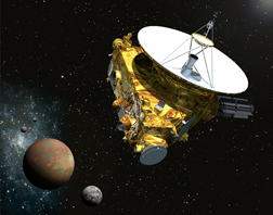
New Horizons
| Spacecraft: |
|
| Chronologies: |
2006 payload #1 ; 2006-001A ; 6,376th spacecraft. |
| Type: |
Planetary Probe (207th)
(Target: Pluto & Kuiper Belt Objects) |
| Families: |
|
| Ranks: |
1,707th American
spacecraft ; |
| Sponsor: |
NASA |
|
Source: NASA
|
| Launch: |
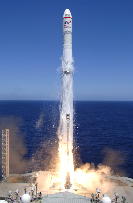
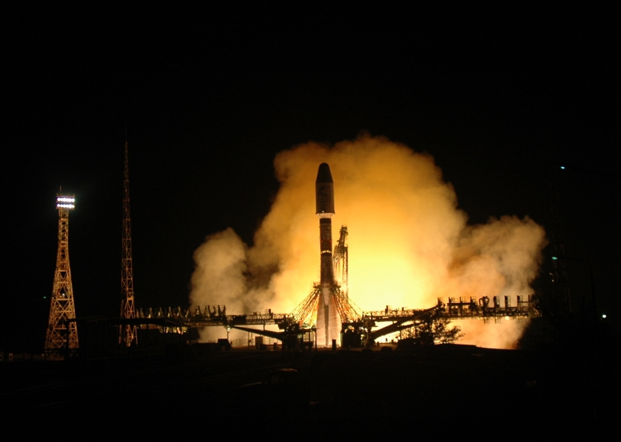
19 January 2006 at 19h00 UTC;
from Cape Canaveral Air Force Station, by an Atlas
V. |
| Orbit: |
Outbound interplanetary trajectory |
| Mission: |
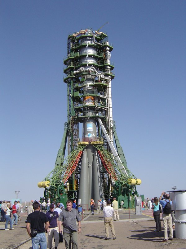
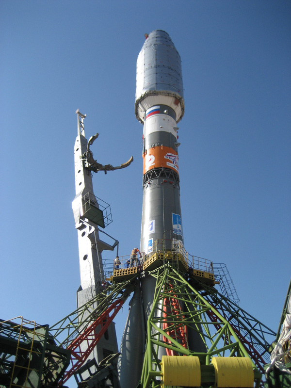
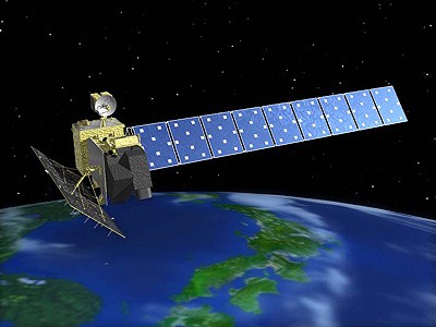
New Horizons is a 450-kg planetary probe
directed toward Pluto and other bodies in the Kuiper Belt. It will
fly around 2.3 million km from Jupiter on 28 February 2007, and to Pluto/Charon
system in 2015, with possible Kuiper Belt Object(s) in around 2017. The
probe's journey will take precisely 3462.7 days -- that is from 19 January
2006 at 19h00 UTC to 14 July 2015 at 12h00 UTC -- to reach Pluto. Encounter
science operations will begin about 150 days before arrival at Pluto. The
probe features a 2.1-meter diameter high-gain antenna for communications
with Earth (as well as radiometry of Pluto) and a radioisotope thermoelectric
generator (RTG) which uses the heat of 11 kg of decaying Plutonium to provide
240 W of electrical power. It carries six monitors: a high-resolution imager,
with a 0.08-m telescope and a suite of detectors (black-and-white and color
CCD, IR and UV spectrometers, a long-range imager, a low energy particle
spectrometer, energetic particle spectrometer, a high-energy ion mass/energy
spectrometer, a dust counter and a radio experiment to study radio propagation
through the Pluto atmosphere). New Horizon also carried a CD containing
signatures of 435,000 Americans. |
| Source: |
Jonathan
Space Report No. 560
; Spacewarn No. 627
; National Space Science Data Center's
2006-001A
; NASA's New Horizons ; Spaceflignt
Now's 19
Jan 06, 2014 Stories
; NASA's 2010-2014
NASA News Releases ; |
|
|
.
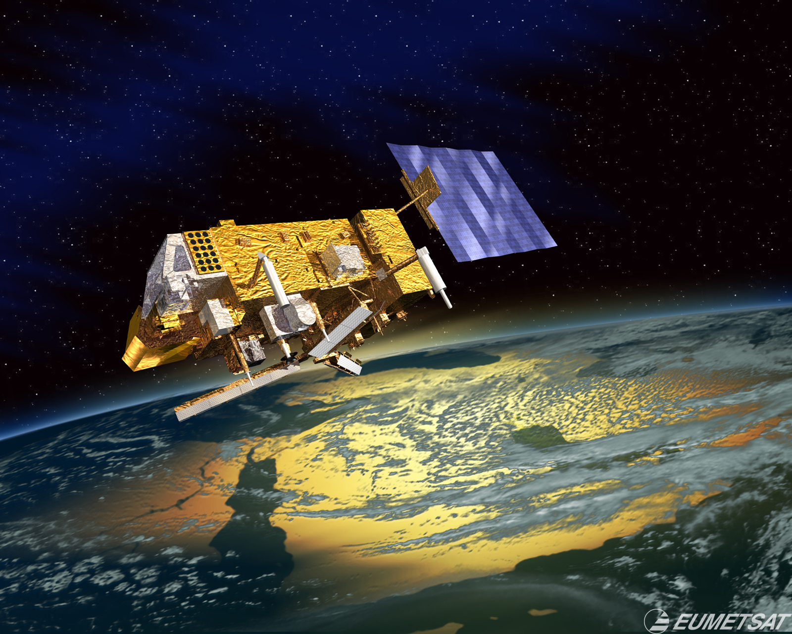
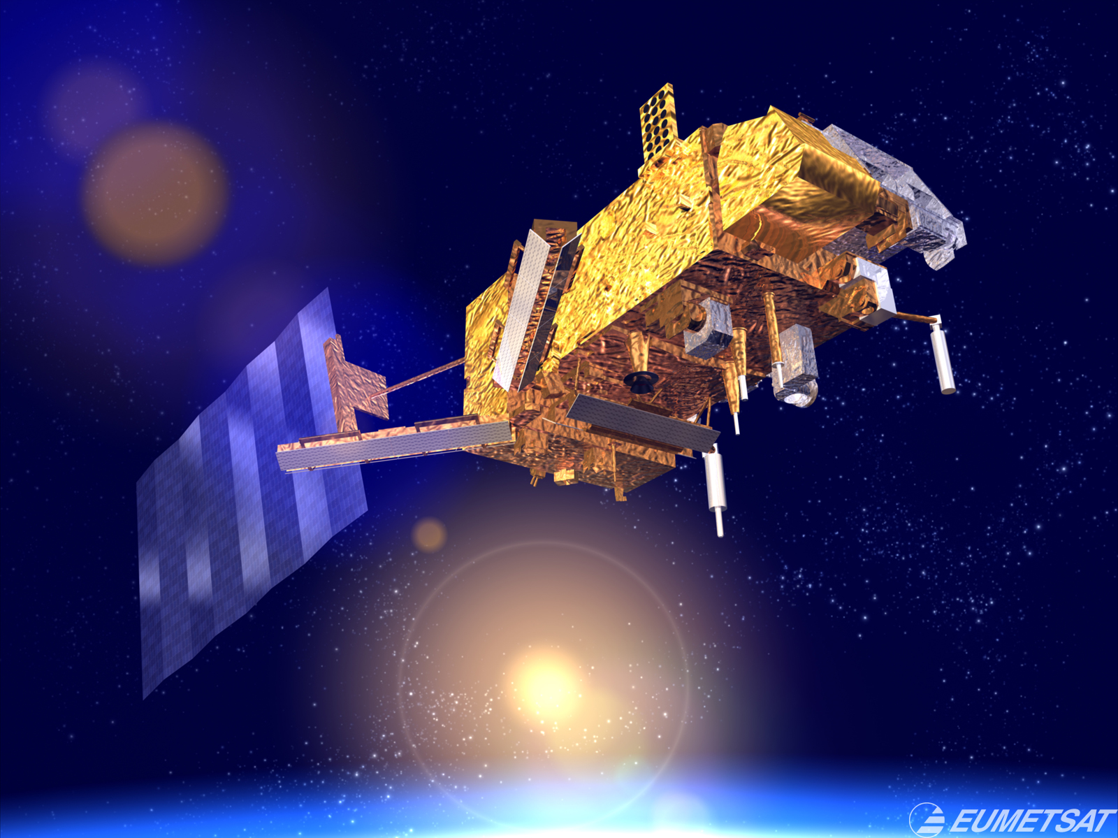
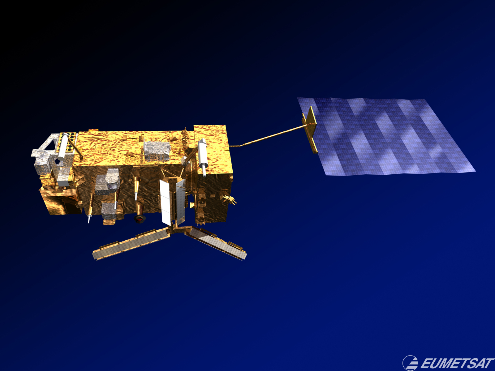
ALOS / Daichi
| Spacecraft: |
ALOS stands for Advanced Land
Observing Satellite and "Daichi" means Land |
| Chronologies: |
2006 payload #2 ; 2006-002A ; 6,377th spacecraft. |
| Type: |
Earth Remote Sensing (162nd) |
| Families: |
|
| Ranks: |
97th Japanese
spacecraft ; |
| Sponsor: |
JAXA / Japan Aerospace Exploration Agency |
|
 |
| Launch: |
24 January 2006 at 1h33 UTC,
from Tanegashima Space Center, by a H-IIA. |
| Orbit: |
Initial: 698 km x 700 km x 98.2° x 98.7
min. |
| Mission: |
ALOS is a four-tonne remote sensing statllite
that carries three instruments for cartographic and natural resource monitoring:
an L-band synthetic aperture radar, an optical 2.5-meter resolution mapping
camera and a 10-meter resolution visible/near-infrared radiometer. |
| Notes: |
The H2A launch vehicle is operated and marketed
by Rocket Systems Corp. with actual launch activities carried out by JAXA
JAXA also manages the satellite and is apparently the effective prime contractor,
with Mitsubishi, NEC and Toshiba as subcontractors. |
| Source: |
Jonathan
Space Report No. 561
; Spacewarn No. 627
; National Space Science Data Center's
2006-003A
; Spaceflignt Now's 24
Jan 06 ;; |
|
|
.
RadioSkaf (SuitSat)
/ AMSAT-OSCAR 54 (AO-54)
| Spacecraft: |
|
| Chronologies: |
2006 payload #3 ; 2005-035C ; 6,378th spacecraft. |
| Type: |
Radio-Amateur (66th) |
| Families: |
|
| Ranks: |
83rd Amateur
spacecraft ; |
| Sponsor: |
Russia/AMSAT-NA (ARISS/AMSAT) |
|
Source: NASA
|
| Launch: |
3 February 2006 at 23h02 UTC,
deployed in orbit from ISS by a cosmonaut. |
| Orbit: |
334 km x 344 km x 51.64° x 91.32 min. |
| Mission: |
AMSAT-OSCAR 54 (Radioskaf or SuitSat) is
an amateur radio beacon that was installed in a discarded Russian Orlan
EVA suit that was ejected from the International Space Station. After activation,
SuitSat transmitted for several orbits and then was thought to go silent.
However better equipped stations were able to continue to hear it, and
it was assumed that it somehow dropped into a very low power mode. NORAD
later identified some debris in the vicinity of SuitSat which may have
been part of the payload or possibly the SuitSat antenna. Based on the
reports the SuitSat team has received, the last confirmed reception of
the SuitSat voice audio was on Saturday February 18, 2006. |
| Source: |
Jonathan
Space Report No.561
; AMSAT
; NASA
; AMSAT-OSCAR
54 (SuitSat) ; Spaceflignt Now's
4
Feb 06 ; |
|
|
.
EchoStar X / Echostar
10
| Spacecraft: |
|
| Chronologies: |
2006 payload #4 ; 2006-003A ; 6,379th spacecraft. |
| Type: |
Communications (998th) |
| Families: |
757th Geostationary
satellite ; |
| Ranks: |
523rd Commercial
spacecraft ; |
| Sponsor: |
EchoStar Communications Corporation |
|
Source :LMI
(A211)
|
|
.
MTSAT 2
| Spacecraft: |
MTSAT-2 stands for Multi-functional
Transport Satellite 2. |
| Chronologies: |
2006 payload #5 ; 2006-004A ; 6,380th spacecraft. |
| Type: |
Meteorology (166th)
and Data Relay |
| Families: |
758th Geostationary
satellite ; |
| Ranks: |
98th Japanese
spacecraft ; |
| Sponsor: |
Japan Civil Aviation Bureau and the Japan
Meteorological Agency |
|
 Source: ATSS
|
|
.
ASTRO-F / Akari
| Spacecraft: |
Akari means "light". |
| Chronologies: |
2006 payload #6 ; 2006-005A ; 6,381st spacecraft. |
| Type: |
Astronomy (106th) |
| Families: |
|
| Ranks: |
99th Japanese
spacecraft ; |
| Sponsor: |
Japan's ISAS |
|
Source : JAXA/ISAS
|
| Launch: |
21 February 2006 at 21h28 UTC,
from Uchinoura Space Center, by a M-V. |
| Orbit: |
Initial: 304 km x 733 km x 98.2°
10 Mar 06: 695 km x 710 km |
| Mission: |
Akari is a 955-kg astrophysics satellite
that carries a Ritchey-Chretien infrared telescope with an aperture of
67 cm and a focal length of 420 cm. The primary mirror is a gold-coated
silicon carbide. It carries two focal plane instruments kept at 6 K by
170 liters of liquid helium. (The helium supply will last for 550 days
of observations.) Akari is expected to provide a significant advance over
the results from the earlier IRAS,
launched in 1983 and which carried out the first all-sky survey at infrared
wavelengths and made a huge impact on astronomy). Previously known as IRIS
(for InfraRed Imaging Surveyor, Akari/ASTRO F is Japan's second infrared
astronomy mission and will carry an ambitious all-sky survey with much
better sensitivity, spatial resolution and wider wavelength coverage than
IRAS. The spacecraft was developed by members of JAXA/ISAS and collaborators. |
| Source: |
Jonathan
Space Report No. 562
; Spacewarn No. 628
; National Space Science Data Center's
2006-005A
; JAXA News
; Spaceflignt Now's 21
Feb 06 ; |
|
|
.
Cute 1.7 + APD
| Spacecraft: |
|
| Chronologies: |
2006 payload #7 ; 2006-005C ; 6,382nd spacecraft. |
| Type: |
Technolog (Student) (215th) |
| Families: |
|
| Ranks: |
84th Amateur
spacecraft ; |
| Sponsor: |
Students of Tokyo Institute of Technology |
|
|
| Launch: |
21 February 2006 at 21h28 UTC,
from Uchinoura Space Center, by a M-V. |
| Orbit: |
Initial: 304 km x 733 km x 98.2° |
| Mission: |
Cute-1.7+APD is a 3.6-kg picosatellite to
train students at the Tokyo Institute of Technology. It is the successor
of the CUTE-I nanosatellite,
developed and built by the second generation of students of this university.
The Avalanche Photo Diode sensor module, or APD, embarked on this 20-cm
x 10-cm x 10-cm nanosatellite was also developed by these student. (The
tiny satellite was ejected from the M-V-8 third stage at 21h45 UTC.) |
| Source: |
Jonathan
Space Report No. 562
; Spacewarn No. 628
; JAXA News
; Cute-1.7
+ APD Project ; Spaceflignt Now's
21
Feb 06 ; |
|
|
.
SSP / "Solarsail Sub
Payload"
| Spacecraft: |
|
| Chronologies: |
2006 payload #8 ; 2006-005B ; 6,383rd spacecraft. |
| Type: |
Technology (216th) |
| Families: |
|
| Ranks: |
100th Japanese
spacecraft ; |
| Sponsor: |
Japan |
|
|
| Launch: |
21 February 2006 at 21h28 UTC,
from Uchinoura Space Center, by a M-V. |
| Orbit: |
|
| Mission: |
SSP (solar sail sub payload, or "soraseiru
sabupeiro-do)" is a 15 -meter-diameter solar sail. It deployed from the
M-V-8 third stage at 21h46 UTC but opened incompletely. |
| Source: |
Jonathan
Space Report No. 562
; Spaceflignt Now's 21
Feb 06 ; |
|
|
.
Arabsat 4A / BADR-ONE
| Spacecraft: |
|
| Chronologies: |
2006 payload #9 ; 2006-006A ; 6,384th spacecraft. |
| Type: |
Communications (999th) |
| Families: |
696th Failure
; |
| Ranks: |
|
| Sponsor: |
Arabsat / Arab Satellites Communications
Organization |
|
 |
| Launch: |
28 February 2006 at 20h10 UTC,
from Baikonur Cosmodrome, by a Proton
M/Briz M. |
| Orbit: |
Geostationary transfert orbit. |
| Mission: |
Arabsat 4A is a 3.3-tonne geostationary communications
satellite which carries 24 C-band and 16 Ku-band transponders to provide
voice, video and internet services to all Arab countries. The spacecraft
was to have offer a wide range of services in the Middle East for ARABSAT,
the communications satellite operator based in Riyadh, Kingdom of Saudi
Arabia. The satellite failed to reach geostationary orbit following a premature
shutdown of Protons Briz-M upper stage. According to several sources,
the Briz-M upper-stage had shut down 27 minutes and 31 seconds into a planned
31-minute second burn. It is unlikely that it could be made geostationary
because the tranfer orbit attained an apogee of 14,700 km only (instead
of the usual 36,000 km). The satellite is a Eurostar E2000+ model equipped
with 24 transponders in C-band and 20 transponders in Ku-band. With a launch
mass of about 3,350 kg, it is the thirtieth Eurostar to orbit. The satellites
is also known as BADR-ONE (not to be confused with the small Pakistani
Badr-A satellite launched in 1990)
Arabsat 4A satellite
was removed from orbit on 24 March 2006. The satellite probably fired its
apogee engine around 0h20 UTC to lower its perigee into the atmosphere
and reentered over the South Pacific at 2407 UTC. |
| Source: |
Jonathan
Space Report No. 562
& 563
; Spacewarn No. 628
; National Space Science Data Center's
2006-006A
; Spaceflignt Now's 28
Feb 06 ; |
|
|
.
Hot Bird 7A
| Spacecraft: |
|
| Chronologies: |
2006 payload #11 ; 2006-007A ; 6,385th spacecraft. |
| Type: |
Communications (1,000th) |
| Families: |
759th Geostationary
satellite ; |
| Ranks: |
272nd European
spacecraft ; |
| Sponsor: |
Eutelsat |
|
|
| Launch: |
11 March 2006 at 22h33 UTC, from
Kourou Space Center's ELA-3, by an Ariane
5 ECA. |
| Orbit: |
Geostationaru at 13° East longitude |
| Mission: |
Hot Bird 7A is a 4,100-kg television broadcast
satellite that carries 38 Ku-band transponders. It renew Eutelsat's current
capacity as well as provide redundancy for the company's HOT BIRD family
of relay spacecraft. Built by Alcatel Alenia Space in Cannes, France, it
is the 21st satellite orbited by Arianespace for Europe's Eutelsat telecommunications
operator. HB7A has a dry mass of 1,740 kg and a solar panel span of 36.9
meters. |
| Source: |
Jonathan
Space Report No. 562
; Spacewarn No. 629
; National Space Science Data Center's
2006-007B
; |
|
|
.
Spainsat
| Spacecraft: |
|
| Chronologies: |
2006 payload #10 ; 2006-007B ; 6,386th spacecraft. |
| Type: |
Military Communications (771st) |
| Families: |
760th Geostationary
satellite ; |
| Ranks: |
273rd European
spacecraft ; |
| Sponsor: |
Spain's HISDESAT |
|
|
| Launch: |
11 March 2006 at 22h33 UTC, from
Kourou Space Center's ELA-3, by an Ariane
5 ECA. |
| Orbit: |
Geostationary at 30° West longitude |
| Mission: |
Spainsat is a 3,680-kg governmental telecommunications
spacecraft that provide secure X and Ku band communications for the
Spanish defense ministry. It carries 13 X-band transponders plus one Ka-band
transponder. It is the first Spanish satellite dedicated to secure government
communications. It is operated by HISDESAT, a company founded in 2001 by
INSA, EADS CASA Espacio, Indra and Sener. The spaceraft assumed the relay
duties handled by the Secomsat military payloads included on Spain's Hispasat
1A and Hispasat
1B satellites, which were launched in 1992 and 1993. Spainsat
was produced by Space Systems/Loral in Palo Alto, California, and is the
25th military payload orbited by Ariane. Spainsat has a dry mass of 1,467
kg and a solar panel span of 31.4 meters. |
| Source: |
Jonathan
Space Report No. 562
; Spacewarn No. 629
; National Space Science Data Center's
2006-007A
; Arianespace's
News
; |
|
|
.
ST5-A (ST5-FWD)
| Spacecraft: |
Space Technology
5 |
| Chronologies: |
2006 payload #12 ; 2006-008A ; 6,387th spacecraft. |
| Type: |
Technology (217th) |
| Families: |
|
| Ranks: |
1,708th American
spacecraft ; |
| Sponsor: |
NASA |
|
|
| Launch: |
22 March 2006 at 14h03 UTC, from
Vandenberg Air Force Base, by a Pegasus
XL. |
| Orbit: |
303 km x 4,550 km x 105.6° x 137 min |
| Mission: |
Space Technology 5 (ST5) Is a the first series
of three microsatellites in the Space Technology mission of NASAs New
Millennium Program. The Goddard-built crafts study the magnetosphere, but
the main point of the project - also known as Nanosat Constellation Trailblazer
- is to demonstrate fully functional satellites in a very small package.
ST5 consists of three small spacecrafts -- ST5-A, ST5-B and ST5-C -- each
with a mass of 25 kg with a power of 20 Watt, and of octagon-shaped (53
cm x 48 cm) with a small extensible magnetometer boom. The satellites include
a cold gas microthruster, and miniaturized telemetry/command and power
systems. Each is called a "full service" satellite, capable of orbit/attitude
maneuver and radio links. In all, about 10 innovative, miniaturized technology
advances will be tested during the 90-day operational span. Among them
are variable emittance coatings (to heat when cold and cool when hot),
metal oxide logic circuits that can operate at 0.5 volts, miniature magnetometers,
and miniature, spinning Sun-sensors. They will orbit in a "string of pearls"
formation. After success with this mission, the hope is to launch many
such microsatellites to better understand the space weather impacts. |
| Launch: |
The Orbital Sciences L-1011 Stargazer carrier
aircraft took off from RW-30/12 at Vandenberg on 22 March at 13h04 UTC.
The Pegasus rocket was dropped from the aircraft at 14h03 UTC over approximately
123° West and 36° Nnorth. At 14h09 UTC, the vehicle reached a polar
orbit and a special dispenser ejected the three satellites. |
| Source: |
Jonathan
Space Report No. 563
; Spacewarn No. 629
; National Space Science Data Center's
2006-008A
; Spaceflignt Now's 28
Feb 06 ; |
|
|
.
ST5-B (ST5-MID)
| Spacecraft: |
Space Technology 5 |
| Chronologies: |
2006 payload #13 ; 2006-008B ; 6,388th spacecraft. |
| Type: |
Technology (218th) |
| Families: |
|
| Ranks: |
1,709th American
spacecraft ; |
| Sponsor: |
NASA |
|
|
|
.
ST5-C (ST5-AFT)
| Spacecraft: |
Space Technology 5 |
| Chronologies: |
2006 payload #14 ; 2006-008C ; 6,389th spacecraft. |
| Type: |
Technology (219th) |
| Families: |
|
| Ranks: |
1,710th American
spacecraft ; |
| Sponsor: |
NASA |
|
|
|
.
FalconSat 2
| Spacecraft: |
|
| Chronologies: |
2006 payload #15 ; 2006 1st loss ; 6,390th
spacecraft. |
| Type: |
Technology (& launch vehicle test) (437th) |
| Families: |
697th Failure
; |
| Ranks: |
1,711th American
spacecraft ; |
| Sponsor: |
SpaceX & USAF Academy and DARPA |
|
|
| Launch: |
24 March 2006 at 22h30 UTC, from
Omelek Island, Kwajalein Atoll, Marshall Islands, by a Falcon
1. |
| Orbit: |
n/a |
| Mission: |
Falconsat-2 is a 20-kg test/science payload
built by cadets at the Air Force Academy for DARPA. It was carried by the
first SpaceX's Falcon 1 rocket. The launch ended in a failure within the
first minute of flight (the vehicle heading back down to the ocean). According
to SpaceX founder Elon Musk, a fuel leak at T+25 seconds caused a fire
in the first stage engine area. It's been reported that the payload
fell back through the roof of SpaceX's machine shop. |
| Source: |
Jonathan
Space Report No. 563
; |
|
|
.
Soyuz TMA-8 / ISS 12S
| Spacecraft: |
Soyuz 11F732 (7K-STMA) No. 218 |
| Chronologies: |
2006 payload #16 ; 2006-009A ; 6,391st spacecraft. |
| Type: |
459th Piloted Spaceship
(250th Piloted mission, 102nd Russian) |
| Families: |
|
| Ranks: |
3,461st Russian
spacecraft ; |
| Sponsor: |
Russian Federal Space Agency & NASA |
|
|
| Launch: |
30 March 2006 at 2h30 UTC, from
Baykonur Cosmodrome's LC-1 by a Soyuz
FG. |
| Orbit: |
Initial: 290.8 km x 244.5 km x 51.6°
x 90.3 min. |
| Landed: |
29 September at 1h13 UTC. |
| Mission: |
Soyuz-TMA-8 is a passenger transport craft
that carried three crewmembers to the International Space Station: commander
Pavel Vinogradov, NASA astronaut Jeffrey Williams and Brazilian astronaut
Marcos Pontes. The spacecraft docked automatically with the Zarya module
on 1st April 2006 at 7h19 UTC, and delivered the crew to the station. The
Brazilian stayed on ISS for eight days, the two others for six months.
Soyuz TMA-8 undocked from Zarya on 28 September2006 at 21h53 UT, carrying
Vinogradov, Williams and Ansari. It landed in Kazakstan on 29 September
at 1h13 UTC. |
| Source: |
Jonathan
Space Report No. 563
& 572
; Spacewarn No. 629
; National Space Science Data Center's
2006-009A
; |
|
|
.
JCSAT-9
| Spacecraft: |
|
| Chronologies: |
2006 payload #17 ; 2006-010A ; 6,392nd spacecraft. |
| Type: |
Communications (1,001st) |
| Families: |
761st Geostationary
satellite ; |
| Ranks: |
101th Japanese
spacecraft ; |
| Sponsor: |
Japan's JSAT Corporation |
|
|
| Launch: |
12 April 2006 at 23h30 UTC, from
Odyssey launch platform, POR, by a Zenit
3SL.
(The Odyssey platform was floating over the
equatorial Pacific Ocean at 154° West) |
| Orbit: |
Geostarionary at 132° East longitude |
| Mission: |
JCSAT 9 is a 4,401-kg communications satellite
that provides voice, video and internet services through out Asia, through
its 20 C-band and 20 Ku-band transponders Ir joins JSAT's nine spacecraft
currently in orbit, providing communications and broadcasting services
to businesses throughout Asia. The successor to the N-STARa satellite at
132º East Longitude, JCSAT-9 is equipped with Ku-band transponders
for domestic communications and an S-band transponder for mobile communications.
In addition, the satellite features new C-band transponders for international
communications. Besides serving domestic and mobile communications customer
bases, JCSAT-9 will cover an extensive area ranging from Hawaii and Oceania
to countries in Southeast Asia, a region witnessing the convergence of
communications and broadcasting, and digitalization of the latter.
Built by Lockheed Martin, it used an A2100AX bus,. |
| Source: |
Jonathan
Space Report No. 563
; Spacewarn No. 630
; National Space Science Data Center's
2006-010A
; JCSAT Corp's
JCSAT-9 ; Sea Launch's JCSAT-9
& 12
Apr 06 ; |
|
|
.
Formosat-3 FM1
| Spacecraft: |
|
| Chronologies: |
2006 payload #18 ; 2006-011A ; 6,393rd spacecraft. |
| Type: |
Earth/Space Science (327th) |
| Families: |
|
| Ranks: |
|
| Sponsor: |
Taiwan's National Space Program Office (NSPO) |
|
Source : OSC
|
| Launch: |
15 April 2006 at 1h40 UTC, from
Vandenberg Air Force Base's SLC-8, by a Minotaur
1. |
| Orbit: |
Initial: 500 km x 540 km x 72°
496 km x 540 km x 72° x 95 min. |
| Mission: |
The FORMOSAT-3 program use a constellation
of six remote sensing microsatellites to collect atmospheric data for weather
prediction and for ionosphere, climate and gravity research. The fleet
consists of six small 62-kg Orbcomm-type crafts with GPS receivers which
will measure atmospheric conditions by studying the effect of the atmosphere
on GPS satellite signals passing through it. Thsy will eventually
be positioned in equally spaced orbit planes at around 800 km altitude.
The project, also known as COSMIC (Constellation Observing System
for Meteorology, Ionosphere and Climate) is a collaboration between the
National Space Program Office (NSPO) of Taiwan and the United States. Data
from the satellites are made available to the international scientific
community in near real-time. After maneuvering their relative positions
in the orbit, they will enable derivation of the atmospheric temperature
and water vapor distribution by looking for the GPS radio signals arriving
from the horizon. The occulted signals suffer refraction depending upon
atmospheric parameters. Such data over oceans will be especially useful
in predicting cyclogenesis conditions. |
| Source: |
Jonathan
Space Report No. 563
; Spacewarn No. 630
; National Space Science Data Center's
2006-011A
; OSC's FORMOSAT-3/COSMIC
; |
|
|
.
Formosat-3 FM2
| Spacecraft: |
|
| Chronologies: |
2006 payload #19 ; 2006-011B ; 6,394th spacecraft. |
| Type: |
Earth/Space Science (328th) |
| Families: |
|
| Ranks: |
|
| Sponsor: |
Taiwan's National Space Program Office (NSPO) |
|
Source : OSC |
|
.
Formosat-3 FM3
| Spacecraft: |
|
| Chronologies: |
2006 payload #20 ; 2006-011C ; 6,395th spacecraft. |
| Type: |
Earth/Space Science (329th) |
| Families: |
|
| Ranks: |
|
| Sponsor: |
Taiwan's National Space Program Office (NSPO) |
|
Source : OSC |
|
.
Formosat-3 FM4
| Spacecraft: |
|
| Chronologies: |
2006 payload #21 ; 2006-011D ; 6,396th spacecraft. |
| Type: |
Earth/Space Science (330th) |
| Families: |
|
| Ranks: |
|
| Sponsor: |
Taiwan's National Space Program Office (NSPO) |
|
Source : OSC |
|
.
Formosat-3 FM5
| Spacecraft: |
|
| Chronologies: |
2006 payload #22 ; 2006-011E ; 6,397th spacecraft. |
| Type: |
Earth/Space Science (331st) |
| Families: |
|
| Ranks: |
|
| Sponsor: |
Taiwan's National Space Program Office (NSPO) |
|
Source : OSC |
|
.
Formosat-3 FM6
| Spacecraft: |
|
| Chronologies: |
2006 payload #23 ; 2006-011F ; 6,398th spacecraft. |
| Type: |
Earth/Space Science (332nd) |
| Families: |
|
| Ranks: |
|
| Sponsor: |
Taiwan's National Space Program Office (NSPO) |
|
Source : OSC |
|
.
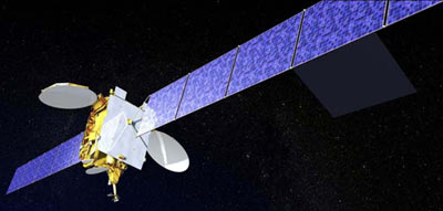
ASTRA 1KR
| Spacecraft: |
|
| Chronologies: |
2006 payload #24 ; 2006-012A ; 6,399th spacecraft. |
| Type: |
Communications (1,002nd) |
| Families: |
762nd Geostationary
satellite ; |
| Ranks: |
524th Commercial
spacecraft ; |
| Sponsor: |
SES Astra |
|
|
| Launch: |
21 April 2006 at 20h47 UTC, from
Cape Canaveral Air Force Station's LC-41, by an Atlas
V. |
| Orbit: |
Geostationary at 19.2° East longitude. |
| Mission: |
ASTRA 1KR is a 4.3 tonne communications satellite
that provides direct-to-home voice, video and internet services to much
of Europe through its 32 Ku-band transponders. It delivers broadcast services
to Continental Europe, and also transmit HDTV channels. The spacecraft
is a Lockheed Martin A2100 Ku-band communications satellite.
The ASTRA Satellite System is
the leading Direct-to-Home (DTH) satellite system in Europe, delivering
services to some 107 million Direct-to-Home and cable households. The ASTRA
satellite fleet currently comprises 13 satellites, transmitting in excess
of 1,600 analogue and digital television and radio channels as well as
multimedia and Internet services. |
| Source: |
Jonathan
Space Report No. 563
; Spacewarn No. 630
; National Space Science Data Center's
2006-012A
; SES ASTRA's News
; |
|
|
.
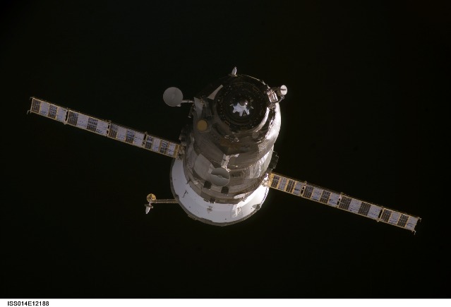
Progress M-56 / ISS
21P
| Spacecraft: |
Progress M (7K-TGM) No. 356 |
| Chronologies: |
2006 payload #25 ; 2006-013A ; 6,400th spacecraft. |
| Type: |
Cargo delivery to the International Space
Station (460th piloted spaceship) |
| Families: |
111th Progress
cargoship (21st to ISS) ; |
| Ranks: |
3,462nd Russian
spacecraft ; |
| Sponsor: |
Russian Federal Space Agency |
|
|
| Launch: |
24 April 2006 at 16h03 UTC, from
Baykonur Cosmodrom's LC-1, by a Soyuz
U. |
| Orbit: |
Initial: 193.6 km x 237.7 km x 51.64°
x 88.53 min.
337 km x 348 km x 51.6° x 91.4 min. |
| Deorbit: |
19 September 2006. |
| Mission: |
Progress M-56 is an automatic cargo transport
vehicle that carries about 2.6 tonnes of various cargoes, including fuel,
food, water and equipment to the ISS. It also carried an experimental picosatellite
named SPHERE (built by MIT students) that will float inside the station,
strictly maintaining its location inside. The cargo craft docked with the
Zvezda module at on 26 April 2006 at 16h12 UT. Progress M-56 is the 21th
Progress cargoflight launched toward ISS and the 111th operation of Progress
vehicles (that began in 1978). The Progress M-56 undocked from Zvezda
on 19 September at 0h28 UT. It was later deorbited over the Pacific. |
| Source: |
Jonathan
Space Report No. 563
& 571
; Spacewarn No. 630
; National Space Science Data Center's
2006-013A
; Energiya's News
; |
|
|
.
Eros-B / Eros-B1
| Spacecraft: |
|
| Chronologies: |
2006 payload #26 ; 2006-014A ; 6,401st spacecraft. |
| Type: |
Earth imaging (163rd) |
| Families: |
|
| Ranks: |
10th Israelian
spacecraft ; |
| Sponsor: |
Israeli ImageSat International |
|
|
| Launch: |
25 April 2006 at 16h47 UTC, from
Svobodny, by a Start 1. |
| Orbit: |
503 km x 513 km x 97.3° x 94.8 min. |
| Mission: |
EROS B-1 is a 360-kg (290-kg?), 800-watt
photo-imaging commercial/military satellite capable of images at
a resolution of 70 cm. It joins the EROS A satellite to provide very high
resolution commercial satellites constellation for a wide range of applications.
Similar to EROS A, the EROS B satellite is expected to provide services
for 8-10 years. The spacecraft is operated by the Israeli ImageSat company
(incorporated in the Cayman Island). ImageSat Internationals shareholders
include Israel Aircraft Industries and Elbit/ElOp Electro Optics Industries
as well as investors from the US and Europe. The satellite was produced
by Israel Aircraft Industries/MBT Space Division and includes Elbit / ElOp
camera installed on board. |
| Source: |
Jonathan
Space Report No. 563
; Spacewarn No. 630
;
National Space Science Data Center's
2006-014A
; ImageSat's
News
; |
|
|
.
Yaogan 1 / RSS 1
| Spacecraft: |
RSS 1 stands for Remote Sensing
S,atellite |
| Chronologies: |
2006 payload #27 ; 2006-015A ; 6402nd spacecraft. |
| Type: |
Earth Remote Sensing (164th) |
| Families: |
|
| Ranks: |
97th Chinese
spacecrarft ; |
| Sponsor: |
China |
|
|
| Launch: |
26 April 2006 at 22h48 UTC, from
Taiyuan Satellite Launch Center, by a Chang
Zheng 4B. |
| Orbit: |
Initial: 601 km x 621 km x 97.8°
May 1, 2006: 628 km x 629 km x 97.8°
624 km x 626 km x 97.8° x 97.2 min. |
| Mission: |
Yaogan 1, or Remote Sensing Satellite 1 (RSS
1) is a 2.7-tonne photo-imaging satellite that to enable land survey, crop
appraisal and disaster monitoring. The satellite was built by the
Shanghai SAST group, which also builds the Feng Yun weather satellites. |
| Source: |
Jonathan
Space Report No. 564
; Spacewarn No. 630
; National Space Science Data Center's
2006-015A
; China Daily Online's 27
Apr 06 ; |
|
|
.
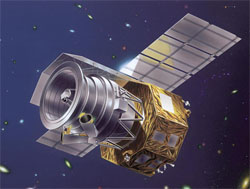
CALIPSO
| Spacecraft: |
(Cloud-Aerosol Lidar and Infrared
Pathfinder Satellite Observations |
| Chronologies: |
2006 payload #28 ; 2006-016A ; 6,403rd spacecraft. |
| Type: |
Earth Remote Sensing (333rd) |
| Families: |
|
| Ranks: |
274th European
spacecraft ; |
| Sponsor: |
NASA/CNES |
|
|
| Launch: |
28 April 2006 at 10h02 UTC, from
Vandenberg Air Force Base's SLC-2W, by a Delta
II. |
| Orbit: |
Initial: 687 km x 689 km x 98.2° x 98.5
min.
Deployment orbit: 687 x 689 km x 98.2° |
| Mission: |
CALIPSO is a, a joint CNES (France) and NASA
meteorological satellite that will work in concert with the co-launched
CloudSat, as well as the three older satellites (Aqua, PARASOL and Aura),
all these five forming what is named as A-Train. The A-Train satellites
have almost the same orbit, all crossing the equator within 15 minutes.
CALIPSO carries three instruments: CALIOP (Cloud Aerosol Lidar with
Orthogonal Polarization) which enables derivation of the vertical distribution
of aerosols and water vapor at a resolution of 40 meters. IIR (Imaging
Infrared Radiometer) will image the clouds at three wavelengths andWFC
(Wide Field Camera) is an off-the-shelf commercial star tracker camera
that will take pictures. The NASA part of the project is considered to
be an ESSP (Earth System System Pathfinder) mission. |
| Source: |
Jonathan
Space Report No. ; Spacewarn
No .630
; National Space Science Data Center's
2006-016A
; |
|
|
.
CloudSat
| Spacecraft: |
|
| Chronologies: |
2006 payload #29 ; 2006-016B ; 6,404th spacecraft. |
| Type: |
Earth Remote Sensing (334th) |
| Families: |
|
| Ranks: |
1,712th American
spacecraft ; |
| Sponsor: |
NASA |
|
|
| Launch: |
28 April 2006 at 10h02 UTC, from
Vandenberg Air Force Base's SLC-2W, by a Delta
II. |
| Orbit: |
Initial: 689 km x 690 km x 98.2° x 98.6
min.
Deployment orbit: 687 x 689 km x 98.2° |
| Mission: |
CloudSat is an meteorological satellite that
will work in concert with the co-launched CALIPSO, as well as the three
earlier satellites (Aqua, PARASOL and Aura), all forming what is named
as A-Train. All five have almost the same orbit, crossing the equator within
15 minutes of each other. CloudSat carries a single radar (CPR or Cloud
Profiling Radar) to obtain the reflectivity of the clouds. The reflectivity
is obtained at a height-resolution of 500 m, and width resolution of about
2 km. Cloudsat is another ESSP (Earth System System Pathfinder) mission. |
| Source: |
Jonathan
Space Report No. ; Spacewarn
No.630
; National Space Science Data Center's
2006-016B
; |
|
|
.
Kosmos 2420
| Spacecraft: |
Kobal't-M No. 2 |
| Chronologies: |
2006 payload #30 ; 2006-017A ; 6,405th spacecraft. |
| Type: |
Reconnaissance (1,186th) |
| Families: |
|
| Ranks: |
3,463rd Russian
spacecraft ; |
| Sponsor: |
Russia Defense ministry |
|
|
| Launch: |
3 May 2006 at 17h38 UTC, from
Plesetsk Cosmodrome's LC-16, by a Soyuz
U. |
| Orbit: |
Initial: 189 km x 337 km x 67.2° x 89.8
min. |
| Mission: |
Kosmos 2420 is probably the second Kobal't-M
satellite, built by the Arsenal factory. Kobal't-M carries small film recovery
capsules and one large reentry vehicle with the camera and more film. |
| Source: |
Jonathan
Space Report No. 564
; Spacewarn No. 631
; National Space Science Data Center's
2006-017A
; |
|
|
.
GOES-13 / GOES N
| Spacecraft: |
GOES stands for Geostationary
Operational Environmental Satellite |
| Chronologies: |
2006 payload #31 ; 2006-018A ; 6,406th spacecraft. |
| Type: |
Meteorology (167th) |
| Families: |
763rd Geostationary
satellite ; |
| Ranks: |
1,713th American
spacecraft ; |
| Sponsor: |
NOAA / National Oceanographic and Atmospheric
Administrationc |
|
|
| Launch: |
24 May 2006 at 22h11 UTC, from
Cape Canaveral Air Force Station's SLC-37B, by a Delta
IV. |
| Orbit: |
Geostationary at 105° West longitude |
| Mission: |
GOES-N, which was designated GOES-13 once
it reaches final orbit, is a 3,209 kg (fuelled, 1,543 kg empty), 2.3-kW
weather satellite that carries imager and sounder instruments, a space
environment monitor, a soft X-ray solar imaging telescope, an energetic
particle detector, and ground-data relaying equipment. It supply
data critical for fast, accurate forecasts and warnings for severe weather,
including tornadoes, winter storms and hurricanes. Additionally, it detects
solar storm activity, relay distress signals from emergency beacons, monitor
the oceans and scan the landscape for the latest drought and flood conditions.
The first spacecraft in the new GOES-N/O/P series, it features a highly
stable pointing platform, which will improve the performance of the imager
and sounder instruments. It also has expanded measurements for the space
and solar environment monitoring instruments. The satellite also features
a new dedicated broadcast capability to be used by the Emergency Managers
Weather Information Network and a new digital weather facsimile capability
for higher quality transmissions of data and products. It joins GOES
10 (operating as GOES-WEST), GOES
12 (operating as GOES-EAST) and GOES
11 (standby, will replace GOES-10 on Jun 27). Arter a six-month check-out
phase, GOES-13 is expected to be put into a storage mode, ready to replace
one of the two existing GOES spacecraft should either experience trouble. |
| Source: |
Jonathan
Space Report No. 565
& 566
; Spacewarn No. 631
; National Space Science Data Center's
2006-018A
; NOAA
; GOES ; Spaceflight
Nows 2013 Stories ; |
|
|
.
Kompass-2 (Compas-2)
| Spacecraft: |
Complex Orbital Magneto-Plasma
Autonomous Small Satellite 2, |
| Chronologies: |
2006 payload #32 ; 2006-019A ; 6,407th spacecraft. |
| Type: |
Earth/Space Science (Earthquake prediction)
(334th) |
| Families: |
698th Failure
; |
| Ranks: |
3,464th Russian
spacecraft ; |
| Sponsor: |
Institute of Terrestrial Magnetism, Ionosphere,
and Radio Waves Propagation, (IZMIRAN) |
|
|
| Launch: |
26 May 2006 at 18h50 UTC, from
a K-84 ("Ekaterinburg") submarine in the Barents Sea, Russia, by a Shtil'. |
| Orbit: |
Initial: 402 km x 525 km x 78.9° x 93.9
min.
399 km x 494 km x 78.9° |
| Mission: |
COMPASS-2 (KOMPAS-2) is a 80-kg earthquake
research satellite for the Moscow-based IZMIRAN science institute, It carries
detectors for electomagnetic signatures created by/before earthquakes and
volcanoes. The satellite carries detectors for electrons, UHF/VHF waves,
UV emission and radiation, a radio frequency analyser for electric field
waves, and a Mayak ionospheric beacon. The satellite was developed by the
Makeev KB.
Reports indicate
that the satellite is not responding to ground commands and that its mission
may be abandoned. On 30 May 2006, the mission
web site reported that: After a few successful contacts with COMPASS-2
it has become clear that serious problems have developped onboard. Insufficient
power supply prevents activation of the scientific payload. |
| Launch: |
COMPASS-2 marked the second launch into orbit
from a submarine. The launch platform was the submarine K-84 'Ekaterinburg'
in the Barents Sea. |
| Source: |
Jonathan
Space Report No. 565
; Spacewarn No. 631
; National Space Science Data Center's
2006-019A
; Interfax ; IZMIRANs
Kompas-2
; Kompas-2Mission
; Spaceflight
Now ; |
|
|
.
Satmex 6
| Spacecraft: |
|
| Chronologies: |
2006 payload #33 ; 2006-020A ; 6,408th spacecraft. |
| Type: |
Communications (1,003rd) |
| Families: |
764th Geostationary
satellite ; |
| Ranks: |
|
| Sponsor: |
Mexico's Satelites Mexicanos SA de |
|
|
| Launch: |
27 May 2006 at 21h09 UTC, from
Kourou Space Center's ELA-3, by an Ariane
5 ECA. |
| Orbit: |
Geostationary at 113° West longitude |
| Mission: |
Satmex 6 is a 5.5 tonne communications satellite
that provides voice, data, internet service, and video services to Mexico,
South America and continental United States, through its 36 C-band and
24 Ku-band transponders. Satmex 6 is a Loral 1300X satellite, built by
Space Systems/Loral of the United States in Palo Alto, California, with
a mass of 2310 kg (5456 kg when fuelled). |
| Launch: Notes |
This Ariane 5 ECA heavy-lift launch is the
27th flight for the Ariane 5 launcher family. The combined weight of Ariane
5's Thaicom 5 and Satmex 6 spacecraft payloads
was more than 8,200 kg, marking a new record for satellite mass delivered
into orbit. With this success, Arianespace has launched a total of more
than 230 satellites since the company pioneered the commercial launch services
industry with its first Ariane mission in 1984. |
| Source: |
Jonathan
Space Report No. 565
; Spacewarn No. 631
; National Space Science Data Center's
2006-020A
; Arianespace News: |
|
|
.
Thaicom 5
| Spacecraft: |
|
| Chronologies: |
2006 payload #34 ; 2006-020B ; 6,409th spacecraft. |
| Type: |
Communications (1,004th) |
| Families: |
765th Geostationary
satellite ; |
| Ranks: |
|
| Sponsor: |
Thailand's Shin Satellite Public Company
Limited |
|
|
| Launch: |
27 May 2006 at 21h09 UTC, from
Kourou Space Center's ELA-3, by an Ariane
5 ECA. |
| Orbit: |
Geostationary at 78.5° East longitude |
| Mission: |
Thaicom 5 is a 2.8 tonne, triaxially-stabilized
communications satellite that provides television and internet services
to the Asia-Pacific region through its 25 C-band and 14 Ku-band transponders.
It will replace the aging Thaicom
1 and Thaicom
2 satellites that were launched in 1993 and 1994. The
spacecraft is an Alcatel Alenia Space Spacebus 3000A with a mass of 1,220
kg (2,766 kg when fully fuelled). |
| Source: |
Jonathan
Space Report No. 565
; Spacewarn No. 631
; National Space Science Data Center's
2006-020B
; |
|
|
.
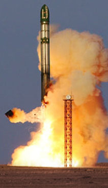
Resurs-DK1
| Spacecraft: |
Resurs-DK1 means "Resurs - High
Resolution 1" |
| Chronologies: |
2006 payload #35 ; 2006-021A ; 6,410th spacecraft. |
| Type: |
Earth Remote Sensing |
| Families: |
|
| Ranks: |
|
| Sponsor: |
Russia |
|
|
| Launch: |
15 June 2006 at 8h00 UTC, from
Baikonur Cosmodrome, by a Soyuz-U. |
| Orbit: |
Iitial: 193 km x 339 km x 70.0°.
18 June: 355 km x 585 km x 69.9°
September 2010: 567 km x 573 km x 69.9° |
| Mission: |
Resurs-DK1 is a 6,650-kg Multi-spectral remote
sensing satellites that provides Earths surface images in hith-resolution.
It is the first Russia civil Earth Observation imaging satellite able of
transmitting high-resolution imagery (1 meter) to the ground stations as
it passes overhead. Its Geoton-1 camera payload enable one-meter resolution
black & white images or two-meter resolution in color. Its mission
is to acquire high-quality visible images in near real-time as well as
on-line data delivery via radio link and providing a wide range of consumers
with value-added processed data. Unlike earlier missions (which captured
images on a film and dropped the canisters over Russia), this satellite
downlinks the data over selected Russian stations. The spacecraft is owned,
designed, built and operated by TsSKB Progress (State Research & Production
Space Rocket Center) of Samara. Roskosmos is funding the project, the commercial
data distributor is Sovinformsputnik of Moscow. The satellite was successfully
placed in its target orbit less than nine minutes after lift-off. However,
a malfunction of unknown nature has occurred during the activation of systems
aboard the spacecraft. |
| Source: |
Jonathan
Space Report No. 566,
632
;
Spacewarn No. 632
; National Space Science Data Center's
2006-021A
; NTs OMZ s Resurs-DK1
; EO's Resurs-DR1 ; ; |
|
|
.
KazSat 1
| Spacecraft: |
|
| Chronologies: |
2006 payload #36 ; 2006-022A ; 6,411th spacecraft. |
| Type: |
Communications (multi-services) |
| Families: |
|
| Ranks: |
1st Kazakh satellite |
| Sponsor: |
Kazakhstan |
|
|
| Launch: |
17 June 2006 at 22h44 UTC, from
Baikonur Cosmodrome, by a Proton-K/Block-DM3 |
| Orbit: |
Geostarionary |
| Mission: |
KazSat 1, the first kazakh communication
satellite, is a 1.4-tonne (with fuel) satellite that carries 12 Ku-band
transponders 8 for fixed communications and 4 for TV-transmissions,
The spacecraft is intended for telecast, fixed satellite communication
and data transmission for Kazakhstan and central asia. The satellite cost
100 million dollars. Kazakhstan purchased the satellite from the Russian
space company Krunichev, which also launched it using its Proton-K rocket. |
| Source: |
Jonathan
Space Report No. 566
; Spacewarn No. 632
; National Space Science Data Center's
2006-022A
; |
|
|
.
Galaxy 16
| Spacecraft: |
|
| Chronologies: |
2006 payload #37 ; 2006-023A ; 6,412th spacecraft. |
| Type: |
Communications |
| Families: |
|
| Ranks: |
|
| Sponsor: |
PanAmSat Corp. |
|
|
| Launch: |
18 June 2006 at 7h50 UTC, from
Odyssey Launch Platform, by a Zenit 3-SL/Block-DM-SL
(positioned on the equator at 154° West
Longitude in the Pacific Ocean). |
| Orbit: |
Geostarionary at 99° West longitude. |
| Mission: |
Galaxy 16 is a 4,640-kg (with fuel) high-power
fixed satellite service (FSS) communications satellite which carries 24
C-band and 24 Ku-band transponders. From its orbital location, it provides
coverage for data and video services, including high-definition television
(HDTV) broadcasts and IPTV (Internet Protocol Television), across the entire
United States, including Alaska, Hawaii and Puerto Rico, in addition to
Canada and Mexico. The spacecraft, which is a Loral LS-1300, is designed
to provide over 10 kilowatts of power throughout its 15-year mission life.
Through its
owned and operated fleet of 24 satellites, PanAmSat is a leading global
provider of video, broadcasting and network distribution and delivery services.
It transmits nearly 2,000 television channels worldwide and, as such, is
the leading carrier of standard and high-definition signals. In total,
the Company's in-orbit fleet is capable of reaching over 98 percent of
the world's population through cable television systems, broadcast affiliates,
direct-to-home operators, Internet service providers and telecommunications
companies. |
| Source: |
Jonathan
Space Report No. 566
; Spacewarn No. 632
; National Space Science Data Center's
2006-023A
; Panamsat's ; Space
System/Loral's Galaxy
16 ; Sea Launch's 18
Jun 06 ; |
|
|
.
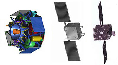
MITEx (USA 187)
| Spacecraft: |
Micro-Satellite Technology Experiment |
| Chronologies: |
2006 payload #38 ; 2006-024A ; 6,413th spacecraft. |
| Type: |
Technology |
| Families: |
|
| Ranks: |
|
| Sponsor: |
DARPA, U.S. Air Force and U.S.Navy |
|
Source: Space
Review
|
| Launch: |
21 June 2006 at 22h15 UTC, from
Cape Canaveral Air Force Station's SLC-17A, by a Delta
II |
| Orbit: |
Geostarionary |
| Mission: |
The MITEX project consists of three spacecraft.
Two of them are small 250-kg-class satellites, one built by Orbital Sciences
(OSC) and the other by Lockheed Martin (LM). The third is an advanced liquid
propellant upper stage developed by the Naval Research Lab (NRL). The NRL
stage has a 400-N thruster and, unusually, solar panels, allowing the stage
to operate for an extended time and deliver multiple payloads to different
orbits. On this mission, the NRL stage will deliver the OSC and LM satellites
to geostationary orbit, where they will carry out a number of maneuvers.
Observers speculate that the small satellites are prototypes for inspector
spacecraft which could rendezvous with and take closeup images of other
geostationary satellites. The three satellites have been given the
cover names USA 187, 188 and 189. It's not known which number applies to
which payload. |
| Source: |
Jonathan
Space Report No. 566
; Spacewarn No. 632
; National Space Science Data Center's
2006-024A
; Spaceflight Now 21
Jun 06 ; Space Review's
Mysterious
microsatellites in GEO: is MiTEx a possible anti-satellite capability demonstration?
; |
|
|
.
MITEx (USA 188)
| Spacecraft: |
Micro-Satellite Technology Experiment |
| Chronologies: |
2006 payload #39 ; 2006-024B ; 6,414th spacecraft. |
| Type: |
Technology |
| Families: |
|
| Ranks: |
|
| Sponsor: |
DARPA, U.S. Air Force and U.S.Navy |
|
Source: Space
Review |
|
.
MITEx (USA 189)
| Spacecraft: |
Micro-Satellite Technology Experiment |
| Chronologies: |
2006 payload #40 ; 2006-024C ; 6,415th spacecraft. |
| Type: |
Technology |
| Families: |
|
| Ranks: |
|
| Sponsor: |
DARPA, U.S. Air Force and U.S.Navy |
|
Source: Space
Review |
|
.
Progress M-57 / ISS
22P
| Spacecraft: |
Progress M (7K-TGM) No. 357 |
| Chronologies: |
2006 payload #41 ; 2006-025A ; 6,416th spacecraft. |
| Type: |
Cargo delivery to the International Space
Station (460thpiloted spaceship) |
| Families: |
112th Progress
cargoship (22nd to ISS) ; |
| Ranks: |
|
| Sponsor: |
Russian Federal Space Agency |
|
Source: NASA
|
| Launch: |
24 June 2006 at 15h08 UTC, from
Baykonur Cosmodrom's LC-1, by a Soyuz
U. |
| Orbit: |
At docking : 335 km x 349 km x 51.6° |
| Mission: |
Progress-M 57 is a cargo craft which carried
about 2.6 tones of various cargo, including food, fuel, water, air and
scientific hardware and equipment to the International Space Station. Following
a two-day free flight, the cargo transport ship docked on the Pirs module
docking port of ISS on 26 June 2006 at 16h25 UT. The vehicle rendezvous
with the Station, fly-about and birthing were performed in the automatic
mode. Progress M-57 is the 22nd flight of the ISS program and the 111th
Progress since 1978. These vehicle are developed and manufactured by RSC
Energia in cooperation with space industry companies. |
| Source: |
Jonathan
Space Report No. 566
; Spacewarn No. 632
; National Space Science Data Center's
2006-025A
; Energiya's News
; Energiya 24
Jun 06 & 26
Jun 06 ; |
|
|
.
Kosmos 2421
| Spacecraft: |
US-PU |
| Chronologies: |
2006 payload #42 ; 2006-026A ; 6,417th spacecraft. |
| Type: |
Electronic Intelligence |
| Families: |
|
| Ranks: |
|
| Sponsor: |
Russia Defense Ministry |
|
|
| Launch: |
25 June 2006 at 4h00 UTC, from
Baykonur Cosmodrome's LC-90?, by a Tsyklon
2. |
| Orbit: |
404 km x 418 km x 65.1° x 92.7 min. |
| Mission: |
Kosmos 2421 is a Russian Navy US-PU satellite
for ocean electronic surveillance. It provide the Russian Navy with
electronic intelligence data for military operations at sea. The most recent
launch of a similar payload was in May 2004, but that spacecraft was destroyed
as it fell from orbit after ceasing operations in late April 2006. |
| Source: |
Jonathan
Space Report No. 566
; Spacewarn No. 632
; National Space Science Data Center's
2006-026A
; Spaceflight Now 25
Jun 06 ; |
|
|
.
NROL-22 (USA 184)
| Spacecraft: |
|
| Chronologies: |
2006 payload #43 ; 2006-027A ; 6,418th spacecraft. |
| Type: |
Electronic Intelligence |
| Families: |
|
| Ranks: |
|
| Sponsor: |
U.S. National Reconnaissance Office |
|
|
| Launch: |
28 June 2006 at 3h33 UTC, from
Vandenberg Air Force Base's SLC-6, by a Delta
IV. |
| Orbit: |
A Molniya-type (12-hour, highly-elleptical
and inclined at 65°) orbit ? |
| Mission: |
This spacecraft is an electronic intelligence
satellite codenamed NROL-22 and it received the designation USA 184, held
over from last year. The intended orbit is an elliptical 12-hour orbit
with an inclination of 63 degrees; NRO data relay and signals intelligence
satellites have used this orbit in the past. This payload is likely to
be one of the signals intelligence series that began with the JUMPSEAT
satellites in 1971. Aviation Week, on the other hand, thinks that
it's a Satellite Data System data relay satellite.
NROL-22 probably
also carries NASA's TWINS-A science payload which carries neutral atom
imagers to map the Earth's magnetosphere. It may also have an additional
USAF SBIRS-HEO test payload. SBIRS-HEO is the highly elliptical orbit component
of the new Space-Based Infrared missile early warning satellite system
that will replace the old DSP satellites. The HEO-1 payload was delivered
to the USAF in 2004 which is consistent with a launch on this mission,
originally scheduled to go up in early 2005. |
| Source: |
Jonathan
Space Report No. 567
; Spacewarn No. 632
; National Space Science Data Center's
2006-027A
; NRO's 27
Jun 06 ; |
|
|
.
STS-121 / ULF-1.1
| Spacecraft: |
Utilization and Logistics Flight-1.1
(ULF-1.1) |
| Chronologies: |
2006 payload #44 ; 2006-028A ; 6,419th spacecraft. |
| Type: |
Piloted Spaceship |
| Families: |
|
| Ranks: |
|
| Sponsor: |
NASA |
|
|
| Launch: |
4 July 2006 at 18h38 UTC, from
Kennedy Space Center's LC-39B, by the Space
Shuttle. |
| Orbit: |
Initial: 155 km x 253 km x 51.6°.
332 km x 351 km x 51.6° x 91.4 min. |
| RecoveryL |
17 July 2006 at 13h14 UT on Runway 15 at
Kennedy Space Center. |
| Mission: |
Space Shuttle mission STS 121 carry seven
astronauts to the International Space Station. The crew consists of commander
Steven Lindsey, pilot Mark Kelly and mission specialists Michael Fossum,
Lisa Nowak, Stephanie Wilson, Piers Sellers and Thomas Reiter (who is stayiing
onbaord ISS as part of the Expedition 13 crew).
It was the first
flight after the Orbiter fleet was grounded a year ago to make safety-related
modifications to the external, cryogenic fuel tank. This time the take-off
was nominal with no significant thermal shield degradation.
Discovery, whicu
carried 12 tonnes of food, fuel, and equipment to the ISS, completed its
rendezvous with ISS on 6 July as it docked with the PMA-2 adapter on the
Destiny module at 14h52 UT. During the 12-day mission, the astronauts tested
new equipment and procedures aimed at increasing Shuttle safety. They deployed
the ISS robotic arm, with its attached camera, to examine the exterior
of the Orbiter for damage (none of significance was noticed). Two astronauts
did three spacewalks. The first one was to test the dynamic response of
the OBSS robot arm extension to check it out for possible use on future
missions to send an astronaut underneath the Shuttle for tile repairs.
During the second EVA, they installated a spare pump module on the ESP-2
platform used as a place to stash spare parts for ISS. They also replaced
an umbilical cable assembly for the Mobile Transporter. On the third EVA,
the astronauts worked at the rear of Discovery's payload bay, playing with
repairing heat shield samples in a test box. The crew also carried out
21 biological and technical experiments on-board.
STS 121 landed back
on 17 July, leaving at the ISS Reiter who will spend some six months at
the station. (The ISS Expedition 13 crew now consists of Pavel Vingradov,
Jeffrey Williams and Thomas Reiter.) The STS-121 mission has concluded
successfully, putting the Shuttle program back on track for further Station
assembly missions. |
| Source: |
Jonathan
Space Report No. 567
& 568
; Spacewarn No. 633
; National Space Science Data Center's
2006-028A
; |
|
|
| sts |
.
Insat 4C
| Spacecraft: |
|
| Chronologies: |
2006 payload #45 ; 2006 2nd loss ; 6,420th
spacecraft. |
| Type: |
Communications |
| Families: |
|
| Ranks: |
|
| Sponsor: |
India's ISRO |
|
|
| Launch: |
10 July 2006 at 12h08 UTC, from
Satish Dhawan Space Centre SHAR's SLP, by a GSLV-F02. |
| Orbit: |
N/a (geostationary) |
| Mission: |
INSAT-4C is the second satellite in the INSAT-4
series (Insat 4A, was launched
in December 2005). The 2,168-kg (950 kg dry) spacecrart carries 12 high-power
Ku-band transponders designed to provide Direct-To-Home (DTH) television
services, facilitate Video Picture Transmission (VPT) and Digital Satellite
News Gathering (DSNG), as well as to serve National Informatics Centre
(NIC) for its VSAT connectivity. It C wass launched by the second operational
flight of the Geosynchronous Satellite Launch Vehicle, (GSLV-F02). The
satellite is designed for a mission life of ten years.
INSAT system was established
in 1983. With nine satellites (INSAT-2E, INSAT-3A, INSAT-3B, INSAT-3C,
INSAT-3E, INSAT-4A, GSAT-2, EDUSAT and KALPANA-1) in service with a total
of 175 transponders in Ku-band, C-band and Extended C-band besides instruments
for meteorological imaging and data relay functions, INSAT is the largest
domestic communication satellite system in the Asia-Pacific region. Once
commissioned, , INSAT-4C would had bneen co-located with INSAT-3C, KALPANA-1
and EDUSAT at 74 degree East Longitude. |
| Launch: |
The GSLV-F02 rocket failed seconds after
launch and crashed into the sea. One of the strapon motors failed to develop
thrust, sending the launcher off course. By 40 seconds after launch, it
was outside the planned corridor and it broke up at 60 seconds. Following
a command destruct, the debris fell in the Bay of Bengal not far from the
Satish Dhawan Space Center launch site.
The Failure Analysis Committee
(FAC), constituted to review the reasons for the failure, concluded that
the primary cause for the failure was the sudden loss of thrust in one
of the four liquid propellant strap-on motors (S4) immediately after lift-off
resulting from the malfunctioning of a propellant regulator. FAC also concluded
that the design of GSLV is robust and recommended implementation of stricter
control on fabrication, inspection and acceptance procedures. |
| Source: |
Jonathan
Space Report No. 568
; ISRO's 5
Jul 06, 10
Jul 06 & 2
Sep 07; |
|
|
.
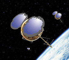
Genesis 1
| Spacecraft: |
|
| Chronologies: |
2006 payload #46 ; 2006-029A ; 6,421st spacecraft. |
| Type: |
Technology |
| Families: |
|
| Ranks: |
|
| Sponsor: |
Bigelow Aerospace |
|
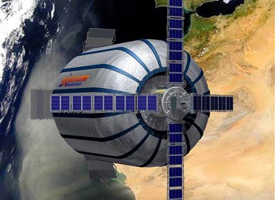 |
Exterior views from Genesis I (Source:
Bigelow
Aerospace)
| Launch: |
12 July 2006 at 14h53 UTC, from
Dombarovskiy launch site, by a Dnepr. |
| Orbit: |
556 km x 561 km x 64.5° x 95.8
min. |
| Mission: |
Genesis 1 is a 1,300-kg entrepreneur's inflatable
satellite which is a pathfinder for future human-occupied space station
modules. The craft successfully inflated about two hours after launch to
its normal cylindrical size of 2.4 meter x 4.5 meter and deployed a pair
of solar arrays. It is made of a tough sheet fabricated from a composite
Kevlar that is often used in bullet-proof vests. The goal of the entrepreneur
is to launch a few more of them, string them together and promote "space
tourism". |
| Launch: |
For the Russian this is the first orbital
launch from the Dombarovskiy launch site, previously just an intercontinental
missile base. |
| Source: |
Jonathan
Space Report No. 568
; Spacewarn No. 633
; National Space Science Data Center's
2006-029A
; Bigelow Aerospace's Genesia
1 ; Space Review's Genesis
and the future space hotel ; |
Genesis I launched by a Dnepr rocket
(Source Bigelow
Aerorospace)
|
|
.
Kosmos 2422
| Spacecraft: |
Oko |
| Chronologies: |
2006 payload #47 ; 2006-030A ; 6,422nd spacecraft. |
| Type: |
Missile Early Warning |
| Families: |
|
| Ranks: |
|
| Sponsor: |
Russia Defense Ministry |
|
|
| Launch: |
21 July 2006 at 4h20 UTC, from
Plesetsk Cosmodrome's LC-16/2, by a Molniya-M. |
| Orbit: |
534 km x 39,134 km km x 62.8° x 703.9
min. |
| Mission: |
Kosmos 2422 is a new missile early warning
satellite in the Oko series put into a highly elliptical orbit. The Oko
satellites are built by the Lavochkin company. Kosmos-2422 was in an initial
533 x 39135 km x 62.9 deg orbit; on Jul 31 it maneuvered to a 539 x 39570
km orbit. |
| Source: |
Jonathan
Space Report No. 569
; Spacewarn No. 633
; National Space Science Data Center's
2006-030A
; |
|
|
.
BelKA
| Spacecraft: |
|
| Chronologies: |
2006 payload #48 ; 2006 3rd loss ; 6,423rd
spacecraft. |
| Type: |
Earth observation |
| Families: |
|
| Ranks: |
|
| Sponsor: |
Belarus |
|
|
| Launch: |
26 July 2006 at 19h43 UTC, from
Baykonur Cosmodrome's LC-109, by a Dnepr. |
| Orbit: |
n/a |
| Mission: |
BelKA was a750-kg Earth observation satellite.
It was the first satellite owned by Belarus; it was built in Russia by
Energiya using the Viktoria (Yamal) bus and carried a 2.5-meter resolution
pan camera and a 10-meter resolution multispectral camera for Earth observation.
BelKA - the first orbiting satellite for
Belarus. The Earth observation platform was built by Energia in Russia
to carry out a robust remote sensing campaign for Belarus and other users
worldwide. Major objectives of the five-year mission included mapping,
climate observations, and tracking geological processes. BelKA's manufacturer
says the satellite was designed to capture both visible and infrared images
in high resolution. These pictures were then to have been digitally sent
to communications stations scattered across Russia. Plans then called for
the images to be sold commercially. The project cost approximately 230
million rubles, which converts to around $9 million, media reports said. |
| Launch: |
The three-stage Dnepr rocket fired out of
an underground missile silo at 19h43 UT. R eports say the rocket's first
stage engine was switched off 86 seconds after liftoff. This was about
ten seconds before the powerplant was to have shut down before giving way
to the Dnepr's second stage. The booster and its paying cargo crashed some
16 miles south of the launch pad, but no damage or injuries have been reported, |
| Source: |
Jonathan
Space Report No. 569
; |
|
|
.
Baumanets
| Spacecraft: |
|
| Chronologies: |
2006 payload #49 ; 2006 4th loss ; 6,424th
spacecraft. |
| Type: |
Student satellite (Technology & Earth
imaging) |
| Families: |
|
| Ranks: |
|
| Sponsor: |
Students of the Moskovskiy Gosudarstvenniy
Tekhnicheskiy Universitet |
|
|
| Launch: |
26 July 2006 at 19h43 UTC, from
Baykonur Cosmodrome, by a Dnepr. |
| Orbit: |
n/a |
| Mission: |
The 92 kg Baumanets is a student satellite
from the MGTU (Moskovskiy Gosudarstvenniy Tekhnicheskiy Universitet) in
N.E. Baumann, the Bauman Moscow State Technical University. It carried
an Earth imager and an amateur radio link. The small spacecraft was to
have operated in space for at least one year as an educational tool and
technology pathfinder for students. |
| Source: |
Jonathan
Space Report No. 569
; |
|
|
.
Unisat-4
| Spacecraft: |
|
| Chronologies: |
2006 payload #50 ; 2006 5th loss ; 6,425th
spacecraft. |
| Type: |
Student satellite |
| Families: |
|
| Ranks: |
|
| Sponsor: |
Students of Universita di Roma "La Sapienza" |
|
|
| Launch: |
26 July 2006 at 19h43 UTC, from
Baykonur Cosmodrome, by a Dnepr. |
| Orbit: |
n/a |
| Mission: |
The 12 kg Unisat-4 is a technology satellite
from the Universita di Roma "La Sapienza". It carried cameras, a GPS navigation
experiment and an aerodynamic reentry device experiment. UniSat 4 was the
fourth member of a series of microsatellites managed by professors and
students at the University of Rome. |
| Source: |
Jonathan
Space Report No. 569
; |
|
|
.
PICPOT
| Spacecraft: |
Piccolo Cubo del Politecnico
di Torino |
| Chronologies: |
2006 payload #51 ; 2006 6th loss ; 6,426th
spacecraft. |
| Type: |
Student satellite |
| Families: |
|
| Ranks: |
|
| Sponsor: |
Student ofPolitecnico di Torino, Italy |
|
|
| Launch: |
26 July 2006 at 19h43 UTC, from
Baykonur Cosmodrome, by a Dnepr. |
| Orbit: |
n/a |
| Mission: |
PICPOT is a small 2 kg, 0.15-meter cube satellite
from the Politecnico di Torino. It carried an Earth imager. |
| Source: |
Jonathan
Space Report No. 569
; Amsat's PicPot
; |
|
|
.
ICE Cube-1
| Spacecraft: |
ICE Cube stands for Ionospheric
sCintillation Experiment CUBESat |
| Chronologies: |
2006 payload #52 ; 2006 7th loss ; 6,427th
spacecraft. |
| Type: |
Amateur technology |
| Families: |
|
| Ranks: |
|
| Sponsor: |
Studen of of Cornell University |
|
|
| Launch: |
26 July 2006 at 19h43 UTC, from
Baykonur Cosmodrome, by a Dnepr. |
| Orbit: |
n/a |
| Mission: |
ICECube-1 was a 1-kg, 0.1-meter size CubeSat.
The mission objective was to design, build, test and operate a fully functional
10-cm CubeSat for GPS scintillation science in Low Earth Orbit. |
| Source: |
Jonathan
Space Report No. 569
; Amsat's ICE
Cube 1 ; Cornell University's ICE
Cube Projetc : |
|
|
.
ION
| Spacecraft: |
ION stands for Illinois Observing
Nanosatellite |
| Chronologies: |
2006 payload #53 ; 2006 8th loss ; 6,428th
spacecraft. |
| Type: |
Student satellite |
| Families: |
|
| Ranks: |
|
| Sponsor: |
Student of University of Illinois |
|
|
| Launch: |
26 July 2006 at 19h43 UTC, from
Baykonur Cosmodrome, by a Dnepr. |
| Orbit: |
n/a |
| Mission: |
ION, consisting of a double cubesat
2 kg, 0.1 x 0.2-meter. It is the first project of the Illinois Tiny Satellite
Initiative (ITSI), which is organized through an interdisciplinary senior
design course. The course objectives include training students to identify,
formulate, and solve engineering problems as part of a large multi-team
project. In addition, the University of Illinois has strived to also
demonstrate the utility of these tiny satellites by following through on
real missions including a science mission. The ION team had hope that the
resulting product will help expand the perceptions of what these tiny satellites
can do someday leading to future space sensor webs. |
| Source: |
Jonathan
Space Report No. 569
; Amsat's ION
; University of Illinois' ION
; |
|
|
.
RINCON
| Spacecraft: |
|
| Chronologies: |
2006 payload #54 ; 2006 9th loss ; 6,429th
spacecraft. |
| Type: |
Satellite satellite |
| Families: |
|
| Ranks: |
|
| Sponsor: |
Student of University of Arizona |
|
|
| Launch: |
26 July 2006 at 19h43 UTC, from
Baykonur Cosmodrome, by a Dnepr. |
| Orbit: |
n/a |
| Mission: |
RINCON was a 1-kg, 0.1-meter size CubeSat. |
| Source: |
Jonathan
Space Report No. 569
; Amsat's RINCON
; |
|
|
.
AeroCube-1
| Spacecraft: |
|
| Chronologies: |
2006 payload #55 ; 2006 10th loss ; 6,430th
spacecraft. |
| Type: |
Technology |
| Families: |
|
| Ranks: |
|
| Sponsor: |
AerospaceCorp |
|
|
| Launch: |
26 July 2006 at 19h43 UTC, from
Baykonur Cosmodrome, by a Dnepr. |
| Orbit: |
n/a |
| Mission: |
AeroCube-1 was a 1-kg, 0.1-meter size CubeSat. |
| Source: |
Jonathan
Space Report No. 569
; |
|
|
.
CalPoly CP1
| Spacecraft: |
|
| Chronologies: |
2006 payload #56 ; 2006 11th loss ; 6,431st
spacecraft. |
| Type: |
Amateur Technology |
| Families: |
|
| Ranks: |
|
| Sponsor: |
Stndent of the California Polytechnic University |
|
|
| Launch: |
26 July 2006 at 19h43 UTC, from
Baykonur Cosmodrome, by a Dnepr. |
| Orbit: |
N/a |
| Mission: |
CP1, a 1-kg, 0.1-meter size CubeSat, is designed
with the objective of providing a reliable bus system to allow for flight
qualification of a wide variety of small sensors and attitude control devices.
It is the first satellite developed at Cal Poly. For the first launch,
CP1 carries a sun sensor developed by Optical Energy Technologies and an
experimental magnetorquer developed at Cal Poly by undergraduate students. |
| Source: |
Jonathan
Space Report No. 569
;; Amsat's CP1
; Cal Poly PolySat Project |
|
|
.
SEEDS
| Spacecraft: |
|
| Chronologies: |
2006 payload #57 ; 2006 12th loss ; 6,432nd
spacecraft. |
| Type: |
Amateur Technology |
| Families: |
|
| Ranks: |
|
| Sponsor: |
Student of of Nihon University (Japan) |
|
|
| Launch: |
26 July 2006 at 19h43 UTC, from
Baykonur Cosmodrome, by a Dnepr. |
| Orbit: |
n/a |
| Mission: |
Nihon University/Japan SEEDS was a 1-kg,
0.1-meter size CubeSat. |
| Source: |
Jonathan
Space Report No. 569;
Amsat SEEDS
; |
|
|
.
nCube-1
| Spacecraft: |
|
| Chronologies: |
2006 payload #58 ; 2006 13th loss ; 6,433rd
spacecraft. |
| Type: |
Amateur Technology |
| Families: |
|
| Ranks: |
|
| Sponsor: |
Norway's University of Technology |
|
|
| Launch: |
26 July 2006 at 19h43 UTC, from
Baykonur Cosmodrome, by a Dnepr. |
| Orbit: |
n/a |
| Mission: |
Norway nCube was a 1-kg, 0.1-meter size CubeSat. |
| Source: |
Jonathan
Space Report No. 569
; Amsat's nCUBE
; |
|
|
.
HAUSAT-1
| Spacecraft: |
HAUSAT-1 stands for Hankuk Aviation
University SATellite-1 |
| Chronologies: |
2006 payload #59 ; 2006 14th loss ; 6,434th
spacecraft. |
| Type: |
Amateur Technology |
| Families: |
|
| Ranks: |
|
| Sponsor: |
Student of South Korea's Hankuk Aviation
University |
|
|
| Launch: |
26 July 2006 at 19h43 UTC, from
Baykonur Cosmodrome, by a Dnepr. |
| Orbit: |
n/a |
| Mission: |
HAUSAT-1 is the first picosatellite in Korea
developed by graduate students. The primary mission objective of HAUSAT-1
development is to offer graduate and undergraduate student great oppertunities
and help them understand the whole developement processes of satellite
design, analysis, manufacturing, assembly, inefration, test, launch. Mission
mission objective were: collecting the satellite position data with spaceborne
GPS receiver, experiment on deployment mechanism of solar cell panel, space
verification of home-made Sun sensor, and getting data related to satellite
Status of Health (SOH) from various sensors. The satellite was designed
for a one year operation. |
| Source: |
Jonathan
Space Report No. 569
;; Amsat's HAUSAT-1
; Hankuk Aviation University's Hausat-1
l |
|
|
.
MEROPE
| Spacecraft: |
|
| Chronologies: |
2006 payload #60 ; 2006 15th loss ; 6,435th
spacecraft. |
| Type: |
Amateur Technology |
| Families: |
|
| Ranks: |
|
| Sponsor: |
Student of Montana State University. |
|
|
| Launch: |
26 July 2006 at 19h43 UTC, from
Baykonur Cosmodrome, by a Dnepr. |
| Orbit: |
n/a |
| Mission: |
MEROPE, a 1-kg, 0.1-meter size CubeSat, is
the first satellite ever in Montana. MEROPE is a completely student run
program which has involved over 75 graduate and undergraduate students.
The project has campus wide involvement with students' majors varying from
the science and engineering fields to business. |
| Source: |
Jonathan
Space Report No. 569
; Amsat's MEROPE
: Montana State University' MEROPE
; |
|
|
.
CalPoly CP2
| Spacecraft: |
|
| Chronologies: |
2006 payload #61 ; 2006 16th loss ; 6,436th
spacecraft. |
| Type: |
Amateur Technology |
| Families: |
|
| Ranks: |
|
| Sponsor: |
Stndent of the California Polytechnic University |
|
|
| Launch: |
26 July 2006 at 19h43 UTC, from
Baykonur Cosmodrome, by a Dnepr. |
| Orbit: |
n/a |
| Mission: |
Cal Poly CP2 was a 1-kg, 0.1-meter size CubeSat.
Its mission was to provide a highly capable bus system that can support
numerous small payloads. The ambitious mission concept includes duplex
1200bps digital communications, three-axis attitude determination and control,
and substantial data processing and storage capability while still providing
at least 33% of the spacecraft mass, volume, and power for payloads. |
| Source: |
Jonathan
Space Report No. 569
;; Amsat's CP2
; Cal Poly PolySat Project |
|
|
.
KUTESat
| Spacecraft: |
KUTESat stands for Kansas Universities'
Technology Evaluation Satellite |
| Chronologies: |
2006 payload #62 ; 2006 17th loss ; 6,437th
spacecraft. |
| Type: |
Amateur Technology |
| Families: |
|
| Ranks: |
|
| Sponsor: |
Student of University of Kansas. |
|
|
| Launch: |
26 July 2006 at 19h43 UTC, from
Baykonur Cosmodrome, by a Dnepr. |
| Orbit: |
n/a |
| Mission: |
KUTESat Pathfinder was a 1-kg, 0.1-meter
size CubeSat.. It is a joint venture among several universities located
in the state of Kansas that aims to promote interest in space activities
while establishing the capability to design, build, test, and operate satellites
at the University of Kansas.
The KUTESat satellites are 10 cm cube pico satellites. The program consists
of three mission phases, each with its own purpose, development, and testing
program. The objective of the first phase of the of the KUTESat program
is to design, develop, and operate a simple CubeSat called Pathfinder.
The primary mission of this satellite is to measure the radiation in LEO
and take photographs with an onboard camera. The second phase of the program
is to build an engineering demonstration of the satellite with an onboard
attitude control system using miniature thrusters. This prototype will
then be tested in the neutral gravity environment by flying it as an experiment
on the NASA JSC KC135 or similar aircraft. The final phase of the KUTESat
mission involves developing and testing three different prototype satellites.
The Inspection Sensor Satellite (ISS) will do the imaging inspection of
a target with its complete translational and rotational capabilities. The
Space Environment Satellite (SES) will measure the space environment away
from the mother ship. The Target Relay Satellite (TRS) will then
act as a target for the ISS and as a relay satellite for both the ISS and
the SES to communicate with the ground. The overall project name for this
third phase of the program is Mission of ISS, SES, TRS, or also known as
MIST. |
| Source: |
Jonathan
Space Report No. 569
; Amsat's KUTEsat
; Kansas University's KUTSAT
; |
|
|
.
SACRED
| Spacecraft: |
|
| Chronologies: |
2006 payload #63 ; 2006 18th loss ; 6,438th
spacecraft. |
| Type: |
Amateur Technology |
| Families: |
|
| Ranks: |
|
| Sponsor: |
Studentof University of Arizona |
|
|
| Launch: |
26 July 2006 at 19h43 UTC, from
Baykonur Cosmodrome, by a Dnepr. |
| Orbit: |
n/a |
| Mission: |
SACRED was a 1-kg, 0.1-meter size CubeSat. |
| Source: |
Jonathan
Space Report No. 569
; Amsat's SACRED
; |
|
|
.
Voyager
| Spacecraft: |
|
| Chronologies: |
2006 payload #64 ; 2006 19th loss ; 6,439th
spacecraft. |
| Type: |
Student satellite |
| Families: |
|
| Ranks: |
|
| Sponsor: |
Student of Hawaii Univerisyt |
|
|
| Launch: |
26 July 2006 at 19h43 UTC, from
Baykonur Cosmodrome, by a Dnepr. |
| Orbit: |
n/a |
| Mission: |
Voyager was a 1-kg, 0.1-meter size CubeSat. |
| Source: |
Jonathan
Space Report No. 569
; |
|
|
.
ICE Cube 2
| Spacecraft: |
ICE Cube stands for Ionospheric
sCintillation Experiment CUBESat |
| Chronologies: |
2006 payload #65 ; 2006 20th loss ; 6,440th
spacecraft. |
| Type: |
Amateur Technology |
| Families: |
|
| Ranks: |
|
| Sponsor: |
Studen of of Cornell University |
|
|
|
.
KOMPSAT-2 / Arirang-2
| Spacecraft: |
|
| Chronologies: |
2006 payload #66 ; 2006-031A ; 6,441st spacecraft. |
| Type: |
Earth Remote Sensing |
| Families: |
|
| Ranks: |
|
| Sponsor: |
South Korea Aerospace Research Institute
(KARI) |
|
|
| Launch: |
28 July 2006 at 7h05 UTC, from
Plesetsk Cosmodrome's LC-133, by a.Rokot. |
| Orbit: |
656.3 km x 680.9 km x 98.1° x 98.6 min. |
| Mission: |
Kompsat 2 is a 800-kg remote sensing satellites
that carries imaging systems to yield high-resolution (1-meter), multispectral
images of Earth's surface. KOMPSAT 2 is setting off on a three-year
mission to provide a wide variety of international customers with a new
source of high resolution imagery of locations worldwide. In South Korea,
the satellite is commonly called Arirang 2. KOMPSAT 2 carries a high resolution
camera jointly developed by Israel's Electro-Optics Industries and Korean
engineers. The imager can resolve objects as small as one meter in black-and-white,
while color pictures taken by the camera will have a resolution of four
meters. The detailed images will be used by South Korea in applications
such as land management, crop and vegetation monitoring, ocean observations,
and other environmental studies. Urban areas, disaster zones, and many
other regions worldwide may also be a prime focus of the mission. KOMPSAT
2's camera provides 45 times better resolution than earlier South Korean
craft. With this increased resolution, pictures from the camera could be
sharp enough to spy on strategic sites such as missile bases and nuclear
plants inside North Korea,. The image distributor says KOMPSAT 2 products
are ideal for intelligence gathering and identifying sensitive areas such
as airfields, missile sites, communication centers, ports, and railroad
depots, among others. It is the second member of South Korea's multipurpose
satellite fleet operated by the Korea Aerospace Research Institute. |
| Notes: |
On 21 March 2001, it was annonnced that,
under an agreement signed between China's Great Wall Industries Corp. and
the Korea Aerospace Research Institute, KOMPSAT-2 will be launched bu a
Long March-2C rocket in April 2004. South Korea chose the Chinese
rocket after its evaluation of four different launch vehicles showed that
the LM-2C is superior in cost and reliability, Chinese source reports. |
| Source: |
Jonathan
Space Report No. 569
; Spacewarn No. 633
; National Space Science Data Center's
2006-031A
; Spaceflight Now's 28
Jul 06 ; Xinhuas 21
Mar 01 ; |
|
|
.
Hot Bird 8
| Spacecraft: |
|
| Chronologies: |
2006 payload #67 ; 2006-032A ; 6,442nd spacecraft. |
| Type: |
Communications |
| Families: |
|
| Ranks: |
|
| Sponsor: |
Eutelelsat |
|
Source : Astrium
|
| Launch: |
4 August 2006 at 21h48 UTC, from
Baykonur Cosmodrome's LC-200, by a Proton-M/Briz-M. |
| Orbit: |
Geostationary at 13° East longitude |
| Mission: |
Hot Bird 8 is 4,875-kg (with fuel), 14-kw
satellite which carries 64 Ku-band transponders to provide radio and television
coverage through 950 digital channels to Europe, North Africa, and the
Middle East, replacing Hot Bird 3. The craft is a Astrium-built Eurostar
3000 satellite carries a communications payload for the French-based Eutelsat
SA company. |
| Source: |
Jonathan
Space Report No. 569
; Spacewarn No. 634
; National Space Science Data Center's
2006-032A
; |
|
|
.
JCSAT-10
| Spacecraft: |
|
| Chronologies: |
2006 payload #68 ; 2006-033A ; 6,443rd spacecraft. |
| Type: |
Communications |
| Families: |
|
| Ranks: |
|
| Sponsor: |
Japan's JSAT Corp. |
|
|
| Launch: |
11 August 2006 at 22h15 UTC,
from Kourou Space Center's ELA-3, by an Ariane
5 ECA. |
| Orbit: |
Geostarionaty at 128° East longitude |
| Mission: |
JCSat 10 is a 4,048-kg fuelled (1,858 kg
dry) communications satellite which carries 30 Ku-band and 12 C-band transponders
to provide direct-to-home radio and television services to Japan, Asia-Pacific
and Hawaii,. The craft is a Lockheed Martin A2100AX Ku/C-band television
broadcasting satellite. |
| Source: |
Jonathan
Space Report No. 569
; Spacewarn No. 634
; National Space Science Data Center's
2006-033A
; |
|
|
.
Syracuse 3B
| Spacecraft: |
|
| Chronologies: |
2006 payload #69 ; 2006-033B ; 6,444th spacecraft. |
| Type: |
Communications 1 |
| Families: |
|
| Ranks: |
|
| Sponsor: |
France Defense Ministry (DGA / Delegation
Generale pour l'Armement) |
|
|
| Launch: |
11 August 2006 at 22h15 UTC,
from Kourou Space Center's ELA-3, by an Ariane
5 ECA. |
| Orbit: |
Geostationary (parking longitude is not available) |
| Mission: |
Syracuse 3B is a 3,750-kg fuelled (1,658
kg dry) military communications satellite which provide SHF and EHF communications
links for the French military. It carries four spot beams in SHF frequencies
and two spot beams in EHF frequencies. |
| Source: |
Jonathan
Space Report No. 569
; Spacewarn No. 634
; National Space Science Data Center's
2006-033B
; |
|
|
.
Koreasat 5 / Mugunghwa
5
| Spacecraft: |
|
| Chronologies: |
2006 payload #70 ; 2006-034A ; 6,445th spacecraft. |
| Type: |
Communications |
| Families: |
|
| Ranks: |
|
| Sponsor: |
South Korea Telecom & South Korean government's
Agency for Defense Development. |
|
|
| Launch: |
22 August 2006 at 3h27 UTC, from
Odyssey launch platform, by a
Zenit 3SL.
(The Odyssey platform was floating on the
equatorial Pacific Ocean at 154° West longitude.) |
| Orbit: |
Geostationary at 113° East longitude. |
| Mission: |
KoreaSat 5 is a 4.5-tonne (with fuel) communications
satellite which carries 24 Ku-band, 8 SHF-band, and 4 Ka-band transponders
to provide digital television and conventional telecom services to the
Asia-Pacific region, serving the interests of commercial and (primarily)
military agencies. The craft is an Alcatel Alenia Spacebus 4000C1 satellite.
(It is reported that there has not been a KoreaSat 4, because the number
four may be associated with death in some Asian cultures. Mugungwha is
the Korean name for South Korea's national flower, the Rose of Sharon.) |
| Source: |
Jonathan
Space Report No. 570
; Spacewarn No. 634
; National Space Science Data Center's
2006-034A
; Sea Launch's 21
Aug 06 ; |
|
|
.
SJ-8 / Shi Jian 8
| Spacecraft: |
|
| Chronologies: |
2006 payload #71 ; 2006-035A ; 6,446th spacecraft. |
| Type: |
Material Processing |
| Families: |
|
| Ranks: |
|
| Sponsor: |
China |
|
|
| Launch: |
9 September 2006 at 7h00 UTC,
from Jiuquan Satellite Launch Center, by a Chang
Zheng 2C. |
| Orbit: |
178 km x 428 km x 63.0° x 90.6
min. |
| Recovered: |
24 September 2006 at 2h43 UT. |
| Mission: |
Shi Jian 8is a recoverable satellite twhich
carried 250 kg of seeds of plants and fungus. The SJ-8 seeds satellite
was recovered in Sichuan province on 24 September 2006. After recovery,
the seeds will be germinated to produce high quality and high yield plants
and their seeds. Unlike earlier SJ satellites, the SJ-8 recoverable satellite
derived from earlier FSW reconnaissance and microgravity satellites. |
| Source: |
Jonathan
Space Report No. 570
& 572
; Spacewarn No. 635
; National Space Science Data Center's
2006-035A
; Sea Launch's 21
Aug 06 ; |
|
|
.
STS-115 / ISS 12A
| Spacecraft: |
|
| Chronologies: |
2006 payload #72 ; 2006-036A ; 6,447th spacecraft. |
| Type: |
Piloted Spaceship |
| Families: |
|
| Ranks: |
|
| Sponsor: |
NASA |
|
|
|
.
ITS P3/P4
| Spacecraft: |
|
| Chronologies: |
2006 payload #73 ; 2006 n/a ; 6,448th spacecraft. |
| Type: |
Space Station Coomponent |
| Families: |
|
| Ranks: |
|
| Sponsor: |
NASA |
|
|
|
.
IGS Optical-2
| Spacecraft: |
IGS stands for Information Gathering
Satellite |
| Chronologies: |
2006 payload #74 ; 2006-037A ; 6,449th spacecraft. |
| Type: |
Photo Surveillance |
| Families: |
|
| Ranks: |
|
| Sponsor: |
Japan Defense Ministry |
|
|
|
.
ZX-22A / Zhongxin-22A
| Spacecraft: |
|
| Chronologies: |
2006 payload #75 ; 2006-038A ; 6,450th spacecraft. |
| Type: |
Communications |
| Families: |
|
| Ranks: |
|
| Sponsor: |
China |
|
|
|
.
Kosmos 2423
| Spacecraft: |
Don-class |
| Chronologies: |
2006 payload #76 ; 2006-039A ; 6,451st spacecraft. |
| Type: |
Photo Surveillance |
| Families: |
|
| Ranks: |
|
| Sponsor: |
Russia Defense Ministry |
|
|
|
.
Soyuz TMA-9 / ISS 13S
| Spacecraft: |
Soyuz 11F732 (7K-STMA) No. 219 |
| Chronologies: |
2006 payload #77 ; 2006-040A ; 6,452nd spacecraft. |
| Type: |
Piloted Spaceship |
| Families: |
|
| Ranks: |
|
| Sponsor: |
Ruaais |
|
|
|
.
SOLAR-B / Hinode
| Spacecraft: |
|
| Chronologies: |
2006 payload #78 ; 2006-041A ; 6,453rd spacecraft. |
| Type: |
Sun Observatory |
| Families: |
|
| Ranks: |
|
| Sponsor: |
JAXA / Japan Aerospace Exploration Agency |
|
|
|
.
HIT-SAT
| Spacecraft: |
|
| Chronologies: |
2006 payload #79 ; 2006-041B ; 6,454th spacecraft. |
| Type: |
Amateur Technology |
| Families: |
|
| Ranks: |
|
| Sponsor: |
Japan's Hokkaido Insttitute of Technology |
|
|
|
.
SSSAT
| Spacecraft: |
|
| Chronologies: |
2006 payload #80 ; 2006-041C ; 6,455th spacecraft. |
| Type: |
Technology |
| Families: |
|
| Ranks: |
|
| Sponsor: |
Japan (ISAS-JAXA) |
|
|
|
.
Navstar 54 (USA 190)
| Spacecraft: |
Navstar SVN 52 / GPS 2R-15 |
| Chronologies: |
2006 payload #81 ; 2006-042A ; 6,456th spacecraft. |
| Type: |
Navigation |
| Families: |
|
| Ranks: |
|
| Sponsor: |
U.S. Department of Defense |
|
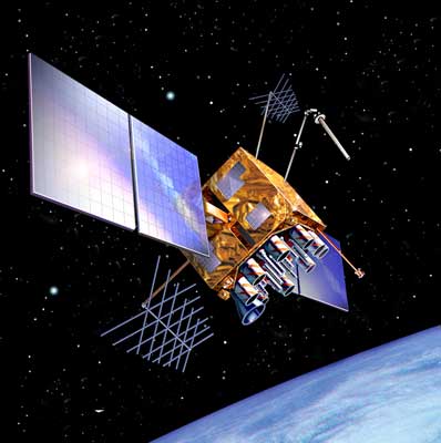 |
| Launch: |
25 September 2006 at 18h50 UTC,
from Cape Canaveral Air Force Station's SLC-17A, by a Delta
II. |
| Orbit: |
Iinitial: 173 km x 20,414 km x 40.0°
x 357 min. |
| Mission: |
Navstar 58 (GPS Block IIR-M, GPS 2R-15, SVN
58) satellite is a navigation satellite in the GPS fleet that is positioned
in Plane A, Slot 2, replacing the aging GPS 2-12 launched in 1992, which,
in turn, will be maneuvered to A-4 as a backup till its useful life ends.
At present, there are 24 operational craft in the fleet, plus five that
are spares. |
| Source: |
Jonathan
Space Report No. 572
; Spacewarn No. 635
; National Space Science Data Center's
2006-042A
; |
|
|
.
DirecTV 9S
| Spacecraft: |
|
| Chronologies: |
2006 payload #82 ; 2006-043A ; 6,457th spacecraft. |
| Type: |
Communications |
| Families: |
|
| Ranks: |
|
| Sponsor: |
DirecTV |
|
|
| Launch: |
13 October 2006 at 20h56 UTC,
from Kourou Space Center's ELA-3, by an Ariane
5 ECA. |
| Orbit: |
Geostarionary at 101° or 119° West
longitude |
| Mission: |
DirecTV 9S is a communications satellite
that carries 52 Ku-band and two Ka-band transponders to provide direct-to-home,
through its 27 spot-beams, voice, video, and internet transmissions to
North American subscribers. DirectTV is a Loral 1300 satellite. |
| Source: |
Jonathan
Space Report No. 572
; Spacewarn No. 636
; National Space Science Data Center's
2006-0 ; DirecTV's 13
Oct 06 ; |
|
|
.
Optus D1
| Spacecraft: |
|
| Chronologies: |
2006 payload #83 ; 2006-043B ; 6,458th spacecraft. |
| Type: |
Communications |
| Families: |
|
| Ranks: |
|
| Sponsor: |
Australia (Singapore-owned) Optus system |
|
|
|
.
LDREX-2
| Spacecraft: |
LDREX stands for Large Deployable
Reflector Small-sized Partial Model |
| Chronologies: |
2006 payload #84 ; 2006-043C ; 6,459th spacecraft. |
| Type: |
Technology |
| Families: |
|
| Ranks: |
|
| Sponsor: |
JAXA / Japan Aerospace Exploration Agency |
|
|
| Launch: |
13 October 2006 at 20h56 UTC,
from Kourou Space Center's ELA-3, by an Ariane
5 ECA. |
| Orbit: |
Initial: 264 km x 35,648 km c 7.0° x
629.6 min. |
| Mission: |
LDREX 2 is a technology demonstration craft
which deployed and then ejected a 6.5-meter antenna as a rehearsal for
Japan's ETS-8 experimental satellite. (LDREX-1, in December 2000,
failed to deploy correctly.) |
| Source: |
Jonathan
Space Report No. 572
; Spacewarn No. 636
; National Space Science Data Center's
2006-0 ; JAXA's LDREX-2
Dep ; |
|
|
.
MetOp 2 (MetOp A)
| Spacecraft: |
|
| Chronologies: |
2006 payload #85 ; 2006-044A ; 6,460th spacecraft. |
| Type: |
Meteorology |
| Families: |
|
| Ranks: |
|
| Sponsor: |
Eumetsat |
|
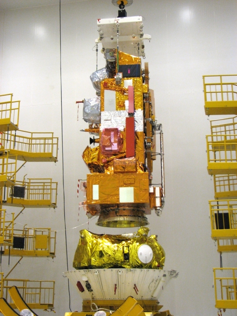
Source: Eumetsat
|
Eumetsat Polar System (Source: Emmetsat)
| Launch: |
19 October 2006 at 16h28 UTC,
from Baykonur Cosmodrome's LC-31, by a Soyuz-2-1A. |
| Orbit: |
819 km x 821 km x 98.7° x 101.3 min. |
| Mission: |
METOP A (METOP 2) is a 4.1-tonne polar-orbiting
weather satellite that inaugurates the Eumetsat Polar System, a European
equivalent of NOAA's polar satellites (just as Eumetsat's METEOSAT series
are the analog of NOAA's GOES geostationary weather platforms). METOP A
carries a wide range of advanced instruments including ozone monitors,
a GPS atmospheric sounding device, and a wind scatterometer, as well as
the usual visible and IR imagers and sounders. It also carries a search
and rescue package as well as five heritage instruments provided by NOAA.
Operationally, there will be close collaboration between NOAA, ESA, and
EUTEMSAT. |
| Source: |
Jonathan
Space Report No. 572
; Spacewarn No.636
; National Space Science Data Center's
2006-0 ; Eumetsat' MetOp
2 , 19
Oct 06 ;; |
|
|
.
Progress M-58 / ISS
23P
| Spacecraft: |
Progress M (7K-TGM) No. 358 |
| Chronologies: |
2006 payload #86 ; 2006-045A ; 6,461st spacecraft. |
| Type: |
Cargo delivery to the International Space
Station (463rd piloted spaceship) |
| Families: |
113th Progress
cargoship (23rd to ISS) ; |
| Ranks: |
|
| Sponsor: |
Russian Federal Space Agency |
|
 Source: NASA
|
| Launch: |
23 October 2006 at 13h40 UTC,
from Baykonur Cosmodrome's LC-1, by a Soyuz
U. |
| Orbit: |
Initial: 195,0 km x 256,0 km x 51.65°
x 88.7 min.
329 km x 346 km x 51.63° x 91.3 min. |
| Deorbit: |
27 March 2007 at 22h44 UTC. |
| Mission: |
Progress M-58 transport cargo vehicle delivered
some 2,4 tons of various cargoes to the International Space Station, including
880 kg of propellant, 52 kg of oxygen, 1221 kg of dry cargoes among which
are 237 kg of food, medical equipment, personal hygiene means and prophylactic
means, 304 kg of USOS equipment, onboard systems and research equipment,
onboard documentation and crew parcels
Following its autonomous,
three-day orbital flight, the cargoship docked with ISS on 26 October 2006.
During the docking process, telemetry sensors indicated that one of the
antennas of the Kurs rendezvous system as part of the cargo vehicle failed
to close completely. The retraction process was suspended until the situation
was made clear. The specialists from the Lead Operational Control Team
(LOCT) looked into the situation and decided to continue retraction. For
safety reasons, the crew of ISS Expedition 14th was commanded to close
Transfer Compartment hatch. During the next communication session, the
docking operation had been successfully completed. Progress M-58 undocked
from the Zvezda module on 27 March 2007 at 18h11 UTC and was deorbited
at 22h44 UTC.
Progress M-58 is
the 23th cargo flight in the ISS program and the 113th flight of a Progress
vehicles since 1978.. |
| Source: |
Jonathan
Space Report No. 572,
573
&
579
;
Spacewarn No. 636
; National Space Science Data Center's
2006-0 ; Energiya's News
; Energiya's 23
Oct 06 & 26
Oct 06 ; |
|
|
.
SJ-6-2A / Shi Jian 6-2A
| Spacecraft: |
|
| Chronologies: |
2006 payload #87 ; 2006-046A ; 6,462nd spacecraft. |
| Type: |
Earth Sciences |
| Families: |
|
| Ranks: |
|
| Sponsor: |
China |
|
|
| Launch: |
23 October 2006 at 23h34 UTC,
from Taiyuan Satellite Launch Center, by a Chang
Zheng 4B. |
| Orbit: |
595 km x 600 km x 97.7° x 96.6 min. |
| Mission: |
Shijian 6C and Shijian 6D (SJ-6 Group 2 satellites
A and B) are Chinese satellites which officially carry radiation detectors
and other space environment-related instruments. They replace the SJ-6
Group 1 satellites A and B. China reports the purpose of these satellites
is to measure the space environment, but it seemed that no scientific results
have been published (an intelligence role seems possible). |
| Source: |
Jonathan
Space Report No. 572
; Spacewarn No. 636
; National Space Science Data Center's
2006-0 ; |
|
|
.
SJ-6-2B / Shi Jian 6-2B
| Spacecraft: |
|
| Chronologies: |
2006 payload #88 ; 2006-046B ; 6,463rd spacecraft. |
| Type: |
Earth Sciences |
| Families: |
|
| Ranks: |
|
| Sponsor: |
China |
|
|
| Launch: |
23 October 2006 at 23h34 UTC,
from Taiyuan Satellite Launch Center, by a Chang
Zheng 4B. |
| Orbit: |
595 km x 600 km x 97.7° x 96.6 min. |
| Mission: |
Shijian 6C and Shijian 6D (SJ-6 Group 2 satellites
A and B) are Chinese satellites which officially carry radiation detectors
and other space environment-related instruments. They replace the SJ-6
Group 1 satellites A and B. China reports the purpose of these satellites
is to measure the space environment, but it seemed that no scientific results
have been published (an intelligence role seems possible). |
| Source: |
Jonathan
Space Report No. 572
; Spacewarn No. 636
; National Space Science Data Center's
2006-0 ; |
|
|
.
STEREO Ahead
| Spacecraft: |
|
| Chronologies: |
2006 payload #89 ; 2006-047A ; 6,464th spacecraft. |
| Type: |
Sun Observatory |
| Families: |
|
| Ranks: |
|
| Sponsor: |
NASA |
|
 |
| Launch: |
26 October 2006 at 0h52 UTC,
from Cape Canaveral Air Force Station's SLC-17B, by a Delta
II. |
| Orbit: |
Final: 0.95 AU x 0.97 AU x 0.12° x 344
days |
| Mission: |
STEREO-A (ahead) and STEREO-B (behind) are
two identical 620-kg (dry mass) heliospheric craft to observe the Sun,
allowing coordinated observations of solar activity from vantage points
inaccessible for Earth-orbiting spacecraft. Optical and UV imagers, radio
burst monitors and particle detectors provide space weather information
and allow study of Earthbound coronal mass ejections from the side. Each
craft will be maneuvered so that STEREO-A will orbit the Sun ahead of the
Earth (with an orbital period of 345 days), and STEREO-B will orbit behind
the Earth (with an orbital period of 385 days).
On 15
December 2006 at 13h50 UTC, STEREO B will pass 10,745 km above the lunar
surface and be thrown into a 130,000 x 870,000 km x 27.9° phasing orbit.
Five minutes later, STEREO A will fly 5,937 km above the Moon and enter
a 180,000 x 1,750,000 km x 33.6° orbi. STEREO A will escape the Earth-Moon
system around 24 December. On 21 January 2007 at 15h52 UTC, STEREO B will
re-encounter the Moon with a 16,029 km altitude flyby and also end up on
a departure orbit. STEREO A will end up in a 0.95 x 0.97 AU x 0.12°
x 344 days orbit around the Sun, leading the Earth. STEREO B will end up
in a 0.99 x 1.09 AU x 0.03° x 389 days orbit trailing the Earth. |
| Source: |
Jonathan
Space Report No. 573
; Spacewarn No. 636
; National Space Science Data Center's
2006-0 ; STEREO
Web Site & Press
Kit ; |
|
|
.
STEREO Behind
| Spacecraft: |
|
| Chronologies: |
2006 payload #90 ; 2006-047B ; 6,465th spacecraft. |
| Type: |
Sun Observatory |
| Families: |
|
| Ranks: |
|
| Sponsor: |
NASA |
|
|
| Launch: |
26 October 2006 at 0h52 UTC,
from Cape Canaveral Air Force Station's SLC-17B, by a Delta
II. |
| Orbit: |
0.99 AU x 1.09 AU x 0.03° x 389 days |
| Mission: |
STEREO-A (ahead) and STEREO-B (behind) are
two identical 620-kg (dry mass) heliospheric craft to observe the Sun,
allowing coordinated observations of solar activity from vantage points
inaccessible for Earth-orbiting spacecraft. Optical and UV imagers, radio
burst monitors and particle detectors provide space weather information
and allow study of Earthbound coronal mass ejections from the side. Each
craft will be maneuvered so that STEREO-A will orbit the Sun ahead of the
Earth (with an orbital period of 345 days), and STEREO-B will orbit behind
the Earth (with an orbital period of 385 days).
On 15
December 2006 at 13h50 UTC, STEREO B will pass 10,745 km above the lunar
surface and be thrown into a 130,000 x 870,000 km x 27.9° phasing orbit.
Five minutes later, STEREO A will fly 5,937 km above the Moon and enter
a 180,000 x 1,750,000 km x 33.6° orbi. STEREO A will escape the Earth-Moon
system around 24 December. On 21 January 2007 at 15h52 UTC, STEREO B will
re-encounter the Moon with a 16,029 km altitude flyby and also end up on
a departure orbit. STEREO A will end up in a 0.95 x 0.97 AU x 0.12°
x 344 days orbit around the Sun, leading the Earth. STEREO B will end up
in a 0.99 x 1.09 AU x 0.03° x 389 days orbit trailing the Earth. |
| Source: |
Jonathan
Space Report No. 573
; Spacewarn No. 636
; National Space Science Data Center's
2006-0 ; |
|
|
.
Xinnuo 2 / Sinosat-2
| Spacecraft: |
|
| Chronologies: |
2006 payload #91 ; 2006-048A ; 6,466th spacecraft. |
| Type: |
Communications (DBS) |
| Families: |
|
| Ranks: |
|
| Sponsor: |
China's Sino Satellite Communications Co |
|
|
| Launch: |
28 October 2006 at 16h20 UTC,
from Xichang Satellite Launch Center, by a Chang
Zheng 3B. |
| Orbit: |
Geostationary at approximately 110° East
longitude. |
| Mission: |
Xinnuo-2 (Sinosat-2) is a 5.1-tonne (with
fuel) communications satellite which carries 22 transponders to provide
analog and digital television to China and Taiwan. The craft is China's
first direct-to-home broadcast satellite. It is the first of a new heavy
Chinese communication satellite series, DFH-4, with a communications payload
by Alcatel Alenia.
A month after its
launch, it was revealed that the satellite failed to deploy its solar panels
and communication antennae and was deemed inoperable, the Sino Satellite
Communications Co. Ltd. (SinoSat), a Chinese satellite operator and the
user of the SinoSat series, has said. A substitute satellite for
the failed craft will take at least three years to develop, with more technical
upgrades, according to a SinoSat spokesman last November. |
| Notes: |
On 27 January 2002, Sino Satellite Communications
Corp (Sinosat), a major satellite operator in Beijing, signed a contract
to buy a satellite from the Chinese Academy of Space Technology to be launched
in 2005 to meet mounting domestic demands for communications and broadcasting.
The move signals that the country's satellite operators are readying themselves
for a new market surge for remote learning, live broadcasting and broadband
Internet access, it was reported.
Founded in 1994,
Sinosat is the only operator in China that owns a European-manufactured
satellite - Sinosat-1. It was
manufactured by Aerospatiale (France) and was delivered into orbit atop
a Chinese LM-3B rocket in 1998. |
| Source: |
Jonathan
Space Report No. 573
; Spacewarn No. 636
; National Space Science Data Center's
2006-0 ; Spaceflight.now 11
Apr 07 ; People's Daily Online's
1
Jun 07 ; China Daily's
18
Jan 02, 28
Jan 02 ; |
|
|
..
XM 4 Blues / XM Radio
4
| Spacecraft: |
|
| Chronologies: |
2006 payload #92 ; 2006-049A ; 6,467th spacecraft. |
| Type: |
Communications (Radio Broadcast) |
| Families: |
|
| Ranks: |
|
| Sponsor: |
XM Satellite Radio
Inc. |
|
|
| Launch: |
30 October 2006 at 23h49 UTC,
from Odyssey Launch Platform, by a Zenit
3SL/Block DM-SL. (The Odyssey platform was positioned at 154° West
Longitude in the equatorial Pacific.) |
| Orbit: |
Geostationary at 115° West Longitude |
| Mission: |
XM 4 is a 5.2-tonne (with fuel) communications
satellite which carries a 18 kW transponder to provide S-band Digital Audio
Radio Service (DARS) to homes and automobiles in North America. It joins
the company's existing fleet of three satellites (XM Rock, Roll and Rhythm).
XM-4 transmits XM Radio's direct broadcast of digital radio programming
to cars, homes, and portable radios throughout the continental United States
and Canada. Built by the Boeing Satellite, the 5,193-kg spacecraft carries
a high-power S-band Digital Audio Radio Service (DARS) payload provided
by Alcatel Alenia Space. It had 18 kilowatts of total power at the beginning
of life on orbit, replacing two co-located XM satellites currently at 115
degrees. XM-4 had a specified lifespan of 15 years.
XM Satellite Radio
broadcast to more than 7 million subscribers live daily from studios in
Washington, DC, New York City, the Country Music Hall of Fame in Nashville,
Toronto and Montreal, XM's 2006 lineup includes more than 170 digital channels
of choice from coast to coast: commercial-free music, premier sports, news,
talk radio, comedy, children's and entertainment programming; and the most
advanced traffic and weather information. |
| Source: |
Jonathan
Space Report No. 573
; Spacewarn No. 636
; National Space Science Data Center's
2006-0 ; XM Radio's30
Oct 06 ; Sea Launch's 30
Oct 06 ; Spaceflignt Now's |
|
|
.
DMSP Block 5D-3 F-17
(USA 191)
| Spacecraft: |
|
| Chronologies: |
2006 payload #93 ; 2006-050A ; 6,468th spacecraft. |
| Type: |
Meteorology |
| Families: |
|
| Ranks: |
|
| Sponsor: |
U.S. Department of Defense |
|
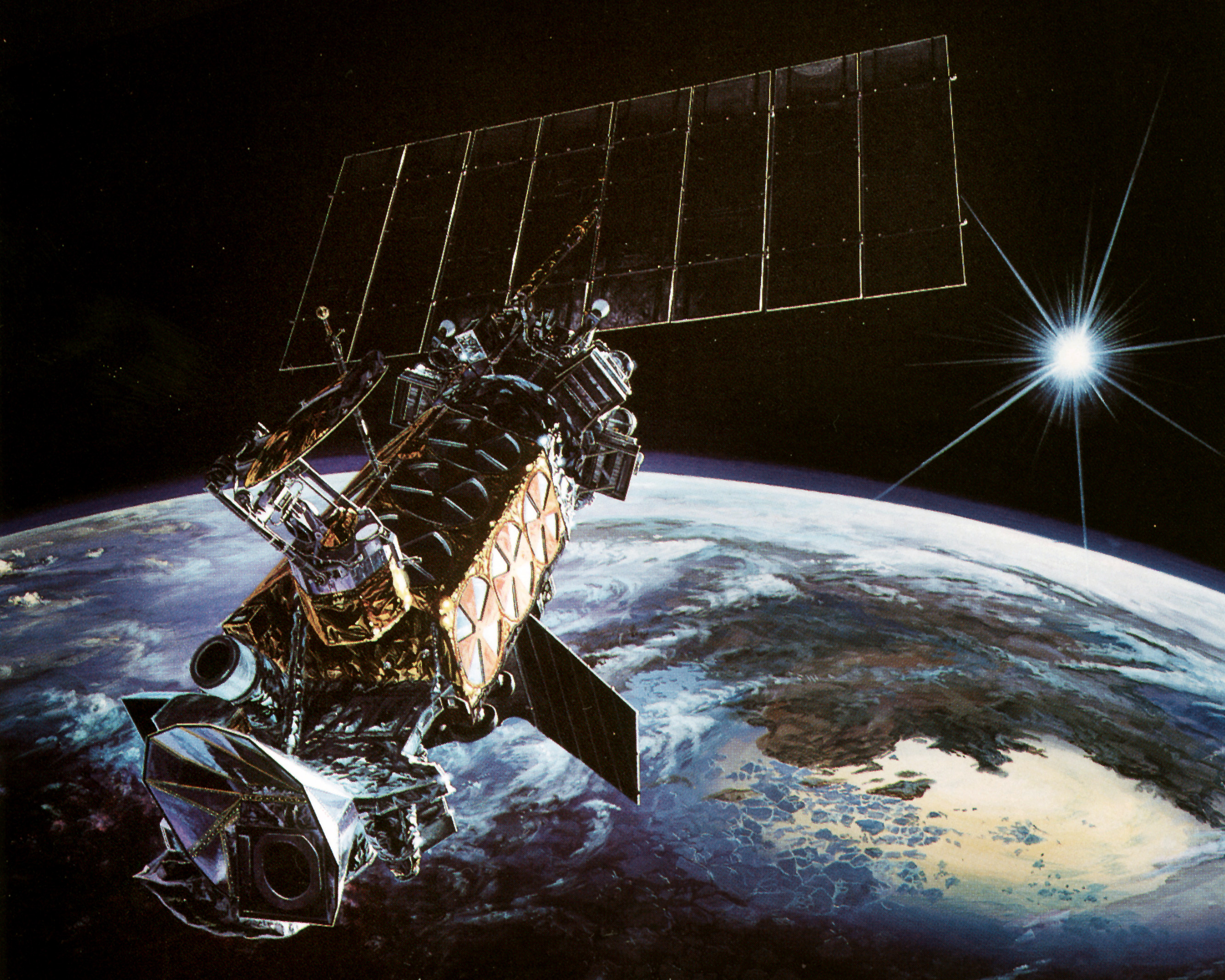
Source: Lockheed
Martin |
|
.
Badr 4 (Arabsat 4B)
| Spacecraft: |
|
| Chronologies: |
2006 payload #94 ; 2006-051A ; 6,469th spacecraft. |
| Type: |
Communications |
| Families: |
|
| Ranks: |
|
| Sponsor: |
Arabsat |
|
|
| Launch: |
8 November 2006 at 20h01 UTC,
from Baykonur Cosmodrome's LC-200/39, by a Proton-M/Briz-M. |
| Orbit: |
Geostationary at 26° East longitude ; |
| Mission: |
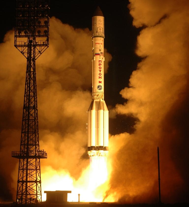 BADR-4,
formely Arabsat 4B, is a 3,280-kg communications satellite which carry
32 transponders in Ku-band for direct-to-home television services, together
with voice and data services, across the Middle East, North Africa and
parts of Europe. Co-located with the rest of the BADR satellites (at Arabsat's
26° East longitude), BADR-4 will provide during its 15-year expected
life wider choices and new possibilities to an audience of 130 million
viewers enjoying more than 240 TV channels and 90 radio stations, as well
as serving all of the 324 millions inhabitants covered from Morocco and
Algeria to the Arabian Gulf. The carft is the 31st Eurostar E2000+ model,
built by Astrium Satellites, for the Arab Satellite Communications Organization
(ARABSAT), based in Riyadh, Kingdom of Saudi Arabia,. Alcatel Alenia Space
manufactured the communications payload. BADR-4,
formely Arabsat 4B, is a 3,280-kg communications satellite which carry
32 transponders in Ku-band for direct-to-home television services, together
with voice and data services, across the Middle East, North Africa and
parts of Europe. Co-located with the rest of the BADR satellites (at Arabsat's
26° East longitude), BADR-4 will provide during its 15-year expected
life wider choices and new possibilities to an audience of 130 million
viewers enjoying more than 240 TV channels and 90 radio stations, as well
as serving all of the 324 millions inhabitants covered from Morocco and
Algeria to the Arabian Gulf. The carft is the 31st Eurostar E2000+ model,
built by Astrium Satellites, for the Arab Satellite Communications Organization
(ARABSAT), based in Riyadh, Kingdom of Saudi Arabia,. Alcatel Alenia Space
manufactured the communications payload. |
| Source: |
Jonathan
Space Report No. ; Spacewarn
No. 637
; National Space Science Data Center's
2006-0 ; Spaceflight Now's 8
Nov 06 ; Arabsat's Astrium's
31
Oct 06 ; ILS's 8
Nov 06 ; |
|
|
.
Navstar 55 (USA 192)
| Spacecraft: |
Navstar SVN 58 / GPS 2R-16 |
| Chronologies: |
2006 payload #95 ; 2006-052A ; 6,470th spacecraft. |
| Type: |
Navigation |
| Families: |
|
| Ranks: |
|
| Sponsor: |
U.S. Department of Defense |
|
|
|
.
Fengyun 2D
| Spacecraft: |
|
| Chronologies: |
2006 payload #96 ; 2006-053A ; 6,471st spacecraft. |
| Type: |
Meteorology |
| Families: |
|
| Ranks: |
|
| Sponsor: |
China |
|
|
|
.
WildBlue 1
| Spacecraft: |
|
| Chronologies: |
2006 payload #97 ; 2006-054A ; 6,472nd spacecraft. |
| Type: |
Communications (Internet) |
| Families: |
|
| Ranks: |
|
| Sponsor: |
WildBlue Communications |
|
|
|
.
AMC 18
| Spacecraft: |
|
| Chronologies: |
2006 payload #98 ; 2006-054B ; 6,473rd spacecraft. |
| Type: |
Communications |
| Families: |
|
| Ranks: |
|
| Sponsor: |
SES Americom |
|
|
|
.
STS-116 / ISS 12A.1
| Spacecraft: |
|
| Chronologies: |
2006 payload #99 ; 2006-055A ; 6,474th spacecraft. |
| Type: |
Piloted Spaceship |
| Families: |
|
| Ranks: |
|
| Sponsor: |
NASA |
|
|
|
.
ITS-P5
| Spacecraft: |
|
| Chronologies: |
2006 payload #100 ; n/a ; 6,475th spacecraft. |
| Type: |
Space Station Component |
| Families: |
|
| Ranks: |
|
| Sponsor: |
NASA |
|
|
|
.
MEPSI 2A/2B
| Spacecraft: |
MEPSI stands for Microelectromechanical
System-Based (MEMS) PICOSAT Inspector |
| Chronologies: |
2006 payload #101 ; 2006-055B ; 6,476th spacecraft. |
| Type: |
Technology |
| Families: |
|
| Ranks: |
|
| Sponsor: |
U.S. Department of Defense |
|
|
| Launch: |
10 December 2006 at 1h47 UTC,
from Kennedy Space Center's LC-39B, by the Space
Shuttle. Deployed from Discovery payload bay on 21 December at 0h19... |
| Orbit: |
|
| Mission: |
MEPSI demonstrates the use of tiny (the size
of a coffee cup) low-power inspection satellites that can be sent out to
observe larger spacecraft. The small inspection satellites are enabled
by microelectromechanical systems (MEMS), and will test the functioning
of small camera systems and gyros. |
| Source: |
Jonathan
Space Report No. ; Spacewarn
No. ; National Space Science
Data Center's 2006-0 ; STS-116 Press Kit, p. 81 ; |
|
|
.
RAFT-1
| Spacecraft: |
RAFT stands for Radar Fence Transponder |
| Chronologies: |
2006 payload #102 ; 2006-055 ; 6,477th spacecraft. |
| Type: |
Technology |
| Families: |
|
| Ranks: |
|
| Sponsor: |
Students of U.S. Naval Academy |
|
|
| Launch: |
10 December 2006 at 1h47 UTC,
from Kennedy Space Center's LC-39B, by the Space
Shuttle. Deployed from Discovery payload bay.on 21 December at 1h56. |
| Orbit: |
|
| Mission: |
RAFT is a student experiment that uses picosatellites
to test the Space Surveillance Radar Fenc and experimental communications
transponders. |
| Source: |
Jonathan
Space Report No. ; Spacewarn
No. ; National Space Science
Data Center's 2006-0 ; U.S. Department of Defense |
|
|
.
NMARS
| Spacecraft: |
RAFT stands for Radar Fence Transponder |
| Chronologies: |
2006 payload #103 ; 2006-055 ; 6,478th spacecraft. |
| Type: |
Technology |
| Families: |
|
| Ranks: |
|
| Sponsor: |
|
|
|
|
.
ANDE-MAA
| Spacecraft: |
ANDE stands for Atmospheric Neutral
Density Experiment |
| Chronologies: |
2006 payload #104 ; 2006-055 ; 6,479th spacecraft. |
| Type: |
Technology |
| Families: |
|
| Ranks: |
|
| Sponsor: |
U.S. Department of Defense |
|
|
| Launch: |
10 December 2006 at 1h47 UTC,
from Kennedy Space Center's LC-39B, by the Space
Shuttle. Deployed from Discovery payload bay.on 21 December at 18h22.. |
| Orbit: |
|
| Mission: |
Space Test Program H2 ANDE consists of two
microsatellites launched from the Shuttle payload bay will measure the
density and composition of the low-Earth orbit atmosphere while being tracked
from the ground. The data will be used to better predict the movement of
objects in orbit. |
| Source: |
Jonathan
Space Report No. ; Spacewarn
No. ; National Space Science
Data Center's 2006-0 ; STS-116 Press Kit, pp 80-1 ; |
|
|
.
ANDE-FCAL
| Spacecraft: |
ANDE stands for Atmospheric Neutral
Density Experiment |
| Chronologies: |
2006 payload #105 ; 2006-055 ; 6,480th spacecraft. |
| Type: |
Technology |
| Families: |
|
| Ranks: |
|
| Sponsor: |
U.S. Department of Defense |
|
|
| Launch: |
10 December 2006 at 1h47 UTC,
from Kennedy Space Center's LC-39B, by the Space
Shuttle. Deployed from Discovery payload bay.on 21 December at 18h22. |
| Orbit: |
|
| Mission: |
Space Test Program H2ANDE consists of two
microsatellites launched from the Shuttle payload bay will measure the
density and composition of the low-Earth orbit atmosphere while being tracked
from the ground. The data will be used to better predict the movement of
objects in orbit. |
| Source: |
Jonathan
Space Report No. ; Spacewarn
No. ; National Space Science
Data Center's 2006-0 ; STS-116 Press Kit, pp 80-1 ; |
|
|
..
Measat 3
| Spacecraft: |
|
| Chronologies: |
2006 payload #106 ; 2006-056A ; 6,481st spacecraft. |
| Type: |
Communications |
| Families: |
|
| Ranks: |
|
| Sponsor: |
Indonesia |
|
|
|
.
NROL-21 (USA 193)
| Spacecraft: |
|
| Chronologies: |
2006 payload #107 ; 2006-057A ; 6,482nd spacecraft. |
| Type: |
|
| Families: |
|
| Ranks: |
|
| Sponsor: |
U.S. National Reconnaissance Office |
|
|
|
.
TacSat 2
| Spacecraft: |
|
| Chronologies: |
2006 payload #108 ; 2006-058A ; 6,483rd spacecraft. |
| Type: |
Technology & Earth imaging |
| Families: |
|
| Ranks: |
|
| Sponsor: |
U.S. Air Force Research Lab |
|

Source: KAF
|
|
.
Genesat 1
| Spacecraft: |
|
| Chronologies: |
2006 payload #109 ; 2006-058B ; 6,484th spacecraft. |
| Type: |
Technology & Earth imaging |
| Families: |
|
| Ranks: |
|
| Sponsor: |
NASA |
|
|
|
.
ETS-8 / Kiku 8
| Spacecraft: |
Engineering Test Satellite (ETS)
VIII |
| Chronologies: |
2006 payload #110 ; 2006-059A ; 6,485th spacecraft. |
| Type: |
Technology |
| Families: |
|
| Ranks: |
|
| Sponsor: |
Japan Aerospace Exploration Agency (JAXA) |
|
|
|
.
SAR-Lupe 1
| Spacecraft: |
|
| Chronologies: |
2006 payload #111 ; 2006-060A ; 6,486th spacecraft. |
| Type: |
Photo Surveillance (radar) |
| Families: |
|
| Ranks: |
|
| Sponsor: |
German Federal Ministry of Defense |
|
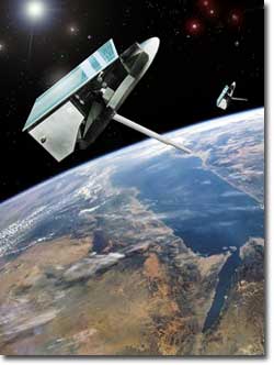
Source: OHB-System
|
|
.
Meridian 1 (Meridian
N1)
| Spacecraft: |
|
| Chronologies: |
2006 payload #112 ; 2006-061A ; 6,487th spacecraft. |
| Type: |
Communications |
| Families: |
|
| Ranks: |
|
| Sponsor: |
|
|
|
|
.
Kosmos 2424
| Spacecraft: |
Glonass-M |
| Chronologies: |
2006 payload #113 ; 2006-062A ; 6,488th spacecraft. |
| Type: |
Navigation |
| Families: |
|
| Ranks: |
|
| Sponsor: |
Russia Defense Ministry |
|
|
|
.
Kosmos 2425
| Spacecraft: |
Glonass-M |
| Chronologies: |
2006 payload #114 ; 2006-062A ; 6,489th spacecraft. |
| Type: |
Navigation |
| Families: |
|
| Ranks: |
|
| Sponsor: |
Russia Defense Ministry |
|
|
|
.
Kosmos 2426
| Spacecraft: |
Glonass-M |
| Chronologies: |
2006 payload #115 ; 2006-062A ; 6,490th spacecraft. |
| Type: |
Navigation |
| Families: |
|
| Ranks: |
|
| Sponsor: |
Russia Defense Ministry |
|
|
|
.
COROT
| Spacecraft: |
COnvection, ROtation des étoiles
et Transits des planètes extrasolaires |
| Chronologies: |
2006 payload #116 ; 2006-063A ; 6,491st spacecraft. |
| Type: |
Astronomy |
| Families: |
|
| Ranks: |
|
| Sponsor: |
France (CNES) |
|

Source : ESA
|
| Launch: |
27 December 2006 at 14h23 UTC,
from Baikonur Cosmodrome, by a Soyuz
2.1b/Fregat. |
| Orbit: |
|
| Mission: |
On 18 June 2014,
CNES announced that CoRoT will be retired from service. Although its instrument
stopped sending data in November 2012, the satellite continues to function
and engineers plan a series of technological experiments before switching
off the spacecraft. "Engineering teams and scientifics have been unable
to recover the instrument," CNES said in a press release. "A series of
operations will now be performed to lower CoRoT's orbit and conduct some
technology experiments before passivating the satellite. Its journey will
end as it burns up on re-entry in Earth's atmosphere."
The CoRoT mission
was supposed to last two-and-a-half years, but it was twice extended in
2009 and 2012. Officials granted a last extension until 2016 three days
before the instrument anomaly on Nov. 2, 2012. CoRoT's data set revealed
32 planets and astronomers are trying to confirm the existence of 100 more
exoplanetsthey believe CoRoT detected. |
| Source: |
Jonathan
Space Report No. 576;
Spacewarn
No. ; National Space Science
Data Center's 2006-0 ; CNES's COROT
; ESA's 27
Dec 06 ; SpaceflighNow's 2014
Stories ; |
|
|
|